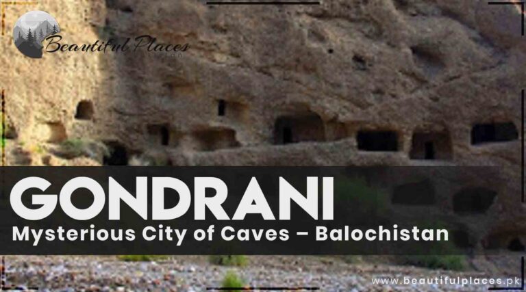
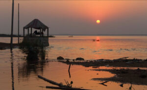
This area is thousands of years old spread over an area of two to three kilometers near Lasbela city. Hundreds of houses with double, triple, and four stories are constructed inside the caves and over the mountains.
Most of the houses comprise two to three rooms and these rooms are connected with each other through tunnels. It is said that it was a Buddhist monastery. It is also narrated that; Buddhismwas on peak thousand years ago. There were almost 1500 caves but now they are 500 only.
Gondrani Caves Balochistan
According to a folk tale, Prince Saif -ul -Malook established this town. According to some sayings, it was settled during the King Chach. Some people connect this place to Hazrat Suleman (A.S).
It is considered to be one of the largest towns of caves in the world. Turkey and other European countries earn millions of dollars in terms of tourism. Its condition is getting worst because of the effect of the weather. You have to reach the Gond Rani area, on the RCD Highway, 15km from Bella to Khuzdar road.
Mysterious City of Caves – Balochistan”
Category
Subcategory
Details
Location
Gondrani, Balochistan
Situated in the heart of Balochistan, the Mysterious City of Caves, Shehr-e-Roghan, is located in the region of Gondrani.
Historical Period
Ancient
Shehr-e-Roghan dates back to ancient civilizations, showcasing a historical timeline that remains a subject of ongoing research.
Architectural Style
Cave Architecture
The city features a unique blend of natural cave formations and human craftsmanship. The caves exhibit intricate carvings and a labyrinthine layout.
Archaeological Finds
Artifacts and Relics
Recent excavations have revealed pottery fragments, tools, and artifacts that provide insights into the lifestyle and technology of the ancient inhabitants.
Cultural Significance
Symbolism and Iconography
The caves are adorned with carvings depicting scenes of daily life, religious rituals, and symbols, suggesting a rich cultural and religious significance.
Access and Permissions
Visitor Information
Access to Shehr-e-Roghan may require permissions due to its archaeological importance. Visitors are advised to coordinate with local authorities or hire knowledgeable guides.
Mysteries and Legends
Local Folklore
The site is surrounded by local legends that add a layer of mystery to the historical narrative, contributing to the enigma of Shehr-e-Roghan.
Research Status
Ongoing
Ongoing research and archaeological studies aim to unravel the mysteries surrounding Shehr-e-Roghan, providing a deeper understanding of its historical context.
Visit Recommendations
Guided Tours
To fully appreciate the historical and cultural significance, it is recommended to engage in guided tours led by experts familiar with the area and its archaeological importance.
Environmental Context
Natural Landscape
Shehr-e-Roghan is set against the rugged landscapes of Balochistan, enhancing the overall experience and providing a natural backdrop to the archaeological wonders.
Conclusion
Timeless Legacy
As the sun sets over Balochistan, Shehr-e-Roghan stands as a silent witness to a bygone era, challenging modern explorers to connect with the timeless legacy of ancient civilizations.
DiscoveringShehr-e-Roghan
Nestled in the heart of Balochistan, the enigmatic Shehr-e-Roghan, also known as the Mysterious City of Caves, in Gondrani, stands as a testament to the rich historical and cultural tapestry of the region. This hidden gem, veiled by the rugged landscapes, invites archaeologists, historians, and adventurers alike to unravel its secrets.
Historical Significance
Dating back centuries, Shehr-e-Roghan holds a profound historical significance, with roots tracing back to ancient civilizations. The city’s strategic location and unique architecture hint at a civilization that thrived amidst the challenges of its time. From the mysterious carvings on the cave walls to the remnants of ancient settlements, each stone whispers tales of a bygone era.
Architectural Marvels
The caves of Shehr-e-Roghan exhibit a remarkable fusion of nature and human craftsmanship. Intricate carvings adorn the cave walls, depicting scenes of daily life, religious rituals, and perhaps the mysteries of the cosmos. The structural design, with its labyrinthine corridors and interconnected chambers, adds to the allure of this architectural marvel.
Archaeological Discoveries
Recent archaeological excavations have unearthed artifacts that shed light on the lifestyle and technological advancements of the inhabitants of Shehr-e-Roghan. From pottery fragments to tools, each discovery deepens our understanding of the societal dynamics that once thrived within these rocky confines.
Cultural and Religious Connections
Shehr-e-Roghan’s cultural and religious significance is evident in the symbols and iconography found throughout the caves. Scholars speculate on the rituals and ceremonies that took place, unveiling a mosaic of beliefs and practices that blend seamlessly with the natural beauty of the surroundings.
Schools and Colleges
Quetta Grammar School (QGS):
Location: Quetta
Type: Private school
Notable for providing quality education.
Sardar Bahadur Khan Women’s University (SBKWU):
Location: Quetta
Type: Women’s university
Offers undergraduate and postgraduate programs.
Balochistan University of Information Technology, Engineering, and Management Sciences (BUITEMS):
Location: Quetta
Type: Public university
Offers programs in IT, engineering, and management.
Tameer-e-Nau Public College:
Location: Quetta
Type: Private college
Provides education at the intermediate and undergraduate levels.
Hospitals:
Sandeman Provincial Hospital:
Location: Quetta
Type: Public hospital
A major healthcare facility providing a range of medical services.
Bolan Medical Complex Hospital:
Location: Quetta
Type: Public hospital
Known for medical education and healthcare services.
Fatima Jinnah General and Chest Hospital:
Location: Quetta
Type: Public hospital
Specializes in chest diseases and general healthcare.
Civil Hospital Turbat:
Location: Turbat
Type: Public hospital
Provides healthcare services to the local population.
FAQs:
Q1: What is the history of Shehr-e-Roghan?
Shehr-e-Roghan boasts a rich history dating back centuries, with archaeological evidence suggesting the presence of ancient civilizations. The exact timeline remains a subject of ongoing research.
Q2: How can one visit Shehr-e-Roghan?
Access to Shehr-e-Roghan may require permissions due to its archaeological significance. It is advisable to coordinate with local authorities or hire a guide familiar with the area.
Q3: What makes Shehr-e-Roghan a mysterious city?
The mystery lies in the intricate carvings, unique architectural layout, and the enigmatic symbols found within the caves, which continue to puzzle researchers about the purpose and nature of the city.
Q4: Are there any legends associated with Shehr-e-Roghan?
Local legends often intertwine with the history of Shehr-e-Roghan, adding a layer of mystique to the site. These legends may vary, highlighting the diverse cultural fabric of the region.
Last Thoughts on Shehr-e-Roghan
Shehr-e-Roghan stands as a silent guardian of a forgotten era, challenging us to unravel its mysteries and celebrate the resilience of ancient civilizations. Gondrani’s Mysterious City of Caves beckons the curious, promising a journey through time and a glimpse into the profound tapestry of human history.
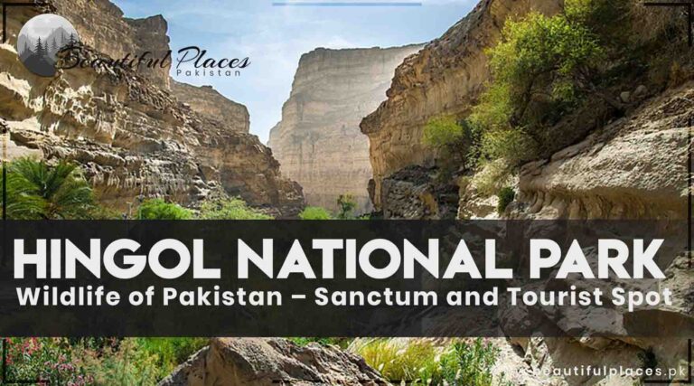
Hingol National Park is the largest park in Balochistan and Pakistan. It surrounds an area of 639043 hectares. 190 km from Karachi, this park included three districts of Balochistan named Gwadar, Lasbela, and Awaran.
It is named after the river Hingol flowing in this area. Situated on the Makran Coastal Highway, it was given the title of National Park in 1988.
This park is considered to be unique because of the four different ecosystems. The famous “Hanglaj Temple” of Hindus is also located here.
Hingol river at Hingol national park -Balochistan-province-Pakistan
This park is divided into mountains, sandy rocks, and a flood plain near the river.
The Hingol Canal passes through this park. It forms a tidal wave before falling into the sea. It is a habitat for many Immigrants birds and crocodiles. Numerous birds and animals are present in the park. Countless valuable and rare plants are also found in this area.
Overview Of Hingol National Park
Category
Details
Location
Makran coastal region, Pakistan
Area
Approximately 6,100 square kilometers
Ecosystems
Mountains, deserts, Hingol River basin
Mammals
35 species, including Baluchistan bear, Indian pangolin, houbara bustard, Persian leopard, caracal, and ibex
Amphibians & Reptiles
65 species, including Russell’s viper, Indian cobra, Sindh krait, spiny-tailed lizard, and various species of frogs
Birds
Over 200 species, including migratory birds like Demoiselle Crane, hawks, eagles, vultures, and flamingos
Landscapes
Mud Volcanoes, Princess of Hope rock formation, Hingol River
Marine Life
Extends to the Arabian Sea with dolphins, green sea turtles, and diverse fish species
Conservation Efforts
Ongoing initiatives focus on habitat preservation, anti-poaching measures, and community involvement. Collaborative programs with local communities aim for sustainable development.
Challenges
Habitat degradation, poaching, and climate change impacts. Addressing these issues is crucial for the long-term survival of wildlife and ecosystems.
Hingol National Park: Preserving Pakistan’s Natural Splendor
Nestled within the enchanting Makran coastal region, Hingol National Park unfolds as a vast tapestry of ecological wonders, spanning approximately 6,100 square kilometers. This expansive sanctuary, situated in Pakistan, showcases an extraordinary diversity of landscapes and hosts a rich array of wildlife, establishing itself as a crucial bastion for biodiversity conservation in the region.
Geographic Kaleidoscope
The park’s geographic allure lies in its diverse ecosystems, encompassing everything from rugged mountains to arid deserts, and the life-giving embrace of the Hingol River basin. This amalgamation of terrains provides a home for an astonishing variety of flora and fauna, making Hingol a unique and vital component of Pakistan’s natural heritage.
Wildlife Extravaganza
Hingol National Park boasts an impressive roster of wildlife, with 35 species of mammals taking residence in its diverse landscapes. Among these inhabitants are the elusive Baluchistan bear, the intriguing Indian pangolin, the regal houbara bustard, the elusive Persian leopard, the agile caracal, and the nimble ibex. The park doesn’t just limit itself to terrestrial wonders; it extends its reach into the Arabian Sea, housing a marine spectacle with dolphins, green sea turtles, and a myriad of fish species.
The avian population of Hingol is equally captivating, with over 200 species of birds gracing the skies. Migratory birds like the ethereal Demoiselle Crane make a seasonal stopover, adding a dynamic and colorful dimension to the arid landscape. Hawks, eagles, vultures, and flamingos complete the avian ensemble, making Hingol a haven for ornithologists and bird enthusiasts.
Landscapes that Tell Stories
The topography of Hingol National Park is a narrative of geological wonders. The ethereal Mud Volcanoes, bubbling with geothermal activity, present a mesmerizing spectacle. The Sphinx-like Princess of Hope rock formation captures the imagination with its grandeur, while the life-sustaining Hingol River cuts through the arid expanse, providing a lifeline to the diverse inhabitants.
Conservation Crusade
Recognizing the need to protect this natural marvel, conservation efforts in Hingol National Park are multifaceted. Habitat preservation initiatives ensure that the various ecosystems continue to flourish, providing a safe haven for the resident wildlife. Anti-poaching measures are in place to safeguard endangered species such as the Baluchistan bear and houbara bustard. Additionally, collaborative programs with local communities strive to strike a delicate balance between conservation imperatives and sustainable development.
Challenges on the Horizon
While Hingol stands as a beacon of conservation, it is not immune to challenges. Habitat degradation, poaching, and the impacts of climate change pose threats to the delicate balance of this ecosystem. Addressing these challenges is imperative for ensuring the sustained survival of the diverse flora and fauna that call Hingol home.
Frequently Asked Questions
What is Hingol National Park, and where is it located?
Hingol National Park is a vast protected area situated in the Makran coastal region of Pakistan. It spans approximately 6,100 square kilometers, showcasing diverse landscapes and ecosystems.
What makes Hingol National Park unique in terms of wildlife?
The park is renowned for its exceptional biodiversity, hosting 35 species of mammals, including the Baluchistan bear, Indian pangolin, and Persian leopard. It is also home to over 200 species of birds, including migratory species like the Demoiselle Crane.
What are the key landscapes and attractions within Hingol National Park?
Notable landscapes include the mesmerizing Mud Volcanoes, the Sphinx-like Princess of Hope rock formation, and the Hingol River, which cuts through the arid terrain. These natural wonders contribute to the park’s allure.
How is Hingol National Park contributing to conservation efforts?
Conservation initiatives in Hingol focus on habitat preservation, anti-poaching measures, and collaborative programs with local communities. The park aims to strike a balance between conservation imperatives and sustainable development.
Are there any endangered species in Hingol National Park?
Yes, the park serves as a refuge for endangered species such as the Baluchistan bear, Indian pangolin, and houbara bustard. Conservation efforts are directed towards protecting and preserving these vulnerable species.
What is the significance of the Hingol River in the park?
The Hingol River is a vital component of the park’s ecosystem, providing a lifeline to the diverse flora and fauna. It sustains the surrounding landscapes and contributes to the overall ecological balance.
Are there opportunities for birdwatching in Hingol National Park?
Absolutely. Hingol is a paradise for bird enthusiasts, with over 200 species of birds, including migratory birds like the Demoiselle Crane. The park offers unique opportunities for birdwatching against a backdrop of diverse landscapes.
How can visitors contribute to the conservation of Hingol National Park?
Visitors can contribute by respecting park regulations, avoiding littering, and supporting local conservation initiatives. Responsible tourism helps in maintaining the delicate balance between human activities and the preservation of the park’s natural wonders.
Last Thoughts on Hingol National Park
In the heart of Hingol National Park, where the Mud Volcanoes meet the Arabian Sea, a delicate dance of nature unfolds. This vast expanse not only shelters a kaleidoscope of wildlife but also stands as a testament to Pakistan’s commitment to preserving its natural splendor. As the sun sets over the Hingol River, it casts a warm glow on a sanctuary where the wild thrives, and the spirit of conservation prevails. Hingol is not merely a park; it is a living testament to the harmonious coexistence of diverse ecosystems and a symbol of Pakistan’s dedication to protecting its ecological heritage.
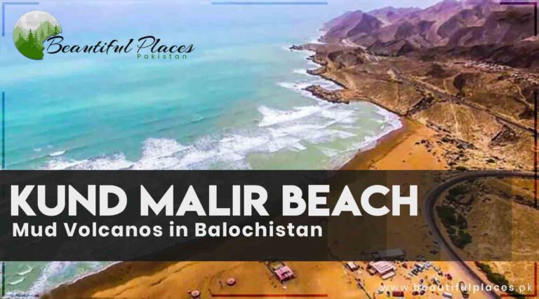
Kund Malir is a wonderful site with mountains on one side, an ocean on the other side, and deserts on the third side. All of these can be viewed at the same time.
This area of the magical atmosphere is a three to four hours drive from Karachi. From Karachi, about the drive of one hour, comes the Hingol Bridge. After crossing this bridge, the dust blows from the grey mountains. These are the alluring volcanos of soil.
Kund Malir Beach
This place is sacred for Hindus. It is narrated that, billions of years ago, when the continents Asia and Europe collided with each other, great mountain ranges came into being such as Himalayan and Karakorum. Malaysia, Indonesia, and Pakistan become volcanoes of soil.
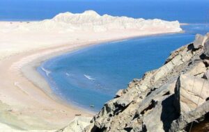
At the Kund Malir, the enchanted atmosphere of the sea scatters blue color. Even the footprints are not visible on the yellow desert spreading near this beautiful seashore. The splendid hills of Hanglaj are situated at some distance.
Kund Malir Beach and Mud Volcanoes in Balochistan
Attribute
Kund Malir Beach
Mud Volcanoes in Balochistan
Location
Hingol National Park, Balochistan
Various locations in Balochistan
Description
A pristine and picturesque beach on the Makran Coastal Highway, known for its golden sands and crystal-clear blue waters.
Mud volcanoes are geological phenomena where natural gases push mud and minerals to the surface, creating cone-like structures. Balochistan has several areas with these mud volcanoes.
Scenic Beauty
Kund Malir Beach offers stunning coastal views, and its serene environment makes it a popular tourist destination.
Mud volcanoes create unique and otherworldly landscapes, often surrounded by barren terrain.
Activities
Visitors can relax on the beach, swim in the sea, and enjoy picnics in the area. It’s a great place for photography and bird watching.
Mud volcanoes are a geological wonder to observe. Visitors can explore these unusual formations and witness the bubbling mud and gases.
Accessibility
Accessible via the Makran Coastal Highway, which connects it to major cities like Karachi and Gwadar.
The locations of mud volcanoes can vary, and some may require off-road exploration.
Natural Beauty
The beach is known for its untouched beauty, with pristine shores and unique rock formations.
Mud volcanoes create a distinctive and intriguing natural landscape, often with a lunar or Martian appearance.
Notable Features
It is part of Hingol National Park, which is home to diverse wildlife and ecosystems.
Mud volcanoes can sometimes emit flammable gases, creating fascinating and surreal natural phenomena.
Conservation Efforts
Efforts are in place to preserve the natural beauty of Kund Malir Beach and its surrounding environment.
Balochistan is known for its efforts to protect and conserve the unique geological features, including mud volcanoes.
Exploring Kund Malir Beach
Kund Malir Beach
Nestled along the turquoise waters of the Arabian Sea, Kund Malir Beach is a haven for beach enthusiasts and nature lovers. The golden sands stretch as far as the eye can see, framed by majestic cliffs and intriguing rock formations. The beach’s allure is heightened by the nearby Princess of Hope, a natural rock sculpture that stands as a testament to the region’s geological diversity.
Visitors to Kund Malir Beach can indulge in sunbathing, enjoy camel rides along the shoreline, and partake in various beach sports. The serene beauty of the beach, coupled with its relative isolation, provides a tranquil escape from the hustle and bustle of urban life.
Mud Volcanoes
Venture further into Balochistan, and you’ll encounter a surreal landscape defined by the enigmatic Mud Volcanoes. These geological wonders, including the Chandragup Mud Volcano nestled within Hingol National Park, paint a landscape that seems straight out of a science fiction movie.
Unlike traditional volcanoes that spew molten lava, mud volcanoes emit a concoction of mud, gases, and water. The result is a mesmerizing display of mud cones and crater-like structures, offering a glimpse into the Earth’s geological processes.
Guided tours to the Mud Volcanoes allow intrepid explorers to witness these mud eruptions up close, providing a rare and memorable experience. While the economic impact of the mud volcanoes is limited compared to tourist destinations, their significance lies in their role as a natural wonder, contributing to the region’s geological and ecological diversity.
Preserving Nature’s Gifts
Efforts are underway to balance the exploration of these natural wonders with conservation initiatives. Kund Malir Beach benefits from conservation measures aimed at preserving its pristine beauty, while the Mud Volcanoes, being natural geological formations, have a minimal environmental impact.
Historical and Notable Sites
Princess of Hope
The Princess of Hope is a natural rock formation sculpted by wind and erosion, standing as a silent witness to the passage of time. This iconic landmark adds a touch of historical and geological significance to the coastal landscape.
Makran Coastal Highway
While not a traditional historical site, the Makran Coastal Highway is a modern marvel that offers breathtaking views of the Arabian Sea. Its construction represents a significant infrastructural development connecting the region and providing access to Kund Malir Beach.
Chandragup Mud Volcano (Hingol National Park)
The Chandragup Mud Volcano is a geological wonder with historical significance. Its eruptions have shaped the landscape over time, offering a glimpse into the Earth’s ancient processes and adding a unique layer to the historical narrative of the region.
Astola Island
Astola Island, also known as Jezira Haft Talar, is the largest offshore island in Pakistan. It has historical importance as it is believed to have been visited by Alexander the Great. The island is a biodiversity hotspot and a site for historical exploration.
Ormara Fort
The historical Ormara Fort, situated along the coastline, bears witness to the region’s maritime history. Built during the colonial era, the fort has played a strategic role in protecting the coastal areas and is a testament to the historical significance of Balochistan.
Kalmat Kali Temple
The Kalmat Kali Temple is a historical and cultural site reflecting the diversity of the region. Pilgrims and visitors alike frequent this sacred place, contributing to the rich tapestry of Balochistan’s historical and religious heritage.
Hinglaj Mata Temple
The Hinglaj Mata Temple is one of the most revered Hindu temples in Balochistan, with historical roots tracing back centuries. The temple attracts pilgrims and tourists, offering a glimpse into the multicultural history of the region.
Buzi Pass
Buzi Pass is a mountain pass with historical significance, providing a route through the rugged landscape. It offers panoramic views of the surrounding hills and valleys, making it a spot of both historical and natural appeal.
Frequently Asked Questions (FAQs)
What is the historical significance of Princess of Hope?
The Princess of Hope is a natural rock formation near Kund Malir Beach, shaped by wind and time. It adds historical and geological significance to the coastal landscape.
How accessible is Kund Malir Beach?
Kund Malir Beach is accessible by road, primarily through the Makran Coastal Highway. The nearest major city is [insert city name], and the beach is reachable by both private and public transportation.
Tell me more about Chandragup Mud Volcano in Hingol National Park.
The Chandragup Mud Volcano, situated within Hingol National Park, is a geological marvel known for its eruptions. It offers insight into Earth’s ancient processes and is a unique historical and natural site.
What other historical sites are there in the vicinity of Kund Malir Beach?
There are several historical sites nearby, including the historical Ormara Fort, the Kalmat Kali Temple, Hinglaj Mata Temple, Astola Island, and the scenic Buzi Pass.
Is there a cultural aspect to the region?
Yes, the region is culturally diverse. The Kalmat Kali Temple and Hinglaj Mata Temple, for example, reflect the religious and cultural diversity of Balochistan.
How can I explore the Mud Volcanoes up close?
Guided tours are available for visitors interested in exploring the Mud Volcanoes up close. These tours provide a thrilling experience to witness the eruptions and unique geological formations.
What is the best time to visit Kund Malir Beach and the Mud Volcanoes?
The best time to visit is during the winter months (November to February) when the weather is mild and comfortable, allowing for an enjoyable exploration of both the beach and the Mud Volcanoes.
Are there accommodations near Kund Malir Beach?
While accommodations near Kund Malir Beach may be limited, nearby towns and cities offer lodging options. It’s advisable to plan accommodation in advance, especially during peak tourist seasons.
Can I combine a visit to Kund Malir Beach with other nearby attractions?
Absolutely. Kund Malir Beach can be part of a broader exploration that includes other historical sites like Ormara Fort, temples, Astola Island, and the fascinating Buzi Pass.
How can I contribute to environmental conservation while visiting?
Visitors can contribute to environmental conservation by following responsible tourism practices. Avoid littering, respect local wildlife, and adhere to guidelines provided during guided tours to minimize environmental impact.
What is the significance of the Makran Coastal Highway?
The Makran Coastal Highway is a modern marvel that not only provides access to Kund Malir Beach but also offers breathtaking views of the Arabian Sea. It represents a significant infrastructural development connecting the region.
Last Thoughts on Kund Malir Beach
Kund Malir Beach and the Mud Volcanoes of Balochistan stand as testament to the Earth’s geological diversity. Whether you seek the tranquility of a sun-kissed beach or the otherworldly spectacle of mud eruptions, this corner of Pakistan invites you to explore the magic of nature in its purest form.
Beyond Kand Malir Beach, the Makran Coastal Highway enters the Bozi Pass area half an hour’s drive from Hingol Bridge.
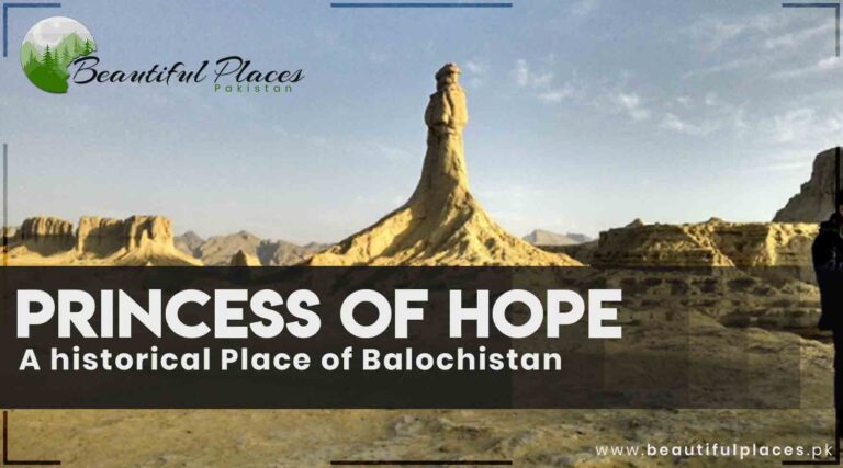
Rare-shaped rocks exist in the Bozi Pass. A rock resembles the sculpture of the Great Sphiny of Gazasituated in Egypt.
Princes of Hope, Balochistan Pakistan
There is a rock like the female figure is standing. It seems as a female is standing with a wrapped shawl. In 2005, the Hollywood actress Angelina Julie visited this place. She called the Feminine sculpture “Princess of Hope”.
These two sculptures can be seen from the main road.
Overview about the Princess of Hope
Feature
Princess of Hope
Location
Near Kund Malir Beach, Hingol National Park, Balochistan
Description
Natural rock formation sculpted by wind and erosion
Historical Significance
Iconic landmark with cultural and geological importance
Appearance
Resembles a woman in a regal pose, giving it its name
Access
Accessible by road, often visited by tourists exploring the coastal area
Cultural Significance
Part of the diverse cultural heritage of Balochistan
Best Time to Visit
Winter months (November to February) for pleasant weather
Accommodations
Limited accommodations nearby; plan lodging in advance
Activities
Sightseeing, photography, exploring the surrounding coastal landscape
Conservation
Conservation efforts in place to protect the natural beauty of the site
Exploring The Princess of Hope
Nature’s Masterpiece
The Princess of Hope emerges majestically from the arid landscape, resembling a woman frozen in a regal pose. Carved by the forces of nature, this striking rock formation captivates the imagination with its graceful curves and intricate details. It is a testament to the artistic prowess of wind and time, crafting a sculpture that transcends the boundaries of mere geology.
Historical Significance
Beyond its geological allure, the Princess of Hope holds a special place in the cultural and historical tapestry of Balochistan. Local lore suggests that the rock formation has witnessed the passage of centuries, silently observing the ebb and flow of civilizations in the region. Its name, “Princess of Hope,” adds a touch of mystique, inviting contemplation on the stories and legends that surround this natural monument.
Famous Sites
Kalmat Kali Temple
A historical and cultural site, the Kalmat Kali Temple is a place of pilgrimage and reflection. It adds a spiritual dimension to the landscape, complementing the natural beauty of the region.
Kund Malir Beach
Famous for its golden sands and clear blue waters, Kund Malir Beach is a popular destination for beach enthusiasts. It offers a serene coastal retreat, complementing the regal presence of the Princess of Hope.
Hinglaj Mata Temple
The Hinglaj Mata Temple is one of the most revered Hindu temples in Balochistan. A site of religious significance, it attracts pilgrims and tourists, contributing to the cultural diversity of the region.
Buzi Pass
Buzi Pass is a mountain pass with historical significance, offering panoramic views of the surrounding hills and valleys. Its historical and natural appeal makes it a fascinating stop for travelers exploring the region.
Makran Coastal Highway
The Makran Coastal Highway is a modern marvel that not only provides access to Princess of Hope but also offers breathtaking views of the Arabian Sea. It represents a significant infrastructural development connecting the region.
Ormara Fort
Ormara Fort is a historical site that bears witness to the maritime history of the region. Built during the colonial era, it stands as a reminder of the strategic importance of the coastal areas.
Astola Island
Astola Island, also known as Jezira Haft Talar, is the largest offshore island in Pakistan. It has historical importance as it is believed to have been visited by Alexander the Great. The island is a biodiversity hotspot and a site for historical exploration.
Frequently Asked Questions (FAQs)
What is the historical significance of the Princess of Hope?
The Princess of Hope is a natural rock formation near Kund Malir Beach in Balochistan, shaped by wind and erosion. While its geological marvel is awe-inspiring, it holds cultural and historical importance, with locals attributing stories and legends to its presence.
Are there other famous sites near the Princess of Hope?
Yes, the region boasts several famous sites such as the Kalmat Kali Temple, Kund Malir Beach, Hinglaj Mata Temple, Buzi Pass, Makran Coastal Highway, Ormara Fort, and the captivating Astola Island.
What educational institutions are located near the Princess of Hope?
While specific details may vary, nearby towns and cities in Balochistan provide educational facilities. Schools in these areas contribute to the educational landscape, nurturing the minds of the local community.
How can one access the Princess of Hope?
The Princess of Hope is accessible by road, often visited by tourists exploring the coastal wonders of Balochistan. It is commonly included in guided tours that offer insights into its geological formations and historical significance.
What is the best time to visit the Princess of Hope and its surrounding attractions?
The Princess of Hope can be visited throughout the year, but the winter months (November to February) offer mild temperatures, making it an ideal time for exploration. This season provides comfortable weather for visits to Kund Malir Beach, Hinglaj Mata Temple, and other nearby attractions.
Is accommodation available near the Princess of Hope?
Accommodations near the Princess of Hope may be limited. It is advisable to plan lodging in advance, considering nearby towns and cities for overnight stays. Kund Malir Beach is a popular destination for those seeking beachfront accommodations.
Can I explore the surrounding attractions in a single visit?
Yes, many of the famous sites, including Kund Malir Beach, Hinglaj Mata Temple, and Buzi Pass, are relatively close to each other. Visitors can plan a comprehensive itinerary to explore multiple attractions during a single trip.
What cultural significance does the region hold?
The region is culturally diverse, with temples like Kalmat Kali and Hinglaj Mata contributing to the religious and cultural heritage of Balochistan. The Princess of Hope, while a geological wonder, is also part of the cultural narrative of the area.
Are there guided tours available for visitors?
Yes, guided tours are commonly available for tourists exploring the Princess of Hope and surrounding attractions. These tours provide informative insights into the geological formations, historical aspects, and cultural significance of the sites.
How can visitors contribute to environmental conservation during their visit?
Visitors can contribute to environmental conservation by practicing responsible tourism. This includes refraining from littering, respecting local wildlife, and following guidelines provided during guided tours to minimize environmental impact.
Last Thoughts on Princess of Hope
In the gentle whispers of the wind, Balochistan unfolds its tale of timeless beauty and cultural richness. From the regal silhouette of the Princess of Hope to the vibrant tapestry of Kalmat Kali Temple, Kund Malir Beach, and the windswept wonders along the Makran Coastal Highway, each site becomes a chapter in the story of a region where history, nature, and culture converge. As visitors tread the sands of this remarkable land, they become part of a narrative that transcends time—an exploration not just of geological marvels but of the enduring spirit that weaves together the past, the present, and the promise of a future filled with discovery and appreciation.
(Ormara Beach)It was included in the Lasbela but nowadays it is a part of the Makran Division.
In 1938, three shipswere used to anchor here and the luggage was imported and exported. It is close these days.
Overview Of Ormara Beach
Location
Ormara Beach, Balochistan
Geography
Coastal area along the Arabian Sea
Scenic Beauty
Pristine sandy beach with clear blue waters
Activities
Swimming, sunbathing, and picnicking. Beachcombing and seashell collection. Fishing and boating. Birdwatching. Exploring nearby caves and rock formations
Local Cuisine
Seafood, particularly fresh fish and prawns
Accommodation
Limited options, mainly small guesthouses and camping
Accessibility
By road: Ormara is accessible via the Coastal Highway (N-10)
The nearest major city is Karachi, approximately 360 km away
Special Attractions
Buzzi Pass, offering panoramic views of the coastline
Historical remnants including the Hingol River Bridge
Marine life and dolphin sightings
Best Time to Visit
Winter months (November to March) for pleasant weather
Local Culture
Rich Balochi culture with traditional music and dance
Safety Considerations
Be cautious when swimming due to strong currents
Additional Information
Ormara Beach is part of the larger Hingol National Park, known for its diverse ecosystem.
Emergency Contacts
In case of emergencies, contact local authorities or the nearest hospital.
It’s advisable to inform someone about your visit to Ormara Beach and your expected return time for safety.
Exploring the Rich Tapestry of Ormara Beach
Ormara Beach
Ormara Beach is a hidden gem nestled along the Makran Coastal Highway in Balochistan, Pakistan. This picturesque beach is renowned for its pristine beauty and unspoiled landscapes, attracting both locals and adventurous travelers seeking a tranquil escape.
The beach is characterized by golden sands stretching for miles, bordered by the azure waters of the Arabian Sea. The serene atmosphere and minimal human intervention make Ormara Beach an ideal destination for those seeking solitude and a break from the hustle and bustle of city life.
Visitors can indulge in various activities, including beachcombing, camel rides, and simply basking in the sun against the backdrop of stunning coastal cliffs. The area is also rich in marine life, making it a haven for birdwatchers and nature enthusiasts. Ormara Beach, with its untouched beauty and soothing ambiance, offers a unique coastal experience for those looking to explore the untamed charm of Pakistan’s coastline
Ormara Beach
Historical Significance
Ormara’s history dates back centuries, with its strategic location along the Arabian Sea making it a crucial maritime point. Historically, it served as a trading post, connecting the Arabian Peninsula with the Indian subcontinent. The remnants of ancient settlements and trade routes in the surrounding areas bear testimony to the region’s historical importance.
During the colonial era, Ormara gained prominence as a port under British rule. The strategic significance of the region heightened during World War II when it served as a naval base. The remnants of military installations and structures from that era add a layer of historical intrigue to the landscape.
Cultural Heritage
The cultural fabric of Ormara is woven with threads of Balochi traditions and customs. The local population, deeply rooted in their heritage, contributes to the vibrant cultural tapestry of the region. Traditional music, dance, and art forms are integral parts of the Balochi identity, and visitors may have the opportunity to witness these expressions of culture during their stay.
The architecture in and around Ormara reflects a blend of indigenous styles influenced by various historical periods. Mosques with intricate designs, reflecting the region’s Islamic heritage, stand as cultural landmarks. The local bazaars, adorned with traditional crafts and artifacts, provide a glimpse into the rich artisanal heritage of the Baloch people.
Natural Splendor
Beyond its historical and cultural significance, Ormara Beach is a sanctuary of natural beauty. The golden sands stretching along the coast offer a serene setting for relaxation and reflection. The turquoise waters of the Arabian Sea teem with marine life, providing a captivating backdrop for both locals and tourists.
The coastal cliffs surrounding the beach add a dramatic element to the scenery, creating a breathtaking panorama that changes hues during sunrise and sunset. Nature enthusiasts can explore the diverse ecosystems, from mangroves to coastal flora and fauna, making Ormara a haven for eco-tourism.
Recreational Opportunities
Ormara Beach offers more than just historical and cultural exploration. Adventurous souls can partake in a variety of activities such as camel rides along the shore, beachcombing, and fishing. The pristine waters are ideal for snorkeling and diving, allowing visitors to discover the underwater wonders of the Arabian Sea.
Preserving the Legacy
Efforts to preserve the historical and cultural legacy of Ormara are ongoing. Conservation initiatives focus on maintaining the ecological balance and safeguarding historical structures. Local communities actively participate in sustaining the region’s unique identity, ensuring that future generations can continue to experience the beauty of Ormara and its multifaceted heritage.
FAQs
Q: Where is Ormara Beach located?
A: Ormara Beach is situated along the Makran Coastal Highway in the Balochistan province of Pakistan, overlooking the Arabian Sea.
Q: What makes Ormara historically significant?
A: Ormara has a rich history, serving as a vital maritime trading post and later gaining importance as a naval base during World War II.
Q: What cultural experiences can visitors enjoy at Ormara?
A: Visitors can immerse themselves in Balochi traditions, witnessing traditional music, dance, and art forms. Local bazaars showcase traditional crafts, providing insight into the cultural heritage of the Baloch people.
Q: Are there remnants of historical structures at Ormara?
A: Yes, there are remnants of military installations from the colonial era and World War II, adding historical intrigue to the landscape.
Q: What recreational activities are available at Ormara Beach?
A: Ormara offers a range of recreational activities, including camel rides, beachcombing, fishing, snorkeling, and diving, making it an ideal destination for both relaxation and adventure.
Q: When is the best time to visit Ormara Beach?
A: The best time to visit Ormara is during the winter months (October to March) when the weather is mild and pleasant, suitable for outdoor activities.
Q: Is Ormara suitable for eco-tourism?
A: Yes, Ormara is a haven for eco-tourism with diverse ecosystems, including mangroves and coastal flora and fauna. Conservation initiatives are in place to maintain the ecological balance.
Q: How can one reach Ormara Beach?
A: Ormara is accessible by road through the Makran Coastal Highway. The nearest airport is Gwadar International Airport, and there are also land routes connecting it to major cities in Pakistan.
Q: Are accommodations available near Ormara Beach?
A: Yes, there are accommodations ranging from guesthouses to resorts in and around Ormara, providing options for various budgets.
Q: Are guided tours available for exploring the historical and cultural aspects of Ormara?
A: Yes, guided tours are available for visitors interested in exploring the historical and cultural facets of Ormara, providing insights into the region’s rich heritage.
Q: Are there conservation initiatives in place at Ormara?
A: Yes, there are conservation initiatives aimed at preserving the natural beauty and historical structures of Ormara. Local communities actively participate in these efforts to sustain the region’s unique identity.
Q: Can visitors engage in water activities at Ormara Beach?
A: Absolutely. Ormara Beach offers opportunities for snorkeling and diving in its pristine waters, allowing visitors to discover the underwater wonders of the Arabian Sea.
Last Thoughts on Ormara Beach Balochistan
Ormara Beach stands as a coastal masterpiece, a serene escape that transcends the ordinary. Its untouched beauty, golden sands, and azure waters weave a tapestry of tranquility along the Balochistan coastline. The symphony of the wind through the palms, the rhythmic dance of the waves, and the sun’s warm embrace create an atmosphere where time seems to slow down.
Ormara Beach is not just a destination; it’s a sanctuary that invites visitors to unwind, reconnect with nature, and embrace the simplicity of seaside serenity. Whether seeking solitude or sharing moments with loved ones, Ormara Beach offers an idyllic retreat, leaving an indelible mark on those fortunate enough to experience its unspoiled charm.
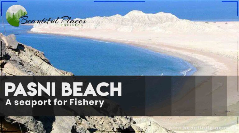
This seaport is 200 miles from Karachialong the land route. It was a small seaport. In 1931, Khan of Kalat Mir Ahmad Yar Khanfocused on its development and expansion.
In no time, this seaport of fishermen become famous in middle Asia. It became popular for exports and imports. In 1942, a severe earthquake hit this area. Sea waves destroyed the city.
Pasni Beach
Overview about Pasni Beach in Balochistan
aspect
Information
Location
Pasni Beach is situated in the southwestern province of Balochistan, Pakistan.
Geographical Features
It is a coastal area with a sandy shoreline along the Arabian Sea.
Scenic Beauty
Pasni Beach offers stunning views of the sea, with a backdrop of arid hills.
Activities
Fishing is a significant activity due to the abundance of marine life.
Cultural Significance
The beach is surrounded by a traditional fishing village, showcasing local life.
Accessibility
Pasni is accessible by road, and there are local transportation options.
Best Time to Visit
The weather is most pleasant from late autumn to early spring (October to March).
Local Cuisine
Fresh seafood is a highlight, with local eateries offering a taste of the sea.
Wildlife
The beach area is known for diverse marine life, attracting seabirds and more.
Local Markets
Pasni hosts a small market where visitors can find local crafts and fresh produce.
Accommodation
Limited accommodation options, with guesthouses and small hotels available.
Safety Tips
Visitors should be cautious about tides and currents while enjoying the beach.
Local Festivals
Pasni is known for its vibrant fisherman festivals, showcasing local traditions.
Medical Facilities
Basic medical facilities are available in Pasni, but it’s advisable to carry essentials.
Pasni Beach, Balochistan
This hidden gem on the Arabian Sea offers a tranquil escape for those seeking a serene retreat away from bustling city life.
Geographical Splendor
Pasni Beach unfolds like a canvas, showcasing a sandy shoreline that gently kisses the azure waters of the Arabian Sea. The landscape is characterized by arid hills that provide a dramatic backdrop, creating a striking contrast against the vastness of the sea. The beach stretches along the coastal town of Pasni, inviting visitors to explore its natural wonders and immerse themselves in the simplicity of coastal life.
Maritime Legacy
Pasni is more than just a beach; it is a gateway to Balochistan’s rich maritime heritage. The beach is fringed by a traditional fishing village, where colorful boats bob gently in the waves. The sight of fishermen casting their nets and preparing for their daily catch adds a cultural richness to the experience. It’s an opportunity to witness the harmonious coexistence of the local community with the bounty of the sea.
Activities and Exploration
Pasni Beach is a haven for fishing enthusiasts. The abundance of marine life in the Arabian Sea makes it an ideal spot for anglers to try their luck. Visitors can engage with the local fishermen, gaining insights into their time-honored fishing techniques and the vibrant culture that revolves around the sea.
Beyond fishing, Pasni offers a serene environment for leisurely strolls along the beach, where the rhythmic sounds of the waves create a soothing melody. The golden hues of the sand, especially during sunset, paint a mesmerizing picture that lingers in the memory.
Local Flavors and Markets
A visit to Pasni would be incomplete without savoring the local cuisine. Fresh seafood is a highlight, and visitors can indulge in the catch of the day prepared in traditional Balochi style. The town also boasts a small market where local crafts, fresh produce, and the vibrant culture of the region come to life. It’s an opportunity to interact with the friendly locals and acquire a piece of Pasni’s unique charm.
Practical Information
Pasni is accessible by road, and the journey itself is an adventure, offering glimpses of the arid beauty that defines Balochistan. While accommodation options are limited, there are guesthouses and small hotels that cater to visitors seeking a modest stay.
Safety is paramount when visiting Pasni Beach. Visitors should be cautious about tides and currents, especially if venturing into the water. It’s advisable to carry essentials, including water, sunscreen, and basic medical supplies, to ensure a comfortable and enjoyable experience.
Beautiful Sites
The beauty of Pasni Beach lies not just in its pristine shoreline but also in the surrounding landscapes. The sight of arid hills framing the beach creates a dramatic contrast, turning every sunrise and sunset into a breathtaking panorama. Walking along the shoreline, one can witness the ebb and flow of the Arabian Sea, a rhythmic dance that whispers tales of the vastness beyond.
As the beach is a gateway to the sea, it offers a peek into the maritime legacy of Balochistan. Colorful fishing boats adorn the coastline, painting a vivid picture of the symbiotic relationship between the local community and the sea. The beach becomes a vantage point to observe the daily rituals of fishermen, casting nets and preparing for their seafaring journeys.
Local Flavors
Pasni’s charm extends beyond its natural beauty to the flavors that define its culinary identity. Fresh seafood takes center stage, with the catch of the day transformed into delectable dishes that reflect the authenticity of Balochi cuisine. From aromatic grilled fish to spiced curries, every bite is a journey into the rich maritime heritage of the region.
Exploring the local market reveals a treasure trove of flavors and aromas. Fishermen bring in their catch, and the market becomes a lively hub where locals and visitors converge. It’s an opportunity to engage with the community, taste traditional treats, and perhaps even bring home some spices and souvenirs that encapsulate Pasni’s unique essence.
Shipping and Commerce
Pasni has a functional port, adding a dynamic aspect to its coastal identity. The port is a hub of shipping activities, playing a crucial role in the transportation of goods and fostering trade. Fishing vessels set sail, creating a bustling scene that mirrors the economic significance of Pasni in the region.
The shipping activities also contribute to the livelihoods of the local community. The commerce and trade that take place at the port underscore Pasni’s role as not just a serene beach but also as a pivotal point connecting the land and the sea.
Practical Information
For those planning to explore Pasni Beach, it’s accessible by road, providing a scenic journey through the arid beauty of Balochistan. Accommodations, though limited, cater to those seeking an authentic and modest stay. Safety remains a priority, especially for those venturing into the water, where an awareness of tides and currents is essential.
Frequently asked questions (FAQs)
Q: Where is Pasni Beach located?
A: Pasni Beach is located in Balochistan, a province in southwestern Pakistan, along the Arabian Sea.
Q: What makes Pasni Beach unique?
A: Pasni Beach is unique for its pristine shoreline, scenic views of arid hills, and its role as a gateway to Balochistan’s rich maritime heritage.
Q: What activities can I do at Pasni Beach?
A: Fishing is a significant activity at Pasni Beach. You can also enjoy leisurely strolls along the shoreline, taking in the beauty of the Arabian Sea.
Q: What is the best time to visit Pasni Beach?
A: The best time to visit Pasni Beach is during late autumn to early spring (October to March) for pleasant weather.
Q: What is the local cuisine like at Pasni Beach?
A: Pasni is known for its fresh seafood. You can savor dishes like grilled fish and spiced curries, reflecting the authentic flavors of Balochi cuisine.
Q: Are there markets near Pasni Beach?
A: Yes, Pasni has a small market where you can find local crafts, fresh produce, and experience the vibrant culture of the region.
Q: How can I get to Pasni Beach?
A: Pasni is accessible by road, providing a scenic journey through the arid landscapes of Balochistan.
Q: Is Pasni Beach safe for swimming?
A: Visitors should be cautious about tides and currents, especially if venturing into the water. It’s important to be aware of safety precautions.
Q: Are there accommodations near Pasni Beach?
A: Yes, there are limited accommodations such as guesthouses and small hotels that cater to visitors seeking a modest stay.
Q: What is the significance of the port at Pasni Beach?
A: The port at Pasni is a hub of shipping activities, playing a crucial role in transportation and fostering trade in the region.
Last Thoughts on Pasni Beach Balochistan
Pasni Beach encapsulates the essence of coastal living—a fusion of natural beauty, culinary delights, and the vibrant pulse of local life. Whether it’s the allure of the sea, the flavors that dance on the taste buds, or the bustling commerce at the port, Pasni is a destination where every aspect harmonizes to create an unforgettable experience. It’s not just a beach; it’s a living portrait of Balochistan’s coastal charm.
The district Thar Parkar accommodates a large part of Desert Thar while marshy areas and salty lakes are located in the south. Most of the people are residing in small villages. According to the 1998 census, 4.54 % of the population is living in cities.
Tharparkar, Sindh, Pakistan
The weather quite changes. It is hot in the daytime and the weather is windy cold at the night. Day times of April, May, and June are too much hot. And the night times of December, January, and February are famous for the freezing cold nights. August to September and December to February are the best tourist season.
Vegetables are cultivated without fertilizers and water. They are stored after drying them. They are edible for one year. One can relish the Mushroom’s curry, wheat tortilla, millet tortilla(bread), Kathia curry, and Singari curry prepared from rainwater with Desi Ghee (pure form of cooking oil obtained from milk and butter).
Mainly agrarian, with a focus on livestock farming and agriculture. Handicrafts and artisanship are also part of the local economy.
Landmarks
The district is known for its desert landscapes, including the Thar Desert, and its distinctive culture, particularly its traditional huts called “bhungas.”
Culture
Rich cultural traditions with a unique blend of music, art, and folk stories.
Education
Several schools and educational institutions, although access to quality education can be a challenge in some areas.
Healthcare
Health facilities are present, but healthcare access can be limited in remote parts of the district.
Notable Feature
Tharparkar is known for its resilience in the face of arid conditions and periodic droughts, as well as its distinct way of life.
Famous Places of Tharparkar
NAUKOT Fort
NAUKOT has the status of desert’s gateway. 67 km from Hyderabad to Mir Pur Khas and 100km from there comes NAUKOT. The last station(city) of THARPARKAR, NAGAR PARKER, is at a distance of 197 km from Mirpur Khas. The Barrage area ends at 6km from Naukot and the Desert starts here.
Naukot fort ,Sindh
At the starting point of the desert, is the fort of Talpur era, which is still in good physical condition. Talpur family architectured forts in Islam Kot, Singharo, and, Mithi but they didn’t get the recognition as Naukot.
Mithi
The head office of district Mithi Tharparkar has located 50 km from Naukot. When the Talpur family came to Mithi, at the beginning of the last century, they built two forts there. Besides this, they also constructed spacious residential mansions regionally known as “Gaddi”.
A park, playland, restaurant, and a guest house has been built in Mithi on the traces of about 800 ft high Gaddi. It is famous for its embroidery work. Its better quality can be found in the market near “Gym Khana”. On the way to Mitti, there comes the place(home) of folk singer “Mai Bhaggi”. One can see Ubiquitous queues of camels there.
Mithi , SIndh Pakistan
In the surrounding of Mitti, Golden hued Sand layer seems to be spread in miles. Jeeps are available for traveling in different areas beyond Mitti. Apart from these, truck-like lorries also run known as “Kakray”.
Every year, the “Thar Desert rally” is organized here. Mitti is the central point of the 200 km long jeep rally. A splendid ceremony is held at the end of this four-categorized jeep rally. Winners are awarded prizes and trophies. Spectacular fireworks are exhibited at the end of this rally.
Thar Rally
Bhalwa and Umar Marvi
It is the hometown of Marvi, who is a symbol of patriotism, Chastity, and infallibility on this land. A girl, who never accepted any oppression. Instead of a crown, she preferred to live a life full of poverty and complications.
The chief of Umar Kot belonged to the nation of Umar Somro. The People of Sindh not only considered him as a chief but also as a spiritual leader. One day he was resolving people’s issues in the court. A courtier came to him and told him about a gorgeous girl named Marvi.
She used to live in Maleer town. She was a daughter of a poor Shepherd. The chief got fascinated by the story of Marvi. He immediately took two camels and moved to Maleer Town with the courtier. This town was a few miles away from the Thar Desert.
Marvi was engaged to his First cousin, Khate. They also loved each other. But, the chief umar came between them and abducted her when she was fetching water from the well along with her friends. She kept mourning and sighing. The chief wanted to marry him. But she refused by saying “Your heaps of wealth and jewels are less than the dust of my lovers’ feet”. Umar ordered to keep her in prison until she agreed to marry him. However, her parents choose to pocket the insult and remained quiet. At last, khate stood up for his right. He pretended to be a beggar and managed to meet Marvi. They devised a plan to flee away. Marvi Started to meet him at the shrine outside the city. Marvi agreed to marry Chief Umar with certain Conditions. One of them was to visit the shrine with other females. In this way, she got a chance to meet Khate.
The Chief was pleased with the Marvi’s consent. So, he lifted the ban. After a few days later, Khate and Marvi took to their heels. The chief tried his best but didn’t get a clue. This fable of Chastity, infallibility, and loyalty are a part of Sindhi Culture.
Marvi Well, Tharparkar
According to some narrators, his fiancé questioned her virginity. The king took the oath of the Quran e Pak to prove her purity. Some said that the king called her foster sister and married her from the palace.
The well from where the marvi was kidnapped is still present in Bhalwa town. These folk tales are transferred from one generation to the next generation so they are changed to some extent.
Gori
Outside the Gori village, situated in between Islam Kot and Nagar Parkar, A temple (Mandar) is located in good condition. It was constructed by a Jain broker about six hundred years ago. It is an important symbol of exceptional architectural style.
Virawah
This village is located about 24 km before Nagar Parkar. In the past, the ranger’s headquarter was there. Pari Nagar village is located near Virawah. It is narrated that it was established in the 5th or 6th century and ruined about 12 times. It was an extremely populated city. Now there are the remains and a temple. Some antiques are stored in Karachi Museum.
Bhodi Sar(بھودی سر)
It is located below the Karoonjhar mountains about 5 km from Nagar Parkar in the northwest. This ancient place was famous for its fine architecture and grand buildings. A few of them are present at this time. Formerly, it was named “Bodhi Sar Nagri”. It was the residence of Queen Bodhi.
She also constructed a pond of the metal base. According to historians, Sultan Mehmood Ghaznavi after conquering “Somnath” passed through this desert. He forgot the route and came to this pond for drinking water. Sodha and Khosa were the famous dacoits of this place. People complained about them in the court of Tughluq, Delhi.
Bhodesar temple
In 1504, these dacoits looted the mother of Sultan Mehmood Bigra and other passengers. In 1505, they had a war with dacoits. The sultan won the war and constructed a mosque at that place. On the coast of the pond, the Samadhi (samadhi mandir is the Hindi name for a temple, shrine, or memorial commemorating the dead) of their wives.
The Karoonjhar Range
Everything else in Tharparkar is desert. Karoonjhar is not, and that contrast is the reason
to come.
The range rises behind Nagarparkar in pink granite, bare and rounded, with
none of the sand and scrub that covers the rest of the district. Several footpaths run up
into it from the town and the walking is straightforward rather than technical, so most
visitors do it without a guide, though taking one is worth the small cost for the stories
attached to each outcrop.
The transformation that people come for happens in the monsoon. Rain turns
the slopes green and sends temporary streams and small waterfalls down the granite, and for a
few weeks the hills look like nothing else in Sindh. That window is short and it does not
arrive reliably every year, which is part of why photographs of a green Karoonjhar are so
prized locally.
Two practical warnings, both of which the guidebooks tend to leave out. Daytime temperatures
here cross 40 degrees for much of the year, so climb early or late and carry
far more water than feels necessary. And there is no lighting anywhere on the
range; once the sun goes the granite is completely dark and the paths are not
obvious. Be back down before dusk.
Nagar Parkar
Thar pakar’s district Nagar Parkar is famous for its beautiful peacocks and venomous snakes. Makhan Bhagti, Sara Dhar, Yoni, Shiva, and Rampla Pir temples are phenomenal places. These buildings are considered the finest model of sub-continent masonry art.
nagar parkar
The holy pond of Hindus of the sub-continent is located here. According to Hindu books, this pond contains the water of 74 pilgrims. About 1km in the south, a huge pilgrim Ganesh is present.
A waterfall falls from the height of forty feet cow-shaped mountain top. A temple and a spring are present at some distance from this waterfall. Hindus consider this spring’s water as “Holy Water”. Here at this place, A tribe is mourning the death of their prince for 700 years. Interestingly, a Pakistani movie “Ram Chand Pakistani” was filmed there. This route goes to Mir Pur Khas. One can travel to Umar Kot by path of Gori and Chachro.
Birth Place of Mughal emperor Shahanshah and Bara Darri
Humayun fled to his relatives Tarkhan Mughal after being defeated by Sher Shah Suri. In these inconvenient and tough times, his wife Hameeda Bano gave birth to Akbar Azam on 4th Rajab. In the Umar kot, on the birth of a son, he sold diamonds and distributed the money among his servants.
After some days, Humayun moved to his maternal relatives in Iran. When Humayun occupied Delhi again, he made Bara Dari, the birthplace of Humayun. This Bara Dari is located two miles away from Umar Kot in the northwest.
Romantic Tales are also attributed to this place the Umar Kot city. One of them is about Momal Rano who’s archetypal is famous as “Momal G Mari”.
Umar Kot Fort
This fort was built in the 11th century during the reign of Somro. The present structure was constructed by Noor Muhammad Kulhoro in 1746. Rajput, Mughal, Kulhoro, Talpur, and Britishers used this place.
On 16 February 1887, a function was organized for the celebration of Queen Victoria’s golden jubilee on the north ground of the city. A salute was given by the seven cannons mounted on the fort. A museum is also there which was established in 1968. Weapons, swords, spears, bows, arrows, royal coins, royal decree, handwritten letters, and shields are exhibited there.
Best time to visit Tharparkar
Tharparkar has two good windows and they offer completely different things.
November to March is the straightforward answer. The heat has gone, the days
are comfortable for walking and for the long drives between sites, and the local festival
calendar is at its busiest. This is when most visitors should come, and it lines up with the
rest of Sindh, so Tharparkar fits naturally into a trip that also takes in Thatta and Karachi.
September and October is the specialist window. Just after the monsoon the
desert is briefly, genuinely green, Karoonjhar runs with water, and Thar looks like the
photographs that circulate every year. It is hotter and less predictable than winter, and the
rain has to have actually arrived, which in a drought year it does not.
Avoid April to August unless you have a specific reason. Daytime
temperatures cross 40 degrees and the combination of heat, dust and distance makes
sightseeing genuinely unpleasant.
Our month by month guide to the best time to visit Pakistan puts this in
the wider picture, and it is worth noting that Tharparkar runs on the same calendar as the
rest of lowland Sindh rather than the northern mountains.
How to reach Tharparkar
Tharparkar is a large district and the sites are spread far apart, so plan the route rather
than the destination.
Mithi is the district headquarters and the usual base, reached by road from
Karachi or Hyderabad. From Mithi the road runs east through Islamkot and on
to Nagarparkar, which is the far corner of the district and the access point
for Karoonjhar.
Nagarparkar is reached via Mithi by car or by minibus. The non air-conditioned minibuses
leave Mithi roughly hourly and only before sunset, cost in the region of
200 rupees, and take about three to three and a half hours. If you are
relying on them, work out the return before you commit to the outward leg, because evening
departures do not exist.
A hired car with a driver is far more practical if you want to see Naukot, Umarkot,
Virawah and Nagarparkar on one trip, since the distances between them are long and public
transport between the smaller sites is thin. Fuel stops are sparse once you are east of
Islamkot, so fill up in Mithi.
Frequently Asked Questions
What is the historical significance of Tharparkar?
Tharparkar has a historical connection to the ancient Indus Valley Civilization, and its diverse communities, including Meghwar, Kolhi, and Rajput, contribute to its rich historical tapestry.
How diverse is the culture in Tharparkar?
Tharparkar is culturally diverse, influenced by Sindhi, Rajasthani, and Thari traditions. Festivals like Holi and Diwali are celebrated with vibrant music, dance, and traditional rituals.
What languages are spoken in Tharparkar?
Languages spoken in Tharparkar include Sindhi, Thari, and Marwari, contributing to the linguistic diversity of the region.
What are the traditional crafts of Tharparkar?
Traditional crafts in Tharparkar include Ralli quilts, known for intricate designs, and pottery, showcasing the artistic prowess of the locals.
What is the architectural style of Tharparkar?
The architecture of Tharparkar features traditional mud and thatch houses that blend with the arid landscape. Historic temples and shrines add to the architectural richness.
What challenges does Tharparkar face?
Tharparkar faces challenges related to water scarcity and desertification. Socio-economic development and sustainable practices are essential for overcoming these challenges.
Last Thoughts on Tharparkar
Tharparkar is the part of Pakistan that least resembles the rest of it. It is desert that
turns green, a Hindu and Muslim landscape sharing the same villages and festivals, Jain
temples standing in sand, and a granite range behind Nagarparkar that belongs to a different
country entirely.
It also asks more of a visitor than most places on this site. The distances are long, the
heat is serious for most of the year, and the transport thins out exactly where the best of
it is. Come between November and March for comfort, or gamble on late September for the
green. Either way give it four or five days rather than two, and base yourself in Mithi.
In conclusion, Tharparkar unfolds as a captivating journey through time, where history and culture converge to create a unique identity. The region’s diversity, expressed through its festivals, languages, crafts, and architecture, invites exploration and appreciation for the resilient spirit of its people.
In terms of population, Sindh is considered the second largest province of Pakistan. Its total area is 141000 square kilometers. Its name is originated from the river Sindh
Sindh stretches from the Jacobabad district in the north to the vast Indus River delta wetlands abutting the Arabian Sea and India in the south, and from the thinly-populated Dadu district in the west to the Thar Desert and a militarized border with India to the east One-third of Pakistan’s 650-mile Arabian Sea coastline is in Sindh.
The economy of Sindh chiefly depends on The River Indus. It is famous not only in Pakistan but all across Pakistan. In beginning, it is Abaseen, Attock in the middle, and the last part is known as Mehran.
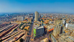
Karachi being the provincial capital and central port has prospered a lot. That’s why it is ranked as a “Metropolitan city”. In addition to Karachi, Hyderabad, Sukkar, Larkana, Dadu, Khair pur, Desert Thar, Thatta and Badeen are also famous for their Tourist spots.
Karachi, aerial view
History of Sindh
Sindh takes its name from the Sindhu River, today known as the Indus. Pakistan’s largest river, the Indus runs nearly 2,000 miles from its origin on the Tibetan Plateau to a 16,000-sq. mi. delta at the Arabian Sea near Karachi, modern Sindh’s capital, major seaport, and Pakistan’s business center. On its way, From Hazara to Gilgit Baltistan, it accrues the water of different stream lakes aquifers, and springs. Here at this point, besides the river, Kabul, The River Kurrum and Bolan from the western side also connected into it. In the Province Punjab, it mixes with the river Satluj, Bayas Ravi, Chenab, and Jhelum at the point of Punjnad.
In the province Sindh, its delta (wetlands that form as rivers empty their water and sediment into another body of water) surrounds almost 125 miles of the coastal area. While the area of its Delta is about three thousand square miles.
Evidence of an advanced urban civilization at Kot Diji, in central Sindh, dates to 3300 BCE and is considered the forerunner of the Indus Valley Civilization that flourished in the region for the next 2,000 years. Arab invaders brought Islam to the region during the 8th century CE, and the Sindhi language developed in Arabic’s distinctive Nakshi script.
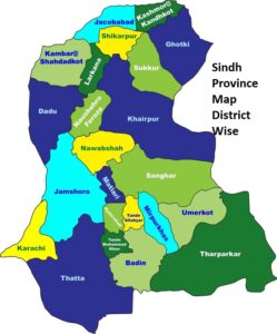
Sindh province Map District Wise
Mohenjo-Daro, Amri, Kot DG have been discovered in this three thousand years old historic place. From 1750 B.C to 5000 B.C, history is still mystified about the era. In 500 B.C, Iranian ruler King Dara-I conquered it. It was included in Iran. After two decades, The Great Alexander came here but moved on without occupying it. Later, Morya Khan ruled it and promoted Buddhism. A large population of Sindh started practicing Buddhism. Thenceforth, Pharteheen, Kashan, and hunn came there. About 40 km from Karachi, Archeology gave the signs of Setheen and Partheen culture in the southeast.
Much of the region came into the orbit of the Mughal Empire during the 17th century—Muslim emperors ruled first through the local Kalhora. From the third to the seventh century, Sindh was under Iranian rule. In 712 AD, Muhammad Bin Qasim introduced Islam to this area. in the tenth century, Muslim rule ended here. Subsequently, Mehmood Ghaznavi invaded and ruled it.
For some time, it was subjugated to Delhi’s dominion. From 1783 A.D to 1843 A.D, Talpurs Commanded it. Tughluq also influenced Sindh. After the declination of the Mughal sultanate, different Governors ruled its different parts, until two major British military victories in 1843, and Sindh’s subsequent rule by the Bombay Presidency, an administrative division of British India.
In 1843, Sir Charles Napier defeated Talpurs near Hyderabad and encompassed Sindh to British India. It became to be a part of the province of Bombay. In 1943, British rulers made it a separate province, and Karachi was declared its Capital. When Pakistan came into being, Karachi became the first capital of Pakistan. Karachi was brought under the Federal Government Administration and, Therefore, Hyderabad was designated as the new Capital of Sindh. It remained the capital of Sindh during Talpurs’ Reign.
In 1955, Sindh was integrated with Western Pakistan (one unit). On 1st January 1955, after the split of one unit, it became a complete province again. According to the Sindh government’s official history, the British conquest was “inhumane,” and “their supporters were Hindus,” resulting in “a constant policy to subdue the Muslim majority and to lionize the Hindu minority in Sindh.
“Father of the Nation” Muhammad Ali Jinnah, who would become the first leader of an independent Pakistan, issued his famous Fourteen Points in 1929; these included a call for Sindh’s separation from the Bombay Presidency. This was accomplished in 1936 when Sindh became a separate province with its own legislature. Many Sindhis were leading supporters of the “two-nation theory” that identified South Asia’s Muslims as a distinct nation deserving of its own state, and the Sindh Assembly was the first in British India to endorse the 1940 Lahore Declaration calling for that independent Muslim state.
At independence in 1947, Pakistan comprised five major ethnolinguistic groups: Bengalis—an absolute majority of the original country’s entire population in then-East Pakistan—and Punjabis, Sindhis, Pashtuns, and Baloch, each a majority within the four respective provinces of then-West Pakistan.
All five of these Muslim-majority communities had long self-identified as a distinct people or culture, and all experienced active secessionist or nationalist movements in the wake of independence. Each of these movements itself had vital transborder aspects, with Sindh’s spanning eastward to India. These links grew primarily from more than one million, relatively wealthy, mostly Muslim, Urdu-speaking, “Mohajirs” who settled in major Sindhi urban centers such as Karachi Hyderabad, and Sukkur after migrating from central and southern India during the 1947 Partition.
Population of Sindh
Official government population statistics continue to be based on the most recent national census in 1998, which put Sindh’s population at 30.4 million out of Pakistan’s then-total 132 million, with 52% living in rural areas. Yet Pakistan’s population has grown rapidly in the current century and is now at or near 200 million.
A provincial government department website reports a Sindh population of 44.2 million, but a 2012 press report citing government sources stated that Sindh’s population increased by more than 80% from 1998-2011 to above 55 million. Other estimates reach as high as 60 million. About one in four Pakistanis live in Sindh, and about one-third of Sindh’s population lives in the Karachi metropolitan area.
According to current stats, Sindh with its 47.9 million population is the most urbanized and industrialized province of Pakistan.
The province is notably more urban than is Pakistan overall. Estimates show that about half of Sindh’s residents live in urban areas, while only 33%-38% of the entire country’s population live in rural areas. According to the CIA World Fact Book, about 14% of Pakistanis are ethnic Sindhis, and 12% speak Sindhi as their mother tongue. If correct, this indicates that about half of Sindh’s population is comprised of ethnic Sindhis.
Decentralization and Separatism
Pakistan’s 1971 bifurcation into two states left a “rump” (West) Pakistan dominated both politically and demographically by Punjabis but contained three other major ethnonationalism communities: Sindhis, Pashtuns, and Baloch.
Support for the two-state approach had always been tepid among these smaller groups—the overarching logic of South Asian Muslim unity did little to incorporate the region’s narrower separatist and autonomist movements—and the success of Bengali separatism led national leaders to pursue a tough state-centric policy that sought to suppress ethno-lingual movements such as those of the Baloch, Mohajirs, and Sindhis.
Increased Punjabi dominance elicited considerable resentment among the country’s ethnic minorities. Sindhi nationalism predated the loss of East Pakistan, beginning soon after 1947 independence with opposition to Punjabi settlers in rural areas and efforts to suppress the Sindhi language (Urdu was declared Pakistan’s official language, thus empowering Urdu-speaking Mohajirs from India).
Many Sindhis also saw themselves acting in opposition to a “Mohajir-Punjabi nexus.” Within four years of independence, the proportion of Sindhi-speakers in the province had dropped from 87% to 67%, and Sindhis became a minority in their own capital city, where about 57% were Mohajirs by the early 1950s.
The 1955 imposition of the “One-Unit” scheme, which had combined West Pakistan’s four provinces into a single political unit, presented another grievance. Soon after, newly irrigated Sindhi land began being granted to retired military officers and bureaucrats (mostly Punjabis), in a practice that continues today.
By one account, up to 40% of Sindh’s best farmland came to be owned by non-Sindhis. Moreover, Sindh, as the lower riparian of the Indus River, continues to have water disputes with Punjab, and Sindhis also found themselves significantly underrepresented in the powerful Pakistani military and civil bureaucracy.
In the 1970s, with Sindhi and Pakistan People’s Party (PPP)-founder Z.A. Bhutto as Prime Minister, Sindhi nationalists sought to change laws so as to strengthen Sindhi identity and potentially lead to a separate or autonomous “Sindhudesh” (“Land of the Sindhis”). This movement was weakened by a mixture of concessions and suppression by the federal government.
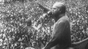
Shaheed Zulfikar Ali Bhutto addressing the nation
The PPP was a national, rather than Sindhi party, banned by General Zia ul-Haq after he took power in a 1977 military coup, and thus did not provide a vehicle for separatism. Although Sindh has always possessed most of the characteristics required for a viable independent state—and some nationalist sentiments persist to this day—its role as Punjab’s conduit to the sea may well be the ultimate reason that successful Sindhi separatism faced long odds.
Sindh’s Mohajirs had their own autonomist movement from the mid-1980s until the early 2000s. This was rooted in that community’s loss of pre-eminence in provincial politics, bureaucracy, and industry, its lack of meaningful representation in the army, and its loss of identity following migration, among other factors. After the 1970 election elevated a Sindhi to the prime ministership, Mohajir student organizations began efforts to consolidate community identity, and in 1984 the Muttahida Quami Movement (MQM or United National Movement) political party was founded, one with an early “penchant for torture, kidnapping, and murder.”
Political violence in Karachi grew to such a scale that, by the early-1990s, it had caught the attention of the army, which launched a crackdown that sent MQM leader Altaf Hussein into apparently permanent exile in London. Yet the party remains a major player in the province (and nationally) and has continued to be dominant in Karachi proper. Sindhi-Mohajir frictions remain unresolved, especially given widespread perceptions among Mohajirs that the provincial government is fundamentally unable to serve the needs of the Mohajir community.
Government and Politics
Sindh provides a core vote bank for the national PPP. Rural Sindhis tend to overwhelmingly support that party, and the city of Lakarna is the base of the powerful Bhutto dynasty (Z.A. Bhutto’s daughter, Benazir, served twice as prime minister, from 1988-90 and again from 1993-1996; her widower, Asif Zardari, took the party reins after her 2009 assassination and ruled Pakistan as its president from 2008-2013; their 26- year-old son is now party chairman).
Meanwhile, the MQM plays a significant role in both national and provincial politics and has for decades dominated municipal governance in Karachi. Sindh sends 75 representatives to Pakistan’s 342-seat National Assembly (NA), or 22% of the chamber’s total.
The 2013 national election saw the PPP again account for a majority (55%) of Sindh’s representation at the federal level, with 41 seats. The MQM won 23 seats (31% of Sindh’s total), demonstrating that these two parties dominate provincial politics. Of the remaining 11 Sindhi seats in the NA, 8 are held by parties affiliated with the Pakistan Muslim League. The Lahore-based branch led by current and thrice Prime Minister Nawaz Sharif (PML-Nawaz) nearly swept Punjab in the 2013 elections and now enjoys an outright majority at the federal level.
The Provincial Assembly of Sindh houses 168 seats for the province’s 28 administrative districts. At present, 92 (55%) of these are held by the PPP, providing that party with an absolute majority. Another 51 seats (30%) are held by the MQM, thus nearly perfectly reflecting the relative proportions found in the NA. The MQM leads an opposition alliance that includes the PML-N, which holds eight PA seats.
Provincial Assembly, Sindh
Total Sindh government expenditures for FY2013/14 were $5.75 billion, nearly 7% higher than total revenue (and up from a 2% deficit the previous year). By comparison, Punjab’s provincial government spent $8.8 billion in the last fiscal year, and Baluchistan’s spent $1.6 billion. Sindh’s provincial government expenditure was nearly identical to that of the North Dakota state government’s ($5.8 billion) in 2013, but for a population more than 50 times as large.
Sindh Chief Minister Syed Quam Ali Shah is also the provincial president of the Pakistan People’s Party and holds a parliamentary seat from the north-central Sindhi city of Khairpur. He was trained as a lawyer and, having been born in the 1920s, is among the most senior of living PPP members. With the exception of a six-week hiatus for the 2013 national elections, he has served as provincial chief minister since April 2008. He also served a 14-month stint in the same office for the government of Prime Minister Benazir Bhutto, and as industries minister in the federal cabinet of her father and PPP founder, Prime Minister Z.A. Bhutto, during the 1970s.
At present, Shah’s office comprises 24 cabinet ministers, 13 special assistants, 5 parliamentary secretaries, 4 coordinators, 3 advisers with portfolios, and a political secretary. Sindh Governor Ishratul Ebad, in an appointed office that represents and reports to the federal government in Islamabad, was seated in 2002, when he became the youngest-ever Sindhi governor at age 39. He began his political life as an MQM student activist during his training as a physician in Karachi and later held ministerial posts in the provincial government.
Upon the 1992 launch of the Pakistan Army’s operations against the MQM (see below), Ebad sought and was granted political asylum in Britain, along with many other MQM leaders, party chief Altaf Hussein among them.
He reportedly remained close to Hussein until he was appointed to the governorship by then-Chief of Army Staff Pervez Musharraf, himself a Mohajir, who had declared himself President of Pakistan following a bloodless 1999 military coup (Musharraf’s party had made a power-sharing arrangement with the MQM following 2002 national elections).
With the MQM chief remaining in apparently permanent exile overseas, Ebad has been able to amass considerable influence over the party apparatus during more than 12 years as governor, even as Pakistan’s Constitution requires that governors are formally and officially nonpartisan.
Economy, Demographics, and Employment
According to the Sindh Board of Investment, provincial economic activity accounts for 33% of the national GDP with only 23% of the country’s population. It also collects fully 70% of the country’s income taxes and 62% of its sales taxes. Nearly half (45%) of Sindh’s employed labor force is engaged in agricultural work. The poultry sector alone employs some 1.5 million people.
The province is home to 54% of the country’s textile units and 45% of its sugar mills. Textiles are Pakistan’s leading export, both globally and to the United States. Sindh also accounts for about half of Pakistan’s total seafood exports, up to one-third of its rice, sugar cane, mango, and vegetable crop production, and 25% of its cotton. Granite and marble are major provincial mineral resources.
Sindh rural area
About 60% of Pakistan’s oil fields and 44% of its gas fields are located in Sindh, and these contribute 56% of the nation’s oil and 55% of its gas production. Sindh government sources also claim that Sindh is the site of one of the world’s largest coal reserves of 185 billion tons, which would account for one-fifth of the world’s total reserves. However, these claims are not supported by independent assessments, which generally find Pakistan as a whole possessing just above 2 billion tons of reserves, the vast majority of these in Sindh. At 5.0% in 2012-13, Sindh’s official unemployment rate was fully 1.2% lower than the country’s overall rate and also bucked a nationwide trend by decreasing slightly over the previous year. (see Table 1)
Unemployment Rate by Percentage: –
2010- 2011
2012-2013
Total Male Female
Total Male Female
Pakistan
6
5.1
8.9
6.2
5.4
9.0
Sindh
5.2
4.8
7.2
5
4.4
8.2
Table 1 source: Pakistan Economic Survey
Sindh’s primary school enrollment rate (for ages 5-9) was 52% in 2014, 5 points lower than the national rate and 10 points lower than Punjab’s. Less than half of the province’s girl children (48%) attend primary school. Female disadvantage also is illuminated in literacy rates: for ages 10 and above, Sindh’s was 60% last year, the same as the national rate and only 2 points below Punjab’s. However, Sindh’s female literacy rate trailed Punjab’s by 7 points (see Table 2).
Data also show that, while overall education rates among Sindh’s urban residents track almost perfectly with those of urban Pakistan overall, the province’s rural populace is notably less likely to ever enroll in school, 22% of Sindh’s rural female population has ever attended school, as compared to 37% of rural Pakistani women overall (see Table 3).
Sindh, along with the Federally Administered Tribal Areas, has been singled out for faring poorly in official assessments of primary education performance, with one study finding less than one-third of its 5th-year students able to perform 3rd-year-level math and one-quarter able to read at the 2nd-year level.
More than one-third of the Sindh government’s expenditures for the fiscal year ending March 2015 (38%) were devoted to “education affairs and services,” up from 36% the previous year. In absolute terms, such spending increased by 21%, from $975 million to about $1.2 billion in the most recent fiscal year.
Table 2. Literacy Rate (10 years and above, by percentage)
Urban
Rural
Total
Male
Female
Total
Male
Female
Total
Male
Female
Total
Pakistan
82
69
76
64
37
51
71
48
60
Sindh
84
70
77
59
22
42
72
47
60
Badin
62
38
51
47
17
33
50
21
36
Thatta
72
45
60
44
19
32
48
23
36
Table 3. Percent of Population That Has Ever Attended School
2012-2013
Urban
Rural
Total
Male
Female
Total
Male
Female
Total
Male
Female
Total
Pakistan
84
70
77
66
39
53
72
50
61
Sindh
85
70
78
57
22
41
72
47
60
Badin
61
36
49
52
19
36
54
23
39
Thatta
68
48
59
46
19
33
49
23
37
Some statistics suggest that Sindhis’ general health is slightly poorer than is Pakistan’s overall (see Table
4). About 11% of the Sindh government’s expenditures for the fiscal year ending March 2015 were
devoted to health services, down from 12% the previous year. In absolute terms, such spending was
essentially static, from $341 million to $347 million in the most recent fiscal year.
Table 4. Percentage Distribution of Population Under 5 Years Fallen Sick or Injured
Male
Female
Total
Pakistan
13.9
12.9
13.4
Sindh
15.8
14.4
15.1
Badin
20.4
18.9
19.7
Thatta
14
12.9
13.5
Conclusion: –
Sindh has a deep history. Sindh is one of Pakistan’s four provinces, accounting for roughly one-quarter of the country’s population in less than 18% of its land area. The vast majority of Sindh’s residents live at or near the final few hundred miles of the river Indus’s coastline.
It holds remarkable significance as Sindh valley from one of the ancient Human Civilizations. Sindh has lots of cultural and modern spots for tourists. Ancient Monuments at Makli, Thatta, and Archaeological Ruins of Moenjodaro are included in the World Heritage Sites by UNESCO.
According to current stats, Sindh with its 47.9 million population is the most urbanized and industrialized province of Pakistan. The macro survey revealed that Sindh has the highest GDP per capita in Pakistan, both in rural and urban areas. In brief, Sindh is the hub of Education, Economy, Culture, Tradition, and tourism.
A historic monument and icon of Hyderabad, Charminar was built in 1591 by Muhammad Quli Qutb Shah. This grand structure with four arches is a blend of Islamic and Indian architectural styles.
Golconda Fort
Dating back to the 13th century, Golconda Fort was the capital of medieval Golconda Sultanate. Known for its impressive acoustics and engineering, it offers panoramic views of Hyderabad.
Qutb Shahi Tombs
Located near Golconda Fort, the Qutb Shahi Tombs house the tombs and mosques of the rulers of the Qutb Shahi dynasty. The tombs display a unique blend of Persian, Pathan, and Hindu architectural styles.
Salar Jung Museum
One of the largest art museums in the world, the Salar Jung Museum boasts a vast collection of art, sculptures, manuscripts, and artifacts. It was established by Nawab Mir Yusuf Ali Khan Salar Jung III.
Hussain Sagar Lake
Built in 1562 by Ibrahim Quli Qutb Shah, Hussain Sagar is a large artificial lake known for the iconic Buddha statue in the middle. The lake offers boating facilities and a picturesque view of Hyderabad.
Birla Mandir (Venkateswara Swamy Temple)
Perched on a hill, Birla Mandir is a Hindu temple dedicated to Lord Venkateswara. Constructed with white marble, it offers a serene atmosphere and panoramic views of the city.
Chowmohallah Palace
Built over 200 years ago, Chowmohallah Palace was the seat of the Asaf Jahi dynasty and is renowned for its architecture and grandeur. It consists of four palaces and showcases the Nizam’s opulent lifestyle.
Ramoji Film City
Recognized as the world’s largest film studio complex, Ramoji Film City is a popular tourist attraction. It offers film sets, entertainment zones, and guided tours, providing a glimpse into the world of Indian cinema.
Laad Bazaar
Located near Charminar, Laad Bazaar is a vibrant market known for its traditional bangles and intricate jewelry. It offers a lively shopping experience with a variety of traditional crafts and accessories.
History of Hyderabad
Founded in 1591 by Muhammad Quli Qutb Shah, Hyderabad has a rich history as a major center for culture, trade, and technology. It was later ruled by the Nizams and played a crucial role in the socio-economic development of the region.
History of Hyderabad
This hot and humid city was established in 1768 by Mian Ghulam Shah Kulhoro on the bank of the River Indus.
Ariel’s view of Hyderabad city
In 1789, Talpur ruler Mir Fateh Ali Khan shifted the capital from Hala to Hyderabad. Renowned as Neron Kot during the King Dahir Regin it was the prior capital of the province Sindh.
Before the creation of Pakistan, it was also known as the “Paris of Sub-continent”. It was because its roads were washed by Rivers’ water. After the detection of Harappa, 110 km from the city Amri, its importance was enhanced.
The first Hetrick of the world was made in 1982 in the Niaz Cricket Stadium Hyderabad.
Famous Places of Hyderabad
Glazed tile work, glass bangles, wood furniture, colorful crafts, blocked-printed Ajrak, handmade fabric Tus, forests Sheikh Makki fort, Talpur monument, Pakka fort, Kulhoro monument, Gham Kot are the eminent places of Hyderabad. The river Indus flows about 9km near Hyderabad. That’s why it is famous for its cold breeze and beautiful gray and blue sky.
If the people from other cities spend an evening here, he will be captivated by the lovely evening of the city. Eid Gha, Rani Bhag, Thandi sarak (سڑک), Clock tower, Dawood Pota library, Makkhi house building are the worth watching places here. Hala-Naka is famous for its variety of food. Must try Traditional Pilla fish, and Limka (different flavored soda water).
Pakka Fort (Qila)
Pakka Qila, Hyderabad
In 1768, Mian Ghulam Shah Kulhoro established a fort from solid bricks for a strong defense. He named it as Pakka Qila. (Pakka Fort). After the death of the last ruler of the Kulhoro family, Talpur had announced as the king of the area. Mir Fateh Ali Khan Talpur left the Khuda Abad. He shifted his capital to Hyderabad in1789. He made his residence there and organized courts there. The entrance door of this fort portrays the spectacular and glorious history of this fort.
Talpur Monument
The tombs of Talpur’s former ministers are located in the center of the city Hurra Abad. Blue glazed tiles on the tomb are still appealing the tourists. Six buildings are established in the Talpur monument. These were constructed between 1785 to 1850.
Kulhora Monument
Earlier Kulhora ruler’s graves are located in Hyderabad behind the Jail. These graves are decorated with beautiful flowers. These fine pieces of architecture are still in good condition.
Sindh Museum
Sindh-museum
Situated on Eid Gha road, this museum exemplifies the history, heritage, and traditions of Sindh. The things that belonged to the emperors of the different eras such as Sama, Somro, Kulhora, and Talpur are placed there. The antiques from Kot DG, Amri, and Mohen jo Daro are also exhibited there.
Institute of Sindhology
Situated in Sindh University, the institute of Sindh is the best place to understand the history, heritage, music, traditions, and other values. Lifestyle Sindh tribes are explained through different models.
Mir Noor Muhammad Talpur Museum
This museum was the personal collection of Mir Noor Muhammad Talpur. The present owner of this museum is Doctor Mir Noor Muhammad Talpur. There is no fee for visiting the museum.
Clock Tower
Constructed in 1914, this clock tower is an identity of Hyderabad. Its architectural style gives a reflection of the British era.
Rani Bhag (zoo)
Its foundation was led by a British General. Its name was changed after the Queen Victoria visit.
Hussain Abad Park
It is captivating because of the artificial lake and birds.
Hyderabad University Park
It is the extended part of Hyderabad’s city. It surrounds an area of 12 acres. A beautiful lake between orchards adds to the beauty of this park. It is the best picnic point for the Locals.
Mustafa Park
Situated in Norani Basti, this park has different models of animals.
Badshahi Bangla
This belongs to Prince Mir Hassan Ali Khan Talpur, who was the son of Mir Naseer Khan Talpur.
Bazaar
Resham Gali and Shahi Bazar are the traditional bazaars of Hyderabad where one can find art, craft, embroidery Sindh’s traditional jewelry, and the handicrafts of inner Sindh. In brief, everything that promotes the Sindhi tradition can be found here.
Miani Jungle
It is a historical place about 9 km away from Hyderabad. It is the place where the British and Talpur had a war in 1843. Because of forest life, and better weather conditions this place is best for a picnic. A children’s park is also there for families. Dak Bangla of the forest department is there for a night’s stay. In addition to this, Jamshoro Burj has its charm.
Kasano Mori
It is a beautiful picnic point that is situated 18 km from Hyderabad and on Mirpur Khas Road. It is an ideal place for swimmers and one day picnic.
Frequently Asked Questions
What is the historical significance of Charminar?
Charminar, built in 1591, symbolizes the cultural blend of Persian and Indian architecture. It served as a grand gateway to Hyderabad and stands as an enduring icon of the city’s historical grandeur.
Why is Golconda Fort famous?
Golconda Fort, dating back to the 13th century, is renowned for its engineering marvels, acoustic wonders, and panoramic views. It offers a glimpse into the medieval history of Hyderabad.
What makes the Qutb Shahi Tombs unique?
The Qutb Shahi Tombs are unique for their architectural fusion, blending Persian, Pathan, and Hindu styles. They serve as the final resting place for the rulers of the Qutb Shahi dynasty.
What can one explore at the Salar Jung Museum?
The Salar Jung Museum houses an extensive collection of art, manuscripts, and artifacts from various cultures and eras. Visitors can explore the artistic evolution of Hyderabad and beyond.
What is the significance of Hussain Sagar Lake and its Buddha statue?
Built in 1562, Hussain Sagar Lake is known for its tranquility and the iconic Buddha statue in its midst. The lake reflects the city’s efforts to harmonize nature with architectural landmarks.
Tell me about Birla Mandir’s significance.
Birla Mandir, or the Venkateswara Swamy Temple, is a serene Hindu temple constructed with white marble. It offers a peaceful retreat and panoramic views of Hyderabad.
What does Chowmohallah Palace represent in Hyderabad’s history?
Chowmohallah Palace served as the seat of the Asaf Jahi dynasty, representing the opulence of the Nizams. The palace complex showcases their regal lifestyle and the royal history of Hyderabad.
Why visit Ramoji Film City?
Ramoji Film City is the world’s largest film studio complex, offering a unique experience with film sets, entertainment zones, and guided tours. It provides a glimpse into the world of Indian cinema.
What makes Laad Bazaar a popular market in Hyderabad?
Laad Bazaar, near Charminar, is renowned for its traditional bangles and intricate jewelry. It offers a lively shopping experience, showcasing the rich tradition of craftsmanship in Hyderabad.
Last Thoughts on Hyderabad
The famous places of Hyderabad stand as living testaments to its storied history. From the regal charm of Charminar to the modern allure of Ramoji Film City, each landmark contributes to the city’s vibrant narrative, making Hyderabad a destination where the past seamlessly intertwines with the present.
Karachi is the largest city in Pakistan. It is also the capital of Province Sindh. This ancient city has a population of more than 20 million. Karachi presents a beautiful contrast of antique and modern cultures and traditions. It plays a key role in the economy of Pakistan. It is famous for its grand buildings, captivating seaports, food streets, and museums.
Brief overview of its history
Attribute
Information
Location
Karachi, Sindh, Pakistan
Coordinates
24.8607° N, 67.0011° E
Population
Over 14 million (2021 estimate)
Province
Sindh
Importance
Economic hub, largest city in Pakistan, major port city, cultural center
Economy
Diverse, including finance, industry, trade, and services
Educational Institutions
Numerous universities, colleges, and schools
Transportation
Well-connected by road, air, and sea. Home to Jinnah International Airport.
Hot and humid summers, mild winters, and monsoon rains
Cultural Diversity
A melting pot of cultures, hosting a variety of ethnic groups
Notable Industries
Banking, finance, textiles, manufacturing, port activities
Entertainment
Home to theaters, cinemas, art galleries, and a vibrant music and arts scene
Historical Significance
Has a rich history dating back to ancient times, influenced by various empires and dynasties
Do Darya is, Famous place in Karachi
History Of Karachi
It was known as “Karro Kala” when the great Alexander’s navy reached there. A village named “Kark” was settled there which was 16 miles away from the existing Karachi. A time came when this port was covered with sand. At this time the people of Kark searched for a better place under the mentorship of “Bhojomil”. They found a place “Kalachi” which was famous as “Karashi” among Arabs Mariners. Afterward, this village adopted the name “Karachi”.
During Talpurs’ reign, it prospered a lot. In 1843, the British Captured this area. Sir Charles Napier shifted their Head Office from Hyderabadto Karachi. At that time, Karachi flourished as a navy port and Military Barracks. In 1936, Sindh became a separate province. Karachi was given the reputation of its Head Office.
In 1947, it was made the capital of Pakistan. Its population was two lacs at that time. After the creation of Pakistan, people from Muslim minority areas of India migrated to Karachi. This led to an increase in population there. This increased population created a big challenge for the administration. Since it was the capital, all the public servants, their offices, and their residence gathered here. And by the end of 1951, its population crossed 1 million.
Saddar Bazar, Karachi famous Bazaar
The second flood of the population came there when an industrial state was established there. People from Punjab and KPK migrated to find a better livelihood. People from the slums of Sindh also shifted to Karachi.
People of different languages and different cultures were accommodated there. Karachi is now a famous historical Multi-Ethnic and multi-cultural city. It is also known as the city of lights. Karachi is the country’s largest economic, industrial, trade, education, and Transportation Centre. In addition to these, it has many famous historical places and picnic spots. It is situated in the west of River Indus and Northern seashore of Arabian sea.
Pakistan’s largest seaport and Airport is also located here. Its weather is moderate because of the seashore. One can enjoy fishery, eye-catching sea bank sights, sailing, golf, and horse riding all over the year.
Famous Places of Karachi
Quaid’s Tomb (Mazar e qaid)
After the death of Quaid e Azam, Syed Hashim Raza decided to build his shrine in the honor of his majesty. He selected a place in the heart of Karachi, in the middle of important roads and tracks. An adept Architect Yahya merchant completed its design in 1956. Mohtarma Fatima Jinnah gave the approval in December 1958. In July 1960, President Ayub Khan inaugurated this project. Quaid’s short biography, old Pakistani coins, and the content of Resolution of Pakistan are placed in its foundations. 1125000-carat silver is used for the safety of the grave. It was opened for the public on January,1 971.
Mazar e Quaid, Karachi
The shrine has a parameter of 65000 yards and the central building is located at a height of 250 feet. Spacious Stairs are constructed on the three sides to reach this vast podium. High-Quality Marble is imported from Mardan and Peshawar. The building height is 114 feet, the dome inner diameter is 70 feet and the outer diameter is 74 feet.
Four arched-shaped doors are placed for the entrance. Calligraphy on the plate (Qatba) is done by the famous calligrapher. Verses of Surah Nasar and Surah Fateh are engraved on taweez (a trinket or piece of jewelry usually hung about the neck and thought to be a magical protection against evil or disease.) The inner dome is decorated with a stunning Chandelier gifted by our respected neighbor China to Pakistan.
A silver net is placed around the grave. From January 1973, Armed Military Forces started guarding the Tomb. Four people of armed forces are positioned inside and four are positioned outside the tomb. the shrine is decorated with orchards covering up to 27 acres. Gigantic Trees and countless flowering plants make this area drop-dead gorgeous. Sitting arrangements have been made for the public. Escalators are available for Government officials and special personalities.
Quaid’s tomb, Karachi. Pakistan
Quaid’s Antiquities room is present on one side of the tomb. It was inaugurated on 23rd March 1982. These Antiquities were gifted from Mohtarma Fatima Jinnah. Quaid’s personal cars PICARD. Model no KAM 1327 and official Cadillac are present there. Quaid’s dresses, bed, sofa, books, wallet, stamps, and a lot of other things are exhibited here. Mohtarma Fatima Jinnah, Shaheed e Millat Liaqat Ali Khan, Begum Ryna Liaqat Ali, Sardar Abdul Rab Nishter, and Noor ul Ameen are also buried inside the Tombs’ Boundary. This splendid building is situated on Quaid e Azam Highway, M.A Jinnah Road, Karachi.
Quaid e Azam House Museum – Flag Staff House
Located on the junction of Faisal Road and Fatima Jinnah Road, formerly known as Flag Staff house was the property of Quaid e Azam. Designed by Moses Somake this building was constructed in 1890. Quaid e Azam bought it for Rs.1115000. Quid’s belongings with furniture were shifted to Flag House in 1948. After the death of Quaid, on 13 September 1948, his sister Mohtarma Fatima Jinnah shifted here.
Flag staff house Karachi, Pakistan
In late 1964, she moved to Mohatta Palace (Qasar e Fatima). Later on, it was given under the custody of Quaid e Azam trust. On 14 February 1985, the Department of Archeology purchased it for Rs 5,507,000. On 25th November 1993, Governor Sindh Hakeem Muhammad Saeed officially inaugurated this museum. It surrounds an area of 10241 square yards. Quaid’s personal things such as sticks, stationery, dress, furniture, shelves, crockery, etc. are placed here. Moreover, The Quran e Pak in his use is also exhibited here.
Liaqat Hall, Library, Bagh e Jinnah and Frere Hall
In the British era, Frere Hall was used as Town Hall. In addition to this, it was the center of social and cultural activities in Karachi. This Venetian Gothic Building was established in acknowledgment of the services offered by Sir Bartle Frere. The ground floor of this building is utilized as Library. Seventy thousand books and drafts are shelved here. The first floor is used as an art gallery where pieces of calligraphers and painters are kept. The central building has a beautiful Garden “Bagh e Jinnah”.
Liaqat Hall library, a famous historical place , Karachi
Sindh Madressatul Islam
sindh-Madrasaa-tul-Islam, Karachi, Pakistan
Its foundation was led by a Turkish descent Sindhi Zulfiqar Ali on 1st September 1885. Based on the British education system, it gained popularity among Sindhi and Balochi Muslims.
Its vision was to introduce the Sindhi people to education compatible with the modern age. Mr. Jinnah being impressed by the vision of the school got admitted his son Muhammad Ali Jinnah. This historical school is situated near Habib Bank Plaza, Karachi.
Wazir Mansion
wazir-mansion, Karachi, Pakistan
The Founder of Pakistan Quaid-e- Azam Muhammad Ali Jinnah was born on 25th December 1876 in a house of Kharadar Karachi named “Wazir Mansion”. It was declared as a national monument and changed into a museum. The ground floor has a library, upper storey has Quid’s personal use things. It also has pictures related to “Tehreek-e-Pakistan”.
Mohatta Palace
In 1927, a Hindu Businessman Shivrtan Chandartan constructed this sumptuous building for his residence. For this, he hired a famous Muslim architect, Ahmad Hussain. Based on Rajhistani culture, he used pink stone from Jodh Pur Bharat and yellow stone from Guzri.
This Building occupies an area of 18500 square feet. He lived for twenty years thereafter its completion. After separation, he decided to move to India. The government of Pakistan took this under supervision and it was utilized by the foreign ministry.
Mohatta Palace karachi Pakistan
In 1964, Fatima Jinnah took it under her custody. It was given the name of Qasar-e- Fatima. After the death of Fatima Jinnah Shehreen Jinnah used to live there. It was sealed after her death.
In 1995, the Government of Sindh decided to transform it into a museum with the intention of promoting and progressing art and culture. It was opened for the public in 1999 after its completion. It is situated on Hatim Alvi Road near the bus stop.
National Museum of Pakistan
national museum Karachi
The National Museum of Pakistan was established on 17th April 1950 in Frere Hall. It was designed to give honor to the Sindh commissioner Bartle Frere. Its purpose is to introduce the history of Pakistani culture to the Public so that they can understand the struggles of their celebrities and forefathers. Thenceforth, it was shifted to Burnes Garden. The previous museum had four galleries while the present one has eleven galleries including Quranic Calligraphy studio.
Quranic Gallery has valuable pieces of Islamic art. While other galleries have the pieces of Gandhara, art, Indus sculptures, Islamic painting, antique coins, and the Documentation of Pakistani political history. Furthermore, it also gives a demonstration of the lifestyle of different races and cultures living in four provinces and Azad Kashmir.
This museum has 58000 antique coins which belong to the 74th century. Hundreds of Sculptures are present in good condition. Department of archeology and museum department are connected here so that people can enjoy everything in one place. Every year, many exhibitions are held on national days and other events. An auditorium is also built in the boundary of the museum for organizing seminars.
State Bank of Pakistan Museum
State Bank of Pakistan, Museum, A famous historical place of Karachi
Situated on I. I. Chundrigar Road, constructed in 1920, this building was known as the Imperial Bank of India till the creation of Pakistan. Later it was used as the central building of Pakistan and then as a library. In 2004, it was ordered to change it into a financial museum. it was inaugurated in 2011. This unique museum tried to cover up about the 4000 years history of currency.
A guidance map is placed at the entrance of the museum. Governor gallery has pictures of governors of Pakistan, their short history, and the furniture, telephone set of first governor-general office. Two-coin galleries have valuable coins from 2500 B.C. to 2010. Outside the coin gallery museum, an old iron door of the strong room is installed. Kiosk technology installed in the coin gallery enables the visitors to see the antiques through 3D over zooming.
In the vast hall of the museum, the first T.M machine, currency printing machine, coins molding machine, and prize bond lucky draw boxes are also available. In the stamp gallery, post tickets are available from 3000 B.C. The currency gallery has currency samples from the creation of Pakistan till 2010. It also has some samples of international currency.
State Bank of Pakistan gallery has charts and documentation from the creation of Pakistan till 2010. On the ninth floor, Sadqeen gallery has famous wall-sized paintings are hanged. A part of the museum is specified for part-time exhibitions.
The facility of A mini theatre is provided to the public for watching different documentaries. This museum is an asset not only for the public but also for the history and economy students.
Meri vedar Clock Tower
For the salutation of the services of sir William Lal meri vedar, the people of Karachi built this monument. This monument is located at the junction of M.A. Jinnah Road and I. I Chundrigar. James Strachan municipal engineer presented its design. Its foundation was led in 1884 and in 1892 Commissioner Sindh, opened it for the Public. Constructed on 44 square feet podium, this tower is 102 feet high. It has clocks on its four sides. It is one of the oldest memories of Karachi but no one can claim about its design.
PAF Museum
On 14th August 1947, Chief of air staff Air Marshal Abbas Khatak, inaugurated it and it was opened for the public in October. The air force decorated the whole
PAF Museum, Karachi
area with grass fields.
All the aircraft used in wars are dismantled on the green grass floor. It includes Star fighter F104 Sabro, F86, Mirage, FT6, F6, T53, Umig15, (Mushak) MF 117, Aero Commander, Antiv AN12, D95A (Travel Air) Beach, 16G (Harvard), Hvskie helicopters different types of radar and others defensive weapons. Founder of Pakistan’s aircraft Viking is also exhibited. An Indian airplane Gnat (Pakistani forces crashed in Pasroor) and other antiques are revealed to the public.
Four sub galleries are designed one of which shows an airplane model with the painting of aerial battles. The other gallery has models of fighter planes from different countries. The remaining two galleries are dedicated to the martyrs of the 1965 and 1971 wars.
Two open galleries show the achievement of Squadrons and paintings of different airbase(stations). There is a souvenir shop for tourists, where they can buy models of small aircraft, air force key chains, shirts pins, and other things. It depicts their solidarity with military troops. Its tour will provoke patriotism in you. This museum is located between Awami Markaz of Faisal Highway and Faisal PAF Base.
Pakistan Merry time Museum
Maritime or merry time museum, Karachi
Pakistan merry time museum Park and art gallery are related to Pak Navy antiques. The central building is located inside the park and comprises six galleries and one auditorium. The cultural heritage of the Pak Navy is presented with different paintings, sculptures, touch screen computers, old weapons, and Taxidermy.
Light House
A lighthouse is constructed on the pattern of Manora Beach lighthouse. A birds-eye view of the museum and park can be taken from the tower.
Marine life gallery
On the second floor of the museum, a marine life gallery is established. This gallery reflects marine life in different stages.
Merry time history museum
It is the most interesting part of the museum. It has information related to Ormara beach. It has the Muslim Navy tools of the time when Muhammad bin Qasim army entered this area and invaded Debel. Old maps of Moden jodaro trading places are also exhibited here.
Museum Lake
A large lake is situated in the boundary of the museum to portray the sea environment. The orientation lobby and Ports Sharbovrs Gallery also give information about marine life. The museum is on Wednesdays for fans.
Pilot Rashid Minhas Shaheed (Nishan e Haider)
He was born on 17th February 1951. His father Abdul Hameed Minhas was a Garrison Engineer in Army. A large number of people in his family were posted in the Navy, air force, and land army on high ranks. He decided to choose the air force.
He got an education from Karachi and Rawalpindi and was finally admitted to PAF Risalpur Academy in 1969. After training, he was sent to Kohat, Risalpur, Peshawar, and Karachi. On 15th August 1971, he became Pilot Officer.
Rashid Minhas Shaheed, tomb Karachi.
At that time, India had started the Bangladesh movement. On 20th August 1971, he was on his routine training. His instructor took the control of the plane and moved its direction towards India. He realized the situation and tried to take control. He was unable to do so. He directed the plane to the ground. He was aware of his ultimate death, but he secured his country by giving his life. As a result, the plane was crashed 32 miles from the boundary and he was martyred.
It was recommended to award him “Sitara e Jurat” but, President Yahya awarded him “Nishan e Haider”. He is buried in the CSD army graveyard before Faisal Highway. Marra airbase is named after Rashid Minhas for the acknowledgment of his sacrifice.
Tuba Mosque (Defense)
Tooba Mosque
It was construed in 1969 under the supervision of Babar Hamid Khan in Defense Housing Authority situated on Korangi Road. It is considered the largest mosque in the World in terms of diameter. It has a unique diameter of 236 feet. It is said that no other mosque is identical to this. 5000 people can offer prayer at one time in its central hall. Its tower(minar) is 70 meters. White marble is used in its construction. It is also known as “Gol Mosque”.
Empress market
Empress Market Karachi
Before the market, it was used as Gallows. This market was built in the memory of Silver Jubilee. The architecture is based on Gothic style. It is not only a market but also an art and historic symbol of British era. Since it is located in the center of Karachi one can buy fruits, dry fruits. Vegetables, meat and almost everything of daily need. Every thing is quite fine in this 140 feet height clock tower market. Based on Roman architecture, The Sindh high court building is worth watching.
Abdullah Shah Ghazi
Shrine of Abdullah Shah Ghazi,Karachi,Pakistan
He was born in 98 Hijri in Madinah Munawwara. It was the time when the empire of Banu Umayya was taking its last breath. The whole country was in a state of huge disorder and disaster. His father took the charge of his education. He moved to Basra and Iraq on the advice of his father. Then he went to Sindh and started preaching Islam. Many people accepted Islam. In the last 151 Hijri the war was implemented and he was martyred and was buried on the bank of present Clifton.
Mango Peer
The saint of the 13th century, Mango peer’s shrine is located in the north part of Karachi. There are springs of warm and cold water. These springs have natural ingredients. Devotees come here and take a bath. Dozens of crocodiles are present in the ponds adjacent to the shrine. They are called “crocodiles of Baba Ji”. بابا جی کے مگرمچھ
Hub Dam
About 33 km from Mango peer to the northwest, the road connects to Hub Dam. With a span of 5 km, Hub Dam is constructed on a large lake. Water is supplied to Karachi through a canal rising from the Hub dam. A beautiful picnic spot on the corner of the dam is the best for an excursion.
Hub Dam
Tariq Road
The highways of Karachi are incomplete without Tariq Road. This important road is the center of shopping and commerce. It is always crowded with the people out for shopping. This road starts from quaideen Highway Allah wali Chorangi and ends at Shaheed Millat Road Tariq Chorangi. Liberty Chowk, rabi center, Mateen center, dolmen center, Kurta Gali, Jheel park, Uzma center, Rahmaniya masjid, café D khan, and Mc Donald’s are its important places. Furthermore, zaib-un-nisa street, Jubilee market, cooperative market, Abdullah Haroon Road, zamzama boulevard, Bohri Bazar, Park tower, and Millennium Mall are important shopping places.
P.I.A Planetarium
PIA planetarium
This planetarium is like a museum where information about the solar system and cosmic trends is presented through slide shows like movies. Decorated with the original airplane seats it is an adventure for the tourists. On Sundays, English shows, while Urdu shows are presented on the other days of the week. An interesting point is that an original airplane is present there. The tourist guide will tell you about this plane, its cockpit, and other systems.
Hindu Gym Khana
Established in 1925, the Mughal Architectural style was repeated in this building. Upper-class Hindus and Seth Rap Gopal aided in this construction. This club was designed for elite class affluent traders. Situated in Sarwar Shaheed road, this building was designed by famous Architect Agha Ahmad Hussain. Now, the national academy of performing arts is present here.
Hill Park
In 1960, officials decided to build a park between PECHSA Society because of the structure of the hill there. It became popular among the people because of its exceptional architecture and location. In the early days, films and tv shootings were completed there. People became excited to see their heroes. Nowadays, neither the artists nor the fans are there. Only the memories are left behind.
Safari Park
safari park, karachi
Located in Gulshan e Iqbal, this park comprises of playland, zoo, and greens grounds. Situated on university road, with an area of 1300 acres was inaugurated by Lieutenant General Atiq ur Rehman in 1970. A theme park named Goaish Adventure is also established here. It is the only park in Sindh with a chair lift. This project worth 2 million dollars was inaugurated on 8th March 2006. One can enjoy a bird’s eye view of the city while traveling over this thrilling chairlift.
Aziz Bhatti Park
This park named after Hero Aziz Bhatti Shaheed (martyred in the 1965 Indo-Pak war) is situated on the famous highway of university road near Urdu Science college. This park is under the Karachi administration.
Sindbad
This park has many sub-branches in Karachi with all kinds of children’s swings. The largest sub-branch is on Rashid Minhas Road, Neepa Chorangi. One of its branches is located in the elite area of Defense Housing Society adjacent to the famous Nisar Shaheed station(choki).
Port Grand
Port Grand is a fun area and a food street on KPT. It has an amusing area for children, a concert arena and a Shopping arcade under one roof.
Fiesta Park
fiesta park,Karachi
Swimming pools with stormy surges and a calm river environment, this water park is the favorite place for children and elders. It has 14 water slides. Seventeen slides are separately available for children. It is located in Karachi Hyderabad super highway near Toll Plaza.
Cosy Water Park
It is the largest water park in Pakistan with an area of 120 acres. Consisting of twelve different areas it is famous for its beautiful lake, islands, and sailing. A lucky draw winner is announced every week. This park is located between DEH Shah Mureed Road TOPASONGAL super highway Gulshan e memar and New Sabzi Mandi.
Karachi War Cemetery (jangi Qabrustan) جنگی قبرستان
During world war – II the people killed were buried in different cities. It was noticed that no one is taking good care of them. Therefore, a separate graveyard was made in Karachi. All the 642 graves here related to the second World War. The dead bodies are taken from Abbottabad and Jehlum. This type of cemetery is also located in Rawalpindi. These graves have the soldiers of World war-I and World War II. The commonwealth commission of military cemeteries is responsible for the take care of these boneyards.
Karachi Zoo
It is the second-largest zoo in Karachi. Established in 1878, it was known as Mahatma Gandhi Garden. After the creation of Pakistan, it was named as “Karachi Zoo”. Mughal Garden, veterinary hospital, and Karachi Municipal Aquarium is also a part of this building. Whenever you go there, just enjoy the elephant ride. In 1992, a Japanese princess visited the natural history museum
Chundrigar Road
This Highway starts from Shaheen Complex and ends at the merry veder clock tower. This highway is well said to be the Wall Street of Karachi. All commercial and financial offices, head offices of companies, stock Exchange, Newspaper and T.V offices, foreign consulate, and Rangersheadquarters are located on this highway.
Teen Talwar
Teen talwar is in the circle of memorial road, situated on Abdullah Haroon Road. Prime Minister Zulfiqar Ali Bhutto gave the approval. Professional Architect Mannu mistri designed it and it was completed in the reign of Zulfiqar Ali Bhutto. Made from marble, these three swords are a symbolic representation of Quaid’s motto “Unity, Faith, and Discipline”.
Port Fountain
It is also known as Karachi Port Trust Foundation. It is the third-largest fountain in the world. It goes to a height of 620 feet. Mounted on 135 square feet podium, this fountain costs about 320 million rupees. Because of its tall height, it can be seen easily from different parts of the city.
Dream World Resort
Karachi’s best resort named “Dream World” is located near the Gulshan e Memar superhighway. It has a golf course, boating, table tennis, floodlights tennis court, sandbags, cricket stadium, ladies swimming pools, horse riding, laser shooting, snooker room, children playland, Harley Thriller bikes, archery, hilltop restaurant, fast food, club house, and whatnot. All is here so make a plan and visit this place.
Jehangir Kothari Parade
About ninety years ago, a famous citizen of Karachi Jehangir Kothari established this, Park. Later on, he presented this to the people of Karachi. A monument is made in his memory. In June 2005, it was renovated. Covering up to 130 square feet, it is one of the largest parks in Pakistan.
It was given the name “Ibn Qasim Bhag” in remembrance of Great Triumpher Muhammad Bin Qasim. All the corridors are well lighted. Green lawns add a charm to it. A beach park is also located near Ibn Qasim Garden which comprises an area of 147 acres. This memorial park is located near the shrine Abdullah Shah Ghazi.
Clifton Beach
clifton karachi
Karachi seashores are no less than the sunny beaches of Florida. Since it is located in the center of Karachi, a lot of people come there. It is the most developed and modern beach in Pakistan. A long park is constructed alongside the beach. Handmade accessories, shops related to marine things, amusement parks, aquariums are available there. Its aquarium fishes are famous worldwide.
A trip to Clifton beach is incomplete without a camel ride.
Shaheed Mohtarma Benazir Bhutto Park
Situated in the Clifton area, this park surrounds an area of 1152 acres. This stunning park has walking and jogging tracks, exercise machines, swimming pools for children, and food courts.
Sea View (Sea Breeze)
Starting from Mc Donald’s, this area goes to the marina club. No other jogging track is better than this sea bank jogging track. A long row of sea view apartments makes it more fascinating. Water is clearer than Clifton. Families prefer to come to this place.
To promote the regional culture and traditions of all provinces, theme-based restaurants are designed. These food points sponsor the food culture of all the provinces of Pakistan through their interiors and menus. Enjoy the Heart touching sea breeze with yummy food and horse riding.
Kimari
Kimari is one of the oldest islands of Karachi. It is the central seashore town of Karachi. It covers sandy beaches, Mangroves forests, small islands, wide coastlines towards the middle and western parts of Karachi. RCD highway, Lyari naddi, and the vast triangle of Arabian sea bank are its boundaries. People can visit Manora and other beaches from kimari via launch.
Fish Harbor
People fond of seafood must visit Fish harbor West Wharf Karachi.
Manora Beach
Manora Beach
Manora is a small island in the south near Kimari. There is a base station of the Pak Army. Civilians also reside in some areas. Besides, it’s under the custody of the Pak army it is still open for the public and tourists. There’s a long sandy beach alongside the southern edge of the Island. Due to its clear water, Manora beach is Tourist’s favorite spot.
The seawater is clearer and transparent here than the sea view and Clifton. Moreover, this place is more close to the city than Hawke’s Bay & other beaches. People can also visit Manora by road but it takes more time. In addition to this, a specific permission letter is also required but any boatman can take from Kimari Port to Manora for fifty rupees only in 20 minutes.
Sandspit Beach
Located in the southwest, 20 km away from the city, this bank is no less than the beaches of Rio de Janeiro. It is better for swimming, horse riding and sunbathing than other beaches. This beach is close to Hawke’s Bay and attractive like this. It is neat and clean and there is no pollution. In the night, you will find turtles everywhere. It will be a pleasant and memorable experience to see these turtles in this clean water.
Hawke’s Bay
view of hawks bay beach
Moving to the west of sandspit, 32km from Karachi Hawke’s Bay is situated. Besides Fishing, camel and horse riding it is favorable for swimming because of its calm waters. In March and April, the water was so clean, clear, and transparent. One can see the fish swimming there.
It is an amazing golden beach shining with the sunshine. If you want a dull complexion, you should definitely enjoy its sunshine. The huts provide complete privacy. This transparent beach is non-rocky. That’s why families can enjoy themselves without any hesitation.
Paradise Point Beach
This beach is a masterpiece of high artistic surges, situated on the bottom right side of the French beach. You will be fresh and delighted by watching the Seaview from the hill. The ocean waves crashing the high cliffs present a splendid view. These appealing and amiable views provoke swimming but it is impossible because of rocky beach particles. Restaurants are there for refreshment.
French Beach
Situated in the middle of Hawke’s Bay and paradise, it is the best bank in Karachi. Blessed with the clear and transparent water, the air is dry there. Beautiful cliffs are present on the seashore. When the waves of the large ocean hit the cliffs it’s a remarkable moment to cherish. It is best for Swimming, Scuba diving and surfing is favorable but one must bring a surfing board with him.
Food Centre
The business road is transformed into Karachi’s food street. The taste of biryani there is matchless. One must enjoy desserts there. It will enhance their food taste and will bring immense pleasure. It is located in Fresco chowk. Besides this, Hyderabad colony, Burns road, Clifton, DHA, Faisal Highway, north Nazim e Abad, Gulshan e Iqbal, Gulistan e johar, etc., provide a vast variety of amazing food.
Khadiji Abshar
24 km from the superhighway, situated on the sidetrack. It’s a superb place to entertain yourself. One must visit this.
Chaukhandi Graveyard
Chaukhandi tombs
It surrounds an area of 3 km, located on the left side, and about 26 to 27 km away from the National Highway. This place this dedicated to Barjhoki and Baloch tribes. They constructed it during the time period of the 15th century to the 18th century. Constructed from sandy rocks, these graves have excellent architectural styles.
For the decoration of these graves, complex beautiful, and unique art is engraved. Horses, swords, flowers, and abstract art are engraved on men’s graves while jewelry designs are designed on female graves. Chaukhandi styled graves are found on the banks of the Indus River and River Makran. This type of graveyards continues till Sewan Shareef.
Frequently asked questions (FAQs)
Q: Where is Pasni Beach located?
A: Pasni Beach is located in Balochistan, a province in southwestern Pakistan, along the Arabian Sea.
Q: What makes Pasni Beach unique?
A: Pasni Beach is unique for its pristine shoreline, scenic views of arid hills, and its role as a gateway to Balochistan’s rich maritime heritage.
Q: What activities can I do at Pasni Beach?
A: Fishing is a significant activity at Pasni Beach. You can also enjoy leisurely strolls along the shoreline, taking in the beauty of the Arabian Sea.
Q: What is the best time to visit Pasni Beach?
A: The best time to visit Pasni Beach is during late autumn to early spring (October to March) for pleasant weather.
Q: What is the local cuisine like at Pasni Beach?
A: Pasni is known for its fresh seafood. You can savor dishes like grilled fish and spiced curries, reflecting the authentic flavors of Balochi cuisine.
Q: Are there markets near Pasni Beach?
A: Yes, Pasni has a small market where you can find local crafts, fresh produce, and experience the vibrant culture of the region.
Q: How can I get to Pasni Beach?
A: Pasni is accessible by road, providing a scenic journey through the arid landscapes of Balochistan.
Q: Is Pasni Beach safe for swimming?
A: Visitors should be cautious about tides and currents, especially if venturing into the water. It’s important to be aware of safety precautions.
Q: Are there accommodations near Pasni Beach?
A: Yes, there are limited accommodations such as guesthouses and small hotels that cater to visitors seeking a modest stay.
Q: What is the significance of the port at Pasni Beach?
A: The port at Pasni is a hub of shipping activities, playing a crucial role in transportation and fostering trade in the region.
Last Thoughts on Karachi
Karachi famous as – the city of Lights, is among the world’s largest megacities, and also, the site of significant sectarian, ethnic, and political violence. This city is an amalgamation of ancient and modern culture. It is famous around the globe for its tourists’ spots, food streets, sea coast, magnificent buildings, museum and much more. Karachi has faced a lot of challenges in the past years but still, it is thriving.
Thatta is an exceptional site that holds a splendid history in it. Bhambhore, Keenjhar lake, Shah Jahani mosque, Haleji lake, Shahjahani mosque, and Makli Graveyard are the assets of this area. The folk tale of Sassi Punnuah attracts the listeners and their place. UNESCO has ranked these places as “the World Heritage Sites”.
Key Information About Famous Historical Places of Thatta
Historical Place
Description
Shah Jahan Mosque
A masterpiece of Mughal architecture, the Shah Jahan Mosque is an intricate structure with beautiful tile work and minarets. It was built during the reign of Shah Jahan.
Makli Necropolis
One of the largest necropolises globally, Makli is a vast cemetery with impressive tombs, mausoleums, and graves, reflecting centuries of diverse architectural styles.
Thatta Fort (Qila Deewar)
An ancient fort that once served as a defensive structure, Thatta Fort offers a glimpse into the region’s history. It features old gates, walls, and strategic architecture.
Chaukhandi Tombs
Located on the outskirts of Thatta, Chaukhandi Tombs are an assemblage of beautifully carved sandstone tombs, showcasing a unique architectural style prevalent in the region.
Shah Jahan’s Graveyard
A burial site for the Mughal emperor Shah Jahan’s family, this graveyard contains the tombs of several family members, providing a serene and historically significant setting.
Keenjhar Lake (Kalri Lake)
While not a historical site per se, the picturesque Keenjhar Lake is a tranquil freshwater lake surrounded by hills, offering a scenic retreat and recreational opportunities.
Famous Historical Places of Thatta
Bhambhore
64 km east of Karachiand 38 km from Chaukhandi a sub road near Gharo 2 km south leads to Bhambore Archaeological Site. Bhambore was actually Debel seaport, where Great triumpher Muhammad Bin Qasim took down the armies. The excavation process of this Historic archaeological site began in 1956. After the completion of proper research, three different periods were confirmed here.
Bhambore city, Thatta
The era of the oldest inhabitants of this place goes from the first century B.C. to the second century A.D. Hindu and Buddhist people were the residents of this place from the second century A.D to the eighth century A.D. In the eighth century, Muslims came here and they used to live there till the 13th century. When the river Indus changed its path, the city was desolated slowly and gradually.
The houses were collapsed and became a heap of remnants. An archaeological museum and rest house are also located near these remnants. The weather becomes more pleasant here after rain.
Keti Bandar
After crossing Gharo, a road on the right side goes towards the south. You will reach Kati Bandar after crossing “ Ghumbad walay Qabrustan” (گنبد والا قبرستان) domed- graveyard.
At this stunning and unique place, you will always remember the worth-watching sight of the mixing of the Indus River into the sea. But keep in mind that, you can only enjoy this sight from June to August. It is because, after these months, the water level drops and the Indus River water doesn’t reach there.
Keti bandar sindh
Sassi Punnuh Tale
Besides, Bhutta Wahan Rahim Yar Khan, it was also the city of Sassi. A character of a famous romantic parable of Bhambore is remembered as “Sassi Punnuah”.
According to local folk tales,
Sassi was born to a rich family. Jutish designed her horoscope and told her that she will fall in love with a Muslim guy at a young age. His parents did not want to be ashamed so they locked her in a box with money and jewels. They throw the box into the sea. An infertile and poor couple found that box. They were extremely happy as they were over the moon. She was named Sassi as she was too gorgeous. The chief of Bhambore awarded her for her beauty. And the revenue of area was given to the girl.
They brought up the girl with great care. She was an apple of her father’s eye. She was drop-dead gorgeous. Her beauty was matchless in the area. A lot of proposals came but she rejected them. One day a Caravan of Makran stopped at the excise duty office. The leader of the Katch caravan had a son named Punnuh. Sassi and Punnuh met there and they fell in love at the first sight. At last, they married each other. But the separation of father and son was unbearable for the leader of Makran. He sent the brothers of Punnuh Cheezay, Noti, and Dhoti to take the Punnuh back. They fainted with him and kidnapped him.
When the Sassi came to know about Punnuh, she went to Makran in search of Punnuh. The hurdles of the route had an adverse effect on her. On her way, a shepherd named Panwar met her. He was attracted to her with an evil intention. She prayed and the Earth split into parts. She had gone under the Earth. When the shepherd realized his mistake, he made a grave of her.
On the way to Makran, when the Punnuh woke up, he quarreled with his brothers and moved towards Bhombore again. When he was on the track to Bhombore, he saw a new grave. He stopped there for a while. He saw the green scarf(dupatta) of Sassi there. The shepherd told him about the whole incident. He prayed for Sassi’s closeness. The earth split for the second time and Punnah was also immersed into the sand. In this way, they became close to each other forever. (it’s a folk tale. No one knows about its authenticity).
Haleji Lake ھا لیچی جھیل
It is 82 km from Karachi and 23 km from Bhombore, the route from Gojo goes Haleji lake. It is the biggest place for the birds to migrate to Asia (during winter season). In the early ages, it was a small lake.
Haleji lake Thatta
During the second world war-II, the British government emerged a canal from the river Indus and enlarged this lake. During the war, thousands of Americans and Britishers shifted to Karachi. The Haleji lake used to serve water for them. It was completed in 24 months. This place is a heaven for the birds’ lovers. PTDC rest house is available for night stay.
Thatta City
Turning back from Highway and moving forward, you will reach the two thousand years old city of Sindh named Thatta. It is 100 km in the east of Karachi and 90 km away from Hyderabad. In the 14th century A.D., it was the center of Islamic art and the capital of Sindh.
Antique things have been discovered during the excavation in the surroundings of Thatta which belonged to the time before Christ. A lot of places and antiques of this historic place are declared as World Heritage by UNESCO.
Thatta city
In 1699, a British caption told in his office that Thatta is larger than London. The wooden art in the old homes of Thatta is worth watching. Buy the handmade printed clothes, glass bangles, Sindhi embroidery, decorations items, and handcrafts. These accessories are loved everywhere. Rabbri (ربڑی) eatable of this place is very renowned.
Shahjahani Mosque
Established in 1647, this mosque was built by Mughal Emperor Shah Jahan. It has an area of 6346 square yards and was Completed in almost three years. Nine lacs Shah Jahani rupees were used for its construction.
Its foundations are 12 to 15 feet deep and made from hilly rocks. Comprising of five doors, it has 94 pillars,6 large and 94 small domes. Its design has the unique ability to travel the sound of Azan without speakers. The air passage (flow) is such that no one feels suffocation. About twenty thousand people can offer prayer at one time.
ShahJahani Mosque,Thatta
It is narrated that Shah Jahan had a dream one night. He was ordered to build a mosque from Allah subhanahu wa ta-ala. He built this grand mosque in a short duration. After being defeated by Sher Shah Suri, and moving towards Iran he stayed at this place to complete the mosque. He completed it with a well-known architect, Mir Abdullah. Blue glazed tiles were imported from Hala. They were mixed with red bricks before construction.
This Muslim architect of Crafty tile work is a supreme example of cultural heritage and traditional masterpiece. Since 1993, this mosque is temporarily included in the UNISCO world cultural heritage. Mosque Dubgheer near Shajahan is also prodigious.
Shah Jahan: 5th Mughal Emperor
Abul Muzaffar Shah-ub-din Muhammad Shah Jahan was born on 5th January 1592. Renowned as “Prince Khurrum” Shah Jahan became the King in Agra on 11 February 1628, after the demise of his father. He gave the title of “Mumtaz Mahal” to his wife Arjumand. His beloved wife died on 7th June 1631 during giving birth to a child.
Fond of art and architect, Shah Jahan built a splendid building in Agra in remembrance of his favorite wife named “Taj Mahal”. Its construction started in 1632 and was completed in 1647. According to some narrators, Ustad Amad Memar Lahori and another one says that ustad Esa Iranian architect completed its design.
Lal Qila Delhi, Jamiya Masjid, Shalimar Bhag Lahore, The Tomb of Jahangir, Masjid Wazir Khan, Shahi Masjid Thatta, and other numerous buildings are the example of Shah Jahan’s great taste in art and architecture. In the reign of Shah Jahan, the Mughals sultanate had extended and stable.
In the war of power and authority, Aurangzaib overtook the Agra and jailed his father. He remained in prison for seven years. On 23rd January 1666, Shah Jahan died in jail at the age of 74.
Tomb of Essa Khan Tarkhan
He built this tomb in his life and was died in 1644. After the completion of this tomb, he cut the hands of the skilled people so that no one can copy the design of the tomb. In addition to this, the tombs of Tughrul Baig, Jani Baig, and Dewan e Shurfa are magnificent pieces of architecture.
Makli Graveyard
Come back to high way from Haleji lake, at some distance, you will see the world’s largest necropolis. Consisting of thousands of graves, it surrounds about 8 km. In these graves, about 120,000 scholars, Philosophers, saints, Kings, Queens, savants, and Generals are buried.
The specialty of these graves is their unique designs and eye-catching features. These designs are living examples of the culture, traditions, and versatility of that time. They are masterpieces of Iranian, Turks, and Sub-continent architecture. Shrine-typed buildings are also constructed on some cemeteries. The structure of these buildings is quite strong and they are made of high-quality construction material. Complex and beautiful Qur’anic Ayahs are engraved on these graves.
Makli Graveyard Thatta
About one lac and eighty thousand tiles are used for the construction of one tomb. Every design is different from the other one. This burial ground is about 97 km from Karachi. According to the supervisor of this graveyard, Mai Makli’s grave is located in the north part. That’s why it is known as “Makli Graveyard.”
Keenjhar Lake
It is an artificially created lake. This lake has facilities for Sailing and fishing. Therefore, it is considered the best picnic point. This lake connects the Sunehri lake ( Golden lake) and Keenjhar lake. It is located about 24 km from Thatta in the North. . PTDC hotel is established near the bank of the lake for a night’s stay.
keenjhar lake
Shonda Graveyard
It is located on “Quomi Highway”, about 36 km on the right from Thatta. The graves are similar to the Chaunkandi graveyard. Rather, the designs are more beautiful than Chaukandi Graveyard. Sindh highway rest house is also located here.
Frequently Asked Questions
What makes Thatta’s UNESCO World Heritage Sites significant?
Thatta’s UNESCO World Heritage Sites, including the Shah Jahan Mosque and Makli Necropolis, are significant for their historical and architectural importance. They represent the cultural richness and opulence of Thatta’s past.
How old is the Shah Jahan Mosque, and why is it famous?
The Shah Jahan Mosque in Thatta was built during the reign of Mughal Emperor Shah Jahan in the 17th century. Its intricate tile work, grand courtyard, and elegant minarets make it a renowned masterpiece of Mughal architecture.
What is unique about Makli Necropolis?
Makli Necropolis is one of the largest necropolises globally, spanning several centuries. It is unique for its diverse architectural styles, including tombs, mausoleums, and graves adorned with exquisite carvings that depict the cultural evolution of the region.
What can visitors expect to see at Thatta Fort (Qila Deewar)?
Thatta Fort, also known as Qila Deewar, offers a glimpse into Thatta’s historical defenses. Visitors can explore its ancient gates, walls, and strategic architecture, experiencing the city’s historical resilience.
What is the significance of Chaukhandi Tombs in Thatta?
Chaukhandi Tombs, located on the outskirts of Thatta, are known for their unique sandstone architecture. These tombs feature intricate carvings that reflect the cultural and artistic fusion prevalent in the region.
Why is Shah Jahan’s Graveyard important?
Shah Jahan’s Graveyard in Thatta is the resting place for the family members of Mughal Emperor Shah Jahan. The tombstones, with their simple yet elegant designs, add a poignant touch to Thatta’s historical narrative.
Is Keenjhar Lake a UNESCO World Heritage Site?
No, Keenjhar Lake, also known as Kalri Lake, is not a UNESCO World Heritage Site. However, it provides a scenic interlude to Thatta’s historical exploration, offering a tranquil retreat surrounded by hills.
How accessible are these historical sites in Thatta for tourists?
Thatta’s historical sites are accessible by road, and the city is well-connected. Visitors can explore these sites with relative ease, and local guides are often available to enhance the experience.
Are there entry fees for visiting Thatta’s UNESCO World Heritage Sites?
Yes, there might be entry fees for some of the UNESCO World Heritage Sites in Thatta. The fees contribute to the maintenance and preservation of these historical treasures.
Last Thoughts on Thatta
Thatta, with its UNESCO World Heritage Sites, invites travelers on a journey through time. Each monument and site tells a story of a bygone era, and collectively they form a living testament to the cultural, architectural, and historical richness of Thatta. For those seeking a profound connection with Pakistan’s past, Thatta stands as an unparalleled destination where history whispers through the ages.
Naran Kaghan, often simply referred to as Naran, is a mesmerizing region located in the Mansehra District of Khyber Pakhtunkhwa, Pakistan. This captivating destination is part of the Kaghan Valley and is renowned for its pristine landscapes, lush green meadows, serene lakes, and soaring peaks. With each passing year, Naran Kaghan has gained popularity among tourists who seek solace in the lap of nature.
Key information about Naran Kaghan
Name
Naran Kaghan
Location
Mansehra District, Khyber Pakhtunkhwa, Pakistan
Population
Approximately 12,000 (Varies with tourism season)
Area
About 2,409 square kilometers
Elevation
2,409 meters (7,904 feet) above sea level
Best Time to Visit
May to September
Climate
Cool and pleasant, with summer temperatures ranging from 15°C to 25°C
Geography
Nestled in the Kaghan Valley, surrounded by lush meadows and towering peaks
Historical Significance
Part of the ancient Silk Road trade route, named after a local saint, Pir Nasir-ud-Din
Major Attractions
Saif-ul-Mulook Lake, Ansoo Lake, Shogran
Adventure Activities
Trekking, hiking, camping, and bonfires
Cultural Experiences
Local cuisine, including dishes like “Chapshoro” and “Sajji”
Education
Schools and colleges, including Government Boys High School and Government Degree College
Healthcare Facilities
Hospitals and medical services available
Local Cuisine
Must-try dishes include “Kaghani Karahi” and local BBQ delicacies
Accessibility
Road access from major cities like Lahore and Islamabad
Accommodations
Range from luxury resorts to budget-friendly options
Winter Visits
Possible, but some areas may be inaccessible due to heavy snowfall
Flower Blooms
Saif-ul-Mulook Lake’s fairy tale flowers typically bloom in June and July
Safety Tips
Be well-prepared for trekking, stay hydrated, and follow local guidance if needed
Local Economy
Heavily dependent on tourism and agriculture
Language
Urdu and Hindko are commonly spoken
Nearby Destinations
Kaghan, Shinkiari, and Balakot
Local Markets
Offer traditional handicrafts and souvenirs
Cell Phone Coverage
Available, but may vary in remote areas
Connectivity
Limited internet access in some areas
Unique Feature
The legend of the fairy tale at Saif-ul-Mulook Lake adds to the area’s mystique
Planning Your Journey
Naran Kaghan: An Overview
Naran Kaghan, a region known for its lush landscapes, pristine lakes, and towering mountains, is a popular tourist destination in Pakistan. The area is accessible from Islamabad via a scenic drive of approximately 7-8 hours.
Best Time to Visit
To make the most of your trip, plan your visit between May and September when the weather is pleasant, and most attractions are open. Winters offer a snowy wonderland but limited accessibility.
How to Reach
The journey to Naran Kaghan is an adventure in itself. You can opt for a private vehicle or public transport. A 4×4 vehicle is recommended for the challenging terrain.
Where to Stay
Accommodation Options
Naran Kaghan offers a range of accommodation options, from budget-friendly guesthouses to luxurious resorts. Some popular choices include Pine Park Hotel, Serena Shogran, and Fairy Meadows Cottages.
Booking in Advance
During the peak season, it’s advisable to book your stay in advance to avoid any last-minute hassles.
Exploring Naran Kaghan
Saif-ul-Mulook Lake
One of the most iconic destinations in Naran Kaghan, Saif-ul-Mulook Lake is known for its emerald waters and the legend of a fairy tale prince. Enjoy a serene boat ride while surrounded by towering peaks.
Babusar Top
The highest point accessible by road, Babusar Top offers breathtaking panoramic views of the surrounding mountains and valleys. A must-visit for nature lovers and photographers.
Lulusar Lake
A tranquil lake en route to Babusar Top, Lulusar is a perfect spot for a peaceful picnic. The scenic beauty here is captivating.
Adventure Activities
Trekking
Naran Kaghan is a trekker’s paradise. Explore trails like the Ansoo Lake trek and the Naran to Babusar Top trek for a closer encounter with nature.
Jeep Safari
Get your adrenaline pumping with a thrilling jeep safari. Explore the rugged terrain and reach places where regular vehicles can’t.
Local Cuisine
Food in Naran Kaghan
Don’t miss the opportunity to savor local delicacies like trout fish and chapli kebabs. You can also find a variety of international cuisines in the area.
Safety and Precautions
Health and Altitude
Naran Kaghan is at a high altitude. Take it slow to acclimatize and drink plenty of water to avoid altitude sickness.
Weather
The weather can be unpredictable. Always carry warm clothing, even during the summer months.
Frequently Asked Questions
Is it safe to travel to Naran Kaghan?
Yes, Naran Kaghan is generally safe for tourists. However, it’s essential to follow local guidelines and take necessary precautions.
Are there ATMs in Naran Kaghan?
Yes, you can find ATMs in Naran Kaghan, but it’s advisable to carry sufficient cash, as connectivity may be unreliable in remote areas.
What’s the best way to get around Naran Kaghan?
Hiring a local guide or renting a 4×4 vehicle is the most convenient way to explore the region.
Is there mobile network coverage in Naran Kaghan?
Mobile network coverage can be patchy, so it’s a good idea to inform your loved ones about your itinerary.
Can I visit Naran Kaghan in winter?
Yes, you can visit during the winter, but be prepared for extreme cold and limited accessibility to some areas.
Do I need a permit to trek in Naran Kaghan?
While some treks may require permits, most don’t. It’s best to check with local authorities or your tour operator.
Windup-Lines
Naran Kaghan, with its enchanting beauty and adventurous activities, is a destination that promises a memorable experience. So, pack your bags, plan your trip, and get ready to explore the wonders of Naran Kaghan. Enjoy the captivating landscapes, delve into local culture, and make memories that will last a lifetime.