Food is one of the strongest reasons to come to Pakistan, and it is also where visitors
are most likely to be looked after, fed too much, and refused permission to pay. A little
preparation makes both halves of that better.
What to eat
The dishes worth seeking out
Biryani. Layered rice with meat and spice, and the usual introduction
to Pakistani cooking. Karachi’s version is the most famous.
Nihari. A slow-cooked beef stew, traditionally a breakfast dish, and
one of the country’s defining meals.
Karahi. Meat cooked hard and fast in a wok-shaped pan with tomato and
green chilli. Ordered by weight, shared from the pan.
Chapli kebab. A flat, spiced patty of minced beef or mutton, crisp
outside, associated with Peshawar
and the northwest.
Sajji. Salt-marinated chicken or lamb roasted whole over an open fire,
a Balochi dish and a reason on its own to eat in Quetta.
Haleem and chicken handi for milder, slower cooking, the handi rich
with yoghurt and cream.
Breakfast and street food
Halwa puri is the classic weekend breakfast: fried bread with chickpea curry, spiced
potato and a sweet semolina halwa, eaten together. Samosas, pakoras and chaat, the last a
cold assembly of yoghurt, chickpeas, potato, tamarind and mint, fill the space between
meals. Naan and roti arrive with almost everything.
Sweet things and tea
Kheer, a cardamom-scented rice pudding, and falooda, a layered dessert of vermicelli,
jelly and milk, are the ones to try first. Pakistani sweets are sweeter than most visitors
expect. Tea is constant: strong, milky and sugared by default, and in the north the salted
pink chai of Gilgit-Baltistan is a genuinely different drink.
Regional differences
The food changes with the geography. Punjab is rich, wheat-based and
dairy-heavy. Sindh, and Karachi above
all, is spicier and carries the strongest Mughal and migrant influence. Khyber Pakhtunkhwa is meat and
bread, grilled simply and seasoned lightly. Balochistan is slow fire
roasting. The northern valleys, including Hunza, are the outlier: apricot, walnut,
buckwheat and dairy, far less spice, and closer to Central Asia than to the plains.
Table etiquette
Use your right hand to eat, pass and accept. Eating with the hand is
normal and cutlery is always available if you prefer it.
Wait for elders to sit and begin.
Expect insistence. A host will press more food on you. Refusing is
allowed, but the expectation is that you accept a little, and accepting graciously is often
easier than declining three times.
Take a small gift to a home: sweets, chocolate or fruit. Offer and
receive gifts with the right hand or with both.
Remove your shoes at the entrance to a home, and always at a mosque or
shrine.
Let them pay. Arguing over the bill is a national sport and as a guest
you will usually lose it.
Dress and general courtesy
Pakistan is socially conservative, and dressing modestly is the single easiest way to be
treated well. For men that means long trousers. For women it means loose clothing covering
the arms and legs, and a scarf carried for mosques, shrines and smaller towns. Standards are
more relaxed in Islamabad and parts of Lahore and stricter in rural areas.
A few other things. Greet people with salaam, which goes a very long way. Ask before
photographing anyone, and particularly before photographing women. Public affection between
couples is not done. During Ramadan, eating, drinking and smoking in public during daylight
is avoided, restaurants may close until sunset, and hours shift.
Eating safely
Drink bottled or filtered water, including for brushing teeth. Busy places with high
turnover are a better bet than quiet ones. Freshly cooked and hot food is safer than food
that has been standing. Beyond that, most visitors eat street food happily and without
incident, and avoiding it entirely means missing much of the point.
Eating as a vegetarian
Pakistani cooking is meat-centred, and vegetarianism is not a widely understood concept
outside the big cities, so it needs a little management rather than a lot. The good news is
that the vegetarian foundations of the cuisine are excellent: daal in many forms, chana,
aloo dishes, palak paneer, sabzi, and the entire bread repertoire.
Two things help. Say that you do not eat meat rather than naming a diet, because the
category will be clearer than the label. And ask specifically whether a dish is cooked in
meat stock or ghee if that matters to you, since it often will be. Vegans will find dairy
genuinely difficult to avoid, as yoghurt, ghee and milk run through almost everything.
Being a guest in someone’s home
This will probably happen, quite possibly on the first or second day, and often on very
short acquaintance. It is one of the best things about travelling in Pakistan and it catches
visitors off guard.
A few expectations. You will be fed considerably more than you want. You will be served
first and pressed to take more, and a polite second refusal is usually overruled. In more
traditional households men and women may eat separately, and a male visitor may not meet the
women of the family at all, which is not a slight. Complimenting the cooking directly to
whoever prepared it, where that is possible, matters more than any other courtesy. Take
sweets, fruit or something for the children rather than arriving empty handed.
Drinking, and what to expect
Alcohol is legally restricted and not part of ordinary social life. Some international
hotels serve non-Muslim foreign guests under a permit system, but the practical position for
most visitors is that a trip to Pakistan is a dry one. Do not offer alcohol as a gift and do
not expect to find it in restaurants.
What replaces it is tea, in enormous quantity. Accepting tea is the basic unit of social
exchange, and refusing every cup reads as coldness in a way that refusing food does not.
Common questions
What food is Pakistan famous for?
Biryani, nihari, karahi, chapli kebab and sajji are the dishes most associated with the country, alongside a large bread repertoire and a strong grilled meat tradition. Regional differences are significant: the northwest grills, Balochistan roasts, Sindh spices heavily and the northern valleys use apricot, walnut and dairy.
Is Pakistani food very spicy?
Often, but not uniformly. Sindhi and Punjabi cooking can be genuinely hot, while the northern valleys are mild and Khyber Pakhtunkhwa’s grilled meats are seasoned lightly. Asking for less chilli is understood everywhere.
Is street food safe to eat in Pakistan?
Generally yes, and avoiding it means missing much of the point. Choose busy stalls with high turnover, eat food that is freshly cooked and served hot, and stick to bottled or filtered water. Most visitors eat street food without difficulty.
How should visitors dress in Pakistan?
Modestly. Long trousers for men; loose clothing covering arms and legs for women, with a scarf carried for mosques, shrines and smaller towns. Islamabad and parts of Lahore are more relaxed, rural areas noticeably less so.
Can you drink alcohol in Pakistan?
Not in ordinary circumstances. Alcohol is legally restricted, absent from normal social life, and available only to non-Muslim foreign visitors through a permit system in some international hotels. Plan on a dry trip.
Last thoughts on Pakistani food and etiquette
The two subjects belong together because in Pakistan they are the same subject.
Hospitality is expressed through feeding people, and being a good guest mostly means eating
what is offered, using the right hand, dressing with a little care and accepting that you
are not going to be allowed to pay. Do that and the food will be the part of the trip you
talk about afterwards. The rest of the practical detail is in our guide to planning a trip to Pakistan.
This question deserves a straight answer rather than either reassurance or alarm, because
both are easy to find and neither is much use when you are deciding whether to book.
The honest summary: the parts of Pakistan where tourism actually happens are safer than
the country’s reputation suggests, and the risks that do exist are mostly ordinary ones
rather than the ones people fear. At the same time, some regions carry genuine restrictions
and are not casual destinations. Safety here is a regional question, never a national one.
What visitors actually experience
The northern areas, which is where the large majority of tourism takes place, are widely
regarded as among the safest parts of the country. Incidents involving foreign tourists are
rare. Tourist areas are monitored, sometimes more visibly than visitors expect. A
substantial number of solo travellers, including solo women, travel through Hunza, Skardu and the Kaghan valley each season and
report straightforwardly positive experiences.
Hospitality toward visitors is genuine and can be overwhelming. Being invited for tea by
strangers is normal, not a prelude to a sale.
The real risks, in order
Roads
Road safety is the most likely thing to actually harm a visitor, and it is
underestimated because it is unglamorous. Mountain roads are narrow and exposed, driving
standards are assertive, and night driving compounds both. Travelling mountain sections in
daylight, with a driver who knows the road, removes most of this risk.
Petty and street crime
Petty theft exists throughout the country, as anywhere. Karachi is the specific case
worth naming: street crime there is a daily reality, and phone snatching by men on
motorcycles is common enough that locals adjust their behaviour for it. In Karachi keep your phone away on the street,
avoid displaying valuables in traffic, and use ride-hailing rather than walking unfamiliar
routes at night.
Altitude and terrain
Much of northern Pakistan is genuinely high, and the trekking routes covered in our trekking guide are serious
mountain environments with limited rescue capacity. Altitude sickness, weather and rockfall
are real hazards, and the answer to them is preparation and a competent guide.
Security incidents
Pakistan does experience terrorism, and government travel advisories reflect that. It is
concentrated in particular regions and rarely touches the tourist circuit, but it is not
nothing, and it is the reason certain areas are restricted rather than merely remote.
Where to be more careful
Parts of Balochistan and districts along the Afghan frontier carry genuine security
restrictions, and access can change at short notice. These are not places to improvise. The
coastal and heritage sites of Balochistan are visited, but
usually with local arrangements rather than independently. Areas immediately along the Line
of Control in Azad Kashmir are similarly restricted, as covered in our guide to permits and restricted areas.
Practical habits that work
Read your own government’s current advisory, and read it regionally rather than taking
the headline.
Move between cities in daylight, especially on mountain roads.
Register with your embassy if it offers the service.
Use a local guide or driver where you are unsure, which also improves the trip.
Dress conservatively, which reduces attention as well as being respectful. More on that
in our planning guide.
Keep copies of your passport and visa, and keep cash in more than one place.
Solo travel, and travelling as a woman
Solo travel in Pakistan is common and generally goes well, particularly in the north. The
main experience solo women report is not hostility but attention: staring, questions, and
frequent requests for photographs. It is usually curiosity rather than threat, and it is
tiring rather than dangerous.
The practical adjustments most solo women make are modest dress including a scarf,
declining photograph requests without hesitation where they want to, arriving in new places
in daylight, and staying in guesthouses used by other travellers. Many report that being a
woman opened doors that would have stayed shut to a man, because it gives access to family
and household spaces that are otherwise separate.
Health, which is the more likely problem
Stomach upsets are far more common among visitors than anything security related. Drink
bottled or filtered water including for brushing teeth, favour busy places with high
turnover, and prefer food that is freshly cooked and hot.
Altitude is the other one. Much of the north sits high enough for altitude sickness to
matter, and the Khunjerab pass is over 4,600 metres. Ascend gradually where you can, and
treat headache and nausea as a reason to descend rather than to push on. Medical facilities
are good in the major cities and limited in the valleys, so travel insurance that covers
mountain evacuation is worth having.
How to read a travel advisory
Government advisories cover the whole country and are written for the worst case in it.
Read them district by district rather than taking the headline colour, because the areas
they warn about are frequently not the areas tourists visit. An advisory that flags parts of
Balochistan and the Afghan frontier is not telling you to avoid Hunza.
Be aware that insurance often keys to those advisories, so if your policy excludes travel
against government advice, check what that means for your specific route before you rely on
it.
Common questions
Is Pakistan safe for tourists right now?
The regions where tourism happens, principally the north, are widely regarded as among the safest parts of the country, and incidents involving foreign tourists are rare. Some regions, particularly parts of Balochistan and the Afghan frontier, carry genuine restrictions. Check a current advisory regionally rather than nationally.
Is Pakistan safe for solo female travellers?
Many solo women travel in Pakistan each season and report positive experiences, especially in the northern valleys. Expect a lot of attention and curiosity. Modest dress, daylight arrivals and traveller-frequented guesthouses are the usual adjustments.
What is the biggest actual risk to visitors?
Road accidents, by a wide margin, followed by ordinary stomach illness. Both are far more likely than anything that makes the news, and both are substantially reducible by travelling mountain roads in daylight with an experienced driver and being careful about water.
Is Karachi safe to visit?
Karachi is visited widely and has an excellent food and cultural scene, but street crime is a real daily issue, particularly phone snatching from motorcycles. Keep your phone out of sight on the street, avoid displaying valuables in traffic, and use ride-hailing at night.
Do you need a guide to travel in Pakistan?
Not for the cities or the main northern valleys, which are straightforward to travel independently. A local guide or driver adds real value on mountain roads, in areas where access rules vary, and for any serious trekking.
Last thoughts on safety in Pakistan
Treating the whole of Pakistan as dangerous is wrong, and it is the mistake that stops
most people coming. Treating all of it as equally safe is also wrong, and it is the mistake
that gets a small number of travellers into difficulty. The workable position is in between:
choose the region deliberately, take the road risk seriously because it is the real one, and
go. The great majority of people who do come back saying the same thing, which is that the
country was nothing like what they had been told.
Pakistan is inexpensive for most visitors, and the gap between what people expect to
spend and what they actually spend is usually in their favour. The useful thing to
understand is not the headline daily figure but which parts of the trip carry the cost,
because it is not the parts most travellers assume.
Daily budgets
Reported spending clusters into three fairly consistent bands:
Budget, roughly 10 to 32 US dollars a day, with about 24 as a common
average. Guesthouses and hostels, local food, buses and shared transport.
Mid-range, around 60 dollars a day. Ordinary hotels, restaurant meals,
entry to the main sites, the occasional domestic flight.
Comfortable, around 145 to 150 dollars a day. Good hotels, private
vehicle with a driver, guided arrangements.
Those are per person per day and they exclude international flights. A two week trip at
the mid-range level therefore lands somewhere around 850 dollars on the ground, which for
most visitors is well under what the same fortnight would cost in Europe or Southeast Asia.
Where the money actually goes
Food is very cheap
A meal at a local dhaba frequently stays under 500 rupees, and eating well at street and
neighbourhood level costs very little. Restaurant meals in the business districts of
Islamabad or Karachi cost several times
that, but they are a choice rather than a necessity. Food is rarely what breaks a budget
here.
Accommodation is cheap to moderate
Simple guesthouses start around 500 to 750 rupees a night. Mid-range city hotels are
moderate by international standards. The exception is peak season in the popular northern
valleys, where good rooms in Hunza and Naran are limited, fill early in
summer, and are priced accordingly.
Transport is the expensive part
This is the item that dominates a Pakistan budget. Domestic flights and, above all, a
hired car with a driver for the mountain sections are where the money goes. A week of
private vehicle in the north can easily exceed everything else combined. Buses and trains
are almost free by comparison, which is why itineraries that stay on the trunk routes cost
so much less than ones that range into the valleys. The options are compared in our guide to getting around.
Ways to spend less without spending badly
Share the vehicle. A car with a driver costs the same for one person or
four, so the mountain sections become dramatically cheaper in a small group.
Take buses between cities. On the main corridors they are comfortable
and a fraction of the flight cost.
Travel in the shoulder season. Rooms in the northern valleys are both
cheaper and easier to get outside the summer peak. See the month by month guide.
Eat where the queue is. The best food in Pakistan is generally the
cheap food, so this costs nothing in quality.
Money in practice
Carry cash. Card acceptance is reliable in city hotels and chain restaurants and patchy
to non-existent elsewhere, and it thins quickly as you go north, so draw what you need
before leaving a major town. ATMs are common in cities and sparse in the valleys. Keep small
notes for rickshaws, local transport and tea, because change is a perennial problem.
Prices are generally fixed in shops and restaurants and negotiable in bazaars and for
transport hired informally. Bargaining is normal in the second category and mildly rude in
the first.
A worked example: two weeks, mid-range
A representative fortnight covering Islamabad, the Karakoram Highway to Hunza, and Lahore,
travelling as a pair and sharing a vehicle, lands roughly here per person:
Accommodation, 13 nights: mid-range hotels and northern guesthouses,
comfortably the smaller half of the budget.
Food, 14 days: a mix of local restaurants and hotel meals. Rarely the
constraint.
Shared vehicle with driver, about 6 days in the north: normally the
single largest line, and the reason group size matters so much.
One domestic flight and intercity coaches for the rest.
Entry fees, tips and extras: modest. Site entry in Pakistan is
inexpensive by international standards.
At mid-range level that fortnight sits close to the 60 dollars a day figure, so roughly
850 dollars per person on the ground. The same itinerary alone rather than as a pair costs
noticeably more, because the vehicle is not shared.
What pushes a Pakistan budget up
Travelling solo. Vehicle hire is priced per journey, so a solo traveller
carries the whole cost.
Peak summer in the north. Rooms in Hunza and Naran are limited and
priced for domestic peak season between June and August.
Flying every leg. Convenient and the fastest way to spend.
Trekking with a full crew. Guides, porters and permits move a trip into
a different bracket entirely.
Tipping and everyday costs
Tipping is customary but small. Rounding up for a driver, a modest amount for a porter or
a guide at the end of a trip, and a little for hotel staff covers it. There is no fixed
percentage culture in restaurants, though service is appreciated in the smarter places.
Small everyday items, tea, a samosa, a rickshaw across town, a bottle of water, cost very
little, which is what makes the country feel inexpensive day to day even when the transport
line is significant.
Common questions
Is Pakistan cheap to travel in?
Yes, by the standards of most visitors. Budget travellers commonly spend around 24 US dollars a day, mid-range around 60. Food and accommodation are inexpensive; transport is the item that carries real cost.
How much money should you bring per day?
Between 10 and 32 dollars a day covers budget travel, around 60 covers mid-range, and roughly 145 to 150 covers comfortable travel with a private vehicle. Bring more in cash than you expect to need, because card acceptance is limited outside cities.
Can you use credit cards in Pakistan?
In city hotels, chain restaurants and larger shops, usually. Outside those, rarely. Card acceptance thins out sharply as you move north, so draw cash in the larger towns before heading into the valleys.
How much does a hotel cost in Pakistan?
Simple guesthouses start around 500 to 750 rupees a night. Mid-range city hotels are moderate by international standards. The exception is the northern valleys in peak summer, when good rooms are scarce and priced accordingly.
Is it expensive to hire a car and driver?
It is the largest line in most itineraries that leave the trunk routes, and it is usually still worth it. Because the price is per vehicle rather than per person, sharing between three or four travellers changes the economics completely.
Last thoughts on what a trip to Pakistan costs
Budget for movement, not for comfort. Rooms and food will almost certainly cost less than
you planned for, and vehicles will cost more. Get the transport line right, share it where
you can, and the rest of a Pakistan trip is one of the better value journeys available
anywhere. Our planning guide covers the other
practicalities.
This is the most consistently out of date subject in Pakistan travel writing. A great
deal of what is published online, including articles still ranking well, describes rules
that stopped applying years ago. If you read one thing about permits, make it something with
a date on it.
The short answer
The blanket No Objection Certificate requirement for foreign tourists was abolished in 2019, as part of a wider visa liberalisation aimed at
encouraging tourism. For the great majority of visitors, to the great majority of places
they want to see, no permit is required at all.
That includes Islamabad, Lahore, Karachi, Hunza, Skardu, Gilgit-Baltistan
generally, Azad Kashmir and
Chitral, along with the heritage sites at Taxila and Mohenjo-daro. If your trip is
valleys, cities and history, you almost certainly need nothing.
What is still restricted
The remaining restrictions are narrow and specific rather than general:
Prohibited and restricted zones inside cantonments. Cantonments are
open to movement, but marked zones within them are not. These are signposted.
Areas close to the Line of Control in Azad Kashmir. Valleys are open;
the immediate frontier is not.
Some valleys along the Afghan frontier, where access varies with the
security situation.
Certain high-altitude trekking and mountaineering routes, particularly
those approaching frontier zones or requiring a peak fee.
Restricted areas carry visible signboards. The practical rule is to treat a signboard or
a checkpoint instruction as final, and never to argue your way past one.
How to apply if you do need one
Where an NOC is still required, it is not something you arrange yourself on arrival.
Applications are made through a Pakistani tour or trekking operator licensed with the
Pakistan Tourism Development Corporation, which submits on your behalf.
Allow 7 to 14 working days for processing, and start the process around three weeks before you intend to travel. Delays are routine rather than
exceptional, and an NOC that arrives after your flight is worth nothing. Expect to supply
passport details, a precise itinerary and dates, and for trekking, the route and the
operator’s own licensing details.
Trekking and mountaineering
Serious high-altitude travel is a separate category from ordinary tourism. Peak fees,
liaison officer requirements and route permissions apply to expeditions, and the rules
differ by peak and by region. If your plan involves the high routes covered in our guide to trekking areas, work
through a licensed operator from the start rather than trying to establish the position
yourself.
Why you should verify anyway
Two reasons. First, this is exactly the area where the rules move: access to frontier
districts changes with the security situation, sometimes at short notice, and a valley open
last season may not be open this one. Second, the online record is unusually unreliable
here, because the 2019 change left years of older articles describing a system that no
longer exists.
So treat any article on this subject, including this one, as a starting point rather than
an authority. Confirm the current position with a PTDC-licensed operator before you book
anything non-refundable, and do it early enough that a permit is still possible if the
answer turns out to be yes.
What changed in 2019, and why it still causes confusion
Before 2019, foreign nationals needed a No Objection Certificate for a long list of
districts, including places that are now entirely routine to visit. The requirement was
removed as part of a visa liberalisation package intended to open the country to tourism,
alongside the introduction of electronic visas and visa on arrival for a number of
nationalities.
The confusion persists for a simple reason. A decade of blog posts, forum threads and
guidebook editions describing the old system is still online, still ranking, and mostly
undated. Advice written in good faith in 2016 now reads as current, and it sends visitors
chasing paperwork they do not need or, worse, deciding the country is too much trouble.
Visas, which are a separate question
An NOC is not a visa, and having one has never removed the need for the other. Pakistan
operates an electronic visa system covering most nationalities, with a tourist category that
is straightforward for ordinary trips. Some nationalities are eligible for visa on arrival
under specific conditions, and requirements differ if you are travelling for work or
journalism rather than tourism. Check the current position with your nearest Pakistani
mission, since visa policy has changed repeatedly in recent years and continues to.
What to do at checkpoints
You will pass police and army checkpoints, particularly in the north and on the approaches
to frontier districts. This is routine and not a sign of trouble. You may be asked for your
passport and for details of where you are going and staying, and in some districts your
details are recorded in a register.
Carry a paper photocopy of your passport and visa page as well as the originals, and a
few spare passport photographs, which are still occasionally requested. Be patient and
polite; the process is usually quick. If you are told an area is closed, that decision is
final and not a negotiation.
Common questions
Do foreign tourists still need an NOC for Pakistan?
For ordinary tourism, no. The blanket requirement was abolished in 2019 and the cities, the northern valleys, Gilgit-Baltistan, Azad Kashmir and Chitral are open without one. Permits survive only for restricted zones, frontier areas and certain high-altitude routes.
Do you need a permit for Hunza or Skardu?
No. Both are open to foreign visitors without a permit, and they are among the most visited destinations in the country.
How long does an NOC take to get?
Where one is required, allow 7 to 14 working days for processing and apply around three weeks before travel. Applications are submitted through a Pakistani operator licensed with the Pakistan Tourism Development Corporation rather than by you directly.
Can you visit Azad Kashmir as a foreigner?
Yes. Azad Kashmir including the Neelum valley is open to foreign visitors. The restrictions apply to the immediate area of the Line of Control, not to the region generally, and local advice on the day is the thing to follow.
What happens if you enter a restricted area by accident?
Restricted zones are signposted and usually protected by a checkpoint, so accidental entry is unlikely. If you are turned back, accept it. Attempting to proceed is taken seriously and is the fastest way to turn a good trip into a bad one.
Last thoughts on permits and NOCs in Pakistan
The headline is genuinely good news, and it is the part most visitors get wrong: for
ordinary travel around Pakistan, the permit question no longer applies. Save the effort for
the two cases where it does, which are frontier areas and high-altitude routes, and check
those specifically rather than assuming the whole country still works the way it did before
2019. The rest of the practical detail is in our guide to planning a trip to Pakistan, and how to get around covers the transport side.
Pakistan is bigger than first-time visitors expect, and the distances are the single
biggest constraint on an itinerary. Karachi
to Lahore is roughly 1,200
kilometres. Islamabad to Skardu is
a long, spectacular day on the road in good conditions, and considerably more in bad ones.
Decide how you are moving before you decide what you are seeing.
There are four realistic options, and most trips use three of them.
Domestic flights
Flying is how most people cover the long legs. Pakistan International Airlines, Airblue
and SereneAir run the domestic network, with the main hubs at Jinnah International in
Karachi, Allama Iqbal International in Lahore and Islamabad International. The routes that
matter to visitors are the trunk connections between the big cities and the mountain
services into Gilgit and Skardu.
The mountain flights deserve a warning. They are flown visually and cancel readily in
cloud, and in winter and heavy monsoon they can be grounded for days at a time. The flight
into Skardu is one of the great scenic flights anywhere, but never build a schedule where a
missed northern flight breaks the trip. Keep the road as a fallback and spare days either
side.
Intercity buses
Buses are the backbone of intercity travel and what most Pakistanis actually use. On the
main corridors the coaches are comfortable, air conditioned, frequent and inexpensive, and
they reach the many places that have no airport. Seats can be reserved online through
services such as Bookme.pk rather than queuing at a terminal.
For a visitor this is usually the best value option on any route under about eight hours,
and often more reliable than the equivalent train. Overnight services exist, though a
daylight departure is the safer choice on mountain routes.
Trains
Pakistan Railways connects Karachi, Hyderabad, Multan, Lahore, Rawalpindi, Peshawar and Quetta, along with a long
list of smaller towns. Fares are very low, and some routes, particularly through the Bolan
and up the Indus, are genuinely memorable journeys.
Be realistic about the trade-off. Trains are slower than the bus, delays of several hours
are ordinary rather than exceptional, and the lower classes are extremely crowded. If you
take the train, book an air-conditioned class, carry your own food and water, and treat the
timetable as a suggestion. Take it for the experience of the journey, not to arrive on time.
Cities and short hops
Lahore and the Islamabad-Rawalpindi corridor have metrobus lines, and Karachi has the
Green Line bus rapid transit. All are cheap and useful along their corridors.
For everything else in a city, ride-hailing has largely solved the problem. Uber, Careem
and InDrive all operate in the major cities, and they remove both the language barrier and
the fare negotiation. Rickshaws remain useful for short distances and are cash only, as are
many local buses, so keep small notes.
Hired cars and the mountains
Once you leave the trunk routes, the normal arrangement is a car with a driver, hired for
the stretch rather than by the day. This is how most people do the Karakoram Highway, Hunza, Kaghan and Swat, and it is the single biggest line in
most budgets.
It is worth paying for. Mountain roads are narrow, weather dependent and often shared
with far more confident local drivers, and a driver who knows the road is a safety measure
rather than a luxury. For the higher valleys and rougher tracks, ask specifically for a 4×4
rather than a saloon car, and confirm whether the price includes the driver’s food and
accommodation.
Practical points that save trouble
Road times are optimistic. Distances in the mountains translate badly
into hours. Assume the estimate you are given is the best case.
Travel mountain roads in daylight. This is the most useful single rule
in Pakistani travel.
Carry cash. Card acceptance thins out quickly outside cities, and
rickshaws and local transport are cash only.
Build slack in the monsoon. Between July and September, landslides
close northern roads for hours or days. See the seasonal guide for what that means month by month.
Get a local SIM on arrival. Ride-hailing, bus booking and maps all
depend on data.
How long the main journeys actually take
Rough guidance for planning, assuming reasonable conditions. Treat every road figure as a
best case and add margin in the monsoon.
Islamabad to Lahore: about 4 hours by motorway coach, 45 minutes by air.
Lahore to Karachi: roughly 2 hours by air. By road it is an overnight
journey and by train considerably longer than the timetable claims.
Islamabad to Naran: most of a day, and the final section is seasonal.
Islamabad to Gilgit: a very long day on the Karakoram Highway, usually
broken overnight at Chilas or Besham.
Gilgit to Hunza: around 2 to 3 hours, one of the best short drives
anywhere.
Islamabad to Skardu: a full day or more by road, or a short flight that
is frequently cancelled.
The pattern to notice is that road time in the mountains bears almost no relation to
distance. Plan by hours, never by kilometres.
Choosing between the options
A simple decision rule covers most journeys. If the leg is over roughly 700 kilometres
and connects two big cities, fly. If it is between cities within a region, take a coach. If
it leaves the trunk network for a valley, hire a car with a driver. If the journey itself is
the attraction, take the train and give it a whole day.
The one combination to avoid is a tight itinerary that depends on a northern flight in
winter or monsoon. That is the single most common way a Pakistan trip falls apart.
Common questions
Can you drive yourself in Pakistan?
You can, and self-drive rental exists in the big cities, but very few visitors do. Driving norms are assertive, signage is inconsistent and mountain roads are demanding. A car with a driver usually costs little more than a rental once fuel is counted, and it buys local road knowledge that is genuinely a safety feature.
Is it better to fly or drive to Skardu and Gilgit?
Fly if you value time and can absorb a cancellation, drive if you want the Karakoram Highway itself, which is one of the great road journeys. Many people fly one way and drive the other, which is the best of both and removes the cancellation risk from the return leg.
Are buses in Pakistan safe and comfortable for foreigners?
On the main intercity corridors, yes. The larger operators run modern air-conditioned coaches with reserved seating, and they are widely used by Pakistani families. Local and rural minibuses are a different and much rougher proposition.
Do ride-hailing apps work in Pakistan?
Uber, Careem and InDrive operate in the major cities and are the easiest way to move around them. Coverage thins outside the cities, and in the northern valleys you are back to arranging a car locally.
How do you book intercity bus tickets?
Online through platforms such as Bookme.pk, or directly at the operator’s terminal. Booking ahead matters around Eid and through the summer peak in the north.
Last thoughts on getting around Pakistan
The pattern that works for most trips is simple: fly the long legs between regions, take
buses between cities within a region, and hire a car with a driver once you are into the
mountains. Trains are for when the journey itself is the point. Fit the itinerary to that
rather than the other way round, and the country becomes much easier than the map suggests.
The rest of the practical planning is in our guide to planning a trip to Pakistan.
There is no single best month to visit Pakistan, because the country does not have a
single climate. The Karakoram and the Makran coast are roughly 2,000 kilometres and about
5,000 metres apart, and what suits one closes the other. The useful question is not when to
visit Pakistan, but when to visit the part of Pakistan you actually want to see.
If you want the short answer: October and November are the safest choice
for a first trip, because they are the only months when the northern valleys and the
southern plains are both comfortable. Everything below explains when that answer changes.
Plains and cities (Lahore,
Islamabad, Multan, Taxila):
October to March.
South and coast (Karachi,
Thatta, the Makran beaches): November to February.
Both at once: October and November, with late September and early
March as the shoulders.
Month by month
January and February
The coldest weeks. Snow closes the roads into the high valleys, and Hunza, Skardu and
Naran are either unreachable or reachable only with difficulty and the right vehicle. The
compensation is that the south is at its best: this is the right window for Karachi, Thatta, Mohenjo-daro and the desert districts,
where daytime temperatures are mild and the humidity has gone. Lahore and Islamabad are cool
and often foggy, and winter smog across the Punjab plain is a genuine consideration for
anyone with a respiratory condition.
March and April
The best photographic weeks in the mountain valleys. Blossom moves up through Hunza and
the Kaghan valley from mid-March, the light is clean, and the crowds have not arrived. The
plains are still pleasant into April. The catch is altitude: the highest passes and the
roads into the upper valleys are still shut, so a March itinerary should stay lower than a
June one. April is the first month when most of the north opens properly.
May and June
The plains become severe, regularly passing 40 degrees, and sightseeing in Lahore or
Multan in June is genuinely unpleasant. The mountains, by contrast, are excellent. This is
when the Karakoram Highway is fully
open, the high lakes have thawed, and trekking routes become viable. Domestic tourism peaks
here, so expect the popular valleys to be busy and accommodation in Hunza and Naran to be
booked well ahead.
July, August and September
The southwest monsoon arrives, and this is the month range that most needs respect. The
rain is concentrated rather than constant, but in the north it brings landslides,
rockfall and washed-out road sections, and mountain roads can close for a day or several.
The consequence is not usually danger so much as delay, and an itinerary with tight
connections will break.
If you travel in these months, keep spare days either side of any flight, prefer the
drier Gilgit-Baltistan side over the wetter southern slopes, and treat road estimates as
optimistic. September improves steadily, and the second half of the month is often superb.
October and November
The best overall window, and the one we recommend to most first-time visitors. The
monsoon has cleared, the air is transparent, the valleys turn gold and red, and
temperatures across most of the country sit roughly between 10 and 30 degrees. Northern
roads are still open, the plains have cooled, and both halves of the country can be
combined in one trip. It is also the most comfortable period for long road days.
December
A transitional month. The high north is closing, the plains are cool and clear, and the
south is coming into its best season. Good for a city and heritage trip, poor for the
mountains.
What the seasons mean in practice
Trekking and high altitude
The trekking season runs roughly June to September, and the highest routes have a shorter
window still. This overlaps the monsoon, which is why serious trekking is planned around
weather windows rather than fixed dates. Our guide to trekking areas covers
the routes themselves.
Roads and passes
Snow decides the calendar in the north far more than temperature does. Passes and upper
valley roads open in stages through spring and close through late autumn, and the dates move
by several weeks from year to year. Always check the current state of a specific road rather
than relying on a seasonal average, including this one.
Ramadan
Ramadan moves roughly eleven days earlier each year, so it drifts through the seasons.
Daytime eating in public is restricted, many restaurants close until sunset, and working
hours shorten. Travel remains entirely possible and the evenings are memorable, but plan
meals differently and expect a slower pace.
So when should you go
Choose by trip type rather than by month. A mountain trip means late April to early
October, accepting the monsoon risk in the middle. A cities, history and coast trip means
October to March. A trip that wants both means October or November, and if those are
impossible, late September or early March will usually work.
Once you have the season, the rest of the planning follows: transport, permits, budget
and safety are covered in our guide to planning a trip to Pakistan.
Weather is only half of the timing question. Domestic tourism is heavily concentrated,
and the northern valleys in July and August are genuinely busy: rooms in Hunza, Naran and
Swat fill weeks ahead, prices rise, and the roads carry far more traffic than usual. If you
want the mountains without the crowds, late May or the second half of September give
similar conditions with a fraction of the demand.
The two Eid holidays move roughly eleven days earlier each year and are the single
biggest travel peaks in the country. Transport is fully booked, intercity roads are heavy
and many businesses close for several days. It is not a reason to avoid Pakistan, and the
atmosphere is memorable, but it is a reason to book ahead rather than improvise.
Ramadan, in the month before Eid al-Fitr, changes the rhythm of the day rather than
closing the country. Restaurants may not serve until sunset, working hours shorten and
daytime eating in public is avoided. Evenings become social and food-centred in a way that
is worth experiencing.
Spring also brings regional festivals worth timing a trip around, including the Kalash
spring festival in the Chitral valleys and Basant-season kite flying in parts of Punjab,
though the latter’s legal status has varied.
What the weather actually does
Three patterns explain almost all of it.
Altitude beats latitude. Pakistan spans 1,500 kilometres north to south,
but the bigger variable is height. Skardu sits above 2,200 metres and the Khunjerab pass
above 4,600, which is why the north can be pleasant while the plains are at 45 degrees.
The monsoon is regional. It arrives from the southeast and weakens as it
moves north and west, so Punjab and Khyber Pakhtunkhwa’s southern slopes get far more of it
than Gilgit-Baltistan, which sits in a rain shadow. This is why the Hunza side often stays
workable in August while the Kaghan road is closed.
Snow decides the calendar, not temperature. High passes and upper valley
roads open and close on snow, and the dates shift by weeks between years. A road that opened
in mid-April one year may not open until May the next.
Common questions
What is the best month to visit Pakistan?
October, for most trips. The monsoon has cleared, the air is clean, northern roads are
still open and the plains have cooled, so it is the one month where the whole country is
comfortable at once. November is a close second.
What is the best time to visit Hunza and Skardu?
May to October. Spring blossom peaks in Hunza from late March into April at lower
elevations, autumn colour arrives in October, and the high summer months offer the most
reliable road and flight access. Winter is spectacular but access is limited and some
services close.
Can you visit Pakistan in winter?
Yes, but plan it as a southern and city trip. December to February is the best window for
Karachi, Thatta, Mohenjo-daro, the Makran coast and the Punjab heritage sites. The northern
valleys are largely inaccessible, and Punjab winter smog is worth factoring in if you have
any respiratory sensitivity.
Is the monsoon a reason to cancel a trip?
No, but it is a reason to change how you plan one. Between July and September, keep spare
days around flights, favour the drier Gilgit-Baltistan side over the southern slopes, and
avoid itineraries that depend on crossing a single mountain road on a fixed date.
When is trekking season in Pakistan?
Roughly June to September, with a shorter window on the highest routes. That overlaps the
monsoon, which is why serious trekking is planned around weather windows rather than fixed
dates and is best arranged with an experienced operator.
How many days do you need in Pakistan?
Ten days covers one region properly, such as Islamabad plus a northern loop. Two weeks
lets you combine the north with Lahore and the heritage sites. Under a week, pick a single
region and stay there, because the internal distances will otherwise consume the trip.
Last thoughts on the best time to visit Pakistan
Most disappointing trips to Pakistan are not caused by bad weather. They are caused by an
itinerary built for one season being run in another: a July plan through mountain roads with
no spare days, or a June week in Lahore. Decide which half of the country the trip is really
about, pick the season that half rewards, and the weather stops being the problem.
Pakistan holds a run of landscape that few countries can match in the same border: five
of the world’s fourteen peaks above 8,000 metres, a coastline on the Arabian Sea, the oldest
planned cities in South Asia, and forests, deserts and glaciers within a day of each other.
The problem for a visitor is not finding beautiful places. It is choosing between them.
This is our list of the most beautiful places in Pakistan, drawn from the guides we have
written region by region. It runs north to south, from the Karakoram down through the
valleys and the Punjab plain to the Indus sites and the Makran coast, because that is how
the country actually changes as you move through it. Every entry links to a full guide if
you want the detail.
Gilgit-Baltistan
1. Hunza Valley
Region: Gilgit-Baltistan | Best time: April to October, blossom late March to April | Nearest base: Gilgit
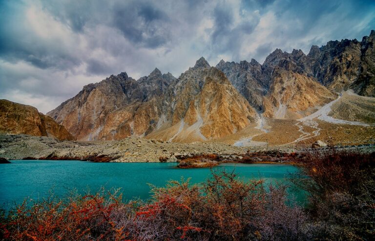
The valley most people picture when they picture Pakistan. Hunza sits below Rakaposhi and Ultar Sar, terraced with apricot and cherry orchards, and holds the restored Baltit and Altit forts above Karimabad. Spring blossom in late March and April and the autumn colour in October are the two moments worth planning around. The turquoise of Attabad Lake, formed by a landslide that dammed the river in 2010, is now one of the most photographed stretches of the Karakoram Highway. Read the full guide to Hunza Valley.
2. Skardu and the Kachura Lakes
Region: Gilgit-Baltistan | Best time: May to October | Nearest base: Skardu town
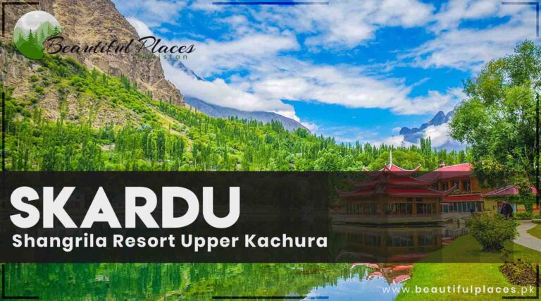
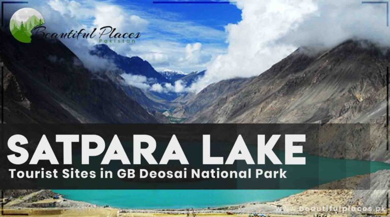
Skardu is the staging point for Baltistan and for the expeditions that walk in toward K2 and the Baltoro glaciers. Around the town are the Kachura lakes, the lower one better known as Shangrila, and Satpara above them. The valley floor is wide, sandy and unexpectedly desert-like given the peaks around it, and the cold desert at Sarfaranga is one of the strangest landscapes in the country. Read the full guide to Skardu and the Kachura Lakes.
3. Fairy Meadows and Nanga Parbat
Region: Gilgit-Baltistan | Best time: May to October | Nearest base: Raikot Bridge on the KKH
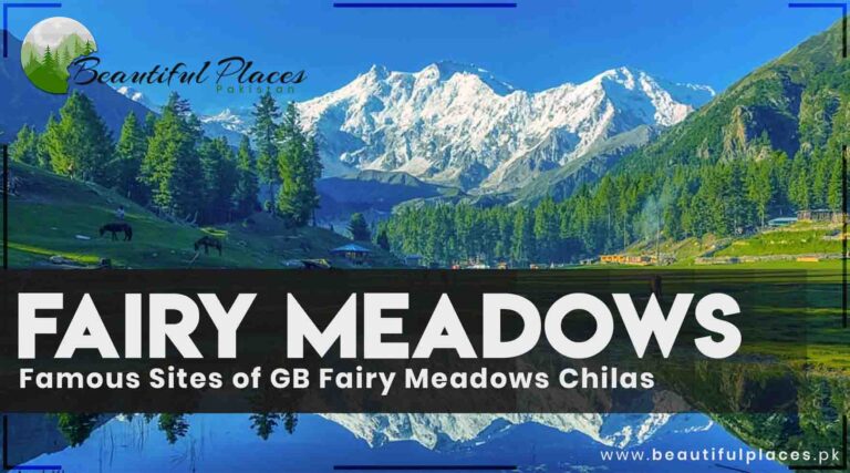
A meadow at around 3,300 metres facing the Rakhiot face of Nanga Parbat, the ninth highest mountain on earth. Getting there is part of it: a jeep track up from the Karakoram Highway near Raikot Bridge, then a walk or pony ride to the meadow itself. There is nowhere in Pakistan where a mountain of that scale sits so directly in front of you. The season is short, roughly May to October. Read the full guide to Fairy Meadows and Nanga Parbat.
4. Deosai National Park
Region: Gilgit-Baltistan | Best time: July to September only | Nearest base: Skardu or Astore
A high plateau above 4,000 metres, called the Land of Giants, that stays under snow for much of the year and turns to wildflower meadow for a few weeks in summer. Sheosar Lake sits near its edge with Nanga Parbat on the horizon. Deosai is one of the last strongholds of the Himalayan brown bear. Access is roughly July to September, from Skardu or over the pass from Astore. Read the full guide to Deosai National Park.
5. Khaplu
Region: Gilgit-Baltistan | Best time: May to October | Nearest base: Skardu, about 100 km west
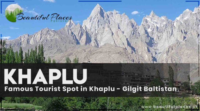
East of Skardu along the Shyok river, Khaplu is quieter than the main valley and keeps a stronger sense of old Baltistan. The restored Khaplu Palace is the landmark, and the Chaqchan mosque nearby dates back centuries. It is also the way in to the Hushe valley and the approach to Masherbrum, which makes it a base for trekkers as well as a destination in itself. Read the full guide to Khaplu.
6. The Karakoram Highway
Region: Gilgit-Baltistan | Best time: May to November for the Khunjerab Pass | Nearest base: Islamabad to Gilgit
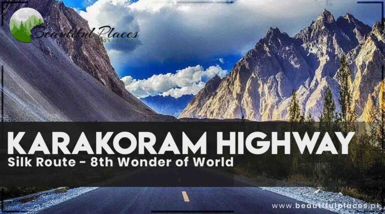
Less a road than a destination. The KKH follows the old Silk Route up the Indus and Hunza rivers to the Khunjerab Pass at about 4,690 metres, the highest paved border crossing in the world. It threads between the Karakoram, Himalaya and Hindu Kush, which meet near Jaglot, and the drive from Gilgit to the pass is among the great road journeys anywhere. Open roughly May to November at the top. Read the full guide to The Karakoram Highway.
7. Ghizer and Phander
Region: Gilgit-Baltistan | Best time: June to September | Nearest base: Gilgit
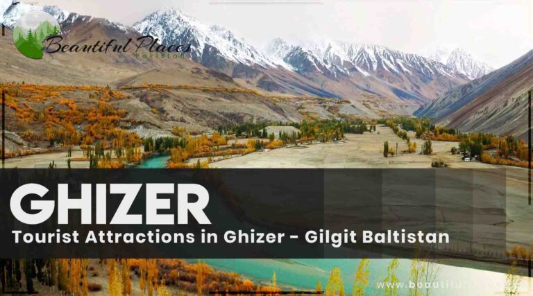
West of Gilgit, Ghizer is the valley of trout rivers and quiet lakes that most itineraries miss. Phander Lake, pale green against poplar and willow, is the image people take away. The road continues to Shandur, site of the highest polo ground in the world and its summer tournament. Ghizer rewards travellers who have already done Hunza and want somewhere with fewer vehicles on the road. Read the full guide to Ghizer and Phander.
Khyber Pakhtunkhwa
8. Swat Valley
Region: Khyber Pakhtunkhwa | Best time: April to October | Nearest base: Mingora
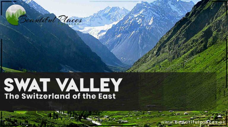
Called the Switzerland of the East, and green in a way the northern deserts are not. Swat is a river valley of terraced fields, forest and orchard, and it carries a deep Buddhist past: this was Gandhara, and stupas and carved rock faces survive throughout the valley. It is also the most accessible of the mountain regions from Islamabad, which makes it the usual first stop for anyone heading north. Read the full guide to Swat Valley.
9. Kalam and Mahodand Lake
Region: Khyber Pakhtunkhwa | Best time: June to September | Nearest base: Kalam, up the Swat valley
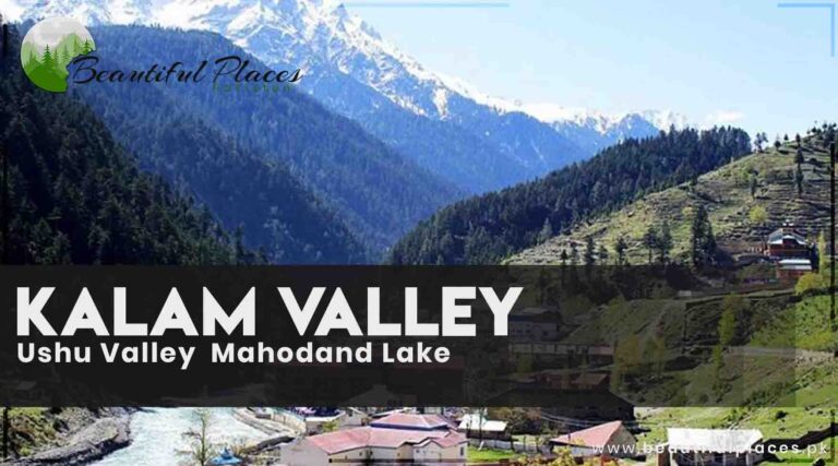
At the top of the Swat valley, Kalam opens into the Ushu and Utror valleys, with deodar forest thick on the slopes. Mahodand Lake sits at the head of the Ushu valley, reached by a rough track that is worth the discomfort. This is high alpine country with meadows and river braids rather than the bare rock of the Karakoram, and it is at its best between June and September. Read the full guide to Kalam and Mahodand Lake.
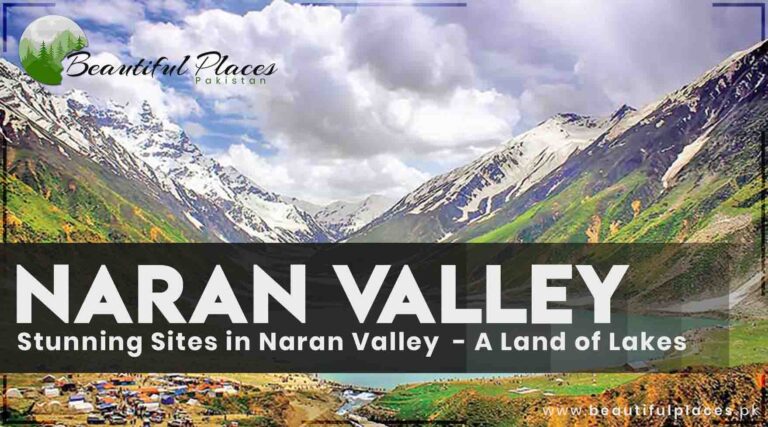
10. Naran and Lake Saif-ul-Malook
Region: Khyber Pakhtunkhwa | Best time: July to September, Babusar Pass seasonal | Nearest base: Naran
The Kaghan valley’s best known stretch, and the location of Saif-ul-Malook, the lake below Malika Parbat that carries the folk story of the prince and the fairy. Lulusar lies further up the valley, and the road continues over the Babusar Pass to join the Karakoram Highway, which is one of the most satisfying links in the north. The pass is seasonal and normally open from around July. Read the full guide to Naran and Lake Saif-ul-Malook.
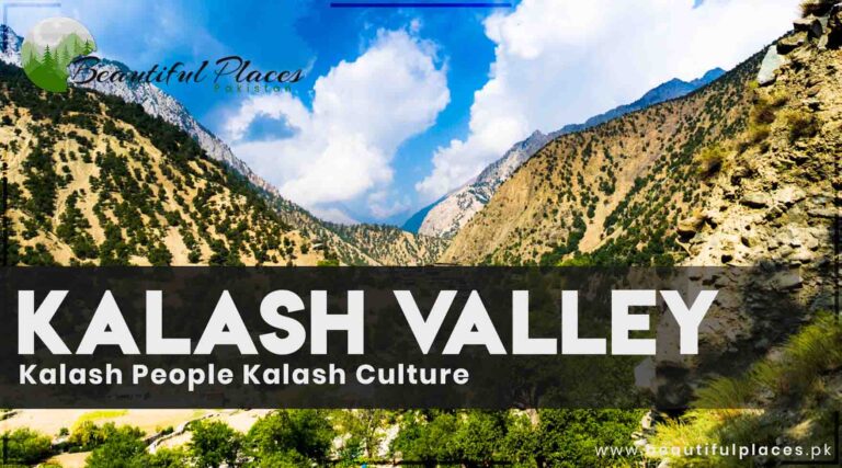
11. The Kalash Valleys
Region: Khyber Pakhtunkhwa | Best time: May for Chilam Joshi, or autumn | Nearest base: Chitral
Three valleys near Chitral, Bumburet, Rumbur and Birir, home to the Kalasha, who keep a distinct language, dress and religion unlike anything else in Pakistan. Their festivals, particularly Chilam Joshi in May, are among the few living traditions of their kind left in the region. Visit with care and ask before photographing anyone; this is a small community, not an exhibit. Read the full guide to The Kalash Valleys.
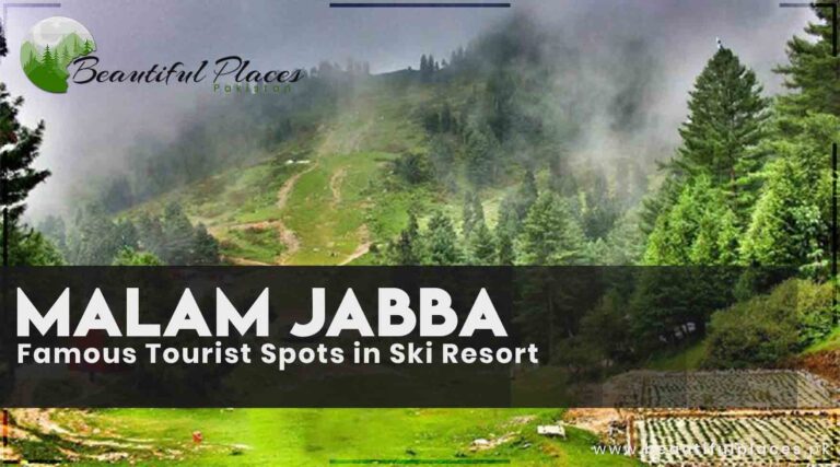
12. Malam Jabba
Region: Khyber Pakhtunkhwa | Best time: December to February for snow, summer for the forest | Nearest base: Mingora
Pakistan’s best known ski resort, on a ridge above the Swat valley at around 2,800 metres. Snow cover runs through the winter months, and in summer the same slopes become chairlift rides, walking and forest views across Swat. It is the easiest place in the country to see high mountain scenery without a long or difficult approach. Read the full guide to Malam Jabba.
Azad Kashmir
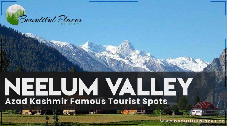
13. Neelum Valley
Region: Azad Kashmir | Best time: May to October | Nearest base: Muzaffarabad
A long, narrow valley following the Neelum river northeast of Muzaffarabad, steep-sided and densely forested. Keran, Sharda and Kel string along the road, and above Kel is Arang Kel, a meadow village reached on foot or by chairlift that is one of the loveliest places in the country. Ratti Gali Lake, higher up, is the other reason people come. The season runs roughly May to October. Read the full guide to Neelum Valley.
14. Leepa Valley
Region: Azad Kashmir | Best time: June to September, the pass is seasonal | Nearest base: Muzaffarabad
Quieter than Neelum and, for many people who see both, the more beautiful. Leepa is a bowl of rice terraces and maize with traditional wooden houses, ringed by forested ridges. Access is restricted at times and the road over the pass is only open in the warmer months, which has kept it far less visited than it deserves. Check the current position locally before setting out. Read the full guide to Leepa Valley.
Islamabad and Punjab
15. Islamabad and the Margalla Hills
Region: Islamabad and Punjab | Best time: September to April | Nearest base: Islamabad itself
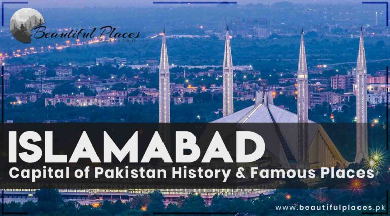
The one capital city on this list, and it earns the place through the Margalla Hills that rise straight out of it. Trail walks start within the city, Daman-e-Koh and Pir Sohawa look back over the whole grid, and the Faisal Mosque sits against the hills at the top of the city. It is the usual arrival point for the north and a genuinely green, orderly place to spend a first day. Read the full guide to Islamabad and the Margalla Hills.
16. Murree, Ayubia and Patriata
Region: Islamabad and Punjab | Best time: Year round, snow in January | Nearest base: Islamabad, about 60 km
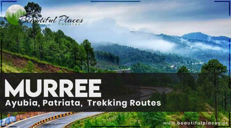
The classic hill station, built by the British as a summer retreat and still the place the plains escape to when the heat arrives. Ayubia National Park nearby has the Pipeline Track through pine forest, and Patriata has the chairlift and cable car. Murree is busy, and that is part of its character; go midweek or out of season if crowds are not what you want. Read the full guide to Murree, Ayubia and Patriata.
17. Taxila
Region: Islamabad and Punjab | Best time: October to March | Nearest base: Islamabad, about 35 km
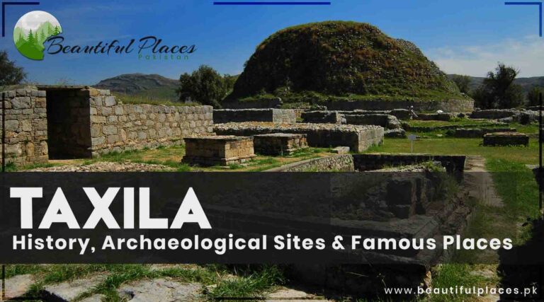
A UNESCO World Heritage Site and the heart of ancient Gandhara, where Greek, Persian, Buddhist and Central Asian influences met. The remains are spread across several sites, including the city of Sirkap, the Dharmarajika stupa and the monastery at Jaulian, with the museum holding the sculpture that makes sense of them. An easy day from Islamabad and one of the most significant archaeological landscapes in Asia. Read the full guide to Taxila.
18. The Salt Range and Khewra
Region: Islamabad and Punjab | Best time: October to March | Nearest base: Islamabad or Lahore
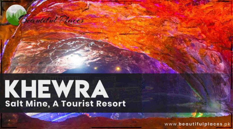
A line of low, eroded hills between the Potohar plateau and the plain, holding the Khewra salt mine, widely described as the second largest in the world, where chambers and a salt mosque sit deep inside the hill. Nearby, the Katas Raj temple complex around its sacred pool is one of the most important Hindu sites in Pakistan. A very different landscape to anything further north. Read the full guide to The Salt Range and Khewra.
19. Lahore
Region: Islamabad and Punjab | Best time: October to March | Nearest base: Lahore itself
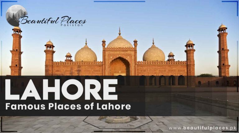
The cultural capital, and the densest concentration of Mughal architecture in the country. The Lahore Fort and Shalimar Gardens are jointly a World Heritage Site, the Badshahi Mosque faces the fort across the Hazuri Bagh, and the tiled facade of the Wazir Khan Mosque inside the walled city is the finest of its kind anywhere. Add the food, and most visitors wish they had given Lahore longer. Read the full guide to Lahore.
Sindh
20. Mohenjo-daro
Region: Sindh | Best time: November to February | Nearest base: Larkana
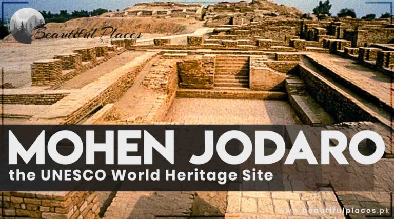
One of the largest cities of the Indus Valley Civilisation, built around 2500 BCE and abandoned roughly a thousand years later. What survives is a planned city of fired brick with streets on a grid, a drainage system, a granary and the Great Bath, all of it thousands of years older than anything else on this list. A UNESCO World Heritage Site, and best visited between November and February. Read the full guide to Mohenjo-daro.
21. Thatta and Makli
Region: Sindh | Best time: November to February | Nearest base: Karachi, about 100 km
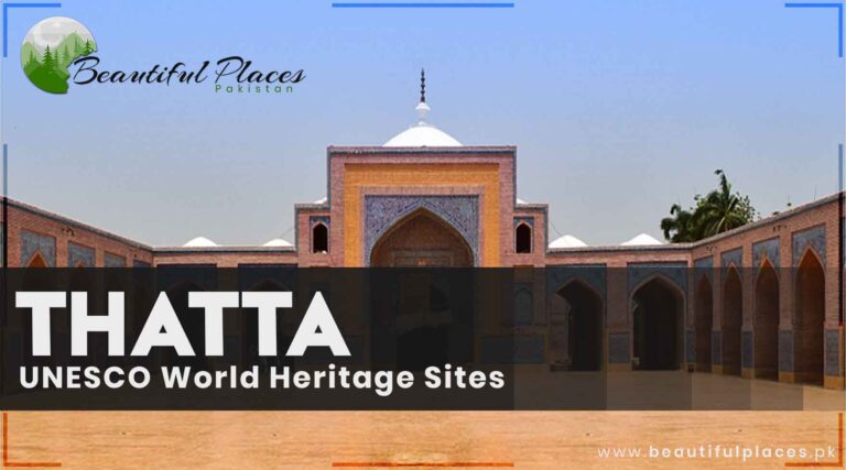
The Makli necropolis outside Thatta is one of the largest funerary sites in the world, a field of carved stone tombs and mausoleums spread over several kilometres and listed by UNESCO. In the town itself, the Shah Jahan Mosque is covered inside with blue and white tilework and has acoustics that carry a voice the length of the prayer hall without amplification. Read the full guide to Thatta and Makli.
22. Karachi and the coast
Region: Sindh | Best time: November to February | Nearest base: Karachi itself
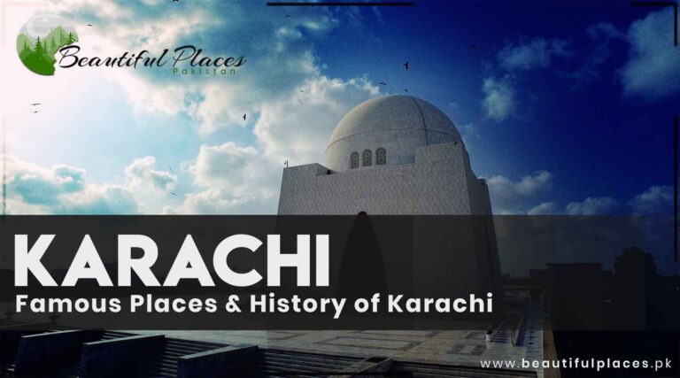
Not beautiful in the way a valley is, but no honest list of Pakistan leaves out its largest city. Karachi has the Arabian Sea at Clifton and Hawke’s Bay, the colonial-era architecture of Saddar, Mohatta Palace, and the best and most varied food in the country. It is loud, enormous and unlike anywhere else in Pakistan, and it is where a great deal of the country’s energy sits. Read the full guide to Karachi and the coast.
Balochistan
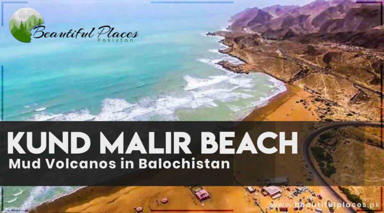
23. Kund Malir and Hingol
Region: Balochistan | Best time: November to February | Nearest base: Karachi, about 240 km
Along the Makran Coastal Highway, Kund Malir is a beach where desert hills drop almost to the water. It sits inside Hingol National Park, the largest in Pakistan, which holds active mud volcanoes, the wind-carved rock known as the Princess of Hope, and the Hinglaj Mata temple, a major Hindu pilgrimage site. The drive from Karachi is one of the most spectacular coastal roads in Asia. Read the full guide to Kund Malir and Hingol.
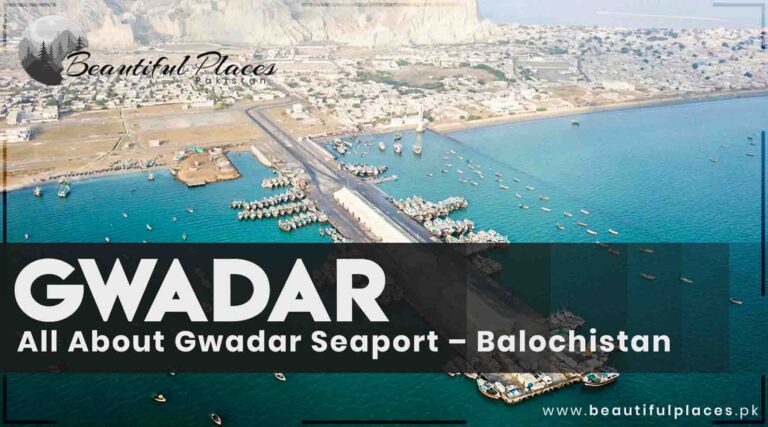
24. Gwadar
Region: Balochistan | Best time: November to February | Nearest base: Gwadar, or fly from Karachi
A deep-water port on the Makran coast, set against the flat-topped Koh-e-Batil headland that gives the town its distinctive hammerhead shape on a map. The beaches either side are long and largely empty, and the coastal rock formations around Ormara and Astola island further east are among the least visited landscapes in the country. Best between November and February. Read the full guide to Gwadar.
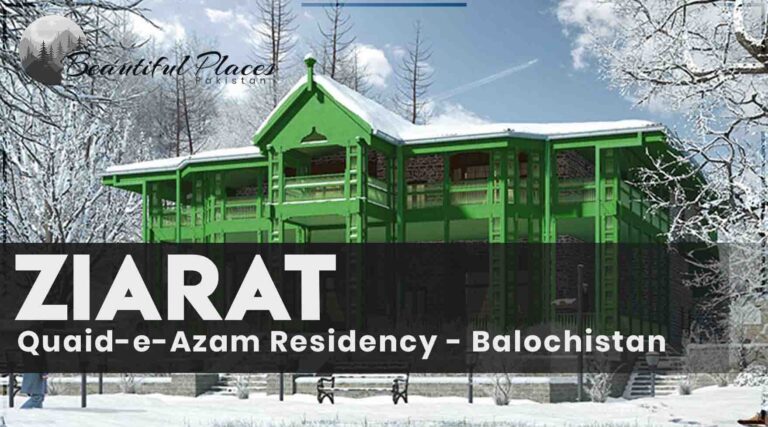
25. Ziarat
Region: Balochistan | Best time: April to October | Nearest base: Quetta, about 125 km
A hill town above Quetta surrounded by one of the largest and oldest juniper forests in the world, some of the trees estimated to be thousands of years old. The Quaid-e-Azam Residency, where Muhammad Ali Jinnah spent his final months, sits among them. Cool in summer, snowbound in winter, and completely unlike the coastal half of the same province. Read the full guide to Ziarat.
How to plan a trip around this list
Two things decide whether a list like this becomes a workable itinerary. The first is
season. The northern entries, from Hunza down to Swat and Neelum, are broadly open April to
October, while the Sindh and Balochistan entries are at their best from November to
February. October is the one month that suits almost everything on this page.
The second is distance. These places are spread across roughly 1,500 kilometres, and the
mountain sections take far longer than the map suggests. Most successful trips take one
region properly rather than three badly: a northern loop, or a heritage route through Lahore,
Taxila and the Indus sites, or a valley trip into Swat and Chitral.
Hunza is the usual answer and a defensible one, for the combination of mountain scale,
orchards, forts and accessibility. If the question means the single most dramatic landscape,
Fairy Meadows facing Nanga Parbat is hard to beat. For those who have seen both, Leepa and
Ghizer are the quiet favourites.
How many days do you need to see the best of Pakistan?
Ten days covers one region properly. Two weeks lets you combine the north with Lahore and
the heritage sites. Under a week, choose a single valley and stay in it, because internal
travel will otherwise consume the trip.
Which is the best region for a first visit?
Gilgit-Baltistan for landscape, entered either by flying to Gilgit or Skardu or by
driving the Karakoram Highway. If your interest is history and architecture rather than
mountains, start with Lahore and Taxila instead.
Are these places safe to visit?
The northern areas, where most of this list sits, are widely regarded as among the safest
parts of the country and see a large number of independent travellers each season. A few
entries, particularly in Balochistan and near the Line of Control in Azad Kashmir, need
local advice on current access before you set out.
Do foreign tourists need a permit for these places?
For almost everything on this list, no. The blanket No Objection Certificate requirement
was abolished in 2019, and Hunza, Skardu, Swat, the Kalash valleys and Azad Kashmir are open
without one. Restrictions survive only for frontier zones and certain high-altitude routes.
When is the best time to visit?
October and November, if you want one answer that works for most of the country at once.
The mountains alone are best from May to September, and the south from November to February.
Last thoughts on the most beautiful places in Pakistan
What makes Pakistan unusual is not any single place on this list. It is the range: that
the cold desert at Skardu, the tiled courtyards of Lahore, a 4,500 year old brick city on the
Indus and an empty beach on the Arabian Sea all belong to the same country, and that most of
them are still visited by very few outsiders. Pick one region, give it more time than you
think it needs, and the rest of the list will still be there.
Pakistan asks more planning of a visitor than most countries its size, and not for the
reasons people expect. The difficulty is not paperwork or danger. It is that the country
runs two climates at once. While the Karakoram passes are under snow, Sindh is warm and
dry; while Lahore is at 45 degrees in June, Hunza is at its best. Almost every planning
mistake we see comes from treating Pakistan as one destination with one season.
This guide covers the practical questions in order: when to come, how to move around,
whether you need a permit, what it costs, how safe it actually is, and what to know before
you sit down to eat. Each section links through to the places themselves.
When to visit Pakistan
If you want one answer: October and November. Autumn is the only period
when the northern valleys and the southern plains are both comfortable at the same time.
Temperatures across most of the country sit roughly between 10 and 30 degrees, the skies
are clear after the monsoon has passed, and the valleys turn colour.
The longer answer depends on where you are going.
The northern mountains (Hunza, Skardu, Swat, Kaghan) are broadly open from
April to October. High passes and the roads into the upper valleys are the first things to
close and the last to reopen.
The plains and the south (Lahore, Multan, Karachi, Tharparkar) are at
their most pleasant from October to March. Summer on the plains is genuinely punishing.
Spring, mid-March to mid-May, brings blossom through the mountain
valleys and mild weather for sightseeing, though the highest routes are still shut.
Monsoon, July to September, concentrates the year’s rain. In the north
this means a real risk of landslides and washed-out roads rather than simply wet days. Build
slack into any itinerary crossing mountain roads in these months.
Winter, December to February, closes roads into Hunza, Skardu and
Naran with snow and ice, and is the right time for the south, the cities and the
archaeological sites.
The practical rule: if your trip is built around mountains, come between April and
October and accept the monsoon risk in the middle of it. If it is built around cities,
history and the coast, come between October and March. If you want both, come in autumn.
Pakistan is large and the distances between the places people want to see are long.
Islamabad to Skardu is a full day by road in good conditions. Karachi to Lahore is roughly
1,200 kilometres. Plan transport before you plan an itinerary.
Domestic flights
Flying is the usual way to cover the long legs. Pakistan International Airlines, Airblue
and SereneAir operate the domestic network, with the main hubs at Jinnah International in Karachi, Allama Iqbal International in Lahore, and Islamabad
International. The northern routes, particularly into Skardu and Gilgit, are weather
dependent and cancel often in winter and during heavy monsoon. Never book a northern flight
as the only link in a tight schedule.
Intercity buses
Buses are the backbone of intercity travel and the option most Pakistanis use. Coaches on
the main corridors are comfortable and inexpensive, and seats can be reserved online through
services such as Bookme.pk rather than at the terminal. This is usually the most reliable
way to reach places without an airport.
Trains
Pakistan Railways connects Karachi, Hyderabad, Multan, Lahore, Rawalpindi, Peshawar and Quetta along with many
smaller towns. Trains are cheap and scenic on some routes, but they are slower than the bus,
frequently late, and crowded in the lower classes. Book an air-conditioned class if you use
them for a long leg.
Cities and short hops
Lahore and the Islamabad-Rawalpindi corridor have metrobus lines, and Karachi has the
Green Line bus rapid transit. Ride-hailing is widespread in the major cities through Uber,
Careem and InDrive, and it removes the need to negotiate fares. Rickshaws and many local
buses are cash only, so keep small notes on you. For the mountains, the normal arrangement
is a hired car with a driver, booked for the stretch rather than the day.
There is more detail in our guide to getting around Pakistan, including realistic journey times and when to choose each option.
Permits and the NOC question
This is the most misreported subject in Pakistan travel writing, so be careful what you
read, including older articles.
The blanket No Objection Certificate requirement for foreign tourists was abolished in 2019 as part of a new visa policy. Most visitors do not
need a permit for the places they actually want to see. Islamabad, Lahore, Karachi, Hunza,
Skardu, Gilgit-Baltistan generally, Azad Kashmir and Chitral are open.
What remains restricted is narrower and specific: prohibited and restricted zones inside
cantonments, areas close to the Line of Control, some valleys along the Afghan frontier, and
certain high-altitude trekking and mountaineering routes. Restricted areas are signposted.
Where an NOC is still required, applications are made through a Pakistani tour or trekking
operator licensed with the Pakistan Tourism Development Corporation. Allow 7 to 14 working
days for processing and apply around three weeks ahead, because delays are normal.
If your plan is valleys, cities and heritage sites, you almost certainly need nothing. If
it involves serious trekking or
anything near a frontier, confirm the current position with a licensed operator before you
book flights. Rules here change with the security situation, and a guide written last year
may already be wrong.
Pakistan is inexpensive by the standards of most visitors. Reported daily spends cluster
in a fairly narrow band:
Budget: roughly 10 to 32 US dollars a day, with about 24 as the common
average. Guesthouses, local food, buses and shared transport.
Mid-range: around 60 dollars a day. Ordinary hotels, restaurant meals,
paid entry to the main sites, some domestic flights.
Higher end: around 145 to 150 dollars a day for good hotels, private
vehicles with a driver and guided arrangements.
Food is where the gap is widest. A meal at a local dhaba often stays under 500 rupees,
while a restaurant meal in an Islamabad or Karachi business district costs several times
that. Simple guesthouses start around 500 to 750 rupees a night. The expensive items in a
Pakistan trip are almost always domestic flights and hired vehicles, not accommodation or
food.
Carry cash. Card acceptance is good in city hotels and chain restaurants and poor
everywhere else, and it thins out quickly as you move north.
Pakistan’s reputation and a visitor’s actual experience are far apart, and being honest
about both matters more than reassurance.
The northern areas, which is where most tourism happens, are widely regarded as among the
safest parts of the country. Incidents involving foreign tourists are rare, tourist areas
are monitored, and a large number of solo travellers, including solo women, report
straightforwardly positive trips. Hospitality toward visitors is genuine and often
overwhelming.
The real risks are ordinary rather than dramatic. Petty crime exists across the country,
and street crime in Karachi is a daily reality, particularly phone snatching from motorcycles.
Road safety is a greater practical danger to most visitors than anything else, especially at
night and on mountain roads. Some regions, principally parts of Balochistan and areas along
the Afghan border, carry genuine security restrictions and are not casual destinations.
The sensible approach is regional rather than national. Check your own government’s
current travel advisory, plan around the areas it flags, move between cities in daylight,
and use a local guide where you are unsure. Treating the whole country as dangerous is
wrong; treating all of it as equally safe is also wrong.
Our longer answer, covering solo travel, health, altitude and how to read a travel advisory, is in is Pakistan safe for travellers.
Food and behaving well
Food is one of the strongest reasons to come. Expect wheat breads at almost every meal,
slow-cooked meat, rice dishes, lentils, and sweets that are far sweeter than most visitors
are used to. Tea, taken strong and milky, is offered constantly and refusing every cup is
read as coldness.
A few things save awkwardness. Eat and pass with the right hand. Dress modestly, which
matters more for women and more outside the big cities, and carry a scarf for mosques and
shrines. Ask before photographing people, especially women. Ramadan changes daytime eating
in public. Hospitality tends to be insistent, and an invitation to tea or a meal is usually
sincere rather than a preface to a sale.
If you would rather browse by region first, our guides are organised that way, from
Gilgit-Baltistan and Khyber Pakhtunkhwa down through Punjab and Sindh to Balochistan and
Azad Kashmir. There is also a broader complete travel guide to Pakistan and an overview of the country if you are still deciding
whether to come at all.
If you would rather start from the places themselves, our list of the 25 most beautiful places in Pakistan runs north to south with a full guide behind every entry.
Last thoughts on planning a trip to Pakistan
Pick the season for the half of the country you actually want to see, book the long legs
before the details, check permit requirements only for frontier and high-altitude plans, and
budget for transport rather than for hotels. Do that and the rest of the trip tends to look
after itself, largely because the country is cheaper, easier and more welcoming than its
reputation prepares you for.
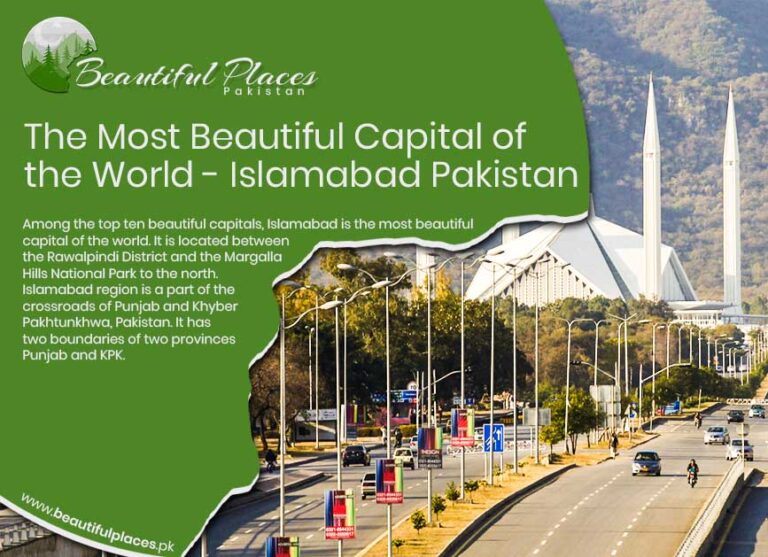
Among the world’s capital cities, very few were built with beauty as a primary objective rather than an afterthought. Islamabad stands apart precisely for this reason. Conceived as a purpose-built capital, it was planned to harmonize nature, governance, culture, and daily life in a way that feels deliberate, calm, and enduring.
Nestled at the northern edge of the Potohar Plateau and framed by the forested Margalla foothills, Islamabad is not simply the political heart of Pakistan—it is one of the rare capitals where landscape defines the city, not the other way around. This intrinsic relationship between urban planning and nature is what consistently places Islamabad among discussions of the most beautiful capital cities on Earth, a distinction explored in depth in The Most Beautiful Capital of the World.
Detailed Statistical Profile of Islamabad, Pakistan
Aspect
Verified & Updated Information
Official Name
Islamabad
Status
Federal Capital of Pakistan
Administrative Unit
Islamabad Capital Territory (ICT)
Country
Islamic Republic of Pakistan
Established
Planned in 1959; officially became capital in 1967
Master Planner
Constantinos Apostolou Doxiadis (Greece)
Total Area
906 km² (350 sq mi)
Urban Area
Approx. 220 km²
Elevation
~ 540–610 meters above sea level
Population (City)
~ 1.3 million (2024–2025 estimate)
Population (Metro – Islamabad–Rawalpindi)
5+ million
Population Density
~ 2,000 persons per km² (urban core)
Geographic Location
Northern Pakistan, Potohar Plateau, foothills of the Margalla Hills
Topography
Rolling plains, forested hills, seasonal streams
Climate Type
Humid Subtropical (Cwa)
Average Summer Temperature
30–38 °C
Average Winter Temperature
3–18 °C
Annual Rainfall
~ 1,100–1,200 mm
Seismic Zone
Moderate seismic risk (Zone 2B)
Time Zone
Pakistan Standard Time (UTC +5)
Official Language
Urdu
Widely Used Language
English (administration, education, diplomacy)
Other Spoken Languages
Punjabi, Pashto, Hindko, Potohari
Government Role
Seat of Federal Government, Parliament, Supreme Court, Diplomatic Enclave
Number of Foreign Embassies
100+ diplomatic missions
Economic Base
Government services, diplomacy, education, IT, real estate, services sector
GDP Contribution
High per-capita contribution relative to population
Public & private tertiary hospitals, research institutes
Major Hospitals
PIMS, Shifa International, Federal Govt. Services Hospital
Transportation
Motorways, Islamabad International Airport, Metro Bus, ride-hailing
Airport
Islamabad International Airport (ISB)
Green Coverage
One of the highest green-area ratios among Asian capitals
National Park
Margalla Hills National Park
Major Water Body
Rawal Lake
Iconic Landmarks
Faisal Mosque, Pakistan Monument, Daman-e-Koh, Lok Virsa Museum
Major Urban Parks
Fatima Jinnah (F-9) Park, Shakarparian, Lake View Park
Urban Planning Model
Sector-based grid system
Safety Ranking (Pakistan)
Consistently among the safest major cities
Cost of Living
Higher than national average, lower than global capitals
Tourism Role
Gateway city to Northern Pakistan
Overall Reputation
Clean, green, planned, calm, high quality of life
Geographic Setting: Where the City Meets the Hills
Islamabad’s Natural Location Advantage
Islamabad occupies a uniquely privileged position in northern Pakistan, sitting at the junction of Punjab and Khyber Pakhtunkhwa. To the north rise the Margalla Hills—part of the Himalayan foothill system—while the south opens into the plains that historically connected the subcontinent’s trade routes and civilizations.
This placement gives the city an immediate visual identity: green ridgelines, seasonal mist, monsoon-fed streams, and long sightlines where urban neighborhoods dissolve into forested slopes.
The surrounding terrain connects seamlessly with historically significant regions such as the Potohar Plateau, a landscape that has hosted ancient settlements, Buddhist monasteries, and early human habitation for thousands of years.
Climate That Shapes the City’s Rhythm
Islamabad’s moderate, humid subtropical climate further reinforces its livability and visual appeal:
Warm summers moderated by elevation and monsoon rainfall
Cool winters with crisp mornings and light fog
Spring and autumn marked by blooming trees, flowering parks, and clear skies
Unlike many dense capitals, Islamabad’s climate encourages outdoor life—walking trails, viewpoint cafés, lakeside parks, and forest hikes are woven into everyday routines rather than reserved for weekend escapes.
A Master-Planned Capital with Human Scale
The Vision Behind Islamabad’s Design
Islamabad was officially designated as Pakistan’s capital in the early 1960s, created to replace Karachi and establish a centrally located, secure, and purpose-built seat of government. Greek architect and urban planner Constantinos Apostolou Doxiadis designed the city using a grid-based sector system, ensuring balance between administration, residential life, and green space.
Unlike organic cities that grow chaotically, Islamabad was planned to feel spacious, with:
Each sector functions as a small, self-contained neighborhood with schools, markets, mosques, parks, and cafés. This human-scale design prevents the anonymity and congestion common in mega-capitals, making Islamabad feel livable rather than overwhelming.
The result is a city where residential calm exists minutes away from government offices, hiking trails, and cultural landmarks—an urban experience few capitals manage successfully.
The Green Identity of Islamabad
A Capital Built Around Nature
Islamabad is one of the greenest capitals in Asia by design, not accident. Forest reserves, national parks, and open spaces were embedded into the city’s blueprint long before urban sprawl could threaten them.
At the heart of this identity lies the Margalla Hills National Park, a protected area offering hiking trails, wildlife habitats, and panoramic viewpoints that overlook the entire city. These hills form a natural northern wall, shielding Islamabad from unchecked expansion and preserving its visual harmony.
This connection between city and wilderness echoes across northern Pakistan, from the forests surrounding Murree to the mountainous corridors leading toward Khyber Pakhtunkhwa.
Parks, Lakes, and Urban Breathing Spaces
Islamabad’s beauty is not confined to its outskirts. Inside the city, green spaces dominate daily life:
Vast urban parks that function as social centers
Tree-covered boulevards that soften traffic corridors
Lakeside retreats offering calm within city limits
Rawal Lake, a major reservoir and recreational hub, anchors the city’s southeastern edge, while central parks create continuous green corridors across multiple sectors. This intentional greenery reinforces Islamabad’s reputation as a capital that prioritizes well-being alongside governance.
Islamabad’s Visual Landmarks: Where Identity Takes Form
Architecture That Complements the Landscape
Islamabad’s most iconic structures were designed to enhance, not dominate, their surroundings. Rather than competing with nature, architecture here often frames it.
The city’s skyline is deliberately restrained, allowing hills, forests, and open skies to remain visually dominant. This restraint distinguishes Islamabad from capitals defined by dense high-rise clusters or aggressive monumentality.
A Capital That Feels Calm, Not Crowded
What visitors often notice first is not a single monument, but the overall atmosphere—quiet roads at dawn, mist drifting over hills, birdsong in residential sectors, and uninterrupted views across valleys.
This calm is rare among world capitals and is a direct result of Islamabad’s planning philosophy, environmental protections, and geographic placement.
Where a Young Capital Inherits an Ancient Civilization
Although Islamabad is one of the world’s youngest capitals, its cultural depth is anything but shallow. The city stands on land shaped by ancient Gandharan civilization, Mughal-era routes, and centuries of migration flowing between Central Asia and the plains of Punjab. This layered inheritance quietly informs Islamabad’s identity, giving it a cultural gravity often overlooked by those who focus only on its modern design.
Just a short drive west lies Taxila, a UNESCO-recognized archaeological landscape that once housed Buddhist universities attracting scholars from across Asia. This proximity places Islamabad within one of South Asia’s oldest intellectual and spiritual corridors, linking it historically to regions such as Peshawar and the ancient trade routes of the northwest.
Faisal Mosque: The Architectural Heart of the Capital
More Than a Mosque – A National Symbol
No structure defines Islamabad more powerfully than the Faisal Mosque. Set against the Margalla Hills, its stark white geometry rises not as an ornament, but as a visual anchor between the city and the mountains.
Unlike traditional domed mosques, the Faisal Mosque embraces a modernist design inspired by a Bedouin tent, symbolizing openness, unity, and faith without excess. Its scale, among the largest in the world, is matched by its restraint—an architectural philosophy deeply aligned with Islamabad’s broader aesthetic.
The mosque’s placement reinforces the city’s spatial intelligence: visible from multiple sectors, framed by natural slopes, and never isolated from its surroundings. This harmony between sacred space and landscape is a defining characteristic of Islamabad’s beauty and a key reason the city consistently earns global admiration as explored in The Most Beautiful Capital of the World.
Pakistan Monument and Shakarparian: Symbolism in Stone and Space
A Narrative of Unity Overlooking the City
Perched above the city at Shakarparian Hills, the Pakistan Monument stands as Islamabad’s most symbolic landmark. Designed to represent the four provinces and three territories of Pakistan, it transforms abstract national identity into physical form.
The surrounding parkland offers sweeping views across Islamabad, Rawalpindi, and beyond—views that reveal how deliberately the city was laid out. From here, the contrast between Islamabad’s structured sectors and Rawalpindi’s organic sprawl becomes immediately apparent, highlighting the intentional planning that defines the capital’s character.
This elevated landscape connects Islamabad not only to Rawalpindi but also to the broader Potohar region, historically linking the capital to cities such as Attock and the ancient forts guarding the Indus crossings.
Lok Virsa Museum: Pakistan’s Cultural Memory Preserved
A Living Archive of Traditions
If Islamabad’s architecture reflects modern aspirations, the Lok Virsa Museum preserves the soul of Pakistan’s past and present. This ethnographic complex showcases traditional crafts, regional music, folk architecture, and daily life from across the country—from the deserts of Tharparkar to the valleys of Gilgit-Baltistan.
Walking through Lok Virsa is less like visiting a museum and more like traveling through Pakistan’s provinces in condensed form. It reinforces Islamabad’s role as a cultural meeting point, where diverse identities coexist rather than compete.
This cultural inclusivity mirrors the capital’s diplomatic character, hosting embassies and international institutions while remaining rooted in indigenous traditions.
Daman-e-Koh and the Viewpoints of Perspective
Seeing Islamabad from Above
Few capitals offer such easy access to elevated viewpoints within city limits. Daman-e-Koh, nestled halfway up the Margalla Hills, provides panoramic views that reveal Islamabad’s spatial clarity—straight avenues, green belts, and sector grids unfolding below.
At dusk, when city lights emerge and the hills darken into silhouette, Islamabad reveals a quieter beauty—calm, measured, and unhurried. This experience is inseparable from the broader mountain culture of northern Pakistan, connecting Islamabad emotionally to destinations like Murree and the forested routes leading toward Abbottabad.
Saidpur Village: Where Time Slows Inside the Capital
A Village Older Than the City Itself
Hidden at the foothills of the Margalla range, Saidpur Village predates Islamabad by centuries. Once a Hindu settlement, later shaped by Sikh and Muslim influences, it now stands restored as a cultural enclave within the capital.
Stone pathways, old temples, and traditional eateries coexist here, offering a rare sense of continuity between Islamabad’s modern identity and the region’s pre-capital past. This coexistence reflects the broader historical layering found across northern Punjab, from Gujrat to Jhelum.
A Capital of Education, Diplomacy, and Thought
Intellectual Life Beyond Monuments
Islamabad’s cultural depth is reinforced by its role as an educational and intellectual hub. Major universities, research institutions, and think tanks attract students and scholars from across Pakistan, contributing to a cosmopolitan yet grounded social fabric.
This academic atmosphere links Islamabad conceptually to historic centers of learning such as Lahore while maintaining its own quieter, research-oriented identity.
Diplomatic enclaves, international cultural centers, and literary festivals further enrich the city’s cultural calendar, ensuring Islamabad remains globally engaged without sacrificing its calm character.
A City Experienced Slowly, Not Consumed Quickly
What ultimately sets Islamabad apart from other capitals is how it invites experience. It does not overwhelm with spectacle or density; instead, it reveals itself gradually—through sunrise over hills, afternoon walks in shaded sectors, museum courtyards echoing with folk music, and viewpoints that encourage reflection.
Islamabad’s beauty lies not in excess, but in balance.
Islamabad Is Not an Endpoint — It Is a Beginning
What ultimately elevates Islamabad from a beautiful capital to a pillar destination is not only what exists within its boundaries, but what it connects you to. Islamabad functions as Pakistan’s most strategic travel gateway, linking plains to mountains, heritage to wilderness, and urban comfort to raw landscapes within a few hours’ drive.
For travelers, Islamabad is rarely consumed in haste. It is absorbed slowly—often as a base city—before journeys fan out toward the north, the plateau, or deeper into Punjab’s historic heartland.
How to Reach Islamabad: Routes That Shape the Experience
By Road: The Capital as a Crossroads
Islamabad is one of Pakistan’s best-connected cities by road, and the journey itself often feels scenic rather than exhausting.
From Lahore and central Punjab, the motorway passes through the rolling terrain of the Potohar Plateau, dotted with salt ranges, lakes, and historic settlements.
From Khyber Pakhtunkhwa, access routes descend from the Hazara region, linking Islamabad naturally with Abbottabad and onward to the mountain valleys.
From Rawalpindi, the transition is almost seamless—two cities functioning as one metropolitan system, yet sharply different in mood and structure, a contrast explored in Rawalpindi: History, Suburbs & Famous Places.
By Air: Pakistan’s Most Convenient Arrival Point
Islamabad International Airport serves as the country’s most efficient international gateway, especially for travelers heading north. Many journeys toward Gilgit-Baltistan, Kaghan Valley, or Azad Kashmir begin here after a night or two in the capital.
Best Time to Visit Islamabad
Seasons That Transform the City
Islamabad’s beauty is seasonal, and each phase offers a distinct personality:
Spring (February–April)
Perhaps the most visually pleasing time, spring brings blossoms to parks, mild temperatures, and clear views of the Margalla Hills. Outdoor cafés, hiking trails, and cultural events peak during this period.
Summer & Monsoon (May–September)
While summers can be warm, monsoon rains turn the hills deep green, waterfalls appear along Margalla trails, and Rawal Lake feels alive. This season often coincides with onward travel to cooler northern destinations like Swat Valley or Naran Valley.
Autumn (October–November)
Clear skies, crisp evenings, and golden foliage make autumn ideal for photography and city exploration.
Winter (December–January)
Cool mornings and misty landscapes dominate winter. While snowfall remains rare in Islamabad itself, nearby hill stations such as Murree offer quick alpine escapes.
Islamabad as a Base for Northern Pakistan
Gateway to Mountains, Valleys, and Glaciers
Few capitals in the world offer such immediate access to dramatic landscapes. From Islamabad, travelers can easily branch out toward:
Hunza and Skardu via road or air for high-altitude exploration
This makes Islamabad not just scenic, but strategically indispensable for Pakistan tourism.
Food Culture: Subtle, Global, and Evolving
A Capital’s Culinary Identity
Islamabad’s food scene reflects its diplomatic and multicultural character rather than regional dominance. You’ll find:
Traditional Pakistani cuisine from every province
Afghan, Central Asian, Turkish, and Middle Eastern influences
Modern cafés and fusion restaurants catering to a young, global audience
Unlike food-centric cities such as Lahore or Karachi, Islamabad’s dining culture emphasizes ambience, view, and experience—hilltop restaurants, garden cafés, and lakeside seating.
This understated culinary approach aligns with the city’s broader philosophy: refined rather than excessive.
Safety, Cleanliness, and Quality of Life
Islamabad consistently ranks as one of Pakistan’s safest and cleanest cities. Wide roads, regulated development, and lower population density contribute to a sense of order rarely associated with South Asian capitals.
For first-time visitors to Pakistan, Islamabad often feels like the most approachable introduction—calm, navigable, and visually reassuring—before venturing into denser cultural centers or remote landscapes.
Why Islamabad Endures as a Global Benchmark?
Islamabad does not compete with the spectacle of Paris, the density of Tokyo, or the historical saturation of Rome. Instead, it defines beauty through balance:
A capital shaped by geography, not conquest
Architecture that respects nature rather than dominating it
Urban life designed for breathing space and human rhythm
In this sense, Islamabad is not just Pakistan’s administrative heart—it is its most thoughtful expression of modern nationhood, where identity, environment, and aspiration converge quietly.
That is why, when discussing the world’s most beautiful capitals, Islamabad is not a claim—it is a conclusion earned through design, restraint, and landscape.
National University of Sciences and Technology (NUST)
Allama Iqbal Open University
International Islamic University Islamabad
Famous Hospitals in Islamabad:
Shifa International Hospital
Aga Khan University Hospital
Pakistan Institute of Medical Sciences (PIMS)
Ali Medical Center
Federal Government Services Hospital
Famous Restaurants in Islamabad:
Monal Restaurant
Tuscany Courtyard
Chaaye Khana
Des Pardes
Street 1 Café
General & Global Perception FAQs
Why is Islamabad called the most beautiful capital of the world?
Islamabad is often regarded as the most beautiful capital due to its unique blend of modern urban planning, abundant greenery, scenic mountain backdrop, clean environment, and calm lifestyle—features rarely found together in a capital city.
Is Islamabad officially ranked as the most beautiful capital?
There is no single official global ranking, but Islamabad is frequently cited by travel writers, tourists, and international publications as one of the most scenic and well-planned capitals in the world.
What makes Islamabad more beautiful than other capitals?
Unlike many capitals, Islamabad was purpose-built with nature integrated into its design. Forested hills, wide roads, organized sectors, and protected green zones create a visually harmonious city.
How does Islamabad compare with capitals like Paris, Tokyo, or Rome?
While Paris excels in historic grandeur and Tokyo in modern density, Islamabad stands out for natural beauty, serenity, and urban balance rather than monument density or population scale.
Geography & Natural Setting FAQs
Where is Islamabad located geographically?
Islamabad is located in northern Pakistan at the foothills of the Margalla Hills, on the Potohar Plateau, near the boundary of Punjab and Khyber Pakhtunkhwa.
What natural features surround Islamabad?
Islamabad is surrounded by the Margalla Hills National Park, Rawal Lake, forest reserves, and seasonal streams that contribute to its lush environment.
Is Islamabad close to the Himalayas?
Islamabad lies near the Himalayan foothills, specifically the Margalla range, which is considered part of the outer Himalayan system.
Why is Islamabad so green compared to other cities?
Green belts, protected forests, planned parks, and strict zoning laws were built into Islamabad’s master plan from the beginning.
City Planning & Urban Design FAQs
Who designed Islamabad?
Islamabad was designed by Greek architect and urban planner Constantinos Apostolou Doxiadis.
Why was Islamabad built as a new capital?
Islamabad was built to replace Karachi as the capital for better security, central location, climate, and long-term urban planning.
What is unique about Islamabad’s sector system?
The city is divided into self-contained sectors, each with residential areas, markets, schools, parks, and mosques, ensuring balanced urban living.
Is Islamabad a planned city?
Yes, Islamabad is one of South Asia’s most systematically planned cities, designed before large-scale settlement.
Parks, Hills & Outdoor Life FAQs
What are the main natural attractions in Islamabad?
Major attractions include Margalla Hills National Park, Rawal Lake, Daman-e-Koh, Shakarparian, Fatima Jinnah Park, and Lake View Park.
Can you hike within Islamabad city limits?
Yes, Islamabad offers multiple hiking trails within city limits, especially in the Margalla Hills.
Is Islamabad good for nature lovers?
Islamabad is one of the best cities in Pakistan for nature lovers due to its forests, trails, lakes, and wildlife.
Does Islamabad have wildlife?
Yes, the Margalla Hills host monkeys, deer, leopards, wild boars, and numerous bird species.
Landmarks & Cultural FAQs
What is Islamabad’s most famous landmark?
The Faisal Mosque is Islamabad’s most iconic landmark and one of the largest mosques in the world.
Why is Faisal Mosque architecturally unique?
It features a modern, tent-inspired design without a traditional dome, blending contemporary architecture with Islamic symbolism.
What does the Pakistan Monument represent?
The Pakistan Monument symbolizes national unity, representing the country’s provinces and territories.
What is Lok Virsa Museum famous for?
Lok Virsa Museum preserves Pakistan’s folk traditions, crafts, music, architecture, and cultural diversity.
Travel & Tourism FAQs
Is Islamabad worth visiting for tourists?
Yes, Islamabad is ideal for tourists seeking scenic beauty, safety, cleanliness, and access to northern Pakistan.
How many days are enough for Islamabad?
Two to four days are sufficient to explore Islamabad’s main attractions at a relaxed pace.
Is Islamabad a good base for northern travel?
Islamabad is the primary gateway for travel to northern Pakistan, including valleys, mountains, and hill stations.
Can Islamabad be visited year-round?
Yes, Islamabad is a year-round destination, though spring and autumn are the most pleasant seasons.
Climate & Best Time FAQs
What is the best time to visit Islamabad?
Spring (February–April) and autumn (October–November) offer the best weather and scenery.
Does Islamabad get snowfall?
Snowfall within Islamabad city is rare, but nearby hill stations receive snow in winter.
Is Islamabad hot in summer?
Summers can be warm, but greenery, elevation, and monsoon rains moderate extreme heat.
Transport & Accessibility FAQs
How do you reach Islamabad?
Islamabad is accessible by air, motorway, and national highways from all major Pakistani cities.
Is Islamabad easy to navigate?
Yes, Islamabad’s grid system, wide roads, and clear signage make navigation simple.
Is public transport available in Islamabad?
Yes, Islamabad has buses, ride-hailing services, and a metro bus system connecting to Rawalpindi.
Safety & Lifestyle FAQs
Is Islamabad safe for tourists?
Islamabad is considered one of the safest cities in Pakistan for both locals and tourists.
Is Islamabad clean compared to other cities?
Yes, Islamabad is widely regarded as one of Pakistan’s cleanest cities.
Is Islamabad expensive?
Islamabad has a higher cost of living than many Pakistani cities, but it remains affordable by global standards.
Food & Culture FAQs
What kind of food is Islamabad known for?
Islamabad offers diverse cuisine, including traditional Pakistani food and international options.
Is Islamabad a street-food city?
Street food exists, but Islamabad is better known for cafés, restaurants, and scenic dining spots.
Education & Intellectual Life FAQs
Is Islamabad an education hub?
Yes, Islamabad hosts some of Pakistan’s top universities, research centers, and schools.
Why do students prefer Islamabad?
Students value Islamabad for safety, academic institutions, calm environment, and quality of life.
Comparative & Intent-Based FAQs
Is Islamabad better than Lahore for tourists?
Islamabad is better for nature and calm travel, while Lahore is better for history and food culture.
Is Islamabad better than Karachi?
Islamabad is quieter and greener, while Karachi is larger, busier, and economically driven.
Is Islamabad good for family travel?
Yes, Islamabad is one of the best cities in Pakistan for family-friendly travel.
Conceptual & Curiosity FAQs
Why does Islamabad feel different from other capitals?
Because it was designed for balance, not density—prioritizing space, greenery, and long-term livability.
Is Islamabad a modern or traditional city?
Islamabad is modern in infrastructure but culturally rooted through museums, heritage villages, and national symbolism.
What kind of travelers love Islamabad most?
Nature lovers, photographers, families, slow travelers, and first-time visitors to Pakistan.
Legacy & Identity FAQs
What does Islamabad represent for Pakistan?
Islamabad represents Pakistan’s vision of a modern, orderly, and environmentally integrated capital.
Will Islamabad remain beautiful in the future?
Due to zoning laws and protected natural areas, Islamabad is better positioned than most cities to retain its beauty.
Why do visitors remember Islamabad differently?
Because its beauty is subtle—experienced through calm mornings, mountain views, and spatial harmony rather than spectacle.
Final Thoughts on Islamabad
Islamabad’s beauty does not announce itself loudly. It does not rely on centuries-old monuments packed into narrow streets, nor does it overwhelm with scale, density, or spectacle. Instead, its distinction lies in something far rarer among world capitals: intentional balance.
This is a city where nature was not pushed aside to make room for power, but deliberately preserved to coexist with it. Where governance operates alongside forests, hills, lakes, and open skies. Where urban life unfolds at a humane pace, shaped by space, silence, and scenery rather than congestion and chaos.
What makes Islamabad exceptional is not just how it looks—but how it feels.
It feels calm without being empty. Modern without being sterile. Planned without being rigid. Green without being artificial.
As a capital, Islamabad represents a forward-looking vision—one where national identity is expressed not through excess, but through restraint; not through domination of land, but through respect for it. It serves simultaneously as Pakistan’s administrative heart, cultural meeting ground, academic center, and the most natural gateway to the country’s most dramatic landscapes.
For travelers, Islamabad offers clarity and comfort before exploration. For residents, it offers livability without compromise. For Pakistan, it offers a quiet statement of what thoughtful urban design can achieve.
In a world where many capitals struggle under the weight of their own growth, Islamabad stands as proof that a capital city can remain beautiful, breathable, and meaningful—not by accident, but by design.
And that is why Islamabad is not merely called one of the most beautiful capitals of the world. It lives up to the title-every single day.
The rental rates of hotels in Murree Guliyat, Kaghan Valley, Swat Valley, Chitral Valley, Gilgit Skardu and Kailash Valley are not stable, but fluctuate depending on the season, weekly holidays and festivals. However, PTDC and government rate house rents are fixed
TIC District Court Complex Sahiwal Phone 040-9200210
Old Press Club Building Stadium Road Bahawalpur Phone. 061-2874241
Noor centre Katcheri Road Multan Ph. 061-9200955
TDCP Resorts / stop-overs
Tourist Resort Jalu Park Lahore
Tourist Resort Changa Manga Lahore
Tourist Resort Sarwar Dera Ghazi Khan
Tourist Resort Fort Munro Dera Ghazi Khan
Watersports Project Haran Mainar Sheikhupura
Tourist Resort Lal Sohanra National Park Bhawalpur
Tourist resort, Charra Pani, Murree
Tourist Resort Ghora Gali, Murree
Tourist Resort Salgran Murree
Tourist resort is located near the river Chenab Chiniot
TDCP Bhajot 27 km Islamabad Expressway Rawalpindi
Tourist Resort Patriata Murree
TDCP Resort Kallar Kahar motorway Interchange District Chakwal
Tourist Resort GT Road Kharian Gujarat
Soft Wheel Train Kashmir Point Murree
Sindh Tourism Development Corporation
Head Office: 115-114 Block Sea Breeze Plaza Shahrah Faisal Karachi Phone: -021-99206081,99239134
Keenjhar lake Resort, Thatta.
Shah Jahan Rest House Shah Jahan, Thatta.
Halchi rest house, halchi Lake Thatta.
Marvi Rest House Mithi Tharparkar.
Sambar Inn Hotel,Larkana.
Kai Inn, Sewan Sharif Jamshoro
Tourism Department Gilgit Baltistan
Khomer Chowk Highway Quaid-e-Azam Niz Dar and Plan, Khomer Gilgit
Ph. -05811-920574,920173
Directorate of Tourism Cheeta Colony Highway, Quaid-e-Azam Near General Bus Stand
Jutial Gilgit, Phone. 05811-920573 920690-91
AD Gilgit 05811-920690
AD Skardu 05815-920663
AD Ghanche 05816-920185
AD Diamer 05812-920183
AD Astore 05817-922068
AD Ghizer 05814-920327
Before you go!
Get the full information about your desired destination in advance to save your precious time and money.
Whenever you want to visit an area especially Murree, Gulyat Hawat, Naran, Gilgit-Skardu, Chitral, you must first check the weather conditions of the respective area on the website of the Meteorological Department www.Pakmet.com.pk. So that you can organize your program in such a way that your program is not affected due to landslides.
Take toilet paper, water bottle, jogger, p- cap, black glasses, bed sheet with cover pillow and towel. Whether the climate is cold or hot, take warm clothes according to the weather. Because the weather is unreliable in the mountainous region, the forecast is clear, suddenly, the weather will cool down immediately due to rain.
For mild cuts and bruises, take it with you as general medicine. Women should not wear jewelry and men should carry more valuable items.
During tourism!
Travel in these areas fearlessly. The people of these areas are very friendly and hospitable. But, never involve too much in their religious activities.
Try to get accommodation (hotel, etc.) before evening so that you don’t have to worry if it’s late when there are fewer available rooms. Especially in the northern regions, there are some difficulties due to the increase in the number of tourists during the summer season and snowfall.
As a precaution, write the names and phone numbers of some hotels in some areas as given so that you should contact them first and ask them.
If the matters are not settled on this matter, then take the number of other hotels from them.
The rental rates of hotels in Murree and Northern Regions are not fixed but vary depending on the season, weekly holidays, and festivals.
Although the people of all regions are hospitable, the rejection of some greedy people may cause you trouble. You can take a guide anywhere. Ride a camel or a horse.
Always settle the charge first when taking pictures. Choose a local driver for a full day with all point details where you want to go. By telling the first point, they will choose the best route for you.
Agent-like gentlemen will escort you to the hotel for hotel booking in different areas. You should avoid this and arrange the fare by contacting the hotel directly.
Try to travel in a big car instead of a small car during snowfall.
Whenever you climb a hill, take your breath slowly. And using your normal pace instead of running up the hill will make you feel less tired.
Whenever you go on a day trip, always keep a bottle of water with you, especially in the paddy areas, it is needed more. Because sometimes there is a lack of air due to the high altitudes.
Water is the best solution for shortness of breath from walking.
People from northern areas are generally more religious, so try not to wear short or tight clothing that exposes your body parts. Especially, short dresses for women can sometimes cause difficulties and problems.
If you go to the northern regions, be sure to drink water from cold natural springs and waterfalls, whether you are thirsty or not.
Do not leave leftover food items, shopping bags, etc. dispose of them in a suitable place.
Do not make a stranger your guide, talk to your hotelier about it.
Pakistan, with its diverse landscapes, towering peaks, and pristine valleys, is a trekker’s paradise. From the rugged mountains of Khyber Pakhtunkhwa (KPK) to the enchanting valleys of Gilgit-Baltistan (GB), this country offers an array of trekking opportunities for both beginners and seasoned adventurers. In this guide, we’ll explore 56 trekking areas that make Pakistan an exceptional destination for trekking.
Trekking Areas in Khyber Pakhtunkhwa (KPK)
KPK boasts some of the most stunning trekking sites in Pakistan, with its high peaks and lush valleys. Here’s a list of 33 trekking areas in KPK:
Trekking Area
Highlights
Naran Valley
Saif-ul-Mulook Lake, Lulusar Lake
Swat Valley
Malam Jabba, Ushu Forest, Mahodand Lake
Hunza Valley
Rakaposhi Base Camp, Passu Glacier
Kaghan Valley
Shogran, Siri Paye, Makra Peak
Kalam Valley
Ushu Forest, Kundol Lake, Bashigram Lake
Dir-Kohistan
Jahaz Banda, Kumrat Valley, Katora Lake
Galiyat Region
Nathiagali, Ayubia, Thandiani
Fairy Meadows
Nanga Parbat Base Camp
Shimshal Valley
Lupghar Sar, Minglik Sar, Braldu Glacier
Buner District
Spin Khwar, Kund Malir, Pir Baba
Karakoram Range
Spantik Base Camp, Rush Lake
Diran Base Camp
Diran Peak, Chillinji Pass
Terich Valley
Terichmir Base Camp, Karambar Lake
Bilchar Valley
Rupal Face of Nanga Parbat, Latbo Glacier
Torghar
Bagan, Miandam, Dharial
Chitral District
Garam Chashma, Kalash Valley, Shahi Masjid
Shandur Pass
Shandur Polo Festival, Shandur Lake
Buner and Swat
Elum Valley, Chagharzai, Pir Sar
Malakand Division
Malakand Pass, Jambil Valley, Jarogo Waterfall
Lower Dir
Komrat Valley, Samar Bagh, Sheringal
Basho Valley
Basho, Bashigram, and Bodigram Lakes
Marghazar Valley
Marghazar, Jaba, and Malam Jabba
Upper Swat
Matiltan, Shahi Bagh, Gabin Jabba
Lower Swat
Landakai, Bagh Dheri, Badwan
Upper Dir
Kumrat Valley, Jahaz Banda, Kala Pani
Kumrat Valley
Thall, Kumrat Forest, Panjkora River
Tirich Mir Base Camp
Terich Mir, Zani Pass, Karambar Lake
Garam Chashma Valley
Garam Chashma, Sheshi Koh Valley
Chitral Kalash Valley
Kalash Culture, Bumburet and Rumbur Valleys
Trekking Areas in Gilgit-Baltistan (GB)
Gilgit-Baltistan is a trekkers’ paradise, offering a stunning array of trails amid towering peaks. Here are 23 trekking areas in GB:
Trekking Area
Highlights
Hunza Valley
Rakaposhi Base Camp, Passu Glacier, Borith Lake
Skardu Valley
K2 Base Camp, Concordia, Deosai Plateau
Shigar Valley
Shigar Fort, Satpara Lake, Arandu
Astore Valley
Rupal Face of Nanga Parbat, Rama Lake
Nagar Valley
Rush Lake, Bualtar Glacier, Hopper Valley
Diamer District
Fairy Meadows, Raikot Glacier, Nanga Parbat Base Camp
Shimshal Valley
Lupghar Sar, Minglik Sar, Braldu Glacier
Khunjerab Pass
Khunjerab National Park, Sost
Hushe Valley
Masherbrum Base Camp, Snow Lake
Baltoro Glacier
Concordia, Gasherbrum Base Camps, Trango Towers
Biafo Glacier
Snow Lake, Hispar Pass, Karfogoro
Barpu Glacier
Snow Lake, Sim Gang Base Camp
Shandur Pass
Shandur Polo Festival, Shandur Lake
Ghizer Valley
Phander Valley, Gupis Valley, Shandur Pass
Yasin Valley
Darkot Pass, Darkot Village, Torkhow
Gilgit Valley
Kargah Buddha, Gilgit Fort, Naltar Valley
Astak Nala
Rush Lake, Kamri Pass, and Chillinji Pass
Shigar District
Kharpocho Fort, Rama Lake, Nansoq Village
Khaplu Valley
Khaplu Fort, Shyok River, Manthokha Waterfall
Phander Valley
Phander Lake, Broghil Valley, Karambar Lake
Rupal Valley
Nanga Parbat Base Camp, Laila Peak
Darel Valley
Chillinji Pass, Brep, Taus Valley
Chapursan Valley
Baba Ghundi Ziarat, Borith Lake, Wakhan Corridor
FAQs
1. When is the best time for trekking in Pakistan?
The best time for trekking in Pakistan is during the summer months, from May to September, when the weather is generally mild and the trails are accessible.
2. Are there trekking guides available in these areas?
Yes, many local guides and trekking companies offer their services in these areas. It’s advisable to hire a guide for safety and to navigate the routes effectively.
3. What should I pack for a trek in Pakistan?
It’s essential to pack appropriate clothing for changing weather conditions, sturdy trekking boots, camping gear, first-aid kits, and essential trekking equipment.
4. Are there any permits required for trekking in these areas?
Some trekking areas may require permits. It’s important to check the local regulations and obtain the necessary permits before your trek.
5. Are these trekking areas suitable for beginners?
While there are treks suitable for beginners, many routes are challenging and require prior trekking experience. It’s crucial to choose a trek that matches your skill level.
6. Are there accommodations available in these trekking areas?
Accommodations vary from basic guesthouses to camping. It’s advisable to plan your accommodations in advance, especially during the peak trekking season.
7. What should I do to ensure my safety while trekking in Pakistan?
It’s important to trek with a group or hire local guides, stay updated on weather forecasts, carry necessary safety equipment, and inform someone of your trekking plans.
Wrapping Up
Pakistan’s trekking sites in KPK and GB offer a mesmerizing blend of natural beauty, cultural diversity, and adventure. Whether you’re an experienced trekker or a beginner, there’s a trail waiting for you in the stunning landscapes of Pakistan. As you embark on your trekking journey, immerse yourself in the grandeur of these majestic mountains, pristine lakes, and rich local cultures, making every step a memorable experience.
His real name was Muhammad Bin Sam. He was born to Bahauddin Sam bin Hussain in 1150. He got high ranks in Army because of his skills.
In 1175, he captured Multan and Uch Sharif by invasion. In 1179, he raided Gujrat. In 1181, he attacked Lahore and set the foundation of the Ghori empire by defeating Sultan Mehmood Ghaznavid. In 1911, he built the Sialkot fort. The armed troops of his army defeated Rajput Prithvi Raj Chohan and his allies, the emperors of Delhi and Ajmer military. They again won the battle in 1192.
He became the king after the death of his elder brother Gias-ud-Din. In 1206, he traveled to Lahore to crush a rebellion. He stayed in Dhamiak village district Jhelum after the eradication of the rebellion. A Hindu attacked him and his three guards while he was offering evening prayer. They were all martyred.
He was buried on the death spot according to his will.
The Indian army named their missile after Prithvi Raj since Shahab-ud-Din had defeated him two times, the Pakistan army named their medium-range ballistic missile Ghori Missile to give him a tribute. The tomb of this brave general is beyond Dina, 13 km on the right side of the Chakwal motorway in Dhamiak village.
Beautiful shrine of brave sultan Shahab-dd-din Ghori who conquered Delhi
Key information about Warrior Sultan Shahab-ud-Din Ghori
Attribute
Warrior Sultan Shahab-ud-Din Ghori
Full Name
Shahab-ud-Din Ghori
Title
Sultan
Born
1149
Died
15 March 1206
Birthplace
Shywa, Ghor Province, present-day Afghanistan
Dynasty
Ghurid Dynasty
Role
Founder of the Ghurid Empire, military leader
Notable Campaigns
Conquest of Ghazni (1173), Expansion into Northern India
Contribution
Played a key role in the establishment of the Delhi Sultanate in Northern India
Major Battles
Battle of Tarain (1191), Battle of Tarain (1192) against Prithviraj Chauhan
Death
Assassinated in 1206 by Khokhar tribesmen
Legacy
Laid the foundation for the Ghurid Empire and influenced the political landscape in Northern India
Warrior Sultan Shahab-ud-Din Ghori
In the annals of history, the name Shahab-ud-Din Ghori resonates as that of a formidable warrior and the founder of the Ghurid Empire. Born in 1149 in Shywa, Ghor Province (present-day Afghanistan), Shahab-ud-Din Ghori left an indelible mark on the medieval world through his military prowess and strategic acumen. This article delves into the life and legacy of this warrior sultan, exploring his conquests, major battles, and the lasting impact he had on the political landscape of Northern India.
Early Life and Rise to Power
Shahab-ud-Din Ghori hailed from the Ghorid tribe, a group with a strong martial tradition. Little is known about his early years, but by the late 12th century, he emerged as a prominent figure in the region. Ghori, along with his brother Ghiyath-ud-Din, seized control of the Ghurid dynasty after the death of their uncle.
Military Campaigns and Conquests
The military campaigns led by Shahab-ud-Din Ghori were marked by audacity and strategic brilliance. In 1173, he captured the city of Ghazni, a significant center in the region. This conquest laid the foundation for the expansion of the Ghurid Empire into the Indian subcontinent.
Expansion into Northern India
Shahab-ud-Din Ghori’s most notable and consequential campaigns were in Northern India. The Battle of Tarain, fought in 1191 against the formidable Rajput ruler Prithviraj Chauhan, showcased Ghori’s tactical prowess. Although he faced defeat in this battle, Ghori returned the following year in 1192 for the Second Battle of Tarain, where he emerged victorious. This victory paved the way for the establishment of the Delhi Sultanate, with Ghori as its first Sultan.
Legacy and Impact
Shahab-ud-Din Ghori’s legacy lies not only in the territories he conquered but also in the political structures he established. The Delhi Sultanate, which endured for centuries, was a testament to his vision and leadership. Ghori’s conquests in Northern India laid the groundwork for subsequent Muslim rule in the region, influencing the course of Indian history.
Major Battles and Assassination
The Battle of Tarain, both in 1191 and 1192, are pivotal chapters in Ghori’s military career. His victory in the latter battle solidified his control over Northern India. However, his reign was cut short when he was assassinated in 1206 by Khokhar tribesmen while on an expedition.
Sultan Shahab-ud-Din Ghori
Sultan Shahab-ud-Din Ghori, born in 1162 in the Ghor region of present-day Afghanistan, emerged as a formidable warrior and a key figure in medieval Islamic history. Founder of the Ghurid dynasty, Ghori’s influence extended far beyond his birthplace, shaping the destiny of the Indian subcontinent.
The Battle of Tarain (1191)
Ghori’s military prowess came to the forefront in the Battle of Tarain in 1191, where he secured a decisive victory over Prithviraj Chauhan. This historic battle marked the beginning of Islamic rule in Northern India and showcased Ghori’s strategic brilliance in navigating the diverse terrains and challenges of the subcontinent.
Visionary Leadership
Beyond conquest, Ghori was a visionary ruler committed to establishing a stable and enduring empire. His strategic governance included the appointment of trusted governors to oversee different regions, fostering unity among the diverse populations. This laid the foundation for the Delhi Sultanate, leaving a lasting impact on the cultural and architectural landscape of India.
Clash of Titans
Ghori’s encounters with the legendary Indian warrior Prithviraj Chauhan added a complex layer to his legacy. Their rivalry, celebrated in historical accounts and epic poetry, symbolized the clash of civilizations and highlighted the intricate interplay of power, ambition, and cultural exchange in the medieval period.
Legacy and Enduring Impact
Sultan Shahab-ud-Din Ghori’s life and achievements constitute an intriguing chapter in Islamic and Indian history. His legacy extends beyond mere conquest, encompassing the enduring impact of institutions and cultural exchanges that characterized his reign. Ghori’s story serves as a testament to the complexities of historical narratives, where warriors are not only agents of conquest but also architects of enduring civilizations.
Frequently Asked Questions (FAQs)
Who was Sultan Shahab-ud-Din Ghori?
Sultan Shahab-ud-Din Ghori, born in 1162 in the Ghor region of Afghanistan, was a formidable warrior and the founder of the Ghurid dynasty. He played a crucial role in medieval Islamic history, particularly in the establishment of Muslim rule in Northern India.
What was the Battle of Tarain, and why is it significant?
The Battle of Tarain (1191) was a historic clash between Sultan Ghori and Prithviraj Chauhan. Ghori’s decisive victory marked the beginning of Islamic rule in Northern India, shaping the course of regional history. It showcased Ghori’s strategic brilliance and military prowess.
How did Sultan Ghori contribute to the establishment of the Delhi Sultanate?
Sultan Ghori was a visionary leader who aimed for stability in his empire. He appointed trusted governors to oversee various regions, fostering unity among diverse populations. This governance model laid the foundation for the Delhi Sultanate, contributing significantly to the cultural and architectural development of India.
Can you elaborate on the rivalry between Sultan Ghori and Prithviraj Chauhan?
The rivalry between Ghori and Prithviraj Chauhan is legendary, celebrated in historical accounts and epic poetry. It symbolizes the clash of civilizations and reflects the intricate dynamics of power, ambition, and cultural exchange in the medieval period.
What is Sultan Ghori’s lasting legacy?
Sultan Shahab-ud-Din Ghori’s legacy goes beyond military conquest. His visionary leadership and governance model left an enduring impact on the Indian subcontinent. The Delhi Sultanate, established under his influence, became a significant cultural and architectural force in the region.
How is Sultan Ghori remembered in historical narratives?
Sultan Ghori is remembered as a complex figure in historical narratives. While celebrated for his military achievements, his legacy also encompasses the nuanced interactions and cultural exchanges that characterized his reign. He is seen as a key architect of enduring civilizations in the medieval period.
What are some key cultural and architectural contributions attributed to Sultan Ghori?
Sultan Ghori’s governance and establishment of the Delhi Sultanate contributed to the cultural and architectural development of India. The fusion of Islamic and Indian styles in art and architecture is one of the notable contributions attributed to his reign.
Last Thoughts on Sultan Shahab-ud-Din Ghori
Sultan Shahab-ud-Din Ghori, a figure etched in the sands of time, emerges as a legendary warrior whose valor resonates through history. His tales wind through the annals of bravery, each battlefield conquered adding a stroke to the grand tapestry of courage. As the curtain falls on the stage of war, Ghori’s legacy stands tall, a story winding up like a scroll of conquest. In the symphony of battles, his victories crescendo, echoing as a timeless melody across epochs. Sultan Shahab-ud-Din Ghori, a name carved into the mosaic of warriors, leaves behind a lasting imprint, his saga winding up with each chapter of valor, a mark on the canvas of bravery and conquest.