
Home Blog Page 10

About Muslim Bagh – Balochistan | History of Muslim Bagh

Muslim Bagh

Muslim bagh is 121 km away from Quetta. A bus for the Muslim Garden is available from the Pasheen Bus stand in Quetta. The scenery changes from Quetta to Kachlak.
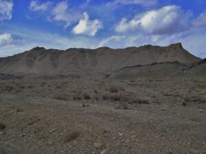
The-Hills-of-Muslim-Bhag-Balochistan.

Muslim Bagh is located 6000 feet from sea level. On the way, there are apples, grapes, and oranges trees instead of drylands and plain grounds.

During the Akbar regime, the Muslim Garden was a part of eastern Qandahar.

Underground water channels are built for irrigation purposes. They are named “Karez”. They are used to supply water to large distances. Shakar Num is the best picnic spot which is a few miles away from this area.

 Key information about Muslim Bagh

Attribute Details
Name Muslim Bagh
Location Balochistan, Pakistan
Coordinates Approximately 29.8500° N latitude and 69.5707° E longitude
Population Estimated population of around 50,000 (figures may vary)
Climate Arid climate with hot summers and mild winters
Elevation Around 1,252 meters (4,108 feet) above sea level
Language Balochi, Urdu
Major Industries Chromite mining, Agriculture
Historical Significance Presence of ancient archaeological sites
Education Limited educational institutions
Healthcare Basic healthcare facilities available
Transportation Connected by road; limited air connectivity
Local Cuisine Traditional Balochi dishes, local specialties
Notable Features Chromite mines, scenic landscapes
Challenges Limited access to education and healthcare facilities, economic diversification

Explore Muslim Bagh

Geography and Landscape

Muslim Bagh is situated in the northwest of Balochistan, surrounded by the Khudai Range and Spin Ghar mountains. The town is strategically located, serving as a gateway to Afghanistan. The area’s topography is characterized by arid landscapes, rocky mountains, and vast stretches of wilderness, contributing to the unique charm of the region.

Mining Heritage

One of the defining features of Muslim Bagh is its association with mining activities. The town is renowned for its chromite deposits, a mineral with significant industrial applications. The mining industry in Muslim Bagh has been a cornerstone of the local economy, attracting attention not only for its economic impact but also for the challenges and opportunities it presents.

Historical Significance

Muslim Bagh has witnessed a tapestry of historical events that have shaped its identity. The town’s history is closely linked to the broader history of Balochistan, a region that has been a crossroads for various civilizations and cultures throughout the ages.

The region’s historical narrative is influenced by the migration patterns of different ethnic groups, including Baloch tribes, Pashtuns, and others. Muslim Bagh, situated at the crossroads of trade routes, became a melting pot of diverse influences, contributing to its unique cultural tapestry.

Colonial Era

During the British colonial period, Muslim Bagh gained prominence due to its strategic location and valuable mineral resources. The colonial administration recognized the economic potential of the region and invested in the development of infrastructure, including roads and railways, to facilitate the extraction and transportation of minerals.

Independence and Post-Partition Era

With the creation of Pakistan in 1947, Muslim Bagh became an integral part of the newly formed country. The mining industry continued to play a crucial role in the region’s development, contributing to the national economy. However, like many other regions in Pakistan, Muslim Bagh faced challenges related to governance, infrastructure development, and socioeconomic disparities.

Challenges and Opportunities

While Muslim Bagh has been blessed with abundant natural resources, it has also faced challenges related to sustainable development, environmental conservation, and the well-being of its residents. Balancing the extraction of minerals with the preservation of the region’s ecological integrity remains a pressing concern.

Historical Places and Picnic Spots in Muslim Bagh, Balochistan:

Chotok Waterfall

Nestled amidst the rugged terrain, Chotok Waterfall is a picturesque natural wonder near Muslim Bagh. The site offers not only scenic beauty but also serves as a refreshing retreat for locals and visitors alike.

Old Fort Ruins

The remnants of an old fort in the vicinity stand as a testament to the historical past of Muslim Bagh. Exploring these ruins provides a glimpse into the town’s ancient architecture and the stories it holds.

Ancient Graveyard

The ancient graveyard in Muslim Bagh is a place of historical significance, reflecting the burial traditions of the region. The tombstones and structures in the graveyard carry the echoes of the past.

Gulshan Park

Gulshan Park is a popular picnic spot, offering lush greenery and a serene atmosphere. Families and friends often gather here to enjoy a day outdoors, surrounded by nature.

Spin Ghar Mountains

The majestic Spin Ghar Mountains provide a stunning backdrop for picnics and outdoor activities. The panoramic views and cool mountain air make it an ideal destination for nature enthusiasts.

Chapli Hills

Chapli Hills, with their rolling landscapes and open spaces, are perfect for picnics and outdoor recreation. The hills provide a vantage point to appreciate the natural beauty of the surroundings.

Local Bazaars

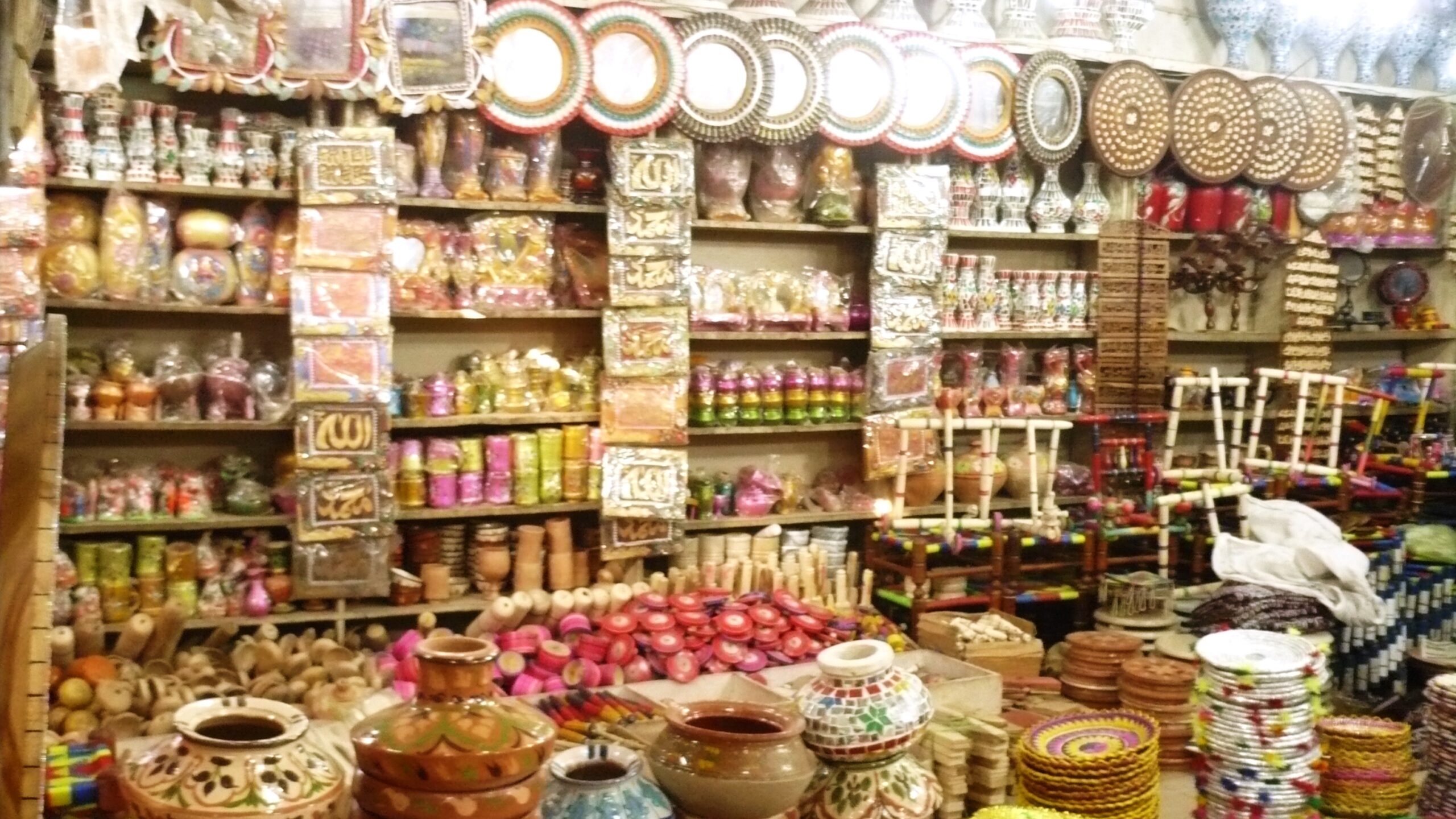
Exploring the local bazaars in Muslim Bagh is a cultural experience. These bustling markets showcase the vibrant life of the town, with shops offering traditional crafts, spices, and local produce.

Mosques and Shrines

Muslim Bagh is home to various mosques and shrines that hold cultural and religious significance. These sites not only serve as places of worship but also provide insights into the town’s spiritual heritage.

Koh-e-Sulaiman Caves

The Koh-e-Sulaiman Caves, situated in the nearby mountains, are a fascinating destination for adventure seekers. Exploring these caves allows for an immersive experience in the region’s geological wonders.

Tips for Visitors

  • Check weather conditions before planning outdoor activities.
  • Respect local customs and traditions, especially when visiting religious sites.
  • Dispose of waste responsibly to preserve the natural beauty of picnic spots.

Schools and Colleges

  • Government High School, Muslim Bagh
  • Muslim Bagh Degree College
  • Balochistan College of Education, Muslim Bagh

Hospitals

  • Muslim Bagh Hospital
  • District Headquarters Hospital, Muslim Bagh
  • Rural Health Center, Muslim Bagh

Restaurants

    • Khan Restaurant
    • Balochistan Grill House
    • Gulshan Cafe & Restaurant

Frequently Asked Questions (FAQs)

What is the historical significance of Muslim Bagh?

Muslim Bagh has a rich history shaped by its strategic location and abundant mineral resources. Its history is intertwined with the broader historical narrative of Balochistan, reflecting the migrations of diverse ethnic groups and the influences of various civilizations.

What is Muslim Bagh known for?

Muslim Bagh is renowned for its chromite deposits, making it a significant player in the mining industry. The town’s economy has historically thrived on the extraction of minerals, particularly chromite, contributing to its identity and economic importance.

Are there notable educational institutions in Muslim Bagh?

Yes, Muslim Bagh is home to schools and colleges that cater to the educational needs of the local population. Some examples include Government High School, Muslim Bagh, Muslim Bagh Degree College, and Balochistan College of Education.

What healthcare facilities are available in Muslim Bagh?

Healthcare in Muslim Bagh is facilitated by institutions such as Muslim Bagh Hospital, District Headquarters Hospital, and Rural Health Center. These facilities play a crucial role in providing medical services to the local community.

Are there any popular restaurants in Muslim Bagh?

Certainly, Muslim Bagh boasts a variety of restaurants that cater to local tastes. Examples include Khan Restaurant, Balochistan Grill House, and Gulshan Cafe & Restaurant, offering a range of dining options to residents and visitors.

How has Muslim Bagh evolved since independence?

Since Pakistan’s independence in 1947, Muslim Bagh has been an integral part of the country. It has witnessed changes in governance, infrastructure development, and socioeconomic dynamics, with the mining industry continuing to be a key driver of its development.

What challenges does Muslim Bagh face today?

Like many regions, Muslim Bagh faces challenges related to sustainable development, environmental conservation, and socioeconomic disparities. Balancing mineral extraction with ecological preservation is an ongoing concern for the town.

Is there potential for growth and development in Muslim Bagh?

Yes, Muslim Bagh holds significant potential for growth and development. Addressing challenges such as sustainable resource management and infrastructure development can unlock opportunities for the town’s progress.

Where can I find the most up-to-date information about Muslim Bagh?

For the latest information about Muslim Bagh, consider checking local directories, community websites, or contacting relevant authorities in the town. Online sources and community forums may also provide updated details about the town and its amenities.

Last Thoughts on Muslim Bagh

Muslim Bagh, with its rich history and abundant natural resources, stands as a testament to the resilience and adaptability of the people who have called this region home. As the town continues to navigate the complexities of the modern era, it remains a symbol of the interplay between tradition and progress, history and the future, all against the backdrop of Balochistan’s enchanting landscapes.
About Punjab – Pakistan | History of Punjab Province

Punjab Province

Tracking The Glories of the Past

Heralding The Dawn of a Future

Province Punjab has been distinguished in every era because of its prolific, fruitful, and fertile lands. Punjab civilization is one of the ancient civilizations. It is due to the amalgamation of local and global cultures. The Capital city of Punjab is Lahore.

Key info About Punjab – Pakistan

Aspect Details
Name Punjab
Location Eastern Pakistan, bordered by Sindh, Balochistan, Khyber Pakhtunkhwa, and the Indian states of Jammu and Kashmir to the east.
Area Approximately 205,344 square kilometers (second-largest province in Pakistan).
Population Exceeding 110 million people (most populous province in Pakistan).
Capital Lahore (cultural and economic hub of Pakistan).
Official Language Urdu (official), Punjabi (widely spoken with cultural significance).
Administrative Divisions Multiple divisions and districts, including Lahore, Faisalabad, Multan, Rawalpindi, and more.
Economy Economic heartland of Pakistan, contributing significantly to the country’s GDP. Known for agriculture, industry, and trade.
Major Industries Textiles, manufacturing, pharmaceuticals, and IT. Lahore is a key center for industrial and technological activities.
Education Home to numerous educational institutions, including the University of the Punjab, Lahore, and various other universities, colleges, and schools.
Cultural Heritage Rich cultural heritage with historical landmarks such as the Badshahi Mosque, Lahore Fort, and Shalimar Gardens. Traditional Punjabi music, dance, and cuisine are integral to the culture.
Transportation Extensive road and rail network connecting major cities. Lahore’s Allama Iqbal International Airport is a key international gateway.
Tourist Attractions Besides historical sites in Lahore, Punjab offers attractions like the Katas Raj Temples, Rohtas Fort, and the scenic hills of Murree.
Festivals Punjabis celebrate various festivals, including Basant (spring festival) and Eid-ul-Fitr, with enthusiasm and traditional fervor.

Explore Punjab

History of Punjab Province

In primeval times, Punjab is termed “Sapat Sindhu” in the holy book of Arya’s “Rigveda”. Rigveda (sacred text)  has some phrases from 2400 B.C. However, it is difficult to tell when Sapat Sindhu became a part of Rigveda. According to the Britannica encyclopedia, the famous tourist Ibn Battuta first used the term “Punjab” in his travelogue.

In the past, Punjab was called by different names.  Some famous names were Punjab, Punj Do Aab, Punj Jinya Krishti, Punjnad, Whake, Gosh, Sapat Sindhu, and Hept Sindhu.

According to researchers, Punjab is Man’s first birthplace. They thought that it is the only place in Asia where about 60 million years old fossils were discovered. Punjab is the name of land irrigated by five rivers. It is a word in the Persian language that is a combination of “Punj” and “Aab”.

In the ancient ages, Punjab was the first battlefield for the invaders coming from the northwest passes. At those times, the defense system of Punjab was strong. The whole sub-continent was saved from foreign dominion. Arya faced a lot of opposition in Punjab. The war between Arya and the ten kings was fought near River Ravi in the Harappa surrounding.

The high-level civilization of Harappa is a manifestation of the existence of an excellent political system there.

In the koro Kheshter ground, a war was fought between Kors and Pandos. The states of king Poras and Maloha were prominent when the Great Alexander attacked this area. He fought with such courage, audacity, and fearlessness that it is engraved in the pages of history with indelible impressions.

Due to this militant quality of Punjabis, the sequence of Greek conquest was broken. The Great Alexander had to come back with a regret in his heart.

The historians have a conflict about the beginning of a historic era in Punjab.

It is assumed that it started after the arrival of Arya in this area (1600 B.C) and Rigveda. After that, Hakhamaneshi came into power. They invented coins. Their reign ended after the attack of the Greeks. Greeks promoted Buddhism. The Greeks’ government ended in just two years. After Alexander, Chander Gapat Moria ruled this area. Then, Bhakti overtook the subcontinent and established Taxila (Surkap).

Sakaya Shik (governed this area for 100 years), Parthi or Pehalwa (Gandhara Art initiated during this regime), Kishan (their era is the golden age of Buddhism), Sasani (their government lasted for forty years) Kedar Kishan (they came from Balkh) and Hun ( they ruled Punjab for two hundred years) are some important pages of Punjab’s deep-rooted history. Sanskrit was the official language. Hun was used to preaching to people. They built the largest temple in Multan. Kashmiri and then Hindu Shahi came into power. This sequence continued until the Arab influx.

Muhammad Bin Qasim occupied Sindh and after one year, Arabs conquered Multan. Thenceforth, Mehmood Ghaznavi subjugated Punjab and led the foundations of the First Islamic Government. Lahore was the province of Ghaznavi Sultanate. Sultans were also blessed with the Punjab reign.

The emperors changed over time. The Mughals era was a golden period for the sub-continent. They started a series of construction of grand buildings in the sub-continent, especially in Punjab.

Lal fort Delhi, Fateh Pur Sikri, Taj Mahal Agra, Taj Mahal, Shahjahan Mosque, renovation of Lahore fort, Sheesh Mahal, Moti Mosque, Shahi Mosque Lahore, Noor Jahan’s tomb, Shalimar Garden, Kamran Bara Dari, Jahangir’s tomb, Rohtas fort, GT road Peshawar to Kolkata, are the symbols of their keen interest in architect.

Sikhs took the advantage of Mughals’ weakness and conquered the various areas of Punjab. Shahi fort, Badshahi Mosque, Hazoori garden, and golden temple in Amar tassar are built by King Ranjeet Singh. At last, the Sikh era ended.

The British had a stronghold in India before the Sikh regime. However, it took one century to conquer Punjab. In 1849, Britishers subjugated Punjab with their planning. Their monarchy ended in 1857, after the freedom movement “Tehreek-e-Azadi”.

There was a time when the boundaries of Punjab (situated in the northwest of the sub-continent) were spreading from Sir Hind Shahreef to Khyber Pass and Kashmir to Karachi on the other side. Sometimes, the administration of Lahore was called Punjab province. The areas of D.G Khan, D.I. Khan, Peshawar, Banu, Kohat, Bahawalpur, Kangra, Kashmir, Hazara, Tibet, Ladakh, Jammu were included in the Punjab territory during the Sikh reign. British included Delhi, Hassar, and Ambala Division in Punjab.

In 1901, The Britishers separated the province KPK (North-West Frontier Province) from Punjab. In 1912, Delhi was declared a separate province.

Today’s Punjab 

Located at 40-27- and 34-1-degrees longitude and 10-69 to 20-75 degrees latitude, Punjab’s demarcated and undisputed boundaries after 14th August 1947 are as follows. In the north, the Himalayas range separates it from Tibet and Kashmir. KPK is situated in the northwest. The river Indus lies between KPK and Punjab. It has Balochistan in the west, Sindh in the south, and India (Hindustan) in the East.

Punjab’s total area is 205344 square kilometers. Its area is about 25.8 % of Pakistan’s total area. At the creation of Pakistan, it was the largest province of Pakistan in terms of population, and still, it is the largest province. Lahore is its capital.

In 1951, according to the first census, the total population of Punjab was 20541000. Nowadays, its population Is about 10 crores.

The mainland of Punjab is located at a greater distance from the poles and at a relatively short distance from the equator. Therefore, the duration of the winter season is less than the summer season. The southern areas are too hot. On the contrary to this, northern areas are cold. The weather is pleasant in February, March, and April. It is very hot from May to July. In some areas (Multan, Bahawalpur, Mianwali, and Bahawalnagar) the temperature goes beyond 48.

Punjab, Pakistan
Punjab, Pakistan

The rainy season starts at the end of July and goes till the mid of September. The winter season prevails from November to January. It is too cold in the northern areas of Punjab and the temperature drops below freezing.

Overall, it is agricultural land. A network of Canals is designed for irrigation and cultivation purposes. It is considered to be the best canal system in the World. The fertility and production of agricultural land depend on this Canal system.

Ancient Roots

The history of Punjab dates back to ancient times when the Indus Valley Civilization flourished along the banks of the mighty Indus River. The region has been a melting pot of diverse cultures, influenced by the Aryans, Persians, Greeks, and Mauryans. The city of Taxila, an ancient center of learning, stood as a beacon of wisdom, attracting scholars from far and wide.

Mauryan and Gupta Empires

Punjab played a pivotal role during the reign of the Mauryan and Gupta Empires. The great Mauryan emperor, Ashoka, embraced Buddhism, and remnants of his rock edicts can still be found in various parts of the province. The Gupta period marked an era of cultural and artistic flourishing, leaving an indelible imprint on Punjab’s heritage.

Islamic Influences

With the advent of Islam in the 7th century, Punjab became a crossroads for trade and cultural exchange. The region saw the establishment of prominent Islamic centers, and Sufi saints played a crucial role in spreading the message of Islam. The city of Multan, with its ancient shrines, became a significant center of Sufi mysticism.

Mughal Splendor

The Mughal era stands as a golden chapter in Punjab’s history. Under the rule of Akbar, Lahore became the capital of the Mughal Empire, witnessing the construction of architectural marvels such as the Badshahi Mosque and Lahore Fort. The prosperity of this period is reflected in the rich gardens and exquisite artwork that dot the landscape.

British Colonial Period

The 19th century saw the arrival of the British in Punjab. The annexation of the region by the East India Company marked the beginning of a new chapter. The British developed infrastructure, introduced modern education, and established military cantonments. However, this period also witnessed significant sociopolitical changes that culminated in the struggle for independence.

Partition and Independence

The partition of British India in 1947 left an indelible mark on Punjab. The province was divided into West Punjab (now in Pakistan) and East Punjab (now in India). The partition resulted in massive migrations, communal violence, and the reconfiguration of cultural landscapes.
Post-Independence Era

Since gaining independence, Punjab in Pakistan has emerged as a powerhouse, contributing significantly to the nation’s agricultural and industrial sectors. Cities like Lahore have become vibrant centers of culture, education, and commerce. Despite challenges, the people of Punjab have demonstrated resilience and an unwavering commitment to progress.

Cultural Diversity and Heritage

Punjab’s cultural richness is reflected in its folk music, dance, and traditional festivals. Bhangra, a lively dance form, and the soulful tunes of Punjabi folk music have transcended regional boundaries, becoming global cultural phenomena.

Historical sites in Punjab

Badshahi Mosque (Lahore)

One of the largest mosques in the world, the Badshahi Mosque in Lahore is an architectural masterpiece from the Mughal era. Built during the reign of Aurangzeb in the 17th century, it boasts intricate marble inlay, elegant calligraphy, and a grand courtyard.

Lahore Fort

Adjacent to the Badshahi Mosque, the Lahore Fort is another marvel from the Mughal period. With its stunning Sheesh Mahal (Palace of Mirrors), Shalimar Gardens, and historic structures, the fort is a UNESCO World Heritage Site.

Shalimar Gardens (Lahore)

Built by Shah Jahan, the Shalimar Gardens are a series of terraced levels adorned with flowing water channels, fountains, and pavilions. The gardens represent Mughal garden design at its zenith.

Sheikhupura Fort (Hiran Minar)

Located in Sheikhupura, the Hiran Minar is a unique structure built by Emperor Jahangir in memory of his beloved pet deer. The complex includes a large water tank and a pavilion.

Rohtas Fort (Jhelum)

Commissioned by Sher Shah Suri in the 16th century, Rohtas Fort is a military stronghold built to prevent the return of the Mughal emperor Humayun. The fort stands as an excellent example of medieval military architecture.

Taxila (UNESCO World Heritage Site)

An ancient archaeological site, Taxila was an important center for Buddhist learning and a significant trade and cultural hub. The ruins include stupas, monasteries, and archaeological remains dating back to the Gandhara period.

Derawar Fort (Bahawalpur)

Located in the Cholistan Desert, Derawar Fort is a massive and well-preserved structure. Built by the Rajputs, it has a distinct medieval feel and provides panoramic views of the surrounding desert.

Katas Raj Temples (Chakwal)

A complex of several ancient temples, the Katas Raj Temples are revered by Hindus. The main temple, dedicated to Lord Shiva, is surrounded by a pool fed by freshwater springs, creating a serene and sacred atmosphere.

Ranikot Fort (The Great Wall of Sindh)

Often referred to as the Great Wall of Sindh, Ranikot Fort is the world’s largest fort, extending over 26 kilometers. Its origins are unclear, and it serves as an intriguing archaeological mystery.

Allama Iqbal’s Tomb (Lahore)

The final resting place of Allama Iqbal, a renowned poet, philosopher, and one of the founding fathers of Pakistan. The tomb is a symbol of national pride and an architectural tribute to his contributions.

Schools

  • Aitchison College (Lahore): A prestigious boys’ boarding school with a rich history and a reputation for academic excellence.
  • Convent of Jesus and Mary (Lahore): A well-known girls’ school with a tradition of providing quality education and a focus on holistic development.

Colleges

  • Government College University (Lahore): A renowned institution with a history dating back to 1864, known for its academic rigor and contributions to education.
  • Forman Christian College (FCC) University (Lahore): Established in 1864, FCC is one of the oldest colleges in South Asia, offering undergraduate and graduate programs.

Hospitals

  • Aga Khan University Hospital (Lahore): Part of the Aga Khan Health Services network, providing high-quality healthcare services and medical education.
  • Shaukat Khanum Memorial Cancer Hospital (Lahore): Founded by Imran Khan, this hospital is a leading center for cancer treatment and research.

Restaurants

  • Cuckoo’s Den (Lahore): Located in the historic Walled City of Lahore, Cuckoo’s Den is known for its rooftop dining and traditional Pakistani cuisine.
  • Salt Bae Restaurant (Lahore): A popular international chain known for its unique presentation of dishes and high-quality steaks.

Frequently Asked Questions (FAQs)

Q: What is the historical significance of Punjab in Pakistan?

A: Punjab, often referred to as the “Land of Five Rivers,” has a rich history dating back to ancient civilizations. It has been a cultural crossroads, witnessing the rise and fall of empires and the convergence of diverse cultures.

Q: Which cities in Punjab are known for their cultural and economic prominence?

A: Lahore, the provincial capital, is a major cultural and economic hub. Other cities like Faisalabad, Multan, and Rawalpindi also contribute significantly to the province’s economic activities.

Q: What is unique about Punjab’s architecture and historical sites?

A: Punjab boasts magnificent Mughal-era architecture, including the Badshahi Mosque and Lahore Fort. The province is home to ancient archaeological sites like Taxila and architectural wonders like the Rohtas Fort.

Q: How has Punjab evolved since the colonial period?

A: The colonial period brought significant changes, including the development of infrastructure and the establishment of educational institutions. Post-independence, Punjab has emerged as an economic powerhouse and a center for education and commerce.

Q: What festivals are celebrated in Punjab, and why are they significant?

A: Punjabis celebrate various festivals, including Basant (spring festival) and Eid-ul-Fitr, with enthusiasm and traditional fervor. These festivals are integral to the cultural identity of the region.

Q: Are there famous educational institutions in Punjab?

A: Punjab is home to renowned educational institutions such as Government College University (GCU) and Forman Christian College (FCC) University in Lahore, contributing to the academic landscape of the province.

Q: What are some notable hospitals in Punjab providing healthcare services?

A: Aga Khan University Hospital and Shaukat Khanum Memorial Cancer Hospital, both located in Lahore, are reputable healthcare institutions known for their quality medical services.

Q: How can I explore Punjab’s culinary scene?

A: Punjab offers a diverse culinary experience. Restaurants like Cuckoo’s Den in Lahore, with its rooftop dining, and international chains like Salt Bae Restaurant provide unique dining experiences.

Q: Is Punjab known for anything else besides historical sites and institutions?

A: Yes, Punjab is known for its vibrant cultural heritage, traditional music and dance forms like Bhangra, and its contribution to Pakistan’s agricultural output, earning it the title of the “Granary of Pakistan.”

Q: How can I stay informed about the latest happenings in Punjab?

A: Stay updated through local news sources, community websites, and online platforms for reviews and recommendations. Engaging with locals and participating in cultural events are excellent ways to stay connected with the pulse of Punjab.

Last Thoughts on Punjab

Province Punjab is a historic province. It plays a key role in the economy of the country. There are many historical cities in this province. Its capital Lahore is referred to as the cultural heart of Pakistan.

Rahim Yar Khan – An Ancient Historical City of Punjab Pakistan

Rahim Yar Khan

Rahim Yar Khan (RYK) is considered a city of ancient heritage. It is the 17th largest city in  Pakistan by population. It plays a key role in the economy of Punjab and Pakistan through the production of cotton. The majority of people belonged to the occupation of agriculture.

Key info aboutRahim Yar Khan

Aspect Details
Name Rahim Yar Khan
Area Southern Punjab, Pakistan
Location Rahim Yar Khan is a city in the Punjab province of Pakistan, situated in the southern part of the province near the Sindh border.
Historical Significance Rahim Yar Khan has historical importance dating back to ancient times, with cultural influences from various civilizations that have traversed the region.
Geographical Features The city is characterized by its location in the fertile plains of the Indus River, contributing to the region’s agricultural significance.
Population Rahim Yar Khan has a diverse population, reflecting the cultural and ethnic diversity of the Punjab province.
Economy The city’s economy is primarily driven by agriculture, with the cultivation of crops such as cotton, wheat, sugarcane, and fruits.
Transportation Rahim Yar Khan is well-connected by road and rail networks, facilitating transportation within the city and to other parts of the country.
Educational Institutions The city hosts various educational institutions, including schools, colleges, and a campus of the Islamia University of Bahawalpur.
Landmarks Notable landmarks include the Sheikh Zayed International Airport, Bahadur Suba Mausoleum, and historical sites that reflect the city’s ancient roots.
Industries In addition to agriculture, Rahim Yar Khan has industries such as sugar and textile mills, contributing to the economic development of the region.
Healthcare Facilities The city is equipped with hospitals and medical facilities, providing healthcare services to the local population.
Cultural Heritage Rahim Yar Khan has a cultural heritage that encompasses traditional music, dance, and local festivals, reflecting the cultural vibrancy of the region.
Modern Developments Recent years have seen infrastructure and development projects, enhancing the city’s facilities and improving the overall quality of life for its residents.

Exploring The Rahim Yar Khan 

Historical Significance

Rahim Yar Khan, beyond its contemporary facade, carries echoes of antiquity. The city’s historical significance can be traced back to ancient times, bearing witness to the rise and fall of civilizations that traversed the fertile plains along the Indus River. This historical richness has left an indelible mark on the cultural ethos of the region.

Geographical Features

Situated in the southern part of the Punjab province, Rahim Yar Khan derives its geographical character from the fertile plains of the Indus River. The abundance of arable land has made agriculture a cornerstone of the local economy, with crops like cotton, wheat, sugarcane, and various fruits thriving in this region.

Economic Landscape

Agriculture takes center stage in Rahim Yar Khan’s economic theater. The cultivation of crops not only sustains the local populace but also contributes significantly to the national agricultural output. In addition to the agrarian sector, industries such as sugar and textiles play a vital role in the city’s economic development.

Transportation Hub

Rahim Yar Khan stands as a well-connected transportation hub, both by road and rail networks. This connectivity not only facilitates the movement of goods but also ensures efficient travel within the city and to other parts of the country.

Some Famous Historical Places

Bhong Mosque

District Raheem Yar Khan is a well-known city for the production of a variety of mangoes, fertilizers companies, flour mills, and Sugar mills. It is important to mention here the first sign of Muslim sanctity, the Mosque.

Mosques have played a major role in the progression of Islam. Mosques are the reflection of Islamic traditions and architectural inheritance in every epoch. In 1932, Renowned personality Sardar Raees Ghazi Muhammad (late) led the foundation of Bhong Mosque in the boundary of his palace in Bhong town Tehsil Sadiq Abad, district Rahim Yar Khan.

In the design of the mosque, gold is used in calligraphy and art. He took the pieces of art from Lahore, Iran, Spain, and turkey and blended them with western fine art to build a splendid masterpiece.

In the construction of the mosque, Teak, Ivory, Marble, valuable stones, Glazed tiles, Fresco, glasswork, Gilded Tracery, ceramic, complex calligraphy, the latest artificial marbleized tiles, colorful cement tiles, and other arts were assorted.

Bhong-Mosque-Rahim-Yar-Khan
Bhong Mosque, Rahim Yar Khan

Islamic art is prominent in all parts of the mosque. This mosque was completed in fifty years. For this purpose, masons from Rajasthan India, craftsmen from Multan for glazed tile work, and calligraphers from Karachi were called. Workshops were established.

The skill was transferred from father to son and then to grandson. One thousand workers were trained during the groundwork of the mosque.

The entering door is a duplicate of Imam Raza (R.A)’s shrine door in Mashhad. A spacious garden with fountains like the Shalamar garden Lahore is there.

He was bestowed with the Sir Agha Khan award in Morocco in recognition of building such a high-profile mosque at the regional level. On 23rd March 2004, the President of Pakistan presented him “Sitara -e- Imtiaz” for his services.

Pakistan post issued the first stamp on 12th May 2004. It is 20 km from the Sadiq Abad. Tourists can visit this mosque by bus and wagon.

Rahim Yar Khan City

In 1751, Fazal Elahi Hilani established the city Nowshera on the remains of Phal Wada fort which is situated 25 km from Sadiqabad. Forth Nawab Sadiq Muhammad Khan, governor of Bahawalpur named this city “Rahim Yar Khan” after the name of his son from his second wife.

Rahim-Yar-Khan-Punjab-Pakistan

Next year, on 23rd February 1882 he died in a fireworks display. Its name was Nowshera in papers until 1932. Nowshera mines canal is still flowing in the city. Sheik Zaid Bin Sultan (United Arab Emirates) captivated the hearts of the people by playing a role in the prosperity and development of this city.

Patan Menara

Artifacts unearthed from the ruins of these desolate settlements on the east bank of the ancient Indus crossing reveal the fact that the area was no less important than the ancient cities of Harappa and Mohan Jodaro.

According to some historians, Mahatma Gautam Buddha established an educational institute there. Patan Menara was the Burj of this splendid building. There is a clue of many basements near the Burj.

The temple was built around 300 BC, according to Sanskrit inscriptions on the recovered bricks. Kernel Manchon excavated near Patan Menara. During this time a very strange thing came to light a very foul liquid substance came out of the earth on which huge ants were sitting. Whoever was bitten by this creature fell down and died in agony. Therefore, the excavation was immediately canceled. These ruins are spread over miles.

Patan-Minar-Rahim-Yar-Khan
Patan Minar, Rahim Yar Khan

In the early 18th century, a big fair was organized there. There were two ponds in the Shiwateri fair. One was full of milk and one was full of water. In 1840, its administrator Sadho Baba Rata suicide by pressing himself in salt.

His devotees made a Mardi named Shiva temple. Here the worship of Shivling began. Childless Hindu women started coming here in droves to have children. Muslim women also started coming there. There arose a dispute and the temple was demolished. A mosque was constructed named Patan Menara. It is present to date.

This old memorable mosque of the Buddhism era is situated 10 km to the east of Rahim Yar Khan city. This mosque is located on a podium at a height of 26 feet and covers an area of 14 square feet.

From the present piece of the building, seeing the beautiful construction, one can be sure that it is a part of this magnificent building which is centuries old. Rahim Yar Khan is declared the twin city of Paris, Abu Dhabi, and Sydney.

Bhutta Wahan

It is situated 20 km away from Rahim Yar Khan city on the KLP road. It is said that this town was settled in Daher’s era. It is supposed to be the birthplace of the famous romantic folk tale character Sassi.

Besides this, it is the hometown of the Mughal emperor Akbar’s courtier and politician Abul Fazal and Scholar Faizi. According to Locals, if a female gives birth to a son in Bhutta Wahan he will have the traits of Abul Fazal, Faizi, and Sassi.

Moreover, it is the homeland of Mughal king Akbar’s advisor Mulla Do Piaza. Located 3 miles from Zahir Pir to Khanpur Road near this Bhutta Wahan, the area of ​​Jajja Abbasia is famous for its high production of dates.

Schools

  • Beaconhouse School System (Rahim Yar Khan Campus): A part of the renowned Beaconhouse School System, providing quality education from preschool to higher grades.
  • The City School (Rahim Yar Khan Campus): A prominent school offering a comprehensive curriculum and a focus on holistic development.

Colleges

  • Punjab College (Rahim Yar Khan Campus): A well-established college providing intermediate and undergraduate programs in various disciplines.
  • Government Sadiq College Women University (GSCWU): A women’s university offering higher education opportunities in Rahim Yar Khan.

Hospitals

  • Rahim Yar Khan Medical College and Hospital: A major healthcare institution providing medical education and healthcare services to the local community.
  • Shifa International Hospital (Rahim Yar Khan): A branch of the renowned Shifa International Hospitals network, offering comprehensive medical facilities.

Restaurants

  • Royal Chalet Restaurant: Known for its diverse menu and comfortable ambiance, offering a variety of Pakistani and international cuisines.
  • The Grill House: A popular restaurant specializing in grilled dishes and offering a contemporary dining experience.

Frequently Asked Questions (FAQs) 

Q: What is the historical significance of Rahim Yar Khan?

A: Rahim Yar Khan holds historical importance dating back to ancient times, with influences from various civilizations that have traversed the region.

Q: Are there ancient landmarks in Rahim Yar Khan?

A: Yes, the city boasts landmarks reflecting its ancient roots, including the Bahadur Suba Mausoleum and other historical sites.

Q: How has Rahim Yar Khan evolved over time?

A: From its historical origins, Rahim Yar Khan has adapted to modern developments, witnessing changes in infrastructure and overall urbanization.

Q: What cultural heritage does Rahim Yar Khan possess?

A: The city’s cultural heritage encompasses traditional music, dance, and local festivals, reflecting the vibrant cultural tapestry of the region.

Q: Are there archaeological sites in Rahim Yar Khan?

A: While not as well-known as some other regions, Rahim Yar Khan has archaeological sites that reveal glimpses of its ancient past.

Q: What role does agriculture play in the history of Rahim Yar Khan?

A: Agriculture has been a historical cornerstone, with the fertile plains of the Indus River contributing to the city’s economic significance.

Q: How can visitors explore the historical side of Rahim Yar Khan?

A: Visitors can explore landmarks like the Bahadur Suba Mausoleum and indulge in cultural experiences, including traditional music and festivals.

Q: Are there efforts to preserve Rahim Yar Khan’s historical sites?

A: Preservation efforts are ongoing to safeguard the city’s historical sites and maintain a connection to its rich heritage.

Q: What is the significance of the Sheikh Zayed International Airport?

A: The airport is a notable landmark and contributes to the city’s modern connectivity, symbolizing its adaptability to changing times.

Q: How can one learn more about Rahim Yar Khan’s history?

A: Local museums, historical societies, and cultural events are great avenues for delving deeper into the history of Rahim Yar Khan.

Last Thoughts on Rahim Yar Khan

 Rahim Yar Khan stands as a dynamic city where history intertwines with progress. It’s a place where the echoes of ancient civilizations harmonize with the hum of modernity, creating a unique cultural and economic tapestry in Southern Punjab. As Rahim Yar Khan navigates its journey through time, it remains a symbol of resilience, growth, and the enduring spirit of its people.

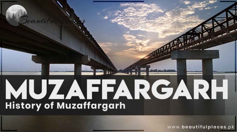
Muzaffargarh District – Punjab Pakistan | History of Muzaffargarh

Muzaffargarh

It is located in southern Punjab. The closest Metropolitan city is Multan. Most people rely on agriculture for their livelihood.Established in 1985, this region not only bears witness to the dynamic pulse of contemporary life but also echoes with the footprints of empires and the whispers of Sufi saints.

From its fertile plains nourished by the Chenab and Indus rivers to the historical landmarks that stand sentinel, Muzaffargarh beckons explorers to unravel its rich tapestry of history and heritage. In this introduction, we embark on a journey to discover the allure of Muzaffargarh, where time seems to dance between the past and the present.

Key information about Muzaffargarh PK

Heading Information
Location Southern Punjab, Pakistan
Establishment Established in 1985 as a separate district
Area Approximately 8,249 square kilometers
Population According to the 2017 census, over 4 million people reside in the district.
Geographical Features Situated between the Chenab and Indus rivers, Muzaffargarh is known for its agricultural plains.
Historical Significance Muzaffargarh has a rich history dating back to ancient times, with influences from various civilizations, including the Indus Valley Civilization and the Mughal Empire.
Economy Predominantly agrarian, with a focus on crops such as cotton, wheat, and sugarcane. The district also has an emerging industrial sector.
Major Crops Cotton, wheat, sugarcane, and rice are among the major crops cultivated in the district.
Languages Spoken Punjabi is the primary language, and Urdu is also widely spoken.
Administrative Setup Divided into several tehsils, including Muzaffargarh, Kot Addu, Alipur, and Jatoi.
Educational Institutions Muzaffargarh has various educational institutions, including degree colleges and schools catering to the educational needs of the local population.
Healthcare Facilities The district has hospitals and healthcare facilities, including Tehsil Headquarter Hospital Muzaffargarh and others, providing medical services to the residents.
Transportation Well-connected by road, with major highways passing through the district.
Notable Landmarks Tomb of Shah Shams Sabzwari, a revered Sufi saint.  Muzaffargarh Fort, a historical fort that reflects the region’s rich history.
Local Culture Rich cultural heritage with influences from Sufi traditions, reflected in local festivals and celebrations. The district is known for traditional music and folk arts.
Industries Agriculture is the primary industry, and there is a growing presence of industries, including textiles and agribusiness.
Natural Resources Rich in fertile agricultural land, with the rivers providing water resources for irrigation.
Tourist Attractions While not widely recognized as a tourist destination, Muzaffargarh offers historical and cultural sites for those interested in exploring the region’s heritage.

Famous Historical Place

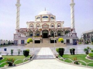
Sakina-Tu-Sughra Mosque

A Pakistani Cardiologist based in the United States Dr. Ismail Bukhari built this mosque in Kotla Raham Ali Shah town which is 11 km from Jatoi and 74 km from Muzaffar Garh.

Before that, there was a madrassa and a small mosque. Maulana Obaid Ullah Sindhi got his early education in this Madrassa. Dr. Ismail Bukhari renovated this mosque and allocated an area of 56 canals. He analyzed different architectural styles of the mosques in the World and selected Turkey’s architectural style for this mosque.

The map of this three-floor mosque was designed by the renowned Turk Architect engineer Najeeb. The raw material was imported from Turkey. The chandeliers in this mosque were designed by the same company which designed the chandeliers of masjid -e- Nabi ﷺ.

Sakina-tu-Sughra-mosque.
Sakina-tu-Sughra mosque

It was completed in a short duration of sixteen months. It gives a pleasant feeling when you enter this mosque.

The sacred names Allah and Muhammad are written with grass. The white marble net in the inner part of the mosque is a fine example of Mughal and Multani art.

The main door of this mosque resembles the front gate of Masjid-e- Nabiﷺ. The height of the mosque is 80 feet and the height of the two minarets is 186 feet. It consists of 23 small domes and teak wood is used in its doors.

A madrassa is connected to this mosque and more than 400 students are getting religious education there.

Transport is available from Multan to Jatoi. People can visit Kotla Raham Ali Shah through local transport.

Kot Addu Fort

Located near Kot Addu, this historic fort dates back to the Mughal era. It stands as a testament to the architectural grandeur of that period and offers a glimpse into the region’s rich history.

Shrine of Hazrat Bahauddin Zakariya

Situated in the city of Muzaffargarh, this shrine is dedicated to Hazrat Bahauddin Zakariya, a prominent Sufi saint. It holds religious and historical significance, attracting devotees and visitors alike.

Alipur Fort

Alipur Fort, also known as Qaisr-e-Nasrullah, is an imposing structure in the city of Alipur. Built during the British colonial period, the fort reflects a blend of British and Mughal architectural styles.

Fort Qasim Bagh

This historic fort is located in Multan but is often associated with Muzaffargarh due to its proximity. Built by the Mughal Emperor Akbar, it served as a military outpost and is now a popular public park.

Ruins of Moenjodaro

While not directly in Muzaffargarh, the district has connections to the ancient Indus Valley Civilization, and remnants of this civilization, including Moenjodaro, can be explored in the broader region.

Kot Sultan

Kot Sultan, a town in Muzaffargarh District, is known for its historical and cultural significance. The town has archaeological sites that showcase the ancient history of the region.

Kot Mithan

This historical town is known for its association with the Sufi saint, Khawaja Ghulam Farid. The shrine of Khawaja Ghulam Farid is a revered place for spiritual seekers and tourists.

Nawab’s Fort, Jatoi

Jatoi, a tehsil in Muzaffargarh District, is home to Nawab’s Fort. The fort carries historical significance and is a reflection of the architectural styles prevalent during the rule of nawabs in the region.

Schools

  • Govt. High School Muzaffargarh
  • The Educators School, Muzaffargarh Campus
  • Bloomfield Hall School, Muzaffargarh

Colleges

  • Govt. Degree College Muzaffargarh
  • Superior College Muzaffargarh Campus
  • Punjab College Muzaffargarh

Hospitals

  • District Headquarters (DHQ) Hospital Muzaffargarh
  • Akram Hospital Muzaffargarh
  • Shifa International Hospital Muzaffargarh

Restaurants

  • Food Street Muzaffargarh
  • Green Hut Restaurant
  • Al-Noor Fast Food

Frequently Asked Questions 

Q: What is the significance of Muzaffargarh District in Punjab, Pakistan?

A: Muzaffargarh District holds historical and cultural importance in Punjab, known for its agricultural prowess, strategic location along the Chenab River, and a rich tapestry of diverse communities.

Q: How did Muzaffargarh get its name?

A: The district is named after Nawab Muzaffar Khan, a prominent figure during the Sikh rule in the early 19th century. His contributions to the development of the area led to the district being named in his honor.

Q: What is the geographical location of Muzaffargarh?

A: Muzaffargarh is situated along the banks of the Chenab River, making it a vital part of the fertile plains of the Indus River in Punjab, Pakistan.

Q: Can you provide a brief overview of Muzaffargarh’s historical background?

A: Muzaffargarh has a rich history dating back to ancient times, with evidence of habitation during the Indus Valley Civilization. It became part of various empires, including the Delhi Sultanate and the Mughal Empire, before witnessing the influence of Nawab Muzaffar Khan during the Sikh rule.

Q: How did British colonialism impact Muzaffargarh?

A: The British colonial period marked significant developments in Muzaffargarh, with the introduction of modern irrigation systems that transformed the district into a major agricultural center.

Q: What is the mainstay of Muzaffargarh’s economy?

A: Agriculture is the backbone of Muzaffargarh’s economy. The district is renowned for the production of crops such as cotton, wheat, rice, and sugarcane, owing to its fertile soil and extensive canal system.

Q: What cultural heritage sites can be found in Muzaffargarh?

A: Muzaffargarh boasts numerous cultural heritage sites, including forts, shrines, and ancient settlements. These architectural marvels reflect the diverse influences that have shaped the district over the centuries.

Q: What challenges does Muzaffargarh face today?

A: Muzaffargarh faces challenges such as water scarcity, inadequate infrastructure, and socio-economic disparities. Efforts are underway to address these issues and ensure sustainable growth for the district.

Q: How has Muzaffargarh evolved post-independence in Pakistan?

A: After the partition of India in 1947, Muzaffargarh became part of Pakistan. The region faced challenges associated with population migration but gradually stabilized, continuing its agricultural prominence within the country.

Q: What opportunities are being explored for the future development of Muzaffargarh?

A: Efforts are being made to address challenges and unlock the full potential of Muzaffargarh. This includes initiatives to improve infrastructure, address water scarcity, and promote socio-economic development for the well-being of the community.

Last Thoughts on Muzaffargarh District

Muzaffargarh District, with its storied past and vibrant present, stands as a testament to the resilience of its people and the richness of its cultural heritage. From ancient civilizations to the challenges of the modern era, Muzaffargarh continues to evolve, contributing to the tapestry of Punjab’s history and progress. As the district looks towards the future, it remains a vital and dynamic part of Pakistan’s cultural and economic landscape.

Dera Ghazi Khan Tourism | Fort Munro – District D.G Khan

Dera Ghazi Khan

This city is located in Punjab Pakistan. It is abbreviated as D.G. Khan. Fort Manru is a famous tourist spot in the district of Dera Ghazi Khan.

Dera Ghazi Khan, a city nestled in the southwestern part of the Punjab province of Pakistan, beckons travelers with a unique blend of historical charm and natural beauty. Renowned for its cultural heritage, the city offers a captivating journey through time, allowing visitors to witness the legacy of ancient civilizations and the traditions of a vibrant local community.

From historical landmarks to picturesque landscapes, Dera Ghazi Khan emerges as a promising destination for those seeking an immersive and enriching travel experience. Join us on a journey as we unravel the tapestry of tourism in Dera Ghazi Khan.

Key  information about Dera Ghazi Khan

Aspect Details
Name Dera Ghazi Khan
Location Southwestern Punjab, Pakistan
Area Approximately 5,306 square kilometers
Population Around 2.9 million
Geography Situated along the western bank of the Indus River, characterized by a mix of plains and riverine landscapes
Historical Significance Dera Ghazi Khan has a rich history dating back to ancient times, with influences from various civilizations, including the Indus Valley Civilization and the Persian Empire. Notable historical landmarks include the Ghazi Khan Fort and the tomb of Hazrat Sakhi Sarwar.
Economy Primarily agrarian, with a focus on crops such as cotton, wheat, and sugarcane. The city also plays a role in trade and commerce due to its strategic location.
Culture Known for its vibrant cultural heritage, Dera Ghazi Khan reflects a blend of Punjabi and Saraiki traditions. The local festivals, music, and traditional dances add to the cultural richness of the region.
Education Home to various educational institutions, including Ghazi University and several colleges and schools. Educational facilities contribute to the intellectual development of the local population.
Tourist Attractions Ghazi Khan Fort: A historic fort with architectural significance.  Tomb of Hazrat Sakhi Sarwar: A revered Sufi shrine attracting pilgrims and tourists.  Taunsa Barrage: A scenic spot along the Indus River offering picturesque views.  Tomb of Ghazi Khan: The final resting place of the founder of Dera Ghazi Khan.
Infrastructure Well-connected by road and rail. The city has hospitals, markets, and other essential facilities for residents and visitors.
Challenges and Development Faces challenges such as water scarcity and socio-economic disparities. Ongoing development projects aim to address these issues and enhance the overall quality of life.

Sacred Shrines and Sufi Traditions

The city is home to the revered Tomb of Hazrat Sakhi Sarwar, a Sufi saint whose shrine attracts pilgrims and tourists alike. The ambiance around the shrine is infused with spirituality and cultural fervor, providing a glimpse into the Sufi traditions deeply ingrained in the region.

Famous Historical places In Dera Ghazi Khan 

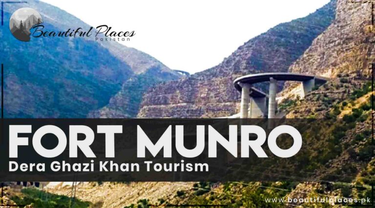
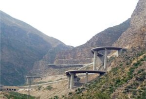
Fort Munro

Fort Munro is a hill station built in the Suleman Mountains during British rule.

It is 174 km from Multan and 85 km from Dera Ghazi Khan. It is named after the former British Commissioner. It is 6470 feet above sea level and the only hill station in South Punjab.

It is an attraction for tourists because of its low atmospheric temperature than the surrounding areas. Many tribal chiefs of Balochistan and government departments have established rest houses.

This area is crowded in the summer season but it is deserted in the winter season. This area is famous for the mangoes and the cold climate in the summer season.

Fort-Manru-Dera-Ghazi-Khan.
Fort Manru, Dera Ghazi Khan

Transport is available from Multan and Dera Ghazi Khan to reach fort Manru.

A TDCP resort and different hotels are there for a night’s stay. A beautiful lake, Ganji hill, and the graveyard of the British era are worth watching places. Sailing can enjoy in the lake of Dam.

The mountains in this area have minerals like iron, gypsum, and uranium.

Ghazi Khan Fort

A testament to the city’s historical legacy, Ghazi Khan Fort stands tall as a symbol of architectural brilliance. Dating back to various eras, the fort offers a captivating journey through the annals of Dera Ghazi Khan’s past.

Tomb of Hazrat Sakhi Sarwar

A revered Sufi shrine, the Tomb of Hazrat Sakhi Sarwar attracts pilgrims and tourists seeking spiritual solace. The vibrant atmosphere surrounding the shrine reflects the deep-rooted Sufi traditions of the region.

Taunsa Barrage

Nature enthusiasts can find respite at the Taunsa Barrage, a picturesque spot along the Indus River. The Barrage not only serves a functional purpose in water management but also provides a scenic backdrop for visitors.

Tomb of Ghazi Khan

Paying homage to the founder of Dera Ghazi Khan, the Tomb of Ghazi Khan is a historical site encapsulating the city’s origins. The mausoleum holds cultural significance and offers insights into the early days of the region.

Saddar Bazaar

For those interested in experiencing the local culture, Saddar Bazaar is a bustling marketplace offering a myriad of sights, sounds, and flavors. From traditional crafts to local delicacies, the bazaar provides a vibrant immersion into daily life.

Indus River Banks

The banks of the Indus River in Dera Ghazi Khan offer serene landscapes and peaceful surroundings. Visitors can take leisurely strolls along the river, enjoy riverine plains, and witness the tranquil beauty of the watercourse.

Choti Zareen

A historical site associated with Alexander the Great’s journey, Choti Zareen is an archaeological site that fascinates history enthusiasts. It is believed to be a location visited by Alexander during his campaigns in the region.

Schools

  • Beaconhouse School System, Dera Ghazi Khan Campus
  • The Educators School, Dera Ghazi Khan Campus
  • Divisional Public School Dera Ghazi Khan

Colleges

  • Ghazi Khan Medical College
  • Government College for Women, Dera Ghazi Khan
  • Postgraduate College Dera Ghazi Khan

Hospitals

  • Ghazi Khan Medical College Hospital
  • District Headquarters (DHQ) Hospital Dera Ghazi Khan
  • Chughtai Medical Center

Restaurants

  • Grill Avenue
  • Al-Kabab Restaurant
  • City Food Point

Frequently Asked Questions 

Q: What historical landmarks can be explored in Dera Ghazi Khan?

A: Dera Ghazi Khan is home to historical treasures such as the Ghazi Khan Fort, the Tomb of Hazrat Sakhi Sarwar, and the Tomb of Ghazi Khan, each encapsulating different facets of the city’s past.

Q: Are there natural attractions in Dera Ghazi Khan?

A: Yes, nature enthusiasts can explore the scenic beauty around the Taunsa Barrage and enjoy the lush landscapes along the Indus River.

Q: What cultural experiences can visitors expect in Dera Ghazi Khan?

A: Dera Ghazi Khan offers a rich cultural experience with traditional festivals, music, and dances. Exploring the local markets provides an opportunity to engage with the vibrant local culture.

Q: How can tourists access Dera Ghazi Khan?

A: Dera Ghazi Khan is well-connected by road and rail. Visitors can access the city through various modes of transportation.

Q: What development initiatives are in progress for tourism in Dera Ghazi Khan?

A: Ongoing development projects aim to enhance infrastructure, address challenges, and promote sustainable tourism in Dera Ghazi Khan for the benefit of both residents and visitors.

Last Thoughts on Dera Ghazi Khan Tourism

Dera Ghazi Khan, with its rich historical heritage, vibrant cultural tapestry, and picturesque landscapes, stands as a captivating destination in southwestern Punjab, Pakistan. From the ancient allure of Ghazi Khan Fort to the spiritual ambiance of the Tomb of Hazrat Sakhi Sarwar, the city seamlessly weaves together tradition and modernity.

As travelers explore the bustling markets, historical landmarks, and the serene banks of the Indus River, Dera Ghazi Khan unfolds as a treasure trove of experiences, inviting all to embrace its unique charm and uncover the stories embedded in its streets and monuments.

About Balochistan | History of Balochistan Province

Balochistan Province

Balochistan is the largest province of Pakistan in terms of area and the smallest province with respect to population. Quetta is the capital of Balochistan. It has a deep-rooted history.Located in the southwestern part of the country, Balochistan shares borders with Iran to the west and Afghanistan to the north, making it a significant crossroads of cultures and a key player in the geopolitical dynamics of the region.

balochistan-province
Balochistan province

Key information  about Balochistan

Name Balochistan
Location Southwest region of Pakistan
Area Approximately 347,190 square kilometers
Coordinates 27.9534° N latitude, 65.5084° E longitude
Population Approximately 13 million
Provincial Capital Quetta
Major Cities Quetta, Turbat, Gwadar, Zhob, Sibi
Official Language Balochi, Brahui, Urdu, Pashto
Ethnic Groups Baloch, Pashtuns, Hazaras, Brahuis, Sindhis, others
Geography Deserts, mountain ranges (Toba Kakar, Sulaiman), Makran Coastal Belt
Economy Predominantly agrarian and pastoral, natural resources (natural gas, minerals)
Industries Agriculture, mining, fishing, handicrafts
Cultural Heritage Rich Baloch culture, music, folklore
Historical Sites Quaid-e-Azam Residency, Chotok Waterfall, Mohenjo-daro archaeological site (near border)
Challenges Underdevelopment, political unrest, resource distribution disparities
Opportunities Natural resource development, infrastructural growth, increased representation
Languages Balochi, Brahui, Urdu, Pashto, Sindhi, Punjabi, others
Province in Pakistan Largest province by land area, least populated, significant geopolitical importance

History of Balochistan

The latest excavations of the archaeological sites revealed that the Civilization and Reich there are older than other provinces. The Balochistan archaeological novelties are more primeval than Mohen Jodaro and Harappa (the civilization of the Indus valley that is about 2500 to 3000 thousand years old).

Before the Indus Valley communities, these Baloch communities were the first model of the Indo-Pak subcontinent civilizations. The primordial paginations of history told that Balochistan was under the Hakhamanishiya state.

The last Achaemenid king (330 B.C to 336 B.C) was murdered in the attack by the Great Alexander. When the Great Alexander returned to Greece after his expedition to northern India, he took the route of Bella and Makran. After his death, it remained under the control of Governor Seleucus. After his successors came under the control of the Ba’athists. It became a part of the Sasanian regime in the era of Nausherwan – e – Adil. (577- 529 A.D).

In 636 A.D, Sindhi Raja captured Makran. After that, the Roy family successors abducted most of the area in Northern Balochistan.

In 643 A.D, the Arabs conquered Makran and they continued to rule there till the 10th century A.D. Thenceforth, Al-Ghaznavi, and Al- Ghori governed it. The Khwarazm emperor Sultan Muhammad Khan took this area into his authority in 1219 A.D. In 1223 A.D. Tatars invaded this area and reached the seashore of Makran. In the 15th century A.D, Balochistan was under the influence of the Arghoon government.

The Arghoon government was a clean sweep by Babur. From 1556 A.D to 1595 A.D it was under the control of Alvi’s Family. In 1638 A.D, Iran took over it and it lasted until 1718 when the Ghilzais came to power. After gaining complete control over Eastern India, Sir Charles Napier in 1843, defeated the emperors of Sindh and included this area in British India. After six years, Sir Henry Laurance conquered Punjab. But it was a difficult task to take over the mountains and warriors’ tribes. Instead of using the authority and army personnel, they started a series of manipulations, intrigues, and conspiracies and tried to connect with the local flatterers, traitors, greedy and selfish chiefs. At last, on 31st May 1876, they declared their government in Balochistan on the basis of the Mustang contract.

Nevertheless, they were unable to completely influence the Baluch tribes. After 1918, they succeeded in establishing their government and asserting their power. Before the British reign, the borders of Balochistan were extended to Dera Ghazi in the east, to the south-west Hilmand river of Afghanistan in the north, Sestan and Karman’s east till port Abbas in the West, and to the Arabian Sea in the south.

They reduced the geographical area of Balochistan. In 1896, they determined the borders of Afghanistan and hand over the Baluch area of Setan to the port of Abbas to Iran. By making the Durand Line boundary between Afghanistan and India, they included the core Balochistan in Afghanistan. The core of Dera Ghazi Balochistan was involved in Punjab. Khan Garh and its surrounding areas became a part of Sindh and were given the name Jacob Abad. A state was formed named Kalat.

At the beginning of the 20th century, movements were started for freedom against the British. Before 1939, the Muslim League and Tehreek Pakistan were not so popular. Jamiat-e- Ulema Hind and the Indian National Congress party had more influence there.

In 1939, during the conference of Qila Saif Ullah, Muslim League was announced as a political party in Balochistan. Khan Kalat Mir Ahmad Yar Khan, Nawab Muhammad Khan Joghazi, Mir Jaffar Khan Jamali, and Qazi Muhammad Esa struggled a lot to declare Muslim League a political party in Balochistan.

Quide-e-Azam-in-Balochistan
Quid e Azam in Balochistan

When Quaid-e-Azam came to Balochistan in 1945, he was given two silver rods as a present. These silver rods weighed 5500 Tola (320754.84375 carats) and about 60 kg. At that time, Quaid-e-Azam appealed to the Indian Muslims to give silver coins. Khan of Kalat weighed Quaid-e-Azam and Mohtarma Fatima Jinnah in silver and gold. All this gold and silver was added to Muslim League Fund.

During the 1946 elections, the representative of the Muslim League Nawab Muhammad Khan Jogazi won the elections with a great majority.

Today’s Balochistan

By this time, the area of Balochistan is 347190 square kilometers which is about 43.3% of Pakistan’s land area. Iran and Afghanistan are situated in the west and northwest respectively. The Khyber Pakhtunkhwa KPK, (formerly North-West Frontier Province) and Punjab are located on the North Border of Balochistan.

It has Sindh in the east and the Arabian Sea in the south. Quetta is the Capital of Balochistan. Quetta, Sibi, Kalat, Makran, Zhob, Loaralai, Khuzdar, Lasbela, Naseer Abad, and Kharan are considered as the big cities of Balochistan.

Balochistan mainly comprises Hilly areas. Mountains named Suleman, Barohi, Pib, Sayahan, Chaghi, and Tuba are included in the area of Balochistan. Some mountains pass has significant importance in history. Bolan pass, Mola pass, and Khojak pass are famous in Balochistan. Some area of Balochistan is situated on the Arabian seashore.

Ziarat-Balochistan.
Ziarat, Balochistan

This coastal area is 471 miles long. The seaports of Mara, Jeuni, Pasni, Sonmiani, and Gwadar port are located here.

Balochistan is Famous for its delicious and good quality fruits. Fine quality grapes, apples, peach yellow plums(apricots), mulberry, pomegranates, melons, and watermelons are produced. While its mountains are full of coal, natural gas, chrome, gold, chromite, Antimony-containing stibnite, known as kohl or Surma, Sulfur, asbestos, marble, glass, and other minerals.

Quetta, Ziarat, Gwadar, Lasbella, and Makran Coastal Highway are famous areas for tourism.

Exploring Balochistan

Ancient Roots

The history of Balochistan dates back to antiquity, with archaeological evidence suggesting human habitation as far back as the Stone Age. The region has witnessed the rise and fall of various civilizations, including the Bronze Age Indus Valley Civilization, whose remnants are found at the renowned Mohenjo-daro archaeological site near the Sindh-Balochistan border.

Persian Influence and Empires

Balochistan, with its strategic location, has been a crossroads for empires and cultures. It was part of the Achaemenid Persian Empire, contributing to its cultural and historical significance. The region witnessed the march of Alexander the Great and the subsequent influence of Hellenistic culture.

Nomadic Tribes and Traditions

Throughout its history, Balochistan has been home to nomadic tribes, including the Baloch people, who have maintained their distinct cultural identity. The Baloch are known for their traditions, music, and the enduring code of conduct known as “Pashtunwali.”

British Era and Post-Independence

During the British colonial period, Balochistan saw geopolitical shifts and changes in governance. The province became part of British India, and later, with the partition of India in 1947, it acceded to Pakistan. Post-independence, Balochistan has been a region of both development and challenges, with efforts to address issues of representation and resource distribution.

Strategic Significance

Balochistan’s strategic importance is underscored by the Bolan Pass, a historic mountain route that has played a pivotal role in trade and military campaigns throughout history. The province’s border with Iran and Afghanistan adds geopolitical significance to its landscape.

Geography and Landmarks

Balochistan is defined by its contrasting geography. The province is home to the arid Makran Coastal Belt, characterized by its vast deserts, as well as the towering peaks of the Toba Kakar and Sulaiman mountain ranges. Notable landmarks include the historic Quaid-e-Azam Residency, the mesmerizing Chotok Waterfall, and the ancient Mohenjo-daro archaeological site, located near the border with Sindh.

Cultural Diversity

The province is a melting pot of diverse ethnicities, including the predominant Baloch people, Pashtuns, Hazaras, Brahuis, Sindhis, and others. This rich ethnic tapestry is reflected in the various languages spoken, including Balochi, Brahui, Urdu, Pashto, Sindhi, and Punjabi, contributing to the cultural vibrancy of the region.

Economic Landscape

Balochistan’s economy is predominantly agrarian and pastoral, with agriculture and livestock playing a central role in the livelihoods of its people. The province also holds significant natural resources, such as natural gas and minerals, contributing to Pakistan’s economic landscape.

Challenges and Opportunities

Despite its vast resources, Balochistan faces challenges, including underdevelopment, political unrest, and disparities in the distribution of resources. However, ongoing efforts for infrastructural development and increased representation aim to address these challenges and unlock the full potential of the province.

Famous Educational Institutions in Balochistan

  • Tameer-e-Nau Public School, Quetta
  • Sardar Bahadur Khan Women’s University, Quetta
  • University of Turbat, Turbat

Prominent Hospitals in Balochistan

  • Civil Hospital Quetta
  • Bolan Medical Complex, Quetta
  • Fatima Jinnah Chest and General Hospital, Quetta

Exploring Famous Restaurants

  • Hanna Lake Resort Restaurant, Quetta
  • Serena Hotel Gwadar Restaurant, Gwadar
  • Zaver Pearl Continental Hotel Restaurant, Quetta
  • Al-Naseeb Biryani House, Quetta
  • Shahbaz Tikka Shop, Quetta
  • BBQ Tonight, Quetta

Frequently Asked Questions (FAQs) 

Q: What is the history of Balochistan?

A: Balochistan’s history is ancient and diverse, marked by the presence of civilizations such as the Indus Valley, Persian empires, and influences from Hellenistic cultures. Its strategic location has made it a crossroads for various cultures and empires.

Q: What are the challenges faced by Balochistan?

A: Balochistan faces challenges such as underdevelopment, political unrest, and disparities in resource distribution. Efforts are underway to address these challenges and unlock the province’s full potential.

Q: What are the famous landmarks in Balochistan?

A: Balochistan is home to notable landmarks such as the Quaid-e-Azam Residency in Ziarat, the historic Bolan Pass, and the ancient Mohenjo-daro archaeological site near the Sindh-Balochistan border.

Q: How diverse is the culture of Balochistan?

A: Balochistan’s culture is incredibly diverse, shaped by ancient traditions, nomadic tribes, and a mosaic of ethnicities. The Baloch people, with their distinct traditions and language, contribute significantly to the cultural fabric.

Q: What is the significance of the Bolan Pass?

A: The Bolan Pass is historically significant as a mountain route that has played a pivotal role in trade and military campaigns. Its strategic importance makes it a key feature in Balochistan’s geography.

Q: Are there famous educational institutions in Balochistan?

A: Yes, Balochistan is home to prominent educational institutions such as Tameer-e-Nau Public School, Sardar Bahadur Khan Women’s University, and the University of Turbat.

Q: What are some famous restaurants in Balochistan?

A: Balochistan boasts a burgeoning culinary scene, and some famous restaurants include Hanna Lake Resort Restaurant in Quetta, Serena Hotel Gwadar Restaurant, and Al-Naseeb Biryani House in Quetta.

Q: What is the natural beauty of Balochistan like?

A: Balochistan is known for its diverse landscapes, including rugged mountains, vast deserts, and a picturesque coastline. Hanna Lake, Gorakh Hill Station, and Astola Island are among the natural wonders.

Q: How has Balochistan contributed to Pakistan’s history?

A: Balochistan’s contributions to Pakistan’s history are significant, from being part of the Achaemenid Persian Empire to its role in the creation of Pakistan. The province continues to play a crucial part in the country’s geopolitical landscape.

Q: What efforts are being made for the development of Balochistan?

A: Ongoing efforts include infrastructural development, increased representation, and harnessing the province’s natural resources. These initiatives aim to address challenges and unlock Balochistan’s economic and social potential.

Last Thoughts on Balochistan

Balochistan is the largest province of Pakistan in terms of area. It is famous for the production of fruits. It is a hilly area and the mountains are full of minerals. Besides this, it has historical places, breathtaking beaches, and beautiful orchards and forests.

Makran Coastal Highway N-10 – Balochistan

Makran Coastal Highway

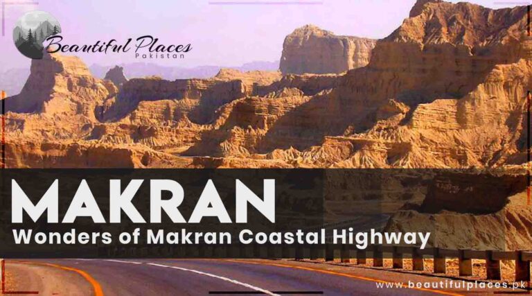
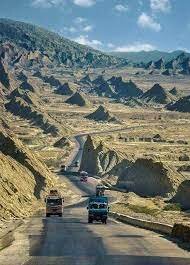
Balochistan coastal highway starts near Karachi and ends at Gwadar port near the Pak-Iran border. This highway is a part of national highway N-10.

Before the construction of this highway, Karachi was linked to Gwadar through a single rough road. After the completion of this highway, the distance remained to 6 hours only. Before that, it was about 2 days long. It is also established by the architect of Resham Highway.

The captivating scenes of coastal highway greenery, blue seashores of Pasni, Jeuni, Mara, and Gwadar are the weakness of tourists.

Makran-Coastal-Highway.
Makran Coastal Highway

Makran Coastal Highway (N-10): Overview

Attribute Information
Location Balochistan Province, Pakistan
Total Length Approximately 653 kilometers
Construction Started Early 2004
Completion Date August 2004 (Phase 1) and December 2016 (Phase 2)
Purpose Connects Karachi to Gwadar Port
Strategic Importance Vital trade route; facilitates economic activity
Scenic Beauty Offers breathtaking views of the Arabian Sea
Engineering Feats Multiple bridges and tunnels; anti-flooding measures
Economic Impact Boosts trade, tourism, and socio-economic development
Connectivity Links major cities including Karachi, Ormara, Pasni, and Gwadar
Security Concerns Some areas require heightened security measures
Maintenance Ongoing efforts to ensure road safety and usability

Makran Coastal Highway (N-10): In-Depth Information

Location and Purpose

The Makran Coastal Highway, also known as N-10, is a significant road network situated in Balochistan, Pakistan. Stretching approximately 653 kilometers, it serves as a crucial transportation link connecting the bustling city of Karachi to the strategically important Gwadar Port.

Construction and Phases

Construction of the Makran Coastal Highway commenced in the early 2000s, with Phase 1 being completed in August 2004. Subsequently, Phase 2 was finished in December 2016, ensuring a well-connected and efficient roadway system.

Strategic Importance

The highway holds immense strategic importance as a key trade route. Facilitating economic activity, it plays a pivotal role in the transportation of goods and enhances connectivity between major urban centers and the Gwadar Port.

Scenic Beauty

Apart from its practical utility, the Makran Coastal Highway offers travelers breathtaking views of the Arabian Sea. The journey along the coastal stretch provides a unique blend of scenic beauty and rugged landscapes.
Engineering Feats

The construction of the highway involved overcoming challenging terrains. It boasts multiple bridges and tunnels, showcasing engineering excellence. Anti-flooding measures have also been implemented to enhance the highway’s resilience during adverse weather conditions.

Economic Impact

The highway has a profound economic impact, boosting trade activities between Karachi and Gwadar. It has catalyzed tourism and contributed to the socio-economic development of the region.

Connectivity

Linking major cities such as Karachi, Ormara, Pasni, and Gwadar, the Makran Coastal Highway ensures smoother transportation and connectivity. It serves as a lifeline for the movement of goods and people.

Security Concerns

Given the region’s geopolitical landscape, certain areas along the highway require heightened security measures. Efforts are continually made to address security concerns and ensure the safety of travelers.

Maintenance and Ongoing Efforts

Regular maintenance is crucial for the highway’s longevity and safety. Ongoing efforts include periodic inspections, repairs, and improvements to uphold road safety standards and usability.

In essence, the Makran Coastal Highway stands as a testament to infrastructure development in Pakistan, playing a crucial role in regional connectivity, trade, and fostering economic growth in the vast and diverse province of Balochistan.

Famous Sites Along the Highway

Ormara

A coastal town known for its beaches and historical significance, providing a serene stop along the journey.

Pasni

Famous for its fishing industry, Pasni is a picturesque coastal town offering a glimpse into the coastal livelihoods of the region.

Gwadar Port

The final destination of the highway, Gwadar is a rapidly developing port city, pivotal in global trade through its connection to the Arabian Sea.

Frequently Asked Questions (FAQs) 

Q: What is the Makran Coastal Highway (N-10)?

A: The Makran Coastal Highway (N-10) is a significant road network in Balochistan, Pakistan, stretching approximately 653 kilometers along the Arabian Sea coastline. It connects Karachi to the strategically important Gwadar Port.

Q: When was the Makran Coastal Highway constructed?

A: Construction of the Makran Coastal Highway began in the early 2000s. Phase 1 was completed in August 2004, and Phase 2 was finished in December 2016.

Q: What is the purpose of the Makran Coastal Highway?

A: The primary purpose of the highway is to enhance connectivity between major cities and facilitate efficient transportation of goods. It plays a crucial role in linking Karachi, a major economic center, to the Gwadar Port.

Q: What is the strategic importance of the Makran Coastal Highway?

A: The highway is strategically vital as it facilitates trade, tourism, and socio-economic growth. It connects Gwadar Port, a key player in the China-Pakistan Economic Corridor (CPEC), to major urban centers.

Q: Are there any famous sites along the Makran Coastal Highway?

A: Yes, there are several notable sites along the highway, including Ormara, known for its beaches; Pasni, famous for its fishing industry; and Gwadar Port, the final destination with significant economic importance.

Q: What are some engineering feats of the Makran Coastal Highway?

A: The highway showcases engineering marvels such as multiple bridges and tunnels. These structures navigate challenging terrains, and anti-flooding measures have been implemented to ensure resilience during adverse weather conditions.

Q: How does the Makran Coastal Highway contribute to economic development?

A: The highway acts as a catalyst for economic development by facilitating trade activities between major cities and the Gwadar Port. It has also contributed to the growth of tourism along the coastal stretch.

Q: What security measures are in place along the Makran Coastal Highway?

A: Some areas along the highway may require heightened security measures due to the region’s geopolitical landscape. Ongoing efforts are made to address security concerns and ensure the safety of travelers.

Q: How does the Makran Coastal Highway contribute to connectivity in Balochistan?

A: The highway connects major cities like Karachi, Ormara, Pasni, and Gwadar, fostering improved connectivity in Balochistan. It serves as a vital transportation link, linking people, cultures, and opportunities.

Q: Is maintenance of the Makran Coastal Highway ongoing?

A: Yes, regular maintenance is crucial to ensure the longevity and safety of the highway. Ongoing efforts include periodic inspections, repairs, and improvements to uphold road safety standards and usability.

Last Thoughts on Makran Coastal Highway N-10

The Makran Coastal Highway is not just a road; it’s a story of development, connectivity, and the harmonious coexistence of nature and human ingenuity. As travelers embark on this journey along the Arabian Sea, they witness not only the physical landscape but also the unfolding chapters of history and progress in the province of Balochistan. In the wake of the highway’s asphalt lies the promise of a region connected, a nation united, and a landscape transformed.

All About Pishin – Balochistan | Famous Places of Pishin

Pishin

Pishin is a district located in the Balochistan province of Pakistan. It is situated in the northwestern part of the province, sharing borders with Afghanistan to the north and the other districts of Balochistan to the south and west. The district is known for its diverse landscape, ranging from mountainous terrain to fertile valleys.

Pishin is an important historical and cultural center in the region, with a rich heritage that reflects the traditions of the Baloch people. The population of Pishin comprises various ethnic groups, including the Baloch, Pashtuns, and other smaller communities. This diversity contributes to the vibrant tapestry of the district’s cultural life.

Overview of Pishin

Aspect Description
Location Northwestern part of Balochistan, Pakistan.
Geography Diverse landscape including mountains and fertile valleys.
Population Comprises various ethnic groups, including Baloch and Pashtuns.
Economy Agriculture is a significant economic activity, with a focus on crops such as fruits, vegetables, and grains.
Culture Rich cultural heritage reflecting Baloch traditions; known for traditional crafts.
Administration Divided into tehsils and union councils for governance and development.
Challenges Faces challenges in infrastructure development, healthcare, and education.
Trade and Borders Strategically located near the Afghanistan border, historically significant for trade and cultural exchange.
Historical Significance Has played a role in shaping regional interactions due to its proximity to Afghanistan.

Some of the famous places in and around Pishin

Qila Mir Azam

  • A historical fort dating back to the British colonial era.
  • It served as a strategic military post and reflects the architectural style of that period.

Pishin Bazaar

  • A bustling market where locals converge for trade and commerce.
  • Offers a vibrant display of local goods, crafts, and traditional items.

Ziarat Baba Kharwari

  • A revered shrine dedicated to a local saint.
  • A place of spiritual significance, attracting pilgrims and visitors seeking blessings.

Hanna Lake (nearby attraction)

  • Located a short distance from Pishin, it is a picturesque lake surrounded by hills.
  • Offers boating facilities and a peaceful environment for visitors.

Sheesh Mahal (Pishin Palace)

  • A historical palace showcasing intricate glasswork.
  • Reflects the architectural grandeur of the past and offers a glimpse into the region’s royal history.

Jamia Mosque Pishin

  • A prominent mosque in the heart of Pishin with distinctive architectural features.
  • A spiritual and cultural center for the local Muslim community.

Toba Kakar Range (surrounding mountains)

  • A mountain range surrounding Pishin Valley.
  • Offers trekking opportunities and panoramic views of the valley.

Pishin Botanical Garden

  • A green oasis showcasing a variety of plants and trees.
  • Provides a peaceful setting for nature lovers and those interested in local flora.

Mukhtar Palace (Karezat Fort)

  • A historical structure reflecting the traditional architecture of the region.
  • Offers insights into the cultural and historical heritage of Pishin.

Pishin Valley

Situated 50km from Quetta this beautiful valley is full of juicy fruits trees These trees are watered through the old methods of irrigation named “Karez”

  • Location: Pishin Valley is situated in the northwestern part of Balochistan, Pakistan.
  • Topography: The valley is characterized by a diverse topography, featuring fertile plains and surrounded by mountains.
Pishin-Balochistan
Pishin Balochistan

Khush Dil Khan Band

A water reservoir is built artificially about 16km from Pishin. If you are fond of hunting, then this is the best place for hunting ducks.

At a distance of about 16 kilometers from Pishin Valley, the Khush Dil Khan Bund stands as a testament to human ingenuity in harnessing water resources. This dam, named after a local figure, serves multiple purposes, including irrigation, water storage, and flood control. It has significantly contributed to enhancing agricultural productivity in Pishin Valley and the surrounding areas.

Khush-Dil-Khan-Bund
Khush Dil Khan Bund

Famous Schools

Government Boys High School Pishin

  • A key educational institution providing secondary education to young boys.
  • Plays a crucial role in shaping the academic landscape of the region.

Government Girls High School Pishin

  • A prominent girls’ school in Pishin offering quality education.
  • Contributes significantly to the empowerment of young girls in the district.

Muslim Model High School

  • A school known for its commitment to academic excellence and character development.
  • Offers education at various levels, contributing to the educational infrastructure of Pishin.

Crescent Model School Pishin

  • A private institution providing modern education facilities.
  • Known for a holistic approach to education, combining academics with extracurricular activities.

Balochistan Residential College

  • A boarding school aiming to provide quality education to students from the region.
  • Focuses on preparing students for higher education and future leadership roles.

Notable Hospitals

District Headquarters Hospital Pishin

  • A major healthcare facility catering to the medical needs of the district.
  • Provides a range of medical services, including emergency care and specialized treatments.

Rural Health Center Pishin

  • Focuses on providing healthcare services to the rural population.
  • Plays a critical role in preventive healthcare and community health programs.

Mukhtar Teaching Hospital

  • A hospital associated with medical education and training.
  • Offers a range of medical services and serves as a center for medical research.

Al-Hilal Hospital

  • A private hospital providing healthcare services to the community.

Known for its modern facilities and a team of qualified medical professionals.

FAQs

Q: What is Pishin’s historical significance?

A: Pishin boasts a rich history, with archaeological evidence suggesting habitation since prehistoric times. It played a strategic role during the British colonial era.

Q: How diverse is Pishin’s culture?

A: Pishin is a melting pot of Baloch, Pashtun, and Persian influences, creating a unique cultural blend reflected in traditions, music, and attire.

Q: What are the notable landmarks in Pishin?

A: Key landmarks include Qila Mir Azam (a colonial-era fort), Pishin Bazaar, and Ziarat Baba Kharwari, a revered shrine.

Q: Tell us about Pishin’s educational institutions.

A: Pishin is home to various schools, including Government Boys and Girls High Schools, Muslim Model High School, and Balochistan Residential College.

Q: Which hospitals are significant in Pishin?

A: Healthcare is provided by institutions such as District Headquarters Hospital, Rural Health Center, Mukhtar Teaching Hospital, and private facilities like Al-Hilal Hospital.

Q: What is the economic backbone of Pishin?

A: Agriculture, supported by the Pishin Lora River, is a vital economic sector, cultivating fruits, vegetables, and grains.

Q: What are the attractions near Pishin?

A: Nearby attractions include Hanna Lake, Toba Kakar Range, and the historical Mukhtar Palace.

Q: Tell us about Khush Dil Khan Bund.

A: Khush Dil Khan Bund is a significant water reservoir near Pishin, contributing to water management, agriculture, and flood control.

Q: Which are the famous schools in Pishin?

A: Notable schools include Government Boys and Girls High Schools, Muslim Model High School, and Balochistan Residential College.

Q: What healthcare services are available in Pishin?

A: Healthcare facilities include District Headquarters Hospital, Rural Health Center, Mukhtar Teaching Hospital, and private facilities like Al-Hilal Hospital.

Wind-up Lines

Pishin, Balochistan, is a region that seamlessly weaves together history, culture, education, and healthcare. From its historical forts to vibrant bazaars, from educational institutions nurturing future leaders to hospitals ensuring the health of the community, Pishin stands as a multifaceted gem within the tapestry of Balochistan. Whether you’re drawn to its historical landmarks, cultural diversity, or the resilience of its people, Pishin invites exploration and appreciation for the layers of richness it offers to those who venture into its embrace.

Some Historical cities of Sindh | Shah Abdul Latif Bhittai

Some Phenomenal Heritage Sites of Sindh

Sindh is blessed with Sufi poets, old civilizations, and heritage sites. Shrine of Shah Abdul Latif Bhaittai is one of the famous poets of the Sindh. Shah Abdul Latif Bhattai is acknowledged as the “Crownless King” of Sindh.

Detaille Info about Sindh PK

Aspect Information
Name Sindh City
Location Sindh Province, Pakistan
Population Approximately 3 million
Area Not specified, but it’s a significant urban area
Historical Significance Sindh City has a rich history and is known for its cultural and historical importance in the region. It is home to several ancient archaeological sites and monuments.
Geography The city is located in the southern part of Pakistan, near the Arabian Sea, and it has a diverse geography that includes both urban and rural areas.
Climate Sindh City experiences a hot desert climate, with scorching summers and mild winters. It’s prone to seasonal monsoons.
Economy The economy of Sindh City is diverse and includes agriculture, manufacturing, trade, and services. It’s a hub for commerce and business activities.
Languages Spoken The primary language spoken in Sindh City is Sindhi, but Urdu and English are also widely used for business and education.
Culture The city has a vibrant and diverse cultural scene, with a rich tradition of music, dance, and art. It’s also known for its delicious cuisine, with various local dishes.
Education Sindh City has several educational institutions, including universities, colleges, and schools. It’s a center for higher education in the region.
Transportation The city is well-connected through road, rail, and air transport. It has a major seaport that facilitates trade and commerce.
Tourist Attractions Sindh City offers various attractions, including historical sites, museums, and markets. Notable places include the Mohenjo-daro archaeological site and the Quaid-e-Azam’s Mausoleum.

Exploring the Historical Cities of Sindh 

Sindh, the southernmost province of Pakistan, boasts a rich tapestry of history, culture, and spirituality. The region is home to several historical cities that have played pivotal roles in shaping the identity of Sindh. Among the luminaries emerging from this land, Shah Abdul Latif Bhittai stands tall as a revered poet and philosopher. Let’s embark on a journey through the historical cities of Sindh, each echoing tales of antiquity and resilience.

Shrine of Abdul Latif Bhittai

Poet of the Soil In the midst of these historical cities lies the town of Bhit Shah, named after the illustrious poet and scholar, Shah Abdul Latif Bhittai. Born in the 18th century, Shah Latif, as he is affectionately called, contributed significantly to Sindhi literature and Sufi thought. His poetry, compiled in the “Shah Jo Risalo”, reflects his deep connection with the land, its people, and a profound spiritual journey.

Bhit Shah is home to the shrine of Shah Abdul Latif Bhittai, a place where devotees gather to pay homage to the poet’s timeless wisdom. The shrine serves as a cultural and spiritual center, fostering a sense of unity and reverence among Sindhis.

As we conclude our journey through the historical cities of Sindh, we find ourselves immersed in a tapestry woven with threads of ancient civilizations, Sufi mysticism, architectural grandeur, and the timeless verses of Shah Abdul Latif Bhittai. Sindh, with its vibrant past and living traditions, continues to be a testament to the resilience and richness of the human spirit.

Shah-Abdul-Latif-Bhittai
Shrine of Shah Abdul Latif Bhittai

As a spiritual leader, he had highlighted the emotions of the poor and oppressed people through his poetry. So, he is respected by the people a lot. At first, the Kulhoro built the tomb. Later, it was decorated by the Talpurs. Both of them tried to make it more beautiful by embellishing it with blue-colored glass tiles. Hala is close to this tomb and the center of these blue tile factories. Tiles were imported from Naseer pur and Multan too. It is the only tomb where “Sufiyana Kalam” (music) is sung at the sunset throughout the year.

 Bhatt Shah Cultural Center

bhit-shah-cultural-centre
Bhit Shah cultural, center

Surrounding up to 120 acres, a garden, Karar Lake, an auditorium, library, and a museum is dedicated to this saint. Situated on the Shah Abdul Latif highway, it has things and information related to life, poetry, teachings, and music.

Mohenjo-daro

Echoes from the Ancient Past Our journey begins with Mohenjo-daro, an archaeological marvel that harks back to the ancient Indus Valley Civilization. Flourishing around 2500 BCE, Mohenjo-daro was one of the largest settlements of its time, featuring advanced urban planning and sophisticated drainage systems. Today, its remnants, a UNESCO World Heritage Site, whisper the stories of an ancient civilization that thrived along the banks of the mighty Indus River.

Sehwan Sharif

Sufi Splendor As we traverse through time, the city of Sehwan Sharif comes into view. Nestled along the banks of the Indus, this city is famed for the Shrine of Lal Shahbaz Qalandar, a Sufi saint whose teachings transcended religious boundaries. The shrine stands as a symbol of Sindh’s syncretic culture, attracting devotees and admirers from various faiths.

Thatta

A Tapestry of History Thatta, the erstwhile capital of Sindh, takes us on a journey through the pages of medieval history. From the 14th to the 18th centuries, Thatta thrived as a center of commerce and culture. Its grand monuments, including the Shah Jahan Mosque and Makli Necropolis, reflect the architectural grandeur of bygone eras.

Hyderabad

Bridging Past and Present Moving forward, we arrive in Hyderabad, a city that seamlessly blends history with modernity. With its roots tracing back to the Kalhora dynasty, Hyderabad showcases a unique cultural fusion. Historical landmarks like the Qadamgah Maula Ali and the iconic Clock Tower add a nostalgic charm to the city’s bustling urban landscape.

Karachi

Gateway to Diversity Karachi, the bustling metropolis and the economic heartbeat of Pakistan, is more than just a city; it is a melting pot of cultures and ethnicities. Once a small fishing village, Karachi has transformed into a dynamic cosmopolitan hub, showcasing the diversity that defines Sindh and Pakistan as a whole.

Sukkur

Engineering Marvels on the Indus Our journey concludes in Sukkur, a city known for the Sukkur Barrage. This engineering marvel, spanning the mighty Indus River, is a testament to human ingenuity. Sukkur’s strategic location and historical significance make it a key player in the economic development of the region.

Schools in city of Sindh:

  • ABC Public School
  • Sindh City Grammar School
  • Beaconhouse School System
  • The City School
  • St. Mary’s High School

Colleges in city of Sindh:

  • Sindh City College
  • Government Degree College
  • Sindh Institute of Information Technology
  • Women’s College Sindh City
  • SZABIST Sindh City Campus

Universities in city of Sindh:

  • University of Sindh
  • Liaquat University of Medical and Health Sciences
  • SZABIST Sindh City Campus
  • Sindh Agriculture University
  • Indus Valley School of Art and Architecture

Hospitals in city of Sindh:

  • Sindh City General Hospital
  • Liaquat Medical University Hospital
  • Patel Hospital
  • Aga Khan University Hospital (outreach clinic)
  • Jinnah Postgraduate Medical Center

Restaurants in city of Sindh:

  • Sindh Delights Restaurant
  • Al-Makka Restaurant
  • Kolachi Restaurant
  • BBQ Tonight
  • Cafe Clifton

Frequently Asked Questions

 What is the significance of Mohenjo-daro in Sindh’s history?

Mohenjo-daro is a UNESCO World Heritage Site and represents one of the largest settlements of the ancient Indus Valley Civilization. It provides insights into advanced urban planning and the social and economic life of an ancient civilization around 2500 BCE.

Tell us more about the Shrine of Lal Shahbaz Qalandar in Sehwan Sharif.

The Shrine of Lal Shahbaz Qalandar is a revered Sufi shrine in Sehwan Sharif, known for its syncretic culture. Lal Shahbaz Qalandar was a Sufi saint whose teachings transcended religious boundaries, attracting devotees from various faiths.

What historical significance does Thatta hold?

Thatta was the former capital of Sindh and thrived as a center of commerce and culture from the 14th to the 18th centuries. Monuments like the Shah Jahan Mosque and Makli Necropolis reflect the architectural grandeur of that era.

How does Hyderabad blend history with modernity?

Hyderabad seamlessly blends historical charm with modern urban life. It has historical landmarks from the Kalhora dynasty, like the Qadamgah Maula Ali, alongside contemporary elements such as the bustling Clock Tower.

What makes Karachi unique among the historical cities of Sindh?

Karachi is the largest city in Pakistan and serves as a melting pot of diverse cultures. From its humble beginnings as a fishing village, Karachi has transformed into a dynamic cosmopolitan hub, reflecting the diversity of Sindh and Pakistan.

What is the Sukkur Barrage, and why is Sukkur significant?

The Sukkur Barrage is an engineering marvel spanning the Indus River, contributing to irrigation and hydropower. Sukkur is strategically located and historically significant, playing a key role in the economic development of the region.

Who was Shah Abdul Latif Bhittai, and what is his legacy?

Shah Abdul Latif Bhittai was an 18th-century Sufi poet and scholar from Sindh. His poetry, compiled in the Shah Jo Risalo, reflects a deep connection with the land and spirituality. His legacy is honored in the town of Bhit Shah, where his shrine stands as a cultural and spiritual center.

Why is Bhit Shah named after Shah Abdul Latif Bhittai?

Bhit Shah is named after Shah Abdul Latif Bhittai as a tribute to the revered poet and scholar. It is the town where he was born, and it houses his shrine, which serves as a place of reverence and cultural significance.

What role does Shah Abdul Latif Bhittai’s shrine play in Sindhi culture?

The shrine of Shah Abdul Latif Bhittai in Bhit Shah is a cultural and spiritual center. It attracts devotees and serves as a symbol of unity, fostering a deep connection with Sindhi culture and traditions.

Last Thoughts on Sindh

The Shrine of Shah Abdul Latif Bhatti is a symbol of Grandeur like his poetry which has been translated to English, Urdu, Punjabi, German and other languages.

Explore the city of Sindh – Hala | Hala handicrafts | Hala Glazed Pottery

Hala

On the National Highway, about 56 km from Hyderabad, Hala is located. It is famous for Glazed Pottery and Enameled woodworking.

The saint of 10th Hijri Hazrat Makhdoom Noh belonged to this place who embraced a lot of people to Islam. He was the first in South Asia who translated Quran e Pak in the Persian Language.

Hala is the town that depicts Pakistani Culture through its glazed pottery.

Hala city
hala city, pottery and handicrafts

Key Information About Hala

Aspect Information
Location Hala is a city in the Sindh province of Pakistan. It is situated in the Matiari District.
Geographical Coordinates Latitude: 25.6157° N, Longitude: 68.3097° E
Population As of the last available data, the population of Hala is approximately [insert population figure].
Language The primary language spoken in Hala is Sindhi. Urdu and English are also commonly understood.
Historical Significance Hala is known for its rich historical and cultural heritage. It has been a center of Sufi culture and is associated with various saints and shrines.
Economy The economy of Hala is primarily based on agriculture. The region is known for the production of crops such as rice, wheat, and sugarcane. Traditional handicrafts, including Hala pottery, are also significant for the local economy.
Tourist Attractions – Shrine of Makhdum Nuh: A prominent Sufi shrine in Hala.
– Hala Handicrafts: Known for its traditional pottery and other handicrafts.
– Hala New Cloth Market: Famous for traditional Sindhi Ajrak and other textiles.
Education Hala has educational institutions ranging from primary schools to colleges, contributing to the educational development of the region.
Transportation The city is connected by road networks, and local transportation includes buses, rickshaws, and other modes of public transport.
Local Cuisine Traditional Sindhi cuisine, including Sindhi Biryani, Saag, and various local sweets, is popular in Hala.
Religious Diversity Hala is characterized by religious diversity, with a significant Muslim population. There are mosques and other religious institutions catering to the spiritual needs of the residents.
Climate Hala experiences a hot desert climate, with high temperatures in the summer and mild winters. Rainfall is relatively low, and the region is prone to drought conditions.

Explore the city of Sindh – Hala

Hala Handicrafts

The legacy of Hala’s handicrafts dates back centuries. The intricate and delicate craftsmanship has been passed down through generations. From beautiful handwoven textiles to stunning woodwork, Hala offers a wide array of handcrafted treasures.

Exploring Hala’s Craft Bazaars

A visit to Hala is incomplete without strolling through its vibrant craft bazaars. These markets are a treasure trove of exquisite items, including textiles, pottery, and traditional Hala caps. Each piece reflects the dedication and artistic prowess of the artisans.

Hala Glazed Pottery

The Allure of Hala Glazed Pottery

Hala Glazed Pottery is renowned worldwide for its unique beauty and craftsmanship. These exquisite pieces are often adorned with intricate designs and vibrant colors, making them highly sought after by collectors and art enthusiasts.

The Art of Hala Pottery Making

Discover the fascinating process of Hala Glazed Pottery creation. From shaping the clay to the final glazing, every step is a testament to the artisan’s skill and devotion. The result is a breathtaking piece of art that captivates anyone who beholds it.

Must-Try Experiences in Hala

1. Pottery Workshops

Immerse yourself in the world of Hala pottery by joining a pottery workshop. Learn the techniques, try your hand at the pottery wheel, and create your own masterpiece.

2. Exploring Hala’s Streets

Take a leisurely walk through Hala’s streets, and you’ll be greeted with the soothing sound of the potter’s wheel and the rich aroma of local cuisine. Don’t forget to stop by the local food stalls for a taste of authentic Sindhi dishes.

3. Visiting Artisan Homes

Many artisans in Hala welcome visitors to their homes and workshops. This is a great opportunity to witness the creation of Hala Glazed Pottery up close and interact with the skilled craftsmen.

4. Hala’s Annual Craft Fair

Plan your visit during Hala’s annual craft fair, a vibrant and lively celebration of the city’s artistry. You can shop for unique souvenirs and experience the city’s cultural festivities.

Schools:

  • Hala Public School: A well-established institution known for its quality education.
  • Government High School Hala: A government-run school offering education at the primary and secondary levels.
  • Hala Montessori School: A popular choice for early childhood education and Montessori programs.

Colleges:

  • Government Degree College Hala: Offering intermediate and undergraduate programs in various disciplines.
  • Hala College of Commerce: Specializing in commerce and business-related education.
  • Sindh Agriculture University College Hala: Focusing on agricultural studies and research.

Universities:

  • There are no universities located directly in Hala. However, nearby cities like Hyderabad and Karachi host several universities offering a wide range of academic programs.

Hospitals:

  • Hala Medical Center: A primary healthcare facility providing medical services and consultations.
  • Hala General Hospital: Offering a range of medical treatments and services to the local community.
  • Private Clinics: Several private clinics and healthcare providers are available for routine medical needs.

Restaurants:

  • Hala Food Street: A popular spot for local cuisine, offering traditional Sindhi dishes.
  • Al-Sheikh Fast Food: A casual dining option known for its quick bites and fast food.
  • Cafe Hala: A cozy cafe serving coffee, snacks, and light meals for a relaxed atmosphere.

FAQs

Q: What is the best time to visit Hala?

A: The best time to visit Hala is during the cooler months, from October to March, to comfortably explore the city and its markets.

Q: Are Hala handicrafts expensive?

A: While some items can be pricier due to their intricate craftsmanship, you can find a wide range of affordable handicrafts in Hala’s markets.

Q: Is it possible to ship Hala Glazed Pottery internationally?

A: Yes, many stores in Hala offer international shipping for their pottery items, ensuring you can take a piece of Hala’s artistry home with you.

Q: How do I reach Hala from Karachi?

A: Hala is approximately a 2.5-hour drive from Karachi, and you can also use the train services to reach this charming city.

Q: What are some traditional Sindhi dishes to try in Hala?

A: Don’t miss out on Sindhi Biryani, Saag, and Sindhi Curry – all tantalizing dishes you can savor in Hala.

Q: Is Hala Glazed Pottery microwave-safe?

A: Most Hala Glazed Pottery is not microwave-safe due to the unique glazing process. It’s best suited for decorative purposes.

Windup-lines

Exploring the city of Sindh – Hala, Hala handicrafts, and Hala Glazed Pottery is a journey into the heart of Pakistan’s culture and artistry. Whether you’re captivated by the beauty of Hala’s crafts or the allure of its Glazed Pottery, this city promises an experience like no other.

So, pack your bags, set out on this unforgettable adventure, and let the magic of Hala whisk you away.

Sanghar District – A famous city of Sindh Province | Sanghar Famous Places

Sanghar

Sanghar is an asset of Sindh Province. It is renowned for its historic and tourists spots which include Chotiyari lake, and Mansoura.

1- Chotiyari lake (a grouping of small and large lakes)

When the explorer of the desert becomes exhausted by seeing the large sandy hillocks and the environment seems gloomy, the water seems to be a blessing for travelers and cattle and the desert seems to be a time of spring.

Chotiyari lake is one of the exceptional lakes where all four sides have desert, trees, and wild bushes side by side. This part of Sanghar lake is 30km from the desert Thar. Well-established roads are there to reach this place. Small lakes and hillocks are located outside the Sanghar.

Bakar, Ekanowari, Tajir, Phulili, Bari, and Saunaro lakes are together named Chotiyari Lake. These lakes rise from Nara canal which is a source of water in these lakes.

chotiyari lake
chotiyari lake

This lake was delayed due to changing of Government and finally completed in 2003. The purpose of this is to collect the water of Monson rain so that it can be used in famine. It is a source of employment for lots of unwaged fishermen. Their houses are located near the lake.

This is also a habitation for crocodiles and turtles. In the winter season, the lake seems to be in full bloom because of millions of birds migrate to this place. Marble tale named bird is noteworthy in these birds. You have to go to Shahdad Pur through Sanghar for reaching this place which is 67 km from Hala.

2-Gharang Bangla (گاڑنگ بنگلہ)

This bungalow was the residence of Hur Leader peer Sibghatullah. Located on the Mir Pur Khas Sanghar, this building was destroyed due to the bombardment of the British army during British control. This place was a headquarters for freedom fighters against British imperialism.

3- Camel Safari

camel-safari-sindh
camel safari sindh

The area of Ichiro Thar is an ideal place for Camel Safari. Fishing and sailing can be enjoyed during the season in  Hatharo lake. Nara Canal arising from the Sukkar barrage is a habitat for birds and crocodiles. Tile work and fresco of Khani rajor Khapro town is famous here.

4- Mansoura

Mansoora was the first Islamic Sindhi capital from 711 A.D to 1006 A.D. This place was designated as a central cantonment by Umayyad rulers and the army. In the abbasi era, its boundaries spread through Multan and Debel. Arabs developed Debel and Mansoora a lot.

On the coast of river Indus, Mansoura and Debel become the center of trade, tradition, and culture. Herbs, spices, clothes, elephant’s teeth, metal, and lots of other things were sent exported to Baghdad from Mansoura. High-ranked educational institutes were established in the city.

Mansoura-the-old-capital-of-Sindh
Mansoura the old capital of Sindh

First-ever Sindhi translation of Quran e Pak was done in Mansoura. According to Geology experts, the earthquake of 893 affected Mansoura and Debel.

The remains of Mansoura are 9 km away from the Shahdad Pur district Sanghar. A bus tracking joins Hyderabad and Shahdad Pur. Shahdad Pur railway station is situated on the Main Railway line.

Overview about Sanghar District

Category Details
Location Sindh Province, Pakistan
Capital Sanghar
Area 10,588 square kilometers
Population Approximately 1.57 million
Official Language Sindhi, Urdu
District Code SDU
Main Towns Sanghar, Tando Adam, Shahdadpur, Khipro
Geography Mainly agricultural, with fertile plains
Economy Agriculture is the primary economic activity, with crops like cotton, wheat, and rice being cultivated. Livestock farming is also common.
Major Rivers Indus River and its tributaries
Education Several schools, colleges, and a university are present. Literacy rate improving but still relatively lower compared to urban areas.
Culture Rich Sindhi culture, with traditional music, dance, and festivals.
Historical Sites Ancient archaeological sites are found in the district, reflecting the historical significance of the region.
Transportation Well-connected by road. Limited rail connectivity.
Industries Limited industrialization, with small-scale industries in agriculture processing.
Tourist Attractions Historical sites, shrines, and natural landscapes contribute to the tourism potential.
Political Significance Active political participation; several political figures have emerged from Sanghar District.

Exploring the Rich Tapestry of Sanghar District

Cultural Riches

The cultural vibrancy of Sanghar is deeply rooted in its Sindhi heritage. Traditional music, dance forms, and festivals add a colorful dimension to daily life. The district is a melting pot of diverse traditions, with locals celebrating festivals like Urs at various shrines, fostering a sense of community and shared identity.

Historical Landmarks

Sanghar is not only culturally rich but also historically significant. The district is home to ancient archaeological sites that stand as silent witnesses to the passage of time. These sites, some dating back centuries, reflect the historical importance of the region, attracting history enthusiasts and archaeologists.

Fertile Plains and Agriculture

The fertile plains of Sanghar make it an agricultural hub. Crops like cotton, wheat, and rice flourish in the region, contributing significantly to Pakistan’s agrarian landscape. The hardworking farmers of Sanghar play a crucial role in sustaining the country’s agricultural economy.

Local Economy

While agriculture dominates the economic landscape, Sanghar is not devoid of small-scale industries. Agriculture processing units and local businesses thrive, contributing to the overall economic well-being of the district. The entrepreneurial spirit of the locals is evident in the bustling markets and trade activities.

Connectivity and Infrastructure

Sanghar is well-connected by road, facilitating transportation and trade. Though rail connectivity is limited, ongoing efforts are being made to improve infrastructure to bolster economic activities and ease the movement of goods and people.

Tourist Attractions

Beyond its educational and economic facets, Sanghar offers a range of tourist attractions. From historical sites to shrines and natural landscapes, visitors can immerse themselves in the beauty and serenity that the district provides.

Schools in Sanghar District:

  • Sanghar Model High School
  • Government Boys High School, Sanghar
  • Government Girls High School, Sanghar
  • The Educators School Sanghar
  • Sanghar Public School
  • The City School Sanghar Campus

Colleges in Sanghar District:

  • Government Degree College, Sanghar
  • Ghazali College of Education, Sanghar
  • Sindh College, Sanghar
  • Quaid-e-Azam College, Sanghar
  • Government Girls Degree College, Sanghar

Universities in Sanghar District:

  • There are currently no universities in Sanghar District. Students typically travel to nearby cities for higher education.

Hospitals in Sanghar District:

  • Civil Hospital Sanghar
  • People’s Medical University Hospital, Sanghar
  • Ali Medical Center, Sanghar
  • Sindh Welfare Hospital, Sanghar
  • Jamal Medical Center, Sanghar

Restaurants in Sanghar District:

  • Al-Mumtaz Fast Food
  • Shahbaz Tikka House
  • Al-Faisal Hotel and Restaurant
  • Pizza Hut Sanghar
  • Spicey Bites Fast Food and Restaurant

Frequently Asked Questions (FAQs) 

Where is Sanghar District located?

Sanghar District is situated in the Sindh Province of Pakistan.

What is the capital of Sanghar District?

The capital of Sanghar District is Sanghar.

Are there any famous schools in Sanghar District?

Yes, Sanghar is home to notable educational institutions, including Sanghar Cadet College, Government Boys and Girls High Schools, The City School, and Beaconhouse School System.

What is the focus of education in Sanghar?

Sanghar is making strides in improving literacy rates, with a focus on providing quality education and enhancing educational infrastructure.

What cultural aspects make Sanghar unique?

Sanghar is known for its vibrant Sindhi culture, with traditional music, dance forms, and festivals like Urs celebrated at various shrines.

Are there any historical landmarks in Sanghar?

Yes, Sanghar boasts ancient archaeological sites that reflect the historical significance of the region, attracting history enthusiasts and archaeologists.

What is the main economic activity in Sanghar?

Agriculture dominates the economic landscape of Sanghar, with crops like cotton, wheat, and rice being cultivated. There are also small-scale industries and local businesses.

How is Sanghar connected in terms of transportation?

Sanghar is well-connected by road, facilitating transportation and trade. Efforts are ongoing to improve infrastructure, although rail connectivity is currently limited.

Are there tourist attractions in Sanghar?

Yes, Sanghar offers a range of tourist attractions, including historical sites, shrines, and natural landscapes, making it a diverse and interesting destination.

What is the population of Sanghar District?

As of the latest available data in 2021, Sanghar District has an approximate population of 1.57 million people.

Last Thoughts on Sanghar District

Sanghar city has famous historical and captivating tourists spots such as Camel Safari, chotiyari lake, and  Mansoura. Besides this, it is also famous for the cultivation of crops.

Nawabshah | Benazirbad | Nawabshah Famous Places

Nawab Shah (Benazir Abad)

From Sanghar via Shahpur chakkar, Nawab Shah is 86 km away. Peoples Medical College and Quaid e Azam university of Engineering and Technology are being considered as distinctive for this city. In summer, the temperature goes to 51. In September 2008, it was named Benazir Abad.

Key information of Nawabshah 

Attribute Information
Location Nawabshah, Sindh, Pakistan
Population Approximately 2 million
District Shaheed Benazirabad District
Region Sindh Province
Nickname “The City of Nawabs”
Language Sindhi, Urdu, and English
Economy Agriculture, industry, and trade
Education Home to various educational institutions and schools.
Landmarks Nawabshah Airport, Qazi Ahmed, and historical sites.
Transportation Well-connected by road and rail, with an airport.
Major Industries Agriculture, textiles, and manufacturing.
Notable Personalities Birthplace of former Prime Minister Benazir Bhutto and Zulfikar Ali Bhutto.

A brief History of Nawabshah (Benazir Abad)

This city was established by Syed Nawab Shah in 1881 who was an immigrant from Dadu. This city progressed by leaps and bounds and became a district in 1912. Situated on central G.T road, this city also has an airport. This airport was built during World War II and was used by British Royal Air Force. Now, this airport is used in an emergency, as an alternative to Karachi Airport.

Some Famous Places of Nawabshah

Kot Jam Karim Ali

This fort is a private property situated near Qazi Ahmad Town. Constructed from paved bricks, it was built by Jam Family.

Naz Bhag

This beautiful garden is situated in Qazi Ahmad Town located on Qomi High way. It is called the Shahlamar of this area because of Greenery, walking area, playground, and attractive fountains.

Naz Bhag, Nawabshah
Naz Bhag, Nawabshah

H.M Khoja Public Library Park.

This library was built for the sake of education and research in the acknowledgment of well-known researcher H.M Khoja

Thal Meer Rukn

15 km from Dolat Pur, on Qomi Highway, the only Buddha Stupa is present in the Thal. One can go to this thousands of years old building through Qazi Ahmad Town.

Karedo Pir lake

This place is a good picnic spot situated in Sakrand. Syed village in Sakrand, has regional glazed tilework decoration pieces, Pir Zikri Mosque, and a school. One can visit Daleel Daro Fort on Sakrand Nawab Shah Link Road.

Paii Forests

A rough road on the left side of National Highway, on Sakrand Bypass, on Nawab Shah Road from Karachi, will take you to the beautiful Paii forest of WWF in 20 minutes. Ayub Khan, Zulfiqar Ali Bhutto, Arab Kings, and other celebrities have visited this historic and beautiful forest.

paii-forest
Paii forest

You will be surprised to see the Ayub Bangla rest house in the middle of the forest. This forest has seventy kinds of birds and different categories of animals. Different spots are established at different places in the forest for the tourists so that they can observe the wildlife closely. Rest house is present for a night stay. It will be a good decision to visit this place after the rain.

Shaheed Benazir Bhutto Park

A testament to the city’s reverence for its political leaders, Shaheed Benazir Bhutto Park stands as a tranquil oasis dedicated to the memory of the late Prime Minister Benazir Bhutto. The park provides a serene environment for residents and visitors alike.

Nawabshah Clock Tower

The Nawabshah Clock Tower stands proudly as a historic landmark, symbolizing the city’s rich heritage. Its architecture and design tell tales of Nawabshah’s historical significance, making it a point of interest for both locals and tourists.

Quba Masjid

Quba Masjid, with its intricate architectural details, stands as a place of worship and reflection. The mosque not only serves the spiritual needs of the community but also adds to the city’s architectural beauty.

Sindh Museum Nawabshah

The Sindh Museum in Nawabshah is a treasure trove of artifacts and exhibits that showcase the rich cultural heritage of Sindh. Visitors can explore historical relics, traditional crafts, and artifacts that tell the story of the region.

Educational Institutions

Nawabshah Medical College: Nawabshah is home to educational institutions like Nawabshah Medical College, contributing to the training of healthcare professionals. The college plays a crucial role in addressing the healthcare needs of the region.

Benazir Bhutto Shaheed University: The city hosts Benazir Bhutto Shaheed University, which offers a range of academic programs, contributing to the educational landscape of Nawabshah and the surrounding areas.

Schools and Colleges: Nawabshah has numerous schools and colleges that cater to the educational needs of its residents. These institutions play a vital role in shaping the academic future of the youth.

Healthcare Facilities

People’s Medical University Hospital: The People’s Medical University Hospital in Nawabshah provides healthcare services to the community. It is equipped with medical facilities, offering essential medical care to the residents.

Civil Hospital Nawabshah: Civil Hospital Nawabshah is a prominent healthcare facility providing a range of medical services, including emergency care, surgeries, and specialized treatments.

Parks and Recreational Spaces

Bilawal Bagh Park: Bilawal Bagh Park is a popular public park known for its lush greenery, walking tracks, and recreational facilities. It serves as a gathering place for families and individuals seeking outdoor activities.

Frequently Asked Questions 

What is the historical significance of Nawabshah?

Nawabshah, now Benazirabad, has a rich history reflected in its landmarks like the Nawabshah Clock Tower and Shaheed Benazir Bhutto Park. These historical sites showcase the city’s cultural heritage and political importance.

Tell me about the educational institutions in Nawabshah.

Nawabshah hosts educational institutions such as Nawabshah Medical College and Benazir Bhutto Shaheed University, contributing to the academic landscape. Numerous schools and colleges play a crucial role in shaping the educational future of the region.

What healthcare facilities are available in Nawabshah?

Healthcare facilities in Nawabshah include People’s Medical University Hospital and Civil Hospital Nawabshah, providing a range of medical services to the community.

What recreational spaces are there in Nawabshah?

Bilawal Bagh Park is a popular recreational space known for its lush greenery and facilities. It serves as a gathering place for families and individuals seeking outdoor activities.

How is Nawabshah embracing its cultural heritage?

Nawabshah embraces its cultural heritage through sites like Quba Masjid and the Sindh Museum, preserving historical artifacts and architectural gems that reflect the city’s past.

Is there a specific significance to the renaming of Nawabshah to Benazirabad?

The renaming of Nawabshah to Benazirabad was a tribute to the late Prime Minister Benazir Bhutto. It symbolizes the city’s respect for its political leaders and their contributions to the nation.

Last Thoughts on Nawabshah

Nawabshah is a city of both ancient and modern culture. Medical college and engineering university is considered to be a great development. It also plays a role in the economy through crops and tourism.