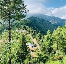
The most famous recreational spot of Balochistan Province, Ziarat, is 2449 meters from sea level.
The weather is cold in Ziarat even in the summer season. It is snow falling in winter and the temperature drops down to -19.
Ziarat, Balochistan Pakistan
Red and Black apples are produced in winters, while black cherry, apricot, and peach fruits are cultivated in the summer season in plenty.
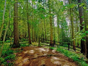
Ziarat is well known for the Juniper Forests. Juniper forests of Ziarat spread over an area of 247000 acres and they had 5000 to 7000 years old trees. They are second after the oldest trees in California. UNESCO has declared them the “World Net of Biosphere Reserves”. Pakistan’s first Bio travel area is in Lal Sohanra is in Bahawalpur.
A PTDC guesthouse and other hotels are there with all the facilities.
15km from the Ziarat, a water dam is a good picnic spot. On the way from Ziarat to Kharwari Baba, stand on the top of the mountain and see the shrine of Kharwari Baba in the lowlands and Allah written naturally on the hill in front. To see this clearly, use a telescope. Means of Transportation can be availed from Quetta Bus Stand.
Key information about Ziarat
Attribute
Information
Location
Ziarat, Balochistan, Pakistan
Altitude
Approximately 2,543 meters (8,343 feet) above sea level
Climate
Cool temperate climate with cold winters and mild summers
Landscape
Surrounded by rugged hills, juniper forests, and scenic valleys
Tourist Attractions
Ziarat Residency (Quaid-e-Azam’s Residency), Juniper Forest, Prospect Point, Ziarat Valley, Sandeman Tangi Dam, Shrine of Baba Kharwari
Historical Significance
Ziarat Residency, the summer residence of Quaid-e-Azam Muhammad Ali Jinnah, Pakistan’s founder
Economy
Primarily agriculture, with apples and cherries being significant crops
Biodiversity
Home to a variety of wildlife, including Markhor, leopards, and various bird species
Cultural Heritage
Enriched with local traditions and cultural festivals, such as the Marri Festival
Accessibility
Connected by road, accessible from Quetta, the provincial capital
Notable Features
Ziarat is known for its stunning natural beauty, juniper forests, and being a serene retreat for tourists
Accommodation
Offers various hotels, rest houses, and cottages for tourists
Outdoor Activities
Hiking, trekking, and nature walks in the beautiful surrounding landscapes
Local Cuisine
Traditional Balochi cuisine, with kebabs, sajji, and bread being local specialties
Famous Places of Ziarat
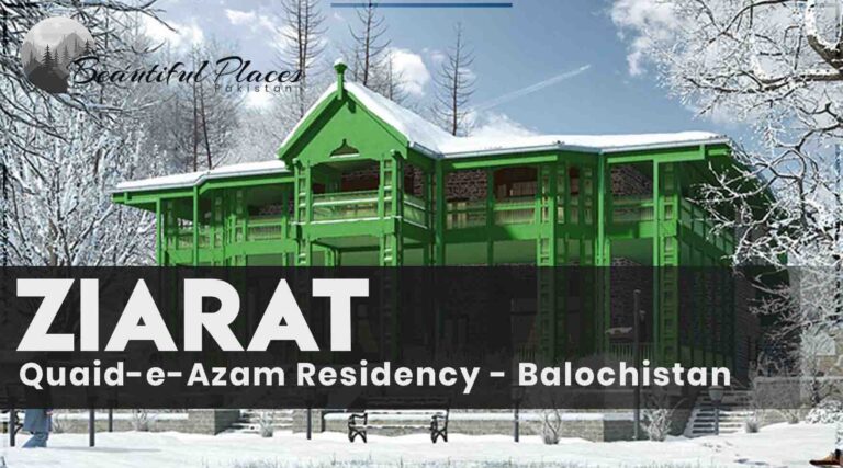
Quid-e-Azam Residency
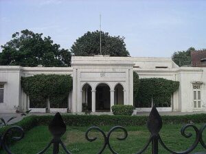
This building was established in 1882 by the British Government. Chief commissioner Balochistan, used this place as a summer headquarter. This building was also used as an army hospital.
Quaid -e- Azam came here when his illness got worse. He used to work there day and night. At last, the doctor suggested shifting Ziarat. He spent the last days of his illness here. On 7th January 1977, the Senate of Pakistan named this residency “Quaid -e Azam” house.
Quaid_e_Azam_Residency, Ziarat,Pakistan
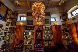
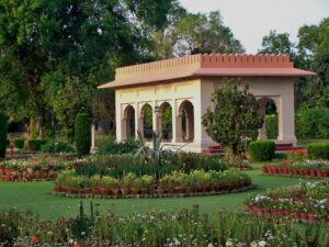
His belongings are also exhibited there. Residency is constructed from fine-quality wood and it is a great construction masterpiece. Surrounded by lush green lawns, poplar trees, and plants with loaded flowers, this building has been given the status of National Heritage.
Ziarat residency’s picture is available on a 100 rupee note.
Chashma Walk
A spring is located 2km away from PTDC Hotel. The spring’s water is used for irrigation. This 2km long way surrounded by mountains and valleys makes you feel fresh and glad.
Sandeman Tangi
At this place, 4 miles from, clear water flows from the top of a small cave inside the sky-high craggy cliff. The water freezes in winter and it becomes an avalanche. It breaks as the winter season ends. It sounds so loud that Ziarat residents recognize that it’s time to say goodbye to the cold. In summer, travelers flock here.
Fern Tangi
A road direct to Fern Tangi 8 km from the highway leads to Quetta from Ziarat. 2km from this point, a cascade falls from the mountain. It has become the best recreational spot because of the scenery and the surrounding area.
fern tangi
Kohen Tangi and Quas Tangi are also beautiful picnic points.
Zindara
This splendid place “Zinadara” is 14 km from Ziarat. Besides this, zarri (16km from Ziarat) and Mana Dam (20 km from Ziarat) are also worth-watching places.
Choteer Valley
This beautiful valley is located on Loralai Road,14 km from Ziarat. The local people of this area live in wood houses. These wood houses are unique as compared to other wood houses in Balochistan. This distinctiveness attracts vacationers to this place. There are a lot of picnic spots in the valley. Rest houses are also existing.
Tangi Chotiyari
Tangi is a local word that means “pass”. This place is at a drive of half an hour on the highway directing Ziarat to Loralai. Stay in the resthouse for some days and enjoy your vacation.
Prospect Point
The steep path from residency goes to prospect. At this point, the most appealing and beautiful scenes of the valley can be viewed. 89000 feet high from sea level, prospect point has Balochistan’s highest mountain peak (3485 meters) in its south.
Prospect point, Ziarat
From this place, the word “Allah” can be seen naturally written on a mountain. Mian Abdul Hakeem Khurwari’s tomb is located 3km from this place. 35 km from Ziarat Minhar(Munna) lake is a worth-viewing place.
Ziarat is renowned for its vast juniper forests, some of which surround Quaid-e-Azam Residency. The juniper trees, some believed to be thousands of years old, contribute to the unique and refreshing atmosphere of the region.
Prospect Point: For panoramic views of the valley and surrounding hills, visitors can head to Prospect Point, offering a breathtaking vantage point. The scenery from this location captures the essence of Ziarat’s natural beauty.
Sandeman Memorial Hall: Named after Sir Robert Sandeman, a prominent British colonial administrator, the Sandeman Memorial Hall is another historical site in Ziarat. The hall serves as a museum, displaying artifacts and documents related to the region’s history.
Hiking and Sightseeing:
Ziarat beckons to nature enthusiasts and hikers, offering scenic trails and opportunities for exploration. The combination of natural beauty and historical sites makes it a haven for those seeking both adventure and tranquility.
Local Cuisine and Crafts:
Visitors can immerse themselves in the local Balochi culture by savoring traditional Balochi dishes and exploring the vibrant local markets. Ziarat is known for its handwoven carpets and Balochi embroidery, providing unique souvenirs for travelers.
Famous Schools
Quaid-e-Azam Public School, Ziarat:
A prominent educational institution that reflects the historical significance of the region.
Famous Colleges
Government Degree College, Ziarat:
A well-known college offering higher education in various disciplines.
Prominent Hospitals
District Headquarters Hospital, Ziarat:
The main healthcare facility catering to the medical needs of the residents and visitors.
Popular Restaurants
Juniper Restaurant:
Known for offering local Balochi cuisine and a cozy ambiance.
Ziarat Valley Restaurant:
A restaurant that provides a scenic view of the valley along with a diverse menu.
Pine Park Restaurant:
Located amidst the natural beauty of Ziarat, offering a relaxing dining experience.
Frequently Asked Questions
Q: What is Quaid-e-Azam Residency?
A: Quaid-e-Azam Residency is a historical building located in Ziarat, Balochistan, Pakistan. It served as the residency of Muhammad Ali Jinnah, the founder of Pakistan, during the last days of his life.
Q: Why is Quaid-e-Azam Residency significant?
A: Quaid-e-Azam Residency holds historical importance as it was the residence of Muhammad Ali Jinnah during the last days of his life in 1948. It is a symbol of the struggle for independence and the birth of Pakistan.
Q: What is the architectural style of Quaid-e-Azam Residency?
A: The architecture of Quaid-e-Azam Residency reflects a colonial style, characterized by its wooden structure and pitched roofs. It is surrounded by a beautiful garden and is situated amidst the scenic beauty of Ziarat.
Q: Can visitors enter Quaid-e-Azam Residency?
A: Yes, Quaid-e-Azam Residency is open to the public. Visitors can explore the rooms and artifacts inside the residency, gaining insights into the life of Muhammad Ali Jinnah.
Q: Are there any museums or exhibits within Quaid-e-Azam Residency?
A: Yes, there is a museum inside Quaid-e-Azam Residency that showcases personal belongings, photographs, and historical documents related to Muhammad Ali Jinnah. It provides a comprehensive view of the leader’s life.
Q: What is the best time to visit Quaid-e-Azam Residency?
A: The best time to visit Quaid-e-Azam Residency is during the spring and summer months (March to June) when the weather is pleasant, and the surrounding landscapes are lush and vibrant.
Q: Are there other attractions in Ziarat besides Quaid-e-Azam Residency?
A: Yes, Ziarat is known for its scenic beauty and has other attractions, including the Juniper Forest, Prospect Point, and the Shrine of Baba Kharwari.
Q: How can one reach Ziarat and Quaid-e-Azam Residency?
A: Ziarat is accessible by road, and the nearest airport is in Quetta. Visitors can hire local transport or use their private vehicles to reach Ziarat and explore Quaid-e-Azam Residency.
Q: Is there an entry fee for Quaid-e-Azam Residency?
A: Yes, there is a nominal entry fee for visitors to Quaid-e-Azam Residency. The funds generated are often used for the maintenance and preservation of this historical site.
Q: Can visitors take photographs inside Quaid-e-Azam Residency?
A: Photography is generally allowed inside Quaid-e-Azam Residency, but it is advisable to check with the authorities for any specific guidelines or restrictions.
Last Thoughts on Ziarat
This city holds significant importance in the History of Pakistan. Furthermore, it is famous for the production of fruits. UNESCO has declared this place on the list of World Heritage sites. A tour to Balochistan Province without Ziarat is incomplete.
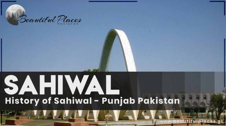
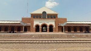
It is situated on the GT road about 37 km from Sahiwal. It was settled in the 19th century and it has Punjab’s most fertile land.
Its villages and towns are part of history. Haveli Lakha, Baseer Pur, and Deepal Pur’s history in this area is about 3000 B.C. Roy Ahmad Khan Kharal and Mehar Murad are proud freedom fighters of this land.
Gol Masjid, Okara.
In 1982, it was transformed into a district. There are army dairy farms that are famous for delicious Cheese. This district is also famous for Neeli Ravi and Sahiwal buffaloes. It is situated on Faisalabad Road and about 14 km from Okara.
Bahadur Nagar Livestock farm holds significant importance due to a large number of buffaloes, bulls, sheep, and goats. Okara is Asia’s largest district of cold storage capacity. It is a modern city with the latest facilities of every kind.
Okara’s Jamiyah Mosque is a unique mosque of its own kind. Sit Garha fort and Mir Chakar’s tomb is located in Sit Garha town.
Key info about Okara
Heading
Information
Location
Punjab, Pakistan
Establishment
Formed as a district in 1982
Area
Approximately 4,377 square kilometers
Population
Over 3 million
District Capital
Okara City
Languages
Punjabi, Urdu, English
Geography
Fertile agricultural land, part of the Bari Doab region
Agriculture
Mainly known for the cultivation of crops such as wheat, rice, and sugarcane
Industries
Agricultural processing, textiles, and small-scale industries
Education
Several schools, colleges, and a university campus
Transportation
Well-connected by road and rail networks
Historical Sites
Limited historical sites, but notable for its cultural heritage
Tourist Attractions
Local markets, parks, and recreational areas
Economy
Agriculture is the primary economic driver, with emerging industrial sectors
Historical Significance
While Okara may not be renowned for ancient historical landmarks, its history is deeply rooted in the broader narrative of the Indian subcontinent. The region has witnessed the ebb and flow of various civilizations and empires. Over time, Okara has evolved from a part of the larger Montgomery District to a distinct administrative entity, reflecting the dynamic history of the region.
Famous Historical Places of Okara
Thatta Ghulam’s Dhero (Thatta Kidona)
Thatta Kedona, a village development project.
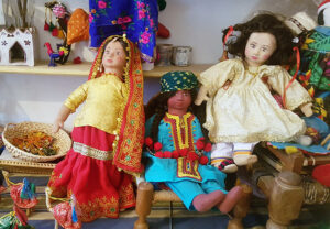
This village is situated in Okara on Faisalabad Road and holds an exclusive international status. In 1993, Doctor Centa Sills trained the girls in the village that how to make dolls.
This process continued until these dolls and toys are exhibited in the museum and theme parks of the World. Many countries in the world prefer to use Pakistani dolls in the Puppet Show.
Deepal Pur’s Fort
The Deepal Pur fort is situated 17 miles away from Okara. Its foundation was led by Kind Deepal. It is narrated that Muhammad Bin Qasim also visited this place.
Famous for the army’s history, it was the capital of Punjab in the past. This fort is many centuries older than Shahi fort Lahore. It is present with its historical splendor. The historical temple, Hindu inn, and the Nankana Sahib’s Inn are historical buildings. People can also visit Bhamman Shah Gurdwara in suburbs.
Deepal Pur’s old Shahi Mosque
Feroz Shah Tughluq built a splendid mosque. The mixture for its building was made from the mixture of beans and jaggery. Its strong walls hold history in them. It remains cold in summer.
Depalpur Sharif
A Sufi shrine dedicated to Hazrat Baba Kamal Chishti, visited by pilgrims and devotees seeking blessings and spiritual solace.
Okara Military Dairy Farm
Known as the largest military dairy farm in Asia, it’s a significant center for dairy production and research.
Ghulam Mohammadabad
A town within Okara known for its vibrant bazaars and cultural significance.
Okara Baradari
A historic site with 12 gates, known as “Baradari,” that once served as a gathering place and a symbol of the city’s heritage.
R.C. Church Okara
A beautiful Roman Catholic church known for its architectural beauty and significance in the local Christian community.
Okara Cantt
The cantonment area of Okara, known for its well-planned layout and military presence.
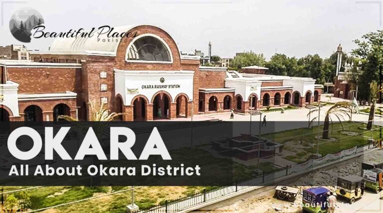
Okara Railway Station
A historic railway station showcasing colonial-era architecture and serving as a transportation hub for the region.
Okara Fort
Also known as Raja Jajja Singh Fort, this historical fort stands as a testament to the region’s historical legacy.
Jamia Masjid Siddique-e-Akbar
A significant mosque in Okara known for its grandeur and cultural importance.
Bharoosa Sharif
A Sufi shrine dedicated to Hazrat Baba Ji Mouj Darya, attracting devotees and visitors.
Famous Schools
Divisional Public School and College Okara
The Educators Okara Campus
Government High School Okara
Notable Colleges
Government Postgraduate College Okara
Superior College Okara
Punjab Group of Colleges Okara
Prominent Hospitals
District Headquarters Hospital Okara
CMH Okara (Combined Military Hospital)
Ali Hospital Okara
Popular Restaurants
Hot ‘n’ Spicy Restaurant
Food Street Okara
Chatkharay Dar Pakwan
Frequently Asked Questions (FAQs)
What is the history of Okara District?
Okara District, established in 1982, has a history deeply rooted in the broader narrative of the Indian subcontinent. While not known for ancient landmarks, its evolution from part of Montgomery District reflects the dynamic history of the region.
What is Okara District known for agriculturally?
Okara is renowned for its significant contributions to agriculture, cultivating crops such as wheat, rice, and sugarcane. The district’s fertile lands make it a vital player in Punjab’s agrarian landscape.
Are there educational institutions in Okara?
Yes, Okara hosts a range of educational institutions, including schools, colleges, and the University of Okara. These institutions contribute to the intellectual growth of the community.
What are some notable landmarks in Okara?
Okara boasts historical sites like Depalpur Fort and the Haveli of Mian Khan. Additionally, landmarks celebrating agriculture include Okara Agriculture University and the Cotton Research Institute.
Are there healthcare facilities in Okara?
Yes, Okara provides healthcare services through hospitals such as District Headquarters Hospital and CMH Okara, ensuring access to medical facilities for residents.
What are the popular festivals in Okara?
Cultural festivals like Basant, the Urs of Shah Shams Tabrez, and the Okara Mango Festival are celebrated with enthusiasm, reflecting the district’s rich cultural tapestry.
Are there transportation hubs in Okara?
Okara is well-connected by road and rail, with hubs like Okara Railway Station and the Okara Bus Terminal facilitating transportation within the district and beyond.
What are some famous markets and bazaars in Okara?
Okara hosts local markets like the Grain Market and Model Bazaar, providing a glimpse into the daily life and commerce of the district.
Tell me about some educational landmarks in Okara.
Educational landmarks include the University of Okara and Okara Institute of Technology, contributing to the educational landscape of the district.
Last Thoughts on Okara District
Okara is a historical city with three Tehsils. It has the honor of Punjab’s most fertile land. It is famous for the production of potatoes, sugarcane, maize, and rice crops and livestock farming. The University of Okara is an educational hub for knowledge seekers.
Welcome to Lahore, the cultural and historical heart of Pakistan!
Nestled in the province of Punjab, Lahore is a vibrant metropolis that seamlessly blends the old with the new.
With a rich history dating back over a millennium, this captivating city is a treasure trove of architectural wonders, enchanting bazaars, and a bustling street life that never fails to mesmerize its visitors.
From its iconic Mughal-era landmarks to its delectable cuisine and warm hospitality, Lahore offers an immersive experience that will leave you enthralled and yearning for more.
So, join us as we embark on a journey to explore the diverse tapestry of Lahore, where the past converges with the present, creating a unique and unforgettable destination.
Lahore city is also famous as the “City of Gardens”. Lahore is the second-largest city in Pakistan after Karachi and 26th largest city in the World. It is the capital of the province Punjab.
It presents a beautiful contrast between ancient historical culture and rich modern civilization. It is renowned internationally for its culture, traditions, cheerfulness, civilization, and hospitality.
Its historical places are included in the UNESCO World Heritage Sites.
Lahore has a rich history and served as the capital of the Mughal Empire from 1585 to 1598. It has witnessed numerous invasions and has been a center of art, culture, and commerce for centuries.
Cultural Heritage
Known as the cultural heart of Pakistan, Lahore is renowned for its traditional music, dance, literature, and cuisine. It is home to various festivals, including the renowned Basant (Kite) Festival.
Educational Institutions
Lahore is a major educational hub with prestigious universities and colleges, including the University of the Punjab, Lahore University of Management Sciences (LUMS), and Government College University.
Transportation
Lahore is well-connected through an extensive road network, railways, and the Allama Iqbal International Airport, which serves domestic and international flights. The city also has a rapid transit system called the Lahore Metro.
Major Industries
Textiles, pharmaceuticals, information technology, automotive, food processing, and handicrafts are among the prominent industries in Lahore.
Cuisine
Lahore is famous for its diverse and mouthwatering cuisine, offering a variety of street food, including Lahori chargha (roasted chicken), nihari (slow-cooked meat stew), and falooda (a sweet dessert).
Festivals
Eid-ul-Fitr, Eid-ul-Adha, Basant (Kite) Festival, and the Urs festival at Data Darbar are some of the major festivals celebrated in Lahore.
Sports
Cricket is the most popular sport in Lahore, and the city has hosted several international cricket matches. It is also home to the Gaddafi Stadium, a renowned cricket venue.
Sister Cities
Lahore has sister city relationships with several cities around the world, including Chicago (United States), Xi’an (China), Istanbul (Turkey), and Kuala Lumpur (Malaysia).
Historical Sites
In addition to famous landmarks, Lahore is home to numerous historical sites such as the Wazir Khan Hammam, Lahore Museum, Jahangir’s Tomb, and the Hiran Minar.
Parks and Gardens
Lahore boasts several beautiful parks and gardens, including the Jilani Park, Model Town Park, Race Course Park, and Bagh-e-Jinnah (Lawrence Gardens).
Art and Literature
Lahore has a thriving art and literary scene, with numerous art galleries, theaters, and cultural festivals. The city is also known for its vibrant publishing industry and hosts the Lahore Literary Festival annually.
Shopping
Lahore is a shopaholic’s paradise, offering a range of shopping options from traditional bazaars like Anarkali and Liberty Market to modern shopping malls such as Emporium Mall and Packages Mall.
Religious Sites
Lahore is home to various religious sites, including the Data Darbar (shrine of Sufi saint Hazrat Data Ganj Bakhsh), Minar-e-Pakistan, and numerous mosques, temples, and gurdwaras.
Museums
Apart from the Lahore Museum, the city has several other museums, such as the Fakir Khana Museum, National History Museum, and Chughtai Museum, showcasing a diverse range of artifacts and art collections.
Performing Arts
Lahore has a vibrant performing arts scene with theaters and cultural centers that host musical concerts, dance performances, and theater plays. The Alhamra Arts Council is a prominent venue for cultural events.
Educational Legacy
Lahore has a rich educational legacy, with historical institutions like Government College University and Aitchison College that have produced notable scholars, leaders, and intellectuals over the years.
Tourism
Lahore attracts a significant number of tourists due to its cultural heritage, festivals, and historical landmarks. The city has a range of hotels, guesthouses, and accommodations to cater to visitors’ needs.
Lahore, Punjab Pakistan
A Brief History of Lahore
Raja Loh, the son of Raja Ram led the foundation of Lahore at a height of 968 from sea level. It is called the contemporary city of Mohen Jodaro and Harappa.
There were other places named Lahore. Hindu Shahi’s capital Lahore was situated on the river Indus. There was a Lahore in Kashmir and Mewar. A Lahore was located near Gawalyar. A seaport of Sindh was named Lahore. It had different names. Loh Pur, Loh Kot, Loharan, Loh Garha, Lohar Kot, Lahnor, Loharo, and Loha Nagar. etc.
It is proved historically that Lahore city was razed several times and then settled before the Muslim era.
Lahore is the capital of Punjab for more than one thousand years. Mahmood Ghaznavid conquered Punjab in 1022 and the Muslim reign started here. He settled in Lahore under a new name “Mehmood Pur”. Ayaz was appointed as the governor of Mehmood Pur.
ancient Lahore
Many rulers ruled here. People’s blood flowed for power. Blood relations came in front of each other for the greed of power.
In 1584, the Great Mughal Emperor Jala -ud – din Muhammad Akbar held his court in Lahore (1584-1598). He declared Lahore the capital of the Mughal Régime. Monarch Akbar renovated the tomb and city. His son Jehangir continued the tradition of his ancestors. Shahdra Garden and Anarkali’s tomb are built by him. His son Shah Jahan built Jahangir’s tomb, Asif Khan’s grave, Noor Jahan’s tomb, Mian Mir’s catacomb, Shalamar Garden, and Wazir Khan Mosque.
One of his prominent works includes the construction of the Taj Mahal Agra. His daughter Jahan Ara established Chobar Ji Garden. His son made the largest mosque in the world of that time in Lahore. He renovated and enlarged the Shahi fort and built the Alamgiri door in front of the Shahi Mosque.
Today’s Lahore
لہور لہور اے ۔۔۔۔ جنیں لہور نئیں ویکھیا ۔۔۔۔۔ او جمیاای نئیں
“دیھاڑے ست تے اٹھ میلے ۔۔۔۔۔ میں گھر جاواں کیہڑے ویلے”
These are the sentences, and titles that are famous for Lahore and the people of Lahore. The reason for this is the lively and jovial hearts of Lahoris.
.Krishan Chand once said, “my eyes get wet when I think about Lahore and its citizens”. Lahore has countless tourists spots and historical places.
History students can visit thousands of years old buildings. If you are fond of greenery, then its numerous parks are waiting for you. It is also called the “City of Gardens”. If you are a true foodie, then you can enjoy the whole of Pakistan’s cuisine in Lahore.
October to March is the best time period for travel. The “Garden” declared Lahore the second-best tourist spot in 2008.
Andron Lahore
Lahore city was situated on a 9-
Androon Lahore, Punjab Pakistan
meter-high wall during the Mughal regime. It had 13 doors. A circular road was used to connect these doors.
There were beautiful gardens neat the wall. Some doors are still existing in Lahore. For the renovation of old historical places in Lahore, different projects like “Dilkash Lahore” and “Walled city of Lahore” have been initiated.
We are hopeful that these societies will regain the old status and beauty of Lahore city. People can visit Andron Lahore to become familiar with the history, culture, and traditions of Lahore.
Walled City of Lahore Authority
Walled City Lahore
A contract was signed in 2012 between the World Bank and the Government of Punjab for the restoration of thousands of years old historical monuments and culture.
According to this agreement, the royal pathways of Andron Lahore, Doors, Walls, and old historic buildings will be renovated. The tourism industry will flourish due to this project. The administration of the walled city Lahore has arranged a guided tour for tourists.
No other guide is better than the walled city authority for Andron City tour. You can contact 042-99204196042. For the awareness of the history and historical places of Lahore, please contact the discoverer of Lahore researcher Faizan Abbas. His contact detail is 0345-4176691
Lahore’s Food
Lahoris are fond of delicious and tasty food. They can travel far places in search of good food. That’s why the good quality restaurants are always overcrowded in different areas of Lahore. I
n the morning, people love to eat Hareesa, Nihari, Bong, Siri Payee, Haleem, Halwa Pori, and Murgh Chaney. Lassi and curd are preferred over tea. In the evening, people not only relish traditional food but also Chinese, continental, Italian, Mexican, and fast food.
There are different places for food restaurants. Lakshmi Chowk is the oldest place and center of traditional food. Daal Chawal, Chicken Karhai, Mutton Karhai, and Tuka tuk are mouth-watering dishes. Now people can enjoy all the food in one place because of Wall city.
Before that, there were food streets in Gawal mandi and old Anarkali. There are many shops for Nihari but Muzang Chungi, scheme mor Mohammadi Nihari, Anarkali Paisa Akhbar Bazaar Nihari are more famous.
Harissa is a Kashmiri dish but it is also a favorite food of Lahoris. Harissa’s best restaurant is near Gawalmandi. Best-quality fresh fish can be enjoyed from Qazaffi stadium Basheer dar Almahi, Gawalmandi Sardar fish, Dubai Chowk, Iqbal Town Haji Sardar fish, Scheme Mor, and Garhi Shaho Haji Saddique. Must enjoy the Kebab of Bhayya in model town.
Gawalmandi food street, Lahore
People can order food like Harissa, Nihari, fish, Haleem, Chicken Karhai, Mutton Karhai, Tikka Kebab, Tukka tuk, Chapli Kebab, Balochi Sijji, Chinioti Kunna, Handi Meat, Siri Payee, Pathoray, Kashmiri Daal Chawal, corn’s tortilla, and mustard green with butter, and Kabuli Pulao in latest Fort Road food street, and Gawal Mandi food street.
People can also enjoy a cold drink, green tea, Peshawari Qehwa, and Lassi. Paray Wali Lassi and Meeta Pan will refresh you. Traditional foods of Hunza can be enjoyed in food street old Anarkali. Now, restaurants are established on Mall Road in front of the High Court.
Moreover, the best and most high-quality restaurants are present in Qazzafi Stadium. Here you can find Pakistani, Indian, Afghani, and Bengali cuisines. Food courts are available near Fortress stadium.
A lot of cafes are present on different roads near M.M Alam in the Liberty area. Local and international foods are provided there at cheap rates. The buffet system is available in Village, Ziafat, Salt n Pepper, WINDMILL, and other restaurants. P.C hotel’s Dum Pakhat will urge you to come here again and again.
Falooda and Raberi milk are old traditional food items. There are many falooda Shops near old Anarkali that are consulted from generation to generation because of their taste.
Besides this, Qasoori Falooda can be enjoyed near the Ichhra graveyard on Feroz Pur Road. Watching the people enjoying ice cream at 2 covered in the woolen cap, two sweaters, with one jacket in bitter cold or drizzling on Baden Road in front of Mall Road Shuhda mosque is a wonderful sight.
You will experience the same view in Chaman ice cream, Punjab ice cream, and Fiesta ice creams parlors. It seems that they are giving free ice cream but that is not true. These shops are famous for their good quality and taste. Fresh fruit juices are also served there.
Roll Patesa (a sweet) of Bismillah Sweets at Chowk Yateem Khana is famous all across Pakistan. Khaleefa’s Khatai, Lal Koh, and Rafique sweets confectionery items are gifts from Lahore.
Playlands in Lahore
Lahore is home to several exciting playlands where individuals of all ages can indulge in thrilling amusement and recreational activities.
These playlands offer a wide range of entertainment options, from exhilarating rides to engaging games and much more.
Here are some popular playlands in Lahore:
Joyland:
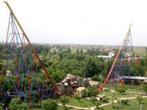
Located in Fortress Stadium, Joyland is one of the oldest and most renowned amusement parks in Lahore. It boasts a variety of rides, including roller coasters, ferris wheels, bumper cars, and water slides.
Joyland also features a dedicated area for children with age-appropriate rides and attractions.
Sozo Water Park:
If you’re looking to beat the summer heat and enjoy water-based fun, Sozo Water Park is the perfect destination.
Situated near Fortress Stadium, this sprawling water park offers a range of slides, pools, and water attractions for visitors of all ages.
Sindbad’s Wonderland:
Situated in the Gulberg area, Sindbad’s Wonderland is a popular indoor amusement park. It offers an array of rides, arcade games, go-karting, and a 7D cinema experience.
The park also includes an indoor ice rink and a food court, providing a complete entertainment package.
Wonder World Lahore:
Located in Johar Town, Wonder World Lahore is a family-friendly entertainment center. It features a variety of indoor and outdoor rides, go-karting tracks, bumper boats, a 5D cinema, and an indoor play area.
The park also offers a selection of food stalls and a dedicated party area.
Aladin Amusement Park:
Situated in the heart of Gulberg, Aladin Amusement Park is known for its fun-filled rides and recreational activities.
The park includes attractions such as a roller coaster, a giant wheel, bumper cars, a haunted house, and a video game arcade.
These playlands in Lahore provide an escape from the daily routine, offering an enjoyable and adventurous experience for individuals and families alike. Whether you seek adrenaline-pumping rides, water-based fun, or a mix of indoor and outdoor activities, Lahore’s playlands have something to cater to every taste and preference.
Famous Places of Lahore
1- Minar -e-Pakistan
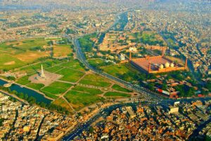
Minar-e- Pakistan is built-in Iqbal Park Lahore as a memorial to Pakistan Resolution. This minaret’s design reflects the modern and old Mughal architectural style. On 23rd March 1940, the Muslims of the Sub-continent passed a formal resolution.
The minaret was designed and built under the supervision of Dagestan’s architect-engineer Nasar ud din Murat Khan. He did this job without any cost. Mian Abdul Khaliq and Co. constructed it. Its foundation was led on 23rd March 1960 and this project was completed on 31st October 1968. It was opened to the Public in 1969. It is an interesting fact that no one inaugurated this place. Its construction expenses worth 500,000 were collected from the taxes of cinema halls and horse race tickets.
Tourists can enjoy the aerial view of the city from the top of the minaret by using a staircase and lift.
A splendid sight of Minar-e-Pakistan.
The total height of the minaret is 276 feet. The open petals around the minaret are at a height of 27 feet. The outer diameter is about 30 feet. The minaret stands on four base platforms. These four base platforms depict the struggle for freedom in a systematic manner.
On the base of the minaret, the context of resolution is written in Urdu, Bengali, and English language on white marble. Calligraphy of different Quran e Pak verses along with references, 99 names of Allah, Quid-e-Azam portraits, Allam Iqbal poetry in Urdu, English, and Bengali, and the national anthem of Pakistan are engraved there.
There are dancing fountains, different monuments, food courts, and a playland.
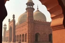
2- Badshahi Mosque (A magnificent paradigm of Islamic architecture)
The foundation of this majestic and spacious was led in 1673 under the regime of Mughal emperor Aurangzeb Alamgir. It was completed in 2.5 years. White marble and red stones were used in their construction.
In the era of Shah Jahan, Dara Shikwa was appointed as the governor of Punjab. He established the shrine of Mian Mir, Bala Pir, and Mulla Shah Qadir. Red stones were used in the construction of these tombs. A large number of stones were left. These extra stones become the reason for the construction of this splendid mosque.
He had a plan to reach the Mian Mir’s tomb through a clean red stoned road barefooted. And nobody was allowed on this road. Before the completion of this project, Aurangzeb Alamgir captured the area and killed his brother Dara Shikwa. He ordered to build a mosque with these red stones.
Badshahi Mosque, Lahore
Fidai Khan was appointed as a supervisor of this mosque. In turkey language, Koka is the son of a nursing mother and is called the son of a midwife, who had breastfed the king in infancy. Fidai Khan performed his duty with utmost diligence. Badshahi mosque is the second largest mosque in Pakistan and the fifth largest mosque in Asia. It has had the honor of being the world’s largest for 313 years.
Its architectural style is similar to the Jama Mosque Delhi. It was constructed in 1648 by Aurangzeb and his father Shah Jahan. There is a mosque in the west of Shahi fort. About one lac worshippers can offer prayer.
There are four minarets on the four corners of the mosque. Each minaret has a height of 176 feet. An amazing fact is that one can view only three minarets of Jehangir’s tomb from these four minarets. 500 rupees note has the picture of this mosque.
The holy presents of Badshahi Mosque
These holy gifts are placed in the rooms above the porch at the entrance door of the Badshahi mosque. It has a green turban with a cap, a green coat, white trousers, and signs of footsteps, all these belong to the Holy Prophet Muhammad (ﷺ), and a white piece that has verses engraved on it.
It also has holy gifts like Hazrat Ali R. A’s first Para of the Quran-e-Pak, turban, amulet, and the handkerchief of Syeda Fatima R.A., Jay-e- Namaz (a piece of cloth for offering prayer), Imam e Hussain’s turban, Bloody handkerchief, Sheikh Abdul Qadir Jilani’s turban, blanket, Jai-e-Namaz, red soil of Karbala, the broken tooth of Hazrat Awais Qarni and much more.
3- Shahi Qila, Lahore Fort, Royal Fort
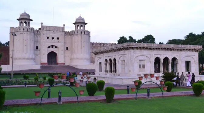
Nobody is sure about who laid the foundation of this fort and when? However, the excavations done by the department of archology revealed that this fort was built before 1025. It is because a gold coin (of the Mehmood Ghaznavid era in 1025) was found at a depth of 62.7 meters from the garden during the excavations in Dewan-e- Aam in 1959.
In 1566, emperor Akbar built a grand fort in Lahore on the foundation of an old mud fort.
This magnificent fort is built in a rectangular shape. It is clearly divided into two parts. The first part consists of admin, entrance pathways, orchards, and Dewan -e- Aam (courtyard).
Shahi Qila, Lahore
The second part has secret and private residents, an elephant’s door, Sheesh Mahal, a private room, Bathrooms, and bedrooms. Its actual main door is in front of Maryam Zamani Mosque, and the outer main door opens at Hazoori Garden. The Grand Badshahi mosque is also located there.
It is included in the UNESCO World Heritage Sites too.
4- Loh’s Samadi
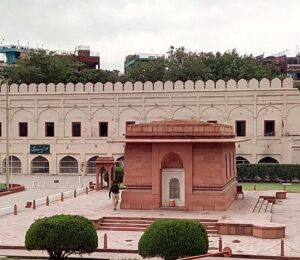
At the entrance to the fort from the Alamgiri Gate, located in front of the Badshahi Mosque and Hazoori garden, on the right is the tomb of Raja Loh under an arch in the southwest corner. It is said that he settled the Lahore city. The constructors of the fort left it as it is. The Alamgiri door is closed due to security reasons.
5- Dolat -e- Khana Khas o Aam (دولت خانہ خاص و عام)
It was established in 1556 in the era of king Akbar. It was the residence of the king. This building consisted of 114 rooms. On 27th 1857, a great court of nine days was held.
6- Dewan-e-Aam
It was constructed by king Shah Jahan. Its construction was started in 1628 and completed in 1631. It is connected to Dolat Khana Khas-o- Aam. The building is standing on 40 red stones pillars. It was damaged in the Sikh era. The British ruler ordered to rebuild its roof. But the red stone fringe around the podium was built in Akbar’s era. A window of marble stills exists in front of this building.
7- Jahangir’s Bedroom
Its construction was completed in 1617. It was specially built for the king. A pond is built in front of the courtyard with an area of 100×100 square feet. It also has fountains. There is a platform for sitting there. In 1928, this building was transformed into a museum. Nowadays, it is named the Mughal gallery. The Taj Mahal Agra’s model made from ivory is worth watching.
8- Dewan -e- Khas
This three-story building was built in 1645 in the era of Shah Jahan. This building is based on 26 stone marble pillars. Its corner has a red Burj where a staircase went into the river.
9- Shah Burj (Sheesh Mahal)
It is the most beautiful building of Mughal’s regime. It was built by King Shah Jahan in 1631-32. It consists of small and large rooms and they are decorated with glass and paint with great ability. On the Northside, there are fine marble windows.
Sheesh Mahal
The sight of Minar -e- Pakistan is worth watching from there. A pool is made from the sky and yellow-colored tiles. There is a fountain in it. This place was used as the king’s harem.
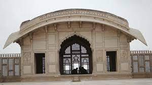
10- Naulakah Bangalow
This bungalow is built in a corner of Sheesh Mahal. It is said that 9 lacs were spent on its construction that’s why it is named “Nauakkah”.
Naulakha Lahore
The white marble pillars are decorated with precious stones such as antiques, lapis lazuli, sapphire, and gold. They lost their shine as time passed. And the valuable stones are extracted from there. One rupee note has its picture.
11- Pai Bhag
It was built by Shah Jahan and only females were allowed there.
12- Hamam Shahi
They were constructed in 1633. They were hot water bathrooms near the Shahi bedrooms. The building is now dilapidated.
13- Shah Burj Gate
It was constructed in 1631 by king Shah Jahan. There is a 58 steps staircase along with the gate. People used to reach Sheesh Mahal by elephants from this place. It was also known as the elephant door. It was a royal pathway. The grave of king Ranjeet Singh is in front of Shah Burj’s gate. Today this gate is used to enter Shahi fort.
14- The Basement (تہہ خانہ )
There are basements below the buildings of Sheesh Mahal, Shah Jahan, and Jahangir rooms on the northwest side of the fort. These basements are cold spaces in the summer season and warm in the winter season. These rooms are designed in such a way that they are naturally well- ventilated and well-lit.
An amazing feature is that there are two tunnels in these basements. This tunnel goes to Jahangir’s tomb, Noor Jahan’s tomb and another tunnel go to Shalamar Garden. These tunnels are so spacious that a carriage and a horse rider can run through these tunnels. Nowadays these tunnels are closed to tourists.
15- Moti Mosque
It was built by Shah Jahan in 1645. Mughal emperors built three Moti mosques. The first Moti Mosque is in Lahore fort. The second mosque was built in Akbar Abad by Shah Jahan in 1654. The third mosque was built in Delhi fort by Alamgir.
Moti-Mosque-Lahore.
16- Taswiri Dewar
There are 350 years old pictures on the outer wall of Shah Burj gate. These are beautiful masterpieces of Mughal art. These pictures reflect the unique era of the Mughal regime. This art is rare in the World. 50 rupees note has the picture of Shahi fort. In 1981, UNESCO has included this fort in the World Heritage sites.
17- Iqbal’s Tomb
Allam Muhammad Iqbal was a great poet, philosopher, and thinker. He was born on 9th November 1877 and his funeral prayer was offered in the courtyard of Shahi mosque on 21st April 1938.
The design of the tomb of Iqbal is quite simple but a splendid masterpiece of unique architectural style. It is present in between the two historical buildings of Badshahi Mosque and Shai fort and on the side steps of Badshahi mosque.
Chief of Architect Nawab Zain Yar Jung Bahadur of Hyderabad Dakan completed the design of the tomb. The craftsmen of Delhi, Agra, and Makrana gave it a shape.
Tomb of Allama Muhammad Iqbal
The red stone for the building was imported from Jay Pur India, while the white marble was available in Pakistan. The building reflects the culture of Afghanistan and Moorish. Renowned calligrapher Hafiz Muhammad Yousaf Sadidi convert the property of Iqbal into inscriptions.
The construction of the shrine was completed from 1946 to 1951. In 1976, the tomb of the Iqbal was handover to the endowment department. Now the rangers of Pakistan are offering the duty of its safety with extreme carefulness.
18- Hazori Garden (Bhag)
This garden was built by king Ranjeet Singh when he celebrated after snatching the world’s most important diamond from the unlucky king Shah Shuja. This valuable diamond was 1.5 inches long and 1 inch wide. It had been the ornament of the peacock throne. At that time, the king ordered to build a garden on the podium between Shahi fort and Badshahi mosque. After the garden, he ordered to build Bara Darri. He ordered to remove marble from different tombs and use them in the construction of Bara Darri.
19- Samadhi Ranjeet Singh
Go to Menaar-e-Pakistan towards Shahi fort, Gurdwara Dera, and Ranjeet Singh Samadhi is located on the right side of Shahi Qila. Gurdwara Dera Sahib was used as a house of worship. The three-stories Samadhi (shrine) of King Ranjeet Singh is on the western side of Gurdwara.
He died on 24th June 1839 and his son Kharak Singh initiated the building of Samadhi. It was completed by the Grandson of Ranjeet Singh in 1848.
samadhi of Ranjit singh Lahore Pakistan
A samadhi is built on an umbrella-shaped platform in the large room on the second floor. The pictures of Ranjeet Singh and Baba Guru Nanak are hung on the wall.
It is narrated that when When his coffin was set on fire, 4 queens and seven concubines also died. A pigeon flying above the bonfire was also burnt in the fire. The ash of all these is present in the Samadhi. Sikh devotees must visit their holy place when they travel to Pakistan.
King Ranjeet Singh
He was born on 13th November 1780 in Gujranwala. His one eye was lost due to smallpox in childhood. He used to take part in wars with his father Mahan Singh at a very young age. He became the chief of the tribe at the age of 12 after the death of his father. He got married at the age of 15.
There were local small tribes. Ranjeet Singh extracted the cannons from the river Jhelum and gave them to the king of Kabul Shah Zaman. Shah Zaman gave him the governance of Punjab. At that time, Lahore was under the control of three cruel Sikh rulers.
The Muslim elites conspired with Raja Ranjeet Singh and on 7th July 1799 they handover the capital Lahore to him. From there, his reign started. In no time, he occupied Punjab and in 1801 led the foundation of the first Sikh government.
In 1806, he signed his first contract with the British. Slowly and gradually, he captured Punjab, Kashmir, and most of the areas of KPK. His administration was better than other rulers.
He was fond of horses and jewels. His success was due to the Luxury, moral decay, and hypocrisy of Muslim leaders and the bravery of European Generals.
He died on 27th June 1839. Kharak Singh and Sher Singh built their Samadhi. Sikhs visit this place every year and consider this place a sacred place. They feel proud to stay here.
20- Maryam Zamani Mosque
Maryam Zamani was a queen of King Akbar. They built this mosque in 1614 along Shahi Qila near Masti gate. It is also known as Begum Shahi Mosque. This mosque is a masterpiece of Mughal art and unique in its kind. There is a pond in the center of the mosque for the purpose of ablution. The artwork and paintings on its wall remind us of the magnificence of the Mughal regime.
21- Iqbal Park
It is a historical park with thick green lands and loaded with flowers. Minar-e-Pakistan is located in its center. It was built as a memorial to the resolution of Pakistan that was passed on 23rd March 1940.
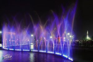
Dancing colorful fountains at Iqbal Park, Lahore
People enjoy a lot in this spacious garden. It’s a recreational place for both elders and children. Elders come there for a walk while children usually enjoy swings. This park is located in front of Badshahi mosque, Shahi Qila, and the General Bus stand.
22- Hafeez Jalandhari
Great poet, writer, and above all the author of the Pakistan National Anthem Hafeez Jalandhari was born on 14th January 1900 in the city of east Punjab named Jalandhar. He took part in the Pakistani movement and urged the Muslims for freedom.
In 1948, he joined the army for the freedom of Kashmir and got injured. The anthem of Kashmir “Watan Hamara Azad Kashmir” was written by him. He wrote poetry full of patriotism for the nation during the war of 1965.
He worked as an advisor with Field Marshal President Muhammad Ayub Khan and as an assistant to Director General Morals. He was a director of Writer Gild. His Kalam “Shah Nama Islam” gave him fame. He wrote the National Anthem of Pakistan. Its music was set by Ghulam Ali.
He was bestowed with “Hilal Imtiaz” and “Pride of Performance” because of his services. He was died on 2nd December 1982 and buried in the graveyard of Model Town Lahore. Later on, his dead body was shifted to the tomb in the boundary of Minar-e-Pakistan.
23- Shahi Hamam
Situated on the left side of the Delhi gate, this building is still in good physical condition. It was used by the King and royal family in the regime of Mughal king Shah Jahan.
It was constructed by Sheikh Ilm-ud-din Ansari. Its bathrooms are made in Turkish architectural style. This building has dressing rooms and steam bathrooms for a hot and cold showers. In 2014 excavations were done for renovations and some basement-shaped buildings were revealed there. The research work is still continued.
24- Masjid Wazir Khan
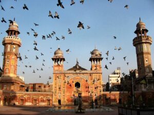
It is located some distance from Shahi Hammam in the Bazaar of Delhi gate. It was established in 1634 by the governor of king Shah Jahan named Hakeem Ilm-ud-din Ansari. He was awarded the title of Nawab Wazir Khan.
It was completed in seven years. Each and every bit of the construction of this mosque was done with great care. The walls are painted with beautiful designs.
Wazir Khan Mosque, Lahore Pakistan
Renowned designers and painters used to come there to learn calligraphy and painting there. And the elites replicated its designs in their palaces. Well, known writer, Kanya Lal wrote in his book that such a magnificent bronze work in this building is rarely seen anywhere else. It is a proud moment for Lahoris.
25- Sunehri Masjid
This mosque was built in 1753 by Nawab Bhikari Khan Naib Hakim Lahore and it is famous for its golden dome and minarets. The structure of the building is so strong and it is present on the first floor. It is still shiny. This mosque is located in the crowded area of Dabbi Bazaar and in the center of Kashmiri Bazar.
26- Tomb of Ayaz Malik
Beyond the Kashmiri Bazaar, the tomb of the favorite and intelligent General of Mehmood Ghaznavid is located. In 1042, after defeating Raja Jay Pal, Mehmood Ghaznavid appointed Ayaz Malik as the governor of Lahore and he was ordered to renovate Lahore. Therefore, he is known as the founder of today’s Lahore.
27- Masjid Shab Bar
It is a small mosque outside the biggest trade center of Lahore Shah Alam Market. It is a two-story building with two shops on the first floor and a mosque on the second floor. Before this, there was a mud platform. People used to offer prayer there. A Hindu temple was built near and the Muslims had the idea to construct a mosque there. The government banned this project because of Hindu-Muslim conflicts.
In May 1922, a group of young people consulted with each other and built a mosque in one night. They started after Esha Prayer and completed the mosque in Fajar. Allama Iqbal wrote a poem about this whole incident.
مسجد تو بنا دی شب بھر میں ایمان کی حرارت والوں نے
من اپنا پرانا پاپی ہے، برسوں میں نمازی نہ بن سکا
28- Newi Masjid / Newi mosque
This strange mosque is located in Kocha Dogra between Lohari Mosque and Shah Alami gate. It was constructed by Zulfiqar Ali Lodhi in the 16th century in Lodhi Era.
There used to be mosques on the platforms. He dug into one story and built the mosque in the basement. The water of the mosque does not go anywhere. Rather, it is drowned down in the ground. The people go down through stairs. This mosque is still in good condition with three domes.
29- Faqeer Khana Museum
This museum is located at Bhati Gate Bazar Hakeema in an old historical house. The ancestors of the Faqeer Family immigrated from Bukhara to Uche Shareef. Faqeer Aziz-ud-din was the Prime Minister and personal physician of King Ranjeet Singh.
Faqeer Khana Museum, Lahore Pakistan
The museum has ancient Islamic antiques, Quran-e-Pak drafts, valuable jewels, and stones, Chinese and Japanese paintings, Miniature cups, engraved stones of Buddhism, rare pottery, carpets, and gifts from the international delegations, Raja Ranjeet Singh and Queen Victoria.
It has 60 rare drats of Quran-e-Pak. It has Quran-e-Pak written by Hazrat Ali R.A, Hazrat Imam Hussain R.A, and Hazrat Imam Hassan R.A.
30- Hazrat Ali Hijwairi
His real name is Abul Hassan Ali bin Usman. He was born in Ghazni Afghanistan. He was a great Persian Scholar and a saint. He was called Hijwairi because he belonged to Hijvair Ghazni. He came to Lahore on the call of his Murshid Sheikh Abul Fazal.
Shrine-of-Data-Ali-Hijvari-Lahore
Thousands of people embraced Islam by following his teachings. There are many books on his saying and teachings. Kashaf-a-fil-Majoob is one of them. A book named Kashaf-ul-Asrar is a famous book on Sufism. He died in 1072.
31- Mall Road
British rulers promoted the art of Mughal, Gothic, and Victorian architectural styles. Punjab High court, Government college, National College of Arts, Montgomery Hall, Railway Station, Punjab University’s old campus, and Punjab Assembly buildings reflect this style of Architecture.
Mall Road is a famous highway in Lahore also called Quaid-e-Azam Highway. There are many buildings on Mall Road that hold historical and cultural importance. There are buildings of British, Mughal, and modern styles of architecture.
No doubt, this road has witnessed many periods of history. Some famous tourists spots are Nasir Garden, Town Hall, Zamzama Top, Lahore museum, Punjab university old campus, National College of Arts, Punjab Public Library, Lahore heritage museum, New Anarkali, Old Anarkali, Bank square, Blue dome, GPO, Punjab High court, State Bank, Suhahda mosque, Panorama, Punjab Assembly, Simet Minaret, Wapda House, Zoo, Avari hotel, Alhamra Hall, Stock Exchange, Dewan-e-Iqbal, Jinnah Garden, Jinnah Library, Governor House, Children Complex, Aitchison college, PC Hotel, Lahore Canal and fortress Stadium.
32- Nasir Garden
It is also called hyde park in Lahore. Its old name was Gol Bhag. The religious and political rallies were initiated from here. This garden is at the start of Mall Road and in the center of the Post Master general office, Government college university, Punjab university old campus, and Jinnah Hall.
33- Zamzama Top (Cannon)
This historic cannon was built in 1757 by Ahmad Shah Abdali. Its length is 14 feet and 4.5 inches with a diameter of 9.5 inches. Irons shells were used in it. In 1761, Ahamad Shah Abdali used this cannon in the Pani Pat war against Marhatta and he gave it to the Governor of Lahore.
In 1762, this cannon was captured by Sikh general Hari Singh Bhangi and it became famous as the cannon of Bhangi. In 1818, this cannon was used against Multan by Raja Ranjeet Singh. When the British occupied Lahore they exhibited this cannon between Punjab University and the museum.
34- Lahore Museum
Lahore museum is the oldest museum in Pakistan. This museum was constructed in 1864 and named “Industrial Arts Museum of the Punjab”. It was constructed in a beautiful building of Tolton Market. Now it has been transformed into the Lahore Heritage Museum.
On 3rd February 1890, the grandson of Queen Victoria Prince Albert led the foundation of the modern building. And in 1984 this museum was shifted to the building. Sardar Bhai Ram Singh gave the design of this building. Sir Ganga Ram worked as an engineer there.
The expense of this building was managed by donations. Five halls of the building were constructed in the first section.
Lahore Museum
At the time of the creation of Pakistan, one-fourth of the antiques were given to Eastern Punjab according to the principles and rules of division. This is the largest museum in Pakistan because of the collection of archaeological items, arts, coins, sculptures, Shahi dresses, and rare stuff of Indo-Pak history.
Due to its expansion from time to time, nowadays, this museum has a picture gallery, Manuscripts and speeches, Fabrics, BA Qureshi, Jain temple, weapons, Regional Culture, Pakistan’s movement, Post tickets, Crafts, Coins & Medals, Gandara, Hindu, Brahman, Buddhism, Indus Valley civilization, Islamic galleries, Sadiqin Galleries, laboratory, modeling section, Research and reference library.
35- Wazir Khan Bara Darri
This Bara Darri was a central point of Wazir Khan Garden and Wazir Khan was the founder of Shahi Hamam and other famous Mughal buildings. The garden is destroyed but the Bara Darri still exists. It is one of the splendid historical buildings that are still in good physical condition. In 1860, it was used as a reading room for Punjab Public Library. It was used as a museum and Telegraph office in the nineteenth and 20th centuries. It is located at the back of the museum.
36- Lahore Heritage Museum (Tollinton Market)
This beautiful building was built adjacent to the museum to hold a grand exhibition from January to April 1864. In this exhibition, the wonders of ancient Hindu and Muslim times were brought to light. These Historical Antiquities were shifted to the present museum. Later on, the Al-Hamra store, Punjab store, and mutton and fish markets were established there. Nowadays, exhibitions are organized for the promotion of art and culture.
37- Tomb of Anarkali
According to the tourist Finch who came to Lahore in 1611, Akbar’s wife Nadira Begum’s nickname was Anarkali. Akbar had sealed Anarkali alive in a wall after seeing him smiling with Prince Saleem. According to English tourist Finch, Anarkali was the mother of Danyal. He was born in 1572. At the time of death, Anarkali was 50 years old while Saleem was 30 years old.
It was incomprehensible to marry a thirty years old man to a fifty years old woman. According to another research, in this shrine, a queen Sahib Jamal is buried who was a cousin of Zareen Khan Koka. Jahangir married her in 1586 in Lahore.
Prince Pervaiz was born to them. The garden of Sahib Jamal was here and he was called Anarkali. She died in 1599 and was buried in this garden. When Jahangir became king, he built a tomb there.
Anarkali’s tomb.
This tomb of Anarkali is situated in the boundary of Secretariat Lahore. Now, offices record is kept in this building. Kharak Singh occupied this building in the Sikh era. Army parade was held in the garden. It was transformed into a church in the British regime.
This building is one of the only historic buildings that still exist. In the British era, a cross was hung on the dome of Anarkali. After that, that cross was fixed in the Cathedral church as a memorial. The beautiful marble amulet of Anar Kali’s tomb was uprooted from the middle and placed along a wall. There is a verse engraved on it.
تا قیامت شکر گویم، کرد گار خویش را
آہ اگر من باز بینم روئے یار خویش را
38- Anarkali Bazar
It is said that Anarkali was a maid of King Akbar. Her real name was Nadra Begum. The king called her Anarkali because of her beauty. When the king was busy on Dakan Mission, Anarkali died. According to some folk tales, the king sealed him in a wall as a punishment for his love affair with Saleem.
The Bazar named after Anarkali is more famous among people than other markets in Lahore.
Anarkali Bazaar
Its streets and roads are full of grocery things. Silk products, leather products, embroidered garments, bangles, embellished shoes, jewelry, ready-made national and international garments, traditional handicrafts, and different metalware. In Short, you can buy anything you want. If you visit Anarkali, must enjoy Jalandhar’s samosas, Waris Nihari and Qasar-e- Shirin’s Pathoray.
39- Tomb of Qutub-ud-Din Aibak
A trader bought Qutub-ud-Din Aibak at a very young age. Qazi Fakhar-ud-Din of Nishapur bought him. He was educated and trained with his sons. He became a Memorizer of the Qur’an Pak. He reached Shahabuddin while selling. Qutub-ud-Din showed the essence of manliness and bravery in different wars with the king.
The king was impressed by his bravery and married his only daughter to him. He was given the title of Lakh Data and Lakh Baksh because of his generosity. He built Qutub Minaret (Qutub’s Lath). He also constructed a mosque. He is also known as the founder of the “slave family”.
He was also fond of Polo. He reserved a ground for Polo. In 1210, he fell down from a horse while playing Polo and died.
His tomb was renovated in the regime of Ex-Prime Minister Zulfiqar Ali Bhutto. The walls are designed with the design of the Qutub Minaret Delhi. This tomb is situated on Qutub-ud-Din Aibak Road between Anarkali road and Hospital Road.
40- Punjab Assembly
The construction of the present building of the Punjab Assembly was started in 1935. Its design was prepared by Basil M Selion.
It is a two-story building and one of the most historic and splendid buildings in the country. This building reflects Roman Architectural style.
Beautiful view of Punjab Assembly, Lahore
In February 1974, this building has the honor of hosting the second Conference of the “Organization of the Islamic Cooperation” (OIC). Usually, the strikes in Lahore end at Punjab Assembly Chowk.
41- Summit Minaret/ Simit Minaret
This minaret was built in 1974 in front of the Punjab Assembly as a memorial to the second OIC conference. Its architecture reflects Turkey, Arabic, Africa, Europe, and Mughal styles. Its design was made by Turk Architect Dedat.
This project started in 1975 and tiles were imported from Turkey. Red stone was imported from Soon Valley. It costs about 1.5 crores and has a height of 155 feet and 5 square meters in width. Its structure is designed in such a way that it can withstand a storm and earthquake with a speed of 200 miles per hour.
Tent-shaped inscriptions are made on its four sides with red stones. The Quran-E-Pak on the lawn on the cord platform was gifted by Mrs. Ayesha Khalid Mirza on 27th Ramazan. Gold was used in the writing of the verses. Before that, there was a sculpture of Queen Victoria. This sculpture is now exhibited in Lahore Museum.
Islamic Summit_Minar_Charing_Cross
This minaret was inaugurated by General Zia-ul-Haq. The gallery on the ground floor has dresses from Islamic countries, jewelry, different gifts, models of Quran-E-Pak calligraphy, models of Aqsa Mosque, Bab-e-Khyber, Faisal Mosque, and a framed piece of Cloth of Ka’ba cover (Kiswa).
42- WAPDA House
This building is owned by the WAPDA department and situated on Charing cross Mall Road. It has different relevant departments of WAPDA. It is an exceptional masterpiece of modern architecture.
43- The Zoo
It is the largest zoo in Pakistan and was established in 1872. It is the fourth oldest zoo in the World. It has more than 1300 animals, 300 mammals, 900 kinds of birds, 40 reptiles, and different aquariums.
There is a playland for children and a cafeteria for refreshments.
Lahore Zoo
Now, it is under the authority of the Wild Life and Parks Department. A lot of advancements are made by this department. It is located on Mall Road near Assembly Hall in front of five Star hotel Avari.
44- Al-Hamra Hall
Al-Hamra is the heart of Lahore culture just as Lahore is the cultural capital of Pakistan. Al-Hamra is an Arabic word that means a woman covered in red cloth. All the buildings are built with red stones.
This exclusive design for Arts Council was given by Expert Architecture Nayyar Ali Dada. These buildings are awarded the Sir Agha Khan International prize. Pakistan Arts Council, established on 10th December 1949 takes care of all these buildings.
Al-Hamra, Arts Council
Different events are held in different halls that are a source of promoting culture on a national and regional level. Night stage drama shows are organized. This grand building is located on Mall Road near the Avari hotel.
45- Bhag Jinnah / Jinnah Garden
Basically, it was a botanical garden and it was named after John Laurence (Subcontinent viceroy 1864-69). John Laurence called the expert team of royal garden Kew in Lahore and started the construction of this garden. Its construction was started in 1862 and completed in 1868.
It was called Laurence Garden or Laurence Bhag in the past. Nowadays, Jinnah gardens occupy an area of 141 acres. The zoo was linked to this garden but some departments were separated after some time. Now, only the botanical resources are present there.
It holds significant importance among the botanical gardens in the world. There are 282 different kinds of trees, 140 kinds of Shrubs, 50 kinds of vines, 30 kinds of one-sided trees, and 100 kinds of lush green plants. Some trees are more than 500 years old.
Bhag Jinnah
This garden is so beautiful that T.V dramas and film shootings are done here. Hearing the scream of the eagle reminds me of Banu Qudsia’s novel “Raja Gidh”. There is Cricket Stadium that is established in 1885. The international cricket team begins its tour by playing a three-day practice match with the local first-class team.
The Quaid-e-Azam Library in Jinnah Garden is one of the best libraries in the country. Dar-ul-Salam Library, Lahore Gym Khana Club, Ladies club, and Cosmopolitan club are its special identities. Besides this, the open-air theatre hall on the hill is grooming artists for years. Gol Gappa (a spicy food) is delicious food there.
46- Pakistan’s Ideology Trust
The foundation of this trust was led by Chief Minister Ghulam Hyder Wai (late) on 14th July 1992. He was a selfless and active worker of the Pakistan movement in Punjab. In 1997, Punjab Assembly at that time transformed Pakistan’s Ideology trust into Pakistan Foundation through an act.
Punjab Assembly verified this decision on 17th August 2008. Renowned journalist and active worker of Pakistan’s movement Majeed Nizami was appointed as the Chairman of the trust.
Its main objectives are the promotion of Pakistan’s Ideology, research the documents of Pakistan’s ideology, keeping their record, and establishing research departments on the Muslim Leaders of Pakistan’s movement.
As you enter the building of the worker’s house (Aiwan-e-Karkunan) in the Madar-e-Millat Park on the Quid-e-Azam highway, you will see pictures of Pakistan’s movement everywhere.
People must visit this two-story building situated on Mall Road in front of Governor House with their children so that they become familiar with the struggles for the creation of Pakistan. Schools and Colleges in different cities visit this place for creating awareness in children.
47- Fortress Stadium
Fortress Stadium is situated at Mall Road Lahore Cantt. It has shopping centers, restaurants, Cafeterias, Playland, Cinema Hall, and Sports Stadium.
It is one of the busiest trading areas of the city. It has shops with a wide variety of fine quality products. Pakistan’s famous Horse and Cattle show was organized there. Also, industrial exhibitions were also held there.
Fortress Stadium
Nowadays, fortress mall, hyper star mall, and the mall of Lahore are also established near Fortress Stadium.
48- Joy Land
This ISO 9001-certified Park was established in 1997 in the area of Fortress Stadium. By this time, changes have been made in accordance with the requirements of the new innovations. It is one of the well-known playlands of the city. It is famous for its unique swings. It is a favorite place among all classes of people for its best security system and clean environment. The swings are positioned keeping in mind the tastes and moods of people of all ages.
49- Yadgar- e- Shuhada
A memorial to the army is built near Garrison Golf Club on the way from Fortress Stadium to Airport. Three pillars and war tools are placed between the fountains of a large park. While the museum has information related to three military forces of the Pakistan army.
50- Memorial of Major Aziz Bhatti Shaheed (Nishan-e-Haider)
The place of martyrdom of Major Aziz Bhatti Shaheed is on the western side of BRB canal Barki Road. During the Indo-Pak war on 10th September 1965, he destroyed the plan of the Indian Army of capturing Lahore and celebrating the victory. A grave of an unknown martyred is also there.
51- Lahore Railway Station
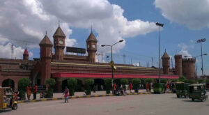
The railway station of Lahore was built during the British era. Its style reflects British architectural elegance.
Lahore railway station
The contract for the construction was given to Mian Muhammad Sultan Chugtai who was the prince of the Shahi Mughal regime. This railway station has 11 platforms. Platform 1 is fixed for Samjhoota Express which connects Pakistan with India.
52- Dai Anga Masjid
Dai Anga’s real name was Zaib-un-Nisa and he was the maid of Shah Jahan and the wife of Murad Khan. This beautiful building was built in 1635 and is situated near the Lahore railway station. In 1850, this building was used as a residence by the first historian of Lahore “Mr. Henry Cop”. In 1903, it was given back to Muslims.
53- Allama Iqbal Museum
This building was known as Javed Manzil. It is situated on Allam Iqbal Road (on a highway from Lahore railway station to Garhi Shaho) in front of Railway Hospital. Allama Iqbal spent rupees 42,025 on the construction of this building. Based on European architecture, it was completed in 1935. He lived there for three years.
In 1961, this building was transformed into a museum. Chief Justice of Pakistan Sheikh Anwar-ul-Haq inaugurated the museum on 1st December 1977. The main purpose of the museum was to highlight the services and life of Allama Iqbal.
Iqbal-Museum-Lahore
It has 10 galleries and related stuff from 1877 to 1938 is exhibited there. These 10 galleries have Iqbal’s drafts, poetry, letters, thanking notes, publications, documentation, educational certificates, medals, clothes, shoes, coat (wasket)of Cheeta’s skin, wristwatch, glasses, models of residence and educational institutes, and pictures. Guides are there to help tourists.
54- Kos Minaret
These minarets were built by great general Sher Shah Suri. They were built after every 3km on the General Road which stretched 3000 km from Peshawar to Bengal. They did not have any specific design rather they were like the brick kiln. All of them were demolished except the one in Karachi Phattak Laurence colony Garhi Shaho.
55- Hazrat Mian Mir
He was a great saint of Qadri Silsila. He was born in 1550 in Sewan Sharif. He came to Lahore at the age of 25 and settled here. He had a simple life and personality. King Jahangir and Shah Jahan were among their devotees.
According to Shah Jahan, Hazrat Mian Mir is one of them who gave him knowledge about God and religion. He was so popular that Sikhs asked him to lead the foundation of their golden temple. He died in 1635.
A part of his tomb was built by Dara Shikwa and another part was built by Aurangzeb. This shrine is built in a spacious area on a platform in Dharampura.
56- Tomb of Nadra Begum
Nadra Begum was the wife of the eldest son Dara Shikwa of king Shah Jahan. She was buried near the tomb of Hazrat Mian Mir according to her last will. She had great respect for him. This two-story square-shaped building is built on a platform. She was buried between Bara Dari and a large pond as in Hiran Minaret.
57- Khusboo Harmain Shahrefan Museum
This museum was established by Al-Haj Muhammad Hussain Gohar a few years ago. He collected holy items from Hijaz (sacred lands of Islam). These sacred pieces are exhibited in showcases, and closets along with their history.
The hair of Holy Prophet Muhammad ﷺ, coat, stick, shoe, a cover of Ka’ba, and objects related to the glorious Islamic historical past associated with holy mountains, plains, Khana Ka’ba, Masjid Nabi ﷺ, and Aab Zamzam well are exhibited there.
You have to go to bungalow number 235 triple road near Gol Bhag Shahad Bhag to feel the blessed atmosphere and enlighten your hearts. The museum is open on Sundays only. You can contact 0333- 4875522 before visiting.
58- Tomb of Ali Mardan Khan
Ali Murad Khan held great positions in the Era of Mughal Emperor Shah Jahan such as an expert Engineer, a High-ranking commander, the most trusted envoy, Governor of Kashmir, Governor Qandahar, and Chief of Kabul.
His services to the Mughal family are very commendable. The construction of Shalamar Bhag and bringing water from India by constructing a special canal to irrigate the garden are his marvelous jobs. He is buried in front of Singh Pura Sabzi Mandi.
59- Sharf-un-Nisa
The chief of Punjab Nawab Zakaria Khan’s daughter Sharf-un-Nisa never married. She used to say that she was married to Quran-e-Pak and sword. She owned a garden in Lahore and there was a minaret in the center of the garden.
She used to recite Qur’an at the top minaret and leave her sword and Qur’an Pak there. She was buried in the minaret according to her will. The Qur’an Pak and sword were also placed there and the doors of the minaret were sealed with bricks.
In the Sikh era, they demolished the minaret in search of treasure. They didn’t find anything except the Qur’an Pak and sword. They took it with them. Allama Iqbal appreciated Sharf-un-Nisa in Javed Nama and said that the glory of Muslims is with the Qur’an Pak and the sword.
Sharf-un-Nisa said that even if my tomb is without a dome and paint, it must have a Qur’an Pak and sword. This strange tower-shaped tomb in Begum Pura Lahore is at a height of 16 feet from the ground.
60- National Museum of Science of Technology
The construction of this museum started in 1965 and it was opened to the Public in 1976. Its purpose was to adopt traditional and unconventional methods to create interest in students and people towards the latest scientific inventions and knowledge.
National Museum of Science and Technology
This spacious building has two floors and four galleries. These four galleries have countless models to explain the basic principles of Science and Technology.
It has information related to Biology, Physics, Mathematics, Mechanical, Electronics, Meteorology, Satellites, Astrology, Computers, Minerals, Natural History, Mass Communications, Light, Trade, Zoology, Environment, and Earth Science. It is linked to the University of Engineering (UET).
61- Shalamar Bhag
According to the narrators, Shah Jahan had a dream about this garden. He selected a place for the construction of the Garden. The owner of that place Lehnga Khan refused to sell it and gave it to Shah Jahan as a gift.
Mughal king Shah Jahan constructed this garden for the recreation of the royal people and he led the foundation on 12th June 1641. The duty of its design was given to renowned designer Ali Mardan. He designed this garden in the Iranian architectural style.
A huge amount of Rs. 600,000 was spent on its construction. A canal was dug from Madhapur India which is 161 away from the garden.
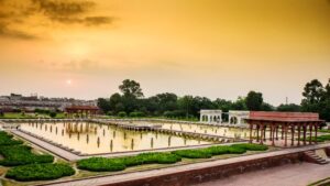
This garden has three sections. Their names are Farrukh Baksh, Faiz Baksh, and Hayat Baksh. The canal water was used to irrigate the garden, the middle part, and then the lower area of the garden. The upper ground has a lake and 105 fountains. The middle section has one lake and 152 fountains and the lower ground has a lake and 153 fountains. All these fountains are internally linked.
A beautiful sunset at Shalamar Garden, Lahore
The building consists of the following parts; Sawan Bhadon Pavilion, Naqarkhana, Dormitory, Bath, Aiwan, Resting Room, Queen’s Resting Room, Baradari, Diwan Khas & Aam, Two Large Domes, and Minaret in the Corners of the Garden.
In 1981, Shalamar Bhag is declared a UNESCO World Heritage Site. On the arrival of international delegations in Lahore, the lively people of Lahore arrange a grand dinner at Shala Mar Garden in their honor. Shala Mar Garden is situated 2km away from the engineering university on the left side of Wagah Road.
62- Yad-e- Gar Shuhda / The martyrs memorial
A beautiful martyrs memorial is built in front of Manawa police station on the road going from Shala Mar Bhag to Wagah. Three memorials are built in the park. The names of brave martyrs are engraved on these memorials who sacrificed their lives on different fronts.
63- Bata Pur Memorial
At the midnight between 5th and 6th September 1965, the Indian Armed Forces crossed Pakistan’s Borders without announcing war.
The Baloch 3 group was given the responsibility of defending the Wagah sector and the BRB canal bridge on GT Road from the enemy. The soldiers of this group fulfill their responsibilities with utmost bravery and great valor and stopped the enemy from crossing the BRB canal. This memorial is built in remembrance of this fight.
64- Bhaini Memorial
At the midnight between 5th and 6th September 1965, a fierce battle took place at Pando village’s Bhaini bridge due to the attack of the cunning enemy without any war announcement. The Baloch regiment blew up this bridge from Dynamite explosives as a defensive act. A memorial is built at this place to present an honor to this Gallantry awarded Baloch Battalion. It is located at Siphon Road 4 km away from Bata Pur.
65- Ravi Siphon
The river Ravi and the BRB canal cross at this point. The canal has been brought back to its former height by crossing the river. You have to go 3 km from the Bhaini memorial to view this splendid sight.
66- Wagah Border
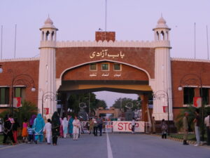
Wagah Border is situated on the old GT Road (built by Sher Shah Suri) going from Lahore to the Indian city Amar Taser near Wagah Village. This border is the central path for people traveling from Pakistan to India and for the transportation of goods.
A flag-raising ceremony is held daily in the evening at this border. Thousands of people from both countries gathered at their borders to enjoy this ceremony. Stairs are built there as in Stadium for watching the ceremony.
Wahga Border Lahore
During this ritual, national songs, and War Hymns are played to enhance patriotism. People raise slogans to support the defense force men. Their passion is matchless. They promote patriotism in people through their courage, bravery, and passion. Every Pakistani at Wagah Border shows his love for the country with every breath.
This border is 30 km away from Lahore. A bus from the Railway station goes straight to Wagah Border through Shala Mar Garden. The ceremony continued for 2 hours. To enjoy this ceremony to the fullest, reach there half an hour before Assar Prayer.
67- Sozo Water Park
This is the best water park in Lahore stretching up to an area of 25 acres. It is situated on the edge of a canal passing through the city near Jallo Park.
Sozo Water Park.
It is unique because of the latest water slides, swimming pools, and rides. There are separate portions for females and children. You can reach this park very easily. You can reach this park by any bus going towards Jallo Park. This park is at a distance of a 10-minute drive from Mall Road.
68- Jallo Park
It is also known as the Forest Research Center and is situated on the bank of the central canal of Lahore at a distance of 20 km from Jallo Village. It is a research center for various kinds of plants and trees.
This park has a small zoo for children, parks, playgrounds, water-theme parks, a playland, a swimming pool, a museum, and a souvenir shop.
Botanical garden at Jallo Park
There is a lake spreading over an area of 450 acres with a facility for sailing. It is the largest park in Lahore in terms of area. There are lush green trees and fresh grass everywhere.
You can enjoy a night’s stay in the huts of a tourist village. A camping site is also there. The TDCP information center is present. You can reach this park via Bus going to Jallo.
69- Tomb of Khan Jahan Bahadur
Khan Jahan Bahadur Jang Kokaltash is counted among the emperors of Aurangzeb Alamgir. He died in 1697. This building is in octagon shape and situated on an octagon platform. The prominent feature of this mosque is that trimmed bricks are used instead of Red Stones. This feature makes it unique in the buildings of that time. This tomb is located near Chowbacha Phatak.
70- Lahore Metro Bus Service
It is the second-largest city in Pakistan after Karachi with a population of more than 1.25 crores. The Punjab government established Metro Bus Authority to provide safe, better, and international-level means of transport to the citizens.
A 27 km long road is built from Gajomata to Shahdara with a huge amount of 30 billion. This project is initiated by this authority with the contribution of Turkey.
A special bridge is built from ground level to height every 8 km. There are 29 bus stops with shades, platforms, washrooms escalators, lifts, parks, ride stands, and mini-parks. Metro Bus Service has been started in Multan, Rawalpindi, and Islamabad. While a report is being prepared for Faisalabad.
71- Gaddafi Stadium Complex
It is located on Feroz Pur Road and is the largest playground in Pakistan. It was established in 1959. The first-ever cricket test match on this ground was played between Pakistan and Australia. It was named “Lahore Stadium”.
It was designed by architect Murat Khan. Its name was changed when Libyan president Muammar Qazzafi gave a speech in favor of Pakistan’s nuclear weapons during the second OIC Conference.
Gaddafi stadium
In 1995, it was redesigned by Nayyar Ali Dada. Qazzafi Stadium, Punjab Stadium, Hockey Stadium, Mini-Hockey Stadium, LCCA ground, Cycle drome, Punjabi Complex, Al-Hamra open-air theatre, and Pakistan’s Cricket Academy all are situated in a large area. Moreover, there are the best food courts. Horse Riding grounds are also there.
72- Chughtai Museum
Well-known painter Abdul Rehman was born on 21st September 1897. He introduced a unique art of its own kind named “Chughtai Art”.
No other artist can beat his level. He preferred to play with watercolors instead of Oil colors paintings. His topics of special interest were Islamic celebrities, Hindi, Dev Mala, Buddhism, Punjabi Farmers, Kashmiri agriculturalists, Bengali Sadhu, and Madrasai young girls. His paintings were exhibited in all countries of Europe.
The first-ever art exhibition in Pakistan’s history was held on 11th December 1949 and his pictures were exhibited there. He had a deep interest in literature and published two collections of fiction named “Lagan” and “Kajal”. The British Government gave him the title of “Khan Bahadur” for his services.
Chugtai Museum
Later on, the Government of Pakistan awarded him the honor of “Hilal-e-Istaqlal” and “Pride of Performance”. Chughtai was considered the greatest artist of modern Islamic art of the century.
His paintings are hung in UNO Headquarters, British Museum London, different Art centers and museums around the World, Pakistani government offices, and in the Presidency.
On 17th January 1975, after his death, his son Rehman Chughtai established Chughtai Art Home near the Chughtai Museum. This art home has valuable and rare pieces of art, many documents, and drafts related to art and research, and thousands of books and pictures.
To visit the Chughtai art home and museum, you have to go to Mian Saleh Lane 4 Garden Block, Garden Town near Kalma Chowk. You can contact 042- 35850733 for further queries and information.
73- Shakir Ali Museum
This museum was established on 27th January 1975 after the death of the famous painter Shakir Ali by the Pakistan National Council of Arts. The students of NCA (National College of Arts) transformed the home of Shakir Ali into a museum under the supervision of Nayyar Ali Dada.
The Government of Pakistan awarded him the honor of “Sitara-e-Imtiaz” and “Pride of Performance” for his services in the field of arts.
Shakir Ali Museum
Shakir Ali’s wristwatch, clothes, utensils, furniture, educational certificates, ID card, pictures of international personalities, glasses, and a Quran-e-Pak is exhibited there. Workshops for music, Art, Dance, Acting, and Painting are organized there. It is situated at 93 Tipu Block Garden Town.
74- The Lahore Heritage Club
Many people are busy restoring the historic and cultural status of Lahore. One of them is Tahir yazidani Malik. He has gathered a huge collection of historic, valuable, and rare Antiquities and organized them into a private museum. To become familiar with the culture of Punjab and Lahore you can contact the admin office at 0321-4372082.
75- Gulshan Iqbal Park
This park is situated in Allama Iqbal Town within 13 doors like Lahore city. Lush green lawns spread far and wide on irregular grounds and colorful flowers blooming everywhere are its identity.
Gulshan Iqbal Park Lahoe
There are playlands, jogging tracks, walking tracks, a cafeteria, a beautiful lake on an island, sailing and boating, a waterfall, canals, and beautiful birds in cages to satisfy your enjoyment.
76- Model Town Park
This famous park of Lahore is situated in the center of the elite area of Model Town. A fountain rising to the top from a pond in the center of the park presents an appealing view. People enjoy this view by sitting on the nearby benches.
This park with slides, swings, small bridges, and corridors is crowded with people every evening. Its jogging track is one of the famous tracks in Lahore.
77- Nawaz Sharif Park
This park is situated on Feroz Pur Road and stretches from the model town corner to the front of Children’s Hospital. It was a wide enough green belt in the era of Chief Minister Mian Muhammad Nawaz Sharif.
He paid special attention to the beauty and expansion of this park. The highest fountain in Lahore has been installed there. It stretches an area of 3 km and has jogging tracks, lakes, fountains, swings, and a mini zoo.
78- Race Course Park
It is a favorite place of people for a family picnic. The people in the family enjoy different games there. A high waterfall enhances the beauty of this park.
The spacious lush green lawns loaded with flowers attract tourists. Different programs are organized there at different festivals. The cart (baggie) and horse ride on solid track is an interesting hobby of people there. This park is situated on Jail Road in front of Services Hospital.
79- Chauburji
It is said that no place in the World is better than Lahore to observe and analyze closely the architectural style of the Mughals. The garden established by Mughal princess Zaib-un-Nisa was located at Chaubarji.
Chauburji, Lahore
The garden is deserted but the central door and the four Burj remain there. This small memorial is present there named “Chauberji”.
80- PIA Planetarium
The museum PIA Planetarium of the national airline of Pakistan named Pakistan International Airlines (PIA) is located near Chauberji.
It was established in 1987 with the objective to provide scientific information to citizens and especially students.
This museum has a Bowing airplane and a Sky-Dom Hall. You can acquire information related to the Solar System’s ancient and latest trends through a slideshow in the large Sky-dome Hall.
People sitting on the airplane seats are informed about the space through the sound effects created by an artificial spaceplane.
PIA Planetarium
You can get information about the internal operations of the airplane from the bowing plane on the green lawn. You have to buy a separate ticket for Airplane and Planetarium.
81- Major Shabbir Sharif Shaheed (Nishan-e-Haider)
Major Shabbir Sharif was born to Major Muhammad Sharif (a Rajput Family) on 28th April 1943 in the district Gujrat. He got his education in different schools in Lahore, Quetta, Murree, and Rawalpindi. While he was studying at Government College Lahore, he joined PMA Kakol.
In 1964, he got a commission in the army. He was awarded the “Sword of Honor” in the passing out parade. In September 1965, he was awarded “Sitara-e-Jurat” on the front of Chumb Joriyan (Iftekhar Abad).
In December 1971 war, he was appointed to the Sulemanki sector. He reached a distance of 2km while attacking the enemy. On 6th December, a bullet from the enemy side hit him. He was martyred. He was awarded “Nishan-e-Haider” for his matchless bravery and courageousness.
He is buried in the graveyard of Miani Sahib near Chauberji. There is a grave of Ghazi Ilm-ud-din on the other side of the road.
82- Zaib-un-Nisa’s Tomb
Princess Zaib-un-Nisa was the daughter of Aurangzeb and Persian lady Dil Ras Bano. She was a pious lady, Hafiz-e- Quran, a scholar, and a poetess of the Persian language.
She worked for the development of Lahore and built the Chauberji Garden. Its boundary was stretched till Nawan Kot at that time. This tomb was a part of this garden. The English translation of his poems is included in the “Wisdom of the East”.
The tomb of this Mughal Princess is located beyond Chauberji’s neat Zaib-un-Nisa stop at Multan Road.
83- The Museum of Puppetry
Rafi Pir theater workshop is the largest and oldest puppet company in Pakistan.
In 1992, the first international festival of the puppet was organized, and Rafi Pir Theater took part in it. This exhibition got a tremendous response and the administration department contacted the puppet companies around the world.
Sculptures in Puppetry Museum Lahore
At last, on 14th January 2004, they inaugurated the first Puppet Museum of Pakistan. Surrounding an area of one acre, this beautiful building has three floors and halls. The puppets of more than fifty countries are placed there. These puppets depict the local culture of the countries.
The students of different schools visit there, and they are shown the puppet show full of fun and amusement.
Besides this, people are trained related to a training program, dance, and music. In the international festivals that are organized from time to time, the local artists of Pakistan and different countries perform in different departments of arts.
A special department named “Art and craft village” is established to promote the regional culture of Pakistan. The skilled workers of Art, embroidery, handicrafts, woodcarving and many other art fields are gathered there.
There are 11 studio shops and two art galleries for this purpose. In Peeru’s café, in addition to the food variety, Sufi Music night, Ghazal night, Qwali night, and Sunday Family Man are organized there. To enjoy this, you have to go to 7km on Raiwind road 1- green acre farm housing society.
84- Safari Park
Safari Park is a worth-watching place other than the central zoo in Lahore. A lot of animals are placed in a large spacious thick green ground. The most prominent feature of this park is Line Safari and Tiger Safari.
You enter through a gate by sitting in a closed vehicle. By traveling on the paved roads, you can see lions and tigers roaming in the open environment. Passing through these paths is an adventure.
You can’t forget the thrill of these moments. Furthermore, a large Aviary is built for birds. There is also a playland for children. This park is 10 km away from the puppet museum. You can reach this park through the bus and wagon going to Raiwind.
85- Rana Resort
This resort is furnished with the best facilities for family events and is situated on the road from Lahore to Multan, 15 km from Bhai Phero near the Balloki head.
You can enjoy Jungle Safari Day and night there. It has a facility of luxury rooms and a tent village. This resort is safe and secure and the boundaries have electric current.
This resort surrounds an area of 250 acres and 2.5 lac trees are planted there. There are 6 miles long canals and an 8-mile-long jogging track.
A charming view of Rana Resort
Ladies beach volleyball, dancing floors, Japanese restaurant, sculptures of different animals, meeting hall, swimming pools, luxury bedrooms, safari train, horse riding, Pink Flamingoes, rare Dalmatian dogs, more than 500 deer of different kinds, more than 200 peacocks, and a water Avery enhance the beauty of this place.
Surrounded by thick green trees, a bone fire party on a starry night is an unforgettable experience. You can do fishing there. you can contact these numbers for the reservation of huts. 042-35713880/ 0300-4828630.
86- Changa Manga Forest (Park)
It is said that in the eighteenth century, there used to live two robbers’ brothers named Changa and Manga. They used to hide in the naturally grown trees of berries after the robbery.
This jungle was named after them because of their fear. When steam engines were introduced to the subcontinent’s railways, there was a need for coal for engines’ fuel. To meet the need for fuel, Shisham, mulberry, hyacinth, and lilac trees were planted. The trees were watered through wells especially dug for this purpose.
After the initiation of the canal system, these canals were used for irrigation purposes. This jungle was built in 1865, and it is the largest man-made artificial jungle in the world.
It surrounds an area of 12,000 acres. In 1960, the government of Pakistan transformed this jungle into a recreational park. A national park, zoo, swimming pools, a children’s park, children’s playland, rich green lawns, and many other recreational spots are built there.
Lush Green trees, Changa Manga Lahore
A prominent feature of this park is the facility of both automatic boats and row-boat is available there in the Mehtabi lake. Moreover, the oldest steam railway engine in the world is there. The forest express(train) operated on steam is there for traveling across the jungle.
A TDCP’s tourist resort equipped with all facilities and an information center is located in the jungle for a stay. This park is located 80 km away from Lahore on Multan Road near Bhai Phero. You can reach there through wagons in the different bus stands of Lahore.
Across the River Ravi
87- Kamran Bara Dari
Kamran baradari and Lahore Bagh are among the oldest Mughal buildings. It was built by the son of King Babar’s son Mirza Kamran in 1520 when he ruled Lahore.
At that time, the Ravi used to flow about 2km away from Bara Dari and Bhag. There were gardens of many chiefs between Kamran Garden and the river Ravi. This garden and Bara Dari were built by Kamran as a summer season residence.
Kamran Bara Dari
During king Muhammad Shah’s regime, the Ravi changed its path. All the gardens including a part of this garden were destroyed. This building is located in between Ravi as a heightened island. This garden is the best tourist spot.
88- The tomb of Noor Jahan
Queen Noor Jahan is the only queen in the Mughal regime whose name was engraved on the coins. She had control over Jahangir’s heart and mind. The king would do whatever he said. From the womb of this woman, the king had no children. They had a daughter only named Shera Fagan.
She used to live alone after the death of Jahangir. Shah Jahan fixed 2 lacs as an annual grant for her. She had distributed all the money among the poor, needy, destitute, and orphans. A huge amount of money was spent on the marriage of poor young girls.
She died on 18th December 1645. She was buried in the mausoleum built by her in her own garden. Her daughter is also buried there. There are two graves in the hall but they are buried in the basements.
The magnificent building of Noor Jahan’s tomb
Noor Jahan used to say that she is afraid of the dark. She willed that instead of burying me in the grave, I should be put in a coffin and the coffin should be hung from the ceiling of the basement. Around the basement, she made a tunnel-like path for the distant light and placed the skylights so that the first and last rays of the sun must fall on the grave.
A tunnel went to Jahangir’s tomb and another went to Shahi Fort. They are closed now. During the Sikh’s invasion, they took off the coffin and jewelry and buried the coffin in the ground. You’ll reach the shrine in 3 minutes from Shahdara.
89- Jahangir’s tomb
The place where Jahangir’s mausoleum is located was actually a garden owned by Jahangir’s wife, Queen Noor Jahan, whose name was Dilaksha Bagh.
The emperor Jahangir died in 1627 at the place of Rajouri on his way from Kashmir to Lahore. The son and successor of Jahangir, King Shah Jahan built this tomb at a huge cost of 10 lacs in ten years.
This mausoleum is a beautiful historical building. And it is proof of the rich history of Lahore. After Taj Mahal Agra, the Mughal architecture seems to be at its peak here. This building has only one floor with a square-shaped architecture.
Emperor Jahangir’s tomb, a fine piece of Mughal’s architecture
This building is constructed at a height of 4 feet. Red stone has been used on the front and on the lower side of minarets. And this stone is also used to decorate marble.
At the four corners are octagonal five-story towers about 100 feet high. The amulet of the tomb is engraved with stones and the ninety-nine attributes of Allah are inscribed.
Lehnga Khan severely damaged the tomb. Ranjeet Singh uprooted the valuable stones and used them in the Sikh Gurdwara in Amritsar.
French General Amice used this building as his residence during the Sikh reign. The British Government renovated this tomb in 1889-90.
After the creation of Pakistan, its reformation continued from time to time. Akbari Inn, the tomb of Asif Jah, and Jahangir’s tomb are linked to each other and situated on the other side of the Railway line. Its picture is printed on one thousand rupees note.
90- Akbari Inn
A row of rooms spread around the four sides between the Jahangir’s tomb and Asif’s mausoleum is called Akbari Sarai. A historian of king Shah Jahan’s court Mulla Abdul Hameed called this place “Jalwa Roza Khana” in his book “Badshah Nama”. It means an attached enclosure of a mausoleum.
Akbari Inn
The inn is surrounded by a high platform with 180 small rooms. There is a veranda in front of every room. Two big doors based on Mughal architecture style are built on the North and Southside of the Inn.
The arts and the architecture on the doors revealed that there were two purposes behind the construction of this inn. The first reason was to provide a stay to the tourists. The second reason was to provide convenience for the staff assigned to maintain the mausoleum.
There is a splendid mosque with three domes between the rooms on the western side of the inn. On the outer side of the mosque, red stone is placed and it is decorated with marble. The interior of the mosque is decorated with carvings.
Ranjeet Singh transformed this inn into an army cantonment. A foreign General Mousa Frangi lived in this inn with his Platoon.
91- Tomb of Asif Jah
His real name was Mirza Abul Hassan. He was the brother of Queen Noor Jahan and the father of Queen Mumtaz Mahal. Jahangir appointed him as the Governor of Lahore in 1625 and gave him the title of Asif Jah.
He was given this title because of his courage and wisdom. He enabled the king Jahangir to conquer India. Shah Jahan also admired him.
In 1641, he was buried in front of Jahangir’s tomb. Built at a cost of Rs 2 million, the mausoleum was octagonal. It used to be counted among the beautiful and majestic tombs of Lahore. It was famous all over the world for its art. It is located at the back of Akbari Inn.
Shopping
Anarkali Bazaar, Gulberg, Liberty market, Main Boulevard Gulberg, Allama Iqbal Town, Ichra Bazar, Rang Mahal, Shah Alam Market, Mall Road, Panorama, and Fortress are the best shopping sites.
92- Small Industries Pakistan and Handicrafts Shop
Small and local industry is considered the backbone of the economic progress of any country. The cottage industry, a department of small industries, plays an important role in the progress of the country.
The domestic industry is the source of income for the major population of the country and department of the handicrafts is one of the important sections. The government of Pakistan has established small industries department for the promotion of this sector.
High-quality home crafts are sold in these departments and shops. These stores are present all across the country. These are, in fact, government-run departmental custody shops.
Pakistani handicrafts exhibition at the Chinese Embassy
The people living in different areas of Pakistan have different lifestyles and they use different handicrafts according to their geographical location.
One of the reasons for different kinds of crafts in Pakistan is the availability of raw materials in that region. A variety of domestic and industrial stuff is exhibited in these shops. You will find it hard to choose between a wide variety of items.
Domestic furniture, bedsheets, beds, cutlery, handmade clothes, and a lot of other stuff is exhibited there.
Given below is a list of different centers in different cities in Pakistan
23 Davis Road Lahore Ph: 042-36364109
Departure lounge Allama Iqbal International airport Lahore Ph: 042-99240463
Pindi club building the mall Rawalpindi Cantt Ph: 051- 9270084-5
Rizwan Plaza Blue area Islamabad Ph: 051- 9217288
Mall of Muree near Marhaba Restaurant Ph: 051- 3410049
Patriata New Murree
P.C Bhurban Muree Ph: 051- 3355700-ext-2552
Quid-e-Azam Shopping center no 4 Multan Cantt Ph: 061-9200709
Lahore is a center of political, educational, tourism, food, and trade. It is considered the backbone of the economy of Pakistan. The UNESCO World Heritage Sites, Parks, Museums, and many other tourist spots make it a favorite place for the explorers. In short, it is the “Cultural Heart of Pakistan”.
During the laying of the railway line from Multan to Lahore, the excavations at 148 km from Multan and 20km before Sahiwal gave the signs of archaeological sites.
The city Harappa was discovered there. However, research was done after 70 years on a Scientific basis.
These signs revealed that the Harappa civilization was a developed community. The map of the city was designed with a proper strategy.
Harappa, near Sahiwal Pakistan
There were solid bricks houses, washrooms, spacious streets, houses in a row, sewerage systems in accordance with the principles of health. Covered pipes, grain storage places, farmers’ residents, wells, metal smelters, bricks and pots kilns, metal seals, colorful embroidered pots, and women’s jewelry of Gold and silver revealed their way of living. All these items and signs give a clue that the people were well settled, skilled, and experts.
Hari Yopia city in Rigveda is actually Harappa city. It has the meaning of a city with the pillars of sacrifice in Sanskrit.
The civilization was divided into many parts. There were defensive walls surrounding the city. There are signs of their foundations. There were big doors for the entrance. The population was dispersed over a large area. The trees discovered during ages have lives of thousands of years.
The river Ravi is flowing 10 km away from the Harappa site.
Key info about the Archaeological Site of Harappa
Heading
Information
Name
Archaeological Site of Harappa
Location
Punjab, Pakistan
Coordinates
30.6228° N latitude, 72.6795° E longitude
Period
Mature Harappan Civilization (3300–1300 BCE)
Excavation Year
Discovered in the 1920s; Excavations ongoing
Significance
One of the major urban centers of the ancient Indus Valley Civilization
Layout and Ruins
Grid-patterned city with well-planned streets and advanced drainage system
Artifacts
Numerous artifacts, including seals, pottery, tools, and figurines
Great Bath
Notable structure with evidence of a sophisticated water management system
Trade and Culture
Indications of trade with other civilizations, suggesting a rich cultural exchange
Historical Context
Flourished alongside Mohenjo-daro and other Harappan cities during the Bronze Age
Current Status
UNESCO World Heritage Site; Protected archaeological site
Museum
Harappa Museum nearby showcasing artifacts and providing historical context
Challenges
Preservation efforts due to weathering and urbanization; Conservation projects ongoing
Research Opportunities
Ongoing archaeological research to uncover more about Harappan civilization
Accessibility
Open to tourists and researchers; guided tours available
Historical Significance
Harappa was a thriving urban center of the ancient Indus Valley Civilization, known for its advanced city planning, intricate architecture, and a complex social structure. The civilization, contemporaneous with ancient Mesopotamia and Egypt, flourished in the Bronze Age.
Harappa Museum
The department of archaeology has built a museum there.
Harappa museum.
This museum has items discovered from Harappa such as sports items, mud sculptures, oysters, snails, pearls, agricultural stuff, Ivory, and deer horns, different kinds of utensils, bone seals, wine stuff, children’s toys, arts on the pots, human skeleton, pearl’s necklace, valuable stones, and jewelry. A brief history is also described there.
A rest house is there for tourists.
Unveiling the Mysteries of Harappa
The Archaeological Site of Harappa, nestled in the fertile plains of Punjab, Pakistan, stands as a silent testimony to the grandeur of one of the world’s oldest civilizations—the Indus Valley Civilization. Discovered in the early 20th century, Harappa, along with Mohenjo-daro, offers a captivating glimpse into a sophisticated urban culture that flourished around 3300–1300 BCE.
Name and Location
The Archaeological Site of Harappa is named after the modern-day village of Harappa, located in Punjab. Situated along the banks of the Ravi River, Harappa is one of the most significant archaeological sites in South Asia.
Excavation and Discoveries
The site gained global attention in the 1920s when British archaeologist Sir John Marshall initiated excavations. The meticulous excavation revealed a meticulously planned city with a grid layout, well-laid streets, and advanced drainage systems. Notable discoveries included seals, pottery, tools, figurines, and the iconic “Dancing Girl” statuette.
City Layout and Architecture
Harappa’s city layout was remarkably advanced for its time. The grid-patterned streets were indicative of a sophisticated urban planning system. The city featured multi-roomed houses made of kiln-baked bricks, a testament to the architectural prowess of its inhabitants. The Great Bath, a large public structure with evidence of an intricate water management system, stands as an engineering marvel.
Artifacts and Cultural Significance
Artifacts found at Harappa provide insight into the daily life, culture, and trade of the Indus Valley people. The discovery of seals with a yet-to-be-deciphered script, pottery with intricate designs, and various tools suggests a highly developed and organized society. The Great Bath, believed to have had ritualistic and cleansing purposes, showcases the cultural and religious practices of the civilization.
Trade and Connections
Harappa’s artifacts reveal a civilization engaged in extensive trade with Mesopotamia and other contemporary cultures. The seals, for instance, have been found in locations far from the Indus Valley, suggesting a vast trade network and cultural exchange.
Challenges and Preservation Efforts
Harappa faces challenges due to weathering, urbanization, and the passage of time. Preservation efforts are ongoing to protect the archaeological remains. Conservation projects aim to strike a balance between public access and safeguarding this invaluable site for future generations.
Museum and Research Opportunities
Adjacent to the archaeological site is the Harappa Museum, a repository of artifacts and a hub for research. Ongoing archaeological excavations and studies provide continuous opportunities for scholars to unravel more about the Indus Valley Civilization.
UNESCO World Heritage Site
In acknowledgment of its immense historical significance, Harappa was designated a UNESCO World Heritage Site in 1980, recognizing its contribution to human history and understanding of ancient civilizations.
Visiting the Archaeological Site of Harappa is like stepping back in time, where the remnants of an advanced civilization whisper stories of innovation, cultural richness, and the human spirit’s eternal quest for knowledge. Harappa remains a mesmerizing testament to the achievements of our ancient ancestors and an enduring source of fascination for archaeologists, historians, and curious travelers alike.
Notable historical sites of Harappa
Great Bath
The Great Bath is an iconic structure, central to Harappa’s historical significance. This large, rectangular tank, with steps leading down to the water, is believed to have had ritualistic and cleansing purposes. The engineering marvel of the Great Bath reflects the advanced water management systems of the Indus Valley Civilization.
Residential Quarters
The excavated residential areas of Harappa reveal the city’s urban planning and architectural prowess. Multi-roomed houses made of kiln-baked bricks demonstrate a level of sophistication in construction, offering insights into the daily lives of the ancient inhabitants.
Assembly Hall
An Assembly Hall, or a large public building, was discovered during excavations. While the exact purpose of this structure is not definitively known, its size and design suggest a place for communal gatherings, possibly for administrative or ceremonial functions.
Marketplace
Evidence of a marketplace with well-defined stalls and storage areas indicates a thriving economic system. The presence of weights and measures suggests a regulated and organized trade environment, emphasizing Harappa’s role as a significant trade center.
Granaries
Harappa features granaries, indicative of the civilization’s agricultural practices and food storage methods. The design of these granaries suggests an understanding of efficient storage and distribution of surplus grains, critical for sustaining a large urban population.
Citadel
The citadel area, elevated above the lower town, housed some of the major structures, including the Great Bath and the Assembly Hall. The citadel’s strategic placement reflects a hierarchical organization of space within the city.
City Walls and Gates
The presence of well-defined city walls and gates showcases a level of urban planning aimed at securing the city. These defensive structures are evidence of the organized layout and concern for the safety of the inhabitants.
Cemetery
Harappa’s cemetery, located outside the city walls, provides insights into burial practices and possibly the religious beliefs of the people. Discoveries of burial sites with various funerary practices contribute to the understanding of the civilization’s cultural and spiritual aspects.
Frequently Asked Questions (FAQs)
Q: What is the Archaeological Site of Harappa?
A: The Archaeological Site of Harappa is an ancient city, part of the Indus Valley Civilization, dating back to around 3300–1300 BCE. It is a UNESCO World Heritage Site located in Punjab, Pakistan.
Q: How was Harappa discovered?
A: Harappa was discovered in the 1920s during excavations led by British archaeologist Sir John Marshall. The site’s significance became evident as artifacts and structures were unearthed.
Q: What makes Harappa historically significant?
A: Harappa is historically significant as one of the major urban centers of the ancient Indus Valley Civilization. Its well-planned city layout, advanced architecture, and artifacts provide insights into early urban life.
Q: What are the key structures at Harappa?
A: The Great Bath, residential quarters, assembly hall, marketplace, granaries, city walls, gates, and a cemetery are among the key structures and areas excavated at Harappa.
Q: What is the significance of the Great Bath?
A: The Great Bath is a large rectangular tank believed to have had ritualistic and cleansing purposes. It is an engineering marvel showcasing the advanced water management skills of the civilization.
Q: Were there cultural exchanges with other civilizations?
A: Yes, artifacts found at Harappa, including seals, suggest trade and cultural exchanges with Mesopotamia and other contemporary civilizations.
Q: What is the significance of the seals found at Harappa?
A: The seals found at Harappa bear yet-to-be-deciphered scripts and are indicative of administrative functions. They are also evidence of long-distance trade.
Q: Are there challenges in preserving Harappa?
A: Yes, Harappa faces challenges such as weathering, urbanization, and the need for conservation. Ongoing efforts aim to balance public access with the preservation of this archaeological site.
Q: Is there a museum at Harappa?
A: Yes, there is the Harappa Museum adjacent to the archaeological site. The museum houses artifacts and provides historical context to enhance visitors’ understanding.
Q: Can tourists visit Harappa?
A: Yes, Harappa is open to tourists, and guided tours are available. Visitors can explore the historical structures and artifacts that offer insights into the Indus Valley Civilization.
Last Thoughts on Harappa
In the windswept plains of Punjab, the Archaeological Site of Harappa stands as a silent storyteller of a civilization lost to time. Its well-planned streets, intricate structures, and enigmatic artifacts provide a window into the ingenuity and cultural richness of the ancient Indus Valley people.
Preserved amidst the challenges of modernity, Harappa invites visitors to embark on a journey through history, where each brick and artifact whispers tales of a bygone era, leaving an indelible mark on the canvas of human heritage.
Sahiwal city is situated on the GT road 169 km from Multan city.
It is counted among the ancient areas. The river Ravi flows in the northwest of Sahiwal and the river Sutlej flows in the southeast. Before, the Mughal regime, Depal Pur was the capital of this area.
When the Britishers occupied Punjab, they declared Pakpattan as district headquarter. After some time, the offices were again shifted to Sahiwal. At that time, Montgomery was the governor of Punjab. This city was named Montgomery. On 16th November 1966, its old name was reinstated.
Sahiwal
It is considered one of the best districts for agriculture. About 80 % of the skilled persons in the confectionery and biscuit industry belonged to this area.
It is the twin city of Manchester’s town named Rochdale. A milestone of Sahiwal is installed in the central area of Rochdale.
A stadium, auditorium, Majeed Amjad Park, Chaman Zar Park are famous places.
Key Info about Sahiwal PK
Heading
Information
Name
Sahiwal
Location
Punjab, Pakistan
Coordinates
30.6727° N latitude, 73.1067° E longitude
Population
Approximately 1.6 million
District
Sahiwal District
Province
Punjab
Official Language
Urdu, Punjabi
Major Industries
Agriculture, Livestock, Textiles, Power Generation
Climate
Hot summers, mild winters
Education
Sahiwal hosts several schools, colleges, and a university
Economy
Agriculture-based, with emerging industrial sectors
Transportation
Well-connected by road and rail networks
Cultural Sites
Historical mosques, shrines, and local festivals
Tourist Attractions
Parks, gardens, and local markets
Notable Feature
Known for Sahiwal breed of cattle
Local Cuisine
Traditional Punjabi cuisine with local flavors
Healthcare
Hospitals and healthcare facilities available
Festivals
Celebrates major Islamic and local festivals
Exploring The Sahiwal
Cultural Heritage
Sahiwal, with its historical mosques and shrines, echoes the cultural tapestry of Punjab. The city comes alive during local festivals, where the spirit of celebration reverberates through its markets and streets. Residents proudly uphold the traditions of Bhangra and other folk dances, adding a colorful dimension to Sahiwal’s cultural identity.
Economic Landscape
Agriculture is the lifeblood of Sahiwal’s economy. The fertile lands surrounding the city support a thriving agricultural sector, with a focus on crops, livestock, and the renowned Sahiwal breed of cattle. In recent years, Sahiwal has also seen emerging sectors such as textiles and power generation, contributing to economic diversification.
Tourist Attractions
Sahiwal offers a blend of natural and cultural attractions. Parks and gardens provide serene spaces for relaxation, while local markets showcase the vibrancy of daily life. The city’s architectural heritage, with historical mosques and shrines, invites exploration by those interested in the history and culture of the region.
Sahiwal Breed of Cattle
A distinctive feature of Sahiwal is the renowned Sahiwal breed of cattle. Known for its high milk-producing capability and adaptability to local conditions, this breed plays a significant role in the city’s agricultural landscape. The Sahiwal cattle breed has garnered recognition not only locally but also internationally.
Tourist attractions in Sahiwal
Qadir Stadium
Qadir Stadium is a prominent sports venue in Sahiwal, hosting various local and regional sports events. It is a hub of activity and a great place for sports enthusiasts.
Sahiwal Zoo
Sahiwal Zoo is a popular spot for families and animal lovers. It houses a variety of species, providing an educational and recreational experience for visitors.
Jinnah Park
Jinnah Park is a serene green space in the heart of Sahiwal, offering a relaxing environment for picnics, walks, and recreational activities.
Local Markets
Sahiwal’s local markets, such as the main bazaar and others, offer a lively and vibrant atmosphere. Visitors can explore these markets to experience the local culture, buy traditional crafts, and savor local flavors.
Famous Schools in Sahiwal
Bloomfield Hall School
The Educators Sahiwal Campus
Government Comprehensive High School
Notable Colleges in Sahiwal
Government College Sahiwal
Sahiwal Medical College
Punjab College Sahiwal
Prominent Hospitals in Sahiwal
Sahiwal Medical Complex
Farooq Hospital Sahiwal
DHQ Teaching Hospital Sahiwal
Popular Restaurants in Sahiwal
Salt Bae Sahiwal
Zaiqa Restaurant
Bundoo Khan Sahiwal
Food Street Sahiwal
Frequently Asked Questions
Q: What is the significance of the Sahiwal breed of cattle?
A: The Sahiwal breed is known for its high milk yield and adaptability to local conditions, making it a vital part of Sahiwal’s agricultural landscape.
Q: How is Sahiwal contributing to economic diversification?
A: While agriculture remains central, Sahiwal has seen the emergence of sectors such as textiles and power generation, contributing to economic diversification.
Q: What are the cultural highlights of Sahiwal?
A: Sahiwal celebrates local festivals with enthusiasm, showcasing traditional dances like Bhangra. The city’s historical mosques and shrines add to its cultural richness.
Q: What educational opportunities are available in Sahiwal?
A: Sahiwal offers a robust education system, with schools, colleges, and the University of Sahiwal providing a diverse range of educational opportunities.
Q: How is Sahiwal addressing healthcare needs?
A: Sahiwal has established hospitals and healthcare facilities to ensure access to quality medical services for its residents.
Q: Are there tourist attractions in Sahiwal?
A: Yes, Sahiwal offers parks, gardens, and historical sites for visitors. Local markets also provide a glimpse into the city’s daily life and culture.
Last Thoughts on Sahiwal
Sahiwal emerges not only as an agricultural hub but as a city that treasures its cultural heritage, invests in education, and embraces economic diversification. Its unique blend of tradition and progress positions Sahiwal as a city of dynamic growth and rich possibilities.
The recreational place of “Gokurt” is 90km from Quetta and 30 km from Sibi.
Surrounded by lush green trees, Gokurt canal has water coming from Kerna, Pir Gaib, and Bibi Nani areas. It is the best picnic spot for people fond of recreation.Nestled in the southwestern region of Pakistan, Balochistan unveils a cultural tapestry rich in history and tradition, with one of its distinctive threads being the enchanting town of Gokurt. This hidden gem, set against the rugged backdrop of the Balochistan landscape, beckons with a unique blend of ancient charm and contemporary allure.
Gokurt, like a well-kept secret, boasts a character shaped by its people, history, and the breathtaking vistas that surround it. As the gateway to a realm of untold stories and unparalleled beauty, Gokurt stands as a testament to the captivating diversity that defines the heart of Balochistan.
A Natural Paradise
Gokurt finds itself ensconced by majestic mountain ranges, fertile valleys, and meandering rivers. The Bolan River gracefully courses through the heart of the town, bestowing upon it a lush oasis amid the otherwise arid surroundings. Gokurt’s ecosystem is further enriched by an assortment of wildlife, featuring diverse avian species, mammals, and reptiles.
Tracing Historical Footsteps
The Bolan Pass, an age-old trade route, has etched a profound historical narrative, and Gokurt plays a pivotal role in this epic. The town hosts a plethora of historical sites, including the Bibi Nani Pass dating back to the Mughal era and the steadfast Mach Fort, an enduring relic from the British colonial period.
A Cultural Kaleidoscope
Gokurt is a melting pot of Baloch, Pashtuns, and various other ethnic communities, each contributing a unique strand to the town’s cultural fabric. These distinct traditions are vividly mirrored in the local cuisine, music, and art, offering a vibrant and diverse cultural experience.
Current Travel Information
Gokurt is a safe and inviting destination for both domestic and international travelers. The ideal time to explore this hidden gem is during the temperate seasons of spring and fall when the weather is most agreeable. The town is readily accessible via road and rail from Quetta and other major cities in Pakistan.
Attractions in Gokurt
Embark on a journey through the captivating Bolan Pass and soak in the breathtaking vistas.
Glide along the Bolan River with a memorable boat trip.
Immerse yourself in history by visiting the time-honored sites of Bibi Nani Pass and Mach Fort.
Delve into the vibrant cultures and traditions of the Baloch, Pashtuns, and other communities that call Gokurt home.
Savor the local cuisine, which tantalizes taste buds with fresh meats, seasonal vegetables, and an array of aromatic spices.
Frequently Asked Questions
Is Gokurt a safe destination for travelers?
Yes, Gokurt is a secure place to visit, welcoming both local and international tourists.
When is the best time to explore Gokurt?
The optimal seasons for a Gokurt adventure are spring and fall, offering mild and pleasant weather conditions.
How can I reach Gokurt?
Gokurt is conveniently accessible by road and rail from Quetta and other major urban centers in Pakistan.
Windup-lines
Gokurt, a well-kept secret of Pakistan, beckons travelers to experience its unrivaled natural beauty, delve into its rich historical tapestry, and immerse themselves in its diverse cultural heritage. This town is a sanctuary of safety and warmth, extending its arms to visitors from all corners of the globe. For a travel experience that is genuinely unique and unforgettable, Gokurt is a must-visit destination.
Vehari is about 100km from the city of saints Multan. It is a historical city and the hometown of a famous personality, Major Muhammad Tufail. It is the district headquarters of three districts Burewala, Mailsi, and Vehari. Vehari is famous for the production of cotton.
Key Info About Vehari
Category
Information
Location
Vehari, Punjab, Pakistan
Population
Approximately 275,000
Area
1,367 square kilometers (528 sq mi)
Coordinates
30.0333° N latitude, 72.3333° E longitude
District
Vehari District
Language
Punjabi, Urdu, and English
Economy
Agriculture, commerce, and trade
Major Crops
Cotton, wheat, sugarcane, and rice
Transportation
Road and rail networks
Education
Several schools and colleges
Healthcare
Hospitals and medical facilities
Notable Places
Jinnah Stadium, Jamia Masjid, and Vehari Fort
Local Festivals
Eid, Basant, and local fairs
Culture
Rich cultural heritage with traditional music and dance
Administration
Vehari is divided into several Union Councils for local governance
Industries
Agriculture, textiles, and small-scale manufacturing
Tourism
Historical sites and parks
Transportation
Road network well-connected to other cities in Punjab
Climate
Hot and arid, experiencing extreme temperatures in summer
Major Highways
Multan Road (N5) and Vehari-Multan Road
Airport
The nearest airport is Multan International Airport (around 100 km away)
Historical Significance of Vehari
Vehari, with its roots extending deep into history, has witnessed various epochs and played a role in shaping the cultural and socio-economic landscape of the region.
The city stands as a testament to the historical richness of Punjab. Over the years, Vehari has been a crossroads for trade and commerce, connecting different regions and cultures. Its historical significance is often reflected in the architecture of mosques, shrines, and other structures that bear witness to the city’s evolution.
The city’s past is intricately linked to the broader history of the Indian subcontinent, particularly during periods of Mughal and British rule. The remnants of historical sites not only serve as architectural wonders but also as windows into the cultural amalgamation that defines Vehari.
Some Famous Personalities
Minhaj-ul-Quran Vehari
Major Muhammad Tufail Shaheed (Nishan -e- Haider)
He was born on 22nd July 1914 in Hoshiarpur eastern Punjab. He did his F.A. from the Government College Jalander and joined the army. In 1947, he got promoted to a Major. After the creation of Pakistan, his father molvi Meraj-ud-din shifted to Sahiwal Chak # 253-EB with his family.
In June 1958, he was transferred to East Pakistan rifles. On 2nd August 1958, the Indian Army occupied a frontier village named “Lakshmi Pur” in Brahman Barya in Eastern Pakistan. Major Tufail was given the task of liberating this area.
Major Muhammad Tufail Shaheed’s Tomb
On 6th August, he attacked this area with proper planning. The enemy was alert. During the advancement, machine gun bullets hit him at a distance of 10 yards in exchange for firing. He continued to fight despite being injured. He stopped the enemy by firing a bomb at the enemy’s machine gun.
During the fight, the Indian army corps fled away. Major Muhammad Tufail was admitted to CMH Kumala and he was martyred during the surgery. On 8th August 1958, he was buried in his village Chak # 253 EB Tehsil Burewala district Vehari.
He was awarded “Nishan -e- Haider”. The chak name was changed to Tufail Abad.
It is located 147 km from Multan.
Masood Jhandir Library
The largest private library in Pakistan is probably the one that is 12 km from Mailsi District Vehari and situated in a small town named Sardar Pur Jhandir.
A landlord of this area named Malik Ghulam Muhammad Chogta had a deep love and passion for books. He was a scholar and poet. In 1890, he led the foundation of a library.
After the death of Malik Ghulam Muhammad, his son-in-law Mian Sardar Muhammad Jhundair took the charge of the library.
Later on, his three sons made this library the biggest private library in Pakistan.
It has more than two lac books, including English and Eastern languages books, novels, and magazines. These books cover almost every topic.
Masood Jhandir Library
Quran -e- Pak in more than 30 languages are kept there.
In addition to this, numerous valuable archives are there. It is a references library and books are not issued. Proper arrangements are done for the accommodation of research scholars.
Culture and Traditions
Cultural Mosaic
Vehari boasts a diverse cultural mosaic, shaped by the traditions of Punjab. The people of Vehari are known for their warmth and hospitality, welcoming visitors with open arms. Traditional music and dance, such as Bhangra and Giddha, echo through the air during festive occasions, creating an atmosphere of joy and celebration.
Festivals and Celebrations
Vehari comes alive during various festivals, with Eid, Basant, and other local celebrations marking the cultural calendar. The colorful bazaars are adorned with vibrant fabrics, intricate bangles, and traditional crafts during these festivities.
Cuisine: The culinary scene in Vehari reflects the flavors of Punjab. Traditional dishes like Biryani, Saag, and Lassi are cherished, offering a gastronomic journey through the region’s culinary heritage. The local street markets present an array of snacks, inviting both locals and tourists to savor the delectable tastes.
Famous Places
Tomb of Sufi Sultan Bahoo
The Tomb of Sufi Sultan Bahoo is a revered Sufi shrine in Vehari. It is dedicated to the renowned Sufi poet and saint, Sultan Bahoo. The shrine is a place of spiritual significance and is often visited by devotees seeking blessings and spiritual solace.
Mausoleum of Qazi Isa
The Mausoleum of Qazi Isa is another important Sufi shrine in Vehari. It commemorates the local Sufi saint Qazi Isa and serves as a site for spiritual pilgrims and those interested in the Sufi tradition.
Vehari Fort (Qila Derawar)
The historic Vehari Fort, also known as Qila Derawar, is a striking architectural structure. It reflects the historical heritage of the region and is known for its grandeur and imposing presence.
Sadiq Public School
Sadiq Public School is a renowned educational institution in Vehari. It is celebrated for its academic excellence and picturesque campus, making it an educational landmark in the city.
Vehari Clock Tower
The Vehari Clock Tower stands as an iconic landmark in the city center. It not only serves as a timekeeping device but also symbolizes the heart of Vehari.
Jinnah Hall
Jinnah Hall is a cultural and community center in Vehari that hosts a variety of events, including cultural gatherings, exhibitions, and social functions. It plays a vital role in the city’s cultural activities.
Iqbal Stadium
Iqbal Stadium is a local cricket venue in Vehari where cricket enthusiasts can enjoy matches and sporting events. It is a hub for sports and recreation in the city.
Vehari Museum
The Vehari Museum is a repository of historical artifacts and items that provide insights into the history, culture, and heritage of the region. It is a place where visitors can explore the city’s past.
Chenab River
Vehari is located along the banks of the Chenab River. The river offers picturesque views and a tranquil environment, making it a pleasant place for leisurely walks and relaxation.
Educational Institutions
Vehari is home to various educational institutions, including colleges and schools. These institutions play a crucial role in the city’s educational development, providing quality education to its residents.
Famous Schools
Beaconhouse School System
The City School
Allied School Vehari Campus
Bloomfield Hall School
Notable Colleges
Government Postgraduate College Vehari
Punjab College Vehari
Government Degree College for Women
Islamia College Vehari
Prominent Hospitals
District Headquarters Hospital Vehari
Akram Shaheed Memorial Hospital
Fatima Jinnah Hospital
Vehari Institute of Medical Sciences (VIMS)
Popular Restaurants
Al-Nakhal Restaurant
Zaiqa Restaurant
Desi Spice Restaurant
City Food Point
Vehari Food Street (local vendors and eateries)
Frequently Asked Questions (FAQs)
Q: What is the historical significance of Vehari?
A: Vehari has a rich historical background, reflecting its role in various epochs, including Mughal and British rule. The city’s architecture and historical sites bear witness to its cultural heritage.
Q: What are the notable educational institutions in Vehari?
A: Vehari is home to several reputable schools and colleges, including Beaconhouse School System, Government Postgraduate College, and Punjab College.
Q: Are there prominent healthcare facilities in Vehari?
A: Yes, Vehari hosts notable healthcare institutions such as District Headquarters Hospital and Akram Shaheed Memorial Hospital, catering to the medical needs of the residents.
Q: What are the economic challenges faced by Vehari?
A: Vehari, like many regions, faces economic challenges such as the need for diversification beyond agriculture, infrastructural development, and efforts to address unemployment.
Q: How is the cultural scene in Vehari?
A: Vehari boasts a vibrant cultural scene, with festivals, traditional music, and dance being integral parts of its identity. Local markets and restaurants also contribute to the cultural experience.
Q: What are the primary industries in Vehari?
A: Agriculture is a significant industry in Vehari, complemented by emerging sectors such as textiles and small-scale industries.
Q: Are there environmental challenges in Vehari?
A: Yes, Vehari faces environmental challenges, including water scarcity and the impact of climate change on agriculture. Sustainable practices are being explored to address these issues.
Q: How is the city addressing infrastructural development?
A: Efforts are underway to enhance infrastructural development in Vehari, focusing on improving roads, transportation, and utilities to support the growing needs of the city.
Q: What are the popular dining options in Vehari?
A: Vehari offers a range of dining options, including local restaurants like Al-Nakhal and Zaiqa Restaurant, providing a taste of traditional Punjabi cuisine.
Q: What initiatives are in place for community empowerment in Vehari?
A: Community empowerment initiatives include skill development programs and projects aimed at addressing poverty and unemployment, fostering a self-sufficient society.
Last Thoughts on Vehari
Vehari is an agricultural city. Furthermore, its importance has increased in the Educational sector because of Jhandir Libray, the University of Education (UE) campus, and the COMSATS Vehari campus.
Balochistan is blessed with natural beauty, historical places, mountain ranges, fruits, and minerals. Bolan Pass is a gateway to South Asia, connecting Jacobabad, Sibi, and Quetta. It is also famous for its tunnels.
Bolan Pass, Balochistan
This pass connects Balochistan to upper Sindh and Punjab. Both the Road and train tracks can be used for this. The interesting fact about Bolan is that the train passes through 21 tunnels and gives a thrilling feel.
Key info about Bolan Mach
Attribute
Information
Location
Balochistan Province, Pakistan
Bolan Pass Length
Approximately 120 kilometers (75 miles)
Mach
A town in the Bolan Pass region
Geography
Mountainous terrain with rugged landscapes
Historical Significance
Part of the ancient trade route known as the “Bolan Pass,” used for centuries
Climate
Arid and dry with hot summers and mild winters
Vegetation
Sparse desert vegetation and rocky terrain
Tribes
Inhabited by various Baloch tribes
Economy
Livestock farming, agriculture, and trade
Transportation
Served as a key transportation route connecting Balochistan to other regions
Notable Features
Natural beauty, the “Bolan Train Safari,” and the picturesque Mach Valley
Wildlife
Home to various species, including leopards, wolves, and various bird species
Challenges
Water scarcity, limited infrastructure, and difficult living conditions
Accessibility
Accessible via road and rail, with the Bolan Pass route being a historical trade and travel corridor
Local Culture
Rich Baloch cultural heritage and traditions are an integral part of life in the region
Tourism
Attracts tourists and adventure seekers interested in the scenic beauty and local culture
Khojak Tunnel
From 1857 to 1858, Quetta, Sibbi, and Chaman railway tracks were constructed because of Russian attack threats in the subcontinent. There was a threat of a Russian attack on India from Bolan Pass. In 1850, some graves of Russians were found in the Sibi, which gives a clue of their presence.
In 1876, The Britishers conquered Quetta and its nearby areas. They devised a railway track plan from Qandahar to Sukkar. This project was initiated in 1879 but it was postponed. The railway line ended at Chaman. In this way, Chaman was the last station toward the Afghan border.
kojak tunnel
Kojak pass was a hurdle for reaching Chaman so it was changed into the tunnel. Regular work started on 14th April 1886. There was a shortage of water because of a dry mountain range in the area. 80 tons of water were brought there by train.
Many people died of Pneumonia due to cold winds during the winter season. 800 masons died because of typhoid in just four months (1890-1891). For lightening the tunnel, a large mirror is placed on the trolly and the reflection of the sun is sent to the tunnel. The tunnel gets illuminated through this process. This process is still in practice.
This tunnel has a height of 5394 feet above sea level at the Shela Bhag station which is 113 km from Quetta. Constructed in 1891, it was the largest tunnel in Asia with a length of 3.91 km. Now, the Lowari tunnel has broken this record with a length of 8.6 km.
In 1976, Khojak tunnel picture was printed on the five-rupee currency note. These currency notes remained in circulation till 2005.
Pir Gaib
About 70 km away From Quetta to Sibi, and in the middle of Bolan Pass, Mach city is famous for its dangerous jail. There is a signboard of “Pir Gaib” on the national highway about 16 km from Mach City.
Pir gaib waterfall, Balochistan
It is better to have a four-wheeled vehicle to travel beyond this area. A route directs to mountains from the center of Bolan Pass. Balochistan’s famous recreational spot “Pir Gaib” is 2 km from the Khajoori village.
Here the water of spring with constant speed, flowing from the naturally made rocky ponds, making its way through mountains, falls in the form of an enchanting waterfall among the lush green palm trees. Sitting in the shade of a nearby palm grove has its own fun.
Exploring Bolan Mach
Historical Significance
Trade and Connectivity
At the heart of Bolan’s history lies the Bolan Pass, a historically significant trade route. This ancient passage has connected civilizations, serving as a lifeline for traders, explorers, and conquerors for centuries.
Sibi Fort
As a testament to the region’s historical importance, Sibi Fort stands proudly, overlooking the landscape. It narrates stories of bygone eras when empires vied for control over these strategic routes.
Bolan
Geography and Climate
Bolan’s geography is a masterpiece of rugged terrain and imposing mountains, with the iconic Bolan Pass carving through the landscape. The district experiences a hot desert climate, where scorching summers yield to mild winters, creating a dynamic and challenging environment.
Wildlife
Bolan is not just about arid landscapes; it’s a haven for diverse wildlife. Various species of birds and mammals find refuge in this region, adding to its ecological significance.
Cultural Richness
Language and Traditions
Balochi and Brahui echo through the air, reflecting the linguistic diversity of Bolan. The district boasts a vibrant tapestry of traditions, from the poetry of the nomadic tribes to the lively dances that celebrate their heritage.
Festivals and Celebrations
Bolan comes alive with vibrant festivals. The Bolan Pass witnesses a unique blend of cultural celebrations during events like Sibi Mela, where music, dance, and local crafts take center stage.
Challenges and Triumphs
Economic Pillars
Agriculture and livestock form the backbone of Bolan’s economy. Wheat, barley, fruits, and dates are cultivated, sustaining the local communities.
Challenges
While Bolan thrives with natural beauty and cultural richness, it faces contemporary challenges. Infrastructure development and resource accessibility are key concerns that the district continues to address.
Schools and Colleges
Government High School, Bolan Mach
Bolan Mach Model College
Al-Falah School and College, Bolan Mach
Bolan Mach Public School
Hospitals and Healthcare Facilities
Civil Hospital Bolan Mach
Bolan Mach Medical Center
Al-Noor Hospital, Bolan Mach
Restaurants and Eateries
Bolan Grill and Restaurant
Spice Delight Fast Food, Bolan Mach
Khan’s Biryani Corner, Bolan Mach
Desert Flavors Café
Frequently Asked Questions (FAQ)
What is Bolan Mach known for?
Bolan Mach is known for its unique combination of rugged landscapes, historical significance, and cultural richness. The region is often appreciated for its scenic beauty and the Bolan Pass.
Are there educational institutions in Bolan Mach?
Yes, Bolan Mach is home to various educational institutions, including schools and colleges such as Government High School, Bolan Mach Model College, Al-Falah School and College, and Bolan Mach Public School.
What healthcare facilities are available in Bolan Mach?
Bolan Mach has healthcare facilities, with notable options including Civil Hospital Bolan Mach, Bolan Mach Medical Center, and Al-Noor Hospital.
Tell me about the dining scene in Bolan Mach. Any recommended restaurants?
There are several restaurants and eateries in Bolan Mach, offering a variety of cuisines. Some popular options include Bolan Grill and Restaurant, Spice Delight Fast Food, Khan’s Biryani Corner, and Desert Flavors Café.
What landmarks or attractions can be found in Bolan Mach?
Bolan Mach is known for the Bolan Pass, a historical trade route that has played a crucial role in connecting civilizations. Additionally, the region boasts scenic spots and natural beauty.
What festivals or events are celebrated in Bolan Mach?
Local festivals and events in Bolan Mach often reflect the cultural vibrancy of the region. The Bolan Pass and surrounding areas may witness celebrations during significant occasions.
How is the climate in Bolan Mach?
Bolan Mach experiences a climate typical of arid regions, with hot summers and mild winters. The terrain and climate contribute to the unique ecosystem of the area.
Are there any ongoing development projects in Bolan Mach?
Information on ongoing development projects may vary, but efforts are often made to address infrastructure needs and enhance the overall quality of life in Bolan Mach.
What challenges does Bolan Mach face?
Like many regions, Bolan Mach may face challenges related to infrastructure development, resource accessibility, and other community-specific concerns.
Tell me about wildlife in the Bolan Mach region.
The Bolan Mach region may host diverse wildlife, including various bird species and mammals. Preserving this biodiversity is often a consideration in local conservation efforts.
How accessible is Bolan Mach?
Bolan Mach is accessible by road, and its strategic location makes it a point of interest for those traveling through the Bolan Pass.
Last Thoughts on Bolan Mach
Bolan Pass is a pathway for traders and a tourist spot for travelers. It is a historic place of province Balochistan. In Bolan, the whispers of history blend seamlessly with the winds that sweep through the Bolan Pass. It is a district where the echoes of ancient trade routes harmonize with the vibrant beats of cultural celebrations.
French historians are credited for discovering this historic archeological site having signs of 2500 B.C to 7000 B.C. They did excavation at Mehar Garh district Kachhi in 1974.
Situated in the west of river Indus near Bolan Pass, these archeological sites revealed that the people of this area were used to living in houses. Barely and wheat crops were cultivated. Furthermore, there were proper arrangements for the breeding of sheep, goats, and other cattle.
Key information about Kachhi District – Balochistan
Name
Kachhi District
Location
Balochistan province, Pakistan
Capital
Dera Bugti
Geography
Diverse landscapes including plains, mountains, and rivers
Population
Approximately [population data needed]
Languages
Primary language is Balochi; Urdu is widely understood
Climate
Arid climate with hot summers and mild winters
Economy
Agriculture and livestock farming, rich in natural resources
Agricultural Products
Wheat, barley, dates, fruits, livestock
Culture
Rich cultural heritage with traditional music, dance, festivals
Transportation
Connected by road networks; Dera Bugti serves as a central hub
Tourist Attractions
Scenic beauty, traditional architecture, cultural events
Education
Presence of educational institutions including schools and colleges
Healthcare
Healthcare facilities including hospitals and clinics
Notable Features
Natural beauty, historical sites, cultural significance
Diverse wildlife contributing to ecological diversity
Exploring Kachhi District, Balochistan
Geographical Splendor of Kachhi District
Kachhi District is situated in the northeastern part of Balochistan and is known for its diverse topography, ranging from fertile plains to arid landscapes. The district is flanked by the Suleiman Range to the west and the Kirthar Range to the east, creating a picturesque setting that has witnessed the ebb and flow of human civilization for millennia.
Mehargarh Civilization
At the heart of Kachhi District lies Mehargarh, an archaeological site that has rewritten the history books. Mehargarh, meaning “Mound of the Dead” in the local language, is considered one of the earliest cradles of civilization. The site spans several periods, with its roots dating back to around 7000 BCE, making it one of the oldest known settlements in South Asia.
Key Features of Mehargarh Civilization
Neolithic Beginnings
Mehargarh provides evidence of the transition from a nomadic, hunter-gatherer lifestyle to settled agriculture. The inhabitants of Mehargarh were among the first to cultivate plants and domesticate animals, marking a pivotal moment in human history.
Urban Planning
The site reveals an organized urban layout, featuring residential structures, granaries, and even an elaborate drainage system. This showcases a level of sophistication in city planning that was unprecedented for its time.
Artistic Expression
Excavations at Mehargarh have unearthed a trove of artifacts, including pottery, figurines, and ornaments. The intricate designs and craftsmanship on these artifacts offer insights into the artistic sensibilities of the Mehargarh people.
Modern-day Kachhi District
Beyond its archaeological significance, Kachhi District is a vibrant region with a unique blend of tradition and modernity. The district is home to diverse communities, each contributing to the cultural mosaic of Balochistan. Agriculture, livestock farming, and handicrafts are integral to the local economy, providing a glimpse into the resilience of the people who have called Kachhi home for centuries.
Tourist Attractions in Kachhi
Bolan Pass
This historic pass, connecting Kachhi to the rest of Balochistan, offers breathtaking views of the rugged landscapes.
Bibi Nani Tomb
A revered shrine dedicated to a local saint, the Bibi Nani Tomb is a spiritual and architectural landmark.
Sibi Mela
The famous Sibi Mela, held annually in Kachhi District, attracts people from across the region with its colorful festivities, traditional music, and cultural displays.
Schools
Government Boys High School Kachhi
Girls High School Kachhi
Al-Noor Public School Kachhi
Colleges
Government Degree College Kachhi
Balochistan College of Business and Commerce, Kachhi
Kachhi Law College
Hospitals
District Headquarters Hospital Kachhi
Al-Biruni Hospital, Kachhi
Rural Health Center Kachhi
Restaurants
Mehran Restaurant
Balochistan Diners
Saba Fast Food
Frequently Asked Questions (FAQs)
Q: What is the historical significance of Kachhi District?
A: Kachhi District is historically significant due to its association with the ancient Mehargarh Civilization, one of the earliest settled civilizations dating back to the Neolithic period.
Q: What is Mehargarh, and why is it important?
A: Mehargarh is an archaeological site in Kachhi District, renowned for being one of the earliest known settlements, offering insights into early human agricultural practices, urban planning, and artistic expression.
Q: What healthcare facilities are available in Kachhi District?
A: Kachhi District has healthcare facilities like District Headquarters Hospital, Al-Biruni Hospital, and Rural Health Center, ensuring medical services for the local population.
Q: Can visitors explore historical sites in Kachhi?
A: Yes, visitors can explore the ancient site of Mehargarh, which holds archaeological treasures from the Neolithic era, showcasing the development of early human civilization.
Q: What are some popular tourist attractions in Kachhi District?
A: Popular attractions include the scenic Bolan Pass, the revered Bibi Nani Tomb, and the annual Sibi Mela, known for its cultural festivities.
Q: How is Mehargarh being preserved for future generations?
A: Preservation efforts for Mehargarh include environmental monitoring, controlled excavation, and public awareness campaigns to protect and promote the historical site.
Q: Are there local culinary delights to explore in Kachhi?
A: Yes, Kachhi offers a variety of local cuisines. Notable restaurants include Mehran Restaurant, Balochistan Diners, and Saba Fast Food, offering a taste of the region’s flavors.
Q: What are the geographical features of Kachhi District?
A: Kachhi District features diverse topography, with fertile plains and arid landscapes, bordered by the Suleiman Range to the west and the Kirthar Range to the east.
Q: How can one reach Kachhi District?
A: Kachhi District is accessible by road, with the Bolan Pass being a historic route connecting it to other parts of Balochistan. The nearest airports and railway stations can also facilitate travel to the region.
Last Thoughts on Kachhi District
Kachhi District, with its roots embedded in the Mehargarh Civilization, stands as a living testament to the journey of human civilization. From the ancient echoes of Mehargarh to the vibrant present, Kachhi invites explorers to unravel its historical mysteries and experience the warmth of its contemporary culture.
Chaman is situated about 120 km away from Quetta in the north, in the northern lowlands of craggy mountains. The water level is low in this small city. That’s why it is not so green.
Pak-Afghan Border near Chaman, Afghanistan
It is close to Afghanistan, and a famous market for international stuff (things) is 2km from this area. Famous for the name of “Chaman Lal”, this city has a beautiful “Satan Dharam” of Arya Socialist.
Its entrance door has beautiful mosaic work. In the subcontinent, Chaman was famous for its grapes. These grapes were stored in ice and transported to Mumbai (Bombay), Madras, and Kolkata. They were called the “Pearls of Chaman”.
Key information about Chaman
Attribute
Details
Name
Chaman
Location
Balochistan Province, Pakistan
Coordinates
30.9222° N latitude, 66.4461° E longitude
Population
Approximately 150,000 (as of last update)
Language
Predominantly Pashto
Climate
Arid climate with hot summers and mild winters
Economy
Primarily agriculture and trade
Major Industries
Agriculture, livestock, trade
Transportation
Road connectivity, Chaman Railway Station
Border Crossing
Important border crossing with Afghanistan
Cultural Significance
Rich Pashtun cultural heritage
Landmarks
Spin Boldak Fort, Bab-e-Dosti (Friendship Gate)
Religion
Predominantly Islam (mainly Sunni Muslims)
Education
Presence of schools and educational institutions
Healthcare
Hospitals and medical facilities available
Notable Events
Various cultural and religious festivals
Challenges
Security concerns due to border proximity
All About Chaman – Balochistan
A Glimpse into History
Ancient Roots
Chaman’s history is deeply rooted in the ancient civilizations that traversed the region. Its strategic location at the crossroads of South Asia, Central Asia, and the Middle East has made it witness to a myriad of cultures and historical events.
Pashtun Heritage
The predominant Pashtun population in Chaman contributes to its rich cultural tapestry. The Pashtuns, with their distinct language (Pashto) and traditions, have shaped the identity of the city over centuries. Chaman resonates with the echoes of Pashtun poetry, music, and traditional rituals.
Chaman Border
Strategic Significance
Chaman shares a border with Afghanistan, making it a strategically significant location. The Bab-e-Dosti (Friendship Gate) is a testament to the historical ties between Pakistan and Afghanistan. It symbolizes not just a border but the interconnectedness of cultures and shared histories.
Trade and Commerce
The Chaman border is a bustling hub of trade and commerce. The border crossing facilitates the movement of goods and people between the two nations, fostering economic ties and cultural exchange. Spin Boldak, on the Afghan side, is a crucial counterpart, making this border crossing a lifeline for the region.
Culture and Daily Life
Festivals and Celebrations
Chaman comes alive with various cultural and religious festivals. These celebrations offer a glimpse into the traditions and customs cherished by the people, showcasing the diversity within unity.
Daily Life
The daily life in Chaman revolves around agriculture, livestock, and trade. The bazaars bustle with activity, reflecting the economic vibrancy of the region. Traditional markets showcase handmade crafts, textiles, and the warmth of Pashtun hospitality.
Famous places of Chaman – Balochistan
Chaman Border
Chaman is known for its border crossing with Afghanistan. The border is a hub for trade and travel between the two countries, and it’s a bustling place with customs offices and a constant flow of people and goods.
Khojak Pass
The Khojak Pass, located near Chaman, has historical significance as it was part of the Bolan Pass, a crucial trade route in the region. The pass is surrounded by rugged mountains and provides breathtaking views.
Chaman Railway Station
The city’s railway station serves as a key transportation hub, connecting Chaman to other parts of Pakistan. The railway journey offers a scenic route through the beautiful landscapes of Balochistan.
Chaman Bazaar
Chaman’s marketplace is a vibrant and bustling center where visitors can explore the local culture. It’s a great place to shop for traditional crafts, local products, and savor the flavors of Balochi cuisine.
Shela Bagh Park
Shela Bagh Park is a tranquil oasis in Chaman, offering a respite from the city’s hustle and bustle. It’s a popular spot for picnics and relaxation, surrounded by lush greenery and scenic views.
Haji Khel Fort
This historic fort is situated near Chaman and is a testament to the colonial-era architecture. It provides a glimpse into the region’s history and the influence of British rule.
Chaman Museum
The Chaman Museum houses a collection of historical artifacts and items that shed light on the history and culture of the region. Visitors can explore exhibits that showcase the local heritage.
A diverse range of Bronze Age pottery: This ancient pottery, dating back over 3,000 years, is crafted from materials like clay, stoneware, and terracotta, featuring intricate decorations such as geometric patterns and depictions of animals.
A remarkable collection of Gandhara sculptures: These sculptures, originating from the period when the Buddhist kingdom of Gandhara thrived between the 2nd and 6th centuries AD, portray Buddhist deities and scenes from Buddhist mythology.
An impressive exhibit of Mughal weaponry: Dating from the Mughal Empire’s rule over the region in the 16th to 18th centuries, this collection includes a variety of weapons like swords, daggers, and shields.
A stunning array of Balochi jewelry: Balochi jewelry is celebrated for its intricate designs, incorporation of precious metals, and gemstones. The jewelry on display in the museum dates from the 19th and 20th centuries.
An extensive display of Balochi textiles: Known for their vibrant patterns and use of traditional motifs, the textiles in the museum date back to the 18th and 19th centuries.
The Chaman Museum: A valuable resource for exploring the rich history and culture of Balochistan, making it an essential visit for anyone interested in the region’s heritage.
Shah Ismail Shaheed Library
This library is an intellectual hub in Chaman, providing access to a wide range of literature and educational resources. It’s a place for learning and research for the local community.
Jogi Chowk
Jogi Chowk is a central meeting point in the city, where various roads converge. It’s a lively hub of activity, and visitors can immerse themselves in the local atmosphere, interact with residents, and observe the city’s daily life.
Schools and Colleges
Government High School, Chaman
Chaman Model College
Al-Badar School and College
Crescent Public School, Chaman
Hospitals and Healthcare Facilities
Civil Hospital Chaman
Chaman Medical Complex
Al-Saif Hospital
Government Rural Health Center
Restaurants and Eateries
Chaman Grill and Restaurant
Spicy Bites Fast Food
Kabul Inn Restaurant
Taste of Chaman Cafe
Frequently Asked Questions (FAQ)
Where is Chaman located?
Chaman is situated in the Balochistan Province of Pakistan, near the border with Afghanistan.
What is the significance of Chaman’s border with Afghanistan?
Chaman’s border is strategically important for trade and cultural exchange between Pakistan and Afghanistan. The Bab-e-Dosti (Friendship Gate) symbolizes the historical ties between the two nations.
What is the population of Chaman?
As of the last available information, Chaman has an approximate population of 150,000.
What is the primary language spoken in Chaman?
Pashto is the predominant language spoken in Chaman.
Are there educational institutions in Chaman?
Yes, Chaman is home to various schools and colleges, including Government High School, Chaman Model College, and others.
What are the major industries in Chaman?
The economy of Chaman is primarily based on agriculture, livestock, and trade.
Are there healthcare facilities in Chaman?
Yes, Chaman has hospitals and medical complexes such as Civil Hospital Chaman and Chaman Medical Complex.
What are some popular landmarks in Chaman?
Spin Boldak Fort and Bab-e-Dosti (Friendship Gate) are notable landmarks in Chaman.
Are there security concerns in Chaman due to its proximity to the Afghan border?
Chaman has faced security challenges due to its border location, reflecting the broader geopolitical context. However, efforts are made to address these concerns.
What cultural events and festivals take place in Chaman?
Chaman hosts various cultural and religious festivals, providing insights into the traditions and customs of the Pashtun community.
Are there restaurants and eateries in Chaman?
Yes, Chaman has several restaurants and eateries, including Chaman Grill and Restaurant, Spicy Bites Fast Food, and others.
What is the climate like in Chaman?
Chaman experiences an arid climate with hot summers and mild winters.
Last Thoughts on Chaman
Chaman, with its historical roots, cultural richness, and strategic importance, serves as a mosaic reflecting the diversity and resilience of its people. As it continues to navigate the challenges of the modern era, the city remains a bridge between nations, embodying the enduring spirit of connection and friendship at its border.
Zhob has the meaning of “flowing water”. Zhob is a name of a city, a district, a river, and a division.
Zhob River, Balochistan-Pakistan
Zhob’s old name was Sandeman. It was changed into Zhob in 1972. Zhob is the second-largest city in Balochistan in terms of area and population after Quetta.
Key information about Zhob city
Attribute
Details
Name
Zhob
Location
Balochistan, Pakistan
Coordinates
31.3417° N, 69.4482° E
Population
Approximately 160,000 (estimate)
Climate
Arid climate with hot summers and cold winters
Elevation
Around 1,524 meters (5,000 feet) above sea level
Language
Predominantly Pashto, with some Balochi and Urdu
Major Industries
Agriculture, Livestock, Trade
Historical Significance
Zhob has a rich history, with evidence of ancient civilizations in the region. It has been a crossroads for various cultures over the centuries.
Transportation
Connected by road; Zhob Airport for air travel
Landmarks
– Fort Sandeman: Historical fort in the city
– Zhob Valley: Scenic natural landscapes
Education
Several schools and colleges, with limited higher education facilities
Local Cuisine
Traditional Pashtun and Balochi dishes, including chapli kebabs and sajji
Notable Events
Zhob Festival, celebrating local culture and traditions
Challenges
Limited access to education and healthcare facilities, water scarcity
Zhob city is surrounded by Stony Mountains and Two high mountains divide this city in the center. Southside has a bazaar and residential area while the north has a cantonment. That’s why it is prominent among the other cities of Balochistan.
Furnished from the furniture of the Victorian era, Zhob Jirga Hall is a center of political, literary, and social activities. The length of river Zhob is 410 km and it flows towards the north.
Zhob Airport, Balochistan
The seashores of river Zhob are always crowded with tourists throughout the year.
Airport, Company Garden, and Shahna Garden enhances the beauty of this city. Silyaza canal flows a few kilometers away from Zhob. A dam is constructed there.
The orchards of grapes, apples, apricot, and peach around the dam intensify the beauty of this place. The archeological remains and old caves are also there which were discovered by Seroral Sign.
Sheen Gar
Sheen-Gar.
Transport is available for Sheen Gar from the Zhob Bus stand. About 2.5 hours of drive, the coldest area of Sheen Gar starts. This area has woods of Chilgoza pine tree.
A small rest house is located on the top of Sheen gar. This beautiful area is full of wild animals and plants. Former president Ayub Khan used to come there for hunting. The moments spend here are unforgettable.
Exploring Zhob, Balochistan
Location and Landscape
Situated at coordinates 31.3417° N latitude and 69.4482° E longitude, Zhob enjoys an elevated position of around 1,524 meters (5,000 feet) above sea level. The city is enveloped by a rugged terrain, contributing to its distinct character. The Zhob Valley, with its picturesque vistas, adds a touch of natural beauty to the region.
Zhob Culture
Zhob is a cultural mosaic, where traditions are woven into the fabric of everyday life. Influenced predominantly by Pashto and Balochi cultures, the city exudes warmth and hospitality. Visitors are often captivated by the vibrant bazaars where the rhythm of daily life beats to the tune of local craftsmanship, delicious street food, and the distinctive blend of languages spoken by the diverse community.
The annual Zhob Festival stands out as a celebration of cultural heritage. Music, dance, and traditional rituals come to life during this event, attracting locals and tourists alike. It’s a unique opportunity to witness the lively spirit that defines Zhob’s cultural identity.
Zhob River
The Zhob River gracefully meanders through the city, bestowing its surroundings with natural beauty and tranquility. Residents and visitors often find solace along the riverbanks, where they can revel in the peaceful ambiance or take a leisurely stroll amidst the lush greenery.
The Zhob River not only adds scenic charm to the city but also plays a vital role in sustaining the local agriculture. Its waters are harnessed for irrigation, supporting the cultivation of crops and the livelihoods of many in this arid region.
Zhob Airport
Zhob Airport serves as a pivotal hub for air travel in the region, connecting this remote city with the broader national and international network. Despite its relatively modest size, the airport plays a crucial role in facilitating travel for the residents of Zhob and nearby areas.
The airport’s significance extends beyond its physical infrastructure. It symbolizes the city’s openness to the world, fostering economic opportunities, tourism, and cultural exchange. For Zhob, the airport is not just a transport hub but a gateway that links the city to the global tapestry.
Economic Pillars
The economy of Zhob revolves around agriculture and livestock, with trade playing a significant role. The city’s arid climate poses challenges, but the resilient community has adapted, engaging in activities like farming and herding. Traditional markets bustle with activity, offering a glimpse into the vibrant local trade.
Challenges and Growth
While Zhob boasts cultural richness, a serene river, and an essential air travel link, it also faces challenges typical of many regions. Access to quality education and healthcare remains a concern, and sustainable development initiatives are essential for the city’s future prosperity.
As Zhob navigates the delicate balance between preserving its cultural heritage and embracing modernization, the city represents a microcosm of the challenges and opportunities facing many regions in Pakistan and around the world.
Schools
Government Boys High School Zhob
Government Girls High School Zhob
The Educators Zhob Campus
Quaid-e-Azam Public School Zhob
Colleges
Government Degree College Zhob
Balochistan Residential College Zhob
Government Girls Degree College Zhob
Hospitals
District Headquarters Hospital Zhob
Civil Hospital Zhob
Al-Syed Hospital Zhob
Restaurants
Kabul Restaurant
Al-Habib Restaurant
City Restaurant Zhob
Quetta Restaurant Zhob
Frequently Asked Questions (FAQ)
Where is Zhob located?
Zhob is situated in the Balochistan province of Pakistan. Its geographical coordinates are approximately 31.3417° N latitude and 69.4482° E longitude.
What is the population of Zhob?
As of the last available estimate, Zhob has a population of approximately 160,000 people. Population figures may vary over time.
What is the climate like in Zhob?
Zhob experiences an arid climate with hot summers and cold winters. The temperature can vary significantly between seasons.
Which languages are spoken in Zhob?
The primary languages spoken in Zhob are Pashto, Balochi, and Urdu.
Are there any notable landmarks in Zhob?
Yes, Zhob is home to Fort Sandeman, a historical fort that holds significance in the city’s history. The Zhob Valley, known for its scenic beauty, is also a notable landmark.
What are the major industries in Zhob?
Agriculture and livestock are significant contributors to Zhob’s economy. Trade also plays a crucial role in the city’s economic activities.
Are there educational institutions in Zhob?
Yes, Zhob has various schools and colleges. Notable ones include Government Degree College Zhob, Balochistan Residential College Zhob, and several others.
Tell me about healthcare facilities in Zhob.
Zhob has hospitals such as District Headquarters Hospital and Civil Hospital, providing healthcare services to the local population.
Is there an airport in Zhob?
Yes, Zhob has an airport, known as Zhob Airport. It serves as a vital air travel hub, connecting the city with other regions.
What is the Zhob Festival?
The Zhob Festival is an annual celebration that showcases the cultural heritage of the city. It typically includes music, dance, and traditional rituals.
What is the significance of Zhob River?
Zhob River flows through the city, providing a scenic backdrop and playing a crucial role in supporting local agriculture through irrigation.
What are the culinary specialties in Zhob?
Traditional Pashtun and Balochi dishes, including chapli kebabs and sajji, are popular in Zhob. Various local restaurants offer these delicacies.
What challenges does Zhob face?
Like many regions, Zhob faces challenges such as limited access to education and healthcare facilities. Sustainable development is a key focus for addressing these issues.
Can tourists visit Zhob?
Yes, tourists can visit Zhob to explore its historical landmarks, natural beauty, and experience the local culture during events like the Zhob Festival.
Last Thoughts on Zhob
In conclusion, Zhob, Balochistan, encapsulates the spirit of a city where tradition meets modernity, where the Zhob River weaves a tale of natural beauty, and where the airport serves as a bridge to the wider world. Exploring Zhob is an invitation to discover a unique blend of cultural vibrancy, riverside serenity, and the aspirations of a community striving for a brighter future.
(Panjgur) It is narrated that when Muslims first captured this area, their five officers were martyred.
They were buried here. It was named “Panjgur” after the five martyrs. This old, popular, and traditional area of Balochistan comprises lush green fields, charming woods, dry mountain ranges, and lowland canals.
Panjgor Airport
This place is known as the “ Shimla of Makran Valley” because of the refreshing atmosphere. Best quality dates like mozowati, languor, Jan zard, zardan and dandari are produced in this area.
Panjgur airport has the shortest runway in Pakistan which is 1524 km long.
Key information about Panjgur
Attribute
Details
Name
Panjgur
Location
Balochistan, Pakistan
Coordinates
26.9569° N, 64.0913° E
Population
Approximately 250,000 (estimate)
Climate
Arid climate with hot summers and mild winters
Elevation
Around 935 meters (3,068 feet) above sea level
Language
Balochi, Urdu
Major Industries
Agriculture, Livestock, Date Farming
Historical Sites
Qasim Bagh, Shahi Tump
Education
Several schools and colleges
Healthcare
District Headquarters Hospital Panjgur
Transportation
Road network, limited air connectivity
Local Cuisine
Traditional Balochi dishes, dates, and seafood
Cultural Events
Balochi cultural festivals and events
Challenges
Limited access to modern amenities, water scarcity
All About Panjgur District – Balochistan
Geographical Location and Climate
Panjgur is strategically located in Balochistan, with coordinates approximately 26.9569° N latitude and 64.0913° E longitude. The district experiences an arid climate characterized by hot summers and mild winters. Its elevation of around 935 meters (3,068 feet) above sea level adds to the rugged charm of the region.
Population and Languages
With an estimated population of around 250,000, Panjgur is a community of diverse backgrounds. Balochi is the primary language spoken, reflecting the rich cultural tapestry of the region. Urdu is also commonly used for communication.
Agriculture and Date Farming
Panjgur’s moniker, “The City of Dates,” is well-earned. The district is renowned for its date palms that stretch across the horizon, contributing significantly to Pakistan’s date production. Date farming is not merely an economic activity; it is a way of life, deeply ingrained in the cultural and agricultural practices of the local residents.
Transportation
The district is connected by a network of roads, facilitating travel within the region. While road transportation is common, air connectivity is more limited, emphasizing the district’s rural and remote character.
Historical Places in Panjgur
Qasim Bagh
Qasim Bagh is a historical site in Panjgur that holds cultural significance. It is known for its historical relevance and architectural elements that tell stories of the past. Visitors can explore the area to gain insights into the historical and cultural heritage of Panjgur.
Shahi Tump
Shahi Tump is another notable historical site in Panjgur. This ancient mound is believed to have archaeological importance, potentially containing remnants from ancient civilizations. Archaeologists and history enthusiasts find Shahi Tump intriguing for its historical mysteries.
Schools in Panjgur
Government Boys High School Panjgur
Government Girls High School Panjgur
Al-Huda Public School Panjgur
Faridia Public School Panjgur
Colleges in Panjgur
Government Degree College Panjgur
Balochistan Residential College Panjgur
Government Girls Degree College Panjgur
Hospitals in Panjgur
District Headquarters Hospital Panjgur
Civil Hospital Panjgur
Al-Habib Hospital Panjgur
FAQs
What is the geographical location of Panjgur?
Panjgur is situated in Balochistan, Pakistan, with coordinates approximately 26.9569° N latitude and 64.0913° E longitude.
How would you describe Panjgur’s climate?
Panjgur experiences an arid climate characterized by hot summers and mild winters, typical of the Balochistan region.
What is the approximate population of Panjgur?
Panjgur is home to an estimated population of around 250,000 people.
What languages are spoken in Panjgur?
The primary language spoken in Panjgur is Balochi, reflecting the rich cultural diversity of the region. Urdu is also commonly used.
Why is Panjgur known as “The City of Dates”?
Panjgur is renowned for its extensive date palm groves, making date farming a significant economic and cultural activity in the district.
Are there any historical landmarks in Panjgur?
Yes, Panjgur boasts historical sites such as Qasim Bagh and Shahi Tump, offering insights into the district’s rich history.
How is education and healthcare in Panjgur?
Panjgur has several schools and colleges, and healthcare needs are addressed by facilities like the District Headquarters Hospital, though challenges in access to modern amenities persist.
What modes of transportation are available in Panjgur?
Panjgur is connected by a network of roads, and while road transportation is common, air connectivity is more limited.
Can you tell us about the local cuisine in Panjgur?
Balochi cuisine in Panjgur is influenced by local traditions and features flavors such as dates, seafood, and aromatic spices.
What challenges does Panjgur face?
Panjgur faces challenges typical of rural areas, including limited access to modern amenities and water scarcity. However, the community’s resilience is evident in their commitment to preserving cultural heritage.
How would you describe the cultural events in Panjgur?
Panjgur hosts cultural events, including Balochi festivals, that add vibrancy to the community, celebrating traditions passed down through generations.
Is Panjgur a tourist destination?
While Panjgur may not be a mainstream tourist destination, it offers a unique experience for those seeking to explore the heart and soul of a community thriving amidst the challenges of its landscape.
Last Thoughts on Panjgur District
Panjgur is more than just a district in Balochistan; it’s a living testament to the harmonious coexistence of tradition and progress. From the sweeping date palm groves to the echoes of cultural festivals, Panjgur invites visitors to experience the heart and soul of a community that thrives amidst the challenges of its unique landscape