
Home Blog Page 4

Famous Sites of GB | Fairy Meadows | Chilas

Famous Sites of Gilgit Baltistan (GB)

Gilgit Baltistan is blessed with breathtaking beautiful Sites. Fairy Meadows Chilas, and Juglot are among them. These sites are known for sky-scrapping peaks, rich green plains, melodious rivers, and murmuring lakes.

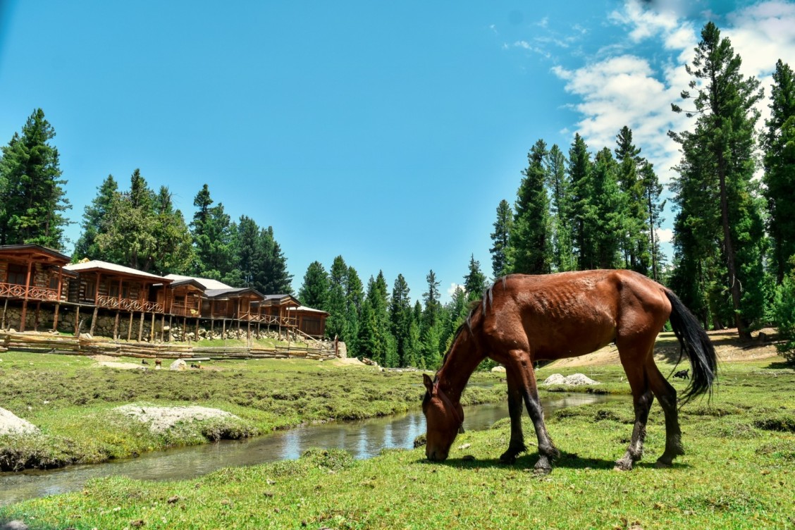
 A_horse_grazing_in_the_fields_of_Fairy_Meadows
A horse grazing in the fields of Fairy Meadows

Overview Of some famous sites in Gilgit Baltistan (GB) 

Site Location Features
Naltar Valley Gilgit District – Breathtaking landscapes with lush greenery and alpine meadows. – Known for skiing in winter and vibrant flower displays in summer.
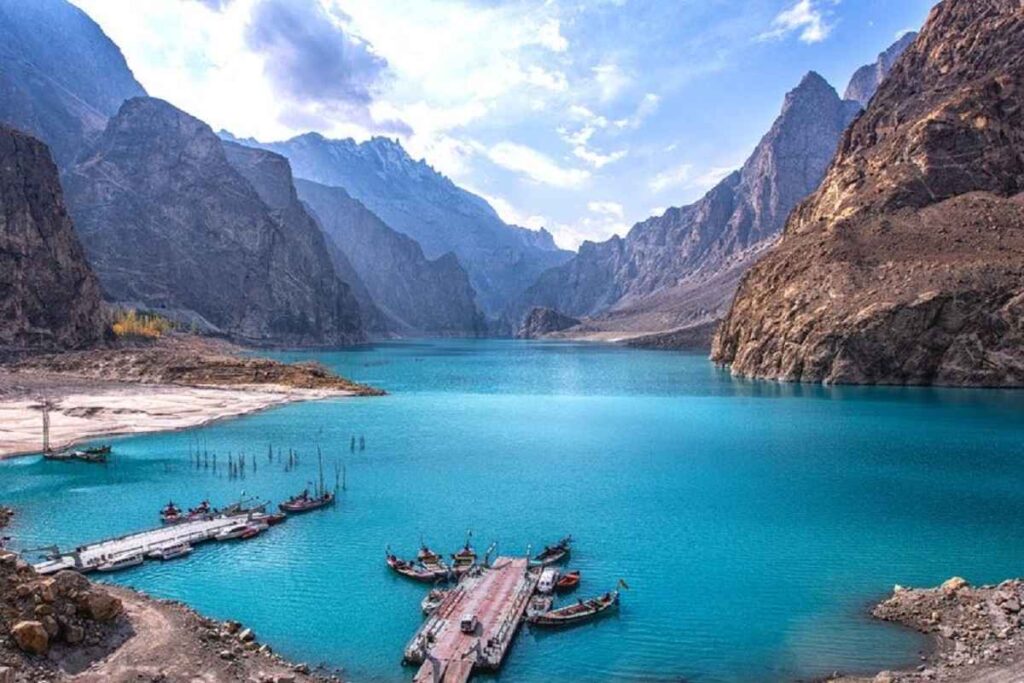
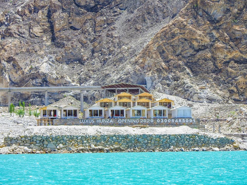
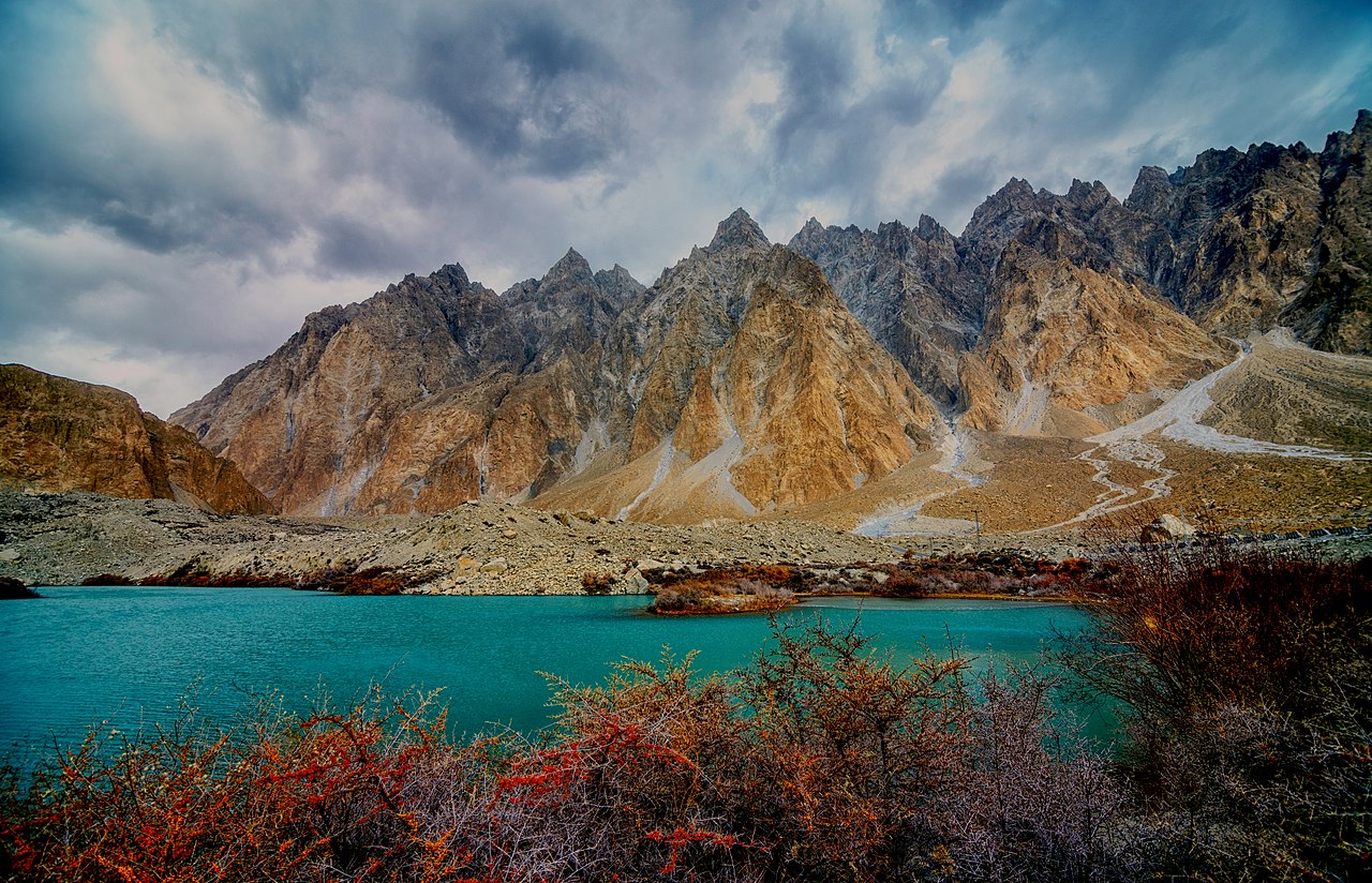
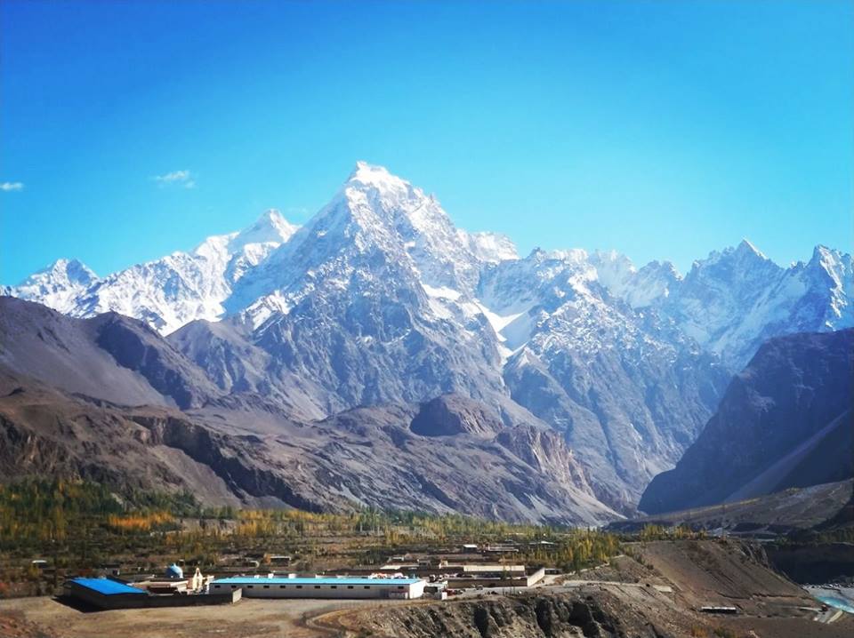
Hunza Valley Hunza District – Surrounded by snow-capped peaks, including Rakaposhi and Ultar Sar. – Historical sites like Baltit Fort and the serene Attabad Lake.
Skardu Skardu District – Gateway to some of the world’s highest peaks, including K2. – Picturesque Shangrila Resort and Upper Kachura Lake. – Skardu Fort offering panoramic views of the valley and Indus River.
Fairy Meadows (Nanga Parbat Base Camp) Diamer District – Stunning views of Nanga Parbat, the world’s ninth-highest mountain. – A starting point for treks to Nanga Parbat Base Camp.
Deosai National Park Skardu District – A high-altitude plateau with unique wildlife, including Himalayan brown bears. – Spectacular landscapes and Sheosar Lake.
Shigar Fort Shigar District – An ancient fort with a rich history and architectural significance. – Located near the town of Shigar, surrounded by stunning landscapes.
Khunjerab Pass Hunza District (Border with China) – The highest paved international border crossing in the world. – Stunning mountainous landscapes and the border point between Pakistan and China on the Karakoram Highway.
Satpara Lake Skardu District – A beautiful freshwater lake surrounded by snow-capped peaks. – Offers boating and a serene atmosphere.
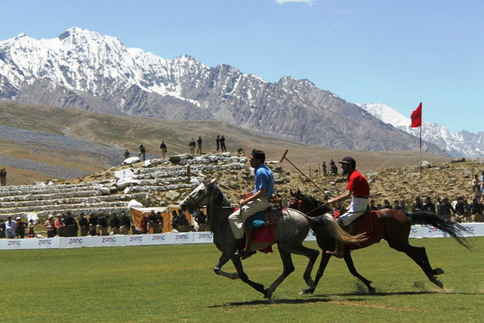
Shandur Polo Ground Ghizer District – Known as the “Roof of the World” and hosts the annual Shandur Polo Festival. – Spectacular landscapes and high-altitude polo matches.
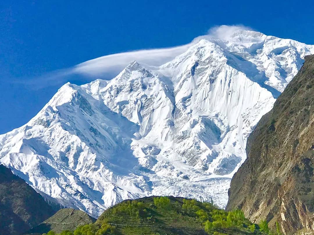
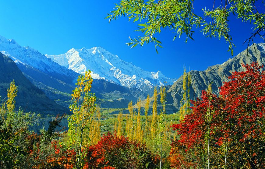
Rakaposhi Base Camp Nagar District – A starting point for treks to Rakaposhi, the 12th highest mountain in the world. – Offers breathtaking views of the surrounding peaks.
Hopper Glacier Nagar District – A stunning glacier surrounded by rugged mountains. – Popular among trekkers and adventure enthusiasts.

Some famous sites in GB

Fairy Meadows

A track from the right side of Raikot Bridge goes to the 9th largest peak in the world and the 2nd largest peak in Pakistan which is Nanga Parbat. This bridge is 61km from Chilas. This peak with a height of 8125 meters is known as the killer mountain.

It is very difficult to ascent this top. Its shape and structure is different on every side but it can be seen clearly from the Diamer, Ropal, and Raikot.

The fascinating site of Fairy Meadows is a base camp for the hikers fond of climbing Nanga Parbat peak. An Austrian hiker Harman Bhal named it “Fairy Meadows” in 1953 because of the stunning tracks and charming scenes on the way to Fairy Meadows.

There are the best-camping sites for tourists going to the basecamps of Nanga Parbat. Jeeps are available near the Shangrila Hotel situated adjacent to Raikot Bridge. Halfway about 8km from Raikot Bridge is full of adventure. The Jeep will take you to Fatori and Tatto Village. You can reach Fairy Meadows in three hours on foot from this village.

 nanga-parbat-trek.
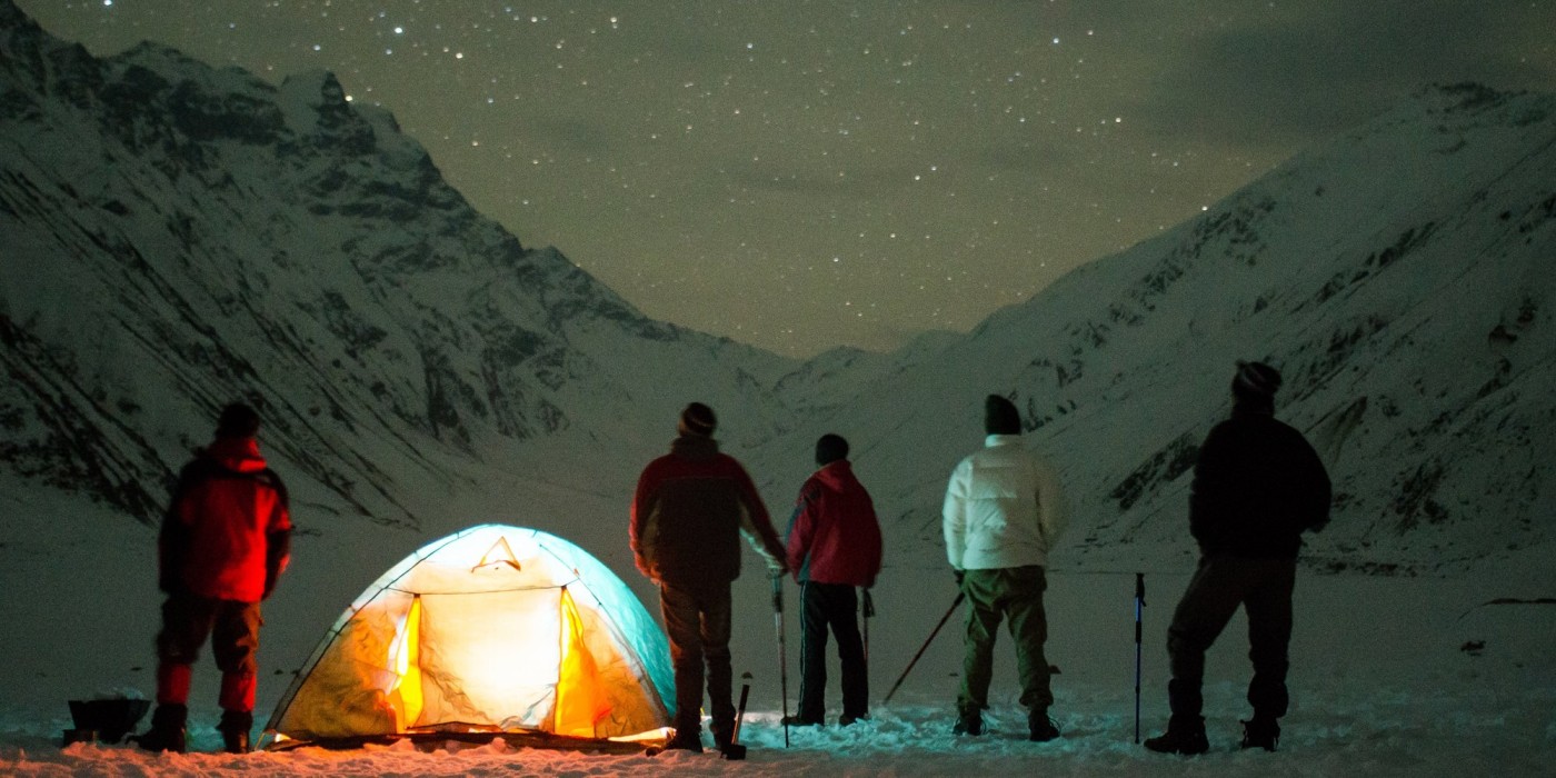
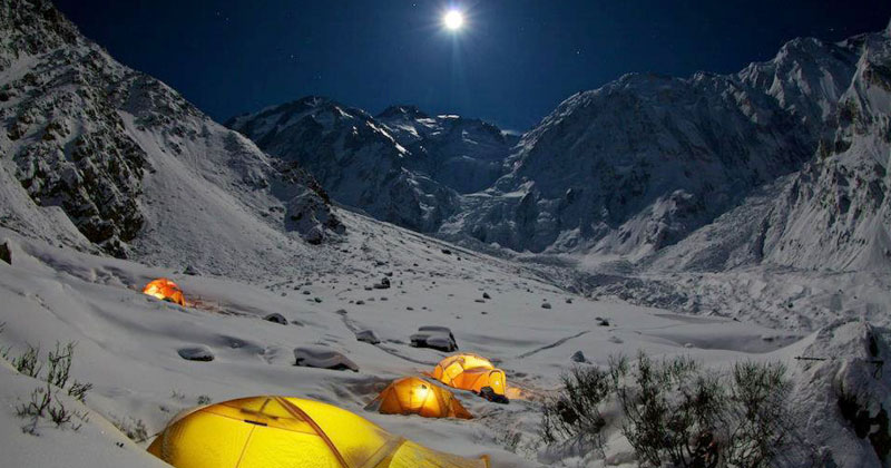
Glowing tents in the starry night of Fairy Meadows are the base camps for Nanga Parbat’s Trekkers

There are facilities for dwelling, dining, and rent village in this captivating valley. People can enjoy horse riding and fishing here. There are the best pastures for cricket, football, and polo match.

Fairy meadows site camps are located at an elevation of 3306 meters. Campfire is arranged for the locals and foreigners at the site camps who come to Fairy Meadows. All the vacationers sing their folk songs by sitting around the fire. They are just tourists irrespective of religion, color, and creed.

This route is open from May to August. After that, it is difficult to reach here due to snowfall. There is a restaurant at the Bial campsite too. It is two kilometers from the main site camp. Beyond 2 hours travel from this camp is the base camp of Nanga Parbat at a height of 4500 meters above sea level.

According to travel correspondent Mustanser Hussain Tarar, the fairies descend here. Fairy Meadows resembles the green areas of Kashmir.

Chilas

 Indus_River_near_Chilas_Gilgit-Baltistan1
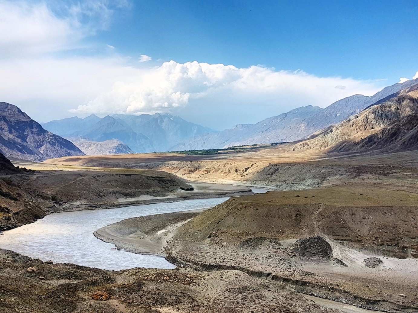
Indus River near Chilas Gilgit Baltistan

Chilas is located at the foothills of Nanga Parbat (8125meters) and is at an altitude of 950 meters above ocean level. It is the boundary of Diamer. Chilas at the bank of the river Indus has the status of base camp for the travelers going to Nanga Parbat and Fairy Meadows.

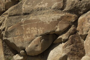
Most of the tourists stay here to see Petroglyphs. Chilas has a dry climate which is extremely cold in winter and terribly hot in summer. A route is directed to Babusar pass from the Thak water channel at a distance of 5km from Chilas.

It is the way to reach Kaghan Valley, Balakot, and Naran from Chilas. Before the Karakoram (Resham) Highway, this route was used to travel from Gilgit to Rawalpindi through Chilas, Babusar, Naran, Kaghan, Balakot, Mansehra, and Abbottabad. This area has hot water springs too.

Chilas fenced by mountains, is 4km from Resham (Karakoram) Highway. Diamer is also famous for Pinus tree forests, Pinon, and grapes.

Nanga Parbat View Point

The main signboard of Nanga Parbat View Point is fixed on the right side before Talechi and beyond Raikot Bridge. You will be spellbound by this clear view of Nanga Parbat. You will enjoy the beauty of this mount for a long distance. There is a Gasho Pashot Lake trek near this viewpoint.

Bunji and Jaglot

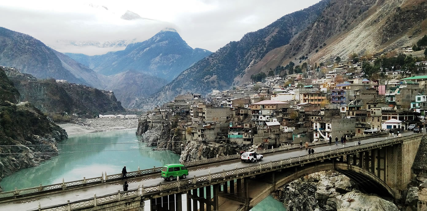
Jaglot (also spelled as Juglot) is a cantonment which is located on the Karakoram (Resham Highway). While the Juglot Village is situated in mountains at a distance of 7km from the Resham Highway. The river Indus turns towards Skardu whereas the Resham Highway goes straight.

 jaglot-town-gilgit-baltistan.
Jaglot Town Gilgit Baltistan

A route turns to the Astore Valley from the right side of Talechi. The Astore Valley was a source of contact between the Gilgit Agency and the British Empire. The easiest way to reach Nanga Parbat is through Astore Valley. A trail leads to Sirkon Lake from Bunji Cant.

Gateway to Northern Areas

Chilas serves as a gateway to various northern regions, including Skardu, Gilgit, and Hunza. Travelers heading towards these destinations often spend a night in Chilas, making it a hub for those exploring the wonders of GB.

Indus River Crossing

The town is situated at a point where the Karakoram Highway crosses the mighty Indus River. The view of the swirling waters against the backdrop of rugged mountains is a sight to behold. The bridge over the Indus River at Chilas adds to the dramatic setting, making it a memorable spot for travelers.

Historical Places

Baltit Fort, Hunza

Perched high above the Hunza Valley, Baltit Fort is a historical gem dating back to the 8th century. Renovated in the 1990s, it stands as a testament to the architectural brilliance of the region. The fort offers panoramic views of the surrounding peaks and valleys, making it a must-visit for history enthusiasts and admirers of ancient craftsmanship.

Shigar Fort, Skardu

Shigar Fort, located in the Shigar Valley, is another architectural marvel. Constructed in the 17th century, it once served as the residence of the local rulers. The fort has been converted into a museum, showcasing the history and culture of the region through artifacts, weapons, and ancient manuscripts.

Altit Fort, Hunza

Altit Fort, even older than Baltit Fort, dates back to the 11th century. Restored by the Aga Khan Cultural Service Pakistan, it offers a glimpse into the evolution of architecture in the region. The fort’s intricate woodwork and ancient chambers transport visitors back in time.

Schools in the Region

Community Schools: In the villages surrounding Fairy Meadows and Chilas, there are community schools that cater to the educational needs of local children. These schools play a vital role in imparting education to the younger generation.

Hospitals and Healthcare

Healthcare Hub: Chilas has a hospital that serves as a healthcare hub for the region. It provides medical services to the local population and is equipped to handle a range of health issues.

Ambulance Services: Both Fairy Meadows and Chilas have access to ambulance services to facilitate the transportation of patients in case of emergencies.

Frequently Asked Questions

What makes Fairy Meadows special?

Fairy Meadows is renowned for its breathtaking views of Nanga Parbat, the ninth-highest mountain in the world. The meadow, surrounded by lush greenery, offers a magical setting for nature lovers and adventure seekers.

How do I reach Fairy Meadows?

To reach Fairy Meadows, one must first travel to the town of Raikot and then embark on a jeep ride through a scenic track. The journey is an adventure in itself, providing access to the mesmerizing meadow at the base of Nanga Parbat.

What historical significance does Chilas hold?

Chilas is known for its ancient rock carvings, dating back thousands of years. These petroglyphs depict scenes from daily life, hunting, and religious rituals, offering a glimpse into the rich cultural history of the region.

Why is Chilas a stopover on the Karakoram Highway?

Chilas serves as a crucial stopover on the Karakoram Highway, acting as a gateway to various northern regions, including Skardu, Gilgit, and Hunza. Travelers often spend a night in Chilas while en route to these destinations.

What accommodations are available at Fairy Meadows?

Fairy Meadows offers comfortable huts and campsites for visitors. These accommodations allow travelers to immerse themselves in the tranquility of nature and witness the stunning sunrise over Nanga Parbat.

What are some local snacks to try in the region?

Local snacks in the Gilgit-Baltistan region include Chapshuro (a pastry filled with minced meat), Phaphar (a traditional whole wheat bread), and Mantu (meat-filled dumplings). These snacks provide a taste of the region’s culinary delights.

Are there medical facilities available at Fairy Meadows and Chilas?

While both locations have basic medical aid available, for more serious health concerns, it’s advisable to seek medical assistance in nearby towns. Chilas, in particular, has a hospital that serves the healthcare needs of the region.

What are the historical forts to explore in the area?

Baltit Fort and Altit Fort in Hunza, and Shigar Fort in Skardu are historical forts in the Gilgit-Baltistan region. These forts showcase the architectural brilliance and cultural history of the area.

Can I explore Fairy Meadows on my own, or do I need a guide?

While it’s possible to explore Fairy Meadows independently, hiring a local guide can enhance the experience by providing insights into the local culture, flora, and fauna, as well as ensuring a safe trek to Nanga Parbat base camp.

What role do the ancient petroglyphs in Chilas play in local history?

The petroglyphs in Chilas are significant historical artifacts, providing a glimpse into the daily life, rituals, and cultural practices of ancient communities. These rock carvings are a valuable archaeological treasure in the region.

Wind Up Lines

While the attractions of Fairy Meadows and Chilas lie in their natural beauty and historical significance, the provision of accommodation, dining options, and essential facilities like medical services ensures that visitors can enjoy these places comfortably and safely. The region’s commitment to balancing the allure of its landscapes with necessary amenities enhances the overall experience for those exploring these famous sites in Gilgit-Baltistan.

Famous Beautiful Sites of Astore City – GB

Astore

Astore is an old city at an altitude of 3200 meters above ocean level. Before the creation of Pakistan, this track was used to reach Gilgit from Srinagar Kashmir. District Astore of the province Gilgit Baltistan is 115km from Gilgit City.

Site Name Location Key Features
Rama Lake Elevation: 10,800 feet Surrounded by rich green mountains, snow-covered for 7-8 months, starting point for Nanga Parbat trek.
Tarishing Valley Located 28km from Astore Offers stunning views of Nanga Parbat and snow-tipped peaks, lush green meadows, and hotels.
Rupal Valley Access from Tarishing Valley Known for its diverse flowers, reached after crossing a hill and glacier, resembling Arang Kel.
Sang Sar Valley Easily reached from Astore Features green meadows, blue water lake, cool winds from Siachin range, and a stunning landscape.
View Point Silk Route (Karakoram) Hwy Offers a view of the meeting point of the Himalaya, Karakoram, and Hindukush mountain ranges.

Silk Route  (Karakoram) Highway, turns right towards Astore from Talechi Road. The river Astore flows here along the road. Astore City has some good hotels and a small market. Its central villages are

  • Rama
  • Rahman Pur
  • Gori Kot
  • Bunji
  • Dashkan (Dashkin)
  • Chilum or Chilam
  • Rattu

You can reach Nanga Parbat (Rupal Face), Rupal Valley, Tarishing Valley, Deosai, and Rama Lake from Astore.

 Beautiful-astore-gilgit-baltistan.
Charming Astore Valley Gilgit Baltistan

Furthermore, Chilum, Punji, Daskan, Singh Sar, Rehman Pur, Kala Pani, Minimarg, Dambabho, Domail, and Gori Kot are good tourist spots. One can reach Skardu from Chilam spot via Deosai plains, Sheosar Lake, and Satpara Lake.

You can only travel there by jeep. Minimarg, Rainbow Lake, and some other spots are considered sensitive since they are located near the Indo-Pak borderline. A special permission letter is required for visiting these areas. This letter can be obtained from the relevant army office after providing details.

The landscapes of Astore resemble the beautiful scenery in the American Cow Boy movies. Local language Shina is spoken there.

Famous Beautiful Sites of Astore City

1- Rama Lake

This lake is at an elevation of 10,800 feet above sea level. This lake, surrounded by rich green mountains remains covered with snow for about seven to eight months a year. A track is directed from here to the 8th highest peak in the world Nanga Parbat.

A jeep can be booked from Astore to reach the lake which is 8km from Astore. (A way to lead to Chilam check post on the left of Rama Lake route. You can reach Skardu by the way of Deosai). There is a PTDC motel between the thick green forests at a distance of 3km from Rama Lake.

It is the best place to enjoy two to three-day vacations. It is a good idea to reach the motel via jeep and then travel to the lake on foot. The lake is quite long. There is a rest house of the forestry department which is 3km from Rama Village. You can book it from Gilgit or Rawalpindi.

 Rama_lake-Astore_Gilgit-Baltistanpak.
Rama Lake in Astore, Gilgit Baltistan

2- Tarishing Valley

Nanga Parbat shadows the whole Tarishing Valley and is surrounded by glaciers. Tarnishing, at the foothills of sky-high snow-tipped peaks (9550 feet from sea level), is 28km from Astore. You can reach Tarishing by jeep from Astore.

People can pay per person to reach Tarishing from Astore by jeep. After half an hour, a route is directed to Kargil and Deosai. This track full of adventure will captivate you. You will not get tired of the hectic journey after seeing the charming sights of Rama Peak, Chongra Peak, and Raikot Peak.

Colorful aromatic flowers and luxuriant green grass everywhere will evoke you to stay here for a day or two. There are hotels and camping facilities too.

 tarishing-valley-astore-gilgit-baltistan.
Snowy tracks of Tarishing Valley in Astore

3- Rupal Valley

Travel to Rupal Valley to fully enjoy the Tarishing Valley site. You will be astonished by the valley with flowers of thousands of kinds. You can reach here after crossing a hill and a glacier. Arang Kel of Neelum Valley Azad Kashmir looks like Rupal Valley.

 Tarishing-Village-Rupal-Valley.
Luxuriant pastures of Rupal Valley in Astore

4- Sang Sar Valley

This beautiful valley has green meadows, thick green forests, and a blue water lake. The cold winds from the Siachin mountain range refresh the tourists here. The rainbow sight in the sky mesmerizes the vacationers. Sang Sar Lake is full of small glaciers and trout fish. The ice cubes in this lake look like shining stars. During snowfall, the trees covered in snow look like shy brides covered in a veil. A jeep can be hired from Astore Valley for Sangsar Valley.

5- View Point

There is a large podium on the right side of Silk Route (Karakoram) Highway at the Pari point beyond Juglot. Park the vehicle on one side. Come to the podium via a staircase. A

meeting point of the three great mountain ranges of the World (Himalaya, Karakoram, and Hindukush) has mentioned on an eight feet high and 8 feet wide wall through a picture. You will get a clear picture as you see above of the Gilgit Mountains. This scenery cannot be enjoyed anywhere else in the World.

FAQs

1. Where is Astore located, and what is its significance?

Astore is an old city located at an altitude of 3200 meters above sea level in the Gilgit Baltistan region of Pakistan. It is known for its natural beauty and tourist attractions.

2. What is the historical significance of the route through Astore before the creation of Pakistan?

The article mentions that the route through Astore was used to reach Gilgit from Srinagar Kashmir before the creation of Pakistan. This historical context adds to the region’s significance.

3. What are the prominent villages and areas in Astore City?

Astore City has several central villages, including Rama, Rahman Pur, Gori Kot, Bunji, Dashkan (Dashkin), Chilum, and Rattu. These areas are part of the Astore region.

4. What are the major tourist destinations that can be reached from Astore?

Astore serves as a gateway to several stunning tourist destinations, including Nanga Parbat (Rupal Face), Rupal Valley, Tarishing Valley, Deosai, Rama Lake, and many others. Each of these places has its unique attractions.

5. How can visitors reach Rama Lake from Astore, and what are the notable features of Rama Lake?

Visitors can reach Rama Lake, which is located at an elevation of 10,800 feet above sea level, by booking a jeep from Astore. The lake is surrounded by lush green mountains and remains snow-covered for several months. It also serves as a starting point for reaching Nanga Parbat.

6. What is the best way to plan a stay at Rama Lake, and are there accommodations available?

The article suggests reaching the PTDC motel, located 3 km from Rama Lake, by jeep and then traveling to the lake on foot. Additionally, there is a rest house of the forestry department that can be booked from Gilgit or Rawalpindi.

7. What are the attractions of Tarishing Valley, and how can visitors reach it from Astore?

Tarishing Valley offers breathtaking views and can be reached from Astore by jeep. The valley is known for its proximity to Nanga Parbat, snow-tipped peaks, and a captivating journey through Rama Peak, Chongra Peak, and Raikot Peak.

8. What is Rupal Valley, and how does it compare to Arang Kel in Neelum Valley, Azad Kashmir?

Rupal Valley is known for its diverse flowers and can be reached from Tarishing Valley. The article draws a comparison between Rupal Valley and Arang Kel in Neelum Valley, highlighting the lush pastures and natural beauty.

9. What does Sang Sar Valley offer to tourists, and how can it be accessed from Astore?

Sang Sar Valley is known for its green meadows, blue water lake, and stunning scenery. Tourists can access this valley by hiring a jeep from Astore.

Wind Up Lines

Astore is a beautiful Town in Gilgit Baltistan. Rama Lake, Tarishing Valley, Sangsar Valley, and Rupal Valley are well-known tourist spots.

Skardu – Baltistan | Shangrila Resort | Upper Kachura

Skardu City – Baltistan 

Where mountains speak the sky

Baltistan was called Skardu in the past because of its central headquarter Skardu. Baltistan has the world’s second-highest peak K-2, Masherbrum (7320 meters) peak, Gasherbrum (8355 meters) peak, Broad peak (8047 meters), and 150 peaks of Karakoram Mountain range out of 300 peaks.

Aspect Information
Location Skardu, Gilgit-Baltistan, Pakistan
Skardu’s Significance A picturesque city known for its stunning natural landscapes and as a gateway to some of the world’s highest mountain ranges.
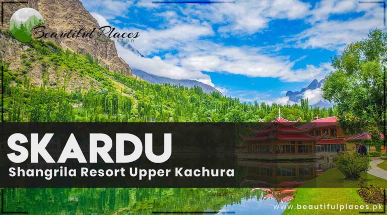
Shangrila Resort A popular tourist destination in Skardu, often called “Heaven on Earth.” It features Shangrila Lake, beautifully landscaped gardens, and the renowned Shangrila Resort Hotel.
How to Reach Shangrila Visitors can reach Shangrila Resort by road or air, with accommodations available in the resort’s hotel and other options in Skardu.
Activities at Shangrila Boating on Shangrila Lake, exploring lush gardens, and taking in breathtaking mountain views. It’s an ideal place for relaxation and nature appreciation.
Upper Kachura A serene area in Skardu, known for the pristine Lower Kachura Lake and its tranquil surroundings.
Access to Upper Kachura Easily accessible from Skardu by road, allowing visitors to explore the beautiful Lower Kachura Lake, enjoy boat rides, and experience tranquility.
Cultural and Recreational Activities Skardu offers opportunities to immerse in the unique culture and traditions of the Baltistan region, as well as outdoor activities like hiking and trekking.
Best Time to Visit The ideal time to visit is from April to September during the spring and summer months, when the weather is pleasant, and natural beauty is at its peak.
Travel Tips Travelers are advised to check local regulations, obtain necessary permits for restricted areas, carry warm clothing, sunscreen, and essential travel documents.
Nearby Attractions Nearby attractions include Deosai National Park, Shigar Fort, and the beautiful Shangrila Resort Gardens, offering more opportunities to explore the region’s natural and cultural beauty.

The world’s largest and most famous glacier “Siachen” after the Pole glacier is here in Baltistan. Stretching between Karakoram and Himalaya ranges, Baltistan has Skardu, Khaplu, Shigar, Kharmang, Hushe, and Gultari Valleys. Parapo, Balay, Marzan, and green tea are among the popular foods of Baltistan.

 skardu-baltistan.
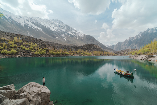
Young Caucasian woman looking at Upper Kachura lake in Gilgit-Baltistan

In the Suburbs of Baltistan

I- Adventure of Skardu Road

A road turns toward Skardu from the Alam Bridge 48km before Gilgit. Skardu is 173km from this point. The Skardu road becomes narrow gradually after splitting from Karakoram Highway.

 Skardu_Road-baltistan
Driving on Skardu Road is a thrilling adventure

It is an adventurous journey between the Karakoram and the Himalayas along the river Indus. It seems difficult to breathe on the Skardu trail for the first time due to the twisting road like snakes, sharp turns of the highway, sky-scrapping mountain ranges, and the river Indus flowing like a thin line below. But, one feels better as you move forward.

II-  Haramosh Valley, Kutwal Lake

At a distance of 25km from Skardu Road, a track lead to Dasu Village from Sassi Village. You can reach there in one hour. From Dasu to Haramosh Valley’s Kutwal Lake is a one-and-a-half-day pedestrian track. So, it’s a three-day journey. If you are a good trekker and have the stamina you can reach earlier.

There is no arrangement for a stay during the journey. You will have to take camping stuff and food with you. Dasu and Iskari have some small restaurants.

 beautiful-kutwal-lake-haramosh-valley-baltistan.
Beautiful Kutwal Lake in Haramosh Valley

A memorial to the martyrs who sacrificed their lives during the construction of the road is built at the Shingas point. This point is 52km from Skardu Turn. A small town Rondu is 30km from Shingas.

Come across the river by crossing the bridge 38km from Dambu Wali Village. Dambu Wali Village is 22km from Rondu. From here towards the right side, a trail is directed to Shangrila Lake. The valley spreads from there. Skardu airport is 22 km beyond this road. And Skardu city is 13 km forward to the airport.

Skardu City

Skardu, the headquarter of Baltistan is at an altitude of 7500 feet above sea level. The Skardu Valley is 10km wide and 40km long. Skardu Base Camp is among the most adventurous and beautiful trekking sites in the World. Skardu is enriched with calm lakes, murmuring waterfalls, sky-kissing snow-capped peaks, and beautiful landscapes.

The world’s second-highest peaks K-2, Siachen Glacier, Batura Glacier, and Biafo Glacier are embracing each other in a unique manner. It is hard to find such a beautiful scene anywhere else in the world. Therefore, climbers from all over the world come here every year to fulfill their hobbies.

 skardu-a-heaven-on-earth
Skardu heaven on Earth

Skardu’s tourism season is from April to October. Peach, apples, apricots, and pear are the best fruits there. This city is located on a very interesting point. The river Indus flows in a calm and serene manner. Skardu is fenced by dry mountains and sand dunes. Wear a sweater before if you are going for an evening walk in Skardu. Do shopping in the old Bazar.

A PIA flight is available from Islamabad for Skardu on a daily basis. And the same plane brings the passengers back to Islamabad. All the flights depend on the weather condition. The flights are canceled if the climate is not favorable. Sometimes, the fights return back to Islamabad without landing at the Skardu Airport due to the lack of required atmospheric pressure.

Traveling at a height of 38,000 feet above the snow-capped mountains is a thrilling experience. According to the global tourism perspective, it is considered among the most beautiful journeys in the World. If you are fortunate to grab a window seat during the Skardu flight, the beauty of the north will mesmerize you.

Lush green valleys, colorful lakes, and snow-clad peaks are awaiting you. Skardu airport is 14km from Skardu City. This track is open throughout the year via Gilgit. Gilgit City is 241km from Skardu with about a 6 to 7 hours drive. A jeep and coster can be booked from Gilgit Bus Stand.

Famous Historical Sites and Tourist Destinations in Skardu

1- Fort Kharphocho Gangope

Raja Bokhany of Makboon family initiated building this fort. The king was a contemporary of Mughal king Babur. But, he died before its completion. His grandson Sher Ali Khan completed it. This fort of the 15th century was constructed near the river Indus bank on a rough rocky hilltop.

It is spreading over an area of two miles. It is said that 12 lac or 1.2 million for making a mud mixture. It is an adventure to reach this fort at the top. Take water along with you. There is a royal polo ground in between the fort. Players are practicing at the noon. It will be a memorable experience to enjoy this royal polo game for you.

A public library and a memorial to the martyrs are adjacent to the polo ground. A stream used to flow in Skardu City. It had a length of 3 miles. It was constructed by queen Gul Khatun of Sher Ali Khan. It was named Ganope after the name of the engineer who built it. There are traces of this stream in the city.

 ancient-kharpocho-mosque-fort-skardu-gilgit-baltistan
Ancient Kharpocho mosque fort at Skardu Baltistan

2- The first organic village in Pakistan

Nansoq, the first-ever organic village in Pakistan is 3km from Skardu City at the confluence of the river Shigar and the river Indus. This village is at the back of the historical Kharphoco fort. British Prince Charles, Lady Camilla Parker, and Prince Agha Karim visited this village in 2006. It is a curious point of Skardu.

 first-organic-village-skardu
First organic village in Skardu

3- Italian K-2 Museum

A museum in the PTDC Motel of Skardu City is established by the contribution of Itlay. This museum has different galleries which portray trekking and hiking in the mountains of Pakistan with the help of charts and pictures. It especially focuses on the peaks that are trekked by Pakistani and global hikers. Documentaries are there too to become familiar with the culture, history, and traditions of Gilgit Baltistan.

 Italian-k2-museum-skardu
Italian Museum of Skardu

4- Lake Katpana 

The beautiful Lake Katpana is 10km away from Skardu City’s Police Line. You can visit historic villages Katpana and Sandos. Spend some time near the grey water lake Katpana. You will see a lot of ducks swimming in this shining water. Thick green woods, desert, and sky-high mounts on its sides present a charming view.

 Katpana-Lake-Skardu-Gilgit-Baltistan.
Reflection of snow-tipped mountains and trees in Katpana Lake, Skardu, Gilgit-Baltistan

5- Shangrila (Paradise on Earth)

A DC3 plane of orient airways took off from the Skardu Airport on 13th October 1954. One of its engines failed and the pilot did a crash landing near the river Indus. All the passengers and the staff remained safe.

Brigadier Muhammad Aslam of North Scouts purchased this plane and took it here. This human heart-shaped lake has a garden, a hotel, and a restaurant. They are established beautifully near the edge of the lake that’s why it is called a part of paradise on Earth.

Accommodation facilities have been provided in the huts of Shangrila Resort situated near Upper Kachura Lake. The outside view from the restaurant and the airplane’s café will enthrall you. Shangrila has gained international recognition because of its charismatic and beautiful geography.

Shangrila is located on the Gilgit road at a distance of 30km from Skardu City. At an altitude of 2500 meters above sea level, this site has 60 lakeside cottages, a zoo, sailing, indoor games, the trout fish farm, café DC three coffee shop (in the airplane), an open-air tandoori restaurant, a gift shop, a Pagoda restaurant, a Lake-view restaurant, helicopter safari services, and other facilities.

6- Upper Kachura Lake

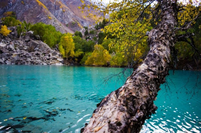
Upper Kachura Lake is beyond Shangrila Lake (Lower Katchura Lake) at 8200 feet above ocean level. It is surrounded by thick fruit trees and sky-high mountains. This lake with deep green color water has a depth of 230 feet. In summer the temperature is usually 15 . The lake completely freezes in the winter. Enjoy boating and sailing on the lake. Restaurants and hotels are there too.

 upper-kachura-lake-skardu-baltistan.
Captivating Upper Kachura Lake of Skardu

FAQs

1. Where is Skardu located, and what is its significance as a tourist destination in Pakistan?

Skardu is a beautiful city in the Gilgit-Baltistan region of Pakistan, known for its stunning natural landscapes and as a gateway to some of the world’s highest mountain ranges.

2. What is Shangrila Resort, and what are its main attractions?

Shangrila Resort is a popular tourist destination in Skardu. It is often referred to as “Heaven on Earth” and is known for its serene surroundings, Shangrila Lake, beautifully landscaped gardens, and the famous Shangrila Resort Hotel.

3. How can visitors reach Shangrila Resort in Skardu, and what accommodations are available in the area?

Visitors can reach Shangrila Resort by road or air. The resort has its own hotel that offers comfortable accommodations, and there are also other lodging options in Skardu.

4. What are the activities and things to do at Shangrila Resort and Shangrila Lake?

At Shangrila Resort, visitors can enjoy boating on Shangrila Lake, explore the lush gardens, and take in the breathtaking views of the surrounding mountains. It’s a great place for relaxation and nature appreciation.

5. Tell us about Upper Kachura and its significance in the Skardu region.

Upper Kachura is a part of the Skardu region and is known for its pristine lakes, including the Lower Kachura Lake. It’s a serene and less-crowded area that offers a peaceful environment for travelers.

6. How can tourists access Upper Kachura from Skardu, and what are the attractions in this area?

Upper Kachura is easily accessible from Skardu by road. Visitors can explore the beautiful Lower Kachura Lake and its surroundings, take boat rides, and enjoy the tranquility of the area.

7. Are there any cultural or recreational activities in Skardu, apart from the natural attractions?

Skardu offers visitors the opportunity to experience the unique culture and traditions of the Baltistan region. Travelers can also enjoy hiking, trekking, and interacting with the local community.

8. What is the best time to visit Skardu, Shangrila Resort, and Upper Kachura for optimal weather and experiences?

The ideal time to visit is during the spring and summer months, from April to September, when the weather is most pleasant and the natural beauty is at its peak.

9. Are there any specific guidelines or tips for travelers planning a trip to Skardu, Shangrila Resort, and Upper Kachura?

Travelers are advised to check local regulations and obtain necessary permits if planning to visit restricted or sensitive areas. It’s also recommended to carry warm clothing, sunscreen, and essential travel documents.

10. Can you provide information on other nearby attractions or day trips that visitors can consider when in the Skardu region?

Visitors to Skardu can explore nearby attractions such as Deosai National Park, Shigar Fort, and the beautiful Shangrila Resort Gardens. These places offer additional opportunities to experience the natural and cultural beauty of the region.

Wind Up Lines

Skardu Valley is an embodiment of natural beauty. There are historical sites too. It is one of the best and ideal city for holidays. You will be enchanted by the beauty of Upper Kachura Lake, Haramosh Valley, Lake Katpana, and Shangrilla Resort.

Chitral Valley – A Serene & Culturally Rich Site of KPK

Chitral

(The land of Tribes)

Chitral is 4840 feet from sea level with an area of 4500 square miles. From the archaeological facts, it is said that these areas were settled before the arrival of Arias. They reached Ganga Jamuna via the routes of Swat and Chitral when Arias left from Central Asia.

Alexander the Great arrived in these areas too. That is the reason why the people of Kafiristan used to call them descendants of Alexander the Great’s soldiers. As time passed, Chitral become independent in 1885.

Chitral-Valley-KPK.j
A beautiful picture of the water stream, forests, and mountains from Chitral, Pakistan

Chitral is linked to all parts of the country via Dir. Public Transport is available from Peshawar, Rawalpindi, Swat, and Dir. There are regular PIA flights from Peshawar  (Kyber Pakhtunkhwa, KPK)  to Chitral. But they depend upon the weather. People can reach from Chitral to Gilgit by Shandor Bypass through a special jeep.

Public Transport can be avail during Shandur Polo Festival. The Tourist season is from May to October. However, it is crowded with holidaymakers from June to September.

Key information about Chitral Valley

Heading Information
Location Chitral Valley is located in the Khyber Pakhtunkhwa province of Pakistan. It is situated in the northwestern region, close to the border with Afghanistan.
Scenic Beauty Chitral Valley is celebrated for its stunning natural beauty. It is surrounded by towering mountains, including the Hindu Kush and the Chitral River. The valley features lush meadows, forests, and clear water streams.
Cultural Diversity The valley is known for its rich cultural diversity. It is inhabited by various ethnic groups, including the indigenous Kho people. Visitors can experience the unique traditions and customs of the local communities.
Tourist Attractions Chitral Valley offers a range of tourist attractions, including the famous Kalash Valleys, which are known for their distinct culture and festivals. The valley also features Shandur Pass, Terich Mir (the highest peak in the Hindu Kush), and the Chitral Fort.
Outdoor Activities Outdoor enthusiasts can enjoy activities like trekking, hiking, and mountaineering in Chitral Valley. The region is a gateway to numerous trekking routes and adventure opportunities.
Kalash People The Kalash Valleys within Chitral Valley are inhabited by the Kalash people, a unique ethnic group with their own language and religious beliefs. Visitors can learn about their culture and attend festivals like Chilam Joshi.
Accessibility Chitral Valley is accessible by road, and there is an airport in Chitral town. The journey offers breathtaking views, with the Lowari Pass being a key route.
Accommodation Accommodation options in Chitral Valley range from budget guesthouses to more comfortable hotels. The availability may vary depending on the season.
Biodiversity The valley is ecologically diverse, with a variety of flora and fauna. It is home to wildlife like the Himalayan Ibex and Marco Polo sheep.
Conservation Efforts Efforts are made to preserve the natural and cultural heritage of Chitral Valley, and visitors are encouraged to engage in responsible tourism practices.

History

The history of Chitral dates back to ancient times. It has been influenced by the Aryans, Persians, Greeks, and the Chinese. The valley was a crucial trade route, and it was often contested by various empires and dynasties.The Kalash Valleys within Chitral are home to the unique Kalash people. The Kalash are believed to be descendants of Alexander the Great’s troops. Their culture and beliefs are distinct, and they practice a polytheistic religion.

Chitral embraced Islam in the 14th century under the influence of Sufi saints. It was later ruled by various Muslim dynasties, including the Katoorids and the Chitrali kings.During the British colonial period, Chitral was a princely state. The region played a role in the Great Game, a geopolitical rivalry between the British and Russian Empires.

Chitral became a part of Pakistan in 1969. Today, it is a district in the Khyber Pakhtunkhwa province.

Famous Tourist Spots in Chitral Valley

Madaklasht – Sishgol Valley

The descending is from Lowari top to Chitral. The historical town of Chitral “Darvesh” can be reached by passing through Ziarat and Ushriyat. Darvesh is the headquarter of Chitral Scouts.

Madaklasht is in the northeast of Darvesh at a distance of 45km. It is an exceptional valley because of its natural beauty. Its snowfalls in this area from 8 to 10 feet. There was a training center for Scouts in the British era. Ice Skating contests were also held.

The people of the valley will welcome you. You can enjoy one day trip to this valley. You can buy handicrafts like handkerchiefs, Mufflers, chokers, and vests.

 Madaklasht-Chitral-KPK-festival.
Snow Sports Festival in Madaklasht Valley Chitral KPK

Chitral City

Chitral City is the headquarter of district Chitral. Mountains are standing in the east and west of Chitral. Chitral has 204 hilltops in its surrounding which are 18,000 feet high. The source of the Chitral River is the Chiāntar Glacier.

The climate is pleasant in summer and bitter cold in winter. The temperature never goes beyond 30  in summer in plain areas and it goes below 0. The river Chitral passes through the center of the city.

Chitral has many splendid buildings such as Chitral Scouts, Shahi fort, Shahi mosque, Polo ground, Governor cottage, Municipal Library, Museum, PIA office, and PTDC Motel. Afghan Café on the corner of Shahi Bazaar is famous for its delicious foods.

Load more ATTACHMENT DETAILS Shandur-Polo-Festival-in-Chitral-KPK
Shandur Polo Festival in Chitral KPK

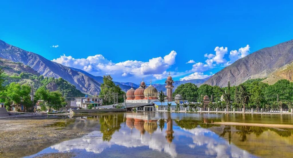
Shahi Mosque

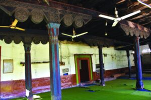
This mosque has a matchless status from Peshawar to Kashgar because of its painting and flowery embroidery. Its construction started in 1919 and was completed in 1925.

 Shahi-Mosque-in-Chitral-KPK
A scenic view of the grand Shahi Mosque in Chitral

It is in the center of the city and is established with solid bricks, stones, and marble. It is designed on the architecture of the historical mosque Mahabat Khan in Peshawar. The palaces of the former king are in the suburbs of this mosque.

Shahi Fort

This fort is the most ancient site of Chitral and a witness of the fierce battles for thrones. The architecture of the fort reflects the lifestyle, culture, and tradition of Central Asia. There are rare pieces of flowery painting in the male section of the fort.

 Shai-Fort-in-Chitral.
Shahi Fort in Chitral – A beautiful masterpiece of architecture

Chitral Museum

This fort is the spectator of the thousands of years old history of Chitral.  It is established near the Polo Ground in 2003. The artifacts related to the ancient Chitral are arranged systematically in beautiful galleries.

They include sculptures, jewelry, utensils, weapons, stuff related to Kalash Culture, manuscripts of the Muslim rulers, documents, and the stuff related to Islamic Culture, Kho tribe culture, and Chitral culture. You can understand the old culture and lifestyle of the people of Kalash by visiting this museum.

 Chitral-Museum
Chitral Museum – a place where time is transformed into space

Barmo Gulshat

It was the central headquarter of the former rulers of Chitral in the past. It is at a height of 2743 meters from sea level. You can enjoy the scenery of the peak Tirich Mir and the suburb valleys from this point. A jeep can be avail from the Chitral for reaching this point.

Chitral Gol National Park

This park is at a height between 1450 to 5000 meters from sea level. it is stretching over an area of 77.5 square kilometers. It is located on a hill where the royal court was decorated in the summer during the reign of Chitral.

Meadows_of_Chitral_Gol_National_Park-KPK
Luxuriant green meadows of Chitral Gol National Park

You will have to book a special vehicle for reaching this enchanting spot. It was given under the administration of the department of Wildlife a few years ago.

Koghuzi

This area of fruits, flowers, lush green valleys, cascades, and waterfalls is at a distance of 20km from Chitral. A mosque here with beautiful embroidery belonged to the royal era of Chitral. It is unique because of its wood engraving and intricate designs. Another beautiful area of Golin is near Koghuzi.

Koghuzi Chitral
The autumn colors of Koghuzi Chitral

The area of Gaju is in the suburb of Chitral and is famous for grapes. The grapes of this area are dried and are used in medicines. To enjoy the sight of the highest waterfall you will have to go to Dagh village. The river Golden merges into the river Mastuj one kilometer from Koghuzi. A jeep track from this point goes to the golden valley.

Garam Chashma

There are many hot water springs in different places in Chitral but the spring of Tehsil Lat Koh is more famous. It is 45km from Chitral in a village named “Garam Chasma”.

These springs are considered beneficial for different diseases and as pain relievers. There are separate bathrooms for males and females. It is a good picnic spot. Chitral Patti (a jewelry item) and valuable stones can be bought from here.

There are beautiful spots like the governor’s cottage, a beautiful mosque, and a polo ground near Garam Chashma. On the polo ground, Buzkashi (a famous game of Afghanistan) is also played.

governor-cottage-chitral-kpk
Governor Cottage at Garam Chashma, Chitral, KPK

A mountain near this spring is considered a sacred place among the Ismaili group. Their leader Ameer Nasir Khusro u meditated on this mountain for 40 days. You can buy handmade clothes, caps, jackets, woolen shawls, and woolen caps. They will remind you of your trip to Chitral.

Daro Ship Fort

The fort Daroship is called Shahi Qila and Durshive Qila in Khawar (a local language). It is present in a valley in Garam Chashma Chitral.

Tirich Mir (The castle of the king of Ghosts)

 Tirich-mir-Chitral.
Tirich Mir is the highest mountain in the Hindu Kush range

The highest peak of Chitral is Tirich Mir at an altitude of 25,760 feet from ocean level. It is located 135 km from Chitral City.

According to folk tales, it is the habitat of fairies and the King’s Palace is at its peak. That’s why when fairies get angry, they push humans, which kills many climbers. Every year, many local and foreign climbers come to reach the peak of this dangerous mountain.

You will see many tents of hikers in the base camp of Tirich Mir. These tents will urge you to stay here.

Zewargol

Zewargol is located in the Tehsil Norkho of Chitral at the Zewar point. The wildlife present at this spot at a height of 10,500 feet from sea level is not found anywhere else. Therefore, hunting is completely banned here.

Booni

Another beautiful site of Chitral is the Tehsil headquarters “Booni”.  It is located 80km from Chitral.  There are facilities for staying and dining.

This spot with Luxuriant green pastures, mountains, peaceful and healthy environment is a perfect package of enjoyment for tourists. A captivating amalgamation of the river Mastuj and the river Kho takes place in this valley.

 Apricot-trees-in-Booni-KPK-Chitral.
Apricot trees in Booni Chitral

Mastuj

Mastuj City is the center point of northern Chitral at a distance of 100 km from Chitral and at an elevation of 7742 feet from sea level. A route goes to Gilgit from this site via Shandur Bypass. In 1895, Mastuj was formally included in Chitral.  Before this, it was linked to Yasin and Ghizar. Booni, Eshin, and Parwak are central villages.

Mastuj-chitral-KPK.
Confluence of rivers at Mastuj Chitral

Mastuj Fort

This fort is located at the confluence of the river Mastuj and the river Yarkhun. The fort is said to have been built by Kashukat in the 16th century and laid the foundation of the Kashukat state.

Chitral Lake

There are two large natural lakes in Chitral. The Shandur lake is 2.5 miles long and one mile wide near the Polo Tournament. There is no way for water to go out. It is said that there is a well in the middle of the lake from where this water goes to the lower valley springs.

According to a traditional folk tale, an old woman went to Shandur lake with her daughter and flock. One day, the young lady was bathing the sheep. Her bangles got stuck in the horns of the sheep and both of them drowned in the lake. A few years later, the bones of the young lady’s hands and wrists were found in the Laspur Valley at the Harchin spring. The bangles were intact on the sheep’s horn.

The second lake is Karomber Lake. It is located in Broghil or Broghol pass at a height of 13,260 feet and at a distance of 256 km from Chitral. Its length is 3 miles and its width is 1.5 miles. Besides these, many small and large lakes are spreading around the Chitral valley such as karezza lake, Chitti Bae Lake, and Chah Tar Lake.

 Karamber-Lake-Chitral-KPK.j
Camping & trekking at Karamber Lake is a thrilling experience

Handicrafts & Shopping

You can buy Chitrali woodwork, scarfs, silk hankies, stones, jewels, vests, coats, caps, embroidery jackets, gold and silver jewelry, Numday, carpets, and other handicrafts in Chitral and its neighboring areas. Shahi Bazaar and PIA Chowk are good shopping markets.

 Chitrali-Culture-KPK.
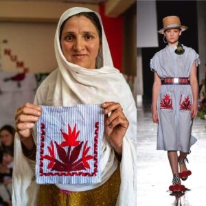
Chitrali Woman’s design displayed at Milan Fashion Week

Culture & Tradition

Culture

  • Languages: The people of Chitral speak multiple languages, including Khowar, Chitrali, and Kalasha. These languages are integral to the cultural identity of the region.
  • Kalash Culture: The Kalash people are known for their vibrant culture. They celebrate festivals like Chilam Joshi and Uchal, during which they perform traditional dances and rituals. The Kalash are famous for their distinct attire, music, and customs.
  • Cuisine: Chitrali cuisine features traditional dishes like Diram-foti (a meat and rice dish) and Shash (a popular bread). The cuisine is influenced by the local resources and the harsh mountain climate.
  • Arts and Crafts: The people of Chitral are skilled in traditional crafts like embroidery and woodwork. Their intricate handiwork is often used to create decorative items and clothing.

Traditions

  • Hospitality: Chitralis are known for their warm hospitality. Guests are treated with great respect and are often offered traditional Chitrali tea, a gesture of friendship and goodwill.
  • Rituals and Celebrations: The people of Chitral celebrate various rituals and events throughout the year. These events are marked by music, dancing, and traditional practices that have been passed down through generations.
  • Eid Festivals: Eid festivals, especially Eid-ul-Fitr and Eid-ul-Adha, are celebrated with enthusiasm. Families come together, offer prayers, and exchange gifts during these occasions.
  • Agricultural Traditions: Chitral Valley’s economy is heavily dependent on agriculture. Traditional farming methods and rituals are observed during planting and harvesting seasons.

Frequently asked questions (FAQs) 

Where is Chitral Valley located?

Chitral Valley is located in the Khyber Pakhtunkhwa province of Pakistan, in the northwestern region near the border with Afghanistan.

What makes Chitral Valley a popular tourist destination?

Chitral Valley is renowned for its stunning natural beauty, cultural diversity, and historical significance. It offers a unique blend of landscapes, including lush meadows, mountains, and the famous Kalash Valleys.

What are the must-visit attractions in Chitral Valley?

Key attractions in Chitral Valley include the Kalash Valleys, Shandur Pass, Terich Mir (the highest peak in the Hindu Kush), and the Chitral Fort. The valley also offers opportunities for trekking and outdoor adventures.

What is the culture of the Kalash people in the Kalash Valleys?

The Kalash people in the Kalash Valleys have a unique culture. They follow a polytheistic religion and celebrate various festivals like Chilam Joshi and Uchal. The Kalash culture is distinct and known for its traditional clothing and music.

How can I reach Chitral Valley?

Chitral Valley is accessible by road, and visitors often travel from major cities like Peshawar. The journey offers breathtaking mountain views, with the Lowari Pass being a key route.

Is Chitral Valley suitable for trekking and adventure activities?

Yes, Chitral Valley is ideal for trekking, hiking, and other adventure activities. It serves as a gateway to numerous trekking routes and offers a range of outdoor experiences for adventure enthusiasts.

What is the best time to visit Chitral Valley?

The best time to visit Chitral Valley is during the summer months, from May to September, when the weather is pleasant, and the valley is at its most vibrant. Winter is typically harsh, with heavy snowfall.

Are there accommodations available in Chitral Valley?

Accommodation options in Chitral Valley range from budget guesthouses to more comfortable hotels. However, the availability of accommodations may vary depending on the season, so it’s advisable to plan ahead.

What languages are spoken in Chitral Valley?

Languages spoken in Chitral Valley include Khowar, Chitrali, and Kalasha. Khowar is the predominant language, while the Kalash people have their own unique language.

How can I ensure responsible tourism in Chitral Valley?

To ensure responsible tourism, visitors should respect the environment and local culture. They should follow guidelines for waste disposal and conservation and support local businesses during their visit.

Wind Up Lines

Chitral is enriched with charming lakes, sky-kissing snow-capped mountains, dancing rivers, tranquil lakes,  orchards loaded with fruits, forests full of wildlife, historical building with marvelous architecture, beautiful skilled people, and handicrafts.

A trip to Chitral is a complete package to explore nature, beautiful landscapes, and historical sites

Kalash Valley | Kalash People | Kalash Culture

Kalash Valley

The homeland of fairies

There is a conflict among historians about the Kalash people. They called themselves the progenies of Alexander the Great. According to a widespread anecdote, when Alexander the Great invaded this area, some wounded soldiers of his army along with their families stopped there while passing by. And this tribe has grown from here.

By a second narrative, these people belonged to the province Nuristan of Afghanistan in the last second century before Christ. The religion of the Kalash people is a combination of many cultures and customs. They believe in many gods, goddesses, charity, idolatry, and superstition. Try to live there as tourists and avoid interacting with their religious activities.

 A_typical_house_in_Kalash_Valley
A typical wood house in Kalash valley

Key information about Kalash Valley

Heading Information
Location Kalash Valley is situated in the Chitral District of Khyber Pakhtunkhwa, Pakistan. It is a remote valley in the Hindu Kush mountain range.
Kalash People Kalash Valley is home to the indigenous Kalash people, known for their unique culture and customs. The Kalash are a Dardic indigenous group with their own language, Kalasha.
Religion The Kalash people practice a polytheistic religion, often referred to as a form of ancient animism. They worship various deities, and their religious practices are a central part of their culture.
Festivals The Kalash people celebrate several festivals, including Chilam Joshi, Uchal, and Choimus. These festivals involve traditional dances, music, and rituals, making them a significant part of Kalash culture.
Traditional Attire The Kalash are known for their vibrant and distinct clothing. Women wear long black robes adorned with colorful embroidery, while men typically wear a traditional tunic and headgear.
Dwellings Kalash houses are made of mud and stone, with thatched roofs. These unique structures reflect the traditional architectural style of the Kalash people.
Agriculture Agriculture is a primary source of livelihood for the Kalash. They cultivate crops like wheat, maize, and barley and use terraced fields for farming.
Language The Kalash people have their own language, Kalasha. The preservation of this language is vital to the cultural identity of the community.
Tourism Kalash Valley has gained popularity as a tourist destination due to its unique culture and picturesque landscapes. Visitors can learn about the Kalash way of life and participate in cultural experiences.
Conservation Efforts are made to protect the cultural and natural heritage of the Kalash Valley. Responsible tourism practices are encouraged to maintain the integrity of the region.

History of Kalash Valley

The history of Kalash Valley is shrouded in mystery, with some scholars suggesting that the Kalash people might be descendants of the armies of Alexander the Great who ventured into the region in 326 BC. However, this theory remains debated, and the origins of the Kalash people remain uncertain.

The Kalash people, who refer to themselves as “Kalasha,” have a unique culture characterized by their polytheistic religious beliefs. They practice a form of ancient animism, worshiping a pantheon of deities and spirits, and their religious rituals are integral to their way of life.

The rugged terrain and remote location of Kalash Valley contributed to its isolation from external influences for much of its history. This isolation allowed the Kalash culture to develop independently and maintain its distinctiveness.

Over the centuries, Kalash Valley has been influenced by various neighboring cultures, including Islamic and Afghan cultures. While these influences have left some marks, the Kalash people have largely retained their unique identity and traditions.

Kalash Valley and its inhabitants have faced challenges over the years, including cultural assimilation and encroachment. However, the Kalash people have made concerted efforts to preserve their cultural heritage and maintain their distinct way of life.

The Kalash people celebrate several festivals, such as Chilam Joshi and Uchal, which are colorful and vibrant expressions of their culture. These festivals involve traditional music, dance, and rituals and serve as a window into the Kalash way of life.

In recent years, Kalash Valley has gained attention as a unique and culturally significant tourist destination. This has brought both opportunities and challenges, as increased tourism has raised awareness about the Kalash culture while also impacting their traditional way of life.

Kalash Valley and its inhabitants have faced challenges over the years, including cultural assimilation and encroachment. However, the Kalash people have made concerted efforts to preserve their cultural heritage and maintain their distinct way of life.

Sections of Kalash

Kalash Valley is basically divided into three sections.

  • Birir
  • Rumber
  • Bumburet

Ayun town is 30km from Chitral city. It is the gateway of the Kalash Valley. This whole town is situated on the bank of the river Chitral. There are routes for the areas of Birir(34km), Rumbur(32km), and Bumburet(40km). Bumburet is the capital of the valley. Most of the Kalash people live here.

 Ayun-Valley-Kalash-KPK.
The heavenly beautiful Ayun Valley of Kalash captivates the tourists

Rumbur is on the right side of the Doba or Dobaz Check post while Barir and Bamburet are on the left side. You will have to submit a fee before entering the Kalash valley on the Dobaz check post. The road is wide towards Bumburet. Pehalwanda, Kandesar, and Ahmadabad are Muslim majority areas.

While, most of the residents are Kalash People in Krakal Ansir, Bron, and Tabrek. The populous of Sheikhanda is Muslim. Bumburet has the highest number of hotels and basic necessities of life for tourists.

People rarely turn to Rumbur and Birir because they are not at high altitudes and the weather here is not as cold as in Bumburet. But to understand the Kailash culture, go to all three places for more information.

You can go to Kalash valley from Chitral for one day. It is a better idea to reach Bumburet via Jeep. Stay in a hotel for two to three days. Visit the valley with a guide. The local guide will take you to the houses and worship places of the Kailash people. This will help you to explore more about the Kalash Culture.

Rumbur valley is longer than other valleys. This valley has natural beauty, a beautiful lake, thick woodlands, walnuts, an abundance of grapes, and a Shifa spring. The first-ever Kalash pilot Election Bibi belongs to this area.

In 1974, the prime minister of Greece Papa Nadyo came to Kalash valley and said “Today the memory of Alexander the Great was refreshed”. People can enjoy Kalash dance during the local festival. You can also request your hotel management for a Kalash dance. They will arrange a Kailash dance and you will have to submit charges for it.

The lawn of the hotel is surrounded by fragrant trees, the melodious music of the nearby waterfalls, and the sight of the Kailash dance taking in the cool breeze, what an atmosphere! Just Imagine! The sunrise and sunset, the beautiful night, and the proximity of the cluster of stars are the splendid scenes of Kailash.

Kailashi Culture and Traditions

Most of the Kalash men live out of the town for livelihood. Due to this most of the burden of Kailash rituals has to be borne by most of the women.

The whole village gathered at the place of the deceased. The body of the deceased is brought to the community center. Different kinds of worship and dancing take place. People twirl around the dead body kept in a coffin. Many flocks of sheep and goats are slaughtered.

This continues for many days. In this way, the one who dies goes away but the ones who are left behind are buried under heavy expenses and debts. During their menstrual cycle, the women go to “Bashalini” on the banks of the river. No one can talk to them. Instead of burying their dead, they would put them in a wooden box and leave them with their personal belongings in a nearby forest.

 Beautiful-Kalash-Women
Kalash people’s dance, their dresses, and jewelry fascinate the visitors

It rots there, stinks, and disappears. When the coffins were broken by the rains and climate change, the bones of their loved ones were desecrated, the Muslims there explained to them, so now they too are burying their dead.

Famous Sites and Tourist Spots in Kalash Valley

Bumburet Valley

Bumburet is the largest and most accessible of the three Kalash Valleys. It is dotted with picturesque villages, traditional Kalash houses, and lush green fields. Visitors can stroll through the villages and interact with the Kalash people, gaining insight into their way of life.

Rumbur Valley

Rumbur is another captivating valley with stunning landscapes. It is known for its charming villages and the scenic beauty of the surrounding hills. The Rumbur River flows through the valley, adding to its natural charm.

Birir Valley

Birir Valley is famous for its terraced fields, which are a striking sight against the backdrop of the mountains. The valley offers ample opportunities for hiking and exploration. The Kalash Museum in Birir provides further cultural insights.

Chitral Gol National Park

Located near Chitral, this national park is a short drive from Kalash Valley. It is home to diverse wildlife, including ibex, markhor, and snow leopards. The park’s landscapes include lush meadows and snow-capped peaks, making it an ideal spot for nature enthusiasts.

Shandur Pass

Shandur Pass is often referred to as the “Roof of the World” and is famous for the annual Shandur Polo Festival. The pass offers panoramic views of the surrounding mountains and is an excellent location for trekking and picnics.

Chitral Fort

While not within Kalash Valley, the historic Chitral Fort is a significant attraction in the nearby town of Chitral. The fort reflects the region’s history and provides a glimpse into its architectural heritage.

Cultural Festivals

The Kalash people celebrate various cultural festivals, such as Chilam Joshi and Uchal, which are major attractions for tourists. These festivals feature traditional dances, music, and rituals that offer a unique cultural experience.

Kalash Villages

The Kalash villages themselves are a significant draw. The traditional Kalash houses, often adorned with intricate carvings and decorations, are a testament to the community’s rich cultural heritage.

Trekking and Hiking Trails

Kalash Valley offers numerous trekking and hiking opportunities for those seeking adventure. These trails lead to hidden meadows, high pastures, and offer stunning views of the surrounding mountains.

Museum

In 1994, Greek Pastor Professor Athanasius established a museum in the Bumburet valley to save the Kalash Culture and Greek civilization.

Local Cuisine

Exploring the local cuisine is an integral part of the Kalash Valley experience. Traditional dishes like Diram-foti (a meat and rice dish) and Shash (a popular bread) offer a taste of the region’s culinary heritage.

  • Diram-foti: A traditional meat and rice dish that is a staple of Kalash cuisine. It is typically served during festivals and special occasions.
  • Shash: A popular bread in the region, often enjoyed with local dairy products and honey.
  • Local Herbal Teas: Kalash Valley is known for its herbal teas, made from indigenous herbs and plants, which are believed to have medicinal properties.

Frequently asked questions (FAQs) 

What is the significance of Kalash Valley?

Kalash Valley is renowned for its unique culture, particularly the Kalash people, who have preserved their distinct traditions for centuries. The valley’s cultural richness and stunning landscapes make it a significant destination for tourists and cultural enthusiasts.

What is the history of Kalash Valley?

The history of Kalash Valley is shrouded in mystery, with theories suggesting ancient origins related to Alexander the Great’s campaigns. The valley’s isolation has allowed the Kalash people to maintain their unique culture and traditions.

What are the cultural festivals celebrated in Kalash Valley?

Kalash Valley hosts various cultural festivals, including Chilam Joshi and Uchal, which are characterized by traditional dances, music, and rituals. These festivals are a vibrant celebration of the Kalash culture.

Is Kalash Valley a popular tourist destination?

Yes, Kalash Valley has gained popularity as a tourist destination due to its unique culture and stunning natural beauty. Travelers visit to learn about the Kalash way of life and immerse themselves in the culture.

What is the traditional attire of the Kalash people?

The Kalash people are known for their distinctive traditional attire. Women typically wear long black robes with colorful embroidery, while men wear traditional tunics and headgear.

Are there any challenges to preserving the Kalash culture?

Yes, Kalash Valley has faced challenges related to cultural assimilation and increased tourism. The Kalash people have made efforts to preserve their cultural heritage while embracing the opportunities tourism presents.

Can tourists experience local cuisine in Kalash Valley?

Yes, visitors have the opportunity to enjoy traditional Kalash dishes prepared by local communities. These dishes often include Diram-foti (meat and rice) and Shash (local bread).

How can I visit Kalash Valley?

Travel to Kalash Valley typically involves reaching Chitral and then traveling to the valley by road. It’s advisable to check local conditions and cultural sensitivities before visiting.

Is there any special etiquette to follow when visiting Kalash Valley?

Respect for local customs and traditions is essential. Visitors are encouraged to engage with the community respectfully and participate in cultural exchanges, including meal-sharing, to ensure a positive and enriching experience.

What makes Kalash Valley a unique destination?

Kalash Valley stands out for its preservation of ancient customs, striking landscapes, and the warm hospitality of the Kalash people. It offers a rare opportunity to explore a culture that has maintained its distinctiveness over the centuries.

Wind Up Lines

Kalash Valley is renowned for its spectacular sites, culture, and traditions. People love to visit Kalash because of its natural beauty. Many well-known ministers and personalities visited Kalash and praised it. Prince William and Kate Middleton visited Kalash and enjoyed the Kalahi dance too.

Sudhanoti District – Kashmir | Famous Site – Palandri

Sudhanoti

Azad Kashmir is divided into ten districts. Sudhanoti (Sudhonoti) is one of them. It is famous for Cadet College in Palandri.With rolling hills, meandering rivers, and dense forests that paint a picturesque backdrop, Sudhanoti is a landscape straight out of a dream. It’s a place where the natural beauty seems to have been kissed by the heavens, and where the local culture and traditions have thrived for generations. As you step into Sudhanoti, you embark on a journey of serenity, adventure, and a deep connection with the Himalayan way of life.

Key information about Sudhanoti 

Attribute Information
Name Sudhanoti District
Location Azad Kashmir, Pakistan
Geographical Features Nestled in the Pir Panjal range of the Himalayas, Sudhanoti is characterized by picturesque hills and valleys.
Area Encompasses a significant area and is known for its stunning natural landscapes and cultural heritage.
Administrative Center The district’s administrative headquarters is in Pallandri, a vibrant town that serves as a hub for the region.
Natural Beauty Renowned for its captivating landscapes, including dense forests, flowing rivers, and breathtaking vistas.
Cultural Significance Home to indigenous communities, Sudhanoti showcases a rich cultural heritage, adding to the district’s charm.
Must-Visit Attractions Includes sites like Toli Pir, Salkhala, Dhalian, and the serene Banjosa Lake, which draw visitors from far and wide.
Trekking and Hiking Trails Offers numerous trekking and hiking opportunities that lead to panoramic viewpoints and remote, unspoiled locations.
Weather Conditions Experiences a variety of seasons, with pleasant summers and snowy winters, making it an appealing year-round destination.
Local Cuisine The district offers a taste of Kashmiri and Pahari cuisine, with dishes like Dum Aloo, Rogan Josh, and Saag making a delightful culinary experience.

History

Sudhanoti’s history is intertwined with the broader historical narrative of the Kashmir region. It has witnessed the rise and fall of various empires and dynasties, including the Mauryan and Gupta empires in ancient times, followed by the arrival of various Buddhist and Hindu rulers.

During the medieval period, Sudhanoti, like the rest of Kashmir, became a prominent center for the spread of Islam. The Mughal Empire established its rule in Kashmir, and the region flourished culturally, attracting scholars, poets, and artists.

In the 19th century, the region saw political changes with the emergence of the princely state of Jammu and Kashmir. Sudhanoti became a part of this princely state, which continued under the rule of the Dogra dynasty until the partition of India in 1947.

The partition led to significant transformations in the region, and Sudhanoti, like other areas, experienced the consequences of political changes and the complex socio-cultural dynamics that followed.

Today, Sudhanoti District stands as a testament to its historical journey, where the echoes of the past resonate in the natural beauty and cultural vibrancy that define the region. It continues to be a captivating destination for travelers seeking to explore history and experience the charm of Azad Kashmir.

Fmous places in Sudhanoti

Palandri

It is the district headquarter of Sudhanoti and is situated 97km away from Rawalpindi via Azad Patan.

However, it is 64km from Rawlakot. PWD rest house is on the mountain top and lush green meadows and green hills can be seen everywhere from this peak. All the basic facilities of life are existing here.

 A_view_of_Pallandri_city_and_Cadet_Collage_Pallandri.
A view of Pallandri and Cadet Collage

Trarkhel

Trarkhel, located approximately 129 kilometers from Rawalpindi, accessible through Azad Pattan, is a charming destination with a unique historical significance. In the aftermath of the partition, Trarkhel was declared the capital, and it continues to attract visitors with its PWD rest house and various amenities, making it an appealing spot for vacationers seeking both a glimpse into history and a tranquil getaway.

Ancient Temples and Shrines

Sudhanoti is home to various ancient temples and shrines, some of which have historical and architectural significance. These religious sites have witnessed the passage of time and are an integral part of the district’s cultural heritage.

Toli Pir

Toli Pir is one of the most iconic destinations in Sudhanoti. Its lush meadows and pristine landscapes make it a must-visit spot for hikers, nature enthusiasts, and those seeking adventure.

Salkhala

The Salkhala region is known for its scenic beauty, with flowing rivers and dense forests. It’s a place where you can lose yourself in the tranquility of nature.

Dhalian

Dhalian is another picturesque spot that beckons travelers with its unspoiled landscapes and opportunities for exploration.

Banjosa Lake

With its crystal-clear waters and peaceful surroundings, Banjosa Lake invites visitors to enjoy the beauty of Sudhanoti at a leisurely pace.

Schools

  • Government Boys High School, Pallandri
  • Government Girls High School, Trarkhel
  • Al-Raziq School, Khaigala
  • Al-Huda Public School, Sehr Bagla
  • Islamabad Model School, Dhalian

Colleges

  • Government Degree College, Pallandri
  • Government Postgraduate College, Trarkhel
  • Al-Saeed College of Education, Sehr Bagla
  • Azad Kashmir Medical College, Pallandri
  • National College of Arts, Sudhanoti Campus

Restaurants

  • Tasty Bites Restaurant, Pallandri
  • Usmania Restaurant, Trarkhel
  • Gulzar Fast Food, Sehr Bagla
  • Kashmiri Spice Restaurant, Dhalian
  • Grace Hotel and Restaurant, Toli Pir

Hospitals

  • District Headquarters Hospital, Pallandri
  • Azad Kashmir Medical College Teaching Hospital, Trarkhel
  • Bilal Hospital, Sehr Bagla
  • Azad Kashmir Health Center, Dhalian
  • Al-Shifa Hospital, Toli Pir

Frequently asked questions (FAQs) 

What is the geographical location of Sudhanoti?

Sudhanoti is located in the Pir Panjal range of the Himalayas, within Azad Kashmir, Pakistan.

What is the significance of Banjosa Lake in Sudhanoti?

Banjosa Lake is a prominent natural attraction, offering boating and picnicking opportunities, surrounded by lush greenery.

Is Sudhanoti known for its historical sites?

Yes, Sudhanoti boasts historical sites like Pallandri Fort and ancient temples, reflecting its historical legacy.

What cultural experiences can visitors enjoy in Sudhanoti?

Visitors can immerse themselves in the local culture, witnessing the traditions, festivals, and warm hospitality of the indigenous communities.

Are there opportunities for trekking and hiking in Sudhanoti?

Sudhanoti offers numerous trekking and hiking trails, each offering unique adventures and breathtaking views.

What is the local cuisine like in Sudhanoti?

Sudhanoti offers a delightful blend of Kashmiri and Pahari cuisine, with dishes like Dum Aloo, Rogan Josh, and Saag making for a delightful culinary experience.

Is Sudhanoti accessible year-round?

Yes, Sudhanoti is accessible throughout the year, with pleasant summers and snowy winters, making it a versatile destination for travelers.

What are some famous educational institutions in Sudhanoti?

Sudhanoti is home to institutions like Government Degree College, Azad Kashmir Medical College, and Al-Raziq School.

Which hospitals are prominent in Sudhanoti?

Hospitals such as District Headquarters Hospital and Azad Kashmir Medical College Teaching Hospital serve the healthcare needs of the region.

Are there popular dining options in Sudhanoti?

Sudhanoti boasts restaurants like Tasty Bites Restaurant, Usmania Restaurant, and Grace Hotel and Restaurant, offering a variety of culinary delights.

Wind Up Lines

Sudhanoti District, with its natural beauty, cultural richness, and accessibility, offers an experience that is both serene and adventurous. It’s a place where you can reconnect with nature, immerse yourself in local traditions, and create memories that last a lifetime. Sudhanoti is a canvas painted by nature and a tapestry woven with the threads of culture, making it a destination that lingers in the hearts of those who have the privilege of exploring it.

Rest Houses & Contact Details for Tourists in Azad Kashmir

Cities and Contact Details of Azad Kashmir or AJK 

You can contact the relevant departments and hotels for details and bookings. Given Below is a detailed description of the rest houses and distances to different sites and about all the districts of Azad Kashmir.


Cities and Districts

Contact Details

Muzaffarabad 05822-921317- 921421-921158
Rawlakot 05824- 920123
Neelum 05821-920106
Mirpur 05827- 920067
Bagh 05823-920067
Kotli 05826-920421


Tourist Information Centers

Districts

Contact details

Kohala near Kohala bridge 05822-922407
Barakot near Barakot police checkpost 05822- 922701


Tourist Rest House / Huts (District Muzaffarabad)

City

Status

Rooms

Saran Peer Chanasi Tourist Rest House 4
Dana Tourist Rest House 3
Barmala Shaheed Makki Tourist Rest House 3


Tourist Rest House / Huts (Neelum Valley)

Sr#

City

Status

Rooms

1 Kutton Angles Huts 7
2 Neelum Karen Tourist Rest House 6
3 Neelum Karen Tourist Motel 20
4 Dawarain Tourist Rest House 5
5 Sharda  Youth Hostel 5 halls
6 Upper Neelum Tourist Huts 4 Huts and Cafeteria
7 Lower Neelum Private Motel Cafeteria
8 Kel Tourist Motel Luxury
9 Hilmat Private hotel 10


Tourist Rest House / Huts (District Bagh)

Sr#

City

Status

Rooms

1 Sudhan Gali Rest House 6
2 Dhir Kot Tourist Hut 6
4 Neela Butt Rest House 3
5 Las Dana  Rest House 3


Tourist Rest House / Huts (District Poonch)

Sr#

City

Status

Rooms

1 Rawlakot PWD Rest House 3
2 Banjosa Rest House 5
3 Koian Rest House 3
4 Ghori Mar Rest House 6
5 Panyola Rest House 3
6 Tatta Pani Tourist Inn 11


Tourist Rest House / Huts (District Mirpur)

Sr#

City

Status

Rooms

1 Mirpur Tourist Rest House 2
2 Jandi Chontra Tourist Rest House 2


Tourist Rest House / Huts (District Kotli)

Sr#

City

Status

Rooms

1 Sarwar Kotli Tourist Rest House 6
2 Tenda Tourist Rest House 3
3 Khoi Ratta Under renovation
4 Fateh Pur Rest House 3


Jhelum Valley

All the tourist rest houses in Chakar, Daokhan, Chinian (Leepa), and Dana are under renovation. Soon, their reconstruction will be completed. After that, they will be open to tourists. For staying in these tourist rest houses, you can go to any district office during office time.

You can book for rest house in different districts from your nearby district office. But, it depends on the related officers and tourist spots’ conditions.

Moreover, PWD rest houses are also open for vacationers. You can visit the PWD head office of the relevant district for further information. You cannot book different PWD rest houses from one office. You will have to visit each of them for a reservation. But, they will provide good service.

Distance of different Sites from Muzaffarabad Neelum Valley

Spot/Site

Distance in Km

Spot / Site

Distance in Km

Khori 10km Petka 17km
Noseri 38 Chilhiyana 46
Jora 66 Kindle Shahi 74
Salkhala 79 Kutton 79
Jagran 92 Ath Maqam 84
Neelum Karen 93 Upper Neelum 95.5
Dawarian 106 Sharda 136
Sargan 168 Kel 155
Aurang Kel 157 Phalwai 182
Taobutt 199


Distance of different Sites from Muzaffarabad Neelum Valley

Spot/Site

Distance in Km

Spot / Site

Distance in Km

Khori 10km Petka 17km
Noseri 38 Chilhiyana 46
Jora 66 Kindle Shahi 74
Salkhala 79 Kutton 79
Jagran 92 Ath Maqam 84
Neelum Karen 93 Upper Neelum 95.5
Dawarian 106 Sharda 136
Sargan 168 Kel 155
Aurang Kel 157 Phalwai 182
Taobutt 199


Distance of different Sites from Muzaffarabad Jhelum Valley

Spot/Site

Distance in Km

Spot / Site

Distance in Km

Sabri 8km Garhi Dupatta 24 km
Saran 28 Duni Baklan 31
Neeli 45 Chanari 51
Chakothi 59 Hattian 50
Chakar 46 Lon Bangla 56
Dungian 61


Distance of different Sites from Muzaffarabad, Sudhan Gali, Bagh

Spot/Site

Distance in Km

Spot / Site

Distance in Km

Dani 33km Garhi Dupatta 24 km
Chakar 46 Sudhan Gali 59
Bagh 80


Distance of different Sites from Muzaffarabad, Leepa Valley

Spot/Site

Distance in Km

Spot / Site

Distance in Km

Sharyan via Neeli 51km Eshan 70 km
Laminian 58 Leepa 101
Chinian 106


Distance of different Sites from Muzaffarabad, Dao Khan

Spot/Site

Distance in Km

Spot / Site

Distance in Km

Neeli 43 km Laminian 58 km
Eshan 70 Daokhan 75


Distance of different Sites from Muzaffarabad, Dhir Kot via Dana

Spot/Site

Distance in Km

Spot / Site

Distance in Km

Chattar Class 21km Dana Khachali 42 km
Hanis Choki 59 Dhir Kot 68
Neela Butt 76


From Mirpur

Spot/Site

Distance in Km

Spot / Site

Distance in Km

Mangla 16km Chician 17 km
Bhimber 50 Samahni 70
Bagh Sir 64 Gujrat 110
Kotli 128 Islamabad 110


From Kohala

Spot/Site

Distance in Km

Spot / Site

Distance in Km

Islamabad 108 km Dhir Kot 24 km
Neela Butt 32 Arja 46
Bagh 64


Kohala, Palandri Route

Spot/Site

Distance in Km

Spot / Site

Distance in Km

Rawlakot 76km Chota Gala 96 km
Hijra 105 Trarkhel 108
Tatta Pani 134


Azad Pattan, Rawlakot Route

Spot/Site

Distance in Km

Spot / Site

Distance in Km

Palandri 22km Rawlakot via Mang 42 km
Trarkhel 54


Kotli, Khoi Ratta Route

Spot/Site

Distance in Km

Spot / Site

Distance in Km

Nikyal (Fateh Pur) 26 km Tatta Pani 40 km
Khoi Ratta 21


Rawalpindi Kotli Route

Spot/Site

Distance in Km

Spot / Site

Distance in Km

Sansa 100km Kotli 136 km


From Bagh

Spot/Site

Distance in Km

Spot / Site

Distance in Km

Dhir Kot 35km Kohala 65 km


Spot/Site

Distance in Km

Spot / Site

Distance in Km

Rawlakot via Arja 48km Via Shujabad 33km
Trarkhel 80km Plandri via Pattan 110km

 From Rawalpindi

Spot/Site

Distance in Km

Spot / Site

Distance in Km

Rawlakot 105km Palandri 95 km
Muzaffarabad 140 Kotli 135
Bagh 150 Mirpur 125

From Kotli

Spot/Site

Distance in Km

Spot / Site

Distance in Km

Tatta Pani 28km Hijra 50 km
Abbaspur 80 Nikyal 40
Khoi Ratta 30


From Muzaffarabad

Spot/Site

Distance in Km

Spot / Site

Distance in Km

Chanari 51km Chakothi 59 km
Garhi Dupatta 24 Hattian Bala 40
Chakar 50 Bagh Kohala 100


All About Province Khyber Pakhtunkhwa (KPK), Pakistan

Province Khyber Pakhtunkhwa (KPK)

Before being called Khyber Pakhtunkhwa (KPK), this region was called Sarhad, Gandara, Bigram, Pishklawati, and other names. According to the history of the province of KPK (Khyber Pakhtunkhwa), it is the cradle of ancient human civilization.

In fact, it is the biggest center of Buddhism. The archaeological remains of Swat, Takht Bhai, and Charsadda are witnesses of the promotion of Buddhism in this area.

 Bab-e-Khyber-KPK
The historical Bab-e-Khyber

Key information about Khyber Pakhtunkhwa

Attribute Khyber Pakhtunkhwa
Location Khyber Pakhtunkhwa (KP) is a province in Pakistan, situated in the northwestern region of the country.
Capital Peshawar is the provincial capital of KP.
Area KP covers an area of approximately 101,741 square kilometers, making it one of the four provinces of Pakistan.
Population As of the last available census data, KP is home to over 35 million people, contributing significantly to Pakistan’s population.
Geography The province boasts diverse topography, including mountains, valleys, and plains. The towering peaks of the Hindu Kush and the Sulaiman Mountains are prominent features.
Climate KP experiences varying climates, from the mountainous cold of its northern regions to the more temperate climate in its southern areas.
Culture The region is rich in Pashtun culture, traditions, and languages, and it has a profound influence on the art, music, and way of life in KP.
Historical Sites KP is known for its historical significance, with sites like the Buddhist archaeological remains in Takht-i-Bahi, the ancient city of Taxila, and the Badshahi Mosque in Peshawar.
Economy Agriculture, trade, and industry play a significant role in KP’s economy. The province is famous for its production of fruits, particularly apples and apricots.
Education KP is home to numerous educational institutions, including the University of Peshawar and Khyber Medical University.
Healthcare The province provides healthcare services through a network of hospitals, clinics, and medical facilities, ensuring access to medical care for its residents.

A brief History of Khyber Pakhtunkhwa (KPK)

There were thousands of Buddhism monasteries and worship places. Then, the tribal era came. The tribal chiefs of different tribes were used to rule this region in the form of small independent governments.

Mehmood Ghaznavid came into Punjab and KPK after defeating king Jay Pal. In 1191, Shahab-ud-Din Gori included this area in his kingdom. Taj-ud-Din Yaldoz, Qutub-ud-Din Aibek, and Al-Tamsh governed this area too.

In 1261, Khwarazm Shah after being defeated by Changez Khan fled away via the Khyber Pass of the Province KPK. Changez Khan chased him till Peshawar. But he returned back from Peshawar.

After overcoming Khilji, Tughluq, and Ameer Taimoor, Babur defeated Ibrahim Lodhi in 1526, and KPK was included in the Mughal monarchy. It remained divided into different parts till 1848 after the fall of the Mughal regime.

After the Sikh rule, the East India Company included Peshawar, Hazara, Kohat, Bannu, Dera Ismail Khan, and Dera Ghazi Khan in the Punjab Province. Furthermore, Malakand and the other four agencies were also given under the administration of Punjab.

In 1901, viceroy India Lord Curzon parted Peshawar, Hazara, Kohat, Bannu, and Dera Ismail Khan from Punjab and made it a separate province named Northern Western Frontier Province (NWFP).

History is witnessed that Pathans have never accepted the British regime. When the struggle for independence began, Pathans took an active part in every movement for freedom from Britishers. The people of the province also supported the ideology of Pakistan.

In 1930, the Residents of the province raised their voices. On 30th April, hundreds of freedom fighters sacrificed their lives in the Qissa Khawani Bazaar of Peshawar. Despite the unarmed, they ran over the tanks and armored vehicles.

In 1947, When Lord Mountbatten came to Peshawar for an assessment of the situation, about one lac Pathans were carrying the Muslim League Flag near the fort and chanting slogans of “Pakistan Zindabad”. In 1947, a month before the creation of Pakistan, 2874 votes were cast in favor of India and 189,240 for Pakistan.

Tribal and non-tribal areas were under the administration of the Federal government of the province.  They were called Bajaur Agency, Mohmand Agency, Kurram Agency, Aurak agency, Zai agency, Northern Waziristan, Southern Waziristan, tribal areas, and Fata. However, Frontier Region (FR) Peshawar, FR Bannu, FR Dera Ismail Khan, FR Kohat, were the non-tribal areas.

In these areas, the government of Pakistan in coordination with local tribes maintains peace and protects the borders. These people sort out their issues and clashes in Jirga (an assembly of local chiefs and leaders to solve the disputes of tribal people). Now, these areas are part of KPK.

Tourist Attractions in KPK

From the tourism point of view, the province of Khyber Pakhtunkhwa (KPK) is bestowed with high mountain ranges, mountain passes, charming lakes, waterfall, cascades, and a healthy and pleasant environment.

Abbottabad, Nathia Gali, Kaghan valley, Swat valley, Chitral valley, Kafiristan, Koh Suleman, Koh Hindukush, Khyber Pass, Tochi Pass, Gomel Pass, Lowari Pass, Kurram Pass, river Indus, river Kanhar, river Haru, river Swat, river Sarn, and river Chitral are worth mentioning sites.

 tourist-spots-swat-kpk
Swat Valley – The Switzerland of the East

There are numerous minerals in the hilly areas of the province. Swat valley has emerald stones Chitral has coal and mica mines. The gums of elevated mountains are sold as Salajeet a precious medicine.

Nature’s Gifts and Wildlife

Valuable herbs such as Violet, cumin, mica, hyacinth, and poison ivy are common here. In addition to Cedar, pine, bark, and poplar trees, there are wild animals like cheetah, bears, Markhor, and sheep.

Malam Jabba

Skiing Paradise: Malam Jabba is a popular skiing resort situated in the Swat Valley. It offers winter sports enthusiasts a thrilling experience with its well-maintained ski slopes.

Swat Valley

The Switzerland of Pakistan: Known as the “Switzerland of Pakistan,” Swat Valley is celebrated for its lush green valleys, meandering rivers, and the enchanting Malam Jabba.

Takht-i-Bahi

Buddhist Heritage: Takht-i-Bahi is an ancient Buddhist archaeological site with well-preserved stupas, monasteries, and artifacts, providing a glimpse into the region’s rich history.

Peshawar

Cultural Melting Pot: Peshawar, the provincial capital, is a city with a deep cultural heritage. It’s a hub for exploring traditional bazaars, historic sites like the Qissa Khwani Bazaar, and culinary delights.

Taxila

Ancient Remnants: The city of Taxila, a UNESCO World Heritage Site, is home to the Taxila Museum and a treasure trove of archaeological remains from the Gandhara civilization.

Kalam Valley

Heavenly Abode: Kalam Valley is known for its idyllic landscapes, pristine rivers, and alpine forests. It’s a favorite spot for trekkers and nature lovers.

Nathiagali

Hill Station Serenity: Nathiagali is a serene hill station with dense forests, providing a refreshing escape from the hustle and bustle of city life.

Kumrat Valley

Hidden Gem: Kumrat Valley remains one of KP’s hidden gems, with its picturesque meadows, wooden bridges, and a sense of untouched beauty.

Mahodand Lake

Alpine Beauty: Mahodand Lake is a stunning glacial lake surrounded by lush meadows, making it an excellent destination for picnics and boating.

Shahi Bagh

Historical Park: Shahi Bagh in Peshawar is a historical garden with a rich past. It’s a beautiful place to explore, unwind, and connect with the city’s history.

Jalozai Camp

Bird Watching: Jalozai Camp is a birdwatcher’s paradise, known for its avian diversity, offering a unique experience for nature enthusiasts.

Historical Treasures of Khyber Pakhtunkhwa

Peshawar Museum

Archaeological Archive: The Peshawar Museum is a treasure trove of Gandharan art and history, housing sculptures, pottery, and artifacts that shed light on the region’s past.

Udegram Buddhist Monastery

Monastic Marvel: Udegram Monastery, near Mingora, Swat, features an impressive stupa and ancient Buddhist relics.

Jamal Garhi

Ancient Stupas: Jamal Garhi is an archaeological site known for its group of Buddhist stupas and monastic cells, showcasing the region’s Buddhist heritage.

Balahisar Fort

Historic Fortress: Located in Peshawar, Balahisar Fort has witnessed various empires and stands as a testament to the region’s tumultuous history.

Butkara Stupa

Buddhist Relics: The Butkara Stupa, near Mingora, is an ancient Buddhist structure with inscriptions and carvings that offer a glimpse into the past.

Charsadda

Ancient Settlement: Charsadda is an area of historical importance, with sites like Pushkalavati, believed to be the ancient capital of Gandhara.

Bala Hissar Fort

Fortress of Ages: Located in Peshawar, this fort has served various rulers over centuries, from the Greeks to the Mughals, and now stands as a historical landmark.

Khyber Pakhtunkhwa’s historical sites are a testament to its deep-rooted heritage, with a remarkable blend of Buddhist, Greek, and Mughal influences. Exploring these sites offers a journey through time and a better understanding of the region’s diverse history.

Educational Institutions

  • University of Peshawar
  • Ghulam Ishaq Khan Institute of Engineering Sciences and Technology (GIKI)
  • Edwardes College Peshawar
  • Islamia College Peshawar
  • Abbottabad Public School

Restaurants

  • BBQ Tonight Peshawar
  • Monal Peshawar
  • The Charcoal BBQ Restaurant Abbottabad
  • Jalil Kabab House Peshawar
  • Madina Restaurant Swat

Hospitals

  • Lady Reading Hospital, Peshawar
  • Hayatabad Medical Complex, Peshawar
  • Khyber Teaching Hospital, Peshawar
  • Ayub Teaching Hospital, Abbottabad
  • Saidu Group of Teaching Hospitals, Swat

Frequently asked questions (FAQs) 

Q: What is the geographical location of Khyber Pakhtunkhwa?

A: Khyber Pakhtunkhwa is situated in the northwestern region of Pakistan, bordering Afghanistan to the west and north, and sharing boundaries with several other Pakistani provinces.

Q: What are the major cities in KP?

A: Some of the major cities in Khyber Pakhtunkhwa include Peshawar (the provincial capital), Abbottabad, Swat, Mardan, and Dera Ismail Khan.

Q: What is the significance of Peshawar in KP?

A: Peshawar is the provincial capital of KP and is known for its rich history, cultural diversity, and bustling markets. It serves as an important administrative and economic center.

Q: Are there any historical sites in KP worth visiting?

A: Yes, KP is home to several historical sites, including Takht-i-Bahi, Taxila, and Butkara Stupa, which provide insights into the region’s ancient heritage.

Q: What are the famous dishes in KP cuisine?

A: KP is renowned for its flavorful cuisine, including dishes like Peshawari karahi, chapli kebabs, and sajji. These dishes are a must-try for food enthusiasts.

Q: What is the significance of educational institutions in KP?

A: KP is home to prestigious educational institutions like the University of Peshawar, GIKI, and Islamia College, contributing to academic excellence in the region.

Q: Are there any notable healthcare facilities in KP?

A: Yes, KP has well-established healthcare institutions like Lady Reading Hospital, Hayatabad Medical Complex, and Ayub Teaching Hospital, providing medical services and training.

Q: What is the climate like in KP?

A: The climate in KP varies from region to region. In the north, there are cold, snowy winters, while the southern parts experience hot summers. The Swat Valley has a milder climate, making it a popular summer destination.

Q: Can I explore natural beauty in KP?

A: Absolutely! KP is known for its stunning natural landscapes, from the Swat Valley’s lush greenery to the serene Nathiagali hill station. Nature lovers will find plenty to explore.

Q: How do I reach KP from other parts of Pakistan?

A: KP is accessible by road and air. Major cities like Peshawar have airports, and a well-connected road network links KP to the rest of the country.

Q: Are there cultural festivals and events in KP?

A: Yes, KP hosts various cultural festivals and events, including the Kalash Festival in Chitral and the Jashn-e-Khyber in Peshawar, where you can experience the region’s vibrant culture.

Wind Up Lines

Khyber Pakhtunkhwa is considered a hub of tourist spots and recreational destinations. It is enriched with natural beauty, historical landmarks, and natural resources. Its deep-rooted history, culture, traditions, norms, food, and festivals attract the holiday makers.

Beautiful Tourist Spots in Kashmir – Gurez Valley & Taobat

Tourist Spots in Kashmir

Nestled in the heart of the Himalayas, Kashmir has long been synonymous with paradise on Earth. Its breathtaking landscapes, pristine lakes, and lush meadows have lured travelers from across the globe. In this comprehensive guide, we’ll take you on a journey through the most beautiful tourist spots in Kashmir PK. Whether you’re an adventure seeker or a nature lover, Kashmir offers something for everyone.

Aspect Information
Location Region in Northern South Asia
Geographic Divisions Jammu and Kashmir, Azad Kashmir, and Gilgit-Baltistan
Area Approximately 85,806 square miles (222,236 square kilometers)
Borders India, Pakistan, and China
Capital Srinagar (in Indian-administered Jammu and Kashmir)
Major Cities Srinagar, Jammu (in Indian-administered territory)
Official Languages Urdu (recognized in both regions), Dogri, Punjabi (in Indian-administered Jammu and Kashmir), English
Religion Predominantly Islam, Hinduism (minority in Indian-administered territory)
Political Status Contested; India and Pakistan administer different parts, with ongoing disputes
Conflict Long-standing territorial conflict between India and Pakistan
Natural Features Himalayan mountains, numerous rivers, and scenic landscapes
Economy Agriculture, horticulture, handicrafts, and tourism (affected by conflict)
Culture Rich blend of Kashmiri, Indian, and Central Asian influences
Tourist Attractions Dal Lake, Gulmarg, Pahalgam, Amarnath Cave, Mughal Gardens
Climate Cold winters with heavy snowfall, moderate summers
International Disputes Disputes over territorial control and sovereignty
Current Situation Ongoing tensions and political complexities
Notable Fact The Line of Control (LoC) divides the region into Indian and Pakistani-administered areas

Gurez Valley

It is spreading from Kel to Kakai village at an elevation of 8500 from the sea level. Tourists are so lost here that they do not want to go back.

This valley consists of small villages named Phalwai, Sardalai, Hilmat, Tao Batt, Durmat, and Dodgaii. Only Hilmat and Tao Butt are worth watching.

Gurez-Valley-Azad-Kashmir.
The beautiful valley Gurez

Hilmat

This village is 38km from Kel. Hilmat has a rest house and other facilities. People can also enjoy camping there.

Taobutt

Tao Butt is the last village of Gurez Valley near the borderline (LOC) a few kilometers away from Hilmat. The river Neelum at this point enters the occupied Jammu Kashmir from Azad Kashmir.

Tourists come to Taubat for a long time to embrace the natural landscapes. Private hotels and shops are there for residence.

 Taobat-Azad-Kashmir
Roaring water channel of Taobat Valley

Srinagar

Srinagar, the summer capital of Jammu and Kashmir, is a mesmerizing blend of natural beauty and rich culture. The Dal Lake, with its charming houseboats and shikara rides, is a must-visit. Stroll through the Mughal Gardens and savor the local cuisine by the waterfront.

Gulmarg

Gulmarg, with its rolling meadows and snow-covered peaks, is a paradise for nature enthusiasts. In winter, it transforms into a skiing wonderland, while in summer, it offers splendid golfing experiences. The Gulmarg Gondola, one of the highest cable cars globally, offers panoramic views of the Himalayas.

Pahalgam

Pahalgam’s lush green valleys and pristine landscapes make it an idyllic retreat. It’s a perfect base for treks and nature walks. The Betaab Valley, named after the Bollywood movie “Betaab,” is a must-see. Don’t forget to try the local delicacies in Pahalgam.

Dal Lake

Dal Lake is not just a waterbody; it’s a way of life in Srinagar. Stay on a houseboat, enjoy a shikara ride, and witness the floating gardens. The reflection of the surrounding mountains in the crystal-clear water is a sight to behold.

Manasbal Lake

Manasbal Lake is a hidden gem for bird lovers. Surrounded by lush gardens and orchards, it’s home to numerous migratory and local bird species. Bring your binoculars and enjoy a peaceful day of birdwatching.

Wular Lake-Asia’s Largest Freshwater Lake

Wular Lake is a marvel of nature. It’s a hub for water sports like water skiing and boating. The scenic beauty of the lake, with the backdrop of snow-capped mountains, is simply breathtaking.

Sonamarg

Sonamarg, adorned with golden flowers, is the base for some of the most famous treks in Kashmir. The Thajiwas Glacier is a popular attraction. It’s a winter wonderland for snow lovers and a summer delight for hikers.

Amarnath Cave

The Amarnath Cave is a significant pilgrimage site in the region. The annual Amarnath Yatra takes devotees to an ice Shiva Lingam. It’s a challenging trek but a deeply spiritual experience.

Unique Experiences

Awantipora Ruins

Awantipora Ruins are a testament to Kashmir’s rich history. Explore the ancient temples dedicated to Lord Shiva and marvel at the intricate architecture.

Shalimar Bagh

The Shalimar Bagh, built by Emperor Jahangir, is a masterpiece of Mughal garden design. It’s a perfect place for a leisurely stroll amidst terraced lawns and cascading fountains.

Shopping in the Local Bazaars

Don’t miss the opportunity to shop for exquisite handicrafts like Pashmina shawls, saffron, and local spices in the bustling bazaars of Kashmir.

Frequently Asked Questions (FAQs)

What’s the best time to visit Kashmir?

Kashmir is beautiful year-round, but the best time is during spring (April to June) and autumn (September to November) when the weather is pleasant, and the landscape is breathtaking.

Is Kashmir safe for tourists?

Yes, Kashmir is a safe destination for tourists. However, it’s advisable to stay updated on the current situation and follow local guidelines.

Can I trek in Kashmir?

Absolutely! Kashmir offers a plethora of trekking opportunities, from easy walks to challenging high-altitude treks. Make sure to hire a local guide for a safe experience.

What should I wear in Kashmir?

In summers, light and comfortable clothing is suitable. In winters, layer up with warm clothes. Don’t forget to pack a pair of sturdy walking shoes.

How can I reach Kashmir?

You can reach Kashmir by air, road, or train. Srinagar has an international airport, and the region is well-connected by road and rail from major cities.

What’s the local cuisine like?

Kashmiri cuisine is a treat for your taste buds. Try dishes like Rogan Josh, Wazwan, and Kashmiri Pulao for a delightful culinary experience.

Windup-lines

Kashmir, with its picturesque beauty and warm hospitality, is indeed a paradise on Earth. The Beautiful Tourist Spots in Kashmir PK offer an array of experiences that will stay etched in your memory forever. So, pack your bags, prepare your camera, and get ready to explore this enchanting land.

Bhimber | Bab-e-Kashmir | Famous Sites in Bhimber

Bhimber

Situated 50km from Mirpur city, Bhimber is 459 meters above ocean level. This historical city is connected to Gujrat and Kharian and is called “Bab-e-Kashmir”. Mughals emperors used to enter Kashmir from this route.

An old road in Bhimber goes to Srinagar through Peer Panjal. It was constructed by the engineer of Akbar King in 1586 and it is called the “Mughal highway”.

Bhimber-Azad-Kashmir.
Bhimber Azad Kashmir

This region was liberated in 1947 under the supervision of Bargedier Habib-ur-Rehman. It is 48km from Gujrat. An ancient Mughalia well, a mosque, and an elephant gate are historical assets.

Key information about Bhimber 

Attribute Information
Name Bhimber
Location Azad Kashmir, Pakistan
Geographical Features Located in the southwestern part of Azad Kashmir, Bhimber boasts a diverse terrain that includes plains, hills, and rivers.
Climate Experiences a moderate climate, with warm summers and chilly winters, making it a year-round destination.
Historical Significance Bhimber has a rich history, with archaeological sites reflecting the region’s ancient heritage.
Cultural Heritage Home to indigenous communities that celebrate local festivals and traditions.
Economy The economy of Bhimber is primarily based on agriculture, trade, and small-scale industries.
Educational Institutions Bhimber has several schools and colleges that offer educational opportunities to the local population.
Local Attractions The region is known for its natural beauty, serene landscapes, and the historic fort of Khari Sharif.
Accessibility Accessible by road from major cities in Azad Kashmir and Pakistan, making it a convenient destination.

HISTORY

Bhimber’s historical significance can be traced back to ancient times. The region has archaeological sites that suggest it was inhabited during the Indus Valley Civilization, showcasing its ancient roots. During the Mughal Empire, Bhimber was an important center. It was known for its strategic location on the trade routes of the time. The Mughals left their architectural influence, as evident in the historic Khari Sharif Fort. In the 19th century, Bhimber, like many other regions in the area, came under Sikh rule. The Sikhs left their imprint on the culture and architecture of the region.

With the partition of India in 1947, Bhimber became a part of Pakistan. The region experienced changes in administration and political dynamics during this transition.

Bhimber is a place with a diverse cultural heritage. It is home to various indigenous communities that have their traditions and festivals. These cultural elements add depth to the historical and cultural narrative of the region.

Famous Tourist Spots in Kashmir

Jandi Chontra

This hill station is 17km from Bhimber at a height of 1000 meters above sea level. The mountain ranges of occupied Jammu Kashmir and Peer Panjal peaks can be viewed from this hill station. There is a tourist rest house in Jandi Chontra.

Jandi-Chontra-Bhimber.
The sky scrapping lush green trees in Jandi Chontra

Samahni Valley

It is completely surrounded by high mountains at a distance of 28km from Bhimber in the north. Cascades and noisy streams with clear water attract everyone.

Saif Ullah Kashmiri is the best guide to visiting Mughlai inns, archaeological sites, camping, and housing facilities.

Bagh Sir Fort and Lake

Bagh sir has a meaning of water and land of gardens. It had gained special attention from the Mughals due to its calm environment. Bagh sir fort is an ancient fort.

Established on the mountain top, there are different points of view about this fort. The majority of the evidence revealed that it was built by the Mughal monarch.

According to some historians, Mughal king Jahangir sicked here while returning from Kashmir and died here. Later on, his dead body was shifted to Lahore.

Bhagsar fort
Ancient Historical Fort- Baghsar

Some said that this fort was built by Sikhs after defeating the last ruler of Bhimber state Raja Sultan Khan in 1812. This place is 12km from both Samahni town in the east and Jandi Chontra.

Bagh sir is utilized as the central location because of its strategic geography, and calm environment. The public is not allowed in this fort since it is under the supervision of the Pakistan army.

Bagh Sir Lake is at 975 meters height above sea level near this fort.  It is almost 1.5 meters long.

Khari Sharif Fort

he Khari Sharif Fort is a historical gem that dates back to the Mughal era. This fort is an architectural marvel, boasting intricate designs and grandeur. It provides a glimpse into the region’s rich history and is a must-visit for history enthusiasts.

Bhimber Gali

Bhimber Gali is a picturesque mountain pass that offers stunning views of the surrounding landscapes. It’s a popular spot for nature lovers, trekkers, and photographers. The lush green hills and serene atmosphere make it a perfect location for relaxation.

Toli Pir

Toli Pir is a charming hilltop in Bhimber known for its lush meadows and panoramic vistas. It’s an excellent place for picnics and hiking. The view from Toli Pir is simply breathtaking, and it’s an ideal spot to witness a sunset.

Sardari Waterfall

Located near Kharian, the Sardari Waterfall is a natural wonder in Bhimber. The cascade of water amidst a lush green forest is a refreshing and scenic spot for nature enthusiasts.

Dharamsal Temple

This ancient temple is a significant religious site for the local Hindu community. The architecture and ambiance of the temple provide insights into the region’s diverse cultural heritage.

Local Markets

Strolling through the local markets in Bhimber offers a glimpse into the daily life of the community. You can shop for local handicrafts, textiles, and enjoy the vibrant market atmosphere.

Local Festivals

Bhimber hosts various local festivals, such as Basant, which is celebrated with great enthusiasm. Visitors can partake in these festivities and experience the cultural richness of the region.

Schools

  • Government Boys High School, Bhimber: A prominent educational institution that plays a crucial role in providing quality education to the students of Bhimber.
  • Government Girls High School, Bhimber: Ensuring the education of young girls, this institution contributes to the empowerment and development of the region’s female students.

Colleges

  • Government Degree College, Bhimber: Providing higher education opportunities, Government Degree College is a significant institution for students in the region.

Restaurants

  • Bhimber View Restaurant: This local eatery offers a taste of the region’s cuisine, serving traditional dishes in a pleasant ambiance.
  • Kashmiri Delights Restaurant: Visitors can savor authentic flavors of Kashmiri cuisine, including renowned dishes like Rogan Josh and Dum Aloo.

Hospitals

  • District Headquarters Hospital, Bhimber: Offering essential medical services, District Headquarters Hospital serves the healthcare needs of the region.
  • Bhimber Medical Center: Providing healthcare facilities, Bhimber Medical Center caters to the medical requirements of the local community.

Frequently asked questions (FAQs) 

What is the geographical location of Bhimber?

Bhimber is situated in Azad Kashmir, Pakistan, in the southwestern part of the region.

What is the historical significance of Bhimber?

Bhimber has a rich history, with archaeological sites dating back to ancient times, showcasing the region’s ancient roots and cultural heritage.

Are there any famous historical sites in Bhimber?

Yes, Bhimber is home to the historic Khari Sharif Fort, which reflects architectural influences from the Mughal era.

What are the educational institutions in Bhimber?

Bhimber hosts several schools and colleges, providing educational opportunities for the local population.

What is the local cuisine like in Bhimber?

Bhimber offers a delightful blend of Kashmiri and Pahari cuisine, with dishes like Dum Aloo and Rogan Josh among the culinary highlights.

What are the major attractions in Bhimber?

Prominent attractions in Bhimber include the Khari Sharif Fort, Bhimber Gali, Toli Pir, and Sardari Waterfall, which provide diverse experiences for visitors.

Is Bhimber easily accessible?

Bhimber is accessible by road from major cities in Azad Kashmir and Pakistan, making it a convenient destination for those seeking to explore the region.

What festivals and cultural events are celebrated in Bhimber?

Bhimber hosts various local festivals, providing visitors with the opportunity to experience the region’s cultural richness and traditions.

Wind Up Lines

Bhimber is a destination where echoes of the past resonate in the historic fort, archaeological sites, and the daily life of the local population. While specific historical records may be limited, Bhimber’s heritage is embedded in its landscapes, architecture, and the traditions of its people. Visitors to Bhimber have the opportunity to explore not just its natural beauty but also the echoes of history that make the region unique.

Tourist Sites in Sudhan Gali Kashmir – Ganga Choti & Gagra

Sudhan Gali

This area full of natural rainforests is waiting for you at a distance of 8km from Dungian and 18km from Chakar. Sudhan Gali (7000 feet above sea level) can be chosen as a base camp to reach 10,200 feet high peak “Ganga Top”.It is a beautiful site in Azad Kashmir.

A tourist rest house and private guest house with residential facilities are also there. A cricket ground famous as Sir Ground is located there near Ganga peak. A tournament is organized every year in June.

 Sudhan-Gali-Azad-Kashmir.
Horses in the rich green meadows of Sudhan Gali

Key information about Sudhan Gali 

Attribute Information
Name Sudhan Gali Kashmir
Location Azad Kashmir, Pakistan
Geographical Features Situated at an elevation in the Pir Panjal range of the Himalayas, Sudhan Gali offers stunning views and lush landscapes.
Climate Experiences cool summers and snowy winters, making it an ideal destination for all seasons.
Trekking and Hiking Offers numerous trekking and hiking opportunities with scenic trails leading to panoramic viewpoints.
Flora and Fauna Rich biodiversity with dense forests, providing habitat for various species of flora and fauna.
Local Culture Home to indigenous communities with unique traditions and warm hospitality.
Must-Visit Sites Prominent attractions include Sudhan Gali Top, lush meadows, and panoramic viewpoints.
Accommodations Limited accommodations available, including guesthouses for visitors.
Accessibility Accessible by road from various cities in Azad Kashmir, making it a convenient destination.
Natural Beauty Renowned for its captivating natural beauty, with dense forests, serene meadows, and breathtaking vistas.

History

Sudhan Gali, like many places in the region, holds a history intertwined with the broader historical narrative of Kashmir. While its specific historical details may not be extensively documented, it bears the marks of the region’s rich heritage.

The Kashmir Valley, which includes Azad Kashmir, has been a melting pot of cultures and civilizations throughout its history. It has witnessed the rise and fall of various empires and dynasties, from the Mauryan and Gupta empires in ancient times to the spread of Buddhism and Hinduism.

During the medieval period, the arrival of Islam played a significant role in shaping the culture and traditions of the region. The Mughal Empire, which ruled over Kashmir, left a lasting impact on the architecture and way of life.

In the 19th century, the princely state of Jammu and Kashmir emerged, with regions like Sudhan Gali becoming a part of it. This princely state continued under the rule of the Dogra dynasty until the partition of India in 1947.

The partition of India brought significant changes to the region, leading to political transformations and complex socio-cultural dynamics. Sudhan Gali, like other areas, experienced the consequences of these changes.

Today, Sudhan Gali is a place where echoes of the past resonate in the natural beauty and cultural vibrancy of the region. While detailed historical records may be limited, the heritage of Sudhan Gali is embedded in its landscapes, its traditions, and the warmth of its people. Visitors to Sudhan Gali have the opportunity to explore not just its natural beauty but also the echoes of history that make the region unique.

Tourist Sites in Sudhan Gali

Ganga top (Peak)

Situated in the district Bagh, this peak is locally known as Ganga Choti. This hilltop at the height of 10,200 feet in the Peer Panjal mountain range is also called the crown of district Bagh.

If you want to enjoy it to the fullest, take a 7km walk from Sudhan Gali to reach the top. Your every step will take you to the peak. It is the best place in this area to visit.

 Ganga-Choti-Bagh-Azad-Kashmir.
Rich green mountains of Ganga Choti

A bird’s eye view of this charming point can be enjoyed from the top. It is covered with snow in winter therefore, April to September is the best season to relish holidays on this site.

Gagran

This marvelous masterpiece of nature is located at 9000 feet in height. A passenger vehicle will take you to Dohlli village. From there, you can reach this point by walking.

The beauty of this place starts revealing as you move forward. The sky gets overcast and it starts drizzling. The day looks like a dark stormy night. There are grazing fields and meadows above Gagran.

From these meadows, the shining roofs of Bagh city houses can be seen. These meadows are spreading to the snow-capped mountains of Haji Peer. A road in Noon Bangla goes to Border via Haji Peer.

It will be a good idea to hire a guard. It will be a better idea to hire a guard.

Sudhan Gali Top

The Sudhan Gali Top offers breathtaking panoramic views of the surrounding landscapes. It’s a place where you can witness the beauty of the Himalayas, with rolling hills and lush valleys stretching as far as the eye can see.

Lush Meadows

Sudhan Gali is known for its meadows, which come alive with vibrant colors during the spring and summer. These meadows provide a perfect setting for picnics, relaxation, and simply enjoying the serene surroundings.

Trekking and Hiking Trails

The region offers numerous trekking and hiking trails, making it a paradise for adventure enthusiasts. Whether you’re a seasoned hiker or a beginner, there are trails suitable for all levels of experience.

Flora and Fauna

Sudhan Gali is home to rich biodiversity. The dense forests that cover the area provide habitat for various species of flora and fauna. Birdwatching and wildlife enthusiasts will find plenty to explore.

Local Culture

The warm and welcoming indigenous communities in Sudhan Gali offer a glimpse into local traditions and lifestyles. You can interact with the locals, partake in their festivities, and experience their unique way of life.

Schools

  • Government Boys High School, Sudhan Gali: This school caters to the educational needs of the local community and plays a crucial role in providing quality education to the students of Sudhan Gali.
  • Government Girls High School, Sudhan Gali: Ensuring the education of young girls, this institution contributes to the empowerment and development of the region’s female students.

Colleges

  • Government Degree College, Sudhan Gali: Providing higher education opportunities, Government Degree College is a significant institution for students in the region.

Restaurants

  • Sudhan Gali Restaurant: This local eatery offers a taste of the region’s cuisine, serving traditional Kashmiri and Pahari dishes in a rustic and charming ambiance.
  • Kashmiri Delights Restaurant: Visitors can savor authentic flavors of Kashmiri cuisine, including renowned dishes like Rogan Josh and Dum Aloo, in this cozy restaurant.

Hospitals

  • Sudhan Gali Health Center: Offering essential medical services, Sudhan Gali Health Center provides healthcare assistance to the local population.

Frequently asked questions (FAQs) 

What is Sudhan Gali’s geographical location?

Sudhan Gali is located in Azad Kashmir, Pakistan, nestled within the Pir Panjal range of the Himalayas.

What makes Sudhan Gali a popular destination?

Sudhan Gali is renowned for its natural beauty, lush meadows, trekking opportunities, and a tranquil atmosphere that attracts nature lovers and adventure enthusiasts.

Are there trekking and hiking opportunities in Sudhan Gali?

Yes, Sudhan Gali offers various trekking and hiking trails, providing adventure seekers with a chance to explore its scenic landscapes.

What is the best time to visit Sudhan Gali?

Sudhan Gali is accessible throughout the year, with pleasant summers and snowy winters, making it a versatile destination for travelers.

Can I experience local culture in Sudhan Gali?

Yes, the indigenous communities in Sudhan Gali are known for their warm hospitality and unique traditions, allowing visitors to immerse themselves in the local way of life.

Are there accommodations available in Sudhan Gali?

While accommodations are limited, Sudhan Gali offers guesthouses and lodges for visitors seeking to stay in the region.

What are some must-visit sites in Sudhan Gali?

Prominent attractions in Sudhan Gali include Sudhan Gali Top, lush meadows, trekking trails, and viewpoints with panoramic vistas.

Is Sudhan Gali easily accessible?

Sudhan Gali is accessible by road from various cities in Azad Kashmir, making it a convenient destination for those seeking a serene escape into nature.

What is the local cuisine like in Sudhan Gali?

Sudhan Gali offers a delightful blend of Kashmiri and Pahari cuisine, with dishes like Dum Aloo and Rogan Josh among the culinary highlights.

Wind Up Lines

Sudhan Gali is a destination that combines natural beauty with cultural richness, making it an ideal spot for those seeking a serene escape in the lap of the Himalayas. Whether you’re a nature lover, an adventure seeker, or a culture enthusiast, Sudhan Gali has something to offer everyone.

Bagh – Kashmir | Famous Tourist Sites of District Bagh

Bagh – Kashmir

Bagh city is the central headquarter of district Bagh. It is 46 km from Rawalakot and 100km from Muzaffarabad via Kohala at the convergence of the rivers Mahil and Mahalwani.

Since these two rivers flow throughout the year, the climate is pleasant. Bagh is mentioned in a five-thousand-year-old history book “Raj Turangi”.

It is at the foothills of the sub-ranges of Himalaya Peer Panjal, Kafir Khan, Sankhra, Basali, Ganga Choti, and Neza Gali. These mountain ranges are at an average height of 12,000 feet from sea level and they are covered with snow nine months a year.

Bagh-District-Kashmir.
Lush Green Pastures of Bagh Azad Kashmir

 Overview  about Bagh in Kashmir

Attribute Information
Location Bagh, Azad Jammu and Kashmir, Pakistan
District Bagh District
Coordinates 33.9814° N, 73.7803° E
Population Approximately 100,000 (as of my last update in 2021)
Language Kashmiri, Urdu, and English
Geography Surrounded by lush green hills and mountains, with the River Poonch flowing through the city.
Economy Primarily agrarian, with agriculture as the main occupation. Fruits and vegetables are cultivated in the region.
Education Several educational institutions, including schools, colleges, and a degree college.
Transportation Connected by road, and the nearest airport is located in Rawalakot.
Tourism Known for its scenic beauty and is a gateway to various tourist spots in Azad Jammu and Kashmir. Tourists visit for hiking, trekking, and natural beauty.
Notable Landmarks 1. Bagh Fort: A historic fort in the city. 2. Sudhan Gali: A picturesque hill station nearby.

Famous Tourist Sites of District Bagh

Bagh – Kashmir, also known as the “Garden of Paradise,” is a region that seems to have been plucked straight from a fairytale. Its name, Bagh, means “garden,” and once you set foot in this land, you’ll understand why. The lush green meadows, pristine rivers, and snow-capped mountains make Bagh an absolute paradise for nature enthusiasts.

The Serene Beauty of Bagh

Bagh’s natural beauty is nothing short of spectacular. Lush orchards, dense forests, and serene meadows create a mesmerizing landscape. The region is surrounded by the Pir Panjal mountain range, and the soothing sound of the gushing Jhelum River adds to the charm.

Exploring District Bagh

District Bagh, an administrative division within the region, is home to numerous tourist attractions. Let’s delve into some of the most famous ones.

The Famous Tourist Sites of District Bagh

1. Bagh Fort

Bagh Fort, a historical gem, stands as a testament to the rich cultural heritage of this region. Built by Chak rulers in the 19th century, the fort is an architectural marvel. Its intricate designs and grandeur reflect the glory of the past.

2. Leepa Valley

Leepa Valley, a hidden paradise in District Bagh, is a picturesque valley adorned with terraced fields and wooden houses. The valley is known for its stunning landscapes and hospitable locals who are always ready to welcome travelers.

3. Sudhan Gali

Sudhan Gali is a charming hill station that offers breathtaking views of the surrounding mountains and valleys. It’s a popular spot for trekking and picnicking, making it a must-visit destination for adventurers.

4. Baghsar Fort

Baghsar Fort is another architectural gem in District Bagh. This well-preserved fort boasts exquisite craftsmanship and offers a glimpse into the region’s glorious past.

5. Ganga Choti

Ganga Choti, also known as the “Throne of Fairies,” is a trekker’s paradise. It offers thrilling treks and the chance to be surrounded by the unspoiled beauty of the Himalayas.

6. Mughal Road

Mughal Road, an ancient trade route, connects Srinagar to Poonch and Rajouri. It’s not just a road but a journey through history and culture.

FAQs

Is Bagh safe for tourists?

Bagh is generally safe for tourists. However, like any other destination, it’s advisable to take standard precautions and stay informed about the current situation.

What is the best time to visit Bagh – Kashmir?

The best time to visit Bagh is during the summer months, from April to June, when the weather is pleasant, and the landscapes are at their vibrant best.

How do I reach Bagh?

You can reach Bagh by road from Srinagar or Jammu. The nearest railway station is at Jammu, and the nearest airport is Srinagar International Airport.

Are there accommodations available in Bagh?

Yes, Bagh offers a range of accommodations, from budget hotels to guesthouses and resorts. It’s advisable to book in advance during the peak tourist season.

What should I pack for a trip to Bagh?

Pack comfortable clothing, trekking gear if you plan to explore the hills, and don’t forget essentials like sunscreen, insect repellent, and a first-aid kit.

Is photography allowed at Bagh Fort and other historical sites?

Yes, photography is generally allowed at most tourist sites. However, it’s a good practice to seek permission and respect local guidelines.

Windup-lines

Bagh – Kashmir, along with the famous tourist sites of District Bagh, is a hidden gem in the crown of the Indian subcontinent. Its natural beauty and historical significance make it a must-visit destination for travelers seeking an escape into serenity and culture. So, when you’re ready to explore the unmatched charm of Bagh, don’t forget to include these famous sites on your itinerary. Happy travels!