
Home Blog Page 5

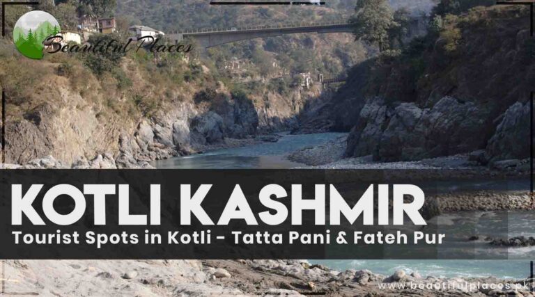
Tourist Spots in Kotli Kashmir – Tatta Pani & Fateh Pur

Kotli

District Kotli is a hilly area. The mountain range rises from here to the mountain of district Poonch. This Kotli district is famous as Madina-ul-Masajid and is located 141 km away from Islamabad.

Occupied Jammu Kashmir, Rawlakot, and Mirpur, are located in its surrounding.

Equipped with the latest facilities, a PWD rest house, and a rest house, this district is located at a height an average height of 1000 meters from sea level.

Kotli-Azad-Kashmir-Pakistan.
A beautiful sight of the city of mosques, Kotli Kashmir

Key info about Kotli

Attribute Kotli, Azad Kashmir
Location Kotli is a district located in Azad Kashmir, Pakistan.
Geographical Features The region is known for its scenic beauty, with lush green hills, fertile plains, and the Poonch River meandering through its territory.
Climate Kotli experiences a temperate climate with hot summers and cold winters, making it a pleasant destination year-round.
Natural Beauty Kotli is celebrated for its picturesque landscapes, serene valleys, and the serene Poonch River, providing a captivating ambiance.
Historical Significance The region has historical and cultural importance, with traces of ancient civilizations and local traditions.
Adventure Activities Kotli offers opportunities for trekking, hiking, and outdoor adventures amidst its beautiful terrain.
Local Culture The region reflects the broader Kashmiri heritage, showcasing local customs, festivals, and traditional architecture.
Accessibility Kotli is accessible by road from various cities in Azad Kashmir, making it a convenient destination for travelers.

Famous Tourist Spots in Kotli Kashmir

Tenda

Tenda is the best viewpoint which is 6km away from Kotli. You can enjoy the charming view of diver Ponch and Kotli city. Keeping in view the importance of this place, AJK tourism department has established a rest house there.

Goi

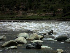
It is a small village in the district Kotli. Waterfalls are flowing near rivers Mahol and Braila. Dubrian is close to this village. A famous war was fought here in which Dogra army men succeeded to flee away to Jammu Kashmir via the river Mahol.

 Goi-Azad-Kashmir
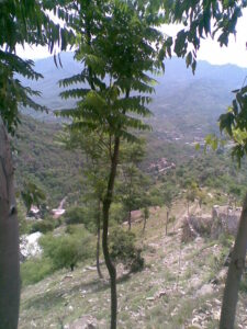
The sky high trees of Goi Kotli Kashmir

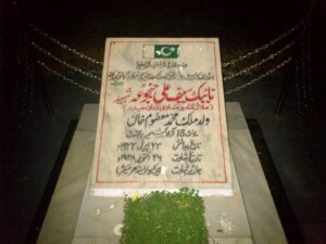
Naik Saif Ali Khan Shaheed

Naik Saif Ali Khan was born on 25th April 1922 in village Khandra of Tehsil Nikyal. On 18th March 1941, he entered the royal core of engineers in the British Indian army. In 1947, after completing his services in the Indian Army, he established Haideri Force in collaboration with Sardar Mohammad with Karelvi.

On 1st January 1948, he established “Sher Riasti” on the order of Lieutenant Kernel Muhammad Sher Khan. He was ranked Platoon commander for his bravery and courageousness. He along with his platoon inflicted heavy losses on the enemy on the front line of Budhakhana.

He got injured and martyred on 26th October 1948. On 14th March 1949, the Defence Council of Azad and Jammu Kashmir awarded him “Hilal-e-Kashmir”. On 30th November 1995, the government of Pakistan declared this award equal to Nishan-e-Haider.

شہادت ہے مطلوب مقصود مومن

نہ مال غنیمت، نہ کشور کشائی

A-memorial-to-Saif-Ali-Shaheed
A memorial to Saif Ali Shaheed

Bethak 

This beautiful place in district Sudhunoti is although a backward area but it is full of natural beauty. You can view the river Ponch and Jammu Kashmir from this point named Char Bhar. A route is directed to this spot from Trarkhel.

Tatta Pani Spring and Tatri Note

There is a water spring at Tatta Pani Point which is 24 km from the road directed to Hijra from Kotli. Sulfur vapors evaporate from this spring due to which its water is too hot.

It is very difficult to stay here in the smell and warmth of Sulphur in the summer season. This spring’s water is beneficial for knee pain and skin allergies. There are bathrooms near this spring that have facilities for cold and warm water.

 Tatta-Pani-Spring-Kotli-Azad-kashmir.j
Tatta Pani Spring Kotli Azad Kashmir

A narrow valley on the left side from Hijra to Tatta Pani Track will take you to the crossing point of Azad and Jammu Kashmir called Tatri note.

Fateh Pur (Nakyal)

This area is located 37 km from Kotli and on the borders of both Azad and Jammu Kashmir due to the partition at the time of the War of Independence (1947-1948).

It is comparatively cooler than other cities in the district since it is at an elevation of 1524 meters from the ocean level. It is considered to be the most beautiful part of Azad Kashmir.

Fateh-Pur-Nakyal-Kotli-Kashmir
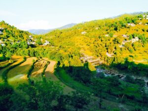
The rich green mountains of Fateh Pur Nakyal, Kotli Kashmir

A rest house and other facilities are accessible to the tourists. The Indian army killed innocent Kashmiri since this area is close to the border.

Khuiratta

This site is 30 from Kotli and is famous for its beautiful orchards. Khuiratta is the best traveling spot near the cease-fire line.

Dheri Sahibzadiyan, Bagh Darbar, Mai Toti, Manowaal, Chattar Chalni, and Karjai Dheriare tourists point. The famous fort of Karjai is near Khuiratta. It was built by Maharaja Gulab Singh.

Khuiratta-Azad-Kashmir-Pakistan
Khuiratta Azad Kashmir Pakistan

Gulpur Waterfall and Tharochi fort

This waterfall flows in three steps and is located in Gulpur Town on the Kotli Mirpur Road. It is an ideal place for families and friends. The ancient historic fort is on the nearby hilltop.

Gulpur-Waterfall-Azad-Kashmir-Kotli.
A beautiful sight of Gulpur Waterfall Kotli Azad Kashmir

Poonch River:

Serenading Waters: The Poonch River is the lifeline of Kotli, gently flowing through the region and creating enchanting vistas. Its crystal-clear waters are not just a scenic delight but also offer an opportunity for peaceful riverside strolls and picnics.

Hill View Park:

Scenic Overlook: Hill View Park offers panoramic views of Kotli and its surrounding landscapes. It’s an excellent place to capture the beauty of the region on your camera and enjoy a peaceful escape amid nature.

Toli Pir

Spiritual Retreat: Toli Pir is a revered shrine located atop a hill. The site is not only a place of spiritual significance but also offers stunning views of the countryside. A trek to Toli Pir is a popular activity for those seeking adventure and spirituality.

 Leepa Valley

Alpine Paradise: Leepa Valley, located near Kotli, is an alpine wonderland known for its lush meadows and terraced fields. It’s a fantastic destination for nature enthusiasts, offering breathtaking vistas and a serene ambiance.

Ghori’s Market

Local Bazaar: Ghori’s Market is a bustling local bazaar where you can immerse yourself in the local culture. It’s a great place to shop for traditional handicrafts, souvenirs, and experience the vibrant market atmosphere.

Jagran Nala

Picnic Spot: Jagran Nala is a scenic spot that provides an ideal setting for picnics. The gently flowing stream, surrounded by lush greenery, makes it a charming location to relax and enjoy a leisurely day out.

Schools

  • Kotli Public School: A reputed educational institution known for providing quality education to students in the region.
  • City Public School Kotli: Committed to offering a well-rounded education and fostering academic excellence.
  • Fauji Foundation Model School Kotli: A school managed by the Fauji Foundation, dedicated to educational advancement.

Colleges

  • Government Degree College Kotli: A prominent college offering a variety of undergraduate programs in arts and sciences.
  • Jinnah Degree College Kotli: Providing higher education opportunities and contributing to the region’s academic growth.
  • Abbasi Institute of Medical Sciences: A college that focuses on medical and health sciences education.

Restaurants

  • Al-Zohaib Restaurant: Known for its local and traditional Kashmiri cuisine, offering a delightful culinary experience.
  • Kashmiri Spice Restaurant: Serving a range of Kashmiri dishes, allowing diners to savor the local flavors.
  • Kotli Continental Restaurant: Offering a diverse menu of Pakistani and international dishes.

Hospitals

  • District Headquarters Hospital Kotli: Providing healthcare services, medical treatment, and emergency care to the residents of Kotli.
  • Kashmir Institute of Medical Sciences (KIMS): A well-equipped medical facility offering a range of healthcare services and treatments.
  • Al-Noor Hospital: A medical institution dedicated to delivering healthcare solutions and medical expertise.

Frequently asked questions (FAQs) 

What is the best time to visit Kotli, Azad Kashmir?

The best time to visit Kotli depends on your preferences. Summers offer pleasant weather for exploration, while winters turn it into a winter wonderland, perfect for snow enthusiasts.

How can I reach Kotli from major cities in Pakistan?

You can reach Kotli by road from cities like Rawalpindi, Islamabad, and Lahore. Public buses and private vehicles are common modes of transportation.

What adventure activities are available in Kotli?

Kotli offers opportunities for trekking, hiking, and camping amidst its scenic surroundings. The Poonch River is great for riverside walks and picnics.

Are there any religious sites to visit in Kotli?

Yes, Toli Pir is a revered shrine located atop a hill in Kotli. It holds spiritual significance and offers breathtaking views of the surrounding countryside.

What are the local delicacies of Kotli?

Kotli offers a taste of Kashmiri cuisine, including dishes like Rogan Josh, Dum Aloo, and the traditional Kashmiri Wazwan feast.

Are there any local markets or bazaars in Kotli for shopping?

Ghori’s Market is a bustling local bazaar in Kotli where you can shop for traditional handicrafts, souvenirs, and experience the vibrant local market atmosphere.

Is Kotli suitable for a family vacation?

Yes, Kotli is an excellent destination for a family vacation, with its tranquil natural beauty, accessibility to educational institutions, and healthcare facilities.

Can I find healthcare facilities in Kotli?

Kotli offers access to healthcare facilities, including the District Headquarters Hospital Kotli and Kashmir Institute of Medical Sciences (KIMS), ensuring medical support if needed.

What is the significance of the Poonch River in Kotli?

The Poonch River not only adds to the scenic beauty of Kotli but also offers opportunities for riverside relaxation, picnics, and leisurely strolls.

How can I make the most of my visit to Kotli?

To make the most of your visit to Kotli, plan to explore the natural wonders, immerse yourself in the local culture, and enjoy the tranquility and adventure that this beautiful region offers.

Wind Up Lines

Kashmir has countless fascinating sites. Kotli is one of the beautiful districts of Azad Kashmir. It is well known for the tourist spots and mosques. It is a perfect place for holidaymakers in Kashmir.

Poonch – Azad Kashmir | Famous Places in Poonch

Poonch

It is one of the ten districts of Kashmir. It is surrounded by beautiful landmarks, waterfalls, cascades, and sky-high mountains.

History of Poonch

It is said that it was settled by Raja Bak (574 B.C. to 637 B.C.) of the Nand family. However, according to a second statement, it was established by Raja Mukhat Apede of Karkot in 695 A.D. Chinese tourist Hieun Tsang visited this place too in 631 A.D.

Key information about Poonch 

Attribute Information
Name Poonch
Location Azad Kashmir, Pakistan
Geographical Features Situated in the Pir Panjal range of the Himalayas, Poonch is characterized by rugged terrain and dense forests.
Area Encompasses a significant area and is known for its stunning natural landscapes and cultural heritage.
Accessibility Accessible by road, offering scenic routes and an adventurous journey for travelers.
Natural Beauty Renowned for its captivating landscapes, including hills, valleys, and rivers that create an enchanting backdrop.
Historical Significance Holds historical importance as a former princely state and has witnessed various political and cultural developments.
Cultural Richness Home to indigenous communities, the region boasts a rich cultural heritage, reflected in its traditions and way of life.
Must-Visit Attractions Includes sites like Banjosa Lake, Rawalakot, Toli Pir, and the historical Red Fort.
Trekking and Hiking Trails Offers numerous trekking and hiking opportunities for adventurers, with trails leading to scenic viewpoints.
Weather Conditions Experiences a variety of seasons, including pleasant summers and snowy winters, making it a year-round destination.
Unique Cuisine The local cuisine showcases a blend of Kashmiri and Pahari flavors, with dishes like Rogan Josh and Saag being popular.

Famous Places in Poonch

Rawlakot

This valley is at an elevation of 1615 meters from ocean level and looks like a pearl in the ring. You have to visit this place to see the beauty. In the summer, the pleasant fragrance of numerous flowers on the lush green grass enriches its beauty.

It got fame because of freedom fighter Sardar Muhammad Ibrahim Khan. This city is furnished with all kinds of modern facilities and is only 110km away from Rawalpindi.

It is linked to all the other areas of Pakistan via a highway. Usually, the tourists stay here by making it a base camp. They visit the Banjosa lake and Toli peer areas on daily basis.

 Ralakot-Azad-Kashmir.
Rawlakot Kashmir

Gulshan-e- Shuhada

This point is 4 km on the highway going to Banjosa from Rawlakot. There are signs of an ancient historical temple. A signboard is also there for awareness. The Rawlakot airport is at a nearby place.

Gulshan-e-Shuhda-House-Kashmir-Poonch
A sight of Gulshan e Shuhda House in Poonch, surrounded by lush green trees

Koiyan

This place with a pleasant environment is 17km from Rawlakot fenced by blossoming woodlands. A tourist lodge by the government is also there.

Banjosa Lake

Located in Tehsil Hajira of district Ponch, this lake is 19km from Rawlakot city. It is at a height of 5898 feet from the ocean level. It is the only picnic spot with a proper strategy.

This lake presents a splendid view surrounded by high mountains and opulent green trees. There are boating and sailing facilities for tourists.

The weather remains calm and pleasant in summer. However, there is snowfall in winter at times. For a stay, there are hotels, huts, and PWD rest houses.

You can reach Banjosa Lake in two and a half hours from Islamabad via Rawlakot. There is a resort on the bank of the lake too.
 Lake_of_Banjosa-Azad-Kashmir.
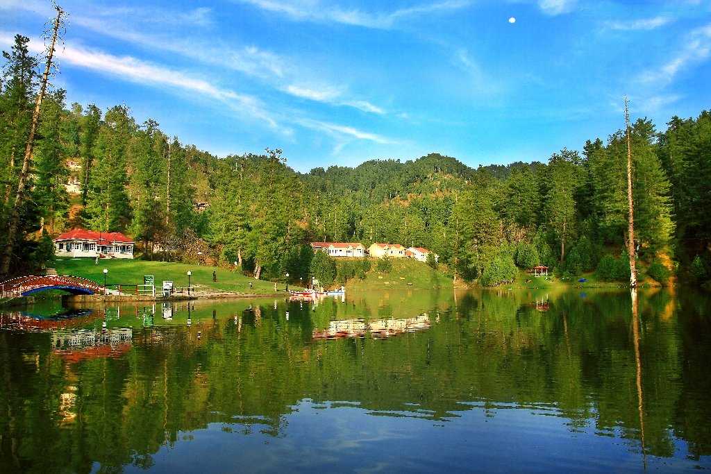
Banjosa Lake, The best picnic spot in Poonch Azad Kashmir

Devi Gali

The beautiful place of Devi Gali is 12 km from Banjosa Lake. It is also a great attraction for nature lover holidaymakers.

Kot Mattay Khan

This site is near Topa on the highway from Rawlakot to Mang. It is a good point to enjoy a picnic in a cool pleasant environment in summer. You can take an aerial view of the valley from here.

Toli Peer

A hilltop is named Toli Peer in the Tehsil Rawlakot of district Ponch. It is at an altitude of 8800 from sea level. It is at a distance of 40km from Rawlakot.

Toli-Peer-Poonch-Azad-Kashmir
A magnificent sight of skyscrapers mountains in Toli Peer Poonch

A beautiful sight of Abbas Pur, Bagh, and river Poonch from Toli Peer. This location is the peak of the three highest mountain ranges.  It is a gift of nature. It is feasible to come here in summer however the climate is cold from October to March.

Ghori Mar

Khai Gala is the way to reach this site which is 30 km away from Rawalakot. You can enjoy an enchanting airborne view of Bagh and Rawalakot from the top. A road from Ghori Mar to Toli Peer will take you to green meadows.

Ghori-MarPoonch-Azad-Kashmir
Ghori Mar Pastures

Cultural Richness

  • Indigenous Communities: Poonch is home to indigenous communities that have nurtured a rich cultural heritage over generations. The culture is reflected in the traditional practices, festivals, and the warmth of the locals.
  • Cultural Celebrations: The region comes alive with vibrant cultural celebrations, such as the annual Loran Mela, where you can experience the lively music, traditional dances, and local cuisine.

A Paradise for Adventurers

Trekking and Hiking Trails: Poonch offers numerous trekking and hiking trails. Each trail presents a unique adventure, leading to scenic viewpoints, secluded valleys, and mesmerizing landscapes.

A Year-Round Destination

Poonch, with its diverse seasons, offers something for everyone. The summers are pleasant, perfect for exploring the natural beauty, while the winters transform the region into a snowy wonderland, ideal for those who seek the allure of snow-covered landscapes.

Schools

  • Government Boys High School Poonch
  • Government Girls High School Poonch
  • Poonch Medical College
  • Islamia Public School Poonch
  • Chenab College Poonch

Colleges

  • Government Degree College Poonch
  • Government Postgraduate College Poonch
  • Kotli College Poonch
  • Army Public College Poonch
  • Poonch Medical College

Hospitals

  • District Headquarters Hospital Poonch
  • Azad Kashmir Medical College Teaching Hospital
  • Poonch Medical College Hospital
  • Al-Khidmat Hospital Poonch
  • Shifa Hospital Poonch

Restaurants

  • Al-Habib Restaurant
  • Nizam’s Restaurant
  • Mumtaz Restaurant
  • Tasty Bites Restaurant
  • Khyber Shinwari Restaurant

Frequently asked questions (FAQs)

What is the geographical location of Poonch?

Poonch is situated in Azad Kashmir, Pakistan, nestled in the Pir Panjal range of the Himalayas.

What is the significance of Banjosa Lake in Poonch?

Banjosa Lake is a picturesque spot in Poonch, ideal for boating, picnics, and enjoying the serene natural surroundings.

Is Poonch a historically significant region?

Yes, Poonch has historical importance as a former princely state, and the Red Fort is a notable historical monument in the region.

What cultural experiences can visitors enjoy in Poonch?

Visitors can immerse themselves in the local culture, enjoying cultural celebrations like the Loran Mela, which features traditional music, dances, and cuisine.

Are there opportunities for trekking and hiking in Poonch?

Poonch offers a range of trekking and hiking trails, providing adventure enthusiasts with opportunities to explore the stunning landscapes.

What is the local cuisine like in Poonch?

Poonch offers a delightful blend of Kashmiri and Pahari cuisine. Popular dishes include Rogan Josh, Saag, and a variety of kebabs.

Is Poonch accessible year-round?

Yes, Poonch is accessible throughout the year, with pleasant summers and snowy winters, making it a versatile destination for travelers.

What are some famous educational institutions in Poonch?

Poonch is home to educational institutions like Government Degree College Poonch, Army Public College, and Poonch Medical College.

Which hospitals are prominent in Poonch?

Hospitals such as District Headquarters Hospital, Azad Kashmir Medical College Teaching Hospital, and Al-Khidmat Hospital serve the healthcare needs of the region.

Are there popular dining options in Poonch?

Poonch boasts restaurants like Al-Habib Restaurant, Nizam’s Restaurant, and Khyber Shinwari Restaurant, offering a variety of culinary delights.

Wind Up Lines

Azad Kashmir is like a heaven on Earth. Poonch is one of the beautiful districts of Kashmir. Rawlakot, Banjosa Lake, Devi Gali, Toli Per, Ghori Mar and Kot Mattay Khan are some famous tourist spots.


Famous Tourist & Historical Places in Swabi – KPK

Swabi

Swabi is a city in Khyber Pakhtunkhwa, situated between the rivers Indus and Kabul. It has historical as well as recreational spots.The district is known for its fertile lands, lush fields, and a network of canals that make it a vital agricultural region. Swabi’s idyllic scenery is further enhanced by the presence of the River Indus, which adds to the region’s natural charm.

Swabi is not only about picturesque vistas; it has its own historical tales to tell. The district is home to archaeological sites like Jamal Garhi, which boasts ancient stupas and monastic cells, providing a window into the region’s Buddhist past. Moreover, Gohar Fort, a historic structure, adds to the historical allure of Swabi.

Swabi-KPK
The lush green meadows of Swabi KPK

For those who appreciate a touch of adventure, Swabi is an excellent starting point for exploring the beautiful valleys of Khyber Pakhtunkhwa, including Malakand, Dir, and Buner. The district serves as a gateway to these pristine destinations, making it a convenient base for travelers.

With its natural beauty, historical sites, and proximity to other scenic areas, Swabi beckons both nature enthusiasts and history buffs. It’s a place where you can witness the harmonious coexistence of nature and heritage, offering a glimpse into the diverse tapestry of Khyber Pakhtunkhwa.

Swabi District is divided into four Tehsils named

  1. Lahor
  2. Razzar
  3. Swabi
  4. Topi

Key information about Swabi

Heading Information
Location Swabi is located in the Khyber Pakhtunkhwa (KP) province of Pakistan. It is situated in the heart of the province.
Geography Swabi is characterized by lush fields, fertile lands, and a network of canals. It is also traversed by the River Indus, enhancing its natural beauty.
Historical Sites Swabi is home to archaeological sites such as Jamal Garhi, which features ancient stupas and monastic cells, and Gohar Fort, a historic structure.
Nearby Destinations Swabi serves as a convenient base for exploring nearby scenic areas, including Malakand, Dir, and Buner. It provides access to these pristine destinations.
Economy The district’s economy is primarily agrarian, with agriculture playing a significant role. It is known for the cultivation of various crops and fruits.
Culture Swabi has a rich cultural heritage, with traditions that reflect the broader Khyber Pakhtunkhwa culture. The district is known for its cultural events and festivities.
Natural Beauty The natural beauty of Swabi is accentuated by its fertile landscapes, lush greenery, and the presence of the River Indus, making it an appealing destination for nature lovers.

History

Swabi and its surrounding areas have witnessed the footprints of various ancient civilizations, including the Gandhara civilization. This region was part of the larger Gandhara region, known for its Buddhist heritage. Archaeological sites like Jamal Garhi, with its ancient stupas and monastic cells, provide glimpses into Swabi’s ancient past.

Buddhism had a significant presence in Swabi during ancient times. The relics and ruins of Buddhist monasteries and stupas are a testament to this influence. The region played a pivotal role in the spread of Buddhism in the subcontinent.

Swabi is also home to historical structures like Gohar Fort. This fort is not only a symbol of the region’s history but also an architectural marvel. It stands as a reminder of the region’s strategic significance in various eras.

Swabi’s culture is a reflection of the broader Khyber Pakhtunkhwa culture. The district has a rich tradition of cultural events and festivities, showcasing the local customs and way of life.

Over the centuries, Swabi has witnessed changes in rulers, empires, and cultural influences. It has been part of various historical transitions, contributing to its unique historical identity.

Famous Tourist & Historical Sites

Kund Park

The borderline of Punjab ends at Khairabad and KPK starts here. It is a small village between the river Indus and the river Kabul. KPK tourism department has established a tourist park there. Vehicles can be parked at the side of the Khairabad point alongside Attock fort.

The two rivers can be seen mixing on the right side near the bridge. Kabul river has brown color while the river Indus has clear blue water. Both the brown color and blue color water flow together at a long distance. It is a fascinating and splendid sight.

Parking is there at a distance of 4km from the Attock bridge. This parking is on Pindi Road 4km from Swabi Interchange and Jahangira if you are coming Islamabad motorway. There is a ferry service, small boats, and cable cars near the edge of the river.

Kund-park-swabi
Kund Park where the river Kabul and the river Indus confluence

Going to the other edge of the river through any of these services is a thrilling experience. This park has rich green lawns, play areas, huts, and restaurants. There are golf cars in this 2.1 km long park. There is a facility for camel and horse riders. You can enjoy fishing too.

Hund

This ancient historical village is 6km from village Chota Lahore of district Swabi on the highway directed to Tarbela Dam which is 22km northeast of Attock. Historians used to call this village “the gate to subcontinent”.

According to Chich historians, this village was settled by Hund the grandson of Hazrat Noh (A.S). The first chapter of the Rig Veda mentions the Odabandpur (Hund) in the 41st Sukta of the 64th Bhajan. It was the capital of Hindu Shahi and an important city of Gandara civilization in 1008.

Alexander the Great crossed the Indus River here at the time of the invasion of the subcontinent. When Genghis Khan reached here like a hurricane, he saw the width of the river and went back.  This was also the decisive battle between Raja Jay Pal and Mehmood Ghaznavid, the defeat of which became the fate of Raja Jayapal of Punjab.

The signs of Hund fort still exist. The valuable artifacts of the region are exhibited in Hund Museum on the bank of the river Indus. This museum can be seen from the river Indus bridge on the Islamabad Peshawar motorway.

 Hund-Swabi
Jeep Race in the river Indus, Hund.

Chota Lahore

The ancient area of Swabi is Chota Lahore. It was a civilized city stretching over a large area. Its oldest name was Salatur.

When the astrologers came and settled here, they were the ones who worshiped Mars. They made this place the temple of Mars and named it Lahore. Xuanzang (Hsüan-tsang) and Kangham have written it the city of “Brahmans”.

Maharaja Ashok built a memorial of Panini. Panini who was a philologist and grammarian wrote the grammar of the Sanskrit language. It was the birthplace of this great scholar. He was the first who embraced Buddhism.

Alexander the Great crossed the river Indus at this point and joined Raja Ambahi as his guest. It was the capital of the Gandara civilization and Raja Jay Pal before the Islamic regime.

Tarbela Dam (The world’s largest earthen filling dam)

Tarbela dam project was started formally on 14th May 1968 when WAPDA and Tarbela Giant Venture signed a contract of 650 million American dollars. It was the biggest contract in the World in terms of finance.

A group of 13 Italian, French, German, and Swiss companies completed this project of the construction of the dam in three steps. The width of the river was blocked with a nine thousand feet high wall. The lower wall of the dam is 42 feet while the upper wall is only 5 feet wide.

A permission letter is required to visit the dam which can be obtained from PRO WAPDA Tarbela or WAPDA house Lahore.

 Tarbela-Dam-Swabi.
A breath-taking aerial view of Tarbela Dam, Swabi

Captain Karnal Sher Khan Shaheed Nishan-e-Haider

Karnal Sher Khan was born on 1st January 1970 and got a commission in the army on 14th October 1994. Captain Karnal Sher Khan appeared as a brave soldier in the war of Kargil. He did great damage to the enemy by setting examples of bravery and courage.

At a height of 17,000 feet, he protected five defensive posts at the front of Gul Tari. On 5th July 1999, the enemy attacked the posts of Karnal Sher Khan with the assistance of two battalions and a heavy mortar. The enemy succeeded in capturing one check post.

Karnal Sher Khan regained that defensive post despite great difficulties. However, during this attack, he was martyred after getting a shot by machine gun. Later on, he was awarded the highest military award “Nishan-e-Haider”. The grave of this brave man is on the Mardan road from Swabi

Jamal Garhi

Historical Stupas and Monastic Cells: Jamal Garhi is an archaeological site of great significance. It is known for its ancient Buddhist stupas and monastic cells, which offer a glimpse into the region’s Buddhist heritage.

Gohar Fort

Historical Fortress: Gohar Fort, located in the district, is a historic structure with a unique blend of architectural beauty and historical importance. It serves as a reminder of the region’s rich past.

Marghuzar

Natural Beauty: Marghuzar, a picturesque town in Swabi, is known for its lush green fields, scenic beauty, and tranquil atmosphere. It’s a perfect destination for those seeking a peaceful retreat.

Yar Hussain

Agricultural Heart: Yar Hussain is a town celebrated for its agricultural significance. The region’s vast fields and fertile lands contribute to the district’s agricultural prosperity.

Shewa Adda

Commercial Hub: Shewa Adda is a bustling market in Swabi known for its economic activity. It’s a place where locals gather for shopping, dining, and socializing.

Shewa

Historical Village: Shewa is an ancient village with historical relevance. It showcases a blend of traditional architecture and a glimpse into the region’s past.

Panjpir

Spiritual Retreat: Panjpir is known for its spiritual and cultural significance. The shrine of Panjpir is a revered site for devotees and travelers.

Frequently asked questions (FAQs) 

Q: What is the significance of Jamal Garhi in Swabi?

A: Jamal Garhi is an important archaeological site known for its ancient Buddhist stupas and monastic cells. It provides insights into the region’s Buddhist heritage and history.

Q: What can visitors expect to see at Gohar Fort?

A: Gohar Fort is a historic fortress in Swabi that offers a blend of historical significance and architectural beauty, making it a notable attraction for history enthusiasts.

Q: Is Marghuzar a popular tourist destination in Swabi?

A: Yes, Marghuzar is a picturesque town celebrated for its lush green fields and tranquil atmosphere, making it a favored spot for those seeking natural beauty and serenity.

Q: What is the specialty of Chota Lahor in Swabi?

A: Chota Lahor is a charming riverside location where visitors can enjoy the beauty of the river and its surroundings, making it an excellent choice for picnics and relaxation.

Q: Why is Yar Hussain known as an important town in Swabi?

A: Yar Hussain is celebrated for its agricultural significance, with vast fields and fertile lands that contribute to the district’s agricultural prosperity.

Q: What can one explore in Shewa Adda?

A: Shewa Adda is a bustling market and commercial hub in Swabi, where locals gather for shopping, dining, and social interactions, offering a taste of the local lifestyle.

Q: Is Shewa known for its historical significance?

A: Yes, Shewa is an ancient village in Swabi that provides a glimpse into the region’s history and traditional architecture, making it an interesting destination for history buffs.

Q: What is the spiritual significance of Panjpir in Swabi?

A: Panjpir is known for its spiritual and cultural importance. The shrine of Panjpir is a revered site for devotees and travelers, attracting those seeking blessings and solace.

Wind Up Lines

Swabi is a historical city of Khyber Pakhtunkhwa. It is blessed with natural beauty and splendid landmarks. Moreover, it is a town of brave people like Sher Khan.

About Leepa Valley – A Tranquil Site of Azad Kashmir

Leepa Valley

It is surrounded by 10 to 16 thousand feet high mountains and is located 1921 meters above sea level.

It is famous as small Kashmir and it looks like heaven because of its luxuriant greenery, waterfalls, thick forests, pleasant climate, calm environment, orchards loaded with fruits, and white snow caps on the high hills.

There are two and three-floor wood houses that look similar. The environment of Leepa valley truly reflects the environment of occupied Jammu Kashmir. No other place is better than Leepa valley to enjoy the autumn season.

The area is covered with snow when red, orange, and yellow leaves stop falling. The routes to Pakistan and Azad Kashmir from Leepa valley are blocked in winter during snow falling.

 Leepa_Valley_Azad_Kashmir_Pakistan
A captivating sight of Leepa Valley

Walnuts, honey, cherry, apple, and apricot are abundant. A road goes to Leepa valley after crossing the river Jhelum Bridge. This bridge is 45km away from the highway directed to Srinagar from Kashmir after Hattian Bala and Neeli Village.

You will have to take a permission letter for this valley from the Hattian Bala deputy commissioner’s office. It is 60km away from Neeli Village.

Key information about Leepa Valley 

Attribute Information
Name Leepa Valley
Location Azad Kashmir, Pakistan
Geographical Features Nestled in the Pir Panjal range of the Himalayas, Leepa Valley is known for its stunning natural beauty.
Area Covers a significant area and is characterized by lush green meadows, dense forests, and flowing rivers.
Accessibility Accessible by road, with a journey that takes you through picturesque landscapes and charming villages.
Natural Beauty Renowned for its captivating landscapes, including terraced fields, alpine meadows, and pristine rivers.
Cultural Significance Home to indigenous communities with a rich cultural heritage, adding to the valley’s charm.
Trekking and Hiking Trails Offers numerous trekking and hiking opportunities that lead to panoramic viewpoints and remote villages.
Must-Visit Spots Includes Leepa, Leepa Meadows, Leepa River, Leepa Valley Wildlife Sanctuary, and the picturesque villages.
Accommodation Options Provides guesthouses, lodges, and camping facilities for visitors who want to immerse themselves in nature.
Local Cuisine Offers a taste of Kashmiri and Pahari cuisine, with local specialties like Gushtaba, Dum Aloo, and more.
Weather Conditions Features a pleasant summer season and heavy snowfall in winter, making it a year-round destination.

Famous Places in the Suburb of Leepa Valley

Eesha

22km away from Neeli Village, Eesha is a perfect place for natural beauty seekers. The road is smooth and solid till this point. For traveling beyond this place, you will have to book a jeep.

It is a better idea to book the jeep from Muzaffarabad. It is an adventurous journey on a motorbike. You can take NOC from the army check post in Eesha.

There are two ways to Leepa valley from Eesha. It will be a great idea to reach there by the Dao Khan way and return back from the other. In this way, you can visit the whole valley.

Dao Khan

It is a charming place 4km from Eesha. Its aerial views are splendid at a height of 2490 meters from sea level. There is a tourist rest house, a forest rest house, and a tent service by the tourism department.

 daokhan-kashmi
Dao Khan Kashmir

Leepa

This central point of the valley is 38km away from Eesha and at an elevation of 1921 from ocean level. Must visit the local hydropower station on the way from Leepa to Chinian. You will be captivated by the fascinating scenery of the valley.

Leepa valley is parallel to occupied Jammu Kashmir. Pakistani and Indian forces are in front of each other. During the tension between the frontline Pakistan and India, Indian army forces attacked innocent citizens of the valley.

The Pakistan army has to be very careful because there are Muslim people on the other side of the border. It is a thrilling experience to climb the hilltop of Leepa from Eesha.

The link between Leepa to Pakistan and Azad Kashmir is jammed due to snowfall in winter. The army helicopters are the only way to reach there in the bitter cold. The Tatwal – area of occupied Jammu Kashmir is in front of Neelum valley.

Tatwal is 15km from Leepa. It was a part of Azad Kashmir before the Indian occupation.

Chinian

Chinian is at an altitude of 2226 meters from the sea level at a length of 6km from Leepa. This area is close to the line of control. There is a rest house and Chanar hotel for the public.

A Glimpse of Paradise

  • Geographical Wonders: Leepa Valley is a symphony of geographical elegance. As you traverse the winding roads that lead to this secluded haven, you’re greeted by lush green meadows, dense forests, and the melody of flowing rivers. The valley is cocooned by mountains, creating a cocoon of serenity.
  • Terraced Fields: One of the distinctive features of Leepa Valley is its terraced fields. These vibrant patches of cultivated land seem to defy gravity as they cascade down the slopes, creating a captivating visual mosaic.
  • Captivating River: The Leepa River meanders through the valley, its crystal-clear waters reflecting the surrounding mountains. It provides the perfect backdrop for picnics and leisurely strolls.
  • Alpine Meadows: Leepa Valley is renowned for its alpine meadows, where you can witness a carpet of wildflowers during the spring and summer months. These meadows are perfect for a quiet retreat or a leisurely hike.

Cultural Charms

  • Indigenous Communities: The valley is home to indigenous communities who have preserved their cultural heritage for generations. The warm hospitality of the locals adds to the valley’s charm, allowing you to immerse yourself in the rich traditions of the region.
  • Charming Villages: The valley is dotted with picturesque villages, each with its unique character. As you explore these villages, you’ll encounter quaint wooden houses, terraced fields, and a way of life that seems untouched by time.

Must-Visit Spots

  • Leepa Meadows: These meadows offer breathtaking views of the surrounding mountains and provide the perfect setting for a picnic or a leisurely stroll.
  • Leepa River: The gentle Leepa River invites you to relax by its banks, enjoy the serene atmosphere, and even try your hand at fishing.
  • Leepa Valley Wildlife Sanctuary: For wildlife enthusiasts, this sanctuary offers a chance to spot native species like the Himalayan brown bear, snow leopard, and the elusive Himalayan monal pheasant.

A Year-Round Destination

Leepa Valley is a destination for all seasons. In the summer, it comes alive with vibrant colors, and the meadows are adorned with wildflowers. During the winter, the valley is transformed into a winter wonderland, with heavy snowfall creating a serene, white landscape.

A Taste of Kashmiri Cuisine

No journey to Leepa Valley is complete without savoring the local cuisine. You can relish the flavors of Kashmiri and Pahari dishes, with specialties like Gushtaba and Dum Aloo tantalizing your taste buds.

Frequently asked questions (FAQs) 

What is Leepa Valley known for?

Leepa Valley is renowned for its breathtaking natural beauty, including alpine meadows, terraced fields, and the serene Leepa River.

Where is Leepa Valley located?

Leepa Valley is situated in Azad Kashmir, a region in Pakistan-administered Kashmir, nestled in the Pir Panjal range of the Himalayas.

How can I reach Leepa Valley?

Access to Leepa Valley is primarily by road. The journey involves traversing picturesque landscapes and charming villages, making the trip itself a memorable experience.

What is the best time to visit Leepa Valley?

The best time to visit Leepa Valley depends on your preferences. Spring and summer offer vibrant landscapes with blooming wildflowers, while winter transforms the valley into a snowy wonderland, ideal for those seeking a winter retreat.

Are there hiking and trekking opportunities in Leepa Valley?

Yes, Leepa Valley offers various hiking and trekking trails that lead to panoramic viewpoints, alpine meadows, and remote villages, providing excellent opportunities for adventure enthusiasts.

What is the cultural significance of Leepa Valley?

Leepa Valley is home to indigenous communities that have preserved their cultural heritage for generations. Visitors can immerse themselves in the traditions and warm hospitality of the locals.

Are there accommodations in Leepa Valley?

Yes, there are guesthouses, lodges, and camping facilities available in Leepa Valley for visitors who wish to stay and experience the natural beauty and cultural richness of the region.

What is the local cuisine like in Leepa Valley?

Leepa Valley offers a taste of Kashmiri and Pahari cuisine. Local specialties include dishes like Gushtaba and Dum Aloo, providing a delightful culinary experience.

Is Leepa Valley accessible year-round?

Yes, Leepa Valley is accessible throughout the year. While the summer months offer lush greenery and wildflowers, the winter season blankets the valley in snow, making it a unique destination for winter enthusiasts.

Are there wildlife attractions in Leepa Valley?

Leepa Valley Wildlife Sanctuary is home to native wildlife species, including the Himalayan brown bear, snow leopard, and the Himalayan monal pheasant, making it an appealing destination for wildlife enthusiasts.

Wind Up Lines

Leepa Valley is full of mesmerizing places. Sites near Leepa Valley such as  Eesha, Dao Khan, and Chinian are worth watching too. It is well known for fruit orchards.

Mirpur – Azad Kashmir | History & Famous Spots

Mirpur

Mirpur city was settled by Meral Shah who was the son of the Ghaghra family. District Mirpur is located in the south of Azad Kashmir.

Mirpur_Azad_Kashmir_Pakistan
An enchanting aerial view of Mirpur Azad Kashmir

This city has plains and hilly areas with a warm climate. It is connected to Pakistan through many routes. The citizens of this town resemble the people of Jhelum and Gujrat.

Over the previous few decades, a lot of people from Mirpur have shifted to the United Kingdom for livelihood. Pakistan is getting a huge foreign exchange because of them.

The Government of Azad Kashmir has established an Industrial State for the promotion of private investment. The old Mirpur city is 459 meters high from sea level and it was a hurdle for the construction of the Mangla dam. Therefore, this new city is established with a proper plan and it has all the latest facilities.

Information about Mirpur in Azad Kashmir

Attribute Information
Name Mirpur
Location Azad Kashmir, Pakistan
Geographical Features Situated on the banks of the Mangla Dam, Mirpur boasts picturesque landscapes and a thriving, man-made lake.
Area Covers a significant area and is one of the largest cities in Azad Kashmir.
Accessibility Accessible by road from major cities in Pakistan, making it a popular destination for tourists.
Economic Hub Known for its strong economy, Mirpur is a significant business and commercial center in Azad Kashmir.
Tourism Attracts tourists with its beautiful surroundings, water sports on the Mangla Dam, and vibrant local culture.
Cultural Diversity Mirpur is a melting pot of cultures, with influences from Kashmiri, Punjabi, and British traditions.
Industrial Development Home to a range of industries, including manufacturing, agriculture, and trade.
Education Hub Hosts educational institutions like Mirpur University of Science and Technology, contributing to higher education in the region.
Healthcare Facilities Provides a range of healthcare services through hospitals and clinics, ensuring the well-being of residents and visitors.
Local Cuisine The local cuisine reflects a blend of flavors, including traditional dishes like Kashmiri Wazwan and Punjabi cuisine.
Natural Beauty The Mangla Dam, a key attraction, offers opportunities for boating, fishing, and enjoying the scenic beauty of the area.
Historic Significance Holds historical importance as a region that was greatly impacted by the construction of the Mangla Dam and the resettlement of communities.
Infrastructure Features modern infrastructure, including roads, bridges, and recreational facilities, making it an attractive city for residents and tourists.

The Historical Tapestry of Mirpur, Azad Kashmir

Nestled in the heart of Azad Kashmir, the city of Mirpur stands as a witness to a rich history that has been shaped by centuries of cultural interactions and, more recently, by the forces of modernity. Let’s unravel the historical tapestry of this captivating city.

Ancient Roots

Mirpur’s history, like the rest of Azad Kashmir, is deeply rooted in the annals of ancient civilizations. The region has been a cradle of diverse cultures and has witnessed the rise and fall of empires over the millennia. It’s believed that the area around Mirpur has been inhabited for thousands of years, with evidence of human settlements dating back to antiquity.

Influence of the British Empire

During the colonial era, the British Empire played a significant role in shaping the region. Mirpur, like many parts of South Asia, came under British colonial rule. The British presence left an indelible mark on the culture, administration, and infrastructure of the area.

The Birth of the Mangla Dam

A pivotal moment in Mirpur’s history occurred in the mid-20th century with the construction of the Mangla Dam. Completed in 1967, this colossal earth-fill dam was built to provide water storage for irrigation and generate electricity. The creation of the dam resulted in the submergence of a significant portion of the old city of Mirpur, displacing thousands of residents. The resettlement of these communities reshaped the city and its demographics.

Post-Independence Era

Following the partition of India in 1947, Azad Kashmir became part of Pakistan. As the region gained autonomy, Mirpur emerged as a major city in the newly formed Azad Jammu and Kashmir. The city’s growth was significantly influenced by the economic opportunities brought about by the Mangla Dam, making it a thriving business and commercial center.

Cultural Diversity

Mirpur’s historical narrative is not only about external influences but also about the tapestry of cultures that have blended here over time. The city’s cultural diversity is a source of pride, with residents embracing Kashmiri, Punjabi, and even British cultural elements. This diversity is reflected in the language, traditions, and way of life of the people.

Modern Mirpur

Today, Mirpur stands as a city where history and modernity coexist harmoniously. Its stunning natural landscapes and economic vitality, driven by industries such as manufacturing and agriculture, paint a vibrant picture of progress.

The city’s modern infrastructure, including roads, bridges, and educational institutions, ensures that it continues to grow and flourish. Yet, it never forgets its historical roots and the challenges it has overcome.

Mirpur, Azad Kashmir, is a city that proudly carries its historical legacy into the future. It’s a place where ancient history, colonial influences, and the ambitions of a modern, dynamic society converge to create a truly unique destination.

Historical Spots in Mirpur Azad Kashmir

Ram Kot Fort

It is narrated that this fort was built above an ancient Shiva temple. This fort located on a mountain peak has the river Jhelum flowing on its three sides.

Muslim rulers of the sixteenth and seventeenth centuries took part in the construction of this temple. It is located in the opposite direction from Mirpur city. People can reach this temple through Mangla Lake by boat.

Army sports club is on the left side 10km away from Mirpur. From there, we can reach the temple using speed boats in 20 minutes. People reach this fort via bikes when the water level is low in Mangla Lake.

Ramkot_Fort-Azad-Kashmir-
Beautiful Ram Kot is fenced by the river Jhelum

Khari Sharif

According to history, this place was ruled by Sohlan Rajput Family. It is an agricultural area of district Mirpur and is commonly called Khari.

It is located in between Mirpur City and river Jhelum hills at a distance of 8km from Mirpur. A well-known writer of romantic love stories Saif-ul-Malook, former prime minister of Azad Kashmir, and Barrister Sultan Mehmood belonged to this area of Khari Sharif.

A_view_of_Mazar_of_Mian_Muhammad_Bakhsa_Khari_Sharif
A view of Mazar of Mian Muhammad Bakhsha, Khari Sharif Mirpur Azad Kashmir

Exploring The Mirpur

  • Geographical Elegance: Mirpur’s geographical beauty is its crown jewel. Situated alongside the Mangla Dam, it enjoys the embrace of rolling hills, lush greenery, and the vast waters of the dam. This picturesque setting creates an environment where nature’s artistry takes center stage.
  • The Mangla Dam: Mirpur’s most renowned feature, the Mangla Dam, is one of the largest earth-fill dams globally. The dam not only provides vital irrigation and power resources but also offers a scenic backdrop for various water sports and leisurely boat rides.
  • Cultural Diversity: Mirpur’s charm extends beyond its landscapes. The city is a cultural melting pot, influenced by Kashmiri, Punjabi, and even British traditions. This diversity is vividly reflected in the local way of life.

A Thriving Economy

  • Economic Hub: Beyond its natural beauty, Mirpur is a bustling economic hub in Azad Kashmir. It boasts a robust economy driven by diverse industries, including manufacturing and agriculture. The city’s markets are a testament to its trading activities, offering a wide array of products and services.
  • Educational Excellence: Mirpur University of Science and Technology (MUST) is a prestigious institution that provides higher education opportunities in the city, contributing significantly to the region’s academic growth.
  • Modern Infrastructure: The city’s infrastructure, which includes well-maintained roads, bridges, and recreational facilities, is a reflection of its modern and progressive nature.

Famous Places in Mirpur

  • The Mangla Dam: The star attraction of Mirpur, the Mangla Dam is not just a reservoir; it’s a serene expanse offering opportunities for boating, fishing, and capturing the scenic beauty that envelops it.
  • Rattan Bagh: For families and nature enthusiasts, Rattan Bagh is a tranquil park and zoo offering a relaxed atmosphere for picnics and leisurely strolls.
  • Kala Mata Temple: This ancient temple dedicated to the goddess Kala Mata is a place of spiritual significance and architectural beauty.

Famous Schools

  • Chenab Group of Colleges: Known for providing quality education and a diverse range of academic programs.
  • Allied School Mirpur Campus: Part of a respected educational network, Allied School offers excellent academic opportunities.

Colleges

  • Mirpur University of Science and Technology (MUST): A significant higher education institution in Mirpur, offering a wide range of undergraduate and postgraduate programs.
  • Govt. Degree College for Women: A prominent college catering to the educational needs of female students in the region.

Hospitals

  • City Hospital and Medical Complex: A well-equipped hospital known for its medical services and experienced healthcare professionals.
  • Fauji Foundation Hospital: Offers a range of healthcare services and is respected for its commitment to quality patient care.

Restaurants

  • Bashir Darul Mahi: Famous for its delectable seafood and local dishes, Bashir Darul Mahi is a preferred dining spot in Mirpur.
  • Pearl Continental Hotel – Taipan Restaurant: Located within the Pearl Continental Hotel, Taipan Restaurant offers a diverse menu with a luxurious dining experience.
  • Yummi Zone Restaurant: A popular choice for local and international cuisine, Yummi Zone Restaurant serves a variety of dishes in a welcoming atmosphere.

Frequently asked questions (FAQs) 

What is Mirpur known for?

Mirpur is known for its stunning landscapes, including the Mangla Dam, and its role as a bustling economic hub in Azad Kashmir.

How do I reach Mirpur?

Mirpur is accessible by road from major cities in Pakistan, making it a convenient destination for tourists and travelers.

What is the Mangla Dam, and what can I do there?

The Mangla Dam is a vast reservoir known for water sports, boating, and fishing. Visitors can enjoy these activities while taking in the breathtaking views.

Is Mirpur a cultural city?

Yes, Mirpur is a diverse city influenced by various cultures, including Kashmiri, Punjabi, and British traditions. This cultural diversity is reflected in the local way of life.

What are the major industries in Mirpur?

Mirpur is home to a range of industries, including manufacturing, agriculture, and trade. It contributes significantly to the economy of Azad Kashmir.

Are there educational institutions in Mirpur?

Yes, Mirpur hosts educational institutions, including Mirpur University of Science and Technology (MUST), providing opportunities for higher education.

What are the must-try dishes in Mirpur?

Visitors can savor local delicacies like Kashmiri Wazwan and a variety of Punjabi-influenced dishes at local restaurants and food markets.

What are the famous places to visit in Mirpur?

Key attractions in Mirpur include the Mangla Dam, Ramkot Fort, Rattan Bagh, and the Kala Mata Temple. Each offers a unique experience.

Is Mirpur a safe city for tourists?

Mirpur is generally considered a safe destination for tourists. As with any travel, it’s advisable to stay updated on travel advisories and follow local guidelines.

What is the best time to visit Mirpur?

The best time to visit Mirpur depends on your preferences. Many tourists choose to explore the city during the pleasant weather of spring and autumn.

Wind Up Line

Mirpur, Azad Kashmir, is a city of contrasts where history meets modernity, and where nature and culture coexist harmoniously. The city’s scenic landscapes, economic vitality, and diverse culinary experiences make it an exciting destination for residents and tourists. Whether you’re exploring the historic Ramkot Fort, enjoying the tranquility of the Mangla Dam, or indulging in local delicacies, Mirpur offers a unique blend of tradition and progress.

About Bahawalpur | History, Culture & Famous Places

Bahawalpur

(Reminder of a Glorious Past)

Bahawalpur division has an area of 15918 square feet which is equal to the European country Denmark. It is situated 192 km from Rahim Yar Khan. It is connected to all the major cities of Pakistan via airport and road.It has splendid pieces of architecture, parks, and educational institutes. Famous for handicrafts, and pottery, there are agro-based industries too.It is the capital of the former state Bahawalpur and the headquarter of the Bahawalpur division of Pakistan to date.

Key information about Bahawalpur 

Category Details
Location Southern Punjab, Pakistan
Area 24,830 square kilometers (9,602 sq mi)
Population Approximately 3.7 million (as of last census)
Language Urdu, Saraiki, Punjabi
Climate Arid climate with hot summers and mild winters
Economy Agriculture, trade, and small-scale industries
Major Crops Cotton, wheat, sugarcane
Historical Significance Former princely state, part of British India
Culture Rich cultural heritage, traditional music and dance
Landmarks Derawar Fort, Noor Mahal, Sadiq Garh Palace
Education Bahauddin Zakariya University, numerous schools and colleges
Transportation Well-connected by road, limited air connectivity
Government Administrative divisions, part of Punjab province
Tourist Attractions Lal Suhanra National Park, Abbasi Mosque
Industries Textiles, agro-based industries, handicrafts
Notable Festivals Eid, Basant, Urs celebrations at shrines

History of Bahawalpur

In the early ages, it was under the rule of a monarch. They called themselves the descendent of Hazrat Abbas (R.A). After the death of the last Abbasi caliph of Bagdad, their progeny immigrated to Iraq and then to the Sindh through Makran.

From the progenies of the caliph, Kulhora ruled over the Sindh and Dawood Potay led the foundation of the Bahawalpur state.

Later on, Nawab Sadiq Muhammad Khan’s grandson, Abbasi Awal established a united state of Bahawalpur in 1748.

In 1849, the Britishers subjugated the subcontinent and this state. Bahawalpur is the first state which unified Pakistan on 3rd October 1947. The credit goes to Ameer Bahawalpur Muhammad Khan Khamis.

In the Suburbs of Bahawalpur City

Dera Nawab Sahib

The homeland of the former minister of Bahawalpur state is Nawab Sahib. Situated 50 km from Bahawalpur, it holds significant importance because of the Gateway to the Cholistan desert.

Sadiq Garh palace can be viewed from the outside.

Sadiq_garh_palace-Dera-Nawab-Sahib.j
Sadiq Garh Palace, An ancient masterpiece in Dera Nawab Sahib

Dera Nawab Sahib and Ahmad Pur Sharqiyah are twin cities.

 Head Punjnad

This head is 20 km from Uch Sharif.

All the five large rivers in Punjab are mixed at this point. Jhelum and Ravi mixed with Chenab. River Bayas connects with Sutlej.

Head_Punjnad_Indus_River_View.j
Head Punjnad Indus River View

Sutlej and Chenab fall into Punjnad near Uch Sharif. This river water goes beyond 45 miles and enters into the Indus River at Mithan Kot. Finally, it falls into the Arabian sea. This head has parks and restaurants for tourists.

Sui Wahar

Gullen town is situated 28 km away on the way from Ahmad Pur to Bahawalpur. The historic monastery of Sui Wahar is 2 km on the left from Gullen.

Before the formation of Pakistan, a copper inscription was recovered from here which confirmed that Raja Kanishka had built Sui Vihar Monastery in 132 AH, eleven years after his accession to the throne.

The stone was not accessible at this place. Therefore, bricks were baked and used. They were large in size.

When the railway line was led, these bricks were used as gravel by the contractors. Mehrab Pur near Sui Wahar is the birthplace of the former Prime Minister of India Bajpai.

Cholistan Desert

The local name of the Cholistan Desert is Rohi. It is 30km away from Bahawalpur City and is famous for Jeep Rally held every year. Derawar fort and Jamiyah mosque are worth visiting places there.

Desert-Safari., Bahawalpur
Vehicles on the tracks of Desert Cholistan during Jeep Rally

Bahawalpur City

The old city of Bahawalpur, like Lahore and Multan, was within a circular road and wall.

Today’s Bahawalpur is recognized due to Noor Mahal, Darbar Mahal, Sadiq Mosque, Victoria Hospital, Quaid -e- Azam Medical college, Sadiq Public School, Zoological Garden, and Dring Stadium Complex.

This cultural area is located within a circular road. Kaptan Kay Pai is a famous food point. It is also famous for Khussa (a special kind of footwear).

Strong Walls was built around the city. They were destroyed with time but the name of the six doors still exists.

Famous Historical Places in Bahawalpur

Jamiya Mosque Al-Sadiq

This mosque is situated in Chowk Bazar and it was constructed by Nawab Muhammad Bahawal Khan-II. It had only one floor.Nawab Sadiq Muhammad Khan-V gave the idea of its renovation. Under the plan, a large bazaar was built on the ground floor behind the Jama Masjid and dedicated to the mosque.

Jamia_Masjid_Al-Sadiq-Bahawalpur-Punjab.
A beautiful mosque in Bahawalpur

And the courtyard of the old mosque was roofed and a new mosque building was built on the upper floor and the bazaar. Now, 20,000 people can offer prayer at one time.A clock tower was built on the upper floor. It was imported from Big Ban London. But it was against Islamic rules so the Ulema gave the order to remove it.Since it is located in the center of the city, people can enter from any gate.

Noor Mahal

In 1872, Nawab Sadiq Muhammad Khan-IV built a palace on the northern side of Bahawalpur near Basti Malooq Shah. It was named “Noor Mahal”.This crystalline white building looks like a beacon of light from afar. Stretching over a large area, Noor Mahal’s structure is based on the Italian architectural style.

Noor-Mahal-Bahawalpur.
Noor Mahal Bahawalpur

Its map was designed by the engineer of the state Mr. Henein. It was completed in 1875 at a cost of 12 lacs. The furniture was imported from Italy and United Kingdom.Surrounding an area of 4140 square meters, this palace has 32 rooms, 14 basements, 6 verandas, and five dooms. In 1902, Nawab Muhmmad Bahwal Khan-V constructed a beautiful mosque on its boundary.The mosque design is replicated with the Aitchison college design. He was a student of that college. In 2001, the Government of Pakistan announced it as a monument.

Darbar Mahal

This palace was constructed by Sir Sadiq Muhammad Khan Abbasi-IV. Its construction was started in 1881 and completed in 1886. He spent 2 lacs on this fort-shaped Palace.It was a combination of many buildings. There were small palaces in it.A box was placed in front of the main door. The people used to put their applications and complaint letters there. Nawab Sahib opened the box daily. He listened to the problems and applications and gave the order to solve them.

Darbar-Mahal-Bahawalpur.
The fascinating historical building of Darbar Mahal

Later on, the court was held there. It was famous as “Darbar Mahal”. Nowadays, Pakistan’s army offices are located there.The other palaces of Nawab Sahib are Gulzar Mahal, and Farrukh Mahal. Gulzar Mahal is also in the army’s custody.

Gulzar_Mahal_Bahawalpur.
An astonishing aerial view of Gulzar Mahal

Nishat Mahal and Farrukh Mahal are constructed in Dera Nawab Sahib and they are in the ownership of Nawab Sahib’s Family.Most of the palaces were built in the era of Nawab Muhammad Sadiq-IV. He is truly the Shah Jahan of Bahawalpur.

Bahawalpur Museum

This museum was established in 1976 for the protection of the culture, traditions, and history of the area. This museum is the biggest inheritor of the history of Bahawalpur state.This museum tells the history of Nawab of Bahawalpur-I to its integration with Pakistan through different items and pictures.The regional culture of Cholistan is depicted in a separate gallery. The sacred antiques of righteous caliphs of Islam and items before Christ are also exhibited.

Bahawalpur-Museum.
An old vehicle in Bahawalpur Museum

Pakistan’s monument gallery, Islamic art gallery, archaeological gallery, Gandara art gallery, Hindu gallery, cultural gallery, Bahawalpur gallery, and Cholistani gallery are established there.A century-old railway steam engine from Punjnad Headworks is exhibited in the courtyard of the museum.It is located on the library road connected to Circular Road. Central Public Library and Sadiq Public School on Ahmad Pur Road are worth-watching buildings.

Craft Bazar

For the promotion of Bahawalpur’s local traditions and cultures, a craft Bazaar was established on 29th December 2011.Women’s home crafts industry is being encouraged through a display hall and a center. Moreover, TEVTA, PVTC, Punjab small industries corporation, police, private organizations, and businessmen have arranged different exhibitions for the demonstrations of local and domestic industry items.

Bahawalpur zoo and museum of Natural History.

Bahawalpur zoo was established by Nawab of Bahawalpur in 1942. In 1955, after the integration of the state of Bahawalpur with Pakistan, it was given under the control of the department of agriculture.From 1977 to 1982, this zoo was under the administration of the Punjab Livestock department. This zoo is famous for the breeding of lions and other livestock.

Peacocks-in-the-Bahawalpur-zoo
Peacocks dancing in the Bahawalpur zoo

The first-ever breeding of Bengal tigers, Asiatic cheetah or leopards, and black bear in Pakistan was done there. A museum named the museum of natural history was established for creating awareness about wildlife.

Lal Suhanra National Park

Lal Suhanra Park is a beautiful amalgamation of the forest, desert lake, and desert situated 36 km away on the east side of Bahawalnagar Road.

Lal-Suhanra-National-Park-Bahawalpur.j
The stream in Lal Suhanra Park Bahawalpur

It was established in 1972 and extends up to an area of 162,568 acres. There is a headwork near Lal Suhanra Park. Large Canals are rising from this headwork and they irrigate the desert area.A children’s park is built on an area of 100 acres. A beautiful lake is built in an area of 7480 acres. This lake has boats and motor launches. A TDCP information center is also located here.

Different places are allocated for Rhinoceros, chinkara deer, black deer, Belgian Blue cow, and many other birds. A watchtower is fixed at a height for taking an aerial view of the natural beauty of the park.A rest house is established at a height named whispering hill. People can book this rest from the Bahawalpur office.

Famous Schools in Bahawalpur

  • Sadiq Public School: Renowned for its academic excellence and holistic education.
  • The City School: A prominent institution offering quality education.

Notable Colleges in Bahawalpur

  • Islamia University College: Affiliated with Islamia University Bahawalpur, known for a range of undergraduate programs.
  • Punjab College: A well-established college providing intermediate and bachelor’s degree programs.

Popular Restaurants in Bahawalpur

  • Mughal Mahal: Known for its delicious Mughlai cuisine and elegant ambiance.
  • Food Street Bahawalpur: A vibrant street with various local and international food options.

Prominent Hospitals in Bahawalpur

  • Bahawal Victoria Hospital (BVH): A major healthcare facility offering a wide range of medical services.
  • CMH Bahawalpur: Combined Military Hospital providing quality healthcare services to civilians and military personnel.

Frequently Asked Questions (FAQs) 

What is the significance of Bahawalpur?

Bahawalpur is a city in the Punjab province of Pakistan, known for its rich history, cultural heritage, and architectural landmarks. It was once the seat of the princely state of Bahawalpur.

How do I reach Bahawalpur?

Bahawalpur is well-connected by road, rail, and air. You can reach it by taking a domestic flight, a train, or by using the extensive road network.

What are the must-visit attractions in Bahawalpur?

Some of the prominent attractions include Noor Mahal, Derawar Fort, Bahawalpur Museum, and the Abbasi Mosque. These landmarks showcase the city’s historical and architectural significance.

Tell me about the cultural events in Bahawalpur.

Bahawalpur hosts various cultural events throughout the year, including festivals, fairs, and celebrations. These events often showcase the local art, music, and traditional crafts.

Is Bahawalpur a safe destination for tourists?

Bahawalpur is generally considered safe for tourists. Like any other destination, it’s advisable to take standard precautions, such as being aware of your surroundings and following local guidelines.

What is the local cuisine like in Bahawalpur?

The local cuisine in Bahawalpur is diverse, offering a blend of traditional Pakistani dishes. You can savor local specialties like Sajji, Saag, and various types of Biryani.

Are there shopping opportunities in Bahawalpur?

Yes, Bahawalpur has bustling markets and bazaars where you can shop for traditional crafts, textiles, and souvenirs. The Shahi Bazaar is particularly known for its vibrant atmosphere.

Wind Up Lines

Bahawalpur is one of the historical cities of Pakistan. Darbar Mahal, Noor Mahal, Museum, and National Park make this a favorite tourist spot. Besides this, local industry plays a role in the economy.

Cholistan Desert – Camel Safari, Jeep Rally | Derawar Fort

Cholistan Desert

(Gateway of Adventure)

The area of Cholistan is ten thousand three hundred and ninety-nine square miles (10,399 square miles). It stretches 483 km in length from northeast to southwest and 64 to 290 km in width.District Bahawalnagar, Bahawalpur, and Rahim Yar Khan are included in this area.

This desert area extends to the agricultural area of ​​Sindh and to the areas of Bikaner and Jaisalmer towards India.This area is also called “Rohi”. The climate is too hot and sometimes the temperature goes beyond 54. Some sand dunes of Sand are higher than 500 feet. Mostly the people are nomads due to a lack of rain.Camels are used as transportation means.

About 1000 years ago, it was a green fertile land. River Hakra used to irrigate this area. It is known as Ghagra and Saraswati in India.History revealed that cities and towns were settled on the sides of the river. Settlements deserted when the river dried up and they moved to the suburbs. Cholistan has signs of 400 ancient settlements.

Cholistan-Desert.
The locals of the Cholistan holding water pitchers

The archaeological experts match this desert area to the archeological sites of Harappa. Many forts are built there.

They include the Derawar fort (50 km from Bahawalpur), Islam Garh Fort (150 km from Derawar fort near Indian Border), Mehar Garh fort (21 km from Abbas city), Jam Garh Fort ( 9 km from Mehar Garh), Marot fort (11km from Jam Garh), Moj Garh Fort ( 32 km from Marot Fort), Khan Garh Fort (70 km from Derawar Fort), Khair Garh Fort ( 70 km from Derawar fort), Nawa Kot Fort ( 45 km from Derawar fort), Bajnot Fort ( 45 km from Nawa Kot ) and Oliyara fort.

Key info about Cholistan Desert

Attribute Information
Location Southern Punjab, Pakistan
Area Approximately 16,000 square kilometers
Climate Arid desert climate with scorching summers and cold winters
Landscape Vast stretches of sand dunes, flat plains, and sparse vegetation
Tribes Inhabited by the Cholistanis, mainly the Samaa, Khosa, and others
Economy Primarily dependent on livestock farming, including camels and cattle
Tourism Popular for its annual Cholistan Desert Rally, showcasing off-road racing and cultural festivities
Wildlife Home to various species, including the Chinkara gazelle and desert fox
Cultural Heritage Rich in traditional customs, arts, and crafts, particularly in camel-rearing communities
Historical Sites Contains ancient ruins and forts, such as Derawar Fort
Challenges Faces water scarcity and desertification issues, affecting livelihoods
Biodiversity Despite arid conditions, the desert supports a variety of plant and animal species adapted to the harsh environment
Notable Features The Derawar Fort, a massive and iconic desert fortress, is a prominent landmark
Accessibility Accessible by road, and the annual rally attracts visitors from across the country

Famous Fort of Cholistan Desert

The great masterpiece of ancient civilization in the desert

It is 47 km from Ahmad Pur Sharqiyah. No one has known about its exact history. But is assumed that this fort was built in the middle of the civilization two and a half thousand years before Christ.

The walls and towers of this square-shaped fort can be seen from Cholistan which is miles away. It is said that this fort was built by Hindu Rajpoot Roy Jajja Bhatti Jaisalmer.

In 1733, Nawab Muhammad Kha Bahawal led the foundation of Bahawalpur state and declared Derawar its capital. He renovated this fort. Bricks were imported from Uch Sharif which is 60 km away.

The process of shifting these bricks was very interesting. They were transported through a man-made chain of hands from Uch to Derawar.

This grand fort has 40 towers with a strong boundary. If you enter through the only entrance on the east side, the tunnel-like path goes up.

This fort is at a height of 60 feet from ground level. Intellectuals, orators, and calligraphers lived in the first building next to the main entrance. The fort has seven floors.

Derawar-Fort-Bahawalpur.
Derawar Fort, A splendid masterpiece of architecture

In addition to the upper floor, the other six floors are underground, with an automated system installed to reach them. Cold Basements were specially built to withstand the heat of the scorching weather.

It also has magnificent tombs of the royal family, a podium for celebrations, two cannons, a special part of the Harappa era, two wells, and a grand mosque. This mosque is constructed with white marble and it was completed in 1848 within a duration of six years.

This fort is in control of the Nawab Family. A permission letter must be obtained from Dera Nawab Sahib city for visiting this fort.

Jamiya Mosque Derawar Fort

When Muslim rulers conquered the ancient forts, they built mosques there. They constructed forts and built mosques in them before the residential area.

Mosques were built near the old forts due to a lack of space inside the forts. It is assumed that there was a small mosque outside the Derawar fort in the first Hijri.

Ameer Muhammad Bahawal Khan built a spectacular mosque in 1825 during his regime. Marble stone is used in its construction. It resembles Delhi Shahi Mosque.

Abbasi_Mosque-Bahwalpur-Cholistan-desert-
Abbasi Mosque in Cholistan desert

The mind is amazed that such a quantity of marble in such a desolate desert must have come from so many places. This mosque still exists today in excellent condition but unfortunately, they are not worshipers.

Cholistan Desert Safari and Jeep Rally

(Passport to Adventure)

Stretching up to 25000 square kilometers, it is the largest desert in Pakistan. For the awareness of desert Cholistan culture, rituals, and traditions camel safari and jeep safari are two options.

Derawar Fort can be a great starting point for a tour of Cholistan. You can avail experienced guide there. They will arrange a camel or a jeep. The best season for the desert safari is November to march.

Arrange for the camping stuff, joggers, blankets for cold nights, jackets, sleeping bags, mineral water, and fast food. Travel to villages and towns to become familiar with the culture.

jeep-ralley
Jeep Rally

Can you imagine the wonderful sight during the camp safari – the moonlit nights with the shadows of the twinkling stars, the cool breeze in the cold weather, and you are sitting around the fire and sipping tea wrapped in a blanket, camel dancing around, and with the sounds of regional melodies in the air?

The annual jeep rally which is organized every year in the march is Pakistan’s largest motorsports festival. The tourist department of TDCP can assist with Jeep Rally, Desert Safari, and camel safari.

Exploring the Mystique of Cholistan Desert 

Geography and Landscape

Cholistan Desert is part of the larger Thar Desert and extends into southeastern Pakistan, sharing borders with India. The landscape is characterized by rolling sand dunes, scattered vegetation, and occasional patches of shrubs. The Sutlej River flows along its northern boundary, providing a lifeline to the region by supporting some vegetation and sustaining the local population.

Ancient History and Archaeological Sites

Cholistan has a history dating back thousands of years, and evidence of ancient civilizations has been discovered in the region. The archaeological site of Derawar Fort stands as a testament to the rich history of Cholistan. Believed to be built in the 9th century by Rai Jajja Bhatti, the fort has served as a strategic military outpost and a symbol of power for various rulers over the centuries.

Culture and Traditions

The people of Cholistan, primarily the nomadic tribes, have a distinct and vibrant culture. The most prominent among them are the Saraiki-speaking Saraiki people and the camel-raising nomads known as the Rohi. These communities have maintained a deep connection with their traditions, visible in their colorful attire, traditional music, and folk dances.

Economy and Livelihood

Cholistan’s economy is primarily agrarian and revolves around livestock farming, especially camel breeding. The Cholistan Desert is renowned for its Marrecha breed of camels, known for their endurance and strength. The camel plays a crucial role in the lives of the locals, serving as a mode of transportation and a source of livelihood. The annual Cholistan Desert Jeep Rally, held near Derawar Fort, is a testament to the importance of these versatile animals.

Wildlife and Biodiversity

While the harsh conditions make it challenging for many forms of life to thrive, Cholistan is not devoid of biodiversity. The desert is home to various species of reptiles, small mammals, and numerous bird species. The Chinkara gazelle, desert cat, and various species of lizards are among the wildlife that has adapted to the arid environment.

Tourism Potential

In recent years, Cholistan has gained attention as a potential tourist destination. The stark beauty of the desert, coupled with its historical sites and unique culture, makes it an intriguing place for adventure seekers and history enthusiasts alike. Visitors can explore the mesmerizing landscapes, visit ancient forts, and experience the warm hospitality of the locals.

FAQs

What is Cholistan Desert known for?

Cholistan Desert is renowned for its vast expanse of arid land, ancient history, and vibrant cultural heritage. It is a part of the Thar Desert and is located in the southern region of Punjab, Pakistan.

What are the major attractions in Cholistan Desert?

Key attractions in Cholistan include Derawar Fort, an ancient fort with a rich history, and the annual Cholistan Desert Jeep Rally, a thrilling off-road race near Derawar Fort. The desert’s unique landscapes, traditional villages, and the nomadic way of life are also notable attractions.

Which tribes inhabit Cholistan Desert?

The Saraiki people, primarily speaking the Saraiki language, and the camel-raising nomads known as the Rohi are the main tribes inhabiting Cholistan. These communities contribute significantly to the cultural richness of the region.

What is the significance of Derawar Fort?

Derawar Fort, believed to be built in the 9th century, holds historical significance as a military outpost and a symbol of power for various rulers over the centuries. Its impressive architecture and panoramic views make it a major attraction in Cholistan.

How important are camels in Cholistan’s economy?

Camels play a crucial role in the economy of Cholistan. The Marrecha breed of camels, known for their endurance, is raised by the locals. Camels serve as a mode of transportation, a source of livelihood, and are celebrated in events like the Cholistan Desert Jeep Rally.

What is the Cholistan Desert Jeep Rally?

The Cholistan Desert Jeep Rally is an annual off-road motorsport event held near Derawar Fort. It attracts participants and spectators from around the world and showcases the challenging terrains of the desert, providing an adrenaline-pumping experience.

Is Cholistan open for tourism?

Yes, Cholistan is open for tourism, and its unique blend of history, culture, and landscapes is attracting an increasing number of visitors. However, sustainable tourism practices are encouraged to preserve the delicate ecosystem of the desert.

What is the wildlife in Cholistan Desert?

Despite its arid conditions, Cholistan is home to various forms of wildlife. This includes the Chinkara gazelle, desert cat, and several species of lizards. The adaptability of these species to the harsh environment is a testament to the desert’s biodiversity.

How do the people of Cholistan maintain their traditional way of life?

The people of Cholistan, particularly the nomadic tribes like the Rohi, maintain their traditional way of life through practices such as camel breeding, traditional music, and folk dances. Their colorful attire reflects the cultural richness that has been preserved for generations.

What measures are in place to preserve Cholistan’s ecosystem?

Efforts are underway to promote sustainable tourism in Cholistan to ensure the preservation of its delicate ecosystem. Balancing the influx of visitors with conservation initiatives is crucial to maintaining the environmental integrity of this unique desert region.

Wind Up Lines 

The land of Province Punjab is enriched with historical landmarks, traces of ancient civilizations, and beautiful tourist spots. The Cholistan Desert, and Derawar Fort are assets of Pakistan.

About Uch Sharif | UNESCO World Heritage Sites in Uch

Uch Sharif

Uch Sharif is a historical city at a distance of 75km from Bahawalpur.

It was situated at the junction of the river Chenab and the river Indus. Due to some reasons; this junction was shifted to 100 km away at the point of Mithan Kot.

It is assumed that the Great Alexander led its foundation in 325 B.C. In the 7th century A.D., it was under the dominion of Chach.

After a seven-day siege, Muhammad bin Qasim conquered it. Later on, in the Muslim era, it was an important center for the promotion of Islamic Teachings. Bulla Shah was also born in this two.

He Said,

اسیں اچے ساڈی ذات اچری اساں وچ وچ دے دس نے ہاں

In this city of beautiful mosques, there is a historic graveyard having the tombs of famous saints such as Bibi Jawindi, Jalal-ud-din Bukhari, and Bhao-ul Haleem. These shrines are masterpieces of Islamic art.

They are furnished with blue and white glazed tile work. No other buildings in Multan and Bahawalpur have such fine and high-quality work.

Key information about Uch Sharif 

Heading Information
Name Uch Sharif
Location Southern Punjab, Pakistan
Area Approximately 25 square kilometers
District Bahawalpur District
Historical Significance Uch Sharif is an ancient city with a rich history, known for its cultural and architectural heritage. It was an important center for Islamic scholars and Sufis.
Landmarks Uch Sharif Tomb Complex, including the tombs of Bibi Jawindi, Baha’al-Halim, and Jalaluddin Bukhari. ,Uch Masjid (Uch Mosque), a historic mosque. , Shrine of Sheikh Saif-ud-din Ghazrooni.
Geographical Features Uch Sharif is situated on the banks of the Sutlej River and is surrounded by fertile agricultural land.
Cultural Significance The city has been a center of learning, attracting scholars and students throughout history. It is recognized for its unique architectural style and as a hub of Sufi mysticism.
Accessibility Uch Sharif is accessible by road, and the nearest major city is Bahawalpur.
Economic Activities Primarily agrarian, with agriculture being a key economic activity due to the fertile soil in the region.
Local Population Uch Sharif has a relatively small population, with a mix of rural and urban residents.
Tourist Attractions The historical landmarks, including the Uch Sharif Tomb Complex and Uch Masjid, attract tourists interested in exploring the city’s rich cultural and architectural heritage.

Javindi Bibi tomb

The tombs are square-shaped or domed-shaped. Bibi Jawindi’s tomb is fully furnished with white and blue tiles. Jalal-ud-din Bhukari tomb’s roof is painted with red and blue colors.

Bha-ul-Haleem’s tomb is also decorated with white and blue tiles.

These buildings have been declared “World Heritage Site” by UNESCO.

 Javindi-Bibi-tomb-Uch-Sharif
The UNESCO World Heritage Site- Javindi Bibi tomb in Uch Sharif

People can travel to Uch Sharif through public transport which is 20km away from Ahmad Pur Sharqiyah.

Well of Baba Guru Nanak

About 100 yards from the tomb of Jalal-ud-din Surkh Posh, there is an old well (watering source). This water well has a pipal tree in it.

According to folk tales, Baba Guru Nanak used to meditate here. The administrator of this tomb Syed Zumurd Hussain Bukhari and a member of the provincial assembly Syed Iftikhar Hussian have many rarest sacred blessed things.

Head Punjnad

Punjnad Headworks is in the suburbs of Bahawalpur at a distance of 20 km from Uch Sharif. It has three canals named Punjnad canal, Abbasia Canal, and Abbasia Link Canal. These Canals are used to irrigate Bahawalpur, its neighboring areas, and Rahim Yar Khan

head-Punjnad.j
Head Punjnad,

All the five rivers in Punjab confluence at this point and after that this combined river meets the Indus river at Mithan Kot. It is the best Picnic Spot for families and holidaymakers. A market is also there.

Exploring The Uch Sharif

Historical Significance

Uch Sharif boasts a heritage that dates back centuries. Historically, it was a center of Islamic learning and mysticism. Scholars and Sufis were drawn to the city, contributing to its reputation as a hub of intellectual and spiritual pursuits. The city’s golden age was during the medieval period when it flourished as an important cultural and religious center.

Architectural Gems

One of the jewels of Uch Sharif is the Tomb Complex, a site that houses the tombs of notable figures such as Bibi Jawindi, Baha’al-Halim, and Jalaluddin Bukhari. These tombs are not merely structures but intricate pieces of art, adorned with exquisite tile work and geometric patterns. The craftsmanship reflects the influence of various Islamic dynasties that ruled the region over the centuries.

The Uch Masjid, or Uch Mosque, is another architectural marvel. Constructed during the reign of the Delhi Sultanate, this mosque showcases a blend of Islamic and Indo-Islamic architectural styles. Its grandeur and historical significance make it a must-visit for those interested in Pakistan’s cultural heritage.

Spiritual Haven

Uch Sharif is also renowned for its Sufi shrines. The shrine of Sheikh Saif-ud-din Ghazrooni attracts pilgrims and seekers of spiritual solace. The serene ambiance around the shrine adds to the city’s spiritual allure.

Geographical Beauty

Situated in an area blessed with fertile land, Uch Sharif is surrounded by lush green fields. The proximity to the Sutlej River not only enhances the city’s natural beauty but historically contributed to its prosperity through trade and agriculture.

Cultural Vibrancy

The cultural richness of Uch Sharif is reflected not only in its architecture but also in the traditions and practices of its inhabitants. Local festivals and celebrations bring the city to life, showcasing the enduring cultural heritage passed down through generations.

Accessibility

While Uch Sharif retains its historical charm, it is accessible to modern travelers. Roads connect the city to nearby urban centers, with Bahawalpur being the closest major city. This accessibility allows visitors to embark on a journey to explore the historical treasures that Uch Sharif holds.

Notable historical sites in Uch Sharif

Uch Masjid (Uch Mosque)

The Uch Masjid, also known as the Uch Mosque, is a masterpiece of Islamic architecture. Constructed with red bricks, the mosque exhibits a unique blend of Persian and Central Asian architectural styles. The mosque’s grandeur and historical significance make it a focal point for architectural enthusiasts and visitors interested in the cultural heritage of Uch Sharif.

Shrine of Sheikh Saif-ud-din Ghazrooni

The shrine of Sheikh Saif-ud-din Ghazrooni is a revered Sufi site in Uch Sharif. Sheikh Saif-ud-din was a prominent Sufi saint, and his shrine attracts pilgrims and devotees seeking spiritual solace. The shrine’s architecture and the surrounding atmosphere contribute to the spiritual and cultural ambiance of Uch Sharif.

Jami Mosque, Uch Sharif

The Jami Mosque, also known as the Friday Mosque, is another significant historical site in Uch Sharif. This mosque, with its distinct architectural features, adds to the religious and cultural heritage of the city. The mosque has witnessed centuries of worship and stands as a symbol of the enduring spiritual legacy of Uch Sharif.

Mai Maharban’s Tomb

Mai Maharban’s Tomb is an important historical site dedicated to a female saint. The tomb, with its architectural intricacies and historical background, adds diversity to the array of structures in Uch Sharif.

Frequently Asked Questions 

What is Uch Sharif known for?

Uch Sharif is renowned for its rich historical and cultural heritage, featuring ancient tombs, mosques, and shrines that make it a significant center of Islamic civilization.

What historical sites are located in Uch Sharif?

Uch Sharif is home to historical landmarks such as the Uch Sharif Tomb Complex, Uch Masjid (Uch Mosque), the shrine of Sheikh Saif-ud-din Ghazrooni, Jami Mosque, and Mai Maharban’s Tomb.

Why is the Uch Sharif Tomb Complex famous?

The Uch Sharif Tomb Complex is famous for housing intricately designed tombs, including those of Bibi Jawindi, Baha’al-Halim, and Jalaluddin Bukhari. These structures are celebrated examples of medieval Islamic architecture.

Is Uch Sharif accessible for tourists?

Yes, Uch Sharif is accessible for tourists. Situated in the southern part of Punjab, Pakistan, visitors can explore its historical sites, including the tomb complex and mosques.

What is the significance of Uch Masjid?

Uch Masjid, also known as Uch Mosque, is significant for its unique blend of Persian and Central Asian architectural styles. Constructed with red bricks, the mosque stands as a testament to the artistic brilliance of the era.

Who was Sheikh Saif-ud-din Ghazrooni, and why is his shrine important?

Sheikh Saif-ud-din Ghazrooni was a revered Sufi saint. His shrine in Uch Sharif is considered a spiritual center, attracting pilgrims and devotees seeking blessings and spiritual solace.

Are there educational institutions in Uch Sharif?

Uch Sharif, being a historically significant town, may have modest local educational facilities. However, large and well-known schools or colleges might be located in nearby urban areas.

What is the local cuisine like in Uch Sharif?

The local cuisine in Uch Sharif may include traditional Pakistani dishes. However, as a historical town, it may not have a wide variety of restaurants, and local eateries might offer traditional meals.

Is Uch Sharif a pilgrimage site?

Yes, Uch Sharif is considered a pilgrimage site due to its association with Sufi saints and the presence of shrines. Pilgrims and devotees visit these sacred sites seeking spiritual blessings.

How can I travel to Uch Sharif?

Uch Sharif is accessible by road. The nearest major city is Bahawalpur, and visitors can travel by car or other public transportation options to reach Uch Sharif from various parts of Pakistan.

Wind Up Lines

Uch Sharif stands as a living testament to the rich tapestry of Islamic civilization and South Asian history. Its historical landmarks, vibrant culture, and spiritual significance make it a must-visit destination for those eager to delve into the roots of the region’s heritage. As visitors wander through the narrow streets and explore the intricacies of its architecture, they are transported to a bygone era, where Uch Sharif thrived as a center of knowledge, spirituality, and artistic expression.

Famous Tourist Sites in Jhelum Valley – Azad Kashmir

Jhelum Valley

This valley is spreading from Muzaffarabad to Chakothi on the right and left side of river Jhelum till 59km. The river Jhelum flows from Srinagar to Muzaffarabad, passing from east to west through mountains meeting the river Neelum at the point of Domel.

Jhelum-Valley-Azad-Kashmir
The lush green meadows of Jhelum Valley

It enters Punjab at the point of Mangla. District Hattian of Jhelum valley is more beautiful from the tourist point of view. There is a solid road from Muzaffarabad to Chakothi. Jhelum valley road is functioning throughout the year due to moderate weather.

Key  information about Jhelum Valley in Azad Kashmir

Attribute Information
Name Jhelum Valley
Location Azad Kashmir, Pakistan
Geographical Features Situated in the Himalayan and Pir Panjal ranges, characterized by lush green valleys, meandering rivers, and snow-capped peaks.
Area Spans a significant area of Azad Kashmir, covering various towns, villages, and natural attractions.
Accessibility Accessible by road from Muzaffarabad, the capital of Azad Kashmir, and other nearby cities.
Natural Beauty Known for its pristine landscapes, including terraced fields, apple orchards, serene meadows, and thick forests.
Popular Tourist Sites Leepa Valley, Toli Pir, Chikar, Leepa, Keran, Upper Neelum, Shounter Lake, Arang Kel, and more.
Outdoor Activities Trekking, hiking, picnicking, and nature exploration. The region offers opportunities for adventure and solitude.
Cultural Heritage Jhelum Valley exhibits a mix of Kashmiri and Pahari cultures, with traditional music, festivals, and crafts.
Seasonal Variations The valley’s beauty changes with the seasons, with lush greenery in summer and snow-covered landscapes in winter.
Accommodation Options Various lodges, guesthouses, and traditional wooden houses are available for tourists.
Local Cuisine Local cuisine includes traditional dishes like kebabs, curries, and bread, often served in family-run restaurants.
Photography Opportunities Jhelum Valley provides endless opportunities for capturing stunning landscapes, local life, and culture.

Famous Tourist Spots in Jhelum Valley

Garhi Dupatta

This town is on both sides of the river Jhelum and is located 24 km away from the highway connecting Muzaffarabad and Srinagar. It is a beautiful town surrounded by mountains.

Garhi_Dupatta_-_Azad_Kashmir
Garhi Dupatta Jhelum Valley

This town is equipped with facilities and is a perfect place for people in search of peace.

Chakar

Beyond 7km from Garhi Dupatta, a track goes upward from Duni Baqlan. The beautiful place of Chakar (Chikkar) is 1828 meters above the sea on a mountain top in the south of Muzaffarabad. There is a PWD rest house on this peak.

Load more ATTACHMENT DETAILS View_of_Jehlum_River_The_Chikar_valley
The Sky-Kissing Mountains of Chikkar Valley

Non Bangla

It is at an altitude of 2011 meters from sea level and 10 km away from Chakar. This splendid hill station is surrounded by trees. There is a small market for basic needs.

Dungia

Dungia is 5 km from Lon Bangla and 2071 meter above sea level. Furnished by nature and fenced by woodlands, it is a perfect place for people in search of natural beauty and calmness. There is a laboratory station for Greek herbal medicines and shrubs examination.

Zalzal Lake

Four villages of Jhelum valley named Karli, Bhatt Sher, Lodhi Abad, and Pidar were devastated completely in the earthquake of 8th October 2005.

About 711 people were killed. The nearby mountain hills and the ruins of four villages blocked the natural flow of water.

As a result, a natural lake came into being at a distance of 3km away from this area. it was named Zalzal. On the way from Chakar to Sudhan Gali, this lake can be seen on the left side at a distance of 7km.

zal-zal-lake-azad-kashmir-
A beautiful sight of Zal Zal Lake in Chakar

Chanari or Chinari

Fenced by elevated mountains, this magnificent gift by nature is 51km from Muzaffarabad. A rest house of Dogara rulers is on the left side of river Jhelum near Bazar.

Well-known for the production of apples, walnuts, honey, and apricot, this site is equipped with all the facilities of life. Quid-e-Azam stayed here in a PWD rest house for a night.

 Chinari.
A splendid sight of Chinari famous for fruits production

Cham Waterfall

The most beautiful waterfall in Kashmir is Cham waterfall. It enhances the beauty of Jhelum valley.

 Cham-Waterfall-Azad-Kashmir
A charming view of Cham Waterfall, Jhelum Valley

Aabshar / Waterfall

This charming waterfall is on the right side of Chanari and Chakothi. It is the beauty of Jhelum valley. You will find many tourists enjoying near this waterfall. You can also enjoy swimming and showering there.

Chakothi

Chakothi is bounded by luxuriant woods with high mountains. It is located 8km away from Chanari.

Only national or local tourists can reach there since it is close to the line of control (LOC). On the other side of Azad Kashmir, the area of Aurari occupied Kashmir is located.

Chakothi
The LOC between India and Pakistan

There is a trade between two countries from this international border line. Due to border tensions between India and Pakistan, you will have a formal entry at the check post 3km before the borderline.

After this process, you can come here as a tourist. Pakistan military men will welcome you at the check post.

A Natural Marvel

  • Geographical Majesty: Jhelum Valley, framed by the mighty Himalayas and the Pir Panjal ranges, is a natural masterpiece. Its rolling hills, terraced fields, and dense forests are adorned with apple orchards and vibrant flora. The valley’s meadows are a verdant carpet under the open skies.
  • Seasonal Serenade: The valley undergoes a magical transformation with the changing seasons. In the summer, it’s a land of endless greenery, where vibrant wildflowers sway in the breeze. When winter arrives, Jhelum Valley becomes a snow-clad wonderland, a true winter wonder.
  • Captivating Rivers: The Neelum and Jhelum rivers gracefully meander through the valley, their waters glistening in the sunlight. These rivers add to the region’s beauty and provide not only aesthetic pleasure but also opportunities for various water-based activities.

The Crown Jewels of Jhelum Valley

  • Leepa Valley: Often referred to as “The Paradise on Earth,” Leepa Valley is renowned for its terraced fields, serene meadows, and traditional wooden houses. It’s a place where you can immerse yourself in local culture and witness the warmth of the local community.
  • Toli Pir: For those seeking panoramic views, Toli Pir is the place to be. A popular trekking destination, it offers stunning vistas of the valley and surrounding peaks. It’s an ideal spot for nature enthusiasts and trekkers.
  • Leepa: The town of Leepa is famous for its enchanting landscapes and vibrant flora. Strolling through apple orchards and embracing the natural beauty is a delightful experience.
  • Keran: Along the banks of the Neelum River, Keran offers mesmerizing river views and a serene environment. It’s an excellent place for relaxation, picnics, and immersing in nature’s embrace.
  • Upper Neelum: Upper Neelum Valley captivates visitors with its pristine beauty and scenic charm. It’s a destination for unwinding and indulging in various outdoor activities.
  • Shounter Lake: Hidden deep within the valley, Shounter Lake is surrounded by lush meadows and snow-capped peaks. It’s a spot for adventure and solitude, a hidden treasure waiting to be explored.
  • Arang Kel: Accessible by a trek, Arang Kel is a remote village offering captivating views of the valley and snow-covered peaks. It’s a destination for those seeking an off-the-beaten-path adventure.

Delightful food spots in Jhelum valley

  • Local Dhabas: One of the best ways to savor the local flavors is by visiting the small roadside dhabas. These humble eateries serve delicious regional dishes like kebabs, curries, and various types of bread. The simplicity and authenticity of these places make for a unique dining experience.
  • Guesthouse Kitchens: If you’re staying in guesthouses or lodges, don’t miss the opportunity to savor home-cooked meals. Many guesthouses offer traditional meals prepared by local cooks, providing a taste of the region’s culinary heritage.
  • Lalazar Restaurant: Located in Jhelum Valley, this restaurant is known for its excellent food and a fantastic view of the Neelum River. You can enjoy a variety of local and international cuisines while taking in the natural beauty that surrounds you.
  • Pine Park Restaurant: Situated in a beautiful setting, Pine Park Restaurant offers not only scrumptious food but also a peaceful ambiance. It’s an ideal place to relax, dine, and enjoy the serene surroundings.
  • Traditional Delights: Don’t forget to try traditional Kashmiri dishes like Rogan Josh (a flavorful lamb curry), Dum Aloo (spiced potatoes), and Gushtaba (minced mutton meatballs in yogurt gravy). These dishes are a culinary delight for those seeking authentic regional flavors.
  • Riverfront Picnics: What’s better than enjoying a picnic on the banks of the Neelum River? Many tourists and locals pack their own meals and head to the river for a delightful dining experience amidst nature.
  • Fruits Galore: Jhelum Valley is famous for its juicy and delicious apples. While exploring the region, you’ll come across numerous apple orchards where you can buy fresh apples and other seasonal fruits.

Frequently asked questions (FAQs) 

What is Jhelum Valley known for?

Jhelum Valley is renowned for its stunning natural beauty, characterized by lush landscapes, meandering rivers, and picturesque meadows. It’s also famous for its cultural diversity and a wide range of tourist attractions.

How can I reach Jhelum Valley?

Jhelum Valley is accessible by road from Muzaffarabad, the capital of Azad Kashmir, and other nearby cities. It’s a scenic journey through the Himalayan foothills.

What are the best times to visit Jhelum Valley?

The valley is enchanting year-round. In summer, it’s lush and green, while in winter, it’s covered in a blanket of snow. The best time to visit depends on your preferences, but many tourists choose to explore the valley in the summer months.

What are the major tourist attractions in Jhelum Valley?

Some of the key attractions in Jhelum Valley include Leepa Valley, Toli Pir, Chikar, Leepa, Keran, Upper Neelum, Shounter Lake, and Arang Kel. Each offers a unique experience of the valley’s natural beauty and culture.

Are there trekking opportunities in Jhelum Valley?

Yes, Jhelum Valley offers excellent trekking and hiking opportunities, with trails that lead to panoramic viewpoints, pristine meadows, and remote villages.

What is the local cuisine like in Jhelum Valley?

Local cuisine features dishes like kebabs, curries, and various types of bread. You can also savor traditional Kashmiri specialties, such as Rogan Josh and Dum Aloo, in the local restaurants and dhabas.

Is Jhelum Valley safe for tourists?

Jhelum Valley is generally a safe destination for tourists. However, as with any travel destination, it’s advisable to stay updated on travel advisories and follow local guidelines for a safe and enjoyable trip.

Are there accommodation options in Jhelum Valley?

Yes, there are various lodging options in the valley, including guesthouses, lodges, and small hotels. Many of these accommodations offer both comfort and a local experience.

What are the must-visit spots for nature enthusiasts in Jhelum Valley?

For nature lovers, Leepa Valley, Toli Pir, and Shounter Lake are must-visit spots, offering unspoiled natural beauty and opportunities for outdoor activities.

Is there a local market in Jhelum Valley for shopping?

Yes, you can explore the local markets in towns like Leepa and Keran for unique souvenirs, local handicrafts, and fresh produce, including the famous apples of Azad Kashmir.

What is the cultural diversity like in Jhelum Valley?

Jhelum Valley is a melting pot of cultures, with influences from Kashmiri and Pahari traditions. Visitors can experience local music, colorful festivals, and the warm hospitality of the residents.

Wind Up Lines

Jhelum Valley is one of the ten districts in Azad Kashmir. Its beautiful sites and charming scenery attract vacationers.

About Jhang – Famous Places | Heer Ranjha Folktale

Jhang

Jhang is a historical city and the homeland of the famous noble prize winner in Physics Dr. Abdul Salam.  It is the burial place of Heer Ranjha and Hazrat Sultan Bahu. It is located at a distance of 177 km from Multan.

Shrine-of-Hazrat-Sultan-Bahu
Sultan Bahu was a Sufi poet and wrote almost 40 books on Sufism

Jhang has four Tehsils Ahmad Pur Sial, Jhang, Chiniot, and Shorkot. It is connected to Multan and some major cities of Pakistan by road and railways. It is surrounded by green fields and the climate is generally hot there.

Heer Ranjha

It is not only a romantic folk tale but also a real incident. At the end of the sixteenth century, there used to live a wealthy landlord in Hazara district Sargodha.His name was probably Muez-ud-din or Meraj Din. They were Jat by the cast and called themselves Ranjhay. His youngest son Waheed-ud-Din alias Waheed Ranjha was fond of playing flute (Bansuri) since Childhood.

He depended on his brothers since his father died in his childhood. He did farm with his brothers but he didn’t like it. When he complained to his brothers, they used to scold him. His sister-in-law also taunted him.One day a Barat (a celebratory wedding procession) came, and a barati praised Ranjha so much for the beauty and splendor of Jhang’s that Ranjha went to Jhang with him.

The people of Barat in Jhang asked him to sing a song with his flute.They started praising him. On the roof of Dewan Khana (room), a crowd of females was also listening to his voice. The daughter of Chochak was one of them. She fell in love with Ranjha.

Heer-Ranjha.
The tomb of Heer Ranja

She requested his father to hire him. He hired him for grazing buffaloes. In this way, their love story began in fields, gardens, and in the shade of trees. And the villagers came to know about their love affair.

They started whispering about their story. Kedo, uncle of Heer complained to her father. As a result, she married to son Seedhay kheray of Chief Rang Pur district Muzaffargarh.He could not bear her separation and became a disciple of Guru ball Nath for the peace of his heart.

One day, he reached Rang Pur.Heer came to know of his arrival. She came back to her father’s home with the help of her sister-in-law. But Kedo didn’t like her.He devised a plan. He asked his brother to send the Ranjha to his town for the preparation of marriage. And he poisoned Heer.

Chochak did so. When Ranjha came there with Barat, he saw the dead body of Heer. He also died on the spot.There is a tomb of Heer on the right side at a distance of 2 miles on Faisalabad Road in Jhang Sadr, 84 miles away from Chiniot.It is famous as Mai Heer Darbar. According to locals, the place where Rajha meditated for Heer is also located in the tomb. Waris Shah wrote this love story in 1766.

Key information about Jhang

Category Information
Location Jhang, Punjab, Pakistan
Population Approximately 590,000 (as of 2021)
Area 8,809 square kilometers (3,402 sq mi)
Coordinates 31.2729° N latitude, 72.3147° E longitude
District Jhang District
Language Punjabi, Urdu, and English
Economy Agriculture, commerce, and trade
Major Crops Wheat, sugarcane, cotton, and rice
Transportation Well-connected to surrounding cities by road
Education Numerous schools, colleges, and a campus of the University of Jhang
Healthcare Hospitals and medical facilities
Notable Places Tarewala Mausoleum, Shorkot Fort, and Chenab River
Culture Rich cultural heritage with traditional music, dance, and local cuisine
Administration Jhang is divided into several Union Councils for local governance
Climate Hot and arid, experiencing extreme temperatures in summer
Major Highways M-4 Motorway, Faisalabad-Jhang Road, and others
Airport The nearest airport is Faisalabad International Airport (about 80 km away)

Famous Places in Jhang

Chenab River

The city is situated on the banks of the Chenab River, and a walk along the riverfront offers scenic views and a peaceful atmosphere.

Shrine of Heer and Ranjha

This shrine is dedicated to Heer and Ranjha, two legendary Punjabi love characters. It is a popular pilgrimage site for those seeking blessings for their love stories.

Tomb of Sultan Bahoo

This historic tomb is dedicated to the Sufi saint Sultan Bahoo. It’s an important spiritual and cultural site in Jhang.
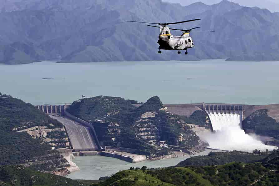
Chenab College Jhang

An educational institution known for its academic excellence and beautiful campus.

Jhang Bazaar

A bustling marketplace where you can experience the local culture, shop for traditional crafts, and savor local cuisine.

Dinga Baba Shrine

Another important Sufi shrine in the city, visited by devotees seeking spiritual solace.

Tareen’s House

The ancestral house of the influential Tareen family, which has played a significant role in Pakistani politics.

Haveli Maan Singh

A historic haveli (mansion) that reflects the architectural heritage of the region.

Rakh Lashkar

A rural area in Jhang known for its agricultural landscapes, offering a glimpse of the agrarian life in the region.

Shrine of Shah Jewna

A revered Sufi shrine, attracting pilgrims and visitors interested in the spiritual heritage of Jhang.

Cultural and Historical Landmarks

Fawara Chowk

Fawara Chowk is a central landmark in Jhang, known for its lively atmosphere and as a meeting point for locals.

Chiniot Bazaar

The bustling Chiniot Bazaar is a cultural hub, offering a vibrant shopping experience with a variety of traditional goods and crafts.

Schools in Jhang

  • Jhang Public School and College
  • The City School Jhang Campus
  • Divisional Public School and College Jhang
  • Beaconhouse School System Jhang
  • The Educators School Jhang
  • Government Girls High School Jhang

College in Jhang

  • Government College University Jhang (GCU Jhang)

University in Jhang

  • Government College University Jhang (GCU Jhang)
    • GCU Jhang offers various undergraduate and postgraduate programs.

Hospitals in Jhang

  • DHQ Hospital Jhang
  • Allama Iqbal Hospital Jhang
  • Al Mustafa Hospital Jhang
  • Civil Hospital Jhang
  • Bilal Hospital Jhang
  • Shahzad General Hospital

Restaurants in Jhang

  • Pizza Hut Jhang
  • Subway Jhang
  • Lal Qila Restaurant
  • Al Rehman Restaurant
  • Food Master Jhang
  • Shaheen Shinwari Restaurant

Frequently Asked Questions (FAQs) 

What is the significance of the Chenab River in Jhang?

The Chenab River holds great significance, providing a serene backdrop and a peaceful escape for both locals and visitors. Its riverbanks are often frequented for leisurely strolls.

Tell us about the historical importance of the Shahi Mosque.

The Shahi Mosque in Jhang is a historical masterpiece, reflecting intricate design and craftsmanship. It stands as a symbol of the city’s rich cultural and religious heritage.

Why is the Shrine of Sultan Bahoo renowned?

The Shrine of Sultan Bahoo is a revered spiritual sanctuary, attracting devotees seeking solace and connection. The shrine is known for its tranquil atmosphere and the legacy of the Sufi saint.

Which educational institutions are notable in Jhang?

Jhang is home to institutions like the University of Jhang and Government College Jhang, both contributing significantly to the academic landscape of the city.

What are some prominent healthcare facilities in Jhang?

DHQ Hospital Jhang and Allied Hospital are notable healthcare facilities, providing a range of medical services and treatments to the local population.

Name a few well-known restaurants in Jhang.

Jhang Sweets and Bakers, Chenab Sweets & Bakers, and Kababish Restaurant are popular eateries, each offering a unique culinary experience in the city.

Are there cultural landmarks in Jhang?

Fawara Chowk and Chiniot Bazaar are cultural landmarks in Jhang, representing lively meeting points and vibrant shopping experiences.

What is the cultural significance of Chiniot Bazaar?

Chiniot Bazaar is a bustling cultural hub known for its vibrant atmosphere and diverse array of traditional goods and crafts.

Wind Up Lines

Jhang stands as a testament to the enduring spirit of Punjab—a region where tradition meets tranquility. Whether exploring its historical landmarks, savoring local delicacies, or simply basking in the scenic beauty along the Chenab River, Jhang offers a multifaceted experience that captures the essence of this culturally rich city.

About Khushab | Famous Spots – Soon Sakesar Valley

Khushab

The word Khuhab is a combination of two words Khush and Aab. It has the meaning of “sweet or pleasant water”. It is enriched with green fertile lands, mountains, valleys, cascades, and lakes.

Moreover, its mountains have minerals like salt and Gypsum. The weather is very cool and calm in Summer and snowfalls at times in winter.

The heavy water and natural uranium research reactor project is there in Khushab.

Khushab-Punjab-Pakistan
The lush green fields of Khushab present a splendid view

Khushab is the homeland of the famous writers Ahmad Nadeem Qasimi and  Abdul Qadir Hassan . Dhoda and Patessa (confectionery items) are the famous desserts of Khushab.

Parents of Saint Sultan Baho migrated to Shorkot from the town of Anga Soon valley.

Soon Valley, Khabeki lake, and Khadoomi waterfall in Kanhatti Garden are beautiful places to visit.

Key  information about Khushab

Category Information
Location Khushab, Punjab, Pakistan
Population Approximately 1,080,000
Area 6,520 square kilometers (2,517 sq mi)
Coordinates 32.2967° N latitude, 72.3375° E longitude
District Khushab District
Language Punjabi, Urdu, and English
Economy Agriculture, mining, and trade
Major Crops Wheat, sugarcane, and cotton
Minerals Salt, coal, gypsum, and limestone
Transportation Well-connected to surrounding cities by road
Education Schools, colleges, and the University of Sargodha, Khushab Campus
Healthcare Hospitals and medical facilities
Notable Places Soon Valley, Sakesar Hill, and Noorpur Thal Lake
Culture Rich cultural heritage with traditional music, dance, and local cuisine
Administration Khushab is divided into several Union Councils for local governance
Climate Hot and arid, experiencing extreme temperatures in summer
Major Highways M-2 Motorway, Khushab-Jauharabad Road, and others
Airport The nearest airport is Faisalabad International Airport (about 160 km away)

Famous Places in Khushab

Soon Valley – Worth A Visit

It is also called Soon Sakesar and is located in the northwest of Khushab on Bannu Road about 45 km from Sargodha.

The central point of this valley is the town of Nowshera. It starts from Pidhra village and ends at the highest peak of Salt Range Sakesar.

Soon-Sakesar-valley-Khushab
An enchanting aerial view of Soon Sakesar Valley

Sakesar is 5010 feet high from the sea level and it is the only place in that region where it snows occasionally in winter. This valley is about 56 km long and 14 km wide.

This beautiful valley has small and large lakes, waterfalls, natural water springs, and thick and lush green forests that attract tourists with their enchanting sights.

The waterfalls of Deep Sharif, Kafiri, and Sodi villages are spectacular. There is a rest house in Sodi Village. Some caves are discovered in this village. It is assumed that the people in the stone age lived there.

The breathtaking scenery on the way to Kanhnatti Garden can only be witnessed in Hollywood movies. In this garden, ponds, lakes, springs, and trees are loaded with hundreds of seasonal fruits awaiting you.

There is a camping site for a night’s stay. You can see Kashmir hills in the southeast on the top of Sakesar mountain when the sky is clear or after rain.

It has Jhelum in the north, Indus River and Kohat hills in the west, Takht Suleman in the southwest, river Chenab in the far east, and Thal desert in the south.

This valley is 190 km from Islamabad and 110 km from Sargodha. Different places of Soon Valley can be visited through local buses from Khushab.

Uchali Lake, and Khabeki lake are two prominent captivating lakes.

Khabeki lake

Khabeki lake is 1 km wide and 2 km long. It is 7 km from Nowshera to Rawalpindi Road. A rest house boating and sailing facility are there is for tourists. It is said that both of these lakes are more than 400 years old.

In the winter season, thousands of Murgabi (Waterfowl birds) migrate there from far and wide. They went back in the summer season.

khabeki-lake-soon-valley-water-khushab
Khabbeki lake of Soon Valley is worth watching place for families picnic

The clothes become neat and clean without detergents by washing them in this lake water. Its water is slightly acidic.

Schools and Colleges

  • Government High School, Khushab
  • Khushab College for Women
  • Khushab Medical College

Hospitals

  • District Headquarters Hospital Khushab
  • Civil Hospital Khushab
  • Khushab Medical Complex

Restaurants

  • Khayyam Hotel and Restaurant
  • Food Street Khushab
  • Al-Syed Restaurant

Frequently Asked Questions (FAQs) 

What is Khushab known for?

Khushab is known for its rich historical significance and natural beauty. It is famous for its salt mines, military presence, and being a hub of cultural heritage.

Where is Khushab located?

Khushab is a district located in the province of Punjab, Pakistan. It is situated in the north-western part of the province.

What are the famous spots in Khushab?

Some of the notable spots in Khushab include the Khushab Fort, Katas Raj Temples, and the Khushab Salt Mines.

What is Soon Sakesar Valley known for?

Soon Sakesar Valley is renowned for its stunning landscapes and is often referred to as a hidden gem. It offers picturesque views, lush greenery, and a serene environment.

How far is Soon Sakesar Valley from Khushab?

The distance between Khushab and Soon Sakesar Valley is approximately. The exact distance may vary depending on the route taken.

What activities can one enjoy in Soon Sakesar Valley?

Soon Sakesar Valley is an ideal destination for nature lovers and adventure enthusiasts. Visitors can enjoy hiking, trekking, and photography in the scenic surroundings.

Are there any accommodations available in Soon Sakesar Valley?

While Soon Sakesar Valley may not have an abundance of hotels, there are usually guesthouses or cottages available for accommodation. It’s advisable to plan and book in advance.

Is there an entry fee to visit Soon Sakesar Valley?

Entry fees, if applicable, may vary and are subject to change. It’s recommended to check with local authorities or information centers for the latest information on entry fees.

What is the best time to visit Soon Sakesar Valley?

The best time to visit Soon Sakesar Valley is typically during the spring and summer months when the weather is mild and the landscapes are lush and vibrant.

Are there any restrictions on photography in Soon Sakesar Valley?

Generally, photography is allowed in Soon Sakesar Valley. However, it’s advisable to respect local guidelines and regulations, especially in sensitive areas.

Can I reach Soon Sakesar Valley by public transportation?

Public transportation options may be limited, and it’s recommended to check for available transport services. Private transportation or hiring a local guide could be more convenient.

Is there mobile network coverage in Soon Sakesar Valley?

Mobile network coverage may vary, and some remote areas might have limited connectivity. It’s advisable to check with your service provider for coverage details before visiting.

Wind Up Lines

Khushab and Soon Sakesar Valley beckon with a blend of historical charm and natural splendor. From the historic Khushab Fort to the enchanting landscapes of Soon Sakesar Valley, these destinations offer a unique experience for travelers.

Whether you seek cultural exploration, outdoor adventures, or simply a tranquil retreat, the rich tapestry of Khushab and the serene allure of Soon Sakesar Valley create an unforgettable journey. Plan your visit to immerse yourself in the beauty and heritage these destinations have to offer, and let the memories linger long after you’ve bid them farewell.

All About Wazirabad | Sohdra Town in Wazirabad

Wazirabad

It is situated on the bank of stream Palku coming from the Himalayas range in the south of river Chenab and 36 km from Gujranwala.

This city of Shaheed Amir Cheema and Molana Zafar Ali Khan was settled by Wazir Hakeem many centuries ago.

 Wazirabad-entrance
Wazirabad, a gate to the deep history

Now it is well-known around the world for the production of high-quality cutlery, lights, industrial manufacturing, knives, swords, axes, leather products, and surgical instruments.
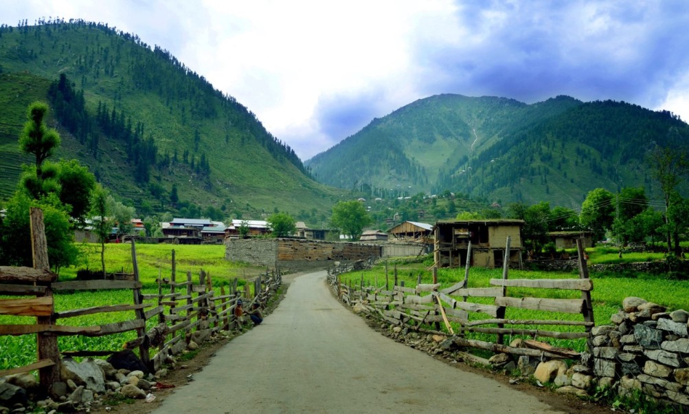
Please visit Sher Shah Suri Dak Chowki (Mail station) and old Baoli (Stepwell). Furthermore, the Gurdwara Kotha and ancient Shamshan temple are worth watching sites.

Key info about Wazirabad PK

Category Information
Location Wazirabad, Punjab, Pakistan
Population Approximately 429,000
Area 491 square kilometers (190 sq mi)
Coordinates 32.4483° N latitude, 74.1158° E longitude
District Gujranwala District
Language Punjabi, Urdu, and English
Economy Known for its cutlery and metalworking industries
Major Industries Stainless steel cutlery, surgical instruments, and hand tools
Transportation Well-connected to surrounding cities by road and rail
Education Several schools, colleges, and educational institutions
Healthcare Hospitals and medical facilities
Notable Places Allama Iqbal Park, Wazirabad Sports Complex, and Kala Shah Kaku
Culture Rich cultural heritage with traditional music, dance, and local cuisine
Administration Wazirabad is divided into several Union Councils for local governance
Climate Hot and arid, experiencing extreme temperatures in summer
Major Highways Grand Trunk Road (GT Road) and other regional roads
Airport The nearest airport is Sialkot International Airport (about 50 km away)

Molana Zaffar Ali Khan Baba-e-Sahafat

A great journalist, writer, and poet Molana Zafar Ali Khan was born in Kot Merath Sialkot. He was appointed as a secretary of Nawab Mohsin-ul-Mulk in Mumbai (Bombay) after getting his education from Ali Garh and Wazirabad.

Then he moved to Hyderabad Dakan and was appointed as secretary home department after getting a promotion.

In 1915, the magazine “Zamindar” issued by her father was banned for the sake of opposing the British. In December 1919, the ban was lifted.

A daily newspaper was re-launched from Lahore. In 1920, he was sentenced to life in prison for mutiny. He was a member of the Indian National Congress till 1932. Then he left due to the cunning tricks of Hindu Leaders.

He joined Muslim League. He was an exceptional poet, eminent speaker, translator, and a leading journalist. The central points of his poetry were politics and religion.

 Tomb_of_Mulana_Zafar_Ali_Khan
Mausoleum of Baba-e-Sahafat

The collection of poetry was published with the names Baharistan, Nigaristan, and Chamnistan. Besides this, he also wrote many books and sacrificed his money and land for the war of freedom.

He died in 1952 and was buried in Karamabad (Wazirabad). The central mosque of Karam Abad has located 4 km on the right side, on the way from Wazirabad to Sialkot.

The tomb of Zafar Ali Khan is located on the lawn of this mosque.

Some famous historical sites in Wazirabad

Sohdra

This town Sohdra, a trustee of great historical heritage is located 3 km away from the road directed from the tomb of Zafar Ali Khan to Sialkot.This primeval city of high walls with hundred doors has heard the footsteps of Mehmood Ghaznavid. It has witnessed the administration of brave Afghan Generals of Ghaznavid’s reign.

The arrival of the Mughal and giving it the name Ibrahim Abad is also recorded in the pages of history. The high Peer Minaret and spacious garden are spectators of the splendor of Ali Mardan.In the time of Sikhs, the ritual of Kriya Karam has also been observed here.

Sher Punjab Raja Ranjeet Singh was crowned here at the age of 13. In the downtimes, it has witnessed the destruction of the Nowlakha garden and other buildings.Besides the holy pond of Hindus and the Setala temple, the mausoleum of Baba Mastan Shah holds significant importance. He is the one who predicted Ranjeet Singh getting a crown.Barfi and sweets are the specialties of this city.

Iqbal Manzil

Iqbal Manzil stands as an iconic historical site in Wazirabad, being the birthplace of Allama Muhammad Iqbal, one of South Asia’s most revered poets and philosophers. The ancestral home has been preserved as a museum, offering visitors a glimpse into the life and times of this intellectual giant.

Wazirabad Barrage

The Wazirabad Barrage, a significant water control structure, has historical importance due to its role in managing water resources in the region. Beyond its utilitarian purpose, the barrage also stands as an architectural landmark and a testament to the engineering prowess of its time.

Dullah Bhatti’s Fort

This historical fort is associated with the legendary Punjabi folk hero, Dullah Bhatti, who is celebrated for his acts of valor and generosity. While the fort itself has weathered the sands of time, its historical resonance adds a layer of intrigue to Wazirabad’s cultural narrative.

Mubarak Haveli

Mubarak Haveli, an old mansion in Wazirabad, is a testament to the grandeur of the Mughal era. The architecture reflects the intricate craftsmanship of the bygone years, and the haveli offers a glimpse into the lifestyle of the elite during that period.

Clock Tower

Wazirabad’s Clock Tower is not only a functional timepiece but also a historical landmark that stands as a witness to the city’s evolution. The tower’s architecture is reminiscent of colonial influences, and it serves as a central point in the city.

Masjid Nizamia

Masjid Nizamia is a historical mosque in Wazirabad known for its architectural beauty and religious significance. The mosque has a serene ambiance and stands as a place of worship that has endured through different eras.

Qazi Ka Bangla

Qazi Ka Bangla is an ancient structure that has historical and architectural significance. The building, with its distinct design, serves as a reminder of Wazirabad’s past and the cultural influences that have shaped the city.

Famous Schools and Colleges

  • Government High School Wazirabad: Typically, government schools are prominent in areas, and you can inquire about the reputation of the local government high school.
  • Private Educational Institutions: Wazirabad might have private schools and colleges. Popular chains like Beaconhouse, The City School, or Punjab Group of Colleges often have a presence in various cities.

Hospitals

  • Wazirabad Teaching Hospital: Check if there is a teaching hospital in Wazirabad associated with medical education.
  • Private Clinics and Hospitals: Local private clinics and hospitals may also provide healthcare services.

Restaurants

  • Local Cuisine Spots: Explore local markets and streets for eateries offering traditional Pakistani and Punjabi cuisine.
  • Ask Locals: Locals can provide recommendations for popular restaurants. Look for places known for their specialties.

Frequently Asked Questions (FAQs) 

What is the historical significance of Wazirabad?

Wazirabad holds historical importance as the birthplace of Allama Muhammad Iqbal, a renowned poet and philosopher. It also features historical sites like the Wazirabad Barrage and Dullah Bhatti’s Fort.

Is there a notable educational infrastructure in Wazirabad?

Yes, Wazirabad has schools and colleges, including government institutions and potentially private educational establishments. The availability may vary, and locals can provide information about prominent educational institutions.

Tell me more about Wazirabad’s craftsmanship.

Wazirabad is famous for its craftsmanship, particularly in cutlery and brassware. The city’s markets showcase intricately designed knives, utensils, and decorative items, reflecting a tradition of skillful artistry.

Are there significant landmarks in Wazirabad?

Yes, apart from historical sites, Wazirabad has landmarks like the Clock Tower and Masjid Nizamia. These structures contribute to the city’s architectural and cultural heritage.

What is the primary economic activity in Wazirabad?

Wazirabad’s economy is primarily industrial, with a specialization in metalworking and manufacturing. The city is renowned for its cutlery industry, contributing significantly to the national economy.

Are there tourist attractions in Wazirabad?

Yes, Wazirabad offers tourist attractions such as Iqbal Manzil, the birthplace of Allama Iqbal, and local markets showcasing traditional craftsmanship. These sites provide insights into the city’s cultural and historical richness.

Tell me about healthcare facilities in Wazirabad.

Wazirabad likely has healthcare facilities, including government hospitals and private clinics. The Wazirabad Teaching Hospital might be a notable institution for medical services.

What are the prominent local festivals in Wazirabad?

Wazirabad celebrates various festivals, including Eid and Basant, contributing to the city’s cultural vibrancy. These events often include traditional music, dance, and communal gatherings.

How can I explore local cuisine in Wazirabad?

Exploring local markets and eateries is the best way to experience Wazirabad’s cuisine. Look for places offering traditional Pakistani and Punjabi dishes, and don’t hesitate to ask locals for recommendations.

Is there any information available about accommodations in Wazirabad?

Accommodation options in Wazirabad may include local hotels or guesthouses. Online travel platforms or local recommendations can guide you to suitable places to stay.

Wind Up Lines

Wazirabad stands as more than a city; it is a living testament to the harmonious coexistence of history, craftsmanship, and modernity. Visitors and residents alike find themselves immersed in a unique blend of tradition and progress, making Wazirabad an enchanting destination in the heart of Punjab.