
Home Blog Page 3

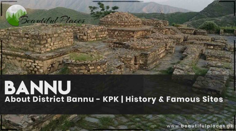
About District Bannu – KPK | History & Famous Sites

Bannu

Bannu is a city in the province of Khyber Pakhtunkhwa. It is about 140km from Dera Ismail Khan and 127km from Kohat at the south of the river Khurrum. Bannu is an agro-based city famous for the production of cereals and pulses. People usually speak Pashto.

It remained under the administration of Sikhs, Britishers, and Muslims.  Many battles were fought for the occupation. It is located inside a strong boundary wall. Gates are also built. This wall has been damaged to a large extent. Some gates are also demolished. This city has many ancient buildings. The traces of many settlements are found in the suburbs of Bannu.

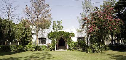
Bannu Walled City, Nicolson House, Bannu Museum, and ancient Akra are famous historical sites.

Qazi-Fazal-Qader-Shaheed-Bannu-Park-in-Bannu.j
Qazi Fazal Qader Shaheed Bannu Park in Bannu

The Bannu – KPK

Aspect Details
Country Pakistan
Province Khyber Pakhtunkhwa (KP)
Location Southern Khyber Pakhtunkhwa, bordering North Waziristan and Karak districts
Area 1,227 square kilometers (474 square miles)
Population Approximately 1.2 million
Official Language Urdu, Pashto
Other Languages English, Hindko
Climate Hot semi-arid with extremely hot summers and mild winters
Famous Landmarks Bannu Cantonment, Bannu Jail, Bannu Medical College, Bannu Stadium
Historical Significance It has a rich historical background and has been a center of trade and commerce for centuries. It has witnessed various invasions and has cultural and architectural influences from different periods.
Cultural Heritage Known for its Pashtun culture and traditions, Bannu showcases vibrant traditional music, dance forms like Attan, and Pashto literature. The city also has unique handicrafts, including embroidery and rug-making.
Educational Institutions Bannu Medical College, Bannu University of Science and Technology, Bannu Polytechnic Institute
Transportation Bannu Airport, Bannu Railway Station, well-connected road network
Major Industries Agriculture, trade, manufacturing, services
Cuisine Bannu offers traditional Pashtun cuisine, including Chapli kebab, Lamb karahi, and Mantu (dumplings). The city is also known for its local sweets like Gulab Jamun and Jalebi.
Festivals Eid-ul-Fitr, Eid-ul-Adha, Pashto cultural festivals like Jashn-e-Bannu, traditional wedding festivities
Sports Cricket, football, wrestling (traditional Pehlwani)
Historical Sites Bannu has historical sites such as Khyber Gate, Bannu Museum, and the ancient ruins of Marwat civilization.
Parks and Gardens Shaheed Benazir Bhutto Park, Dost Muhammad Khan Park
Art and Literature Bannu has a growing art and literary scene, with local artists and writers showcasing their work at exhibitions and literary events.
Shopping Traditional bazaars offering a variety of handicrafts, fabrics, and Pashtun attire.
Religious Sites Bannu has several mosques, including Ghosia Masjid and Miryan Mosque, along with Hindu temples and Sikh gurdwaras.
Museums Bannu Museum, showcasing local artifacts, historical relics, and tribal heritage.
Performing Arts Bannu hosts cultural events and music concerts, featuring traditional Pashto music and dance performances.
Educational Legacy Bannu has a history of educational institutions, including Government High School Bannu, which has produced notable scholars and professionals.
Tourism Bannu attracts tourists with its historical sites, natural beauty, and cultural heritage. Visitors can explore the local culture, enjoy traditional Pashto music and dance, and experience Pashtun hospitality.

Bannu Famous Places

Bannu Fort

The Bannu Fort is a historical landmark in the city. It was originally built during the reign of Durrani Empire and later renovated by the British. The fort offers a glimpse into the region’s rich history and architectural heritage.

Tochi River

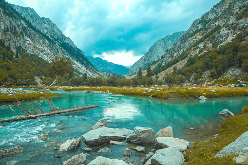
The Tochi River flows through Bannu, providing scenic beauty and opportunities for picnicking and leisure activities. The river is surrounded by lush green fields and offers a tranquil environment.

Lalazai Picnic Point

Located near Bannu, Lalazai Picnic Point is a popular recreational spot. It features beautiful gardens, picnic areas, and a waterfall, attracting locals and tourists for relaxation and enjoyment.

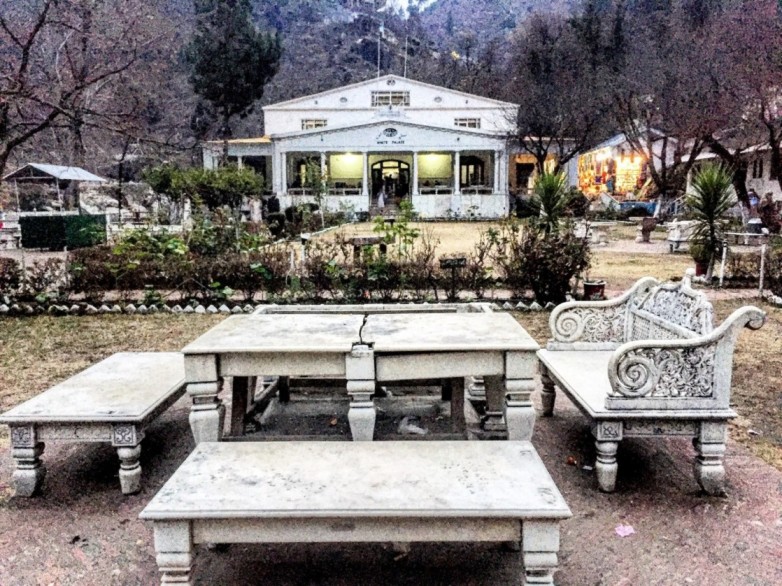
Shahi Bagh

Shahi Bagh, a historical garden, has been a backdrop for cultural events and celebrations. It remains a hub for local traditions and festivities.

Akhunabad

This religious site holds immense importance for the local population and serves as a place of pilgrimage and spiritual significance.

Ghulam Khan Village

Located near the border, Ghulam Khan Village plays a vital role in cross-border trade and relations. It reflects the region’s commercial ties and strategic importance.

Schools in Bannu

  • Bannu Model School and College
  • Government High School
  • Islamia Public School and College
  • Beaconhouse School System
  • The City School

Colleges and Universities in Bannu

  • Bannu Medical College
  • Bannu Law College
  • Government College of Technology
  • Gomal University
  • Government College for Women

Hospitals in Bannu

  • District Headquarters Hospital
  • Khalifa Gul Nawaz Teaching Hospital
  • Women and Children Hospital
  • Combined Military Hospital (CMH)
  • Bacha Khan Medical Complex

Restaurants in Bannu

  • Bannu Kabab House
  • Charsi Tikka House
  • Quetta Tawa Fry Restaurant
  • Pizza Planet Bannu
  • Royal Foods Restaurant

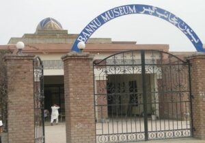
Bannu Museum

The items used in the eras of Muslims, Britishers, Sikhs, and Hindus are kept in Bannu Museum established in 2009. Keeping weapons is a sign of bravery and manliness in Pashtun culture.

Swords, guns, revolvers, and shields are kept there. The local musical instruments Banjo drums, satar, and rabab are kept there. Regional clothes, coins, and jewelry made of stones are also exhibited. Quran-e-Pak models with beautiful calligraphy are also placed.

 Bannu-Photos-Bannu-Museum
Bannu Museum

This museum is located on Norank Chowk. There are archaeological signs in Bhart spreading over 133 acres.

Challenges and Development

Despite its rich history and culture, Bannu faces several challenges. Infrastructure development, socio-economic issues, and security concerns need to be addressed. However, there are ongoing initiatives aimed at improving the living conditions and prospects of the people in the region.

FAQs

What is District Bannu?

District Bannu is a region in the Khyber Pakhtunkhwa province of Pakistan. It serves as an administrative division with Bannu city as its headquarters.

How can I reach Bannu?

Bannu is accessible by road and is well-connected to other major cities in Pakistan. You can reach Bannu by bus, car, or other private transportation.

What is the population of District Bannu?

The population of District Bannu was around 1.5 million people. Please note that population figures may have changed, and it’s advisable to check the latest census data for the most accurate information.

What are the major attractions in Bannu?

Bannu has historical and cultural significance. Some notable attractions include Bannu Fort, Daudzai Irrigation System, and various bazaars that offer a glimpse into the local culture.

What languages are spoken in District Bannu?

Pashto is the predominant language spoken in Bannu, reflecting the Pashtun culture of the region. Urdu is also widely understood.

Is Bannu safe for tourists?

Like any other destination, it’s advisable to stay updated on the current security situation. Check travel advisories, and it’s recommended to respect local customs and guidelines for a safe and enjoyable visit.

What is the climate like in Bannu?

Bannu experiences a semi-arid climate with hot summers and mild winters. Summers can be extremely hot, with temperatures rising significantly.

Are there educational institutions in District Bannu?

Yes, Bannu has several educational institutions, including schools, colleges, and a university. Bannu Medical College is one of the notable institutions in the area.

What is the economy of Bannu based on?

Agriculture is a significant part of the economy in Bannu, with the cultivation of crops like wheat, sugarcane, and tobacco. Livestock farming is also common. Additionally, trade and commerce contribute to the local economy.

How can I obtain more information about District Bannu?

For the most up-to-date and detailed information, you can contact the local government offices, visit official websites, or consult tourism authorities. Local libraries and community centers may also provide additional resources.

Wind Up Lines

District Bannu in KPK is a place where history, culture, and development intersect. With its historical sites, diverse demographics, and a promising future, Bannu is a district of immense potential. While it faces challenges, it is making strides towards a brighter tomorrow, ensuring that its unique heritage continues to thrive and evolve.

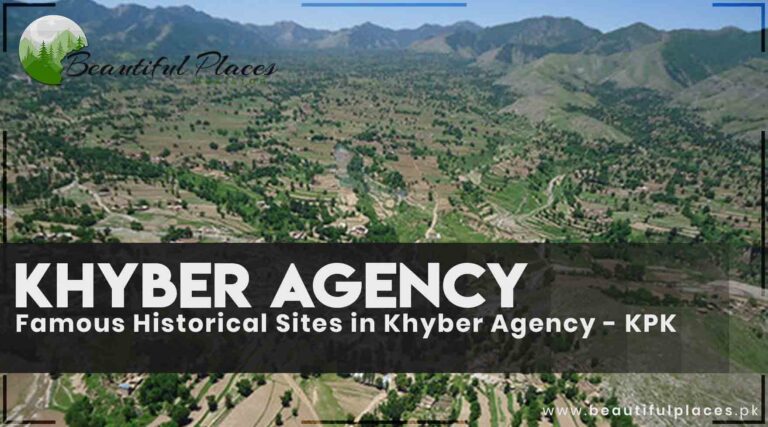
Famous Historical Sites in Khyber Agency – KPK

Khyber Agency

Nestled in the heart of Khyber Pakhtunkhwa, Khyber Agency beckons with tales etched in stone and whispered through the winds. Covering 2576 square kilometers, this district is a treasure trove of history, culture, and breathtaking landscapes, where Pashto voices resonate.

Four Tehsils, One Tale

Khyber Agency reveals its secrets through four Tehsils:

  • Bara Tehsil, where the echoes of time mingle with the rugged terrain.
  • Jamrud Tehsil, where history stands tall in the form of the iconic Jamrud Fort.
  • Landi Kotal Tehsil, where the highest point of the Khyber Pass meets adventure.
  • Mula Gori Tehsil, a quiet haven with stories waiting to be uncovered.

Detaille Info about Khyber Agency – KPK

Aspect Information
Location North-western region of Pakistan, bordering Afghanistan.
Capital Peshawar (administratively; no specific capital within Khyber Agency).
Area Approximately 2,576 square kilometers.
Population Around 617,361 people (as of the 2017 census).
Language Pashto is the most widely spoken language.
Main Tribes Afridi, Shinwari, Mullagori, and others.
Geography Rugged, mountainous terrain with the Khyber Pass as a significant feature.
Administrative Status Historically, Khyber Agency was one of the Federally Administered Tribal Areas (FATA). It has now been merged into Khyber Pakhtunkhwa as a result of the 25th Amendment to the Constitution of Pakistan in 2018.
Economy Primarily agrarian, with subsistence farming and trade through the Khyber Pass playing a key role in the local economy.
Notable Places – Khyber Pass, an ancient trade route and important historical landmark.
– Landi Kotal, a major town in the area.
– Bara, Tirah Valley, and Jamrud are other important regions.
Culture and Traditions Rich Pashtun cultural heritage, with traditions like Jirgas (tribal councils) being significant in resolving disputes.
Historical Significance Khyber Pass has been a historic trade route and a strategic military location for centuries. It has seen numerous invasions and migrations throughout history.
Security Situation The region has had a history of militancy and conflict due to its proximity to the Afghanistan border, but efforts have been made to improve security.
Education Limited educational infrastructure, but efforts have been made to increase access to education in recent years.
Healthcare Limited healthcare facilities, with the need for improved healthcare services.

Historical Spots in Khyber Agency

Bab-e-Khyber

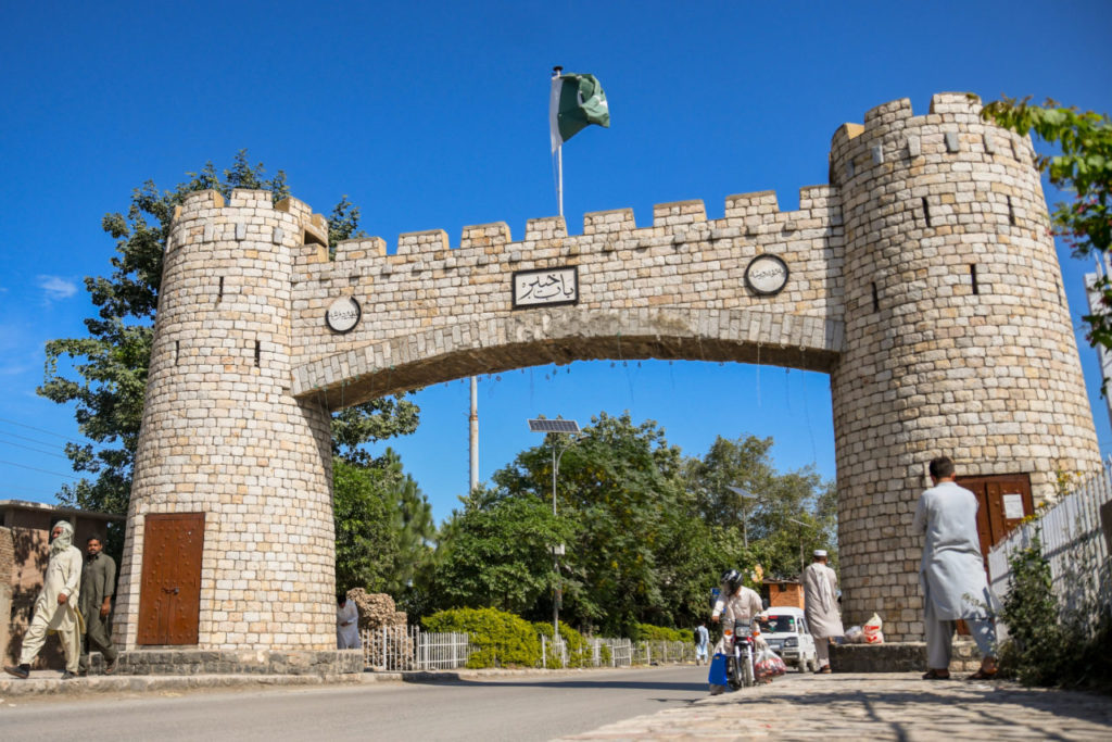
Khyber Agency border starts after crossing Karkhano market on the Torkham road in Peshawar city. Try to visit this area with a local person. A little further on is the Khyber Gate, constructed in 1964 with carved stones.
The history of the Khyber pass is engraved near Bab-e-Kyber in both English and Urdu languages. Apart from the invading emperors in different periods, a brief history of the nations that passed through here and a sketch of historical battles are also given.

Its picture is printed on the ten-rupee note. The area of Kyber Pass is in Koh Suleman.

Bab-e-Khyber-Peshawar
Bab-e-Khyber Peshawar, a gateway to an ancient city

Jamrud Fort

Khyber Pass starts from the Jamrud area 6 km forward to Bab-e-Khyber. Jamrud fort was reconstructed by army commander in chief Hari Singh Nalwa of King Ranjeet Singh in 1823 on the traces of an old fort. The fort is built with rough stones and mud. Ameer Singh Nalwa was killed in the war of Ameer Kabul and was buried in this fort.

 jamrud-fort-1.
Majestic Jamrud Fort in Khyber Agency

Regimental monument

The Khyber Pass has monuments of the British officers killed in World War II (1878-79). The medals of regimental forces that were appointed on the Khyber Pass for safety are also engraved on the big stones.

Ali Mosque

King Babur stayed in this mosque and fixed camps here when he was coming to Peshawar from Kabul. It is the narrowest area of Khyber Pass. There is a rare valuable stone.

It is narrated that it was thrown on Hazrat Ali (R.A) by a woman while he was offering prayer. It is 75 % out of the mountain and 25% inside it. Ali fort is at the top of the Ali mosque. (It is only a narration but historically it is not proven).

It is in the northwest of Shagai fort. Shagai fort is at an altitude of 2300 feet from sea level and was constructed in 1920 by the British regime. F.C are appointed there.

 ancient-ali-masjid-in-Khyber-agency.
Ancient Ali Masjid in Khyber Agency

Sphola Stupa

Tucked away amidst the rugged terrain of the Khyber Agency in Pakistan, the Sphola Stupa stands as a serene sentinel of a bygone era, echoing the deep spiritual roots of Buddhism in this historically significant region. With a history that dates back to ancient times, this stupa is a testament to the enduring legacy of Buddhism in the South Asian subcontinent.

Sphola Stupa, often referred to as the “Sphola Mound,” is located approximately 10 kilometers from Zirai Village in the Khyber Agency. This modest yet evocative structure is a sacred relic for both local and visiting pilgrims and history enthusiasts alike.

Sphola-stupa-Khyber_Pass.
Sphola Stupa near Khyber Pass

Landi Kotal

Landi Kotal is 47km from Peshawar and is located at an elevation of 1072 meters from sea level. Landi Kotal is the highest point of Khyber Pass.

This Frontal railway station has brief history written near the ticket house. Khyber rifles’ garrison is located in this large shopping center. Delicious Karhai Ghost ( a local dish made with meat) of Landi Kotal Bazaar is famous. You can relish tortillas and Karhai with Qahwa.

Khyber Rifles Officer Mess

This headquarters of the pickets of Khyber Pass in Landi Kotal holds significant importance. In 1980, a British military officer came to the lawn drunk and found a tree running away. He ordered to tie the tree with chains. His order was fulfilled. That tree is still tied in the chains.

 Khyber-Rifle-officer-mess-in-khyber-Agency-
Khyber Rifle officer mess in Khyber Agency

Quid-e-Azam and other high-ranked officers visited this place too. Their pictures are hung in the mess hall of officers. There are a few sundials in the world that move with the sunlight. One of them is fixed here. It still tells the correct time.

Machini Check

It is the last point on the Pak Afghan border. A map on the ground gives information about Pakistan and Afghanistan check posts. Gallows are there which were constructed by king Taymor Ling.

Torkham

Torkham is located on the Durand line between Pakistan and India about 57 km from Peshawar. Afghanistan border starts from Torkham. Quid-e-Azam visited this site in 1947 and gave a clue of Pak-Afghan friendship by shaking hands with the soldier across the closed border gate.

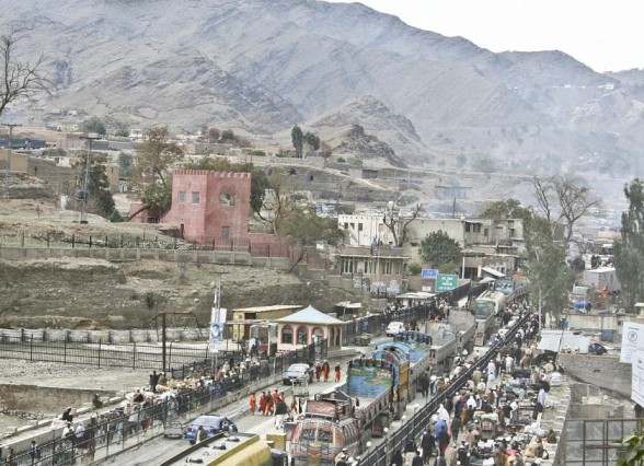
It is better to visit this place with a local person from the Khyber Agency. And give the details of your friends to fort Bala Hissar 10 days before the visit. They will inform you on the day to visit. In this way, you will be a guest of the Khyber Agency. They will brief you about the Khyber Agency fort, details of important sites, Khyber officer’s rifles mess, Khattak dance, and Machini Check post. You will have to pay charges for it.

Trucks_crossing_into_Kyber_Pakhtunkhwa_at_Torkham-
Trucks crossing into Khyber Pakhtunkhwa at the Torkham border

Schools in Khyber Agency

  • Government High School, Landi Kotal
  • Government Girls High School, Landi Kotal
  • Government Boys High School, Jamrud
  • Government Girls High School, Bara
  • Government Middle School, Landi Kotal
  • Government High School, Tirah
  • Government High School, Bara

Colleges in Khyber Agency

  • Government Degree College, Landi Kotal
  • Government Degree College, Jamrud
  • Government Degree College, Bara
  • Government Girls Degree College, Landi Kotal
  • Government Commerce College, Jamrud
  • Government Commerce College, Landi Kotal

Hospitals in Khyber Agency

  • Landi Kotal Hospital
  • Jamrud Hospital
  • Bara Hospital
  • Landi Kotal Civil Hospital
  • Jamrud Civil Hospital

Restaurants in Khyber Agency

  • Shinwari Restaurant, Landi Kotal
  • Afridi Restaurant, Jamrud
  • Khyber Food Point, Bara
  • Rahat Bakers and Fast Food, Landi Kotal
  • Tariq Shinwari Restaurant, Jamrud

FAQs:

What is Khyber Agency, and where is it located in KPK?

Khyber Agency, formerly one of the administrative agencies in the Federally Administered Tribal Areas (FATA) of Pakistan, is situated in the Khyber Pakhtunkhwa (KPK) province. It borders Afghanistan and is known for its rich history.

What are the famous historical sites in Khyber Agency?

Khyber Agency boasts several historical sites, including Jamrud Fort, Ali Masjid, and the legendary Khyber Pass, which have significant historical and cultural importance.

Can you tell me more about Jamrud Fort?

Jamrud Fort, located in Khyber Agency, is a historic fort built during the British colonial era. It played a crucial role in the region’s history and is a popular tourist attraction today.

What is the significance of Ali Masjid in Khyber Agency?

Ali Masjid is a historic mosque and fortress in the Khyber Agency region. It has historical and religious importance, as it is associated with various events, including the British-Afghan wars.

Tell me about the Khyber Pass and its historical relevance.

The Khyber Pass is a mountain pass that connects Pakistan and Afghanistan. It has been an ancient trade and invasion route, serving as a significant historical link between South Asia and Central Asia.

Are there any museums or visitor centers in Khyber Agency to learn more about its history?

Yes, there are museums and visitor centers in the Khyber Agency that showcase artifacts, exhibits, and information related to its history and culture.

Is it safe to visit these historical sites in Khyber Agency?

Safety conditions in the region can vary, so it’s essential to check the latest travel advisories and local conditions before planning a visit. It’s advisable to hire a local guide or tour operator who is familiar with the area.

Wind Up Lines

Khyber Agency is a testament to history’s endurance, where the past beckons in every stone, fort, and market. Explore this land of echoes and whispers, where the rhythms of the pass guide your journey into the heart of Pakistan’s rich heritage.

About Beautiful Shigar Valley – Gilgit Baltistan

Shigar Valley

It feels as if you are traveling in the Cholistan Desert when the jeep reaches Khaplu Road from Skardu. Shigar Valley is 32km to the north of Skardu Valley. Shigar Valley was a state in the past. The whole Valley abounds with grapes, apples, walnuts, peach, apricot, mulberry, and pears. The dry fruits of Baltistan are unique.

The river Shigar irrigates the whole valley. Enjoy a walk around the river. Go to the local villages. Observe the regional culture. Buy the handicrafts if you like them. There are traces of the Buddhism era in the Shigar Valley which were discovered by Doctor Carl Ganter.

Details About Beautiful Shigar Valley

Feature Details
Location Northern region, 32km north of Skardu, Baltistan, Pakistan
Geography Surrounded by Cholistan Desert; Shigar River irrigates the valley
Crops Abounds with grapes, apples, walnuts, peach, apricot, mulberry, and pears
Local Culture Rich regional culture with opportunities to explore local villages
Historical Traces Traces of the Buddhism era, including inscriptions in Tibetan and Sanskrit
Buddhist Era Traces dating from the 8th to 10th century
Zehar Mohra A unique stone believed to have the capacity to absorb poison
Shigar Fort A 350-year-old fort, a masterpiece of Kashmiri architectural style
Architecture Constructed on a giant rock at an elevation of 2250 meters above sea level
History Built by Rah Hassan Khan with the help of Kashmiri artisans
Current Use Operated by Serena Hotels as a hotel with high-quality restaurants
Museum Features a two-floor museum with artifacts from the Shigar State
Ambraq Mosque An ancient mosque constructed by Islamic scholar Ali Syed Hamdani

There are thousands of pictures inscribed on the rocks and writing pieces in the Tibetan and Sanskrit languages. They belong from the eighth to the tenth century. A stone is found there which is called “Zehar Mohra”. It is said that this stone has the capacity to absorb the poison.

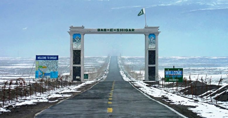
 Shigar-Valley-The-best-place-to-visit-in-Gilgit-Baltistan
The beautiful Bab-e-Shigar

Shigar Fort (Residence) – The Palace on the rock

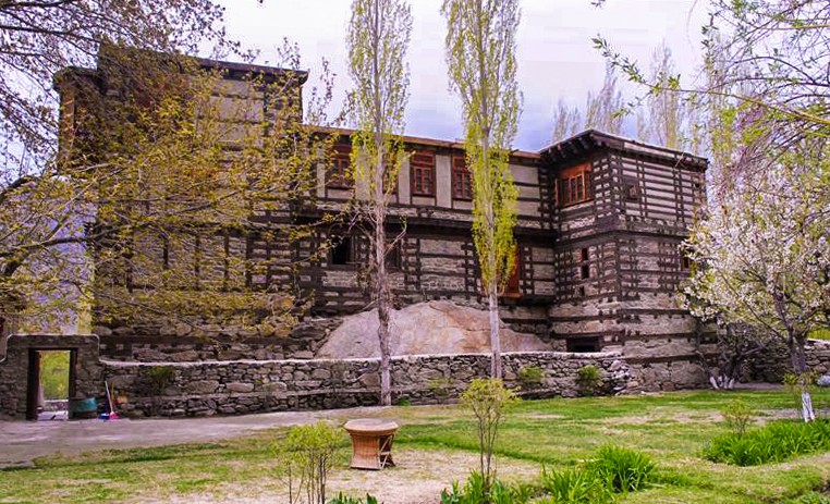
This 350-year-old fort was the palace and residence of Shigar’s emperor in the famous Valley Chinpa of Shigar. This fort was built at an elevation of 2250 meters above sea level near the Shigar brook on a giant rock. This fort was built by Rah Hassan Khan, He called artisans of wood from Kashmir.

Professional architect Nayyar Ali Dada gave his services to resolve the technical issues related to maintenance. It was done to protect this masterpiece of Kashmiri architectural style asset. Nowadays, Serena Hotels (the largest chain of hotels in Pakistan) is operating this residence as a hotel.

There are the best facilities for residing and high-quality restaurants. A two-floor museum has been established there. It has things and artifacts used in the Shigar State.

 Shigar-Valley-The-best-place-to-visit-in-Gilgit-Baltistan
Shigar Fort – a cultural asset of Pakistan

Ambraq Mosque

This mosque is one of the ancient mosques in the Shigar Village. It was constructed by millionaire Ali Syed Hamdani. He was the first Islamic scholar in Gilgit Baltistan. People embraced Islam due to his struggles.

FAQs

Q1: What is the best time to visit Shigar Valley?

The best time to visit Shigar Valley is during the summer months, from May to September when the weather is pleasant for exploration.

Q2: Are there trekking opportunities in Shigar Valley?

Yes, Shigar Valley offers excellent trekking opportunities, with trails that lead to picturesque spots and offer a chance to experience its natural beauty up close.

Q3: Can I buy local handicrafts in Shigar Valley?

Yes, you can explore local villages and purchase handmade crafts, adding a touch of local artistry to your visit.

Q4: What is the significance of Shigar Fort?

Shigar Fort is a historic treasure, showcasing Kashmiri architectural style. It now operates as a hotel and museum, offering a glimpse into the region’s cultural heritage.

Q5: Are there any significant historical sites in Shigar Valley?

Yes, there are historical traces from the Buddhism era in the valley, with inscriptions and artifacts dating from the 8th to 10th century.

Windup Lines

Shigar Valley, with its bountiful orchards, rich culture, and echoes of history, is a hidden gem in the heart of Baltistan. As you wander through its local villages, exploring the traces of its Buddhist past and visiting the architectural marvel that is Shigar Fort, you’ll experience the essence of this remarkable valley. Be sure to absorb the beauty of the landscape and its unique stone, “Zehar Mohra,” known for its extraordinary properties. A visit to Shigar Valley is a journey through time, culture, and natural wonder.

Famous Tourist Spot in Khaplu – Gilgit Baltistan

Khaplu

Historical Landmark Monuments

Khaplu is the capital of the district Ghanche which is in the east of the province Gilgit Baltistan. Khaplu was the second largest state of Baltistan near Ladakh. At an altitude of 2600 meters above sea level, Khaplu is located near the Shyok River at a distance of 103 km from Skardu.

The highway in Skardu City adjacent to Polo ground will take you to Khaplu City. A beautiful sight will welcome you after crossing 35km. It is a splendid spot where the river Indus and the river Shyok confluence. One can enjoy river rafting on the river Shyok.

khaplu-stream-gilgit-baltistan-
A splendid view of Khaplu stream in autumn

Khaplu is colder than Skardu. District Ghanche is the coldest point in Pakistan. This district has two military frontlines connected to the Indian-occupied area of Ladakh. Khaplu is the base camp to reach Hoshe Valley and an initiating point to reach Saltoro Kangri, K-2, Mashabrum, Gondogoro Pass, K-6, and K-7 tracks.

There are found apricots of 300 kinds. It is called “Samarkand Sani” due to the abundance of fruits. Ghanche Lake, Bara Lake, and Thally La Lake are good tourist spots. Khaplu, Buraq, Kaldaq, and Khalotang are the best for trekking and hiking while Bia Mari and Thoksi Khar are famous rock climbing points.

Details of Khaplu

Feature Details
Location Khaplu, Gilgit Baltistan, Pakistan
Geography Situated in the Shyok Valley with a backdrop of snow-capped peaks
Historical Significance Known for its historical heritage and preserved culture
Local Culture Rich local culture with influences from Tibetan and Balti traditions
Scenic Beauty Offers breathtaking views of the Karakoram Range and serene landscapes
Khaplu Fort A historic fort that has been restored and serves as a museum
Baltistan Culture Chance to experience Balti music, traditional dances, and local crafts
Adventurous Activities Opportunities for trekking, mountaineering, and exploring the Shyok River
Tourist Facilities Limited but comfortable accommodations and dining options

Tourist Attractions in Khaplu Valley

1- Khaplu Fort Residence

This ancient and historic 700-year-old fort was owned by the ruler of old Kaplu’s state. This palace is the best model of Tibetan architectural style in Pakistan. It is transformed into a grand luxury hotel of the international standard.

 khaplu-fort-giligt-baltistan
Khaplu Fort is a historical masterpiece

This hotel has become a favorite spot for tourists and holidaymakers. It has fine residing facilities, restaurants, and dining areas depicting local culture. The most intriguing thing is the private palace of the king. It has many floors and is now changed into a museum. This museum with plenty of rooms has artifacts related to the culture of Khaplu and Baltistan.

Home utilizations, weapons, clothes, furniture, utensils, jewelry, and many other items are exhibited in these rooms. Especially, the rare and valuable belongings of the royal family are worth watching. To sum up the discussion, it can be said that the Khaplu fort residence museum is the biggest cultural museum in Gilgit Baltistan.

2- Chaqchan Mosque & Monastery

 Evening_at_Chaqchan_Mosque.j
A peaceful evening view of the historical Chaqchan mosque

This most antique mosque was constructed in 1504. It is attributed to Syed Ali Hamdani. Renowned historian John Harley has called it the most beautiful monastery in Asia because of its distinctiveness and magnificence.

It is said that Chaqchan has a meaning of “an item of iron”. There is a pillar. The chain was tied to the pillar and the locals believed that at one time this chain was connected to the sky. The person who was abused would shake the chain. It is also called “Shiakh Chan” which has a meaning of “the mosque of justice”. The mosque and the monastery are established at a height. This two-story mosque is made of wood from floor to roof.

Beautiful windows are built by joining small pieces of wood. There are geometrical shapes, circles, sun, rivers, pigeons in a row, and other designs engraved on the wood. It is furnished with the etchings of exquisite mosaic patterns, vines, shrubs, carvings, lilies, and beautiful birds.

There is an ancient Swastika (a religious symbol) sign too in both clockwise and anticlockwise directions. The curves and arches on its roof are an open challenge to modern architecture. It is narrated that, before 1362 there was a Gompa (Gonpa) of Buddhism before the construction of this mosque.

This mosque and monastery are about 5km from Khaplu Wagon Stand.

3- Thagas Valley

There is a solid trail to Thagus from Khaplu. As you exit from Khaplu Bazar and travel along the river Shyok, the Thagus Valley will welcome you at a distance of 50km from Khaplu. Old rocky streets, thousands of years old shrines, and all the monasteries begin to glow with the atmosphere of sanctity.

There is a mosque near the mausoleum of Mir Muhammad Ishaq towards ascent. It is said that it was established in 1601. These worship places have exclusive woodwork. Beautiful vines and intricate designs are made. There are many monasteries in which woodwork on the windows spreads to the roof. The peaks of K-2 and Siachen can be seen from this valley if the sky is clear.

 trekkin-karakoram-kahplu-thagas-valley.
Hikers use the Thagas Valley trek to reach Karakoram

4- Kharfaq Lake

Kharfaq Village is a one-hour drive from Khaplu. A three to four hours pedestrian track from this village will take you to Kharfaq Lake. This beautiful lake is teeming with trout fish. Sometimes, the trout fish in this lake weighs more than 10 pounds. You can enjoy fishing there but a license is required.

5- Hoshe

Enriched with natural landmarks, Hoshe village is 38km from Khaplu. It is hard to live in this village without warm clothes even in the hot month of July. Hoshe at a height of 3600 meters is one of the most attractive spots in Pakistan.

The residents of different countries in the world wish to visit this site again and again due to its charm. The reason for this captivating beauty is the beginning point of four famous treks. Mashabrum Base Camp Trek, K-6 Base Camp, K-7 Base Camp, Nagma Valley Trek, and K-2 Base Camp Trek (from Gondogoro Pass to Concordia) are included in these treks.

These are the enthralling names that are considered sacred among mountain lovers. You can reach Khaplu to Hoshe via a jeep.

 hoshe-gilgit-baltistan
Rich green pastures of Hoshe Valley

6- Basha Valley

The route to great Concordia is so charming that you will forget to blink your eyes. The journey beyond Hyderabad town will leave a pleasant impact on you. It is a four-hour journey from Skardu. The fascinating valley of Basha begins from the river Braldu.

Visit the jungle and a small valley at the point of Gorocho. The Roaring River, skipping water waves, lush green woods, charming waterfall, snow-capped peaks, and loaded flowers on the trees will rejuvenate you. The butter and famous desert Marzan of Basha Valley are famous in the whole region. You will see local and foreign trekkers all around in Basha Valley.

 basha-valley-gilgit-baltistan.
Braldu river – Basha Valley

7- Bagrote Valley

A signboard 15km before Gilgit points towards Bagrote (Bagrot) Valley. The distance to this valley from Gilgit in the east is about 45km. The track to reach the valley is tough and narrow but unforgettable. The upper valley is the most enchanting spot and the best for cultivation.

The important village Sinakkar of the valley is at a distance of two hours. The meadows are beyond this point. You can enjoy the beautiful sight of Hinarche from here. You will see locals and foreigners trekking in this area. Diran Peak (7270 meters) and Dobani Peak (6143 meters) are located there.

 Garo-bagrote-gilgit-baltistan.
An aerial view of  Garo in Bagrote Valley

Nagar Valley is on the other side of Bagrote Valley. It is said that very few climbers are successful in hiking Dobani Peak. Every year researchers come to the Bilpi Glacier for research and exploration. There is a splendid track to reach Diran peak through pastures. On the other side, travel of four to five hours will take you to Dar.

Garosh point is at the same distance (four to five hours) from Dar. These are seasonal villages. In summer, you will see locals with goats, sheep, and other animals. This valley which is renowned for fruit trees of pears, walnuts, apricots, and apples is the favorite site of local and foreign hikers and trekkers too.

FAQs

Q1: What is the best time to visit Khaplu?

The best time to visit Khaplu is during the summer months, from May to September when the weather is most favorable for travel and outdoor activities.

Q2: Is Khaplu Fort open to tourists?

Yes, Khaplu Fort is open to tourists and serves as a museum, providing insights into the region’s history and culture.

Q3: Are there trekking opportunities in Khaplu?

Absolutely, Khaplu offers fantastic trekking options, with routes that lead to stunning vantage points and natural beauty.

Q4: What are the cultural experiences one can have in Khaplu?

Travelers can experience the rich Balti culture, including music, traditional dances, and the opportunity to purchase local crafts.

Q5: How can I reach Khaplu?

Khaplu is accessible by road from Skardu, which is well-connected to the rest of Gilgit Baltistan. Travelers can fly into Skardu and then proceed to Khaplu by road.

Wind Up Lines

Gilgit Baltistan is not only known for beautiful scenery, and trekking sites, but also for its historical landmarks. Khaplu Fort Residence and Chaqchan Mosque are some historical assets while Bagrote Valley and Thagas valley are nature’s gift for adventurous people.

Gilgit City | History | Tourist & Historical Sites

Gilgit City

Situated at an altitude of 5000 feet above sea level, Gilgit has always been the trade hub of the region. And even today it is the headquarters of the province of Gilgit Baltistan. And there is a relationship between Gilgit City and the neighboring country China for 2000 years.

Detail of Gilgit City

Feature Details
Location Gilgit City, Gilgit-Baltistan, Pakistan
Geography Situated in the picturesque Gilgit Valley, surrounded by mountains
Elevation Approximately 1,500 meters (4,900 feet) above sea level
Climate Cold desert climate with hot summers and cold winters
Local Culture Rich blend of Balti, Dardic, and Shina cultures
Languages Predominantly spoken languages are Shina, Balti, and Urdu
Economy Primarily dependent on agriculture, trade, and tourism
Tourist Attractions Naltar Valley, Karimabad, Baltit Fort, Altit Fort, and more
Transportation Connected by road to Skardu and the rest of Pakistan
Air Travel Gilgit Airport serves as a gateway for air travel to the region
Hotels Several hotels and guesthouses catering to tourists
Markets Bustling local markets offering traditional handicrafts and local products
Education Home to various schools and colleges, including Karakoram International University
Cuisine Local Balti and Shina dishes, alongside Pakistani and international options
Adventure Sports Offers opportunities for trekking, mountaineering, and outdoor activities
Natural Beauty Surrounded by stunning mountain ranges, with the Gilgit River flowing through the city

A Brief History of Gilgit

Gilgit Agency and adjoining areas were evacuated by the people from Maharaja Kashmir’s military without any assistance. And they arrested Brigadier Ghansara Singh that was appointed by Kashmiri Monarch. Their command was in the hands of retired Karnal Mirza Ahsan Khan (Late). And he called “Fateh-e-Gilgit”.

The area of Gilgit Baltistan was a part of the state of Jammu and Kashmir before the partition. The geographical importance of Gilgit Baltistan has increased due to the Karakoram (Resham) Highway.

Today’s Gilgit City

The city is equipped with all kinds of latest facilities since it is the capital of the province of Gilgit Baltistan. You can reach the province of Gilgit Baltistan from all over Pakistan via car, jeep, bus, and wagon. The general bus stand in Gilgit is located at the boundary of the city. You can reach Gilgit from Rawalpindi via coster at any time.

Gilgit airport is there that connects Gilgit to the areas of Pakistan. Flights are available for Gilgit from Islamabad on daily basis. From the airport, you can reach the hotels located in the center of Gilgit City in five to ten minutes.

There is a bridge on the Rawalpindi road at a distance of 10km from Gilgit City. It is attributed to Aalam Khan. The Resham (Karakoram) Highway, turns towards Hunza from this bridge. You will find hotels for every class there. Your choice depends on your budget.

Besides regional and traditional items, you can buy Chinese products from NLI Market, Karnal Hassan Market, Makkah Market, Madinah Market, Kashmiri Bazaar, Jamil Gym Store, and handicrafts, and Qayyum Handicrafts on airport road. Danyor, Oshikhandass, Bigrote, and Namal are worth mentioning valleys.

The temperature of Gilgit City ranges from 10  to 40 centigrades.

 gilgit-airport-transfer.
A beautiful view of PIA plane at Gilgit City’s airport

Famous Tourist Destinations and Historical Sites in Gilgit City

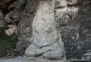
1- Buddha Sculpture

The picture of Mahatma Buddha is engraved on a giant hill stone on the Kargah Road (at a distance of about 8km) in the west of Gilgit City. This inscription is 10 feet long at a height of 30 feet from the ground.

It is a glorious masterpiece of the Gandhara Civilization.  A monastery and three stupas are located nearby which were discovered in 1931.

Showing 81 of 828 media items Load more ATTACHMENT DETAILS Kargah-Buddha-Gilgit.
Kargah Buddha Sculpture

2- Nopora Basin

There is a sketch of a witch on a hill rock. According to a popular tale, a witch was buried here due to her cruelty and oppression.

3- Taj Mughal Monument

This memorial is established to give tribute to Taj Mughal who was the ruler of Badakhshan. He conqured Gilgit in 1290. It is 30km from Gilgit.

4- Shikargah

There is a fish farm for trout at Shikargah. Visit this farm and gain information about this expensive and tasty fish.

5- Chinar Bagh & Martyres Memorial

There is a beautiful park named “Chinar Garden”. There are Chinar trees that are older than one hundred years. The river Gilgit passes through the northwest edge of this garden.

 Chinar-bagh-bridge-gilgit-baltistan.
Chinar Bagh bridge Gilgit Baltistan

In front of this garden, in Gilgit Provincial Assembly, the graves of two famous Mujahideen (soldiers) of the War of Independence of 1947-48, Karnal Hassan Khan and Babur Khan, and a memorial to the martyrs have been erected. The memorial which was established in 1962 is reminiscent of the amazing courage of the native.

6- Chinese Cemetry and memorial

The Silk Route  (Karakoram  Highway )turns towards Hunza after crossing China Bridge before Gilgit City. At the spot of Danyor, a cemetery and a memorial (Yad-e-gar) has established for the Chinese workers and masons who sacrificed their lives during the construction of Resham Highway.

During the construction of the Karakoram Highway from 1966 to 1978, 810 Pakistani and 82 Chinese Workers died.

 chinese-cemetry-gilgit-baltistan.
Chinese Cemetery in Gilgit city

7- Naltar Valley

It is perhaps the favorite valley in Pakistan for adventurous people. A journey by jeep is the best to reach this valley which is surrounded by the ice-tipped Hindukush mountain range, alpine trees, and rich green meadows. It is 35km from Gilgit at an altitude of 10,000 feet above sea level.

The Resham Highway separates from the road directed to Hunza from Gilgit at the point of Namal Village. Then it goes gradually uphills.  The upper Naltar’s pastures are the best choice to get rid of the hot climate of Gilgit.

Enjoy these valleys. They are awaiting you. Relish the sips of tea in a small restaurant in the pleasant weather. It is the beginning point to reach Naltar Pass (4200 meters above sea level), Ishkoman Pass (4800 meters), and Daintar Pass (15,700 feet). The whole valley is awaiting trekking enthusiasts.

Sky resort is another good spot there. Pakistan Airforce (PAF) organizes snow sports every year. The players from all around Pakistan come here to participate. There is a chairlift too. This 19km long valley has four lakes. It is better to take a local guide along with you during the visit to this valley. Enjoy the 12km trek.

One can do camping in the first and fourth lake. Book a jeep for upper Naltar. It is because Upper Naltar comes after Lower Naltar.

 Naltar_lake_in_Autumn_Gilgit
A mesmerizing lake of Naltar Valley near Gilgit City

FAQs about Gilgit City

Q1: What is the historical significance of Gilgit City?

Gilgit City has a rich historical heritage, serving as a hub of ancient trade routes and being part of various empires, including the Mauryan and Kushan dynasties.

Q2: What are the must-visit tourist attractions in Gilgit City?

Some must-visit sites include Naltar Valley, Baltit Fort, Altit Fort, Karimabad, the local bazaars, and the serene surroundings of the city.

Q3: Is Gilgit City a good base for exploring the Gilgit-Baltistan region?

Yes, Gilgit City is an excellent base for exploring the region, with good road connectivity to other prominent destinations like Skardu and Hunza.

Q4: What is the best time to visit Gilgit City for tourists?

The best time to visit Gilgit City is during the summer months, from May to September, when the weather is most favorable for tourism.

Q5: Are there opportunities for adventure sports in and around Gilgit City?

Yes, Gilgit City and its surroundings offer ample opportunities for trekking, mountaineering, and other adventure sports.

Windup Lines

Gilgit City, with its rich history, stunning landscapes, and vibrant culture, beckons travelers to explore its enchanting streets and immerse themselves in the heritage of the region. Whether you’re captivated by the ancient forts, enchanted by the local markets, or seeking thrilling adventures, Gilgit City is a gateway to the wonders of Gilgit-Baltistan. Plan your visit to this historical and tourist gem and experience the magic of Gilgit City for yourself.

Tourist Attractions in Ghizer – Gilgit Baltistan

Ghizer

District Ghizer is a part of north Gilgit Baltistan. It is a multi-cultural, multi-ethnic, and multi-lingual city. It is a hub of people speaking the Khowar, Burushaski, and Wakhi languages. The lifestyle of people is quite simple. The native of this region always welcomes guests.

Besides its natural beauty, Ghizer is also famous for trekking routes and trout fish. Sher fort, Bobar, Single, and many other mesmerizing spots enhance the beauty of Punial Valley.

The archaeological traces in Hatoon village are a cause of attraction for tourists. Transport is available for every area of Ghizer from the Punial Road of Gilgit City.

phander-lake-ghizer-gilgit-baltistan.
Phander Lake in Ghizer is an ideal site for camping and picnic

Punial Police checkpoint is across the bridge at a distance of 8km from Gilgit City. The passports of foreign tourists are checked here. From here, Punial is 34km, Single is 54 km, Gahkuch is 72km, Gopiz is 109km and Phander is 168km.

Details of Ghizer

Attribute Details
Name Ghizer
Region Gilgit-Baltistan
Location Northern Pakistan
District Ghizer District
Geography Mountainous terrain with stunning landscapes
Elevation Varies, with some areas exceeding 7,000 meters
Population Approximately 150,000 (as of last available data)
Official Language Urdu, Shina, and other regional languages
Time Zone Pakistan Standard Time (UTC+5)
Climate Cold desert climate, with harsh winters
Major Religion Islam (predominantly Sunni)
Economy Primarily based on agriculture and tourism
Tourist Attractions – Phander Valley – Shandur Pass – Gupis Valley
Transportation Limited road network, no airport
Notable Features Rich cultural heritage, vibrant festivals
Educational Institutes – Government Degree College, Gahkuch
Hospitals Several healthcare facilities in Gahkuch
Restaurants Local eateries serving traditional cuisine
Local Dishes Try chapshuro (a local dumpling dish)
Languages Shina, Wakhi, and other regional dialects
Cultural Festivals Chilm Joshi Festival, Shandur Polo Festival
Local Crafts Handwoven rugs, traditional clothing

Tourist Destinations and Historical Sites in Ghizer

1- Henzel View Point and Stupa

It is a good viewpoint on the Ghizer Road, 20km beyond the Nopora. There are traces of Stupa from the fourth or fifth century.

2- Sher Fort

Sher Qila has situated 38km from Gilgit in the north of the river Gilgit. It was the capital of Punial state. You have to go to the other side of the river to see the fort. There is a polo ground, a beautiful mosque with woodwork, and a 160 years old watch tower. You can enjoy fishing in Sher brook and the small lake.

 sher-fort-ghizer-gilgit-baltistan-
Ancient Sher Fort of Punial State

3- Single

It is 61km from Gilgit. The trekking routes for Chilas and Kohistan Valley go from this site. Here, the blue and white color river will enchant you. Famous spring Gorjor is near the Single. There is a spot for catching trout fish.

4- Gahkuch

Gahkuch is 73km from Gilgit and it is the district headquarter of Ghizer in the Punial Valley. It is the ideal place for trekking, duck hunting, and fishing. It is famous for the abundance of grapes too. It is the gateway to Ishkoman Valley. One can reach from Gilgit to Ghizer (Gahkuch) in one and half hours. Gahkuch has official rest houses and private hotels.

 river-ghizer-gahkuch-ghizer-gilgit-baltistan.j
River Ghizer flowing in Gahkuch

5- Ishkoman Valley

This valley is spreading in the north and south and the river Gilgit converges at the point of Gahkuch. The Karakoram mountain range separates from Hindukush in Ishkoman Valley. The headquarters of Ishkoman Valley is “Chatorkhand” which is about 100km from Gilgit.

If you want to go directly to Ishkoman Valley from Gilgit, you can have breakfast and then leave. After spending the day in Ishkoman and other sites, you can easily return to Gilgit by evening. One can reach Darkot Pass and Broghil Valley after crossing Karomber Glacier from Ishkoman.

 Ishkoman_Valley_in_summer-
Lush green fields Ishkoman Valley in Summer attracts the holidaymakers

6- Karomber Valley and Karomber Lake

This valley is beyond Ashkoman Valley’s headquarters Chatorkhand. This valley has the most alpine meadows in the northern areas. In the ancient ages, Buddha pilgrims used to reach Afghanistan and Wakhan via this route.

Karomber Lake is at an elevation of 4260 meters above sea level. This lake at the foothills of Pamir Mountain Range is the second-highest lake in Pakistan. It is one of the most bioactive lakes on Earth. This 9.3 km long lake is located at the border of Gilgit Baltistan and Khyber PK and is 205km from Gilgit.

The trek here connects Gilgit to Ghizer. This trek passes through Naltar, Ishkoman, and Yasin Ghizer. Many tourists enjoy this trek every year.

 karamober-lake-ghizer-gilgit-baltistan.
Karomber lake is a jewel on the Ghizer beauty

7- Gopis (Gupis)

You will see a beautiful sight of the confluence of the river Punial (muddy water) and the river Yasin (crystal blue water) before Gupis. There are the most captivating landscapes between Gahkuch and Gopis.

The beautiful Gupis region is at the bank of the river Gilgit, 112km west of Gilgit City. You can reach Yasin Valley and the mausoleum of Havaldar Lalak Jan (Nishan-e-Haider) from there.

8- Yasin Valley

Yasin Valley is a spectacular and beautiful region of the district Ghizer which is situated on the right of Yasin Bridge. This valley is 137km from Gilgit and 62km from the Gahkuch (district headquarter of Ghizer).

The extremely beautiful fields and fruit orchards present a splendid contrast of natural beauty. It is not only famous among tourists for its beauty but also provides a great trek for trekking enthusiasts.

It includes Darkot to Chitral via Broghil Pas and Baba Gundi via Chilinji Pass. There is a hot water spring too. According to locals, the one who bathes in spring water either dies immediately or is cured of the disease. There is a fort of former rulers in the Yasin Valley.

There are traces of forts that were constructed by Gawaharmans. It is said that Mir Wali’s son killed renowned adventurer George Howard in 1868. There is still a rock in Yasin Valley on which George Howard wrote the number 20 and marked Dara Kot 20 miles and signed it below. But he was killed due to unknown reasons.

 darkot-village-ghizer-gilgit-baltistan.
Snow covered Darkot Village of Yasin Valley, Ghizer

9- Fitti Das

Pictures of humans and animals are engraved on large stones near Nazbar brook in Fitti Das.

10- Havaldar Lalak Jan Shaheed (Nishan-e-Haider)

Havaldar Lalak Jan was born in Hund Village of Yasin Valley. He was a brave soldier of the Northern Light Infantry (reporting name: NLI) regiment. He harmed the enemy with bravery, courage, bravery, and chivalry in the Kargil war.

He was providing services to the company headquarters when he came to know about the invasion of the enemy’s armed forces. It was May 1999. Seeing his bravery and courage, he was sent to the front lines. On 7th July, the Indian Army attacked Lalak Jan’s post by artillery. During this time, shelling continued day and night. He embraced martyrdom after being hit by bullets in the chest.

He was awarded Nishan-e-Haider- the highest military award. Havaldar Lalak Jan Shaheed is the first in the northern areas to receive this honor. You can travel to Darkot Valley and Darkot Lake after crossing Darkot Glacier beyond Hunder. You can reach there via a bike or a jeep.

11- Khalti Lake

The river Gilgit is called the river “Ghizer” beyond Gupis. Khalti Lake is a 20 to 30 minutes drive from Gupis City. It is situated on the highway directed to Shandur and is famous for trout fish.

The blue water freezes in the winter and the locals walk on it. Stay here in a PTDC motel at night. The scenery of the lake looks splendid from the hotel.  There is a camping site near the lake which is established by the Gilgit Baltistan Tourism Department.

 khalti-lake-ghizer-gilgit-baltistan.
Reflection of autumn in Khalti Lake presents a splendid sight

12- Individuality (انفرادیت)

You will tall sculptures on sky-high mountains by crossing Dahimal and Pingal. The archaeological traces and relics testify to the historicity of this area. Innumerable pictures incised on the stones represent the antique heritage of the whole Gupis Valley.

There are 3500 years old archaeological remains at the confluence of the river Yasin and the river Gupis. Megalithic circles are present in different sizes and shapes. You can see all this on foreign TV channels but you have to come here to enjoy watching them with your own eyes. The stones on the way to Gupis are connected in such a way that the pieces of the Jigsaw Puzzle are placed together.

 Closer-view-of-a-megalthic-grave-in-gupis-valley
Ancient megalithic circle

13- Phander Lake

Phander Lake (also spelled as Phundur) is a beautiful lake in the district Ghizer. This lake is known for its natural beauty and trout fish. This lake is located near Phandur Village on the Shandur Highway. The crystal clear water, shining sand, luxuriant grass, tall and thick green trees, and the Rocky Mountains covered with snow will captivate you.

The scenery of the lake and valley from PTDC hotel is fascinating. Phandur is also called “Chota Kashmir” (little Kashmir).  There are residential hotels in Phander Valley too. Staying in a hotel or camping, the choice is yours. The river Ghizer flows from Phander Lake. Teru Village is 32km from Phandur.

 phander-valley-gilgit-baltistan
A beautiful aerial view of Phander Valley

Cold and bitter wind blow at night in this village at an altitude of 3100 meters. There are some shops and a rest house. Guides and horses are available for trekking in this area.

The Shandur Pass starts from here after crossing 24 km. Laspur is awaiting you at a distance of 7km from Shandur Pass. The automobile descends towards Sirlaspur below the Shandur Pass. There is a heritage museum and a few hotels.

14- Handarap Valley & Handarp Lake

Handarap Valley is located in the west of Phander Valley between two rivers. These two rivers Hundrab and Shandur flow from Dadrili glacier. This place is heaven in Ghizer for trout anglers. This region is nominated as a camping site by WWF.

In early 1980, Rainbow and brown trout fish were introduced here in Handarap which is 190km from Gilgit, and 118km from Gahkuch at an elevation of 10,800 feet. There is a one-day trek to Handarap Lake which is located in Handarap National Park.

 shandur-handarap-national-park.
Animals grazing in Shandur-Handarap national park

15- Shandur Mela (Festival)

 shandur-polo-festival.
Shandur Festival is a worth watching festival to visit in Shandur

The northern area upper trek is from Chitral to Gilgit via Booni, Mastuj, Shandur Pass, Phander, and Gupis. In this beautiful, difficult, and long trek, Shandur is at an altitude of 12,500 feet stretching over an area of 20km.

This spot is not only famous for its freezing environment, enchanting location, natural beauty, and calm atmosphere but also for the three-day festival and polo tournament. This fair is organized every year by the mutual collaboration of the Chitral and Gilgit Baltistan administration in the month of July.

Polo is a popular game in northern areas. The first tournament in Shandur was played in 1936. At that time, the polo was played on the fourteenth of the lunar month in the light of the moon.

Nowadays, thrilling games are played between Gilgit, Baltistan, and Chitral. At the time of the festival, a camp town is set up in the beautiful valley of Shandur. On this occasion, the Gilgit Baltistan Tourism Department held special ceremonials.

Local and foreign tourists come here every year to enjoy polo matches organized at the height of 12,250 feet. During the festival, the bustle of Shandur is at its peak. Markets are decorated. Camps are established in a lane. There are different arrangements to amuse and entertain the tourists. Folk music, dance, and other traditional sports and games are included in them.

You can stay in the nearby valleys of Phander and Laspur after spending the whole day in Shandur. But you will always remember a night’s stay at Shandur. Transport is available from Gilgit and Chitral during the festival days.

 Shandur’s Climate

Shandur’s climate is cold. If you plan to stay, bring warm clothes and a sleeping bag. There is no accommodation arrangement on normal days. It would be better to come to Chitral and Gilgit with full preparation and travel stuff. The cold winds can affect your skin and face. Use a skin ointment there. There are many private organizations that can arrange a trip for you with all the facilities.

16- A road to China

Gilgit to Hunza journey is one of the most beautiful trips in the World. Take snaps on the way to this beautiful journey. This 3 hours-long drive is unforgettable. At first, Gilgit’s airport runway can be seen at a distance of 200 feet as the wagon leaves Gilgit City by passing through Gilgit’s Bazaars.

After 10km, the vehicle crosses the Gilgit Bridge and moves parallel to Gilgit Valley. There is a swinging bridge over the Hunza River at a distance of 17km from Danyor. Namal Settlement is at the western edge of this bridge. Namal is the gateway to Naltar Valley.

17- Army Memorial

A monument has established by Pak Army near the corner of Rahimabad Raod which is about 35km from Gilgit. Stay for a while at this memorial. Pay a tribute to the workers and engineers who sacrifices their lives during the construction of the Karakoram Highway.

Enjoy a cup of tea at the tuck shop in the boundary of this memorial. There is a beautiful fall at a distance of an hour’s drive from this point. The road begins to ascend beyond this point. Here, the river Gilgit changes into the river Hunza.

18- Old Silk Route

A roadside board will indicate the ancient road that was used for centuries instead of the current Silk (Karakoram) Road. Even today some tourists satisfy their passions by traveling to some parts of it.

19- Chalt

Chalt is the location where Indo Pak and Asian Land link. This region is a part of Nagar in the north of the river between two valleys. A road from Karakoram Highway will take you to Chalt across the river. Charpot is probably the most beautiful site in the valleys of northern areas that is near Karakoram Highway.

 chalt-valley-gilgit-baltistan
Chalt Valley of Gilgit Baltistan

At the time of the British attack, Mir of Hunza Safdar Ali said that “Chalt and Charpot are more important than our wives”. Besides Bar Valley, many other trekking sites also begin from this point. The best tourist season for this spot is the beginning of the autumn season. Chalt is 48km from Hunza and 54km from Gilgit.

FAQs

What are the must-visit tourist attractions in Ghizer?

Ghizer offers a range of beautiful destinations. Some must-visit places include Phander Valley, Shandur Pass, and Gupis Valley.

What is unique about Phander Valley in Ghizer?

Phander Valley is known for its pristine lakes and lush green meadows, making it a paradise for nature lovers and a great spot for camping and hiking.

What’s special about Shandur Pass?

Shandur Pass is often called the “Roof of the World.” It’s famous for the annual Shandur Polo Festival and offers breathtaking panoramic views.

Can I engage in outdoor activities in Ghizer?

Absolutely! Ghizer is a haven for adventure seekers. You can go trekking, fishing, and even partake in local sports like polo.

Are there any cultural festivals celebrated in Ghizer?

Yes, Ghizer hosts the Chilm Joshi Festival, which celebrates the arrival of spring, and the Shandur Polo Festival, a thrilling event for sports enthusiasts.

What should I shop for as souvenirs in Ghizer?

Look for handwoven rugs, traditional Wakhi and Shina clothing, and local handicrafts as unique souvenirs to remember your trip.

Is Ghizer easily accessible from major cities in Pakistan?

While Ghizer is not as easily accessible as some other cities, it can be reached by road from Gilgit, the capital of Gilgit-Baltistan.

Are there accommodations available in Ghizer for tourists?

Yes, there are a variety of accommodations, including hotels, guesthouses, and camping options in Ghizer to suit different budgets.

What’s the best time to visit Ghizer for tourism?

The best time to visit Ghizer is during the summer months, from May to September, when the weather is milder and most tourist attractions are accessible.

Is there a local cuisine in Ghizer that tourists should try?

Yes, don’t miss the opportunity to taste local dishes like chapshuro, a delicious dumpling dish, and savor the unique flavors of Gilgit-Baltistan cuisine.

Wind Up Lines

Ghizer is a cultural district of Gilgit Baltistan with many tourist sites. Phander Lake, Karomber Valley, Gupis ,Yasin Valley,  Shandur,  and Handarap National Park are among the most attractive sites.

Rakaposhi – Ranked 27th Highest Peak in World

Rakaposhi

After taking a turn on the Hunza Road, the beautiful peak of Rakaposhi, loaded with thousands of tons of snow, emerges at once through the cracks of red rocks. Rakaposhi peak will accompany you on the Karakoram Highway for 40km.

Its color changes to a unique color at every turn. This peak with an altitude of 25,551 feet is reckoned as one of the most beautiful peaks in the world. It is the eleventh highest peak in Pakistan and 27th highest peak in the world.

 rakaposhi-karakoram-peak-nagar-valley.
Snow-tipped Karakoram Mountain peak Rakaposhi view from Nagar Valley

There are many trails to reach this peak but the easiest one is by Silk Route, before Aliabad via Pisson and Minapin Village. There is a three to four journey on foot from Minapin Village to Rakaposhi base camp. Move forward from Minapin Village with food, an airtight tent, a guide, and other necessary stuff.

Feature Details
Name Rakaposhi
Location Karakoram Range, Gilgit-Baltistan, Pakistan
Elevation 7,788 meters (25,551 feet)
Prominence 2,715 meters (8,907 feet)
Range Karakoram Range
First Ascent First climbed by a British team in 1958
Notable Fact Known for its relatively gentle and beautiful slopes, making it a popular peak for mountaineers
Scenic Beauty Offers breathtaking views of the Karakoram Range
Trekking Serves as an excellent trekking destination, with various trekking routes available
Climbing Attracts climbers from around the world, offering both challenging and rewarding ascents
Geographical Significance Lies near the junction of three important mountain ranges: the Karakoram, Himalayas, and Hindu Kush
Local Legends Surrounded by local folklore and legends, adding to its mystique
Expeditions Hosts numerous mountaineering expeditions, contributing to the local economy
Accessibility Accessible from the town of Gilgit, with further trekking required for closer views
Safety Climbing and trekking on Rakaposhi require proper equipment, experience, and permits
Best Time to Visit Summer months (June to September) offer the most suitable weather for climbing and trekking activities

The river Minapin flows till Minapin Glacier. Small ice cubes also flow along the water in river Minapin. Two splendid waterfalls on your way will urge you to stay there. Stay in Hapakan for a day. From this point, the Rakaposhi base camp trek has thick green forests and low and high trails.

Minapin Glacier, deserted peak, Minapin Village at the back, and Silk route will amaze you. The next stop is Tafakhri. Rakapsohi’s beauty is in full swing there. Before descending into Tafakhri Valley, one can see a crowd of Minapin and other glaciers that look like beautifully carved sculptures of various sizes and shapes.

These shapes and sizes are the results of climate changes and thunderstorms. The ice layers cover Rakaposhi in such a way that it looks like a beautiful bride in a white Kashmiri Shawl. Most of the time, Rakaposhi is shrouded in mist. And it covers a large part of this region in fog. That’s why it is called the “mother of mist”.

 Rakaposhi-Expedition-gilgit-baltistan
The colorful flowers near Rakaposhi basecamp captivate the mountaineers

Naltar, the first settlement of Nagar is 8km from Siknderabad adjacent to Hunza. About 8km from Nalt, the Rakaposhi view will spellbind you at the point of Gulmit. There are different cafeterias at this point near the water spring. Stay here for a while. Take pictures to your heart’s content.

Nasirabad is 6km from this spot. Here, Rakaposhi appears with a different view. 10 km ahead of Murtazaabad, 5 miles after crossing Hassanabad comes the Hindi bridge. Garnet stones can be found near the river Hunza bank below the Hindi school. Rakaposhi will appear at the point of Aliabad.

You can enjoy a view of the Golden Peak and Altar Glacier. The slopes of this glacier are of granite. Due to this reason, the ice can’t stay over it. There is an Aliabad (Karimabad) general bus stand too. A commercial area is located on Resham highway. Whereas, Karimabad is the central area that is located at some height.

FAQs

Q1: Where is Rakaposhi located?

Rakaposhi is situated in the Karakoram Range, within the Gilgit-Baltistan region of Pakistan.

Q2: What is the elevation of Rakaposhi?

Rakaposhi stands at an elevation of 7,788 meters (25,551 feet) above sea level.

Q3: Is Rakaposhi a popular destination for climbers?

Yes, Rakaposhi is a renowned destination for mountaineers due to its relatively gentle slopes and stunning views.

Q4: Can tourists visit Rakaposhi without mountaineering experience?

While a full ascent may require mountaineering skills, trekking routes around Rakaposhi are accessible to tourists without climbing experience.

Q5: When is the best time to visit Rakaposhi?

The ideal time to visit Rakaposhi is during the summer months, from June to September, when the weather is most favorable.

Wind Up Lines

Rakaposhi is a famous trekking and tourist spot in Gilgit Baltistan. Rakaposhi stands as a majestic sentinel in the Karakoram Range, captivating climbers, trekkers, and nature enthusiasts with its grandeur. This beautiful peak is not only a symbol of the region’s natural wonder but also a testament to the adventurous spirit of those who dare to conquer its slopes.

Whether you’re an experienced mountaineer or a traveler seeking breathtaking views, Rakaposhi’s allure is undeniable. Plan your visit to this Himalayan gem and be mesmerized by the allure of Rakaposhi.

About Hunza | History | Culture | Tourist Sites

Hunza

The land of legends

Chinese called it “Kanjut”. Hindus called it Humadesh which has a meaning of “The land of mountains”. Hunza was a free state. It was a royal state till 1974 with Karimabad its capital. In 1974, after the formal affiliation with Pakistan, Hunza is directly linked to the Federal Capital Islamabad and the regional capital Gilgit of Gilgit Baltistan.

 attabad-lake-hunza
Turquoise color lake – Attabad of Hunza

Karimabad, Hunza’s capital city is located at an altitude of 2438 meters above sea level near the left edge of the Silk Route at a distance of 112km from Gilgit.

The views of four peaks Rakaposhi, Dran, Golden, and Astar from different sites of Hunza make it unique from other regions. The valley presents different sceneries with the changing weather. This distinctiveness makes it stand out from others.

Details of Hunza

Feature Details
Location Gilgit-Baltistan, Pakistan
Geographical Nestled in the Karakoram Range
Elevation Varies, with Karimabad around 2,400 meters (7,900 ft)
Historical Significance Former princely state, part of the Silk Road trade route
Culture Unique and vibrant, strong community bonds, traditional music, dance, and festivals
Tourist Attractions Baltit Fort, Altit Fort, Attabad Lake, Karimabad Bazaar, Passu Cones, Hussaini Bridge, and more
Scenic Beauty Towering peaks, lush green valleys, serene lakes, and terraced fields
Activities Trekking, mountaineering, cultural experiences, shopping for local handicrafts
Best Time to Visit Spring and summer months (April to October)
Accessibility Connected to Gilgit via the Karakoram Highway

Hunza is divided into three sections on the basis of dialect. People speak Wakhi in Gojal, Burushaki or Burushki, and Shina in central. However, Burushaki is spoken in Hunza. The people of Hunza are famous for their longevity. According to them, the reason behind this are fruits, vegetables, and Hunza’s water.

 a-beautiful-street-of-hunza-gilgit-baltistan
A beautiful street of Hunza

Hunza’s water has iron sufficiency and gold particles. Granite mines and handmade Paffu cloth of Hunza are famous among the visitors. Colorful, intricate, and beautiful embroidery is done on the clothes. This cloth is used to make women’s caps, gowns, and coats.

Hunza Valley is enriched with fruits. Apricots, peach, grapes, apples, plums, and cherry orchards are abundant. You can eat them. No one will stop you. But it is better to take permission. In summer, there are apricots of various kinds. Local people dry them on the terrace and in the fields.

The best tourist season is from April to September. The weather is pleasant during this time. There is a crowd of photographers in Hunza during autumn. Light woolen clothes are required. However, warm clothes are essential in snowfall.

If you want to go till Khunjerab Pass, you will have to wear warm woolen clothes even in summer. It is because there is snowfall in June and July at Khunjerab pass which is 4733 meters high.

Tourist Attractions & Ancient Historical Traces in Hunza

1- Karimabad

The old name of Karimabad (capital city of Hunza Valley) is Baltit. It was changed after the name of Prince Agha Karim Khan. Karimabad is located at an elevation of 2437 meters above sea level.

A route separates from Silk Highway at Aliabad and ascends towards Karimabad. As you move gradually upwards, Hunza Valley is resplendent there with all its indescribable beauty. You reach there by passing through hotels.

 hunza-gilgit-baltistan.
The starry night of Hunza mesmerizes the travelers

In the local market, there are shops for dry fruits like almonds, apricots, walnuts, mulberry, tourism guide offices, restaurants, special embroidered shawls, handmade rugs, souvenirs, stones, jewels (discovered from the mountains of Gilgit Baltistan), handmade cloth Paffu, and other stuff.

You can also buy handicrafts by visiting the women weaving center. Hunza looks more beautiful at night in the floods of lights. Hidden paradise restaurant is a specialist in Hunza’s local food. Enjoy the Italian food and walnut cake in Café D. Enjoy Fittis which is a local cake. There are cherry and apricots trees in the surrounding Karimabad.

2- Baltit Fort

Experience the magic of a royal past

This fort is located at some height in the Baltit Village at the end of Karimabad Bazaar. Mir of Hunza’s family ruled Hunza for 940 years. This fort is still there as a memory of their empire.

About 700 years ago, a ruler of the Mir family married a woman of Tibet. His wife called skilled artisans from Tibet. They worked with the regional craftsmen and created this splendid masterpiece. This residential palace was constructed with mud, stones, and wood.

At an altitude of 2800 meters above sea level, this fort is designed in such a way that it can withstand earthquakes, storms, and enemy invasion. It was the residence of Mir of Hunza till 1950.

This fort-shaped palace is changed into a cultural museum. This museum reflects the historic traditions of Hunza with regional culture. Hundreds of years old rooms have carpets, utensils, closets, emperors’ attires, and other things. You will be aware of the local traditions of Hunza after visiting this fort.

Enjoy the scenery of Hunza and Nagar from the balcony of the fort. After watching the view of the valley from the terrace you will be sure that it is the same region which is the Shangrilla of “The Lost Horizon” (a novel by James Hilton). You will agree that this is the largest photography region in the world.

There is a ticket for this museum. Buy a ticket for you and visit the ancient era. Enjoy a trip to the Baltit Village on the return from the fort (museum). Do gossip with the locals. The best time for photography of the valley from the fort is morning time and evening time is for the fort’s photography from the valley.

 Hunza-Karimabad-Baltit-Fort
The grand Baltit Fort of Hunza

3- Vicotria Monument

A memorial is built in the north of Altar Glacier ahead Baltit fort. It is a tribute to Mir Nazim Jan.

4- Duikar

Adore the beautiful sunrise from Duikar which is located at a height of 10,000 feet at a distance of 10km from Karimabad above Altit Village. One can see 8 peaks from this spot that are more than 7000 feet high.

The light rays that fall on these peaks at sunrise and sunset present a wonderful view. But you will have to leave the Hunza before sunrise to cherish this moment. It is better to stay in the “Eagle nest” hotel there to sight the sunset. There are other hotels too.

5- Altit Fort

This fort is a few kilometers away from Karimabad in the Altit Village. It is about 900 to 110 years old. It is said that it was the headquarters of Hunza’s monarchs till the 13th century. It holds an exceptional status because of its antique architecture and location.

Its foundation is so strong that it can resist an earthquake on a 7.9 scale. This fort with narrow corridors has a prison too. It is now altered into a museum. One can view the river Hunza, Karakoram Highway, Lady Finger peak, Baltit fort, Rakaposhi peak, and Hilan peak. This fort was completed in 1 year. There is a royal garden and an 1100 years old tree near the fort.

Load more ATTACHMENT DETAILS altit-fort-gilgit-baltistan.
The majestic Altit Fort

6- Nagar Valley (The land of peaks and glaciers)

Nagar City and Valley is 120km from Gilgit. Nagar is at an altitude of 7550 feet and is well known for Hispar, Hoper, Miar, and Minapin Glaciers. This valley has hot water springs and emerald mines. The river Hunza splits Nagar from Hunza. Nagar City, situated opposite Hunza was once important like the state of Hunza.

This valley spreading over a large area has its central town Nagar across the river Hunza in front of Karimabad. You will see layers of crops and orchards everywhere. Jafarabad, Hassanabad, Skindarabad, Altit, Gulmit, ad Nagar Valley are considered among the big villages. The first mosque in Nagar was established by Raja Kamal Khan after accepting Islam. This mosque which was constructed in 1696 is a masterpiece of local culture.

 jharoka-nagar-valley.
A view of Nagar Valley from the balcony of Baltit Fort

7- Hoper Valley

Hoper Valley is situated 16km away from Nagar. This valley is greener than Hunza and Nagar Valleys. There are thousands of years old clay-colored glaciers. You can reach there with the help of a local guide. It is the only glacier in the world that is at a height of 8000 feet above sea level.  Hoper Lake is situated nearby. Ultar peak can be seen clearly here. Hispar Valley and Lake are 22km beyond Hoper.

 Hoper-Valley-hunza-gilgit-baltistan
Sky-scrapping mountains of Hoper Valley

8- Central Karakoram National Park

At this time, there are 21 national parks, 98 wildlife sanctuaries, 102 game reserves, and 94 community control hunting areas in Pakistan. Central Karakoram National Park was established in 1993.

Stretching over an area of 10,000 square kilometers, it is the largest park in Pakistan. It includes four districts of Gilgit Baltistan. Hoper, Hispar, Rakaposhi, Bagrot, Haramosh,  Astak, Tormik, Shigar (Basha, Baraldu), Hoshe, are worth mentioning valleys.

 central-karakoram-national-park-gilgit-baltistan
Concordia-Gondogoro trek in Central Karakoram-National Park

Baltoro,  Biafo, Panorama, Hinarchi, and Hispar glaciers are here. K-2 (the second highest peak in the world at a height of 8611 meters), Bardak, Gasherbrum I, and Gasherbrum II are located in this region.

9- Rush Lake (Rush pri peak)

It is one of the highest alpine peaks in the world at an altitude of 5098 meters. Rush peak is 15km from Miar and Golden peaks. To reach rush lake and valley, the route directed to Nagar from Hispar is used. It is called the highest lake in Pakistan at an elevation of 15,400 feet. Every year many holidaymakers come here.

10- Ganish

It is the most ancient region in Hunza. There is a watch tower, old traditional mosques, and cultural centers. Ganish Village is located near the bank of river Hunza. And 7500 feet high Hunza hill is located nearby. You can analyze the regional norms and culture by talking to locals.

 beautiful-ganish-village-hunza.
Beautiful Ganish Village in Hunza Valley

11- Buddhism Rocks

A few kilometers away from Ganish, quotes from the Buddhism era are engraved on large stones above the river Hunza. Besides the citations in Kharosthi, Gupta, Sogdiana, and Tibetan languages, there are shapes too. Altit fort can be seen on a hill rock across the river.

 Sacred_Rock_of_Hunza_
Sacred rocks of Buddha in Hunza Valley

12- Attabad Lake

On 4th January 2010, land sliding near Attabad caused the rock fragments and wreckages to block the downstream flow of the river Hunza, creating a lake. A region of about 42km has become a part of the lake from Attabad to Gojal. As a result of this, transportation on the Resham Highway (Silk Route) was disrupted.

For some time, giant motor boats were the source of transportation. Later on, with the contribution of China, Pakistan constructed miles of long tunnels near the coast of the lake. This lake is still in use for boating.

 luxus-Hunza-resort-in-Attabad-Lake.
Hunza Resort in Attabad Lake

13- Lord Kitchener Memorial

In 1903, Lord Kitchener visited this place for the first time as a commander in chief of the Indian army. A monument was established in the memorial to this visit. This memorial is on the way to Gulmit from Saret. Now, this memorial is submerged in Attabad Lake.

14- Gulmit

Gulmit was the summer headquarter of the Hunza state. It is at an altitude of 7900 feet above sea level. Gulmit presents a splendid view of Kathedral Peaks and Gulmit Tower Mountain. Gulmit village is located nearby.

Gulmit has the meaning of “Valley of Flowers” in Turkish and Persian languages. There are rock carvings on a hilltop. There are different hotels too. You can reach Passu glacier from here.

15- Gulmit Museum

Ther is a small museum in Gulmit. Items related to Hunza Valley are exhibited here. The mummified body of the Markhor (national animal of Pakistan) is kept in this museum with horns. The erstwhile flag of the Hunza state, made on cloth, is also hung as a symbol of the state’s traditions. Attires of Hunza’s former rulers, antique weapons, wood utensils, home décor items, and other stuff are exhibited in beautiful showcases.

16- Borith Lake

This lake has the status of the world’s highest salty lake. This lake is located at the back of a small hill northwest of Hussaini village near Gulmit. It is at a distance of 25 to 30 minutes on foot.

17- Passu Cones

 1280px-Batura_lake_and_passu_cones
A beautiful sight of Passu Cones near Batura Lake

A throng of strange and incredible structure rocks is visible near Shiskot. These pointy and elevated peaks are called “Passu Cones”. You have never seen this kind of unusual formation before. It is indeed a wonderful landscape.

Passu is a beautiful village at a distance of 14km from Gulmit. The inhabitants of this village guide the hikers and mountaineers. Tourists and climbers start their adventure for Batura, Passu, Kuck, Lagar, and other peaks from Passu Village. It is the beginning point of Shamshal Valley and Batura Glacier.

You will be hypnotized by the beauty of Passu.

18- Sost

Sost (also spelled as Sosat or Sust) is a small town at the border of Pakistan. Now, it has become a commercial center due to the transportation of merchandise from neighboring countries like China. You will see containers and brokers everywhere.

 sost-hunza-gilgit-baltistan
Sost dry port connecting China and Pakistan via Silk Route

Restaurants and residential hotels are there too. On 1st May 1986, Kunjebrab Pass was opened by the governments of China and Pakistan for transportation. In 1996, Pakistan Customs and Immigration were formally shifted to Sost. A bus is available for Sosat from Rawalpindi.

19- Khunjerab National Park

This national park is stretching over an area of 2269 square kilometers in Gojal north Hunza. Its boundaries spread from Karakoram Highway to the Pak-China border Khunjrab Pass. You can enter the park after buying tickets. One can see yaks, Ibex, Urial, marmoset, tigers, and Marcopolo sheep.

 himaliyan-ibex-khunjerab-national-park.
Himalayan Ibex Khunjerab National Park

20- Misgar Valley

Misgar Valley is the last settlement before China at a distance of 15km from Sost in Gojal. It is enriched with antique artifacts. Here in this valley, many passes of China and Afghanistan connect with each other.

This valley is covered with layers of fields that are irrigated through clear water channels. You can reach a small fort KD (Kalander Chand) in an hour from valley Misgar. There are many long treks for hikers. It is better to take a local guide along with you.

FAQs

Q1: Where is Hunza located?

Hunza is a breathtaking valley situated in the Gilgit-Baltistan region of Pakistan, nestled amidst the towering peaks of the Karakoram Range.

Q2: What is the historical significance of Hunza?

Hunza has a rich history, with a heritage dating back to ancient times. It was once a princely state and part of the Silk Road trade route, known for its strategic location.

Q3: What is unique about the culture of Hunza?

Hunza boasts a unique and vibrant culture, with a strong sense of community and traditional practices. Visitors can experience traditional music, dance, and local festivals.

Q4: What are the must-visit tourist sites in Hunza?

Hunza offers a plethora of tourist attractions, including Baltit Fort, Altit Fort, Attabad Lake, Karimabad Bazaar, and the picturesque landscapes surrounding the valley.

Q5: When is the best time to visit Hunza for tourists?

The best time to visit Hunza is during the spring and summer months, from April to October, when the weather is pleasant, and the valleys are in full bloom.

Windup Lines

Hunza stands as a jewel in the crown of Gilgit-Baltistan, offering a harmonious blend of history, culture, and natural beauty. This enchanting valley has been a witness to centuries of trade and traditions, with a culture that continues to thrive. Whether you’re exploring the ancient forts, savoring local cuisine, or simply taking in the breathtaking landscapes, Hunza leaves an indelible mark on the hearts of all who visit. Plan your journey to this captivating valley, and let the magic of Hunza immerse you in its rich history, vibrant culture, and awe-inspiring landscapes.

Khunjerab Top – The Highest Border in the World

Khunjerab Top

 khunjerab-pass-gilgit-baltistan.
Khunjerab Pass – Gilgit Baltistan

Khunjerab Top is the highest crossing border of the World at an altitude of 16,000 feet above sea level. It is the highest point of Karakoram Peak too.

Every year, roads are blocked due to heavy snowfall. And the border is closed from 15th October to 1st May. It is also called the “Roof of the World”. After reaching Khunjerab Top, cover yourself in warm clothes, jackets, woolen caps, and black glasses. Wear joggers. In this way, the bitterly cold winds will not affect you.

The eyes are scarred by the rays of the sun when sunlight falls on ice. The most important thing is the deficiency of oxygen at height. There can be difficulty in breathing. Try to walk slowly. Take deep breaths.

 karakoram-highway-road-to-khunjerab-pass-border-pakistan-
Karakoram Highway Road, directed to Khunjerab Top

Embrace the military people on the top. Talk to them about their experiences. You will realize how much they are suffering for the safety and protection of our beloved country. Wave hands to the soldiers at the Chinese border. Raise the slogan

پاک چین دوستی

زندہ آباد

Key Information  about Khunjerab Top

Feature Details
Location Pakistan-China Border
Elevation 4,693 meters (15,397 feet)
Mountain Range Karakoram Range
Connecting Countries Pakistan and China
Accessibility Karakoram Highway (KKH)
Importance Strategic trade route and border crossing
Scenic Beauty Surrounded by majestic peaks and glaciers
Wildlife Home to Marco Polo sheep, ibex, and marmots
Opening Period Typically from May to November
Closure in Winter Due to heavy snowfall and extreme cold
Cultural Significance Part of the ancient Silk Road
Visa Requirements Visa required for crossing into China
Tourist Attractions Attabad Lake, Passu Cones, Khunjerab National Park
Local Cuisine Traditional Pakistani and Chinese dishes
Nearby Towns Gilgit, Hunza (Pakistan), Tashkurgan (China)
Border Crossing Experience Offers stunning views and a unique cultural blend

Exploring The Khunjerab Top

Nestled in the majestic embrace of the Karakoram Range, Khunjerab Top stands as an awe-inspiring testament to the natural beauty and cultural richness of the region. As the highest border in the world, this pass, located at an elevation of 4,693 meters (15,397 feet), not only serves as a strategic trade route but also beckons travelers with its breathtaking landscapes, historical significance, and a tapestry of cultural experiences.

Historical Places

Khunjerab Top is part of the ancient Silk Road, a historic trade route that connected the East and West. The region is dotted with remnants of this glorious past, including old caravanserais and trade posts that whisper tales of merchants and explorers who traversed these high mountain passes centuries ago. The very essence of Khunjerab Top serves as a living history book, allowing visitors to touch the heritage of the Silk Road.

Culinary Delights

The border region is a melting pot of culinary flavors, blending the rich traditions of Pakistan and China. Travelers can savor a delightful mix of traditional Pakistani dishes, such as biryani and kebabs, alongside the aromatic offerings of Chinese cuisine. Local eateries along the Karakoram Highway provide a gastronomic journey, offering a chance to indulge in unique fusion dishes that reflect the cultural diversity of the region.

Restaurants and Accommodations

While the terrain around Khunjerab Top may be rugged, there are oases of comfort for travelers. Along the Karakoram Highway, quaint restaurants offer not only nourishment but also a chance to unwind and enjoy the scenic surroundings. Accommodations range from cozy guesthouses to campsites, allowing visitors to experience the serenity of the mountains while rejuvenating for the journey ahead.

Cultural Tapestry

The cultural blend at Khunjerab Top is as diverse as the landscapes. With influences from Pakistani and Chinese cultures, the region showcases unique traditions, music, and art. Local festivals celebrate the spirit of the mountains, and visitors often find themselves immersed in the warmth of the local hospitality, gaining insights into the lives of the communities living in these high-altitude regions.

Schools and Hospitals

In the vicinity of Khunjerab Top, small communities have established schools that serve the educational needs of local children. These schools not only impart academic knowledge but also play a vital role in preserving and passing on the cultural heritage of the region. Additionally, healthcare facilities, though limited, cater to the basic medical needs of the communities, ensuring the well-being of residents and travelers alike.

Frequently Asked Questions 

What is Khunjerab Top?

Khunjerab Top is the highest border in the world, located at an elevation of 4,693 meters (15,397 feet), on the Pakistan-China border in the Karakoram Range.

Why is Khunjerab Top historically significant?

Khunjerab Top is part of the ancient Silk Road, a historic trade route connecting the East and West. It has remnants of caravanserais and trade posts, reflecting its historical importance.

What kind of food can I expect at Khunjerab Top?

The region offers a delightful fusion of Pakistani and Chinese cuisine. Traditional dishes like biryani and kebabs coexist with Chinese favorites, creating a unique culinary experience.

Are there restaurants and accommodations at Khunjerab Top?

Along the Karakoram Highway, there are restaurants offering local and fusion dishes. Accommodations range from cozy guesthouses to campsites, providing comfort in the mountainous terrain.

What is the cultural blend like at Khunjerab Top?

The cultural blend at Khunjerab Top reflects influences from both Pakistani and Chinese traditions. Local festivals, music, and art showcase the rich cultural diversity of the region.

Are there schools near Khunjerab Top?

Yes, small communities in the vicinity have established schools to cater to the educational needs of local children. These schools play a role in preserving and passing on the cultural heritage.

What about healthcare facilities near Khunjerab Top?

While healthcare facilities are limited, there are basic medical services available to address the needs of both local residents and travelers passing through the region.

Is Khunjerab Top open year-round?

Khunjerab Top is typically open for travel from May to November. During winter, heavy snowfall and extreme cold weather conditions lead to the closure of the pass.

What are some nearby tourist attractions?

Tourist attractions near Khunjerab Top include Attabad Lake, Passu Cones, and Khunjerab National Park, offering stunning natural beauty and diverse landscapes.

Can I experience local festivals at Khunjerab Top?

Yes, depending on the time of your visit, you may have the opportunity to experience local festivals that celebrate the spirit of the mountains and the cultural traditions of the region.

Wind Up Lines

Khunjerab Top, the highest border in the world, is more than just a geographical marvel. It’s a journey through time, a feast for the senses, and an opportunity to connect with the rich cultural tapestry that defines this high-altitude region. From ancient trade routes to the fusion of flavors, from the echo of schoolchildren’s laughter to the nurturing care of local hospitals, Khunjerab Top invites travelers to experience the heights of tranquility and heritage at the top of the world.

Stunning Sites in Naran Valley – A Land of Lakes

Naran

The valley’s width starts increasing after crossing glaciers. You will reach Naran as soon as the river’s waves become calm. You will start shivering as you enter Naran. It feels like someone is passing through the street of his lover.

You will see camps near the river before Naran city. You can fix your camp there. You can borrow it as well. It doesn’t mean that there are no hotels in Naran. Kaghan Valley has the best modern hotels equipped with all facilities. There is a PTDC motel and youth hostel too.

Naran city is 88km from Balakot at a height of 7888 feet above ocean level. Balakot has become the second-best tourist spot after Murree due to the reconstruction of the Balakot Naran highway. It is because of the facilities too. Naran has gained the status of a tourism base camp.

 nran-kaghan-kpk.
Beautiful Lake and Mountains, Lake Saiful Muluk, Naran Valley,

You can enjoy one day trip to Lala Zar, Lake Saiful Malook, Batta Kundi, Babusar Top, and other sites while staying in Naran. If you plan to visit these areas for one day, hire a jeep a day before. It is better to stay in Lala Zar and Bisal for one day. Usually, the tourists go to the suburb of Naran in the daytime. The crowd in the Naran Bazar is worth watching at night.

Details of Naran Valley

Attribute Details
Name Naran Valley
Region Khyber Pakhtunkhwa, Pakistan
Location Northern Pakistan
District Mansehra
Geography Mountainous terrain with lush valleys and lakes
Elevation Approximately 2,409 meters (7,904 feet)
Population The valley serves as a tourist destination, no permanent residents
Official Language Urdu, Pashto, and other regional languages
Time Zone Pakistan Standard Time (UTC+5)
Climate Cold climate with heavy snowfall in winter
Major Religion Islam (predominantly Sunni)
Economy Tourism, agriculture, and livestock
Tourist Attractions – Saif-ul-Mulook Lake – Lalazar – Shogran – Babusar Pass
Transportation Limited road network, no airports
Notable Features – Scenic landscapes and meadows – Adventure activities including trekking and paragliding
Educational Institutes No permanent educational institutions in the valley
Hospitals Basic healthcare facilities available in Naran
Restaurants Local and international cuisines are available in Naran
Local Dishes Local cuisine with a focus on BBQ and traditional Pakistani dishes
Languages Pashto, Hindko, Shina, and other regional dialects
Cultural Festivals Local festivals and celebrations, often aligned with Islamic events
Local Crafts Traditional handicrafts and textiles

If you are fond of fishing, you can enjoy catching trout after taking permission from the department of fisheries. The stuff for fishing can be bought from the Naran market. This tasty fish can be caught easily in the cold freezing water. The weather is pleasant during the day and cold at night due to the snowy hills in the neighboring areas.

Cover yourself with warm clothes during the night. A route goes to Lake Saiful Malook from the right side of the iron bridge located at the end corner of Naran Bazar. There are PTDC hotels and lodges of different departments on the left side after crossing the river. You will be refreshed by the river Kanhar’s dancing water and sky-scrapping mountains behind it by sitting in the restaurants of PTDC hotel.

Tourist Destinations & Adventures in Naran Valley

1- Lake Saif-ul-Malook – A realm of fairy tales.

 camping-view-of-lake-saiful-malook-at-night
A camping view of frozen lake Saif-ul-Malook on a starry  night

A trip to Naran Valley is incomplete without enjoying the enchanting landscapes of Lake Saif-ul-Muluk. It is 8km southeast of Naran at an altitude of 10,550 feet from ocean level. One can reach there on foot within two hours. A jeep from Naran can take you to the lake too. An adventurous glacier is awaiting you on the way to the lake.

This lake is in the corner bejeweled like a bride. It is wearing a dress of white snow and twirling in the water. It seems to be immersed in purity and holiness during winter. It feels as if winged princesses and fairies are about to descend into the lake.

According to the folk tales, these fairies dance in the lake at the fourteenth of the moon. After visiting this lake, you will believe why it is called the “Queen of the lakes”. You will be hypnotized by the beauty of this round-shaped lake surrounded by sweet-smelling flowers.

The local guides will tell you a tale of prince Saif-ul-Malook and princess Badi-ul-Jamal. Give some money as a tip to these guides and enjoy the anecdote. There are restaurants, shops, hotels, and camping facilities. Sun rise and Sun set are the best times to adore the exquisiteness of this lake.

2- Malika Parbat

Lake Saif-ul-Malook is sitting like a shy bride at the foothills of Malika Parbat which is the highest peak of Kaghan valley at an altitude of 17,335 feet. It is about 8km from the lake. It is considered dangerous for hikers because of vertical slopes, unsafe uphill, and weird glaciers.

Load more ATTACHMENT DETAILS Malika_Parbat_Queen_of_the_mountains
Malika Parbat – the queen of the mountains

3- Ansoo Lake

It is unique among all the lakes because of its natural geography and shape. It has the shape of a ‘tear’. One can reach there on foot or by a mule and horse. It is advisable to visit this lake with a guide, warm clothes, and all your belongings.

 ansoo-lake-naran-valley-kpk.
A captivating view of Ansoo Lake – Naran Valley

4- Ghar or Cave

This lake is at a distance of 5 minutes on the bank of the river Kanhar. This river is on the left side of the bridge which is at the corner of the main Naran Bazar. It is a symbol of the romantic relationship between Prince Saif-ul-Malook and fairy Badi-ul-Jamal.

According to the tale, this couple hid in this cave to protect themselves from the white giant. Native children await you during the season holding torches. You can see the cave with the help of these torches. Never forget to give a tip to these children.

5- White Water River Rafting

If you like challenges, then river rafting and sailing are your games. These are the games of brave and courageous people. River rafting is itself adventurous. There are many spots in Pakistan where you can enjoy these sports along with a visit to the historical sites.

 white-water-river-rafting-Naran-Kaghan.
White Water River Rafting is a thrilling experience for tourists in Naran Valley

The rivers flowing in between sky-high mountains and snow-tipped hills are the source of various water sports in Pakistan.

  • River Kunhar from Naran to Kaghan
  • River Pankora from Dir to Bat Khela
  • River Indus from Juglot to Thakot

River Hunza from Aliabad to Gilgit are the best sites for water sports. You will find the relevant department in Naran. Adventure Foundation of Pakistan can assist you. The contact detail is 0992-371103. Make a plan for a holiday if are fond of adventure. These rivers are awaiting you.

6- Aab Shar

A beautiful waterfall is near the road from Naran to Babusar Top in Batta Kundi. It is the largest fall from Balakot to Babusar.

7- Lala Zar

 Lalazar-Tourist-spot-kaghan-valley
The sweet and pleasent flowers and rich green meadows of Lalazar attract the tourists

Lala Zar, the land of flowers is 18km from Naran at an elevation of 10,500 feet above ocean level. To reach here, you will have to go to Batta Kundi on the Babusar top. A jeep track from here will take you to 5km away Lala Zar.

It is the best place for people fond of hiking and trekking. Rich green velvet grass mat, enchanting sights, and colorful butterflies will mesmerize you. According to regional narration, Lala Afghani sacrificed his life for his love Sohni.

This place is named Lala Zar after him. The Sohni jungle is near Lala Zar where the Sohni used to wait for Lala Afghani. A difficult track is directed to Saiful Malook from Lala Zar.

8- Jalkhad

A little settlement at the shore of the river Kanhar and at a height of 10,300 above sea level is named Jalkhad. It is 40km from Naran. Here, the only way to connect Azad Kashmir to the Kaghan valley is by road. This trail has a way at an altitude of 13000 feet via the Noori Top Pass.

The beautiful and historical Shadra town is on the other side of this road on the edge of the river Neelum. About 3 km from Noori Top, while descending towards Shadra, a track on the right leads to Lake Noori about 12750 feet above sea level. The waterfall on the way to the lake is considered among the most beautiful falls in the valley.

 jalkhad-naran-kpk.j
Tiger peak on the Jalkhad’s trail

9- Bisal

The way to Dudipatsar Lake is from Bisal which is 8km away from Jalkhad. This lake is 15km from Bisal (Basil). Besal is at an altitude of 10660 feet above sea level. Bnar Khatta is a few distances away from Bisal where many people were martyred in a day during the war of independence of 1857.

10- Dudipatsar Lake

This lake is more charming, captivating, and charismatic than Lake Saif-ul-Malook. It is a fascinating masterpiece of natural beauty. It is 15km on the right of Bisal Lake at a height of 11,700 feet above sea level. It is 5 to 6 hours on foot. One can go there via horse or a mule. Guides and horses are available in Bisal.

The route is too beautiful. You will not be exhausted by the journey because of the rich green plains, streams, and colorful flowers. You can stay for some time in the Mallan town. The best trout fish in the Kaghan valley is from Dudipatsar Lake.

 Dudipatsar-Lake-naran-kpk.
A splendid scenery of Dudipatsar Lake, Naran KPK

11- Lulusar Lake

This lake is 60km from the Naran Chilas central highway at a height of 11,200 feet above ocean level. It is formed from the river Kanhar which is 3km from Besal. This lake stretches at a length of 3km and is the longest lake in the Naran Valley. This spectacular lake surrounded by flamboyant flowers is spreading like the English alphabet “W”.

Its water is deep emerald and blackish. It is narrated that a blind daughter of Mughal emperor Jalal-ud-Din Akbar washed her eyes from this lake water. She gained her sight after washing her eyes.

This lake remains calm and quiet every time. It covers itself in snow during winter. While the weather is pleasant during the summer because of the ice that remained in the mountains.

 Lulusar-Lake-naran-kpk
An enchanting view of Lulusar Lake at the foothills of Ice-tipped mountains

12- Singer Lake

It is at a height of 13,000 feet from sea level. If you have the time and courage, you can reach the lake in 5 hours by traveling along the stream on the right about 4 miles from Lulusar Lake.

13- Sat Sar Mala & Bito Gha Lake

These lakes are linked like a beautiful necklace. Their water keeps merging into each other. A way goes to these lakes beyond Lulusar Lake. You can visit these lakes in five to six hours. They are at an elevation of 13200 feet to 13900 feet above sea level.

Move towards the main highway while returning from Sar Sat Mala. From the left of Damri, Bitto Gha Lake is on the other side of Bito Gha top. There are three small lakes too.

 sat-sar-mala-lake-naran-kpk
Sarsat Lake and the lakes in the suburbs looks like pearls in a necklace

14- Gati Das

The last village of Kaghan valley is Gati Das which is 9km from Lulusar. You will find flowing brooks, rivulets, and wildflowers in this village which is at a height of 12,500 feet from sea level. Spacious and large stadium-shaped rich green plains are the identity of this village. Here, the beauty of Kaghan is in full swing.

15- The Suburb Lakes of Kaghan Valley

Dharamsar and Shambhak lakes are located at a height of 13,100 from sea level towards Gatti Das plains at a distance of 8km from Babusar Top. Besides these lakes, there are Ratti Gali Lake via Jorian, Noori Lake via Jalkhad, Gattian via Noori Top, Siral Lake through Noori Top, and Singer Lake near Lulusar Lake. Naran is rightly said the “Land of Lakes”.

 lulusar-dudipatsar-natioanl-park.
The area between Lulusar and Dudipatsar is declared as National Park

16- Babusar Top

The road goes upwards from the Gatti Das Village. You will reach Babusar Top, the last corner of Kaghan Valley at an altitude of 13,687 feet. It is 7km from the vertical uphill. There are ice-capped hilltops and rich green plains all around.

While there are dry mountains on the other side of the peak. In 1892, the Britishers made a track for their horses. Now, it has turned into a proper route. Before the construction of the Resham (Karakoram) Highway, northern areas of Gilgit Baltistan were connected to Naran Valley via this old track.

Here, the climate is bitter cold due to the fast winds. Don’t forget to take woolen caps and jackets. There is a temporary arrangement for a night’s stay. Babusar Village is 13km away on the other side of the top. A 13km descent will take you close to 5500 feet towards ocean level.

Chilas City is located 37km beyond this point on the Karakoram (Resham) Highway. The tourists usually stay here for two to three hours and then return back to Naran or move forward to Chilas. You can enjoy camping here too.

 babusar-top-naran-valley
Babusar Top is the initiating point of the Moon Soon Belt.

FAQs

1. Where is Naran Valley located in Pakistan?

Naran Valley is situated in the Khyber Pakhtunkhwa province of Pakistan, in the northern region of the country.

2. What makes Naran Valley a must-visit destination for travelers?

Naran Valley is celebrated for its breathtaking natural beauty, including lush valleys, serene lakes, and stunning meadows, making it a paradise for nature enthusiasts.

3. What is the best time to visit Naran Valley?

The best time to visit Naran Valley is during the summer months, from May to September, when the weather is pleasant and most tourist attractions are accessible.

4. Are there any famous lakes in Naran Valley?

Yes, one of the most famous lakes is Saif-ul-Mulook Lake, known for its enchanting beauty. Other notable lakes include Lulusar Lake, Ansoo Lake, and Dudipatsar Lake.

5. What adventure activities can one enjoy in Naran Valley?

Naran Valley offers a range of adventure activities such as trekking, paragliding, and jeep safaris, allowing visitors to explore the stunning landscapes.

6. How is the road network to Naran Valley?

The road network to Naran Valley is limited but accessible during the summer season. However, it’s essential to check the road conditions before planning a trip.

7. Are there educational institutions or healthcare facilities in Naran Valley?

Naran Valley primarily serves as a tourist destination, so there are no permanent educational institutions or large healthcare facilities. Basic healthcare facilities are available in Naran.

8. What is the local cuisine in Naran Valley?

Visitors can savor traditional Pakistani dishes and BBQ items, as well as international cuisines in Naran Valley’s local restaurants.

9. Can tourists participate in local festivals and cultural events in Naran Valley?

Naran Valley occasionally hosts local festivals and celebrations, often tied to Islamic events, offering a glimpse into the local culture and traditions.

10. Are there accommodations available for tourists in Naran Valley?

Yes, Naran Valley offers a variety of accommodations, including hotels, guesthouses, and camping options, to cater to different preferences and budgets.

Wind Up Lines

Naran Valley is a beautiful gift of nature. It is one of the most astonishing areas of Khyber Pakhtunkhwa (KPK). Saif-ul-Malook, Lulusar Lake, Dudipatsar Lake, and Babusar Top are renowned around the globe for their spectacular scenery, trekking areas, and water sports.

All About District Indus Kohistan – KPK

Indus Kohistan

Indus or Abaseen Kohistan is a distant district of Pakistan’s province Khyber Pakhtunkhawa (KPK). It is stretching over 34.40 to 30.35 longitude and 50.2 to 75.30 latitude. The district of Kohistan has an area of 7581 square kilometers.

Greek historians Herodotus and Ptolemy named Kohistani areas “Diokaie”. Naran Valley, Andrak, Chor’s mountains, Swat Valley, Nanga Parbat’s area Chilas, Tangir, and Darel set its natural boundary. The climate in the upper and central areas of Kohistan is pleasant in summer and extremely cold in winter.

There is heavy snowfall in the upper regions. The temperature here is below the freezing point. The lower areas that are near the River Indus are too hot and cold in summer and winter respectively. Jalkot, Harban, Palis, Pattan, Khandiya, and Dabir are central areas.

Load more ATTACHMENT DETAILS Dassu_Indus-Kohistan-kpk.
Mighty mountains of Dassu Indus Kohistan

Details of District Indus Kohistan – KPK

Attribute Details
Name District Indus Kohistan
Province Khyber Pakhtunkhwa (KPK), Pakistan
Region Northern Pakistan
Headquarters Pattan
Location Northern areas of KPK
Geography Mountainous with the Indus River running through
Elevation Varies, with some areas exceeding 6,000 meters
Population Approximately 200,000 (as of last available data)
Official Language Pashto, Hindko, and other regional languages
Time Zone Pakistan Standard Time (UTC+5)
Climate Cold and temperate, with heavy snowfall in winter
Major Religion Islam (predominantly Sunni)
Economy Primarily based on agriculture and livestock
Tourist Attractions – Natural beauty, rivers, and valleys
Transportation Limited road network, no airports
Notable Features – Rich cultural heritage – Scenic landscapes
Educational Institutes Limited educational institutions in the district
Hospitals Basic healthcare facilities in major towns
Restaurants Local eateries serving traditional cuisine
Local Dishes Local cuisine with a focus on lamb and rice
Languages Pashto, Hindko, Shina, and other regional dialects
Cultural Festivals Local festivals reflecting Pashtun culture
Local Crafts Traditional handicrafts and textiles

Sites near Indus Kohistan

1- Pattan

The river Indus confluence with the river Chowadara and Palas in this fertile area which is 42km from Basham. One can reach Dabir, Kial Valley, Basham, and Komala via Pattan. There is an inscription in the memory of martyrs near the Petrol Pump. Please pray for the souls who sacrificed their lives for our future.

2- Dasu-Komala

Pattan is 36km forward to Komala. Two cities connect Karakoram Highway (Silk Route) between Basham and Chilas. In them, district Dasu is the central headquarter of Kohistan. There are government offices and rest houses. While Komala is the trade center. The river and mountains turn themselves from Dasu.

 komila_bridge-indus-kohistan-kpk.
Komala (Komila) bridge over Dasu Dam, Indus Kohistan KPK

3- Seo Mosque

This mosque is located in Seo Village near the district capital Dasu. This 250-year-old historical mosque is constructed with wood pillars and beams. The beauty of the mosque is enhanced by engraving beautiful designs on the wood. It is a place of cultural representation in the district of Dasu. Its best trail is from Komala.

seo-mosque-indus-kohistan-kpk
Ancient Seo Mosque in Indus Kohistan KPK

4- Shitial

Beyond Sazin, there are statements in Logrian, Kharoshti, and Barahmen languages inscribed on various stones. These statements belong from the third to the seventh A.D. and before Christ. Some places have engravings of wild animals, Hunn, Sogairin, Moon Idol, and Buddha Stupa.
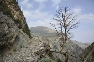
You will have to cross the bridge on the left side of the river to see the pictures that are 1000 to 5000 years old before Christ. You can also buy local handicrafts from a nearby village.

5- Darel Valley

This beautiful Valley is 82km northwest of Chilas Valley. A jeep track from Shitial Bridge will take you to Darel Valley. It is the administrative headquarter of Gumary Valley.

It is the biggest center of archaeological remains and therefore the archaeological department is there too. Manikal is its central area. The signs of Buddha University are a few distances from Mazot. Mahatma Buddha pictures are carved on large heavy stones.

There are archaeological traces in the Sonikot and Lolokot too. Gomaray has ancient traces and the rest houses. Chinese Tourists Faseen (430) and Yaun Xeng (630) have visited Darel Valley. One can book a PWD rest house from Chilas and Gilgit.
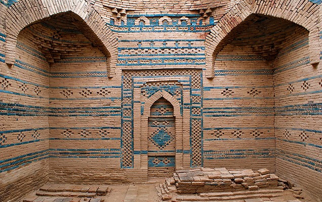
Showing 84 of 786 media items Load more ATTACHMENT DETAILS Pillared-verandah-of-Gayal-Mosque-Darel.
Ancient Gayal Mosque in Darel Valley, Indus Kohistan KPK

6- Harban

There are the names of Buddha Monks on the stones near Harban and in Menargah, Thor, Hod, and Getch on both sides of Karakoram Highway.

FAQs

1. Where is District Indus Kohistan located in Pakistan?

District Indus Kohistan is situated in the Khyber Pakhtunkhwa (KPK) province in the northern areas of Pakistan.

2. What is the geography of Indus Kohistan?

The district is characterized by mountainous terrain and is traversed by the Indus River, which adds to its picturesque natural beauty.

3. What is the population of District Indus Kohistan?

The district had an approximate population of 200,000 residents.

4. What are the major languages spoken in Indus Kohistan?
The primary languages are Pashto and Hindko, with regional dialects like Shina also being spoken by some communities.

5. Are there any notable tourist attractions in Indus Kohistan?

While not a major tourist destination, Indus Kohistan offers natural beauty, serene rivers, valleys, and breathtaking landscapes for those seeking a quieter, off-the-beaten-path experience.

6. What is the climate like in the district?

The region experiences a cold and temperate climate with heavy snowfall during the winter months, making it particularly challenging to access in those times.

7. Are there educational institutions and healthcare facilities in Indus Kohistan?

Educational institutions are limited in the district, and basic healthcare facilities can be found in major towns. However, it’s important to be aware of the limited resources available.

8. What are the local dishes or cuisine specialties in Indus Kohistan?

The cuisine in Indus Kohistan typically features dishes with a focus on lamb and rice, reflecting the local culinary traditions.

9. Can tourists explore the cultural heritage of Indus Kohistan?

Yes, the district has a rich cultural heritage, and you can experience local festivals and traditions that reflect the Pashtun culture.

10. How can one reach Indus Kohistan, and is it easily accessible?

The district has a limited road network, and there are no airports. Traveling to Indus Kohistan can be a bit challenging, and it’s advisable to plan your journey accordingly.

Wind Up Lines

Khyber Pakhtunkhwa is enriched with historical sites, ancient archaeological remains, splendid landmarks, and high mountains. Indus Kohistan is one of the historical towns of KPK. Dasu, Komala, Darel Valley and Seo Mosque, are beautiful historical spots.

About Gilgit Baltistan – A Heavenly Blessed Land

Gilgit Baltistan

Heavenly Blessed Land

Gilgit Baltistan is among the extremely beautiful and charming northern areas of Pakistan. These areas are spreading over capacious land covering up to 72494 square kilometers. And it consists of Hunza, Astore, Gilgit, Ghizer, Diamer, Skardu, and Ghanchy.

The capital of the province Gilgit Baltistan is Gilgit. On first November 1947, the people of this region get rid of the slavery of the Kashmiri emperor without any external aid. On 16th November 1947, with the assistance of Sardar Muhammad Khan Political Agent, Pakistan took it under its control by the will of the common people. While the Baltistan got freedom on 14th August 1947.

Load more ATTACHMENT DETAILS Naltar-valley-gilgit-baltistan-
Charming Naltar Valley of Gilgit Baltistan

These regions with an altitude ranging from 4000 feet to 25,000 feet above ocean level are well known around the globe for sky-high giant mountains, sky-kissing, ice-tipped peaks, long glaciers, and narrow valleys. These landscapes are inviting scientists, tourists, and hikers for a long.

Famous Mountain Peaks, Passes, and Glaciers in Gilgit Baltistan

Deosai is the second highest plateau in the Asia after Pamir Plateau in the north. The famous mount peaks in the world such as K-2 (28,250 feet, the second-highest peak in the world), Nanga Parbat (26,607 feet), and Rakaposhi (25,520 feet) are located in these areas.

Its large glaciers are Siachen, Baltoro, Chogo Lungma, Rimo, Hiapar, and Biafo.

 deosai-national-park-pakistan
Rich green meadows of Deosai National Park

Many historical and ancient passes are here too. These include Babusar, Burzil Qamri (Diamer), Karakoram, Muztagh, Chorbat, Zojila, Saltoro, Thalay, Alampe, Braldu, Basha (Baltistan), Hispar Irshad, Kilik, Mintaka, Khunjerab, Shimshal (Gilgit), Karamber, Broghil, and Shandur Passes. These passes are of significant geographical importance.

Geographical Location of Gilgit Baltistan

It is the region that connects two great states of Asia, Pakistan, and China. On the other hand, it splits the two great states India and Russia. The geographical importance of this zone can be evaluated from the titles given to Gilgit Baltistan.

Hunza is called “the region where three empires meet”. The borderlines of China, Russia, and British India were used to meet in the north of Hunza. It is also entitled “End of the World” and “the Winter Land of Asia”. Now it is called the “Center of the World” because it is the connection point of five countries China, India, Tajikistan, Afghanistan, and Pakistan.

 hunza-valley-gilgit-baltistan.
Natural view along Attabad lake in Pakistan mountains at Hunza valley

There is no monsoon rain in northern areas. The area of natural forests is about 4% of the total land area. The climate is terribly hot in Summer and bitter cold in winter. The hottest month is July and the coldest month is January.

It is heavy snowfall in the districts of Ghanche, Ghazar, Astor, Skardu, Hunza, Nagar, and in low valleys. The ice melts in summer and causes floods in the river Indus.

Beautiful Tourist Spots in Gilgit Baltistan

Nature has blessed these areas with sky-scraping mountains, rivers, brooks, watercourses, glaciers, valleys, and lakes. Upper Kachura, Lower Kachura (Shangrila), Sidpara, Naltar, Shandur, Deosai, Phander, Rama, Gdai, Zircon, (Bonji), Kutwal, Gasho (Jaglot), Gultari, and Borith (Gilmat Hunza), Lakes are worth mentioning because of their exquisiteness and beauty.

Fairy Meadows in Chilas and Sital in Tangir are renowned around the world for their spectacular beauty. May to September is the best season for tourism. But the ice doesn’t melt on the high peaks. This may cause trouble for hiking and trekking.

 shangrila-upper-katchura-lake-skardu
Shangrila Resort near Upper Katchura

Rivers & Springs Flowing in Gilgit Baltistan

Load more ATTACHMENT DETAILS ganish-bridge-hunza-river-gilgit-baltistan
Ganish Bridge over Hunza river Gilgit Baltistan

The noteworthy rivers of this region are Indus, Shyok, Shigar, Astore, Hunza, and Gilgit. All the rivers and brooks of this area confluence with the River Indus. Agriculture and power sector of Pakistan is chiefly based on the River Indus.

There are many hot and cold-water springs in Gilgit, Baltistan, and Diamer. People use these springs’ water for curing different diseases. The springs of Raikot, Bar, Nagar, Barsat, Damas Punial, Gronjur, Darkot, and Murtazaabad (Hunza) are very famous.

National Parks in Gilgit Baltistan

There are four national parks in Gilgit Baltistan. They are named Deosai National Park, Shandur National Park, Khunjerab National Park, and Central Karakoram National Park.

Silk Route Festival

Cultural and trade delegates from Pakistan, neighboring countries, and Central Asian states attend this festival. It is arranged in the summer season due to pleasant weather and a charming environment.

At this festival, government, private, social, regional, and international departments organize their stalls. Local and foreign troupes also perform. Its special programs are held in Gilgit. Its partial programs are organized in Hunza and Skardu.

 silk-route-festival-gilgit-baltistan
Cultural Dance at Silk Route Festival, Gilgit Baltistan

Water Sports

River rafting, canoeing, and kayaking can be enjoyed at these sites. From Jaglot to Thakot in the river Indus, Naran Kaghan in the river Kunhar (Kanhar), from Bahrain to Mingora in the river Swat, Aliabad to Gilgit in the river Hunza, Gopiz to Gilgit in the river Gilgit are sites for water sports. Tours operators of Islamabad and tour operators of related areas can assist you.

Load more ATTACHMENT DETAILS paragliding-in-Karakorum
Paragliding in Karakorum

Wind Up Lines

Gilgit Baltistan is an alluring province of Pakistan. It is the best region for vacations, family trips, festivals, adventurous sports, and trekking. It is due to the beautiful tourist spots like  Diamer  Tangir, Darel, Chilas, Bonardas, Gonarfarm, Raikot, Nanga Parbat, and Fairy Meadows, sky-high mountain peaks, and murmuring rivers.