8000 B.C, Mehrgarh is an ancient city built with red bricks
3000 B.C, Indus Valley Civilization, Mohen Jodaro, and Harappan Civilizations
1700 BC, the Arrival of Aryans from Central Asia. Arya wrote Rigveda Maha Bharat
516 B.C., Gandhara civilization. Pushkalavati (Charsadda) and Taxila are is to be its capital.
325 B.C., The arrival of Alexander the Great in Hund, Taxila, Salt Range, and returning through Makran Desert.
321 B.C., Chandragupta Maurya founded the Moorish Empire. His grandson Ashoka converted to Buddhism and spread Buddhism in the subcontinent.
60 AD, the Arrival of Kashan from Central Asia. They made Kabul their main capital while Peshawar was called their winter capital
711 A.D, Muhammad Bin Qasim entered Pakistan till Multan and Islam flourished in that era.
In 870 AD, Hindu Shahi made Hund the capital and ruled for about 1020 days.
During 979-1030, Mehmood Ghaznavid attacked the subcontinent for 17 times.
1129 A.D, Shahabuddin Ghori, Khilji, Tughluq, Lodhi and Suri dynasties.
1221 AD, the Arrival of Genghis.
1469, Birth year of Baba Guru Nanak of Sikh religion
1526, defeating Ibrahim Lodhi in the field of Panipat and Zaheer Uddin Babar set the foundation of
the Mughal Empire.
1540-45, Sher Shah Suri and Babur fight
1556-1605, Mughal Emperor Jalaluddin Akbar took over the government.
1605-1627, Jhangir’s era ( A true lover of art) He promoted the Persian language and worked for it.
1627-1658, Mughal Emperor Shah Jahan built the Taj Mahal, Agra, Shalimar Bagh, Lahore, Jahangir tomb, and Shahi mosque Thatta.
1658-1707 AD, Aurangzeb Alamgir’s reign. Shahi Masjid Lahore was built
In 1739 D, Arrival of Nader shah from Iran.
In 11740-1773, Ahmad Shah Durrani, the ruler of Afghanistan, conquered Punjab, Kashmir, and Sindh.
In 1799-1 839, Ranjit Singh ruled as Maharaja.
In 1843, Sir Charles Napier captured Sindh.
In 1846, The British gave Kashmir to Gulab Singh.
In 1849, the British occupation of Punjab.
In 1857, the war of independence was fought.
In 1858, British rule was established.
In 1877, Queen Vitoria assumed the title of” queen of India “.
In 1887, Balochistan came under the control of the British.
In 1906, the All India Muslim League was established.
In 1940, The Pakistan resolution was presented.
In 1947, On August 14, the Islamic state of Pakistan came into being on the world map.
1948, Death of Quaid-e-Azam. Pakistan and India fought over the Kashmir issue.
In 195, Prime Minister Liaquat Ali Khan was martyred in Liaqat Bagh Rawalpindi.
In 1956, The Constitution was passed.
In 1965, On September 6, India attacked Pakistan in the dark of night. (The war ended after 17 days with the intervention of the United Nations).
In 1969, Yahya khan took over the government.
1970-1977, Zulfiqar Ali Bhutto was the Prime Minister.
In 1972, The region of East Pakistan separated from West Pakistan and became Bangladesh,
88, General Zia-ul- Haq imposed martial law.
In 1979, Prime Minister Zulfiqar Ali Bhutto was hanged.
In 1988, General Zia-ul-Haq died in a plane crash along with top military leadership.
During 1988-1990, Ms. Benazir Bhutto was elected as the first woman Prime Minister.
1990-1993, Mian Muhammad Nawaz Sharif assumed the post of Prime Minister.
1993-1996, Mrs, Benazir Bhutto became the Prime Minister for the second time.
During 1997-99 Mian Muhammad Nawaz Sharif became the Prime Minister for the second time.
In 1998, Pakistan responded to India’s five nuclear blasts with seven blasts and received the honor of being the first ever atomic power among the Muslim States.
1999-2008 General Pervez Musharraf took over the elected government of Mian Muhammad Nawaz and he was sent to Saudi Arabia.
In 2001, 9/11 happened.
On 8th September 2005, more than 80,000 People lost their lives to severe earthquakes.
In 2007, Mian Muhammad Nawaz Shan returned from Saudi Arabia.
In 2008, Ms. Benazir Bhutto left the world at Liaquat Bagh Rawalpindi and Asif Ali Zardari was elected President.
During 2008-2013, Syed Yusuf Raza Gilani became the prime minister.
In 2013, Mian Muhammad Nawaz Sharif will be elected Prime Minister for the third time with a huge majority.
In 2013 ‘Mamnoon Hussain was elected as the President of Pakistan.
Languages & Dialects
Urdu, English, Punjabi, Sindhi, Balochi, Pashtu, Saraiki, Shina, Balti, and Khwar in northern areas.
Talpur House Museum Personal Items – Tando Muhammad Khan – Hyderabad
Taxila Museum Gandhara Civilization (1918) Taxila
Umarkot Museum Umarkot related to the reign of King Akbar
Allama Iqbal Museum (at Allama Iqbal Birthplace) Sialkot
Last Thoughts on Pakistan
Pakistan is not only a land of diverse landscapes and rich history but also a nation with a vibrant culture and a hospitable population. From its ancient archaeological sites to modern architectural marvels, the country offers a unique blend of heritage. Its towering peaks, majestic glaciers, and breathtaking lakes make it a paradise for adventure seekers.
As you explore this remarkable nation, you’ll encounter the warmth of its people and the echoes of a history that spans millennia. Whether you’re trekking in the northern mountains, wandering through the bustling cities, or admiring the cultural treasures, Pakistan offers an unforgettable journey.
Kaghan valley is one of the most beautiful valleys in Pakistan. It is renowned for its high mountains and blue water lakes. Sky-high snow-capped mountains, lush green forests, jumping streams, glaciers, and melodic waterfalls, are the identity of this valley.
It has an area of 1627 km stretching from Balakot to Babusar Pass. This valley with a length of 161km has Gilgit in the north, heavenly beautiful Azad Kashmir in the east and the south, and Kohistan range in the west.
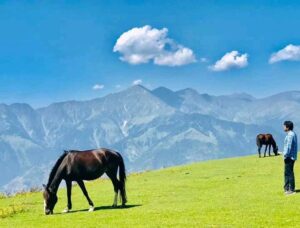
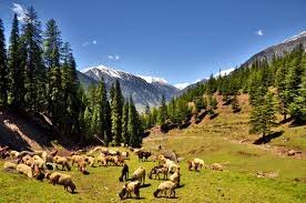
Animals grazing in the rich green meadows of Danna Valley -Kaghan KPK
The climate is cold. The tourist season is from May to mid-October. While May to September is an ideal season because the temperature ranges from 5 centigrade to 20 centigrade. The moon soon season is from mid of July to the mid of mid-August. Therefore, it is land sliding in these areas during rain. The roads are blocked as a result.
Check the details about the weather of Kaghan valley from www.pakmet.com.pk before visiting.
Details of Kaghan Valley
Attribute
Information
Location
Northern Pakistan, in the Hazara region
Area
Approximately 1,627 square kilometers
Geographical Features
Sky-high snow-capped mountains, lush green forests, rivers, glaciers, waterfalls
Climate
Cold, with the tourist season from May to mid-October
Accessibility
Well-connected by road from major cities like Karachi, Peshawar, Faisalabad, Lahore, and Rawalpindi
Transportation
Public transport and jeeps available; some areas accessible only by jeep
Tourist Attractions
Bala Kot, Mountain Biking, Jeep Safari, Horse Riding, Shogran, Siri Meadows, Paye Meadows, Koh Makra, Paras, Sharan, Darshi, Musa Ka Musalla, Shino, Jared, Mahandri, Manoor Gali, Khanian and Danna Meadows, Kaghan Town, Shangri Top, Glaciers
Unique Features
Lush green meadows, towering mountains, and a diverse range of adventure activities
Notable Events
Kaghan Valley Festival, local fairs, and cultural celebrations
Travel Guide
Public Transport of every kind is available for Mansehra from Karachi, Peshawar, Faisalabad, Lahore, and Rawalpindi. A wagon can be booked from Mansehra to Kaghan valley. You can stay during your journey. It is better to reach there via a jeep from Mansehra or Bala kot.
The jeep can take you to the areas where it is impossible to reach by car or wagon. Besides this, Suzuki vehicles will take you to Babu Sar top. But you will have to hire a jeep for Siri Paye, Shogran, Lala zar, and Saif-ul-maluk lake. You will have to pay the rent per day. It is advantageous to visit these areas by a jeep, as you can stay where you want. PTDC coster leaves at 9 am daily from Flash Main hotel Rawalpindi for Naran.
Tourist Destinations & Adventures in Kaghan Valley
1- Bala Kot
The historical city of Bala Kot at a distance of 40km from Mansehra is called the door to Kaghan valley. Bala Kot has a meaning of high fort. It is also called Bala Kot since it is located on a high hill. It is spreading over an area of 10 square kilometers.
Bala Kot city with an altitude of 3226 feet above sea level is located on both sides of the river Kahnar (Kunhar). The river Kanhar flows from the north to the south by playing tricks, shaking its head, blowing foam, and swinging. The river is wide before the Bala Kot boundary on the right side. The river is calm here. There are many picnic spots near the river. You can enjoy it there too.
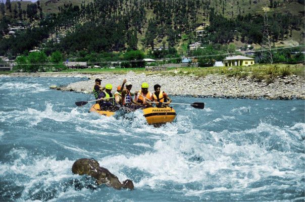
River Rafting is a thrilling experience in river Kunhar Balakot
When the Mujahideen movement started in the Sikh era, the Maharaja Ranjeet Singh had to face a lot of trouble because of this movement. Its founders were Syed Ahmad Shaheed and Shah Ismail Shaheed. Their graves are in Bala Kot. These graves were destroyed in the earthquake of 2005.
2- Mountain Biking
Bala Kot to Babusar Top Trekk is the best trek for adventurous tourists fond of cycling. This track with ice-capped sky-kissing mounts, dancing streams, and singing rivers has its own charm.
3- Jeep Safari
You can go to Kaghan Valley in your own vehicle. But, there are some areas where you cannot reach by car. Therefore, it is an ideal site for Jeep Safari. You can go Bala Kot to Babusar top, Shogran, Paye, Upper Kaghan, Shatran, Lake Saif-ul-Malok, Lala Zar, Noori Top, and other places to enjoy the thrill and adventure of Jeep Safari.
4- Horse riding
Kaghan valley is a perfect place for horse riding. Horses can be found easily from Naran, Lake Saif-ul-malook, Lala Zar, Siri Paye, and Siri. You can enjoy yourself there with your family. You will remember the horse ride in the Kaghan valley, around the Saiful Muluk Lake, and from Basil to Dudipatsar.
Horse Riding is an unforgettable experience in Kaghan Valley
5- Kewai
Kewai town is 26km from Balakot on the Naran main highway. Its old name was Kewari. Kwari has a meaning of door or gate in the Hindi language. A trail goes to Shogran and Siri Paye from the right side of Kewai.
6- Shogran
Shogran is 8km from Kiwai at an elevation of 7750 feet above ocean level. Shogran has a meaning of beautiful place or settlement. A slopy climbing road from Kewai will take you to the captivating Shogran site by passing through Pines and Sanober trees.
An alluring sight of snow clad mountains of Shogran attracts the holidaymakers
The charming sight of the route will take refresh you. Ice-tipped mountains and luxuriant plains will give you a pleasant feel. The climate keeps changing here. The sky is clear. Gradually, dark grey clouds will surround you. Light rain will start in a few moments. The sky will be fair in no time. This repeats many times in a day.
Stay here for at least two days to fully enjoy the weather. There are hotels for residence, and markets for shopping. Special vehicles are required to reach Shogran as it is situated on the height. Hire a jeep from Kewai and park your car there. The jeeps from here will take you to Siri and Paye Meadows.
7- Siri Meadows
The enchanting Siri Meadows is 5km from Shogran at a height of 8500 feet from sea level. It is extremely attractive because of its thick tall trees, lush green grass, and captivating clean environment. There is a lake between velvet flowers and fertile green plains too. You can enjoy camping. You must have foodstuff along with you. One can reach there via jeep or on foot because of the difficult path.
A heavenly beautiful lake in between the lush green Siri Meadows
8- Paye Meadows
A beautiful meadow of Paye is situated on the foothills of the Makra mountains at an altitude of 9500 above sea level. It is 3km beyond Siri. The alluring pastures of the Paye are compared with the Melbourne Cricket Stadium of Australia (It is said that this stadium is the most beautiful green ground in the World).
You will forget Melbourne after visiting Paye Meadows. Stay for a day in this valley to enjoy the thundering clouds and varying weather. You can buy some stuff from here but it is better to have all the belongings from Shogran. A lake has been formed due to rain. A plant is also found there similar to the shape of a snake.
Makra Peak Paye Meadows is among the favourite trekking sites for hikers
9- Koh Makra
Above Paye, at an altitude of 14,000 feet is the peak of Koh Makra. This area has an abundance of wildflowers, herbs, and shrubs. Physicians and medical herbalists are seen here in search of herbs.
10- Paras
A giant tree of Deodar Cedar is on the way to Kaghan from Kewai. According to locals, this tree is 2000 years old. Paras Town is famous for its apple orchards at a distance of 5km from Kiwai. It is said that there found a special stone that changed into gold after hitting by iron. But no one has found it yet. The river is too close to the road here. It seems that they are embracing each other.
11- Sharan (Shatran)
Sharan is located at an elevation, 15km away from the highway on the left side of Paras. It is at an altitude of 7,500 feet above sea level. One can reach there in 1.5 hours by jeep. It is a place of velvet green grounds fenced by lush green thick forests. Wildlife and beautiful birds are there too. There is a rest house and a youth hostel for a stay.
12- Darshi
Darshi’s forest is 4km from Sharan. There is a pedestrian track. A folk tale of Darshi and Munshi is famous about this forest. A local will tell you the story.
13- Musa (A.S) ka Musalla (prayer mat)
Musa Ka Musalla (Musalla has a meaning of prayer mat) is at a height of 13,500 feet from ocean level. You can reach this spot on foot from Darshi’s forest via Nadi Bangla. Two narrations are associated with this site. It is said that Prophet Hazrat Musa (A.S) offered a prayer here. According to a second narration, a pious man named Musa used to worship here on musalla (prayer mat).
Musa ka musalla Kaghan Valley
14- Shino
Shino Town is beyond Paras. Shino has a meaning of sacred water. There is a hatchery department for trout fish by the fisheries department of Khyber Pakhtunkhawa (KPK). The trout from here are left into Dodipatsar lake, Saiful Muluk Lake, and the river Kunhar.
15- Jared
Jared is forward to Shino at a distance of 40km from Balakot. There are domestic industries for walnut wood furniture. In addition to this, there are Numda, mats, rugs, carpets, woolen shawls, and blankets Khadi. A handicraft development center and a shop are established there by the government of Pakistan.
16- Mahandri
Mahandri Town is at an elevation of 5050 feet above ocean level at a distance of 4km from Jared. Mahan is the name of a place where two rivers confluence in the local language. Here, the river Manoor convergences with the river Kanhar. The curd of Mahandri and the cold water of the river Manoor are famous. The jeep travels along the Manoor stream (coming from the east) towards the Valley Manor. The Kach Gali, Biari, and Bela points come the way to the jeep track and pedestrian. This same beautiful track reaches Lake Saiful Muluk. Take a guide, camping stuff, and belongings to enjoy this captivating pedestrian.
Snowy tracks of Mahandri are ideal for snow sports
17- Manoor Gali
Manoor Gali is at a height of 12,200 feet from sea level. A trail goes to Saif-ul-Malook Lake and Ansu Lake from the right side of Mahandri. Splendid sights will travel along with you on this track. You will not find the scenery of this route anywhere else in Kaghan Valley. The government doesn’t pay heed to the development of this point. Therefore, it is not famous among holidaymakers.
18- Khanian and Danna Meadows
Khanian point is at an elevation of 7626 feet above ocean level. The river’s waves are so noisy and fast here because of the narrow valley at this point. A jeep track on a solid road from Khanya will take you to the height of Danna Meadows.
This point at a distance of 15km is a 1-hour drive track and 3 hours pedestrian track. There are dangerous turns too. But the beauty of these meadows above 9500 feet will mesmerize you. Danna Meadows is renowned for the production of Golden, Umber, and King golden apples.
A beautiful tourist resort in Khanian, Kaghan Valley
19- Kamal Ban
Kamal Ban forest is 6km from Danna. There is a rest house by the UK in this area. This forest rest house was established in 1924 at a height of 6,500 feet from sea level. It is one of the oldest rest houses in this area.
20- Kaghan Town
Kaghan Town is 59km from Balakot and 6km from Khanya on the main highway. This whole valley is recognized because of this Kaghan Town at an altitude of 6650 feet above ocean level.
According to ancient tales, the ruler of this valley was a Hindu female Kagi. The name of this site was Kagan after her name. It transformed into Kaghan with the passage of time. Sarwal peak is the highest top in the suburb of Kaghan at an elevation of 13,529 feet. There are spacious meadows in the northeast and beautiful villages are situated around.
There are facilities for staying and dining for the tourists. Vacationers on a long trip stay here for at least one day. Honey and cow’s ghee are considered among the best gifts of Kaghan. When the mountains are snow-clad in the winter, then Kaghan is the last point to reach via transport.
21- Shangri Top
The beautiful point of Shangri is at an altitude of 12,700 feet in the north of Kaghan Town. One can reach Khuli Gatti via jeep. And then a journey of two hours will take you to an extremely attractive site of Shangri. People can enjoy the scenery of Musa ka Musalla, Danna Meadows, Kaghan, Koh Makra, and Naran mountain ranges from the Shangri top.
22- Glaciers
It was difficult to cross three to four huge glaciers on the way to Naran from Kaghan a few years ago. But now a proper track has been built by cutting glaciers through modern technology. The thrill of those moments will be remembered for a long time as you sit in the car and pass through the high walls of snow on both sides of the road. You will see such high snow walls from Naran towards Batta Kundi.
FAQs
1. What makes Kaghan Valley a popular tourist destination?
Kaghan Valley is renowned for its stunning natural beauty, including snow-capped mountains, lush forests, and vibrant meadows. It offers a range of adventure activities, making it a favorite among tourists.
2. What is the best time to visit Kaghan Valley?
The ideal time to visit Kaghan Valley is from May to mid-October, with the peak tourist season from May to September. The monsoon season is from mid-July to mid-August, but landslides can occur during heavy rain.
3. How can tourists access Kaghan Valley?
Kaghan Valley is accessible by road from major cities like Karachi, Peshawar, Faisalabad, Lahore, and Rawalpindi. Public transport and jeeps are available for transportation within the valley.
4. What are the adventure activities available in Kaghan Valley?
Kaghan Valley offers adventure activities such as mountain biking, jeep safaris to remote areas, horse riding, and trekking. Visitors can explore meadows, lakes, and mountain peaks.
5. What are some of the must-visit locations within Kaghan Valley?
Must-visit locations include Bala Kot, Shogran, Siri Meadows, Paye Meadows, and Shangri Top. These areas are known for their natural beauty and unique attractions.
6. Are there accommodations and dining facilities available in Kaghan Valley?
Kaghan Valley offers a range of hotels and restaurants to cater to the needs of tourists. Visitors can find suitable places to stay and enjoy local cuisine.
7. What are the unique features that set Kaghan Valley apart from other destinations?
Kaghan Valley’s unique features include its captivating landscapes, adventure opportunities, and a diverse range of activities for nature enthusiasts and thrill-seekers.
8. Is there a famous festival or event that tourists can attend in Kaghan Valley?
Kaghan Valley hosts the Kaghan Valley Festival and local fairs, providing tourists with a chance to experience the local culture and traditions.
9. How can tourists make the most of their visit to Kaghan Valley?
To make the most of their visit, tourists are encouraged to explore the diverse attractions, engage in adventure activities, and immerse themselves in the valley’s natural beauty.
10. Are there any safety precautions that tourists should be aware of when visiting Kaghan Valley?
Visitors should be cautious during the monsoon season, as landslides can occur. It’s advisable to check weather conditions and travel advisories before planning a trip.
Last Thoughts on Kaghan Valley
Kaghan Valley is like a paradise on Earth. It’s charming valleys, snow-capped mountains, luxuriant pastures, and plains, and trekking sites attract tourists and climbers.
Manshera city and district is ahead of Hazara Valley at a distance of 22km from Abbottabad. It was settled by Sikh ruler Man Singh of this area. It is named Mansehra after him.
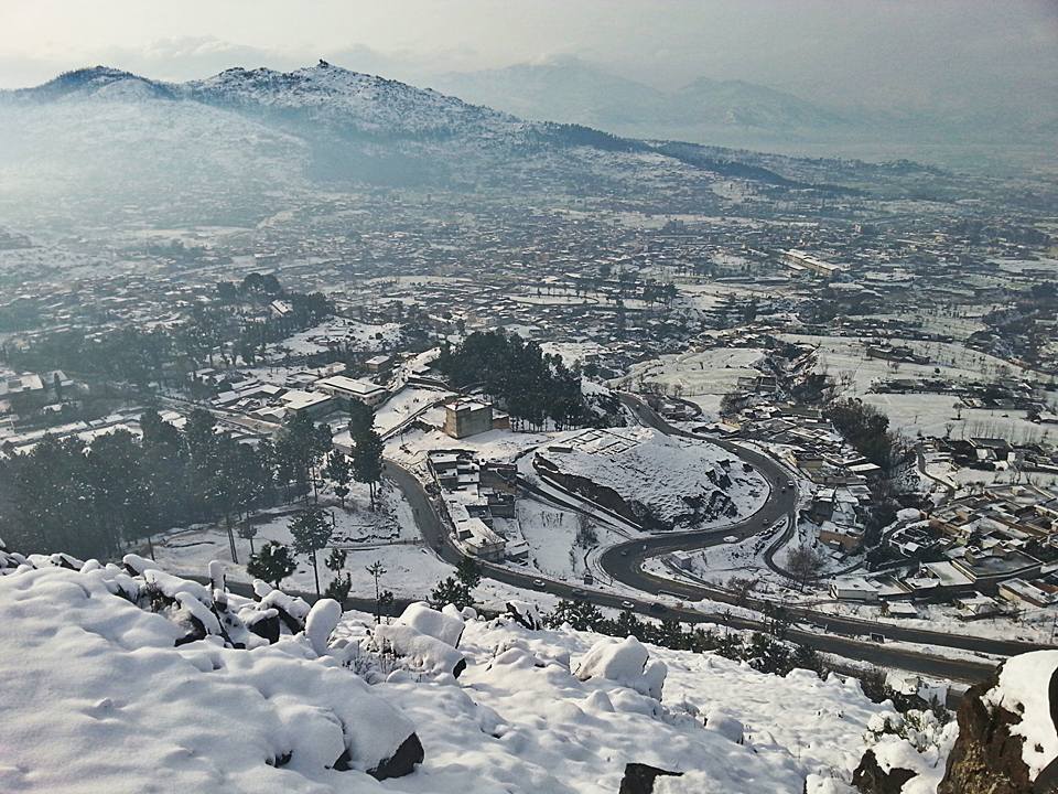
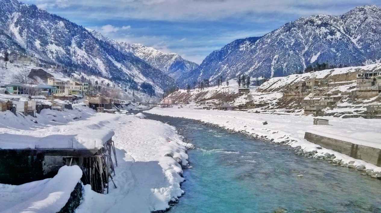
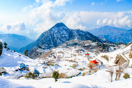
An alluring aerial view of Mansehra covered in snow
This centuries-old city is related to the Buddhism religion too. The proof of this is Ashoka Rocks. The Resham Highway or Karakoram highway goes straight from here. While the Kaghan valley is on the right side. Mansehra is the base camp for Kaghan Valley. You can book a jeep or Suzuki for the valley. However, Jeep is a better option.
Details of Mansehra
Attribute
Information
Location
Located in the Hazara region of Pakistan
Province
Khyber Pakhtunkhwa
Altitude
Approximately 1,020 meters (3,350 feet) above sea level
District
Mansehra District
Population
Approximately 98,000 (as of the last available data)
Major Language
Urdu, English, and Hindko (local language)
Geography
Surrounded by picturesque mountains and natural beauty
Historical Sites
Shahi Mosque, Gurdwara Siri Guru Singh Sabha, and more
Nearby Attractions
Kaghan Valley, Naran, Shogran, and Saif-ul-Mulook Lake
Economic Activities
Agriculture, tourism, and trade
Transportation
Connected by road and accessible from major cities
Notable Events
Kaghan Festival, local fairs, and cultural celebrations
Historical and Tourist Spots in Mansehra
1- Gurdwara Siri Guru Singh
This beautiful Gurdwara holds significant importance in the center of Mansehra city. It is situated on Kashmir Road. This building is being utilized as a municipal library these days. It is renovated by the locals.
Gurdwara Siri Guru Singh is an asset for Sikh community
2- Ashoka Rock Edicts
A new monarch Chander Gapat Morya, established a state in the north of Ganga, 20 years after Alexander the Great left the Subcontinent. His reign lasted for 100 years in different areas of the Subcontinent. His grandson Ashok become the king in 274 B.C. He was the first ruler who issued orders for the nation and engraved them on the stones.
Upper Boulder with Inscriptions Mansehra Rock Edicts
When he converted to Buddhism, the pain and suffering inflicted on human beings by human hands had a profound effect on his heart that he became against killing not only human beings but also animals. As a head of state, he worked a lot for the progression and promotion of Buddhism. The Morya state tore into pieces after the death of Ashoka in 232 B.C.
His sayings engraved on the stones can be found in different parts of the subcontinent. His orders can be seen on the left side of Bhat Bridge and in the Park in Mansehra.
3- Petra Valley
You can enjoy an aerial view of Mansehra and neighboring areas from the Petra Point hill near Bala Kot Bypass. The day and night view from this top is fascinating.
4- Dadar Valley
A Suzuki van will take you to the Dadar Valley from the Mansehra bus stand which is recognized for the area of Stupas built in the Ashoka era. The sun’s rays on the shiny water of the river Sirin spread like a gold net in the whole valley.
A wonderful sight of Dadar Valley after rain
It was the favorite of the Britishers because of its healthy and clean environment. They also established a TB (tuberculosis) sanitorium. The trees in the woods in the suburb of the valley at the foothills of sky-scraping mountains, rich green fields, sounds of cascades, and the aroma of Chappal Kebab and Qahwa are awaiting you. Enjoy the thrilling waves of the river Sirin during the fishing.
Two central routes separate from Mansehra. The right turn is directed to Kaghan valley and the left side will take you to Karakoram or Resham highway, Gilgit, Hunza, and Khunjerab Pass.
5- Atter Shisha
A small village is named Atter Shisha on the Balakot Kaghan road a few distances away from Mansehra. It is well known for the story of Mughal King Jahangir and his wife Noor Jahan. They stayed here for some days during their visit to Kashmir.
The queen forgot her perfume and mirror here. It was named Atter Shisha (the name of perfume and mirror in the local language). A track is directed to Muzaffarabad (capital of Azad Kashmir) from Garhi Habib Ullah.
6- Sirikot
When you reach Tilli village from Garhi Habib Ullah via Dargha Sharif the pointed mountain of Sri Kot from the turn shows its appearance wrapped in fog. You will feel like it is December in July since it is located on the peak.
Coming here one realizes that the sweet fragrance of the soil is so much more than the money and it is better to lean against the trees here than to walk under hard sidewalks and modern buildings.
There are signs of Shiv Maharaj Temple and Barari Devi in a nearby village. A rest house, plum, and walnut trees are awaiting you there. The roads are blocked here from January to March because of the snowfall.
Mansehra Shiva Temple
FAQs
1. Where is Mansehra located, and why is it known for its tourist sites?
Mansehra is a city in the Hazara region of Pakistan’s Khyber Pakhtunkhwa province. It is renowned for its diverse tourist attractions.
2. What are the most prominent tourist sites in Mansehra, and what makes them special?
Mansehra boasts several tourist sites, each with its unique charm. Could you provide an overview of the key attractions and what sets them apart?
3. How accessible are these tourist sites in Mansehra for visitors, and what transportation options are available to reach them?
Accessibility is crucial for travelers. Can you share information on how tourists can reach the various sites in Mansehra and the transportation options available?
4. Are there any historical or cultural landmarks in Mansehra that visitors should explore?
Mansehra’s history and culture are rich. Are there specific sites or landmarks that offer insights into the region’s heritage?
5. What is the best time to visit Mansehra and its tourist sites for the most enjoyable experience?
Weather and seasons can impact the travel experience. When is the ideal time to explore the tourist sites in Mansehra?
6. Are there any accommodations, restaurants, or facilities available for tourists in Mansehra and its vicinity?
Convenience is essential for travelers. Are there hotels, restaurants, and other amenities to cater to the needs of tourists in the area?
7. What outdoor activities, adventure opportunities, or natural beauty spots are available in Mansehra for visitors to explore?
Nature enthusiasts and adventure seekers often look for outdoor activities. What options are available for them in Mansehra?
8. How do these tourist sites contribute to the overall tourism and economy of Mansehra and the surrounding region?
Tourism can have economic significance. How do the tourist sites in Mansehra benefit the local economy and support the tourism industry?
9. Are there any cultural events, festivals, or traditions in Mansehra that visitors can participate in or witness during their visit?
Local culture and traditions can enhance the travel experience. Are there any specific cultural events, festivals, or traditions in Mansehra that visitors might encounter?
10. Can you recommend any specific itineraries or routes for visitors looking to explore the tourist sites of Mansehra efficiently?
Itineraries and routes can help travelers make the most of their visit. Do you have recommendations for planning a trip to Mansehra’s tourist sites?
Last Thoughts on Mansehra
Mansehra is a historical city ofKhyber Pakhtunkhwa (KPK). It has many traces of the Gandhara civilization and the Buddhism era. Besides this, it is known for its beautiful sights, mountains, and lush green meadows
Abbottabad has situated 71km from Hassan Abdal at an altitude of 4120 feet above sea level. It is spreading over an area of 1967 square kilometers. Fenced by rich green mountains, it was settled by Caption James Abbott.
This city is renowned for its pleasant environment, quality educational institutes, and as a center of educational & training institutes for the Pakistan Army. You will see the defense offices of the Pak Army in different areas of the city since it is the headquarter of the Pakistan Military.
A splendid view of Dolores Park near Harnoi River Abbottabad
There are facilities of every kind as it is the largest trade center in the region. It has remained the base camp for the tourist visiting Gilgit, Chilas, Kaghan, Naran, and Skardu. The temperature never goes beyond 30 centigrades even in summer.
A beautiful lady garden, Public Library, Pakistan Military Academy (PMA), ancient grand buildings of the British era, Abottabad Museum, St. Luke’s church (the oldest building of Abottabad), Ayub Medical Complex, and Jalal Baba Auditorium are worth watching places.
Shimla is located at the edge of the city on a hilltop. You can enjoy the hiking and beautiful scenery around. This top gives a different view of Abbottabad during the day, night, and in rain. The city looks more beautiful after the rain. The river Harnoi is a good picnic spot there.
Details of Abbottabad
Information
Details
Location
Abbottabad is located in the Hazara region of Khyber Pakhtunkhwa province, Pakistan. It is situated in the northwestern part of the country.
Altitude
The city is at an altitude of approximately 4,120 feet (1,256 meters) above sea level.
Population
According to the last available data, the population of Abbottabad is over 1 million. However, it’s essential to verify the most recent population figures for accuracy.
Geography
Abbottabad is surrounded by hills and lush greenery, making it a picturesque and relatively cool area compared to other parts of Pakistan. It is known for its scenic beauty.
Climate
The city experiences a moderate climate with mild summers and cold winters. It’s an attractive destination for those seeking relief from the extreme heat of other regions in Pakistan.
History
Abbottabad has a rich history and was established during the British colonial period. It is named after Major James Abbott, who played a significant role in its development.
Economy
The economy of Abbottabad is diverse, with agriculture, trade, and services being the primary contributors. The city has a growing business and commercial sector.
Education
Abbottabad is known for its educational institutions. It hosts the Pakistan Military Academy (PMA), which is the premier military training academy in the country. The city also has several universities and schools.
Tourism
The city and its surroundings offer numerous tourist attractions, including natural beauty, hiking, and historic sites. Abbottabad serves as a gateway to various hill stations and scenic spots in the region.
Notable Landmarks
– Ilyasi Mosque – St. Luke’s Church – Shimla Hill – Thandiani – Harnoi Lake – Jinnah Road (Main bazaar) – Comsats University Abbottabad Campus
Transport
Abbottabad is well-connected by road to major cities like Islamabad, Rawalpindi, and Peshawar. The nearest airport is Islamabad International Airport, approximately 120 kilometers away.
Local Cuisine
The local cuisine includes traditional Pakistani dishes, as well as regional specialties. Various restaurants and eateries offer a wide range of culinary options.
Culture
The culture of Abbottabad is influenced by the ethnic diversity of its residents. Pashto, Hindko, and Urdu are commonly spoken languages. The city hosts cultural events, festivals, and markets that showcase its vibrant culture.
Famous Tourist Spots in Abbottabad
1- Ilyasi Mosque
Nawa Sher Town at the foothills of a cliff below Thandiani in Abbottabad city is renowned internationally for Ilyasi Mosque. There was a natural water spring. Hindus wanted to build a temple there, while Muslims argued to construct a mosque. There was a conflict between them for some time. At last, Muslims succeeded in establishing a mosque there.
People gave a lot of funds for its construction. This splendor mosque is a masterpiece of beautiful architecture. Its walls, roofs, ceilings, and minarets represent Islamic culture and architecture. The weather is pleasant in summer. It is crowded during vacations. Fritters (pakora) shops are considered the best street food outside the mosque.
Ilyasi Mosque is a masterpiece of Islamic architecture
2- Sarban
Sarban is a long and heightened mountain of Abbottabad in the east of the valley. It looks charming during the rainy season. Allama Muhammad Iqbal went to Abbottabad before leaving for England for his higher education. He wrote a poem with the name “Abar”. He mentioned Sarban in the first couplet.
اٹھی پھر آج وہ پورب سے کالی کالی گھٹا
سیاہ پوش ہوا پھر، پہاڑ سربن کا
Beautiful Sarban mountains attracts the tourists
3- Galiyat
Galiyat (also written as Galyat or Galliat) is an attraction for tourists because of its lush green pastures, and high mountains in Abbottabad city. It is rich in natural beauty, sky-kissing trees, and fragrant flowers. Bara Gali, Nahtia Gali, Kala Bagh, Donga Gali, Kala Pani, Shangla Gali, and Khaira Gali are situated from the east of Abbottabad to the West. This same route goes to Murree.
Luxuriant green meadows of Galyat captivate the vacationers
4- Nathia Gali
It is the official residence of the Khyber Pakhtunkhwa (KPK)‘s Governor for the summer. Specimens of nature’s craftsmanship and ingenuity, the dense forests, the lush greenery, and the trails running right through the middle of the rainforest urge nature-loving tourists to trek and hike. The sunset in this area is mesmerizing.
Snow capped mountains of Nathia Gali
5- Thandiani
Thandiani has a meaning of Cold in the local language. In fact, this area is known for its cold. The nights in Thandiani are cold at the time when the air conditioners stop functioning due to the heatwave in South Punjab.
The structure of the mountains around it is such that when the sun rises here it does not rise completely in one go but comes to the fore intermittently and rises completely. This view of the sunrise cannot explain in words.
This site is 2700 meters above sea level and 24km from Abbottabad. It is located at a height on a road. You can reach there via a road. It is a natural hill station. You will always remember the mountain peaks surrounded by lush green forests and cloudbursts.
There are caves on the path to the height. These caves are the residents of wild animals. You will feel as if you are moving towards the sky when you go to Thandiani for the first time. A private wagon from Abbottabad will take you to Thandiani. You can see Peer Panjal’s hills in the east and Nanga Parbat in the north if the sky is clear.
Sky-high rich green mountains of Thandiani
In the Suburbs of Abbottabad
This is Abbottabad too
A historical Gurdwara is in the Gurdwara Bazaar where Maharaja Ranjeet Singh used to come for religious activities. Dhamtour village is in the suburb of the city and in the southeast of Abbottabad.
Cloth is knit by conventional and traditional methods. Relationships of boys and girls for their marriage are established in a conference room (Jirga) adjacent to the mosque. There is no change in the customs and traditions of this area. This village reflects the lifestyle of the Hazara region.
The famous village Satora is 15km from Abbottabad in a valley surrounded by woods. It is a favorite place for nature lovers. The most beautiful villages are near Banda Phagwarian and Dobather Shimla.
FAQs
1. Where is Abbottabad located, and what makes it historically significant?
Abbottabad is located in the Khyber Pakhtunkhwa (KPK) province of Pakistan. It is historically significant due to its establishment during the British colonial period.
2. What is the significance of Abbottabad’s name, and who was Major James Abbott?
Abbottabad is named after Major James Abbott, a British officer who played a key role in its development. He is known for his contributions to the region.
3. How is the climate in Abbottabad, and why is it a popular destination for tourists?
Abbottabad has a moderate climate with mild summers and cold winters. Its pleasant weather and scenic beauty make it a popular tourist destination.
4. What are some of the notable landmarks and attractions in Abbottabad?
Abbottabad is home to various landmarks, including Ilyasi Mosque, St. Luke’s Church, Shimla Hill, Thandiani, Harnoi Lake, Jinnah Road, and Comsats University Abbottabad Campus.
5. How does Abbottabad contribute to the economy of KPK, and what are its primary economic sectors?
Abbottabad’s economy is diverse, with contributions from agriculture, trade, and services. It has a growing business and commercial sector.
6. What role does education play in Abbottabad, and which educational institutions are prominent in the city?
Abbottabad is known for its educational institutions, including the Pakistan Military Academy (PMA). The city hosts universities, colleges, and schools.
7. How can tourists access Abbottabad, and what transportation options are available?
Abbottabad is well-connected by road to major cities such as Islamabad, Rawalpindi, and Peshawar. The nearest airport is Islamabad International Airport.
8. What are the local cuisine and cultural highlights of Abbottabad?
The local cuisine includes traditional Pakistani dishes, and Abbottabad’s culture is influenced by the ethnic diversity of its residents. The city hosts cultural events, festivals, and markets that showcase its vibrant culture.
9. What are some outdoor and adventure opportunities for tourists in and around Abbottabad?
The city and its surroundings offer numerous outdoor activities, including hiking and visits to natural beauty spots and hill stations.
10. How can I learn more about the history, culture, and attractions of Abbottabad before visiting?
To learn more about Abbottabad, its history, culture, and tourist attractions, you can research online, read travel guides, and visit the city’s official websites for information.
Last Thoughts on Abbottabad
Abbottabad City can be considered a hub of tourism. There are many historical and breathtaking sites. Its importance has been enhanced because of the headquarter of the Pakistan Military.
Hazara is a region of the province Khyber Pakhtunkhawa which is the amalgamation of the cultures of Shina (Kohistani), Pashtun (Swati Pashtu), and Hindko nations. It was called Arasha before the arrival of Islam. When the Mongols invaded the subcontinent, Ameer Taymor conquered Dehli and moved to Hazra via Kashmir.
Details
Aspect
Haripur, Hazara
Khanpur, Hazara
Location
Located in the Hazara region of Pakistan.
Situated in the Hazara region, near Haripur.
Prominent Attractions
1. Sardar Haji Muhammad Khan’s Haveli.
1. Khanpur Dam – a major reservoir for water supply and recreation.
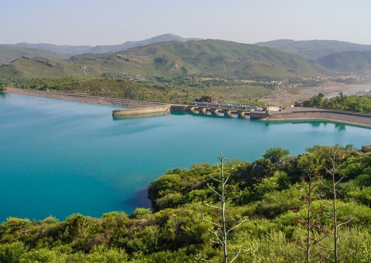
2. Tarbela Dam is nearby.
2. Picnic spots and scenic views.
Historical Significance
Has historical landmarks and old buildings.
Known for the Khanpur Dam, an engineering marvel.
Cultural Landmarks
Some historical and cultural sites.
The culture is influenced by the dam and its surroundings.
Accessibility
Well-connected by road.
Accessible by road from nearby areas.
Accommodations
Several hotels and guesthouses available.
Limited accommodations primarily catering to visitors.
Best Time to Visit
Throughout the year, with pleasant weather.
Best during the cooler months for outdoor activities.
Outdoor Activities
Hiking, sightseeing, and exploring historical sites.
Water sports, picnicking, and hiking near the dam.
Economic Contribution
Contributes to the local economy through tourism and trade.
The dam provides water supply and supports some local businesses.
Local Culture
Rich in cultural diversity and traditions.
The culture is influenced by the presence of the dam.
He was astonished by the beauty of this area. So, he decided to appoint his army in this area for protection and safety. His army had 1000 Mongols and Turks. It was named Hazra after the group of one thousand military people.
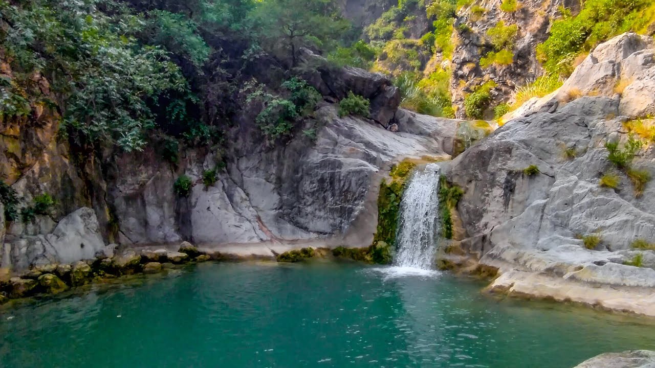
Hazraa Waterfall is one of the eight falls near Jab Valley
Hazara has Azad Kashmir in the east and river Jhelum, river Indus in the west, and Swabi on the other side. Gilgit Baltistan surrounds Hazra in the north and Potohor Pleateu in the south and southeast. This area has remained a source of attraction for the invaders of the West because of its natural beauty and clean environment.
This area looked like a lake in the summer, therefore, it was given the name Aorish. Aorish is a word in the Sanskrit language. Haripur was the old headquarter of Hazara. Now, Abbottabad has this status.
Haripur
Haripur is the first city of Hazara on the Resham Highway (Karakoram Highway). Its foundation was laid by King Hari Singh Nalwa in 1823 during the Sikh regime.
This city of flowers, orchards, and fruits is renowned for its black hills too. The artisans and craftsmen of this area make different products from these black mountains stones. They make designs and inscriptions on these products. Such products with engravings on them have been discovered in Taxila which is near Hazara.
These archaeological artifacts have proved that this talent was at its peak in the past ages which makes it a unique city from the others.
A spectacular view of Bhuttri Dam in Haripur Hazara
Khanpur
Khanpur in the southeast of Haripur is well-known for the production of oranges. The orchards of this area have Lokat, Kinnow, and Lychee trees too. A beautiful dam is also established in Khanpur. It is a water storage dam with a good picnic spot. The lake of this dam has facilities for fishing, boating, sailing, swimming, river rafting, paragliding, and other water sports.
Khanpur Dam is an ideal place for a family picnic
FAQs
1. Where is Hazara, and why is it known for its famous sites like Haripur and Khanpur?
Hazara is a region in Pakistan known for its scenic beauty and historical significance. Haripur and Khanpur are notable sites within Hazara.
2. What are some of the prominent attractions in Haripur, Hazara?
Haripur has several tourist attractions. Could you provide more details about these sites and their historical or natural significance?
3. What can visitors expect to see and experience in Khanpur, Hazara?
Khanpur is known for its attractions. What are the key points of interest in Khanpur, and what activities are available for visitors?
4. Are there any historical or cultural landmarks in Haripur or Khanpur that tourists should explore?
Visitors often seek out historical or cultural landmarks. What sites in Haripur and Khanpur offer insights into the region’s history and culture?
5. How accessible are these sites in Hazara for tourists, and what transportation options are available to reach them?
Transportation is a crucial aspect of travel. Can you provide information on how tourists can access Haripur and Khanpur in Hazara?
6. Are there any specific accommodations, restaurants, or facilities available for tourists in Haripur and Khanpur?
Convenience is essential for travelers. Are there hotels, restaurants, and other amenities to cater to the needs of tourists in these areas?
7. What is the best time to visit Haripur and Khanpur for the most enjoyable experience?
Weather and seasons can significantly impact the experience. When is the ideal time to visit these famous sites in Hazara?
8. Are there any outdoor activities, adventure opportunities, or natural beauty spots in Haripur and Khanpur that visitors should explore?
Outdoor activities and natural beauty often attract tourists. What options are available for nature enthusiasts and adventure seekers in these areas?
9. How do these sites contribute to the overall tourism and economy of the Hazara region?
Tourism can play a vital role in the local economy. How do Haripur and Khanpur benefit the Hazara region in terms of tourism and economic development?
10. Are there any cultural events, festivals, or traditions in Haripur and Khanpur that visitors can participate in or witness during their visit?
Local culture and traditions can add depth to the travel experience. Are there any specific cultural events or festivals that visitors might encounter in these areas?
Last Thoughts on Hazara
Hazara Division of Khyber Pakhtunkhwa is a historical and tourist spot. Khanpur dam, Bhuttri dam, and Haripur waterfall are the best picnic spots
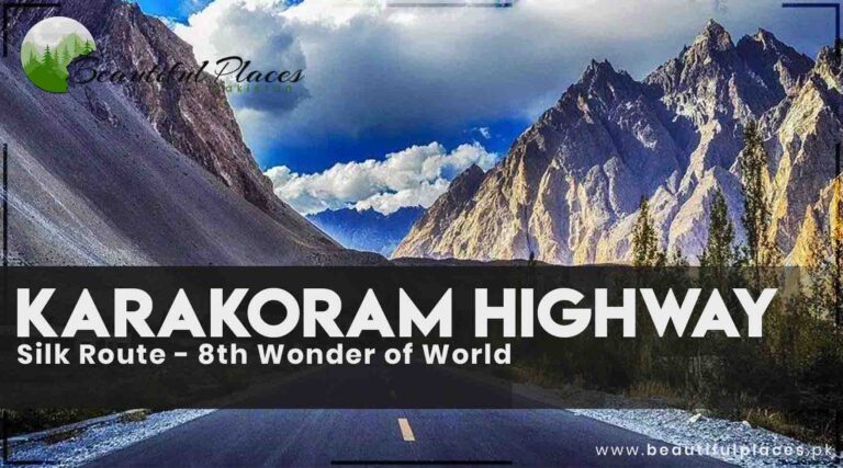
Karakoram Highway is built by the mutual collaboration of the Islamic Republic of Pakistan and the People’s Republic of China. It connects China and Pakistan. Its construction started in 1966. About 24, 500 people took part in its construction.
Aspect
Information
Name
Karakoram Highway (Silk Route)
Location
Connects China and Pakistan
Construction Start Year
1966
Construction Workers
Approximately 24,500 people
Construction Sacrifices
892 lives lost during construction
Significance
Considered the 8th Wonder of the World
Collaboration
Constructed through collaboration between the Islamic Republic of Pakistan and the People’s Republic of China
Impact on Tourism
Boosted tourism in Pakistan, especially in the valleys along the route during the summer
Challenges
Harsh terrain, rugged rocks, high altitudes, and sometimes, harsh weather conditions affecting travel to Skardu and Gilgit
Access to Central Areas
Air-conditioned and non-air-conditioned buses, wagons, and coasters available from Pirwadhai General Bus Stand Rawalpindi
Prominent Locations
Chalas, Gilgit, Astore, Hunza, and Skardu
Air Travel to Skardu and Gilgit
PIA flights available, but subject to specific weather conditions
Start and End Points
Starts from Hassan Abdal, ends in Xinjiang province, China
Impact on Gilgit Baltistan
Key role in the region’s progress, providing business and employment opportunities, though impacting local culture
Terrain Description
Highway built by cutting rugged rocks, touching mountain peaks at some points, and embracing foothills at others
Eight hundred and ninety-two people lost their lives during the construction of this World Wonder. It can be said that there is a sacrifice of one life for the construction of the one-kilometer road.
It is considered the eighth Wonder in the World which is completed by the teamwork of Pakistani Engineers (FWO) and Chinese Experts. It fascinates every tourist by twisting roads and beautiful scenery.
This highway is built by cutting rugged rocks. This highway touches the mountains’ peak at some points. While at the other places, it seems to move by embracing the foothills of sky-scraping mountains.
The silk route has boosted tourism in Pakistan
Karakoram highway was inaugurated formally by the Chief Martial Law Administrator General Zia-ul-Haq of Pakistan and a Chinese Minister at the point of Tahkot after its completion.
Before the Shahra-e-Resham, Babusar was the only track to reach these areas. This way is used to connect Mansehra, Bala Kot, Kaghan, Naran, Besal, and Babusar to Chalas. This route used to remain functional for four months a year. And it was blocked for the remaining year due to snowfall.
This highway has played a key role in the progress of Gilgit Baltistan but, it has affected the traditions, culture, norms, and conservatism of this region. People have gained opportunities for business and employment after the establishment of this highway.
This highway has boosted tourism in Pakistan. The valleys in the suburbs of this highway are crowded with local and foreign tourists in the summer.
Air-conditioned and Non-Air- Conditioned buses, wagons, and costers are available for all the central areas of Gilgit Baltistan from Pirwadhai General Bus Stand Rawalpindi. In these central areas, Chalas, Gilgit, Astore, Hunza, and Skardu are more prominent. These all spots are linked to each other via roads. A four-wheeled jeep can be hired for visiting the valleys and different areas of these sites.
PIA flights are available for Skardu and Gilgit. But, it requires special weather conditions like atmospheric pressure to land in Gilgit and Skardu. Sometimes, the flights return back to Islamabad due to climate conditions.
Shahra-e-Resham or Karakoram Highway starts from Hassan Abdal at a distance of 48km on the Rawalpindi to Peshawar road. It passes through Abbottabad, Mansehra, Basham, Chalas, Hunza, Sust, and Khunjerab Pass. It enters China in the province of Xinjiang.
Pak China border at Khunjerab Pass
Places in the suburbs of Silk Route
1- Shiva Temple
This ancient historical temple is on the left side of Hathi Mera Chowk on the Gilgit Raod at a distance of 6km from Mansehra. It is called “Shiva Ji Ka Mandir”.
2- Bafa
It is the headquarter or capital of Hazara’s plain area Pikhal. Gali Bagh is a famous village in Baffa. It is the same place that was the capital of the Turk Government. The remains of historical buildings of that time are still there. Baffa is famous for a special dish called “Khawa”. It is prepared with pure milk.
3- Siran Valley
A jeep track goes to Jabori, Nadi, and Sharan (Kaghan Valley) along the river Siran near the Shinkiari. There is a forest rest house established in 1919 at a distance of 24 km from Jabori. It was damaged in the earthquake of 2005.
Siran Valley is a beautiful and easy trek for new hikers
4- Shinkiari
Shinkiari has the meaning of a green garden. There is a junction of Shinkiari Konsh Valley, Siran Valley, and Bafa at a distance of 18km from Mansehra. This area is favorable for tea production because of its geography, climate, and natural environment. There are tea orchard research institutes too.
5-Shahzaib Lake
A route on the right side after crossing the Shinkiari border is directed to artificial Lake Shahzaib. It is located 5km from Karakoram Highway (Shahrah Resham), on Dadar Bhogar road near the bank of the river Siran. There are some restaurants and hotels for a stay near this beautiful lake. There are facilities for swimming and sailing. It is a peaceful and calm place since it is away from the main road.
6- Bit Gram and Cable Car
This area will provide you with facilities of every kind. This site has traces of Buddhism near the hills of Pishora. There is a cable car which is 12 km from Bit Gram Bazar on the Karakoram Highway. This cable car operates on a single wire to move across the river Nandi Har. It is a thrilling experience to travel on a single-wire cable car with a noisy river below. Stay here for refreshment.
7- Thakot
Bridge over the river in Thakot attract the visitors
The river Indus flows along the Resham Highway till Thakot. From here, the rivers diverge. On the completion of the Karakoram Highway (Shahrah e Resham), Pakistan’s President General Zia-ul-Haq and the Chinese Minister were inaugurated at this site.
There is a different kinds of settlements beyond Thakot Bridge which are 77km from Mansehra. Their traditions, culture, and norms are quite different.
8- Bisham
It is about in the center of Rawalpindi and Gilgit at a distance of 28km from Thakot. Almost every vehicle stays here for a while. It is a crowded site in this area. You can make it your base camp for Alai. The beautiful valley Dabir is near this site. You can use this track to reach Swat the Switzerland of the East via Alpuri and Shangla Top.
9- Alai Valley
This district of Mansehra is known for Pakhtun Culture and hospitality. You can reach Thakot and Basham. This valley is enriched with lush green gardens and Deodar Cedar tree forests and has a pleasant cold in summer. It is better to wear warm clothes here. It is bitter cold in the valley from November to April. A jeep can be avail from Kund Bridge which is 2km from Basham. But, public transport is accessible from Thakot.
10- Basham to Sazin
The valleys of northern areas fenced by mountains seem to be the princesses imprisoned by giants. The region from Basham to Sazin is blessed with natural beauty. The human intellect is astounded by the roaring river Indus between luxuriant green sky kissing mountains, an abundance of evergreen trees on both sides of the river, an excess of clear cascades and waterfalls, singing, dancing, and murmuring water channels.
But unfortunately, the tourists miss nature’s masterpieces and splendid landscapes due to the long distance between Rawalpindi to Gilgit. And they are longing for Hunza’s mountains to satisfy their taste in tourism. It is my sincere advice to all the tourists eager for natural beauty to visit all the areas from Basham to Sazin.
FAQs:
1. What is the Karakoram Highway, and where does it connect?
The Karakoram Highway is a road built through collaboration between Pakistan and China. It connects China and Pakistan and is a significant transportation route in the region.
2. When did the construction of the Karakoram Highway begin?
Construction of the Karakoram Highway started in 1966.
3. How many people were involved in the construction of the highway, and what sacrifices were made during its construction?
Approximately 24,500 people participated in the construction of the highway. Tragically, 892 individuals lost their lives during its construction, which highlights the challenges faced in building this route.
4. Why is the Karakoram Highway often referred to as the “Eighth Wonder of the World”?
The Karakoram Highway is often considered the eighth Wonder of the World due to its remarkable construction and scenic beauty. It is a testament to the collaboration between Pakistani Engineers and Chinese Experts.
5. How has the Karakoram Highway affected the region of Gilgit Baltistan?
The highway has played a significant role in the progress of Gilgit Baltistan by opening up opportunities for business and employment. However, it has also impacted the traditions, culture, norms, and conservatism of the region.
6. What impact has the Karakoram Highway had on tourism in Pakistan?
The highway has boosted tourism in Pakistan, with many local and foreign tourists visiting the valleys along the route, especially during the summer months.
7. What are the prominent places of interest along the Karakoram Highway and the Silk Route?
The article mentions various places of interest, including the Shiva Temple, Bafa, Siran Valley, Shahzaib Lake, Bit Gram and Cable Car, Thakot, Bisham, Alai Valley, and Basham to Sazin. These are all scenic and culturally significant spots along the route.
8. What are the challenges related to transportation to places like Skardu and Gilgit along the Karakoram Highway?
Flights to Skardu and Gilgit can be affected by specific weather conditions, such as atmospheric pressure. Sometimes, flights may have to return to Islamabad due to unfavorable weather conditions.
9. How can tourists access different areas in Gilgit Baltistan from Rawalpindi, and what are the prominent destinations in the region?
Tourists can access central areas of Gilgit Baltistan from Pirwadhai General Bus Stand Rawalpindi via air-conditioned and non-air-conditioned buses, wagons, and costers. Prominent destinations include Chalas, Gilgit, Astore, Hunza, and Skardu, all of which are connected by roads.
10. What is the significance of the Silk Route for Pakistan and China?
The Silk Route symbolizes the companionship between Pakistan and China and has benefited both countries in terms of economy and tourism.
Last Thoughts on Karakoram Highway
Silk Route is a symbol of Pakistan and China’s companionship. It has benefited both countries in terms of economy and tourism.
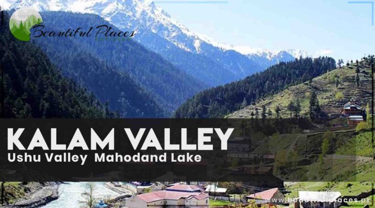
Kalam is at an altitude of 6,800 feet above sea level at a distance of 96km from Mingora. The river Utror and the river Ashoka merge into each other at this spot. This river gets the name river Swat beyond this site. Stay in Kalam and make a base camp there. And enjoy a day trip to upper valleys like Usho, Matiltan, Mahodand, Gabral, and Utror.
Snow-tipped mountains of Kalam fascinate the hikers
There are hotels, markets, and facilities of every kind. It is an ideal place for hiking, trekking, and Trout fishing. You will see many people enjoying sitting on cots alongside the river. The way to Kalam is open from April to November. After this season, it is difficult to reach Bahrain because of snow falling. However, some hotels are open during snowfall. The experienced drivers will take you to Kalam during snowfall.
The weather is cold here even in June and July.
Details of Tourist Spot
Tourist Spot
Description
Kalam Village
Kalam is located at an altitude of 6,800 feet and serves as a base camp for exploring various upper valleys.
Usho Valley
Usho Valley, at 7,300 feet above sea level, is known for its lush green forests, ice-capped mountains, and waterfalls.
Mahodand Lake
Mahodand Lake, 35km from Kalam, is famous for its trout fish, high cliffs, lush mountains, and boating adventures.
Utror Valley
Utror, located 12km from Kalam, is an idyllic place known for its grand mosque and as the starting point for various valleys.
Matiltan
Matiltan is 7km from Ushu and is named after the white mud in the area. It features a beautiful waterfall.
Chorat Gol
Chorat Gol is a wide valley south of Matiltan with snow-covered mountains, cascades, waterfalls, and mushrooms.
Glaciers
Large glaciers, about 15km from Matiltan, offer picnic opportunities and scenic natural beauty.
Neel Sar Lake
Neel Sar Lake is known for its rocky track and gradual elevation, and it’s a camping site for trekkers.
Pari (Fairy) Lakes (Khanpiro 1 and 2)
These lakes are known for their crystal-clear waters and the folklore of fairies swimming and dancing.
Kandol Lake
Kandol Lake, near Lado village, is ideal for camping and trekking and is a beautiful spot for boating.
Spin Khwar Lake
Hidden in the mountains, Spin Khwar Lake can be reached through Kandol or Lado valley, offering a serene escape.
Gabral Valley
Located 35km from Utror, Gabral Valley is renowned for its natural beauty, including the river Gabral’s cold waters.
Kalam Mosque
The Kalam Mosque is constructed from walnut wood and features Gandhara Art-inspired designs.
Bhoin (Aryani)
Bhoin is a spacious meadow above Kalam hilltop, offering beautiful views of neighboring areas.
Famous Tourist Sites in Kalam
1- Kalam Mosque
This mosque of Kalam is located on the bank of the river Swat. The Kalam village is beyond this mosque. The Kalam Jamiyah mosque is constructed from walnut wood. This mosque is established on giant girders. Designs are engraved on them according to Gandhara Art.
Kalam Mosque in Swat is an ancient historical asset
2- Bhoin (Aryani)
There is a spacious meadow above the Kalam hilltop across the river. You can reach there via jeep. It is an extremely beautiful area where the neighboring areas present a splendid sight. Two valleys are connected to each other. You can reach there almost two hours from Kalam.
3- Ushu
The road dived into two parts from Bantar point forward to Kalam. The left side has Utror (Atror) and Gabral. While the left side has Ushu valley at a height of 7300 feet above ocean level with a distance of 12km from Kalam.
This valley is furnished with lush green forests and ice-capped mountains. According to Muhammad Parvesh Shaheen, the region from Bantar to Mahodand is adorned like a bride. Ushu valley is about 40 miles long. The Ochar waterfall falling from an altitude of 1500 feet is very famous.
Rich green pastures of Ushu Valley
4- Matiltan
Matiltan is the headuqater or capital of Ushu valley and is 7km beyond Ushu. Matiltan is the name of white mud in the Kohistani language. This area is called Matiltan because of the white mud in this area. There is a beautiful waterfall at an altitude of 700 feet neat Mitlatan.
A beautiful scene of Matiltan Village in winter
5- Chorat Gol
A wide valley in the south of Matiltan is named Chorat Gol. Its mountains are covered with snow. This valley is blessed with cascades, waterfalls, and mushrooms. It is the second-best choice of tourists after Miandam.
6- Glaciers
A large glacier is about 15km from Matiltan. It remains even in summer. It is a good choice for a picnic.
7- Mahodand Lake
This lake at a distance of 35km from Kalam is famous for its abundance of trout fish. This site will fascinate you with sky-high cliffs and lush green mountains. Its thrilling horse riding experience in the capacious plains is unforgettable.
Situated at a height of 9000 feet, it has dimensions of 3 miles in length and 2 miles in width. Stay in the camps in this part of heaven. You will always remember the boating adventure on this lake. Saif Ullah and Nasur Ulllah lakes are 1km and 2km respectively from Mahodand Lake. People can reach there via jeeps and bikes.
Mahodand Lake is the best tourist spot
8- Neel Sar Lake
One day is required to reach this area which is at a distance of 10km from Mahodand Lake. The main reason for this is the rocky track and gradual elevation. A camping site is established near the lake for tourists. The travelers can stay in these camps for two to three days. Kachi Khani Top (Pass) is a few distances from this lake. You can reach Chitral Valley via this pass.
9- Pari (Fairy Lake) – Khanpiro Lake 1
There is a distance of about 10km by Jeep from Kalam to Utror (Atror). From here towards Anakhar site, Khanpiro Lake is located at a distance of 7km and 6 hours on foot. It is very important for the tourist who is eager to reach this lake to be steadfast and patient.
The tourists usually get upset by the difficulty and horror of the track. There are many waterfalls and cascades on the way to this lake. This lake with a triangle shape has crystal white water that comes from the nearby waterfalls. It is narrated that the fairies swim and dance in the full moon night. They sing and their voices can be heard in distant places.
10- Pari (Fairy Lake) – Khanpiro 2
It is located near the fairy lake Khanpiro 1. It is large and deeper than the other one. You will have to take a gas cylinder with you. The wood is not available here because of the vertical surface.
11- Utror (Atror)
Utror is 12km from Kalam at an altitude of 7300 feet. A grand mosque furnished with wood inscriptions is the identity of Utror. The ways to different valleys initiate from here.
Animals grazing in the lush green meadows of Utror Kalam
12- Kandol Lake
There is 1.5 hours drive from Kalam on the Utror road to reach Lado village. Kandol Lake is 3 hours away from Lado village on foot. It is in between Kalam and Upper Dir. The best track to reach this point is via Kalam. It is an ideal spot for people fond of camping and trekking.
Kandol Lake is an ideal lake for boating and camping
13- Spin Khwar Lake
This beautiful lake is hidden in the mountains in the north of Kondol Lake and in the east of Atror Valley. There are two ways to reach this lake. One is through Kandol and the other one is by Lado valley. The Lado valley track is easy while, the Kandol way is tiring and dangerous. Take the stuff of camping with you.
14- Gabral Valley
Gabral valley is 35km from Utror at an elevation of 2268 meters. You will start to believe why Swat is called the Switzerland of the East by visiting Gabral, Bela, Kashkan, bara, Mali Koh, Chota Jabba, Bara Jabba, Rangsi, Labri, and other beautiful sites. The water of the river Gabral coming from this charming valley is as cold as the water of Superior Lake America.
Shahi Bagh of Gabral Valley is a beautiful place for a family picnic
FAQs
1. Where is Kalam located and what is its significance?
Kalam is situated at an altitude of 6,800 feet above sea level, approximately 96 km from Mingora. It is known for its scenic beauty, rivers, and access to various upper valleys.
2. What are the major rivers that converge in Kalam, and what river does the Swat River become beyond Kalam?
The rivers Utror and Ashoka merge in Kalam, forming the Swat River, which continues beyond Kalam. This confluence is a notable geographical feature of the region.
3. What outdoor activities and attractions can visitors enjoy in Kalam?
Kalam offers opportunities for hiking, trekking, and trout fishing. Visitors can explore upper valleys like Usho, Matiltan, Mahodand, Gabral, and Utror.
4. What is the best time to visit Kalam, and what is the weather like there during June and July?
The article mentions that the way to Kalam is open from April to November. However, it’s noted that even in June and July, the weather can be cold.
5. What are some of the key tourist spots in and around Kalam?
There are numerous tourist spots, including Kalam Village, Usho Valley, Mahodand Lake, Utror Valley, Matiltan, Chorat Gol, glaciers, Neel Sar Lake, Pari (Fairy) Lakes, Kandol Lake, Spin Khwar Lake, Gabral Valley, Kalam Mosque, and Bhoin.
6. What is the significance of Kalam Mosque, and what makes it unique?
Kalam Mosque, located on the bank of the Swat River, is constructed from walnut wood with engravings in the Gandhara Art style. It is an ancient historical asset in the region.
7. How can visitors reach Bhoin (Aryani), and what does this area offer in terms of scenery?
Bhoin is a spacious meadow above the Kalam hilltop and can be reached via jeep. It provides beautiful views of neighboring areas and connects two valleys.
8. What are the features and attractions of Usho Valley, and how can visitors reach it from Kalam?
Usho Valley is known for its lush green forests, ice-capped mountains, and the famous Ochar waterfall, which falls from an altitude of 1500 feet. It can be reached from Kalam.
9. What is the significance of Matiltan, and why is it named as such?
Matiltan, located 7 km beyond Ushu, is known for its white mud, which gives it its name. It features a beautiful waterfall at an altitude of 700 feet.
10. How can visitors access Chorat Gol, and what makes this valley a popular choice for tourists?
Chorat Gol is a wide valley south of Matiltan, characterized by snow-covered mountains, cascades, waterfalls, and mushrooms. It is a popular destination for tourists, often compared to Miandam.
Last Thoughts on Kalam Valley
Kalam is a serene place in Swat Valley. Its neighboring areas Mahodand Valley, Utror (Atror), Kandol, Maltiltan, Gabral Valley, glaciers, and trekking sites captivate the tourists, holidaymakers, and vacationers.
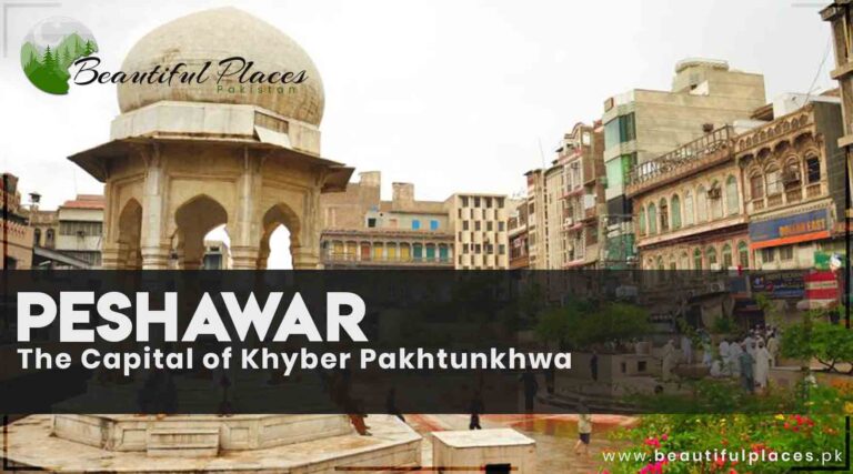
Peshawar is one of the ancient cities in South Asia. It is also named the “City of Flowers”. It is the capital of Khyber Pakhtunkhwa (KPK). Peshawar is the sixth largest city in Pakistan. This city is connected to all the major cities of Pakistan.
Peshawar is well known for its variety of food, handicrafts, and fruits. Islamia College Peshawar, Chowk Yadgar, Sethi House, Mahabat Khan Mosque, Peshawar Museum, Bab-e-Khyber, Qissa Khwani Bazaar, and Bala Hissar Fort are some worth mentioning sites.
Islamia College Peshawar, a splendid historical heritage
Peshawar – Capital of Khyber Pakhtunkhwa
Category
Details
Country
Pakistan
Province
Khyber Pakhtunkhwa (KP)
District
Peshawar
Region
Peshawar Valley
Founded
Ancient city with a history dating back over 2,000 years
Area
1,257 square kilometers (485 square miles)
Population
2,412,000
Official Language
Urdu, Pashto
Time Zone
Pakistan Standard Time (UTC+5)
Climate
Hot semi-arid with extremely hot summers and mild winters
Major Religion
Islam
Currency
Pakistani Rupee (PKR)
Deputy Commissioner
Mr. Mohammad Ali Asghar
Known For
Rich cultural heritage, historic landmarks, hospitality, Peshawari cuisine
The history of Peshawar is as old as the history of Khyber Pakhtunkhwa. According to Herodotus, the oldest name of Peshawar was Caspitros. Which is the city of the ancient Haft-i-Aqalitim, the seventh province of Paktika, from which the Achaemenid king Darius the Great set out on an expedition to the Arabian Sea.
It is named Bigram in Rag Veda, the ancient sacred book of Hindus. The first king of the Kashan family declared Peshawar its capital in the first century. He established monasteries and schools for the promotion of Buddhism.
This valley was called Korah and the residents were called Korohila when the first Islamic army reached the site of Gandara under the leadership of Hazrat Sanan bin Salma alias Ashab Baba. A famous Chinese tourist and historian Xuanzang (Hsüan-Tsang) have written the name Poloshapolo and Pur Shahpur in the Sanskrit language for Peshawar.
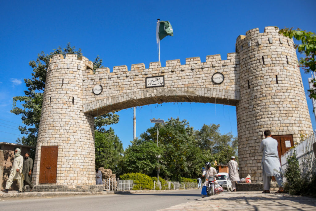
Bab-e-Khyber Peshawar, a gateway to an ancient city
Different royal families of Hindus ruled it in the 700th century after the Buddha era. King Jay Pal declared the area of Hund as the capital of his state located at the shore of the river Indus within the boundary of Peshawar. The king jumped into the fire and committed suicide after getting continuous defeat from Mehmood Ghaznavid.
After that, the Islamic civilization started prevailing there. And the experts of Turkmenistan, Samarkand, Bukhara, Turkey, Iran, Afghanistan, and Middle Asia reached there. As a consequence, the buildings of the city seemed to have a reflection of Islamic civilization rather than Gandara civilization.
With the arrival of the Mughals, Mughal architecture reached its peak in Peshawar which is still seen in the residences, Havelis, and mosque there. There was a fortification around the city and it had 16 doors. Some of them were dilapidated and they were renovated a few years ago.
Dialects in Peshawar
The residents of Peshawar and its suburbs speak Pashtun and Hindko with fluency. According to the New York monument, Pashtun is the fourth oldest language in terms of conservatism.
Famous Historical and Tourist Spots in Peshawar
1- Fort Bala Hissar
It is the most ancient cultural heritage of Peshawar. Bala Hissar is a Persian language word that has a meaning of heightened or supreme fort. It was originally built by Hoshang Pashdad, the great-grandson of Kimarth.
According to Major M Nawaz, it was present 2000 years ago. According to the reference in Ahmad Hassan Dani’s book, the Chinese tourist Xuanzang (Hsüan-Tsang) called it Shahi Mahal or Royal Palace in 630. According to doctor Hussain Khan, this fort was given the name of Qila Bala Hissar by the Afghan king Taymoor Shah Durrani (1773-1793).
Historically it remained a strategic city. All the foreign invaders paid special attention to this fort at the time of the attack on the subcontinent. Ghaznavid, Ghori, Mughals, Durrani, Subektagin, Hindu Royals, Sikhs, and the British tried to demolish it. The son of Shah Abdali Taymor Shah used this fort as his residence. He built rooms and gardens.
The governor of Ranjeet Singh Nalwa Singh destroyed it completely but reconstructed it under the supervision of a French engineer in 1830 for the purpose of defense. They used raw bricks and mud during the repair.
Later on, the Britishers used solid bricks in the renovation when they realized the culture and defense importance. In the British regime, they used to keep the prisoners in this fort. When a shot was fired in the central bazaar, a movement started against the British.
The people involved in that movement were imprisoned in this fort. The stuff of different eras, clothes, shoes, weapons, and photographs of different officers who were appointed in the fort are exhibited here.
The most beautiful part of this fort is the royal court or Shahi Darbar. A brief history of the fort is engraved on the inner walls of the fort. This fort was constructed in the northwest corner of Peshawar city on a high rock but now it is in the center of the city because of the increased population.
Situated on the central G.T Road, it is under the supervision of the Frontier Constabulary since the creation of Pakistan. It is their head office too. A special permission letter is required for the visit to the fort. It can be taken from the central office.
Bala Hissar fort
2- Jamiya Mosque Mahabat Ali Khan
Mahabat Ali Khan was the governor of Peshawar during the Mughal reign. His real name was Lehrasab. He was the governor of Kabul in Jahangir’s regime. He got the title of Mahabat Ali Khan because of his bravery and courage.
This title has the meaning of “the one who put you in astonishment”. When he became the chief of Peshawar under the rule of Shah Jahan he built a splendid mosque in the Samai door. It has a long minaret and a big dome.
Constructed with marble stones, it is a marvelous piece of Mughal architecture. Constructed from 1658 to 1662, this mosque is the best model of the Islamic mosque. According to a second reference, this mosque was built in 1670 in the Auregzeb Alamgir era.
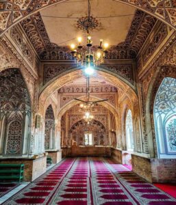
The astonishing interior of Mahabat Khan mosque in Peshawar
Two big doors are on the north and south sides and a large pond has been established in the center. Small hostel rooms have been constructed on both sides of the two doors. Old-fashioned lanterns are hanging in the mosque. Its minarets were damaged during the Ranjeet Singh attack. They were renovated after that. Italian governor Abu Tabela of the Sikh’s reign used to throw the criminals from the minaret.
3- Chowk Memorial
In 1857, a memorial to Lord Hasting was built in the center of Peshawar. It was called Hasting’s memorial. It was difficult for the common people to pronounce this name. It was changed to Chowk Yadgar or Chowk Memorail.
The historic Yadgar Chowk which is a center of political and religious activities
In the era of Field Marshal Ayub Khan, it was demolished by the mayor of Peshawar in one night and a cone-shaped minaret was built at the place of the beautiful memorial. The design of the minaret was never liked by the locals. After some time, it was transformed into its original design.
It gained the status of a political, religious, and social center in the last decade. A parking facility is provided to the citizens in the north-south of this memorial without changing the design of the memorial.
4- Meena Bazar
It is the best bazaar for females’ stuff adjacent to the Memorial Chowk. Local and regional clothes, embroidery raw materials, and female stuff can be found there.
5- Clock Tower
It was built in 1900 as a memorial to the diamond’s jubilee of Queen Victoria. And dedicated to British provincial governor Surcharge Cunningham. A Hindu contractor Lala Balmakand constructed it.
At that time, small bricks were used in Peshawar for construction. They were called Waziri Bricks. Lala constructor introduced the concept of large bricks. In this way, it was named “Bala ki Eint” (بالہ کی اینٹ). These bricks are still famous with this name.
Lala built this tower with large bricks and imported watches from London. This watch was called “Balo ka Gharyal”. (بالو کا گھڑیال). It was working properly for one century. After that, it remained jammed. Its time was corrected its one century birthday in 2000. It is located on the road going to Gor Kathri and Sethi Mohalla.
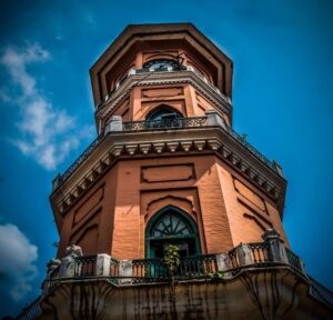
The ancient Clock Tower (Ghanta Ghar) in Peshawar witnessed the sands of time
6- Sethi Mohalla
The people of Sethi Mohalla belonged to the profession of trade. Their business was spreading all around central Europe. Their lifestyle was like the royals because of the abundance of wealth. Their villas reflect their status. Their mansions are great masterpieces of architecture of the eighteenth and nineteenth centuries.
Doors, windows, rooms, and each corner of the mansions are designed by highly skilled craftsmen. There are models of Iranian, Gol Canda, Bukhara, and Kashmiri architecture. Some mansions are linked with each other by wood bridges.
A mansion of Sethi Mohalla, a fine piece of Mughal architecture
The government has purchased one of the mansions and turned it into a museum to save the cultural heritage. The best way to reach this area is from Yadgar Chowk via Clock Tower. Tehsil Gor Kathri Museum is adjacent to Sethi Mohalla.
7- Tehsil Gor Kathri (Jahan Begum Inn)
It is located in the upper area of the city and an aerial view of the city can be taken from here. This is a sacred place for Hindus and Sikhs and is on a 50 feet high hill.
It is in the center of the city and stretches over an area of ninety canals (a unit of measurement). In this temple, the Hindus perform the rituals of the shaving head. The temple is still in good physical condition.
Greeks, Huns, Ghori, Suri, Mughals, Durrani, Sikhs, and the British people made this place their residence. In 1641, the daughter of Shah Jahan named Jahan Ara built a mosque and an inn. Passengers and traders used to stay there. 36 rooms of the total 49 rooms in the inn and the mosque still exist.
Later on, it was declared the tehsil headquarters of Peshawar. From then till now it is called Tehsil Gor Khatri. Two fire engines of merry vedar company were imported in 1919-1921 when the fire brigade office was established. These engines are still operating.
A city museum is established in 2006 and artifacts related to the rulers of Peshawar are exhibited there. Archaeological remains are present in underground buildings in the southeast area of Gor Kathri. These remains give a clue that Peshawar was existing in the fourth and sixth centuries before Christ.
Gol Khatri Peshawar, a gate to old civilizations
8- Qissa Khawani Bazaar
Peshawar was once famous as the city of roses. The roses are not there now but their memorial is still in Qissa Khawani Bazaar. It is in the center of Peshawar and looks like the ancient streets of Baghdad.
In the past, the locals and passengers used to tell stories at the edge of the road by sitting at the big checkpoints. They used to enjoy Red Nan (tortilla), roasted meat, and Qahwa (a drink like black tea) during their meeting. As time has passed, those people are no more. But, Nan, meat, and Qahwa are there.
A beautiful view of Qissa Khawani during festivals
British high commissioner Herbert Edwards has called it the Pakadli of Central Asia. A memorial is built in remembrance of those killed in the 1930s by British troops firing on unarmed protesters.
The father of Indian actor Shah Rukh Khan belonged to Shah Wali Qattal of Qissa Khawani Bazaar. Nowadays, his uncle lives there. Raj Kapoor of the well-known Kapoor family of Bollywood also belonged to Peshawar.
9- Peepal Mandi
This wholesale market of clothes and grains is located in the Peepal Mandi. This peepal market has an old tree of Peepal. It is said that Mahatma Buddha used to worship here.
10- Qasim Ali Khan Mosque
This mosque was built by Qasim Ali Khan in the Mughal regime. He was the brother of Mahabat Khan. It was damaged in the flood. Haji Ghulam Samad Samdani renovated it. This mosque was constructed in 1846 in the center of Bazaar Masgaran and Dilgaran in Peshawar.
It was the time when Mughal Empire was in decline. The Britishers had occupied most of the areas of India. However, it can be said that this mosque was constructed in the Sikhs regime. But the art of architecture that became popular in the Mughal period was so strong and grand that the same architecture continued for centuries.
The grand Qasim Ali Khan mosque
Later on, the front of the mosque was renovated. It has the status of “Dar-ul-Fatawa” for the people of Peshawar. The Muftis of Mufti Popalzai are performing the duties of Imamate and oratory from generation to generation.
11- Dilip Kumar House
Famous Indian actor Dilip Kumar belonged to Peshawar. His real name is Yousaf Khan. Yousaf Khan was shifted to India. The provincial government is planning to transform his house into an art gallery. Dilip Kumar visited his house in 1998 which is located in Mohalla Khudadad (Doma Gali) of Peshawar.
This 5 marla ( a unit to measure land) house is made of wood and has three floors. The ground floor is changed into an art gallery.
12- Namak Mandi
Namak Mandi has the same status in Peshawar as the Gawalmandi and food street of Lahore. This bazaar is in the center of Peshawar city and is famous for its high-quality food and recipes.
Mutton Karahi, Tikka Kebab, Chappal Kebab, and other various kinds of Barbecue. Charsi Tikka Kebab is also a good point. Besides this, many restaurants have been established on Ring Road, especially Hayatabad bypass.
There is the best setup with a contrast of traditional and modern environments. There are good restaurants on university road too. Shab Daig is a unique dish of Sheraz café. You will have to order one day before to taste this dish.
Barbecue restaurants in Namak Mandi Peshawar
13- Food Streets & Chapli Kebab
Chapli Kebab is the cultural dish of every region of the province KPK. In a special way, kebabs are prepared in large frying pans with a mixture of mince of cow and buffaloes, corn flour, onions, tomatoes, and a variety of spices. If food is not cooked in one’s house, chapli kebabs are required from the bazaar.
Nisar Charsi Tikka, Lazeez Chawal House, Jalil Kebab House, and Afghan Sadaqat Juice Corner are some famous food points.
Laziz Chawal restaurant
14- Shah Qubool James Street
It is located in Namak Mandi. You can buy valuable stones, rings, and other ornaments.
15- Nishtar Hall
A large beautiful hall is established near Peshawar high court for the literary and cultural programs. It is dedicated to Sardar Abdul Rab Nishter who was a great leader of the Pakistan Movement. He belonged to Peshawar.
He served as a Minister and governor of Punjab. He has buried in the basement of Quid-e-Azam tomb.
Nishter Hall Peshawar, a masterpiece of modern architecture
16- Peshawar Museum
This grand building was built in front of the government house in 1901. A vast hall was established in this building and named Victoria Memorial Hall. Foreign civil and army officers were used to staying here during official government celebrations.
It was utilized as a dining hall for some time. It was transformed into a museum in 1906. Dakrawall was named as the first curator. He served here for 21 days. Windows and ventilators were used as sources of light as there was no electricity. In 1927, it was given under the administration of the provincial government. It was extended in 1970-71.
Today, there are different galleries. Buddha life gallery, Islamic gallery, ethnological gallery, Quran gallery, and coin gallery. The most valuable asset of this gallery is the artifacts of the Kanshak family. They were discovered in 1908 and 1909 excavations.
Peshawar Museum, a visit to ancient civilizations
They include pots, sculptures, stone items, greek, Sethin, Parthenon, Sassanid, and other traces of the Kushan period. Moreover, traces of Chander Gapat Moria and other Hindu rulers’ eras, Hanuman shapes, and hunter’s sculptures are there.
What the building holds matters more than its history, and this is the part usually left
out. The Peshawar Museum has one of the largest and finest collections of Gandhara
art anywhere in the world: grey schist Buddhas, reliefs telling the life of the
Buddha panel by panel, and the Greco-Buddhist sculpture produced in this region when
Hellenistic technique met Buddhist subject matter. The famous fasting Buddha and the
reliquary caskets are here.
This is the single best reason to spend an afternoon in Peshawar even if you have no other
interest in the city. The Gandhara civilisation that produced it ran across this whole region,
and the sites at Taxila and through the Swat valley are where most of it was excavated. See the museum first and
the sites make far more sense afterwards.
17- Gurdwara Bhai Juggan Shah
Sikh rulers constructed numerous buildings in the era from 1823 to 1848. Sikh worship places Gurdwara Bhai Juggan Shah is unique because of their architecture. This gurdwara is located near Asia gate.
18- Rehman Baba
It has been admitted with certainty that there is no cell or house of Pathans where Rehman Baba’s poems are not recited. In these poems, Baba has expressed human emotions so well that every Pathan considers it as an expression of his emotions. His poems are so famous that they have now become proverbs.
His real name was Abdul Rehman. He was born in 1634 and belonged to Bahadur Kali which is six miles away from Peshawar. He was a literate person. He received formal education in Sufism and Fiqh. He never gave up worldliness.
He was fond of music. Therefore, his poetry has a touch of softness and sweetness. His words portray the complex concepts of Sufism in a very simpler and more beautiful manner. He usually remained in deep thoughts. Therefore, he never paid attention to the grammar in his verses.
The poetry that he used to send to his friends from time to time is all that is left. His poetry got so much fame but there are very few details about his life. He died in 1706 and his tomb is in Hazar Khawani.
Rehman Baba Mausoleum
19- Karnal Sher Khan (Army Stadium)
There was a lake at this place before the park and stadium. This lake was changed into a pond. Gradually, the ground was dry. Military barracks were established there. There is a golf club too.
On 17th May 1990, a project for the construction of a park and a stadium was started. Mir Afzal Khan late inaugurated this project. A playland for children is established there near the vast green lawns.
Swings are there for the amusement of Children. Different festivals and exhibitions are organized in this oval-shaped museum. Army sports competitions are also held here. The celebration and exhibition every year on the 6th of September invigorates patriotism in the people.
This park is dedicated to Karnal Sher Khan Shaheed Nishan-e-Haider who sacrificed his life for the safety of the country. It is located on Khyber Road. Another, modern and beautiful playland is near Arbab Niaz Stadium.
20- Islamia College Peshawar
Islamia College Peshawar is an illuminating chapter of our freedom movement and we are proud of it. The foundation of the college was led by Sahibzada Abdul Qayum Khan in March 1912.
Its construction ushered in a new era of knowledge development in the province. It is the most ancient educational institute in Peshawar. Its building is quite exquisite and worth watching.
A mosque in the college has enhanced the beauty. There are gardens like the Mughal architecture style. The founder of Pakistan Quaid-e-Azam Muhammad Ali Jinnah and his sister Fatima Jinnah visited this college. Quid-e-Azam Muhammad Ali Jinnah bequeathed one-third of his estate to the college in his will.
A beautiful aerial view of Islamia College Peshawar
A 1000 rupees note has its picture on it.
21- Sir Sahibzada Abdul Qayum Museum
A museum is established after the name of Sir Sahibzada Abdul Qayum at the University of Peshawar. This small museum has exceptional models of Gandara civilization.
Getting to Peshawar and when to go
Peshawar sits at the western end of the Grand Trunk Road, about 160 km from
Islamabad, and the motorway makes it a comfortable two hours or so by car. Coaches
run constantly from Rawalpindi and Islamabad, and the city has its own airport with domestic
connections. It is one of the easiest major cities in Pakistan to reach.
October to March is the season. Peshawar sits low on the plain and summers
are severe, regularly passing 40 degrees through May, June and July, which makes walking the
old city and the bazaars genuinely unpleasant. The winter months are mild, clear and exactly
right for the walled city, and they coincide with the season for the rest of lowland Pakistan.
Our month by month guide sets out how that fits a wider trip.
One practical note. Peshawar is a working city rather than a tourist one, and the old city in
particular is dense, busy and best seen on foot with someone who knows it. Hiring a local
guide for a morning in the walled city turns a confusing warren into the most rewarding few
hours in the province. Check current advice before travelling toward the Khyber Pass and
Torkham, since access beyond the city is managed separately and changes.
Meena Bazaar near Yadgar Chowk is a better option for female shopping. Embroided shoes can be purchased from Lara cobbler in the shoe market. Chitral Bazaar is famous for Chitrali cultural products. Foreign products can be purchased from Cantt Sadar and Karkhano markets.
Best Schools in Peshawar:
Peshawar Model School: This institution is renowned for its quality education and a wide range of extracurricular activities, providing a well-rounded learning experience for students.
Beaconhouse School System, Peshawar Campus: As part of the well-established Beaconhouse network, this school offers a strong academic curriculum and modern facilities.
F.G. Boys High School, Peshawar Cantt: This government school provides quality education to boys and has a long history of academic excellence.
F.G. Girls High School, Peshawar Cantt: The female counterpart to the boys’ school, this institution offers education and support for girls in Peshawar.
Edwards College, Peshawar: Known for its historical significance, Edwards College provides higher education and a platform for intellectual growth.
Best Colleges and Universities in Peshawar:
University of Peshawar: This prestigious institution offers a wide range of academic programs, research opportunities, and is a hub for higher education in the region.
Khyber Medical University: Known for its medical programs, Khyber Medical University is a center of excellence in healthcare education and research.
Islamia College University: A historic institution, it provides a diverse range of undergraduate and postgraduate programs, contributing to the academic growth of the region.
Edwardes College, Peshawar: Beyond its school, Edwardes College also offers higher education programs and is a well-regarded institution in Peshawar.
Institute of Management Sciences (IMS), Peshawar: Known for its business and management programs, IMS is a popular choice for students pursuing careers in business.
Best Hospitals in Peshawar:
Lady Reading Hospital (LRH): LRH is one of the largest and most well-equipped public hospitals in Peshawar, offering a wide range of medical services and specialized departments.
Hayatabad Medical Complex: Known for its modern facilities and expert medical staff, this hospital provides high-quality healthcare services to the people of Peshawar.
Khyber Teaching Hospital: Affiliated with Khyber Medical University, this government-run hospital offers comprehensive medical services and specialized departments.
Northwest General Hospital & Research Centre: A private hospital with a strong reputation for healthcare, it offers a range of medical services and advanced technology.
Bacha Khan Medical Complex: Located in the heart of Peshawar, this medical complex provides healthcare services to the local population, including specialized care.
Best Restaurants in Peshawar:
Namak Mandi: Famous for its Peshawari cuisine, Namak Mandi is a must-visit for lovers of kebabs, karahi, and traditional Pashtun dishes.
Kabul Restaurant: Offering Afghan and Pashtun cuisine, Kabul Restaurant is known for its delicious pulao and mantu, a type of dumpling.
Charasi Tikka: A popular spot for grilled meat lovers, Charasi Tikka is known for its flavorful kebabs and tikka dishes.
PC Peshawar: Marhaba Restaurant: Located in the Pearl-Continental Hotel, this restaurant offers a diverse menu, including continental, Pakistani, and international dishes.
Mezban Restaurant: Known for its barbecue and traditional Pashtun dishes, Mezban is a favorite for those looking to savor local flavors.
Frequently Asked Questions (FAQs):
What is the historical significance of Peshawar?
Peshawar has a rich history, serving as a gateway to Central Asia and playing a crucial role in the region’s trade and culture for centuries.
Are there any cultural attractions in Peshawar?
Yes, Peshawar boasts cultural treasures such as the Peshawar Museum, Mohabbat Khan Mosque, and Qissa Khwani Bazaar.
What is the climate like in Peshawar?
Peshawar experiences a hot desert climate with extremely hot summers and mild winters. It’s important to consider the weather when planning your visit.
Are there any famous personalities associated with Peshawar?
Peshawar is the birthplace of Malala Yousafzai, the Nobel laureate and education activist, and has connections to various artists, writers, and political figures.
Last Thoughts on Peshawar
Peshawar is among the oldest continuously inhabited cities in this part of the world, and it
still behaves like what it has always been: a trading city at the mouth of the Khyber, where
the goods and the people moving between Central Asia and the subcontinent have had to pass
for two thousand years. That is why the museum holds what it holds, and why the bazaars feel
the way they do.
It is not a city that presents itself to visitors, and it rewards time rather than a
checklist. Give it two days, come between October and March, start at the museum, and walk
the walled city with a guide.
In short
Peshawar, the capital of Khyber Pakhtunkhwa, stands as a city with a rich tapestry of education, healthcare, and culinary delights. It’s a hub of learning, with excellent schools, colleges, and universities catering to students’ diverse needs. The city’s healthcare infrastructure is top-notch, featuring prominent hospitals equipped to meet the medical requirements of the region. Peshawar’s culinary scene is a treat for food enthusiasts, offering a wide range of local and international flavors.
As a city steeped in history and culture, Peshawar offers both residents and visitors a blend of tradition and modernity. Whether you’re here to explore its educational institutions, seek quality healthcare, or savor its diverse cuisine, Peshawar has much to offer to those who come to experience its unique charm.
It is said that this city is located about 30km from Peshawar on the G.T road and was settled by King Akbar. In this decisive battle between the Pathans and the Sikhs in that bloody battle of 1823, the Sikhs were finally victorious. As a result, the whole valley was occupied by the Sikhs.
The graves of martyrs are still present on the hills in the suburbs of the city. A fine masterpiece of architecture Taj building is on the G.T road Nowshera. Established in 1920, it is under the administration of the archaeological department because of its unique architecture.
It is commonly called Nokhar in the district of Nowshera. Famous poet Khushal Khan Khattak was born in Nowshera. A well-known Sikh commander Phalang Singh is buried in Nowshera. Military barracks have been established in Nowshera in the British regime. Therefore, it holds great significance.
Jinnah Park and a small zoo are located near the river Kabul. The army training center, locomotive factory, PAF Risalpur, and Cherat are its identity.
Ghari Kapoora, Azakhel Bala, Grand Trunk Road, Qila Sheikh Musa Khan
Educational Institutes
University of Engineering and Technology (UET) Nowshera, Cadet College Nowshera, Frontier Homeopathic Medical College
Sports Teams
Nowshera Warriors
Transportation
Nowshera Cantonment Railway Station, Peshawar International Airport
Tourist Attractions
Jalozai Refugee Camp, Azakhel Bala Park, Qila Sheikh Musa Khan Park
Famous Places of Nowshera:
Azakhel Payan: It is a village near Nowshera known for its historical importance. The village is home to ancient Buddhist stupas and relics, attracting tourists and history enthusiasts.
Jehangira: Located on the outskirts of Nowshera, Jehangira is known for its scenic beauty and the historical site of Ashoka Rock Edicts. The edicts date back to the 3rd century BC and are inscribed with ancient inscriptions.
Risalpur: Situated approximately 12 kilometers south of Nowshera, Risalpur is famous for its Pakistan Air Force Base and Aviation College. The base houses various aircraft and provides training facilities for pilots.
Khat Kaliyan Wildlife Park: This wildlife park is located near Nowshera and offers a unique opportunity to observe and learn about various animal species. It is a popular spot for picnics and family outings.
Schools in Nowshera:
Army Public School and College, Nowshera Cantt
Beaconhouse School System, Nowshera Campus
F.G. Boys High School, Nowshera Cantt
F.G. Girls High School, Nowshera Cantt
The Educators, Nowshera Campus
Peshawar Model School, Nowshera
Colleges and Universities in Nowshera:
University of Engineering and Technology (UET), Peshawar Campus, Nowshera
Govt. Post Graduate College, Nowshera Cantt
Jinnah College of Nursing, Nowshera Cantt
Garrison Cadet College, Kohat Road, Nowshera
Riphah International University, Nowshera Campus
Govt. Commerce College, Nowshera Cantt
Hospitals in Nowshera:
Combined Military Hospital (CMH), Nowshera Cantt: CMH is a well-known hospital in Nowshera, providing medical services to military personnel as well as civilians. It offers a wide range of healthcare facilities, including emergency services, specialized clinics, and surgical procedures.
Khyber Teaching Hospital, Nowshera: This government-run hospital is affiliated with Khyber Medical University and provides comprehensive healthcare services. It has various departments, including general medicine, surgery, gynecology, pediatrics, and more.
Nowshera Medical Complex: This public hospital in Nowshera offers healthcare services to the local population. It has specialized departments, including cardiology, orthopedics, ophthalmology, ENT, and others.
Azakhel Teaching Hospital: Located in Azakhel Payan, this hospital serves the medical needs of the local community. It has departments for various specialties and provides both inpatient and outpatient services.
Restaurants in Nowshera:
Taj Mahal Restaurant: Located in the heart of Nowshera, Taj Mahal is a popular restaurant known for its delicious Pakistani and Indian cuisine. It offers a wide range of traditional dishes and a comfortable dining environment.
Khyber Shinwari Restaurant: This restaurant specializes in Shinwari cuisine, which is a traditional Pashtun cuisine known for its flavorful grilled meats and bread. It is a favorite spot for locals and visitors who appreciate Pashtun culinary delights.
Shahjahan Restaurant: Shahjahan is a family-friendly restaurant in Nowshera that offers a diverse menu, including Pakistani, Chinese, and continental dishes. The restaurant provides a pleasant ambiance and caters to different taste preferences.
Peshawari Shinwari Restaurant: Known for its authentic Pashtun flavors, this restaurant serves a variety of traditional dishes, including grilled meats, karahi, and kebabs. It is a popular choice for those seeking a taste of Pashtun cuisine.
Khyber Pakhtunkhwa Restaurant: This restaurant showcases the culinary heritage of Khyber Pakhtunkhwa, offering a range of regional specialties. From Peshawari chapli kebabs to Charsi tikka, the menu features a variety of flavorsome dishes.
Khushal Khan Khattak
Khushal Khan Khattak was a well-known poet and nationalist leader of Pashtu or Pashtun. He gave the lesson of nationalism through his poetry.
His poetry has the topics of manliness, honor, bravery, and advice. He died in 1960 and was buried at the foothills of the small hills of Kora Khattak. Four colored marble was given by king Zahir Shah for the construction of the shrine. A rest house and a library are near the shrine.
Cherat
It is a hilly area of district Nowshera in the Peshawar region. It is at an altitude of 4,500 feet. The reason for the fame of this city is the military barrack. It is called Cherat after the name of major Chert.
In 1853, it was discovered by major Cook. This site was utilized by the British army in 1861 as a centurion in the south a few kilometers from Nowshera. The climate is too cold since it is located at a very high point. There are snowfalls in winter.
A means of public transport will take you to Cherat top in one hour from Nowshera.
The sky high mountains of Cherat in Nowshera
Frequently Asked Questions (FAQs):
What is Nowshera known for?
Nowshera is known for its strategic location, historical significance, and agricultural productivity. It has a rich history, with notable landmarks and historical events.
Are there any famous historical figures associated with Nowshera?
Yes, Khushal Khan Khattak, a renowned Pashtun poet and nationalist leader, was born in Nowshera. The city also has historical sites related to battles between Pathans and Sikhs.
What are the popular tourist attractions in Nowshera?
Some popular tourist attractions in Nowshera include Azakhel Payan, Jehangira, Risalpur, and the Khat Kaliyan Wildlife Park. These sites offer a mix of historical, scenic, and wildlife experiences.
What are the educational institutions in Nowshera?
Nowshera is home to various educational institutions, including the University of Engineering and Technology (UET) Nowshera, Cadet College Nowshera, and Frontier Homeopathic Medical College.
Where can I find authentic local cuisine in Nowshera?
You can enjoy authentic local cuisine at restaurants like Taj Mahal Restaurant, Khyber Shinwari Restaurant, Shahjahan Restaurant, Peshawari Shinwari Restaurant, and Khyber Pakhtunkhwa Restaurant.
Is there a military presence in Nowshera?
Yes, Nowshera has a significant military presence with military barracks and a history of British military utilization in Cherat.
What is the climate like in Nowshera?
Nowshera experiences a hot semi-arid climate with mild winters and hot summers. It’s important to be prepared for the weather if you plan to visit.
Wind-up Lines:
In conclusion, Nowshera is a city steeped in history and culture. From the legacy of Khushal Khan Khattak to its strategic location and agricultural productivity, Nowshera offers a diverse range of experiences. Whether you’re exploring historical sites, enjoying local cuisine, or taking in the natural beauty of the region, this city has much to offer. With its educational institutions, healthcare facilities, and a strong military presence, Nowshera stands as an important hub in the Khyber Pakhtunkhwa province of Pakistan. If you’re seeking a blend of tradition, history, and natural beauty, Nowshera is a place worth discovering.
Famous Tourist Destinations in Gilgit Baltistan GB
Gilgit Baltistan is blessed with countless beautiful spots, snow-capped peaks, glaciers, and historical places. Satpara Lake and Deosai National are among the most fascinating tourist destination.
Key information about Deosai National Park and Satpara Lake
Tourist Site
Deosai National Park
Satpara Lake
Location
Northern Pakistan, Skardu District
Skardu, Gilgit-Baltistan
Altitude
4,114 meters (13,497 feet)
2,636 meters (8,650 feet)
Area
3,000 square kilometers (1,158 sq mi)
N/A
Terrain
Plateau, alpine meadows, and plains
Mountainous, surrounded by snow-capped peaks
Wildlife
Brown bears, Himalayan ibex, red foxes, snow leopards
Various migratory birds, trout fish
Flora
Alpine flowers, herbs, and shrubs
Alpine vegetation, grasslands
Accessibility
Limited road access, seasonal (May to November)
Road access, year-round
Key Attractions
Sheosar Lake, Bara Pani, wildlife sightings
Boating, fishing, panoramic views
Best Time to Visit
Summer months (July to September)
Summer and early autumn
Accommodation
Limited camping facilities, no hotels within the park
Hotels and guesthouses in Skardu
Activities
Wildlife photography, trekking, camping
Boating, fishing, picnicking
Conservation Status
Protected national park
Natural lake, no specific conservation status
Additional Information
Second-highest plateau in the world
Source of the Satpara Dam, which provides hydropower
Some Of Its Beautiful Sites
Satpara (Sadpara) Lake
Satpara Lake is the source of water supply to Skardu City. It is 8650 feet above ocean level. This Turquoise color lake stretches at a length of 2.5 kilometers. There was a small island in the middle of the lake. It got immersed during the construction of the dam for water storage.
According to locals, this lake has gold mines in the depth. That’s why its water shines in the daylight. But no one knows about its reality. A dam is under construction on this lake. Satpara Lake is spreading its essence at a distance of about 8km from Skardu City on Deosai Road. For night stay, there is a PTDC motel too. Buddha Rocks are located nearby. They are among the traces of Buddhism in Gilgit Baltistan.
Satpara Lake is a beautiful lake at the foothills of sky-high mountains
Satpara Lake and a Folk Tale attributed to the Lake
According to a traditional anecdote, a populous settlement was residing there. The inhabitants of this valley were wicked and self-centered. One day a beggar begged. Everyone denied to help him.
An old woman gave him two tortillas (bread) which she cooked for her daughter. The beggar prayed for them. He asked the old lady to leave the town with her precious stuff. He said that this town is going destroy soon. He advised, “Go to the hilltop and don’t look back”. When the mother and daughter reached the center of the peak, they turned back to see their town for the last time.
Unfortunately, they became stones. A woolen utensil “Bil Khor” also turned into stone. This stone is still famous as “Api Bil Khor” in the Nayanever village. According to some locals, the settlement of the old woman submerged and turned into a lake. A permission letter is required from the fishery department to do fishing in this lake.
Ali Malik’s top
Ali Malik’s Top is 25km from Satpara. It is the gateway of Deosai. The Deosai Valleys start from here. The police will enter your details at the check post. These valleys will spellbind you.
Burji La – The Coldest Top
This peak is too cold and has an altitude of 4800 meters. K2 and other tops can be viewed due to the height of Burji La peak. Burji La is at a distance of two days travel on foot from the Ali Malik’s top.
The snow-clad mountains of Burji La peak attract the hikers
A beautiful camping site is at the point of Shatong Nala. Enjoy camping if you have camping stuff available. A new concrete bridge is constructed over the Deosai River at a driving distance of one hour. Before the concrete bridge, there was a strong bridge made from wooden boards and iron wires.
It was an adventure to cross the bridge on a jeep. It is a good camping site too. You will see many local and foreign tourists enjoying camping at this site. It is called “Bara Pani”.
Deosai (Bara Pani)
Spreading over an area of 3000 square kilometers, this site at an altitude of 4000 meters above sea level is the second highest plateau (plain) in the World. This area is covered with snow from November to May. The spring season in Deosai is in August. In this season, millions of wildflowers bloom over the lush green velvety grass. Their sweet and pleasant fragrance spreads all around and soothes the eyes.
The reflection of snow-capped mountains on the crystal water and the colorful butterflies of hundreds of kinds make the environment so dreamy that Deosai seems to be paradise. There are numerous wild animals in Deosai.
They include Himalayan Ibex, Snow leopard (Barfani Cheetah), marmots, and Tibetan wolfs. In 1993, this area has been given the status of a National Park for the protection of endangered species and animals. Kala Pani river is a few distances from Bara Pani, and the next stop is Sheosar Lake.
There are five camping sites in Deosai for tourists. Ali Malik, river Shatong, river Bara Pani, river Kala Pani, and Sheosar Lake are among these five camping sites. You can enjoy glimpses of K2 and Masherbrum tops if the sky is clear. Which can be a beautiful monument forever.
The colorful flowers of Deosai National Park
Chilam
After crossing Bara Pani, Kala Pani, and Sheosar Lake you will enter Chakor Pass. At the end of this pass at a height of 4230 meters, the descent begins. The Chilam settlement starts as the descent ends.
From Chilam, a path is directed to Kargil and the other route leads to Tarshing and Astore. Astore is three hours travel from Chilam Choki.
Discovering the Beauty and Richness of Gilgit-Baltistan: Deosai National Park and Satpara Lake
Gilgit-Baltistan, nestled in the northern part of Pakistan, is a region that seamlessly combines breathtaking landscapes with a rich cultural heritage. Among its many gems, Deosai National Park and Satpara Lake stand out as prime examples of nature’s grandeur. As we embark on a virtual journey through these tourist sites, we will not only explore their natural beauty but also delve into the historical significance and the presence of essential facilities like schools and hospitals in the region.
Deosai National Park
Location and Landscape
Deosai National Park, often referred to as the “Land of Giants,” is situated in the Skardu District of Gilgit-Baltistan. At an impressive altitude of 4,114 meters (13,497 feet), this park boasts a sprawling 3,000 square kilometers of alpine meadows, plateaus, and plains. Its unique terrain makes it the second-highest plateau in the world.
Flora and Fauna
The park is a haven for biodiversity, with alpine flowers, herbs, and shrubs dotting the landscape. Visitors are treated to sightings of brown bears, Himalayan ibex, red foxes, and even the elusive snow leopards. The Sheosar Lake, one of the key attractions, adds a shimmering jewel to this highland wonderland.
Historical Significance
While Deosai National Park primarily captivates visitors with its natural beauty, it also holds cultural and historical significance. The ancient trade routes that crisscrossed through this region connect it to the historical Silk Road, adding a layer of cultural richness to the area.
Education and Healthcare
Though predominantly a natural reserve, efforts have been made to provide essential services in the vicinity. However, due to its remote location, the presence of schools and hospitals is limited. Local communities and government initiatives have established schools to ensure education for the children living in the area. Medical facilities, while basic, aim to meet the healthcare needs of the local population.
Satpara Lake
Location and Altitude
Situated in Skardu, Gilgit-Baltistan, Satpara Lake is a shimmering gem set amidst the snow-capped peaks of the region. At an altitude of 2,636 meters (8,650 feet), the lake’s pristine waters reflect the beauty of its surroundings.
Activities and Attractions
Satpara Lake is not just a scenic spot; it’s a hub of activities. Boating on the crystal-clear waters, fishing for trout, and enjoying a leisurely picnic by the lakeside are popular among visitors. The lake also serves as the source of the Satpara Dam, a crucial water reservoir that provides hydropower to the region.
Historical Significance
While Satpara Lake may not have a deep historical footprint like some other sites in Gilgit-Baltistan, the region itself is steeped in history. The nearby Skardu Fort, perched on a hill overlooking the town, stands as a testament to the historical legacy of the area.
Education and Healthcare
The proximity of Satpara Lake to Skardu ensures better access to educational and healthcare facilities compared to more remote areas. Schools in Skardu cater to the educational needs of the local population, and hospitals provide essential medical services.
Frequently Asked Questions
What makes Deosai National Park unique?
Deosai National Park is unique for its high-altitude plateau, making it the second-highest in the world. The park is often called the “Land of Giants” due to its breathtaking alpine meadows and diverse wildlife.
What wildlife can be spotted in Deosai National Park?
Visitors can spot a variety of wildlife, including brown bears, Himalayan ibex, red foxes, and the elusive snow leopards. The park is a haven for nature enthusiasts and wildlife photographers.
Is there any historical significance to Deosai National Park?
While primarily a natural reserve, Deosai has historical importance, with ancient trade routes connecting it to the historical Silk Road, adding a cultural layer to its stunning landscapes.
Are there educational and healthcare facilities in Deosai National Park?
Due to its remote location, educational and healthcare facilities are limited. However, local communities and government initiatives have established basic schools and medical services to cater to the needs of the population.
What activities can one enjoy at Satpara Lake?
Satpara Lake offers various activities, including boating on its crystal-clear waters, fishing for trout, and picnicking by the lakeside. The lake is also the source of the Satpara Dam, providing hydropower to the region.
Does Satpara Lake have any historical sites nearby?
While Satpara Lake itself may not have deep historical roots, the nearby Skardu Fort, overlooking the town, stands as a historical site, adding to the cultural richness of the region.
What is the altitude of Satpara Lake?
Satpara Lake is located at an altitude of 2,636 meters (8,650 feet), surrounded by the majestic peaks of the Gilgit-Baltistan region.
Are there educational and healthcare facilities near Satpara Lake?
The proximity of Satpara Lake to Skardu ensures better access to educational and healthcare facilities compared to more remote areas. Schools and hospitals in Skardu cater to the needs of the local population.
How can I reach Deosai National Park and Satpara Lake?
Both Deosai National Park and Satpara Lake are accessible by road. Skardu, the main town in the region, serves as a base for visiting these sites. Flights to Skardu are also available from major cities.
When is the best time to visit Deosai National Park and Satpara Lake?
The best time to visit is during the summer months (July to September) when the weather is more favorable for outdoor activities, and the landscapes are at their vibrant best.
Last Thoughts on Gilgit-Baltistan
Gilgit-Baltistan, with its awe-inspiring landscapes and cultural richness, is a treasure trove waiting to be explored. Deosai National Park and Satpara Lake offer a glimpse into the region’s natural beauty, while the historical sites and the presence of schools and hospitals highlight the multifaceted character of this extraordinary part of Pakistan. Whether you seek adventure, serenity, or a brush with history, Gilgit-Baltistan has it all.
Gilgit Baltistan (GB) is bestowed with wonderful tourist destinations. Manthoka Fall, Cold Desert, and Askole Village are some of the beautiful places.
Details of beautiful places in GB
Tourist Site
Location
Main Attractions
Skardu
Skardu city
Shangrila Resort, Shangrila Lake, Deosai National Park
Hunza Valley
Hunza region
Karimabad, Baltit Fort, Altit Fort, Attabad Lake
Naltar Valley
Naltar region
Naltar Lakes, Skiing, Hiking, and Scenic Beauty
Gilgit City
Gilgit city
Gilgit River, Karakoram University, Local Bazaars
Fairy Meadows
Nanga Parbat Base Camp area
Nanga Parbat view, Hiking, Camping
Baltistan Valley
Skardu region
Beautiful landscapes, Mountain scenery
Khaplu Valley
Khaplu region
Khaplu Fort, Shyok River, Serene environment
Deosai National Park
Skardu region
High Plateau, Wildlife, Scenic Views
Shigar Fort
Shigar region
Historical Fort, Shigar River, Culture
Rama Lake
Astore region
High-altitude lake, Nanga Parbat View
Must visit places in GB
1- Manthoka Waterfall / Aab Shar
There is a beautiful waterfall in the Manthoka Nagar area from the right of Madhopur and Mehdiabad. It is located on the highway directed to Kharmang from Skardu. It is claimed that it is the highest waterfall in Pakistan with a height of 180 feet. There is an ideal site for fishing and camping near the fall.
A beautiful sight of animal grazing in Manthoka Waterfall
2- Askole – the last village in Pakistan
Askole (also spelled as Askolay), is the last human settlement towards the highest peak of Pakistan’s K-2. The sky-scraping peaks of Karakoram start after this village which is 3048 meters above sea level. Human life is impossible in these mountains.
In the past, this village has a strong relationship with Tibet and Ladakh. The impact of that relations can be seen in the lives of the people of this village. This village looks so beautiful in the summer and seems like a bride in winter.
Askole Village in Gilgit Baltistan
The only route connecting this village to the world blocks in winter is due to heavy snowfall. The residents of this area shift to the basements of two-floor low-roof houses. And they spend four months in these basements. During this time, they depend on stored dry grains and yak milk.
3- Askole (Askolay) House Museum
A museum has been established at the foothills of sky-high and cold Karakoram mountains to be acquainted with the history, culture, traditions, norms, and information related to hiking. For further queries, you can contact Italian K-2 Museum in Skardu.
4- For Hikers
People fond of hiking and trekking can buy used stuff for hiking from the different shops of Skardu Bazaars. The foreign climbers bring this mountaineering stuff from their countries. After hiking they sell it at cheap prices in the local market or give it as gifts to the local people.
5- Thanda Sehra (Cold Desert)
On the way from Gilgit to Skardu, 35km before Skardu, you will feel as if you are traveling in the desert. You will sense the same while traveling in the suburbs of Skardu like Shigar, Khaplu, and other valleys.
According to some experts, it is the most elevated desert in the World. At the altitudes of 13,000 feet to 16,000 feet, this cold desert is located within the boundaries of Pakistan, Hindustan (India), and China. The snow-clad mount peaks behind the desert enhance its grandeur.
A captivating view of Cold Desert
FAQs:
1. Where is Manthoka Waterfall located, and what makes it unique?
Manthoka Waterfall is located in the Manthoka Nagar area, on the highway directed to Kharmang from Skardu. It is claimed to be the highest waterfall in Pakistan with a height of 180 feet. Visitors can also enjoy fishing and camping in the vicinity.
2. What is the significance of Askole Village in Gilgit Baltistan?
Askole is the last human settlement towards the highest peak of Pakistan, K-2. It marks the starting point for the towering peaks of the Karakoram. The village has a unique relationship with Tibet and Ladakh, influencing the lives of its residents. In winter, due to heavy snowfall, the village becomes isolated as the only connecting route to the world gets blocked.
3. Is there a museum related to hiking and mountaineering in Askole Village?
Yes, there is an Askole House Museum established at the foothills of the Karakoram mountains, offering insights into the history, culture, traditions, and information related to hiking. For additional information, visitors can contact the Italian K-2 Museum in Skardu.
4. Where can hiking enthusiasts find gear for their adventures in Skardu?
Hiking and trekking enthusiasts can find used mountaineering equipment in the shops of Skardu Bazaars. Foreign climbers often bring this gear from their countries and sell it at reasonable prices in the local market or give it as gifts to the local community after their treks.
5. What is the Cold Desert in Gilgit Baltistan, and where is it located?
The Cold Desert is located between Gilgit and Skardu, approximately 35km before Skardu. Some experts consider it to be the highest desert in the world, situated at altitudes of 13,000 to 16,000 feet. The snow-covered mountain peaks in the background add to its breathtaking beauty.
6. What are the main attractions for tourists in Gilgit Baltistan, apart from the places mentioned in the article?
Gilgit Baltistan offers a wide range of attractions for tourists, including the Shangrila Resort, Shangrila Lake, Deosai National Park, Karimabad, Baltit Fort, Attabad Lake, Naltar Lakes, Gilgit River, Khaplu Fort, Rama Lake, and more.
7. How can visitors access Gilgit Baltistan and these tourist destinations?
Visitors can access Gilgit Baltistan by air through the Skardu and Gilgit airports or by road from major cities in Pakistan. Once there, various modes of transportation, including buses and jeeps, are available to reach the different tourist destinations.
Last Thoughts on Gilgit-Baltistan
Manthoka Waterfall, Askole, and Cold Desert are well-known among hikers for trekking areas. They are ideal places for holidaymakers too.
On the way from Manglor towards Jahanabad, this captivating tourist spot is 50km from Mingora at an altitude of 9000 feet from ocean level. This region has two Buddha Stupa and six monasteries and the history of this area date back to 2000 years.
The snow-capped mountains of Malam Jabba mesmerize the tourists
This site holds a unique status because of its height and snow falling. It is an ideal place for ice sports, especially ice skating. Annual ice sports competitions were organized there. Therefore, PTDC hotel was established. A chairlift was installed there too with the contribution of Austria. These two points were destroyed. Ice sports competition resumed in 2011.
The enchanting route from Mingora to Malam Jabba will urge you to stay. There are restaurants and hotels near the top.
Key information about Malam Jabba
Name
Malam Jabba
Location
Swat Valley, Khyber Pakhtunkhwa, Pakistan
Elevation
Approximately 2,804 meters above sea level
Famous For
Skiing resort, lush green meadows, and scenic beauty
Skiing Season
December to February
Ski Facilities
Ski slopes, chair lifts, and equipment rental
Accommodation
Hotels and resorts with comfortable lodging options
Adventure Activities
Apart from skiing, options include hiking, trekking, and horse riding
Natural Beauty
Surrounded by picturesque landscapes, lush forests, and pristine mountain views
Accessibility
Accessible by road from Mingora, the largest city in Swat Valley
Local Cuisine
Traditional Pashtun dishes and local specialties
Nearby Attractions
Buddhist archaeological sites, Udegram, and scenic valleys
Safety
Malam Jabba and the surrounding areas in Swat Valley are considered safe for tourists. Always check the latest travel advisories before planning your visit.
History
The Swat Valley, where Malam Jabba is located, has a rich historical heritage. It is believed that the region was inhabited by ancient civilizations and served as a significant trade route between the Indian subcontinent and Central Asia. Swat Valley, including Malam Jabba, was a center of Buddhist civilization during the Gandhara period. Many Buddhist monasteries, stupas, and relics have been discovered in the area, reflecting the region’s Buddhist heritage.Malam Jabba gained prominence as a skiing resort in more recent times. The area’s potential for winter sports was recognized, leading to the establishment of ski facilities and infrastructure.
Malam Jabba has become known for its ski slopes, chair lifts, and opportunities for skiing enthusiasts. It hosts skiing events and attracts both local and international visitors during the skiing season, which typically runs from December to February. Over the years, Malam Jabba has seen developments in terms of accommodations and adventure activities. Hotels and resorts have been established to cater to tourists looking to experience the region’s natural beauty and outdoor adventures.
The region’s natural beauty, with lush green meadows, dense forests, and pristine mountain views, has contributed to Malam Jabba’s allure as a tourist destination.The local culture in and around Malam Jabba is influenced by the Pashtun heritage, and visitors can experience the warm hospitality and traditions of the local population.
Famous Tourist Spots in Malam Jabba
Shangla Top
The district Swat is linked to the district Shangla via the Resham Highway. Most of the tourists go to Abbottabad on the Resham Highway via Shangla Top Besham instead of returning to Malakand after visiting Swat. Or they travel to Mansehra, Balakot, Kaghan, Naran, Lalazar, Shogran, and Babusar from Besham.
Apart from Babusar, people from Mansehra also go to Garhi Habibullah, Muzaffarabad (Azad Kashmir), Abbottabad, Nathia Gali, Ayubia, and Murree. Reach Khwazakhela (Khawaja Khel) beyond Mangalore and Char Bagh.
A beautiful water channel flowing between lush green trees of Shangla Top presents a charming view
A straight road from here is directed to Madyan, Bahrain, Kalam, Gabral, Utror (Atror), and Mahodand. However, the second route in the east will take you to Shangla top to a height of seven thousand feet from sea level. Stay on the top for some time. Enjoy the sight and take pictures. This top gives a beautiful sight of the Malam Jabba.
There are three forest rest houses and some private hotels on the track from Khwazakhela to Besham. Then, the slop starts from here and ends at Alpuri.
Alpuri is the district headquarter of Shangla and a spectacular valley. The shrine of Sufi Pashtun Poet Ustad Hafiz Alpuri is located here. There are fewer sites for tourists in the Alpuri Valley. However, its suburb has natural springs, charming waterfalls, and woods spreading over miles.
You will always remember the journey to Porn and Martong from Alpuri which is 40 km. There is a beautiful valley in the southeast of Alpuri which is called Lelonai. The road is divided into three routes beyond Alpuri near Karora.
Chakesar valley is surrounded by snowcapped mountains and woodlands at a distance of 30km from Karora. You can reach there via car. This road joins Shahpur, Damori, and Ajmer in the north near Karora and in the east, it joins the Resham Highway at Besham.
Shahpur is at a distance of 10km from Karora. Its old name is Dalai. Where houses with traditional architecture in the mountains along a beautiful stream look like rosary beads from the rosary. Olandar is a few kilometers forward to Damori. The surrounding mountains are covered with white snow. When the cold winds come from these mountains, even in hot weather, teeth start grinding from the cold.
There are hotels and restaurants in Olandar. Ajmer is a masterpiece of unveiled natural beauty a few kilometers away from Olandar. You will be mesmerized by the waterfalls, cascades, and streams of this valley. Bochi Dand lake is a few hours’ walks away from Ajmer. Its blue water will freeze your hands. Let us return to Khwazakhela.
Miandam
The extremely beautiful, peaceful, and calm site of Miandam is 10km on the right side beyond Fatehpur and 14km from Khwazakhela. It is at an elevation of 6000 feet.
It resembles Murree and is renowned for its snowy mountains, flowing streams, and fruits. Besides, PTDC, there are hotels and life facilities of every kind. The sunlight barely reaches the PTDC since it is fenced by luxuriant and thick green mountains.
PTDC Motel of Miandam provides all kinds of facilities to the tourists
Madyan
Madyan is 56 km from Mingora at an elevation point of 4,335 feet from sea level. The river Bashigram confluences with the river Swat. Surrounded by mountains, the atmosphere in Madyan flickers at night in the small houses built on the mountains, so it feels as if stars have come from the sky.
It is a crowded area. There are bazaars, markets, and hotels of every kind. People can buy local jewelry, handicrafts, shawls, and other stuff from the market. Madyan has the Swat’s largest trout farm. It has worth watching the mosque too.
Crystal blue water of the river in Madyan Malam Jabba
Cheel Valley
This beautiful valley is just a 15 minutes drive from Madyan. It is divided into two parts. The older Cheel and the new Cheel. Must visit the old Cheel to enjoy the natural beauty.
Tiret Valley
A track is directed to Tiret valley (also spelled as Terat) across the Ranzra Bridge at a distance of 4km from Madyan. The handicrafts and local industry are very famous. There are many archaeological traces of Buddhism in this valley. The Jamiyah mosque is a splendid piece of architecture.
Bashigram valley and Bashigram Lake
Bashigram is in the east of Madyan. The major area of this valley is covered with thick forests. A road on the right-hand side of the bazaar near the bus stand of Madyan goes along the river Bashigram and turns towards Bashigram valley.
At a distance of two kilometers from Madyan, the ascent begins with a bend in the shape of the English letter N. Transportation is available to Bai Bin. It is about a four-hour drive from Bai Bin to Bashi Gram along with the village of Mughal Mar, Shako, Bela, and Kas. Lake Bashi Gram is located at the foot of a hill some distance away from Mughal Mar.
According to locals, this lake is bigger and deeper than Lake Daral. Spreading over a vast area, it is fenced by ice-tipped mountains. It is a thrilling experience for hiking and adventure. This lake is 20km from Madyan. The use of honey is the Sunnah of our Holy Prophet (ﷺ). You can take honey as a gift from here.
The glacial Bashigram Lake is one of the most beuatiful lakes in Pakistan
Bahrain
The city of Bahrain is located at an altitude of 4,500 feet above ocean level at the confluence of the Daral and Swat rivers. It is 10km beyond Madyan. It is called the gateway of Swat Kohistan. Here the beautiful scene of the river Daral falling into the river Swat in the form of a waterfall is a charming and unforgettable sight.
There are hotels and the latest facilities of every kind. The wood mosques of this region are remarkable. The Earth’s surface gradually rises from here.
A splendid sight of Bahrain Malam Jabba
Aab Shar (waterfall)
A charming milky-colored waterfall is 2 miles from Bahrain in the Bajot area. You can reach there via Lagan village.
Panashi Lake and Shah Lake
These two beautiful lakes are at a distance of three hours from Gorni village by passing through Daroli, Khanko, Banda, and Bela. The ice chunks floats over Panashi Lake even in the month of August. Take some snacks and a guide with you to visit this valley. And stay in Bahrain at night.
Daral Lake
It is the largest lake in Swat. The river Daral of Bahrain rises from this lake. Daral lake is in the northeast of Saidgai Lake at a distance of three hours drive. Sholgara is located nearby. The tales of fairies and giants are common.
The largest glacial lake Daral in Malam Jabba Swat
Saidgai Lake
It is situated in the mountain range of Hindukush. There are innumerable small and large lakes. The ways to reach this lake are Dir and Upper Swat. Sakhra Lal Koh (Upper Swat) is the best track to reach here. It is impossible to explain the beauty of this lake in words.
Tourists use Sadgai Lake Trek for hiking
Mankial (Mankyal) Lake
Arrange a guide to Mankial Lake from the Mankyal site which is a few kilometers from Bahrain. There is a distance of 3 hours from Jeep and 4 hours by foot to reach Mankial Jabba and lake from Mankial. It seems like the river coming from the Malam Jabba top is irrigating the forest.
A hotel was built by PTDC at this site but it was burnt due to some unknown reasons. You will be mesmerized by the beauty of this whole valley. You can enjoy camping as there is no hotel to stay in. It is better to take food with you. This valley is so calm and clean since there is no tourism.
Lush green pastures of serene Mankial Valley
Chandsar Lake
This lake is toward Dobair forward to Mankyal.
Kolai
It is a comfortable place about 18km away from Bahrain. There is a rest house too at this site at a height of 5000 feet.
Godar Lake
This lake is before Kalam city and the earlier powerhouse. It is at a distance of 14 hours. It is better to reach this place with the help of a guide.
Famous food points in and around Malam Jabba
Local Dhabas: You can find small roadside dhabas (local eateries) in and around Malam Jabba serving traditional Pashtun dishes. These might include chapli kebabs, a delicious minced meat dish, and mantu, a type of dumpling typically served with yogurt and spices.
Hot Tea Stalls: Enjoy a hot cup of tea or chai from local tea stalls. Pakistani tea is often flavored with aromatic spices and herbs, providing a warm and comforting experience, especially during the cold winter months.
Resort Restaurants: Some of the hotels and resorts in Malam Jabba offer dining options with a variety of Pakistani and continental dishes. You can enjoy both local flavors and international cuisine in these establishments.
Local Bakeries: Look for local bakeries that offer freshly baked bread, pastries, and sweets. The bread, in particular, is known for its soft and fluffy texture, making it a great accompaniment to various dishes.
Street Vendors: In the nearby towns and markets, you might come across street vendors selling a range of local snacks and treats. Don’t miss the opportunity to try some regional specialties.
Local Sweets: Savor local sweets and desserts, such as jalebi (a sweet, deep-fried dessert), barfi (sweet milk-based confection), and gulab jamun (fried milk balls soaked in sugar syrup), available at local sweet shops.
Frequently asked questions (FAQs)
What is Malam Jabba famous for?
Malam Jabba is famous for being a picturesque hill station and a popular skiing destination in Pakistan. It’s renowned for its lush green meadows, ski slopes, and stunning mountain views.
When is the best time to visit Malam Jabba?
The best time to visit Malam Jabba for skiing is during the winter season, from December to February. However, the region’s pleasant weather makes it a year-round destination for nature lovers and hikers.
Are there ski facilities available for beginners at Malam Jabba?
Yes, Malam Jabba offers ski facilities suitable for both beginners and experienced skiers. There are ski slopes, chair lifts, and equipment rental options for visitors.
How can I reach Malam Jabba?
Malam Jabba is accessible by road from Mingora, the largest city in Swat Valley, Khyber Pakhtunkhwa. The journey by road offers stunning views of the Swat Valley.
What other outdoor activities can I enjoy in Malam Jabba?
Apart from skiing, visitors can enjoy activities like hiking, trekking, and horse riding in the scenic surroundings of Malam Jabba.
Is Malam Jabba safe for tourists?
Yes, Malam Jabba and the surrounding areas in Swat Valley are considered safe for tourists. However, it’s always advisable to check the latest travel advisories before planning your visit.
What type of cuisine is available in Malam Jabba?
While Malam Jabba is not known for its culinary scene, you can find local dhabas (eateries) serving traditional Pashtun dishes like chapli kebabs and mantu. Some hotels and resorts also offer a range of Pakistani and continental cuisine.
Are there accommodations available in Malam Jabba?
Yes, there are hotels and resorts in and around Malam Jabba that provide comfortable lodging options for visitors.
Can I witness cultural traditions in Malam Jabba?
Yes, you can experience the warm Pashtun hospitality and local traditions in Malam Jabba, making it not just a scenic destination but a cultural experience as well.
Are special permits required to visit Malam Jabba?
Typically, no special permits are required for tourists to visit Malam Jabba. However, it’s advisable to check local regulations and conditions before traveling.
Last Thoughts on Malam Jabba
Malam Jabba stands as a hidden gem within the breathtaking landscapes of Swat Valley, Pakistan. Whether you’re an avid skier seeking thrilling slopes or a nature enthusiast in pursuit of serene meadows and mountain vistas, this destination offers a perfect blend of adventure and tranquility. From its skiing facilities to the warmth of Pashtun culture, Malam Jabba promises an unforgettable experience for all who venture to its pristine hills. So, if you’re looking for a place where the beauty of nature meets the thrill of winter sports, Malam Jabba is ready to welcome you with open arms, making it a must-visit destination for both local and international travelers.