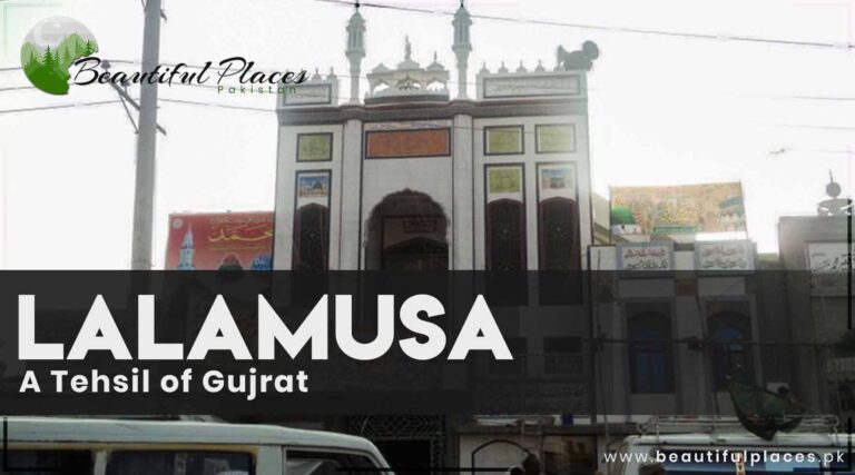
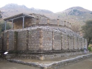
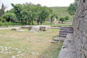
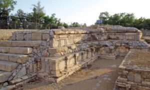
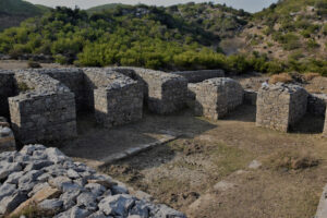
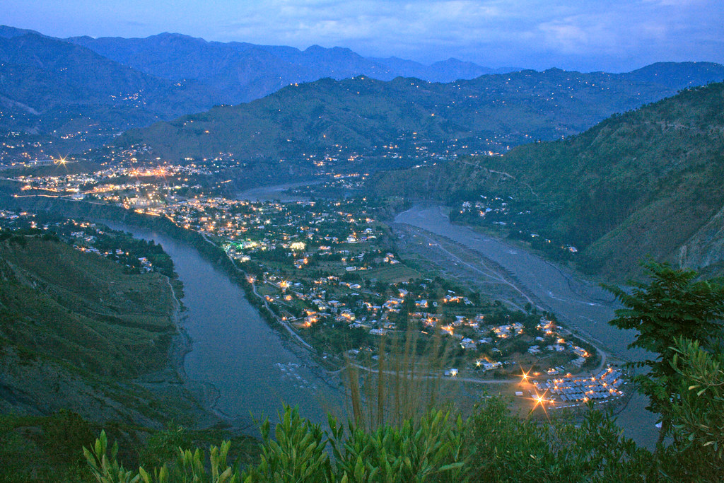
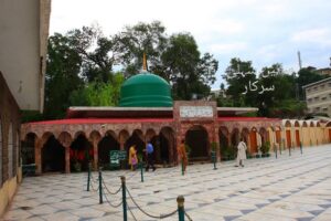
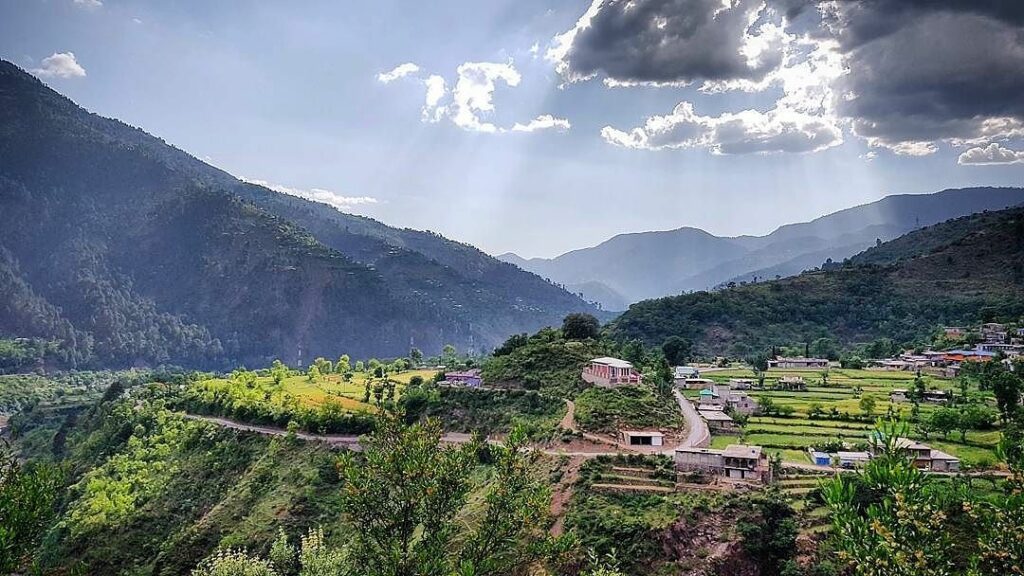
Lalamusa is one of the Tehsil in Gujrat. This small district provides all the basic facilities of life. ‘
It is well known for the personalities Alam Lohar (a folk singer) and journalist Javed Chaudhery. Vishno Devi temple is an ancient heritage.
Daal (beans) and Paratha (tortilla) of Mian G hotel on G.T road Lala Musa is a delicious dish.
The historical junction of Lalamusa
Key Info About Lalamusa
Attribute
Information
Location
Lalamusa, Pakistan
Coordinates
32.6282° N, 73.7603° E
Population
Approximately 120,000
Province
Punjab
Importance
Industrial and commercial center in the Gujrat District.
Economy
Known for its industrial and manufacturing sector, including steel mills and ceramics.
Education
Home to various schools and colleges.
Transportation
Well-connected by road and rail.
Notable Landmarks
Nishan-e-Manzil, a historical building, and various industrial sites.
Nearby Cities
Gujrat (about 20 kilometers to the east), Kharian, and Sarai Alamgir.
Alam Lohar (Folk Singer)
The grave of the folk local singer of Punjabi language Alam Lohar is on the left side of the road in Lalamusa City about 15 km from Gujrat. Please recite a Dua for him whenever you visit there.
Alam Lohar (1928–1979) was a highly revered Punjabi folk singer, musician, and cultural icon from Pakistan. Born in the small village of Achh in the Punjab region, Alam Lohar gained widespread recognition for his soulful renditions of traditional Punjabi folk songs.
Musical Legacy
Alam Lohar’s musical journey was deeply rooted in the rich cultural heritage of Punjab. He was known for his powerful and resonant voice, coupled with his ability to play the chimta, a traditional Punjabi musical instrument resembling tongs. Lohar’s performances were characterized by the raw and emotive quality of his vocals, captivating audiences across the subcontinent.
Popular Songs
One of Alam Lohar’s most iconic contributions to Punjabi music is his rendition of the famous folk song “Jugni.” His version of “Jugni” became immensely popular and remains a classic in Punjabi folk music. He also sang a diverse range of other folk songs, often accompanied by his chimta, creating a unique and authentic musical experience.
The grave of folk singer Alam Lohar
Historical Gems of Lalamusa
Lalamusa, a tehsil nestled within the Gujrat District of Punjab, Pakistan, is adorned with historical sites that resonate with the echoes of bygone eras. These sites stand as testaments to the rich cultural heritage and historical significance of the region.
Bibi Wala Maqbara
Bibi Wala Maqbara is a historic tomb that holds cultural and religious importance. It is known for its distinctive architecture and is believed to be the resting place of a revered figure, drawing visitors seeking spiritual solace.
Kotli Qazi
Kotli Qazi is an ancient site that carries historical significance. It is marked by remnants of structures that hint at the architectural styles prevalent in the region during different periods of history. Exploring Kotli Qazi offers a glimpse into the ancient roots of Lalamusa.
Tehsil Complex
The Tehsil Complex, while a contemporary administrative hub, houses historical records and archives that provide insights into the history of Lalamusa. It is a blend of the old and the new, serving as a repository of historical documentation.
Chak No. 21 Lalamusa
Chak No. 21 is an area that has witnessed historical events and is emblematic of the agrarian history of Lalamusa. The sprawling fields and landscape retain the essence of the region’s agricultural heritage.
Qabristan Road
Qabristan Road is home to several ancient graveyards, each gravestone telling stories of families and individuals who have been part of Lalamusa’s narrative over the years. These graveyards serve as silent witnesses to the passage of time.
Schools in Lalamusa
Government High School Lalamusa
The Educators School Lalamusa
New Punjab Public School
Tameer-e-Millat Public School
Iqra Public School
College in Lalamusa
Government Postgraduate College Lalamusa
Offers various undergraduate and postgraduate programs.
University in Lalamusa
Currently, there is no university within Lalamusa itself, but nearby cities like Gujrat may have university campuses.
Hospital in Lalamusa
DHQ Hospital Lalamusa
A district headquarters hospital providing medical services to the local population.
Restaurants in Lalamusa
Lalamusa, being a smaller city, may not have a wide variety of standalone restaurants. However, there may be local eateries and food stalls offering traditional Pakistani cuisine.
Frequently Asked Questions (FAQs)
What is the historical significance of Lalamusa?
Lalamusa holds historical importance as a tehsil in the Gujrat District of Punjab, with traces of ancient structures and sites reflecting its cultural heritage.
Are there notable educational institutions in Lalamusa?
Yes, Lalamusa is home to various schools and colleges catering to the educational needs of the local population, contributing to the intellectual growth of the tehsil.
What is the economic landscape of Lalamusa?
Primarily an agrarian region, Lalamusa has fertile land supporting the cultivation of crops. Additionally, there is a developing industrial sector contributing to the economic dynamism.
Are there healthcare facilities available in Lalamusa?
Yes, Lalamusa is equipped with healthcare facilities, including hospitals and clinics, ensuring that the community has access to essential medical services.
Tell me about the cultural events in Lalamusa.
Lalamusa hosts cultural events and festivals that celebrate the traditions and customs of the local community, providing a vibrant and festive atmosphere.
Are there historical landmarks to explore in Lalamusa?
Certainly, Lalamusa boasts historical sites such as Bibi Wala Maqbara, Kotli Qazi, and others, each offering a glimpse into the tehsil’s rich history.
What are the major industries in Lalamusa?
While agriculture is predominant, Lalamusa has seen the emergence of small and medium-sized enterprises, diversifying its economic activities.
Can you recommend popular restaurants in Lalamusa?
Local residents and directories can guide you to popular restaurants in Lalamusa, each offering a taste of the local culinary scene.
Tell me about the educational hub of Lalamusa.
Lalamusa prioritizes education with the presence of schools and colleges, contributing to the intellectual capital and development of the tehsil.
How is Lalamusa connected in terms of transportation?
Lalamusa is well-connected to major road networks, facilitating transportation within the region and connecting it to neighboring areas.
Last Thoughts on Lalamusa
Lalamusa, as a tehsil of Gujrat, encapsulates the essence of Punjab – a region where tradition and modernity coexist, where the land is a source of sustenance, and where the community is the heartbeat of progress. With a foundation built on history, agriculture, and evolving economic activities, Lalamusa stands as a testament to the resilience and dynamism of the Gujrat District.
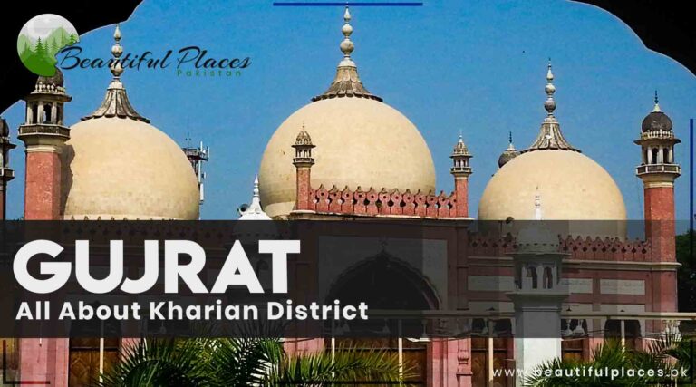
Lala Musa and Kharian are rich Tehsils of district Gujrat.
Most of the people are residing in United Kingdom UK, France, and Europe for livelihood. Therefore, high-quality products outlets are in Kharian.
A TDCP restaurant, children’s playland, and information center are also there.
Kharian is called the little Norway of Pakistan because many people in Kharain are settled in Norway.
Mesmerizing sight of Kharian Cantt. Courtesy: Facebook.
This small district is a perfect fusion of city and village life. You can enjoy a family trip there.
Key info about Kharian District, Gujrat
Attribute
Information
Location
Kharian District, Gujrat, Punjab, Pakistan
Area
Approximately 1,874 square kilometers
Population
Approximately 1.2 million (2021 estimate)
Tehsils
Kharian Tehsil, Lalamusa Tehsil, Sarai Alamgir Tehsil, and Dinga Tehsil
Major Towns
Kharian, Lalamusa, Sarai Alamgir, Dinga, and others
Languages Spoken
Punjabi, Urdu, and English
Economy
Agriculture, manufacturing, and trade.
Education
Several schools, colleges, and educational institutions.
Landmarks
The area is known for its natural beauty and historical sites.
Transportation
Well-connected by road and rail. The M2 motorway passes through the district.
Notable Personalities
Various individuals from Kharian have made significant contributions in various fields.
Historical Legacy
Kharian District boasts a rich historical legacy that echoes through its landscapes. Traces of ancient civilizations and structures offer glimpses into the cultural tapestry that defines this region. Historical landmarks serve as time portals, connecting the present to eras long gone, and include sites like old temples, forts, and architectural remnants that narrate the district’s story.
Historical Gems of Kharian District
Kharian District, nestled in the heart of Punjab, Pakistan, boasts a rich historical tapestry with numerous sites that echo the stories of bygone eras. From ancient structures to remnants of civilizations, these historical landmarks in Kharian District offer a glimpse into the cultural heritage of this vibrant region.
Bibi Wala Maqbara
A testament to the district’s cultural diversity, Bibi Wala Maqbara is a historic tomb that holds both religious and architectural significance. The site is adorned with intricate designs, reflecting the artistic styles prevalent in the region during different periods.
Mangla Dam
Although a modern engineering marvel, the Mangla Dam has historical importance. Its construction in the 1960s led to the creation of the Mangla Reservoir, reshaping the landscape and affecting local communities. The dam’s history intertwines with the development of the region.
Tilla Jogian
Tilla Jogian, a sacred hill, is not only a historical site but also a place of religious importance. With archaeological remnants dating back to the Buddhist era, it serves as a connection to ancient civilizations that once thrived in the area.
Ghumbat
Ghumbat, meaning “dome,” is a historical site featuring an ancient structure that resembles a dome. While its exact historical context may vary, it stands as a mysterious testament to the architectural heritage of Kharian District.
Mukeshpuri
While Mukeshpuri is primarily known for its natural beauty, it has historical significance as it served as a summer retreat during the British colonial era. The area’s serene landscapes and historical structures make it a notable destination.
Kharian Cantonment
The Kharian Cantonment, established during the British colonial period, holds historical importance as a military base. The cantonment’s architecture and layout reflect the colonial influence on the region.
Dinga
Dinga, a town in Kharian District, has historical sites that include old temples and structures reflecting the architectural styles of different eras. Exploring Dinga provides a journey into the district’s historical roots.
Schools in Kharian
Government High School Kharian
Punjab Group of Colleges Kharian
Beaconhouse School System Kharian
The Educators Kharian
Allied School Kharian
Fauji Foundation Model School Kharian
The Citizens Foundation (TCF) School Kharian
College in Kharian
Punjab College Kharian
University in Kharian
Kharian Institute of Medical Sciences (KIMS)
KIMS offers medical and healthcare education.
Hospitals in Kharian
Kharian Medical Complex
DHQ Hospital Kharian
Kharian Combined Military Hospital (CMH)
Restaurants in Kharian
Hot ‘n’ Chilli Restaurant
KFC Kharian
Pappu Samosa House
Al-Quresh Restaurant
Mirch Masala Restaurant
Skyways Fast Food & Restaurant
Frequently Asked Questions (FAQs)
What is the historical significance of Kharian District?
Kharian District holds a rich historical tapestry, with sites like Tilla Jogian and Mangla Dam reflecting its cultural heritage. These landmarks offer glimpses into ancient civilizations and historical events.
Are there notable educational institutions in Kharian District?
Yes, Kharian District is home to various schools and colleges that contribute to the educational development of the region. These institutions play a crucial role in nurturing intellectual growth.
Tell me about the healthcare facilities in Kharian District.
Kharian District is equipped with hospitals and clinics that provide healthcare services to the community. The healthcare infrastructure contributes to the overall well-being of the residents.
Are there famous landmarks in Kharian District?
Certainly, Kharian District boasts landmarks like Bibi Wala Maqbara, Ghumbat, and Mukeshpuri. Each holds historical, cultural, or religious significance, adding to the district’s charm.
What is the economic landscape of Kharian District?
The district’s economy is diverse, encompassing agriculture and emerging industries. Fertile land supports crops, while a growing industrial sector contributes to economic vibrancy.
Tell me about the cultural events in Kharian District.
Kharian District hosts cultural events and festivals that celebrate local traditions. These gatherings contribute to community bonds and showcase the district’s cultural identity.
Can you recommend popular restaurants in Kharian District?
Local residents and directories can guide you to popular restaurants in Kharian District. These establishments offer a taste of the local culinary scene.
What are the notable historical sites in Kharian District?
Historical sites in Kharian District include Tilla Jogian, Mangla Dam, and Bibi Wala Maqbara. These sites provide insights into the district’s historical roots.
Is Kharian District well-connected in terms of transportation?
Yes, Kharian District is well-connected through road networks, facilitating transportation within the district and connecting it to neighboring areas.
Tell me about the educational hub of Kharian District.
Kharian District prioritizes education, with the presence of schools and colleges contributing to the intellectual growth and development of the region.
Windup-Lines
Kharian District in Gujrat, Pakistan, is a place where history, culture, and modernity intersect. Its rich historical legacy, diverse educational institutions, healthcare facilities, and culinary offerings make it a vibrant and multifaceted region.
Visitors and residents alike can explore its historical gems, partake in educational opportunities, and savor the flavors of its local cuisine. Kharian District, with its unique international connections, stands as a testament to the historical and cultural tapestry that defines this dynamic corner of Punjab, Pakistan.
Sarai Alamgir is one of the three districts in Gujrat. Its name, Sarai, harks back to the Mughal era, signifying a resting place for travelers.
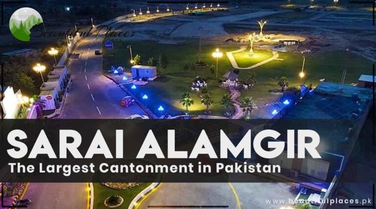
Sarai Alamgir is 15 km from Kharian Cantt near the right coastline of river Jhelum. It was settled by king Alamgir. One of its identities is Military College. It is the largest Cantonment in Pakistan
Handicrafts of Bamboo and Chick are exhibited at the corner of the road. A route goes to Mirpur Azad Kashmir which is 57 km from Sarai Alamgir Canal.
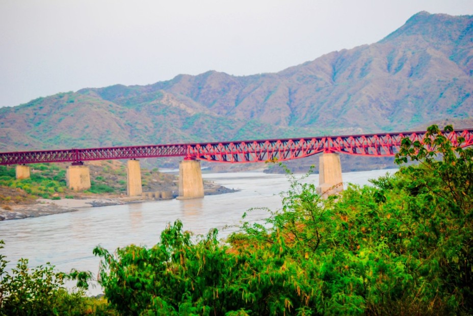
Sarai Alamgir Bridge
Key info About Sarai Alamgir
Attribute
Information
Location
Sarai Alamgir is a town located in the Gujrat District of the Punjab province in Pakistan.
Population
The population of Sarai Alamgir was estimated to be around 48,000 plus.
Geography
Sarai Alamgir is situated along the eastern bank of the Jhelum River, which flows through the region. It is known for its picturesque surroundings.
History
The town has historical significance, as it was an important center during the Mughal period and is believed to have been founded by Emperor Akbar.
Economy
The local economy is primarily agrarian, with farming and agriculture being the main sources of income for the residents.
Education
Sarai Alamgir has educational institutions ranging from primary schools to colleges, contributing to the education of its residents.
Transportation
The town is connected to major cities like Gujrat, Jhelum, and Lahore via road networks, making it accessible for transportation.
Attractions
There are a few historical sites and parks in the area, making it a potential tourist destination for those interested in history and natural beauty.
Notable Residents
Sarai Alamgir has been home to various notable individuals, including politicians, scholars, and artists.
The Mughal Connection
In the heart of Punjab, Sarai Alamgir was once a vital junction on the historic Grand Trunk Road, connecting Delhi to Kabul. The Mughals, known for their architectural prowess, left their mark here. You can still see remnants of their influence in the city’s design.
The British Influence
During the British colonial period, Sarai Alamgir was transformed into a military cantonment. The British built barracks, roads, and other infrastructure that laid the foundation for the cantonment’s modern identity.
Famous Sites
Sarai Alamgir, a town nestled in the heart of Punjab, Pakistan, is adorned with historical and cultural gems that beckon both locals and visitors. These famous sites offer a glimpse into the town’s rich heritage, showcasing architectural marvels and sacred spaces that have withstood the test of time.
Gurdwara Chakki Sahib
An epitome of religious harmony, Gurdwara Chakki Sahib is a sacred Sikh shrine with historical significance. The gurdwara stands as a testament to the town’s cultural diversity and is a place of reverence for the Sikh community.
Qila Naushera
Qila Naushera, a historical fort, is a commanding presence that dates back to ancient times. The fort’s robust architecture reflects the military history of the region and offers panoramic views of the surrounding landscapes.
Rasul Barrage
The Rasul Barrage, situated on the Jhelum River, is both an engineering marvel and a scenic spot. It serves the purpose of water regulation and provides a serene environment for visitors to enjoy the river’s beauty.
Sarai Alamgir Railway Station
A nod to the town’s connection with the railways, Sarai Alamgir Railway Station stands as an architectural landmark. Its historical charm and the bustling activity within the station offer a glimpse into the town’s transportation history.
Raja Porus’s Grave
According to local lore, the grave of Raja Porus, a historical figure associated with Alexander the Great’s invasion, is located in Sarai Alamgir. The site holds archaeological significance, connecting the town to ancient narratives.
Bhikki Shareef
Bhikki Shareef is a revered spiritual site with a historical mosque. The site attracts devotees and visitors alike, offering a tranquil space for spiritual reflection.
Baba Talib-ud-Din Shrine
A spiritual sanctuary, the Baba Talib-ud-Din Shrine is dedicated to a revered Sufi saint. The shrine is a place of pilgrimage for those seeking spiritual solace.
Jinnah Park
Jinnah Park provides a recreational space for residents and visitors. With lush greenery, play areas, and walking paths, it serves as a vibrant hub for community activities.
Sarai Alamgir Clock Tower
The Clock Tower is a prominent landmark in the town center, serving as both a functional timekeeping structure and a symbol of civic pride.
Shaheed Minar
Dedicated to the martyrs, Shaheed Minar stands as a memorial, honoring those who sacrificed their lives. The monument is a symbol of remembrance and patriotism.
Frequently Asked Questions (FAQs)
What is the significance of Sarai Alamgir as the largest cantonment in Pakistan?
Sarai Alamgir’s status as the largest cantonment in Pakistan signifies its strategic importance for the armed forces. It serves as a key military installation with various facilities and infrastructure.
Are there specific regulations for civilians living within the cantonment area of Sarai Alamgir?
Yes, living within a cantonment comes with specific regulations to ensure security and compliance. Residents are expected to adhere to certain guidelines set by the cantonment authorities.
What educational institutions are present within the cantonment of Sarai Alamgir?
Sarai Alamgir’s cantonment area likely hosts various educational institutions, including schools and colleges. Residents can access quality education within the cantonment.
How is the security maintained within the cantonment of Sarai Alamgir?
Security within the cantonment is a priority, and measures are in place to ensure the safety of military personnel and residents. Access control and surveillance systems contribute to maintaining a secure environment.
Are there recreational facilities available for civilians within the cantonment area?
Cantonment areas often include recreational facilities for both military personnel and civilians. Parks, clubs, and sports amenities may be available for the community.
Do civilians require special permissions to reside within the cantonment area of Sarai Alamgir?
Residing within the cantonment area usually requires permissions and compliance with certain criteria. The cantonment board or relevant authorities can provide information on the residency process.
What healthcare facilities are available within the cantonment of Sarai Alamgir?
Cantonments typically have well-equipped military hospitals and healthcare facilities. Residents can access quality medical services within or in proximity to the cantonment.
How does living in the cantonment of Sarai Alamgir differ from living in other parts of the town?
Living in the cantonment often comes with certain privileges and regulations not applicable in other areas. The lifestyle may differ due to security protocols and the military presence.
Is there a specific historical significance associated with the cantonment area of Sarai Alamgir?
Cantonments often have historical significance tied to military events or strategic importance. Exploring the history of Sarai Alamgir’s cantonment can provide insights into the town’s past.
How can civilians contribute to community activities within the cantonment of Sarai Alamgir?
Civilians residing in the cantonment can typically engage in various community activities, events, and social initiatives. Local community centers and organizations may facilitate such involvement.
What amenities and services are available for residents within the cantonment area of Sarai Alamgir?
Residents in the cantonment likely have access to a range of amenities, including educational institutions, healthcare facilities, recreational spaces, and other essential services.
Is there a specific process for obtaining information or addressing concerns within the cantonment area of Sarai Alamgir?
Residents can usually contact the cantonment board or relevant authorities to obtain information, address concerns, or seek clarification on matters related to living within the cantonment area.
Last Thoughts on Sarai Alamgir
Sarai Alamgir is more than a geographical location; it’s a living narrative that weaves together the threads of history, culture, and progress. As the town continues to evolve, it stands as a testament to the resilience and adaptability of its people, creating a legacy that will endure through the passage of time.
Situated on the left bank of the river Jhelum about 51 km from Gujrat, it is said that Jhelum is the smallest district of Pakistan with an area of 3587 square kilometers.
This city has four districts.
The beautiful valley Jhelum of the brave soldiers
Its name is also mentioned in Mahabharat. It has always been a city of martyrs and Ghazi. The devoted inhabitants of this homeland have always laid their lives for the protection of their country. Hats off to Jhelum.
It is also known as the Land of Soldiers, martyrs, and warriors.
The river Jhelum rises from spring Veri Nag of Himalaya range, flowing through Srinagar Dal Lake it enters Pakistan.
Key Info About Jhelum PK
Property
Information
Location
Jhelum is a city in the Punjab province of Pakistan. It is located in the northeastern part of the country.
River
The city is situated on the eastern bank of the Jhelum River, from which it gets its name.
Population
As of 2021, Jhelum had an estimated population of around 393,042 people.
History
Jhelum has a rich history and has been associated with various historical periods, including the Indus Valley Civilization, the Persian Empire, the Mauryan Empire, and more. It is known for its historical significance and ancient ruins.
Economy
The economy of Jhelum is primarily based on agriculture, trade, and small-scale industries. It has a diverse economic base, with a focus on textiles, ceramics, and agriculture.
Transportation
The city is well-connected by road and rail. The Grand Trunk Road (GT Road) runs through Jhelum, connecting it to other major cities in Pakistan. The city also has a railway station.
Education
Jhelum has several educational institutions, including schools, colleges, and a campus of the University of the Punjab.
Landmarks
Notable landmarks in Jhelum include the Rohtas Fort, the Jhelum Cantt, and the Tilla Jogian, a historical hill.
Language
The predominant language spoken in Jhelum is Punjabi, with Urdu and English also widely used.
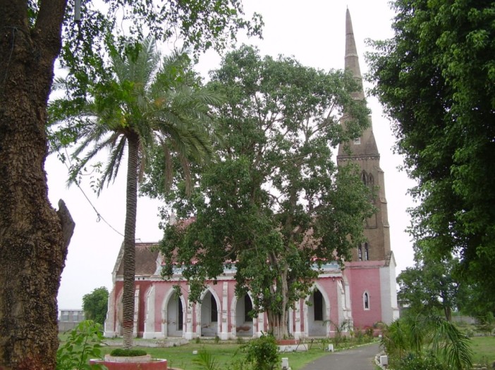
CMH mosque, Jones Church, Major Muhammad Akram Shaheed Park, and library are worth watching places of Jhelum City.
The splendid building of Johns Church Jhelum
There is an ancient Afghani Mosque near the railway bridge of the river Jhelum, the staircase of the mosque end in the river.
Indian prime minister Indre Kamal Gujral and Man Mohan Singh belonged to Jhelum. It has significant importance in history. Signs of old history are everywhere in Jhelum.
Exploring The Jhelum
Historical Echoes
Jhelum, an ancient city nestled along the banks of the Jhelum River, boasts a history that spans millennia. Tracing its roots back to the Indus Valley Civilization, the region has witnessed the rise and fall of empires, with notable influences from the Mauryas, Kushans, Ghaznavids, and Mughals. However, one of the most enduring historical landmarks is Rohtas Fort, constructed in the 16th century by Sher Shah Suri. This UNESCO World Heritage Site stands as a formidable symbol of military architecture and strategic prowess, a silent witness to the shifting tides of power in the Indian subcontinent.
The city’s association with Alexander the Great further adds layers to its historical tapestry. Jhelum, or the Hydaspes as it was known in antiquity, was the site of the famed Battle of the Hydaspes in 326 BCE. This confrontation between Alexander and KingPorus, a regional ruler, left an indelible mark on the city’s history, forever intertwining its fate with the exploits of the ancient world’s most celebrated conqueror.
Facts and Geography
Situated on the eastern bank of the Jhelum River, the city is strategically positioned in the northern part of Pakistan. The river, after which the city is named, weaves its way through the landscape, providing sustenance to the lands it touches. With a history dating back millennia, Jhelum has evolved into a vibrant urban center while retaining its historical charm.
Cultural Mosaic
Jhelum’s cultural mosaic is a harmonious blend of diverse influences. The city has been a melting pot of Hindu, Buddhist, and Islamic traditions, each leaving an indelible mark on its customs, art, and architecture. The Raja Bahadur Kamakhya Temple and Tilla Jogian, a sacred hill associated with Guru Nanak, bear testimony to the city’s cultural diversity.
Famous Places
Rohtas Fort
A colossal fortress, Rohtas Fort, with its imposing walls and strategic design, is a testament to military architecture. It not only served as a defensive bastion but also stands as an architectural marvel.
Khewra Salt Mines
Although not within the city limits, the Khewra Salt Mines are a notable attraction nearby. These mines, the world’s second-largest, boast intricate salt carvings, underground chambers, and therapeutic environments.
Old City and Bazaar
The old city of Jhelum exudes an old-world charm with narrow streets and traditional architecture. The bustling bazaar is a vibrant hub where the past and present converge.
Peer Chattal Shah Shrine
A Sufi shrine, the Peer Chattal Shah Shrine, attracts devotees seeking spiritual solace. The shrine is not just a religious site but also a cultural beacon.
Modern Dynamism
While Jhelum cherishes its historical legacy, it is equally a dynamic modern city. Urban life thrives amidst historical remnants, and the city has embraced progress without losing touch with its roots. The convergence of tradition and modernity is evident in the bustling markets, educational institutions, and vibrant local festivals.
Jhelum has a rich historical heritage, dating back to ancient civilizations, and it was a key location during Alexander the Great’s campaign in the Indian subcontinent.
What are the major tourist attractions in Jhelum?
Notable tourist attractions include Rohtas Fort, Tilla Jogian, Khewra Salt Mines, and the old city with its bustling bazaar.
How can I get to Jhelum?
Jhelum is accessible by road, and it’s well-connected to major cities in Pakistan. The nearest airport is in Islamabad, which is approximately 100 kilometers away.
What is the local cuisine in Jhelum?
Jhelum offers a variety of local dishes, including biryani, seekh kebabs, nihari, and traditional Punjabi dishes. You can also find international fast-food chains in the city.
Are there any famous educational institutions in Jhelum?
Yes, Jhelum is home to well-known schools and colleges, including Government Murray College and various branches of the Beaconhouse and City School systems.
Is Jhelum a safe place for tourists?
Jhelum is generally considered a safe place for tourists. However, as with any travel destination, it’s advisable to exercise standard precautions and stay updated on local conditions.
What are the best times to visit Jhelum?
The best time to visit Jhelum is during the cooler months, from October to March, when the weather is pleasant for sightseeing and outdoor activities.
Are there any religious or cultural festivals celebrated in Jhelum?
Yes, Jhelum celebrates various religious and cultural festivals, including Eid, Diwali, and Muharram. These festivals are an excellent opportunity to experience the local culture and traditions.
What healthcare facilities are available in Jhelum?
Jhelum has several hospitals and healthcare facilities, including DHQ Hospital, Aziz Bhatti Shaheed Teaching Hospital, and Maryam Memorial Hospital, providing medical services to residents and visitors.
Can I explore the old city on foot?
Yes, the old city of Jhelum is best explored on foot. Its narrow streets and traditional architecture offer a glimpse into the city’s historical charm, and you can easily wander through the bustling bazaars.
Last Thoughts on Jhelum
Jhelum, with its storied past and dynamic present, stands as a living testament to the passage of time and the resilience of cultural heritage. From the echoes of ancient battles to the vibrant pulse of contemporary life, Jhelum continues to narrate a tale that captivates historians, travelers, and enthusiasts alike. As it navigates the currents of the 21st century, Jhelum remains a city that treasures its history, celebrates its diversity, and beckons those eager to explore the depths of its storied past.
Completed in 1541, this fort was built by Sher Shah Suri (Farid Khan) for the suppression of Gagrahs. Actually, they used to help the Mughals against Sher Shah Suri.
At the completion of this fort, Sher Shah Suri said” I have stabbed the backbone of the enemy”. It is one of the greatest forts in South Asia. Different arguments are given about the meaning of the word Rohtas.
Rohtas Fort – UNESCO World Heritage Site
According to locals, Rohtas has the meaning of “Shining like an egg”. This fort used to shine in the night because of its construction material. That’s why it was named “Rohtas”.
There is also a Rohtas Garh Fort in India. Heavy large giant bricks are used in the construction of this fort instead of small bricks like in the other forts.
Key information about Rohtas
Name
Rohtas Fort
Location
Near Jhelum, Punjab, Pakistan
Built By
Sher Shah Suri
Construction Period
1541 – 1548
Purpose
Defensive military fortification
Architectural Style
Afghan-Persian
UNESCO World Heritage Site
Yes
Key Features
Thick defensive walls, 68 bastions, 3 main gates
Historical Significance
Built to suppress Gakhar tribes
Importance
A UNESCO World Heritage Site and a symbol of military architecture of its time
According to research, Rodomel had announced a gift of one gold coin to the mason as per day wage. This fort was completed in four years seven months and twenty-one days with the expense of 34 lacs and 25 thousand.
This fort with a perimeter of 4 km was divided into two sections. A 1750 feet high wall was constructed for dividing the residential area and military section.
The military size of the fort can be gauged from the fact that apart from artillery, 40,000 infantry and 30,000 troops were stationed here. About 86 large towers and 12 doors were built for the safety of the fort. Each door was numbered.
The most splendid, worth-watching part of this fort is its majestic boundary wall. It is still present in pretty good condition.
There is a small beautiful mosque near the Kabuli door. This mosque is one of the rare and splendid pieces of construction by Sher Shah Suri.
Raja Man Singh, a faithful general of Mughal ruler Akbar Azam built a palace. It was called Haveli Man Singh. it is located on the top of a high hill and its architectural style reflects Hindu architecture.
The palace of the widowed sister of Man Singh Srimati Roop Kumari is at a distance of 300 yards from his palace. Wells were dug called “Baoli” for fetching water. Baddi Bowli (water well) and Sat Bowli are still present there.
The inhabitants of this area used to fetch water from these wells. A pond has been built there in the southern part and Eid Gah in the center.
The gallows of the fort are on the fourth floor. Considering the charming high workmanship, great architecture, and archaeological importance of this fort, it is included in the UNESCO World Heritage Site.
A museum is established on the upper building of Sohail gate. The sculpture of Sher Shah Suri, his two swords, weapons, coins, clothes, and many other rare things are exhibited there.
A signboard “Rohtas Fort 8 km” is hanging on the left side of city Dina on the G.T Road, about 15 km away from Jhelum.
The Neighbouring Sites of Rohtas Fort
Siri Chola Sahib
This building was constructed by Raja Ranjeet Singh and is located northwest of the Rohtas fort. It is used as a worship place by Sikhs.
It is said that Baba Guru Nanak gave the good news to the king that his seven generations would rule the Subcontinent. And this prediction came true.
Tilla Jogian
One of the oldest temples of Hindus Tilla Jogian is located in the southwest of Jhelum – the land of rain gutters, springs, and minerals besides Gorakh Natas, priests, sadhus, pandits, and monks.
It is narrated that the Tilla was established by Guru Gorakh Nath in the first century B.C. It is the highest peak of the Eastern Salt Range about 3200 feet elevated from sea level.
According to the research of General Ghangam, this temple of Tilla Jogain was present at the time of the Great Alexander. There are several historical buildings on the mountain top and in the surroundings.
These buildings have large water ponds, twelve temples, a Dargah, a Buddha monastery, and a water storage pond of Mughal and Central Asian style. The aerial view from Tilla Top situated 24 km from Rohtas Fort is so enchanting.
The sunrays first fall here at this top. That’s why thousands of years ago the Hindu worshippers of the Sun used to come here to preach about the sun.
It is mentioned in the folk tale of Waris Shah. Ranjha went to Tilla Jogian to take Jog for his Heer. The founder of the Sikh religion Baba Guru Nanak meditated here for forty days.
Raja Ranjeet Singh has built a memorial there. Mughal Monarch Jahangir visited this place many times. Old buses go to Tilla Jogain directed from Dena to Rohtas fort.
The historical sacred place of Hindus and Sikhs
These buses will drop you on the way. You have to reach the Tilla top on foot. You can reach the top via jeep. It is an adventurous place for bikers. Please arrange water and food for the journey to the top.
A TDCP camping site and the kicking area are also there.
Mangla Tourist Resort and Army Water Sports Club
Mangla Dam was built in 1976 and is located a few kilometers away from Mangla Mirpur Road on Dena Bypass. A permission letter is required from PRO WAPDA Mangla or WAPDA House Lahore for visiting this dam.
Pakistan army’s resorts and private tourist resorts are established near the lake of the dam. There are facilities for sailing, rafting, water gliding, boating, and restaurants.
The enchanting site of mangla dam
You can enjoy it by motorboat, speed boat, water scooter, and launch.
Lehri’s National Park
This area is included in the National Parks of Pakistan and is located in Potohar Plateau Dina district about 10 km from G.T Road. It is near Lehri Village and is named after it. Named after the nearby Lehri town, this national park is a haven for nature enthusiasts and wildlife aficionados. Spread across lush landscapes, the park is characterized by rolling hills, dense forests, and meandering streams, offering a serene escape from the hustle and bustle of urban life.
The park is home to a diverse range of flora and fauna, with a variety of indigenous plant species adding to the scenic beauty. Visitors to Lehri’s National Park have the opportunity to witness an array of wildlife, including deer, foxes, and various species of birds. The presence of hiking trails and picnic spots provides outdoor enthusiasts with an ideal setting to explore the natural wonders of the region.
Lehri National Park
Fort Nandana
This fort is located on a large mountain near Bhaganwala in Tehsil Pind Dad Khan. It was built with stones, mud, lime, and red sand. It has significant importance in history because of three sweet water wells.
Sultan Mehmood Ghaznavid defeated the grandson of the king Nandyal in the 10th attack. In the 13th century, the fort was demolished during the attack of the Mongols.
Nanda Fort
Renowned Muslim Tourist Al-Baroni stayed here. It is narrated that he measured the circumference of the Earth. There is a temple and a mosque.
During the excavation in 1976, thirty graves of Mehmood Ghaznavid’s armed men have been discovered.
FAQs
What is the historical significance of Rohtas Fort?
Rohtas Fort holds immense historical significance as a military fortress built by Sher Shah Suri in the 16th century. It was strategically constructed to impede the return of the Mughal Emperor Humayun to India.
Why was Rohtas Fort built?
The fort was built as a defensive military structure to block the advances of Emperor Humayun. Sher Shah Suri, having seized power, aimed to establish his authority and thwart any attempts by Humayun to reclaim the throne.
What architectural features make Rohtas Fort unique?
Rohtas Fort is renowned for its massive sandstone walls, 12 grand gates, and various bastions. The architectural style reflects a blend of Afghan and Turkish influences, showcasing the military engineering brilliance of the time.
What structures can visitors explore within Rohtas Fort?
Visitors to Rohtas Fort can explore notable structures such as Haveli Maan Singh, Rani Mahal, Sohail Gate, and Talaqi Gate. These structures add depth to the historical narrative of the fort.
Why is Rohtas Fort designated as a UNESCO World Heritage Site?
In 1997, Rohtas Fort was recognized as a UNESCO World Heritage Site due to its exceptional universal value. It stands as a well-preserved example of medieval military architecture, offering insights into the historical context of the region.
How can one access Rohtas Fort?
Rohtas Fort is approximately 109 kilometers from Islamabad and is easily accessible by road. Visitors can reach the fort by private or public transportation.
What conservation efforts are in place for Rohtas Fort?
Ongoing conservation efforts aim to preserve the structural integrity and historical significance of Rohtas Fort. These efforts focus on maintaining the fort as a cultural heritage site.
Are there guided tours or information available for visitors?
Yes, there are tourist information centers and guides available at Rohtas Fort to enhance the visitor experience. These resources provide valuable insights into the history and significance of the fort.
Can visitors explore the interiors of Haveli Maan Singh and Rani Mahal?
Yes, visitors have the opportunity to explore the interiors of Haveli Maan Singh and Rani Mahal, experiencing the grandeur and historical ambiance of these structures.
What makes Rohtas Fort a unique destination for tourists?
Rohtas Fort offers a unique blend of historical significance, architectural brilliance, and natural beauty. It provides visitors with an immersive experience, allowing them to step back in time and witness the grandeur of medieval South Asian history.
Last Thoughts on Rohtas Fort
Pakistan is blessed with historical landmarks, beautiful lakes, and mesmerizing sites. Rohtas Fort is one of them. It is included in the UNESCO World Heritage Site.
The restaurants and hotels make it a good point for tourists and holidaymakers.
The Khewra Salt mines were discovered in 326 B.C during the fight between the Great Alexander and Raja Porus on the shoreline of the river Jhelum. The horses of the troopers were found licking the stones during grazing.
This gave them a clue about the presence of salt. Now, the mining of salt is continued here. Khewra Mine is the second largest salt mine in the World. About 220-million-ton minerals are located here.
The Second Largest Salt Mines in the World
The Kohistan Range starts from Bego wala near the river Jhelum and ends at Kala Bhag River Indus. Its length, width, and height are 300km, 8 to 33 km, and 2200 to 4990 feet (Koh Sakesar) respectively.
It is also considered a geological museum. It is because there are traces of the pre-Cambrian era to AH about a billion years ago. In1849, the British started mining on the basis of Scientific terms.
In 1872, a renowned British mining engineer Dr. Warth dug a large mine to gain access to the salt deposit that is still in operation. Nowadays, salt is being obtained from the seventeen levels of the salt mine.
According to scientific principles, 50% of the salt is extracted while the remaining is left there to ensure the strength of the mine.
Key info about Salt Range
Attribute
Information
Location
Khewra, Punjab, Pakistan
Discovery
Ancient times, but officially opened in 1872
Depth
Approximately 945 feet (288 meters)
Length
About 18 miles (29 kilometers) of tunnels
Salt Reserves
Estimated to have over 600 million tons of salt
Salt Composition
Primarily composed of rock salt (halite)
Salt Mining Method
Underground mining with drilling and blasting
Geological Significance
One of the world’s oldest and largest salt mines
Tourism
Major tourist attraction with salt sculptures
Health Benefits
Believed to have therapeutic properties
Industrial Use
Salt production and various industrial processes
Transportation
Salt is transported through rail and road networks
Environmental Concerns
Efforts to address salt dust and waste disposal
Khewra Salt Mine Tourist Resort
Let us travel the mine. You can contact to PMDC office for the guide. A female guide is also there. A mini-train outside the tunnel will take you to travel the 1 km long salt mine. You can travel on foot.
But a train is a better option because he will guide you about different processes and spots. The tourists are only allowed on the sixth floor and they think that is the ground floor. All recreational spots are established there.
Inside the Khewra Mines
A mosque from salt bricks, Chagii mountain, an internet café, Angoori Garden, and a Pakistan minaret are built in the Chandni Chowk located inside the mine. A post office made of salt bricks is also there.
There is a crystal valley below on the right side of the Pakistan minaret. This crystal salt is only found in Pakistan. It is also called Diamond Valley.
The 240 feet high assembly height is estimated by blowing a paper. There is a way called Pul Sirat and a beautiful Sheesh Palace is built from pink crystal salt. After crossing the Pul Sirat, there is Dewar-e-Mohabbat (wall of love) and Dewar-e-Cheen (wall of China).
A pond beyond the wall of China is named “Jheel Saif-ul-Malook”. A portrait of Allama Muhammad Iqbal and the name of Muhammad ﷺ are exhibited on the wall.
On the return from Pul Sirat, there is Anarkali and Nithya Gali. A beautiful restaurant is located near Sheesh Mahal. You can also visit hundreds of years old tracks on the western hill and enjoy an aerial view.
Hospital
A hospital model is placed on the right side of the Chandni Chowk. But the actual hospital is on the seventh floor. In this special hospital, the patients with allergies and Asthma are kept in a different environment for 110 hours.
This type of arrangement is also available in Ukraine and Poland for patients with allergies and asthma. The PMDC tourist resort is located outside the salt mine. You can stay there after your reservation.
You can buy different products made of salts from the shops outside the resort. You can get a bus for Khewra and Pind Dad Khan from Jhelum.
Khewra has located 230 km from Lahore via motorway, and 30 km away on the Pind Dad Khan Road. The distance of Mandra, Dadiyal, Chakwal and Khewra is 160 km from Islamabad.
FAQs
What is the historical significance of Khewra Salt Mine?
Khewra Salt Mine holds historical importance dating back to the time of Alexander the Great. Its discovery by his troops in 320 BC marks the beginning of its historical legacy.
What makes Khewra Salt Mine a unique geological attraction?
The mine is renowned for its extraordinary salt formations, intricate crystals, and naturally occurring sculptures, making it a visually stunning geological marvel.
How can visitors access Khewra Salt Mine?
Khewra Salt Mine is accessible by road, approximately 160 kilometers from Islamabad and 260 kilometers from Lahore, making it a feasible destination for day trips or extended visits.
What wellness opportunities does the mine offer?
The mine’s microclimate, rich in salt particles, is believed to have therapeutic benefits. Visitors can experience these wellness benefits in designated salt therapy rooms within the mine.
Is Khewra Salt Mine suitable for educational visits?
Absolutely. Guided tours offer insights into the mine’s history, geological formations, and cultural significance, making it an enriching educational experience.
How has the mine embraced sustainability in tourism?
Khewra Salt Mine places a strong emphasis on sustainable tourism practices to ensure the preservation of delicate salt formations. Conservation efforts are in place to balance tourism with environmental protection.
Are there recreational amenities available for visitors?
Yes, the mine provides well-maintained pathways, illuminated chambers, cafeterias, and souvenir shops, enhancing the overall experience for visitors of all ages.
What is the artistic significance of the mine’s underground chambers?
Beyond geological wonders, the mine features intricate salt carvings and sculptures, showcasing the artistic capabilities of the miners and adding an artistic dimension to its appeal.
Can visitors explore the mine independently or are guided tours necessary?
While some areas may be explored independently, guided tours are recommended to fully appreciate the mine’s history, geological features, and cultural significance.
Is Khewra Salt Mine suitable for all age groups?
Yes, the mine caters to visitors of all ages. Its diverse attractions, educational value, and wellness offerings make it an inclusive destination for families, students, and tourists alike.
How does Khewra Salt Mine contribute to the region’s cultural heritage?
The mine’s historical legacy, cultural importance, and unique features contribute to the preservation and celebration of the region’s rich cultural and mining heritage.
Last Thoughts on Salt Range
the Khewra Salt Mine’s significance as a tourist resort lies in its ability to offer a multifaceted experience. It appeals to those seeking natural beauty, historical insights, wellness opportunities, and educational value. As a testament to the harmonious coexistence of nature, history, and tourism, Khewra Salt Mine continues to draw visitors from far and wide, contributing to its enduring significance as a unique and memorable destination.
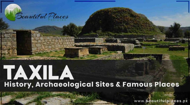
The city of Taxila is located at the head of Doaba (a place between two rivers) in between the river Indus and the river Jhelum. It was famous as Taxshasila and Takhasila in the Sanskrit language in the past.
However, it was called Taxila in Rome and Greece. The Britishers used to call it Taxila at the time of the Invasion by Alexander the Great on the Subcontinent.
Taxila, A Historical Landmark
Today this modern city is renowned for archaeological sites, gravel stones, marble, stone utensils, decoration items, and heavy mechanical complex. There are more than 50 archaeological sites around 30km on the outskirts of Taxila.
Key information about Taxila
Name
Taxila
Location
Rawalpindi District, Punjab, Pakistan
Historical Significance
An ancient city with a history dating back to 6th century BCE, a center of Buddhism, and a hub for learning and culture
Archaeological Importance
UNESCO World Heritage Site, a significant center of ancient Buddhist civilization
Located in the picturesque Taxila Valley, surrounded by Margalla Hills
Notable Periods
Achaemenid, Mauryan, Indo-Greek, and Gandhara Buddhist periods
Educational Institutions
Ancient Taxila was a renowned center of learning and attracted students from across the world
Alexander’s Visit
A historical link to Alexander the Great’s visit and interactions with local scholars
Monasteries & Stupas
Abundance of monastic complexes, stupas, and relics showcasing Buddhist influence
Gandhara Art
Known for its distinctive Gandhara art, a fusion of Hellenistic and Indian styles
Ancient Trade Hub
Played a crucial role in trade along the Silk Road
Present-day Significance
A place of historical and cultural importance, attracting scholars, historians, and tourists
Accessibility
Easily reachable from Rawalpindi and Islamabad
Preservation Efforts
Continuous restoration and conservation work to safeguard the heritage
Languages
Urdu, Punjabi, and English widely spoken
Nearby Attractions
Islamabad, Rawalpindi, Margalla Hills National Park
Local Markets
Offer Gandhara art replicas and other handicrafts
Accommodations
A range of hotels and guesthouses for tourists
Climate
Mild, with warm summers and cool winters
Unique Features
The Taxila Museum houses an extensive collection of artifacts from the region’s history
Local Cuisine
Traditional Pakistani and Punjabi cuisine
A brief History of Taxila
When Alexander the Great reached the Indus after continuous conquests, King Taxilas came across the river to meet him.
They formally greeted each other. King Taxilas said, “if you are not here to take away water and other necessities of life then what shall we fight for?”. It is because these are the few reasons for which people fight. “Yet the items like gold and silver are concerned, if I am richer than you then I will give a part of my jewels and money.
And If I am poorer than you, I am not interested in your wealth”. Alexander replied; “What do you think that you will escape by showing this act of politeness? If you think so you are at fault. I will fight the war of givenness and benefit till my last breath.
I will never let you go beyond me”. They exchanged valuable gifts and let the Taxilas live happily with his state. King constructed a bridge of boats for Alexander at the point of Aohind hund
The Archaeological Sites and Famous Places in Taxila
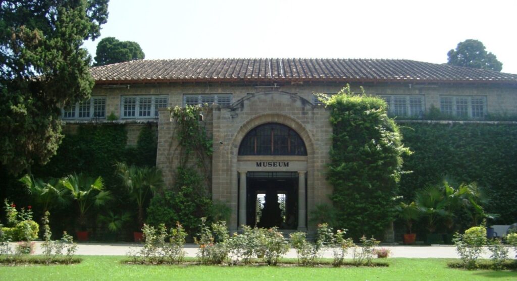
The museum
Its foundation was led by general lord Chelmsford in 1918. It is located in the center of an orchard. On 15th April 1928, Habib Ullah member of the Education department inaugurated the museum.
The design for the building was devised by the principal of Meo School of Art Lahore S.M Silwan. This museum with a central hall and two galleries has more than 7000 rare artifacts discovered from Taxila.
The Taxila Museum of History
It has stone, lime, and mud sculptures, ancient coins, Sanskrit and Brahman, the Kharosthi alphabet, mud and metal utensils, and jewelry of gold and silver.
It has significant importance on the international level since it is the largest center of Gandara civilization. It is closed on the first Monday of every month.
Sir John Marshall
He was appointed the director of archaeology in 1902 in the British regime. He did the survey and excavations at Char Sadda, Raj Garh, Sir Nath, Sravasti, and Mohen Jodaro in his interest.
He excavated the ancient traces of Taxila from 1913 to 1934. He also established the Taxila museum. As we enter the museum, the personal chair, table, portrait, and belongings are arranged systematically on the right side of the museum.
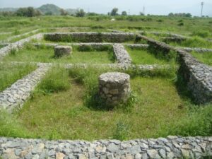
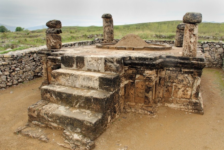
In 1913, the excavations in Taxila began under the supervision of Sir John Marshall. It is one of the oldest cities, Stupa, and Temples
Bhir mound (200 to 600 B.C.)
The museum of Taxila is located adjacent to this ancient city. In the 6th century B.C. Achaemenid King Darius, I conquered Gandara. And led the foundation of the capital of the state.
Here he introduced engraved coins, Bars, stamps, Aramaic writing, and Kharosthi alphabets. In 326 B.C., King Ambahi after being defeated by Alexander invited the great Alexander to this place.
Here Alexander met kotelia and Chander Gapat Moria. Prince Ashok and Kunal also ruled there. Raja Ashok introduced Buddhism here for the very first time. After his death, Greece destroyed Taxila and Gandara.
The 2000 years old mound in Taxila
Sirkap ( 200 B.C to 200 A.D)
In the second century B.C., when Bactrian Greek King Demetrius invaded Taxila, he established a new state of Bactrian Greek. He settled in a new city Sirkap too.
A boundary wall and four doors were built to save the city. This second town of Taxila is called Diomalai folktale Raja Risalo and the Sirkap from the seven demons.
In the 40th A.D., a disciple of Jesus Scent Thomas reached Sirkap Taxila. The king welcomed him into the court. Famous tourist Apollonius visited Taxila in 44 A.D. and said that it is like Nineveh city and fenced like Greece.
The narrow streets are like Athens. There are traces of the Greek, Saka, and Pahlavi epochs.
An ancient steps temple in Sirkap Taxila
In the second century A.D., Kashan rulers destroyed Pahlavi’s reign and led the foundation of a large empire which was stretching to the river Ganga.
This ancient city is 2 km from Taxila Museum. Its reliquaries are still unique because of chess-style bazaars and straight roads.
Jandial temple (100 B.C.)
Greek-style beautiful pieces have been discovered from this temple located at a distance of 300 meters from the north door of Sirkap city. This temple is dedicated to The Zoroastrian nation.
Jandial Temple of Buddha Civilization
Sir Sikh (200 B.C. to 500 B.C.)
Kashan rulers settled the third city of Taxila in 80 A.D. at a distance of 2km from Taxila’s second city Sirkap.
It is narrated that the name of sir Sikh’s brother was Sirkap. He was the person who ruled this area. The 18 feet wide wall of this city reflects its brilliant past.
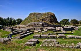
Dharmarajika Stupa (200 B.C. to 500 B.C)
It is the oldest and largest monastery of Buddhism in Dharmarajika Taxila. It is located at the edge of the Dharam stream.
This monastery was built by monarch Ashok of the Maurya family on the sacred ashes of Mahatma Buddha.
Maharaja Ashok was called Dharmarajika because he served Buddhism. That’s why this monastery was given the name “Dharmarajika”. Its central stupa has a diameter of 131 feet. And the dome has a height of 45 feet.
The stupa was damaged in the earthquake of 40 A.D. during the Kashan regime, it was reconstructed and renovated two times. And different sights of his life were shaped on the stones.
These stones were fixed near Stupa. At the end of the fifth century, Kashan lost his state to Safeed Hun. This place is 3km from Taxila’s museum in the North near Shah Pur village.
The Oldest Monastery of Buddha in Taxila
Kunal’s Stupa
This stupa is located in the southwest of Sirkap city on a hilltop. It is dedicated to the son of King Ashok. It is said that his stepmother had destroyed his eyes while taking revenge.
Jaulian Monastery
Jaulian Buddhist Monastery in Taxila
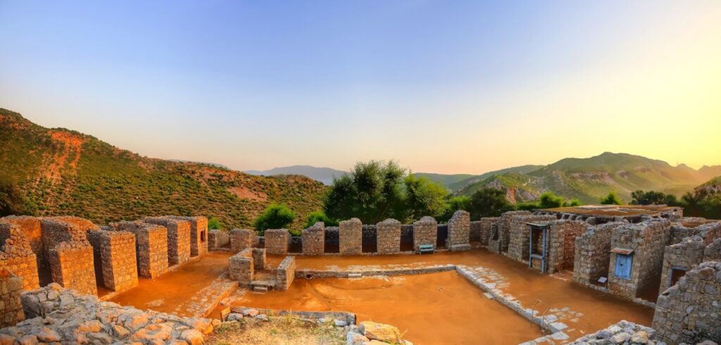
From Taxila Museum, on Haripur Road, a small road to the northeast from Nakra Bangla stop leads to Jaulian Stupa.
The archaeological remains of Jaulian belonged to the Kashan era. It consists of a Buddhism stupa constructed at a height of 300 feet and a Monastery.
Large stones are shaped and transformed into different sculptures. They depict the life events of Mahatma Buddha.
Such a huge amount of sculpture is rarely seen anywhere. Therefore, national and international researchers consider it mandatory to visit this place.
Mohra Muradu (200 B.C. to 500 B.C.)
This monastery of Buddhism belonged to the second century and is built away from the city. It is built on hatiyal hill for meditation. In the fourth and fifth centuries, it was furnished and renovated on a large scale.
Its stupa is fixed at 14 feet high podium. However, a Gandara-style style monastery consists of 27 rooms. The novel discovery of this place is 20 feet high around Manti Stupa.
The Mohra Muradu Temple
It was established as a memorial to a respectable and honorable teacher. The stupa in the central hall of Taxila Museum is a replica of the stupa in the Room of Mohra Murad temple.
This Buddhism worship place is in the west of Monastery Jaulian and on the east side of Taxila Museum About 6km away.
Piplan
It is called piplan due to the thick shady trees of peepal. They used to provide shade during sunlight and rain to everyone before excavations.
Different archaeological remains have been discovered during excavations and they are placed one over the other.
This monastery of ancient times was built at the beginning of the Kashan regime. But it was ruined in the fourth and fifth centuries.
The archaeological remains in Piplan Image Courtesy Dawn.
These traces were leveled and a new monastery was built. Its architectural style reflects Mohra Murado and Jaulian. This monastery is 6km away from Taxila Museum.
Jinnan wali Dheri (400 A.D. to 500 A.D.)
This monastery of Buddhism and Stupa traces are located about 10km to the northeast of the museum and 3km to the west of Jaulian village in Bhera village. It is a fine piece of architecture.
Jinnan Wali Dheri
Khola Inn
The stone discovered from Khola Inn gives a clue that Taxila was settled in 3000 B.C. These traces are assumed to be the first building of Taxila. The remains of Khola Inn have located 3km the southwest from bharr mound.
Hatiyal
These traces were discovered in 1980 and proved that this is the place where Mahabharat -the sacred book of Hindus, was first recited in a court.
Giri Fort
This fort is located beneath the margala hills about 8km away from Taxila on the northeast side. There are signs of two monasteries and Stupa.
One of them is below the hill and the other one is at the hilltop. Giri fort is at the hilltop and was built by Buddhist worshippers in the fifth century.
The Ruins of Giri Fort Taxila
After that, Sultan Masood, the son of Sultan Mehmood Ghaznavid stayed here too. Khurram Gujjar and Khurram Paracha villages are the ways to this fort.
Bhalmala
It holds a significant status because of its Christianity cross sign architecture style. A plate was discovered there to depict the death scene of Mahatma Buddha.
A monastery like other monasteries is located on the East side of Stupa. The first stop for every trade flock traveling from Taxila to Resham highway in the northeast is Bhalmala Which is 22km away from Taxila Museum.
The beautiful scenery of Bhamala Pakistan
The role of King Ashok and Chandragupta Maurya is very important therefore it is important to write about their life history.
King Ashoka
He is called the greatest king in the history of the subcontinent. He is also called Ashoka the Great. A sculpture of three lions on the pillar top of Sang Khara is the national sign of modern India.
Raja Ashoka ordered to build this and it was discovered by Sarnath. Ashoka was born in Bundu SAR. He was fond of luxury at a young age. He eradicated the rebellious activities in Taxila in his father’s government.
In 272 B.C., after the death of his father, he became the king. His rule was all over Pakistan, in the southwest area of Balochistan and the Northern areas of the province KPK. At that time, Pakistan had two names, Ithrapath and Adichie.
While the Taxila was the capital. Patali Puttar was also its capital. In the war of 261 B.C., he was conquered but about one lac people were killed. 1.5 lac were arrested and millions of people were sick and starved.
After seeing the terrifying results of the war, he stopped his war policy and adopted the peaceful religion of Buddhism. He sent the Buddha scholars not only to Subcontinent, Sri Lanka, and Burma but also to Tibet, China, Japan, Egypt, Sham, and Maqdunia.
He declared Buddhism the royal religion. He engraved the orders, announcements, and instructions of the government near the public speaking places on a hill or a stone. 36 orders of such kind have been discovered to date.
These all orders are written by the engravers of Taxila. He was the first ruler of the Subcontinent who built Stone buildings. Kashmir valley’s city, Srinagar was settled by Ashoka.
Pakistan was very prosperous during his tenure. A luxury lifestyle was common. Most of the people were well-literate.
He died in 232 B.C. and ruled this area for 40 years. Nobody knows how he died. But according to a Tibet narrative, he died in Taxila.
King Ashoka
Chandragupta Maurya
He was the son of a Gypsy Tribal chief. While his mother belonged to a low caste. He gained military pieces training.
He had a conflict with Magda’s king Nand Raja due to some reason and the king ordered him to leave the country.
When he came to Punjab, he met Alexander the Great. He urged him to attack Magda. But his wish never came true because Alexander left this place.
After the death of Alexander The Great, there arose a rebellion against the Greeks in Punjab. Chandragupta Maurya gathered the army and defeated the Greeks with his assistant Chankia.
He captivated most of the area in Punjab. Later on, he invaded Magda and killed Raja Maha Padm Dhan Nand. He became the king and led the foundation of the Maurya family after his mother’s name.
Slowly and gradually, he conquered a different state and set a vast state. He made patli Puttar his reign’s capital. His state prevailed from Bengal to Koh Hindukush. And from Himalayan to Narbada.
His army had 6 lac people, 30 thousand armed men, 9 thousand warrior’s elephants, and 8 Ruth’s. In 297 B.C., he gave his government to his son Bundu SAR and went to the forest with Mahatma Badar Baho. He died of starvation.
Khan Pur Lake and Dam
This dam is built on the river Haro. Its purpose is the supply of water to Hazara, Rawalpindi, and Islamabad for drinking, irrigation, and industrial needs.
It is 167 feet high and stretches at a length of 1550 feet. It has a capacity of storing 2.5 lac acres of water.
This lake is 48 km away from Islamabad and located near Khanpur town of province KPK. That’s why it is called Khanpur lake.
The mesmerizing lake of Khanpur Lake Dam
Every year, the KPK tourism development corporation held sailing and other sports competitions. Moreover, fishing and sailing facilities are there for tourists and the students who came with informative tours.
Families of Rawalpindi, Islamabad, Abbottabad, Haripur, and Taxila come here for a picnic on weekends. You can reach there from Taxila via an Auto and a Suzuki van.
Schools in Taxila:
City Public School Taxila: A reputable school offering primary and secondary education with a focus on academic excellence.
Fauji Foundation Model School: A school run by the Fauji Foundation, providing quality education to students in the region.
Colleges in Taxila:
Government Degree College for Women: This college offers undergraduate programs for female students in various disciplines.
Government Degree College for Men: Provides undergraduate education for male students in a range of fields.
Universities in Taxila:
University of Engineering and Technology (UET) Taxila: Known for its engineering and technology programs, this university is a prominent institution in the region.
Hospitals in Taxila:
THQ Hospital Taxila: A government-run hospital that provides medical services to the local community, including emergency care and outpatient services.
Taxila Institute of Medical Sciences (TIMS): A private hospital and medical institute offering a wide range of healthcare services.
Restaurants in Taxila:
Food Street Taxila: A popular spot for local and traditional Pakistani cuisine. It offers a variety of dishes and is a favorite dining destination.
New Savour Foods: A restaurant known for its delicious fast food and traditional Pakistani dishes.
Zaika Restaurant: Offers a diverse menu with a mix of Pakistani, Chinese, and fast-food options.
Fast Food Junction: A small eatery serving quick and tasty fast-food items like burgers, sandwiches, and fried chicken.
FAQs
1. What is the historical significance of Taxila?
Taxila is an ancient city with a history dating back to the 6th century BCE. It was a center of Buddhism and a hub for learning and culture. It played a crucial role in ancient Buddhist civilization and was a significant trade hub along the Silk Road.
2. Where is Taxila located?
Taxila is located in the Rawalpindi District of Punjab, Pakistan. It is situated in the picturesque Taxila Valley, surrounded by the Margalla Hills.
3. What are some famous sites and landmarks in Taxila?
Taxila boasts numerous archaeological sites, including the Taxila Museum, Sirkap, Julian Monastery, Jaulian, and Mohra Muradu. Each of these sites holds historical and cultural significance.
4. How can I reach Taxila, and what are the nearby attractions?
Taxila is easily accessible from Rawalpindi and Islamabad. Nearby attractions include Islamabad, Rawalpindi, and Margalla Hills National Park.
5. Can you tell me about the historical significance of Taxila during Alexander the Great’s visit?
Taxila has a historical link to Alexander the Great’s visit, where he met local scholars and exchanged valuable gifts with King Taxilas. Taxila’s significance during this time is reflected in its archaeological remains.
6. What is the architectural significance of the Taxila Museum?
The Taxila Museum, founded in 1918, houses more than 7,000 rare artifacts discovered from Taxila. It contains stone, lime, and mud sculptures, ancient coins, scripts in Sanskrit and Brahman, and various utensils and jewelry made of gold and silver. The museum is a central repository of the Gandhara civilization’s art and history.
7. Can you provide information on some of the important archaeological sites in Taxila?
Taxila features several significant archaeological sites, including:
Bhir mound (200 to 600 B.C.)
Sirkap (200 B.C. to 200 A.D.)
Jandial temple (100 B.C.)
Sir Sikh (200 B.C. to 500 B.C.)
Dharmarajika Stupa (200 B.C. to 500 B.C)
Kunal’s Stupa
Jaulian Monastery
Mohra Muradu (200 B.C. to 500 B.C.)
8. Who were King Ashoka and Chandragupta Maurya, and what were their roles in Taxila’s history?
King Ashoka, also known as Ashoka the Great, was a renowned ruler who embraced Buddhism and promoted it throughout the region. He played a significant role in the history of Taxila and established many stone buildings and engravings.
Chandragupta Maurya was a leader who rose to power by defeating various rulers in the region. He founded the Maurya dynasty and extended his rule over a vast area, including Taxila. He made Patali Puttar (modern-day Srinagar) the capital.
9. What is Khanpur Lake and Dam, and where is it located?
Khanpur Lake and Dam are situated on the Haro River and serve the purpose of supplying water to Hazara, Rawalpindi, and Islamabad for various needs, including drinking, irrigation, and industry. The lake is located near Khanpur town in the Khyber Pakhtunkhwa province, approximately 48 kilometers from Islamabad.
10. What recreational activities are available at Khanpur Lake and Dam?
Khanpur Lake and Dam offer recreational activities such as sailing and other water sports competitions. Tourists can also enjoy fishing and sailing. It’s a popular destination for picnics among families from Rawalpindi, Islamabad, Abbottabad, Haripur, and Taxila.
11. How can I reach Khanpur Lake and Dam from Taxila?
You can reach Khanpur Lake and Dam from Taxila by taking an auto or a Suzuki van. The journey is approximately 48 kilometers and provides a beautiful scenic route.
12. Are there any nearby sites that are worth visiting around Taxila?
Nearby sites that are worth visiting around Taxila include the Khola Inn, Hatiyal, Giri Fort, and Bhalmala, each with its unique historical and architectural significance.
13. What languages are commonly spoken in Taxila?
In Taxila, you will commonly hear Urdu, Punjabi, and English spoken by the local population.
14. What types of accommodations are available for tourists in Taxila?
Taxila offers a range of hotels and guesthouses to accommodate tourists. You can find various options to suit your preferences and budget.
15. What is the climate like in Taxila?
Taxila experiences a mild climate with warm summers and cool winters, making it a suitable destination for year-round visits.
Last Thoughts on Taxila
Taxila has a deep history. Its ancient and archaeological sites are famous among history writers. Dharmarajika Stupa, Bhamala, and Buddha monasteries are worth watching spots.
It is the largest district of Kashmirby area and the smallest district in terms of population. Athmuqam is the central headquarter which is 84km from Muzaffarabad.
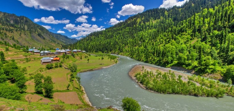
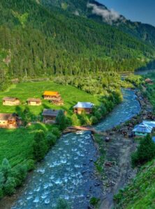
A breathtaking sight of Neelum Valley
Neelum valley is spreading over an area of 240km from Domel to Tao Butt on both sides of the river Neelum in the northeast of Muzaffarabad. The total area of neelum valley is 3621 square kilometers.
Its population is about 3 Lacs. There are deodar cedar, pine, and walnut evergreen forests on one side while sky-high and snow-capped mountains are positioned on the other side.
Cold and clear water springs, waterfalls, and streams with thrilling waves are there for refreshing your mood. Occupied Jammu Kashmir is at some locations of the river Neelum.
It is parallel to Kaghan valley. Elevated mountains covered with snow act as a boundary between these valleys. It is ideal for trekking.
Key information about Neelum Valley
Attribute
Information
Name
Neelum Valley
Location
Azad Kashmir, Pakistan
Geographical Features
Nestled in the Himalayan range, Neelum Valley is characterized by lush green valleys, pristine rivers, and majestic mountains.
Climate
Neelum Valley enjoys a temperate climate, with warm summers and snowy winters, making it a year-round destination.
Natural Beauty
Known for its breathtaking landscapes, Neelum Valley offers diverse natural attractions, including meadows, forests, and rivers.
Historical Significance
The valley has historical and cultural significance, with traces of ancient civilizations and historical sites.
Adventure Activities
Neelum Valley is a haven for adventure enthusiasts, offering trekking, camping, and opportunities for outdoor sports.
Local Culture
Indigenous communities in the valley celebrate their traditions and festivals, giving visitors a glimpse of the local way of life.
Accessibility
Neelum Valley is accessible by road, and visitors can reach it from Muzaffarabad, the capital of Azad Kashmir.
History
Neelum Valley, nestled in the heart of Azad Kashmir, Pakistan, boasts a captivating history that spans ancient civilizations, dynasties, and cultural influences. While specific historical records may be limited, the valley’s story begins in antiquity, with traces of the Indus Valley Civilization testifying to its ancient roots. Over the centuries, it has been shaped by the rise and fall of empires, from the Mauryan and Gupta dynasties to the Mughal Empire, leaving behind architectural remnants that echo the past.
The Mughals, in particular, made their mark on Neelum Valley, introducing the region to their distinctive culture and architectural grandeur. The valley’s cultural heritage reflects its place within the larger Kashmiri context, with shared traditions and a rich history.
With the partition of India in 1947, Neelum Valley became part of Pakistan, marking a significant chapter in its history. This transition brought changes in administration, and the valley continued to evolve.
Today, Neelum Valley stands as a testament to its historical legacy, with its lush landscapes, pristine rivers, and majestic mountains serving as a canvas for the stories of the past. The indigenous communities in the valley celebrate their traditions and cultural heritage, offering visitors a chance to immerse themselves in the local way of life. In Neelum Valley, the echoes of history resonate in every corner, making it a destination that seamlessly weaves the past into its breathtaking natural beauty.
Famous Tourist Spots in Neelum
Petka
Petka is the first tourist spot at a distance of 19km from Muzaffarabad. There are a few hotels and restaurants in a large market.
Mobile networks of all companies are available there. Beyond this point, only zong and local network scom facilities are available. There is an official guest house too.
Noseri
Neelum Jhelum hydro project, a splendid masterpiece of Pakistan-China friendship is under construction at the point of Noseri. It is 38 km from Muzaffarabad.
This project is capable of producing 968 megawatts of electricity by connecting the river Neelum to the River Jhelum through an underground tunnel.
Dhani Waterfall in Noseri
Challiana
Human’s emotions are so deep here at this unique site situated on the shore of the river Neelum at a distance of 46 km from Muzaffarabad.
The line of control (LOC) between India and Pakistan has divided this small town into two parts. There is a crossing bridge for meetings of Kashmiri residents on both sides of the border.
Indian army, national flag, and cannons can be seen across the borderline. The relatives of the two towns cannot sit together. River Neelam is the hurdle between them. People of the two towns shout to talk to each other at the riverbank throughout the year.
Their voices are clearer during winter when the water flow is slow and less noisy. On the other side of the river, Tetawal village of occupied Jammu Kashmir is located.
It remained the Tehsil headquarters of Neelum valley at the time of United India. But now it is in the Indian Territory.
The Lush Green Mountains and meadows of Leepa Valley near Challiana
Ashkot
67km away from Muzaffarabad, this town is famous for rainforests on the left edge of river Neelum.
Kundul Shahi
Kundal Shahi town is 74km from Muzaffarabad where Jagran pond merges with the river Neelum. The hotel, bazaar, restaurant, and all the basic facilities are there.
Jagran valley is on the left side of Kundal Shahi. You can catch trout fish in the Jagran stream. But you have to take a license from Mahi Parwari Muzaffarabad.
An aerial view of Kundal Shahi Village in Neelum Valley
Forward Jagran stream, there is a beautiful hilltop named Babwan top. Thaniyan peak is located nearby. You can reach Rani Lake from Thaniyan. It is a one-day long-distance walk. You can reach it earlier by riding on animals.
Kutton Waterfall
Azad Kashmir is full of waterfalls. But Neelum valley is well-known for them. And Kutton fall is the most famous one. It is above the Jagran stream.
It reminds me of Niagara Falls Canada. Beyond this, there are worth watching sites of Jagran valley. Kutton Waterfall and Jagran valley are 6km from kundal Shahi via road.
An underground stone-made hydro project of 324 megawatts is a unique piece of architecture by France and Swedish companies.
Mountain top “Raja Pogi” in front of Jagran is telling the interesting and beautiful folk take of Deomalai.
The Kutton Waterfall in Neelum Valley reminds you of Niagra Falls
Salkhala
Salkhala is 5km forward from Kindle Shahi. There is an arrangement for fish growth by the fishery’s department in this village.
Ath point or Athmuqam
The district headquarters of Neelum valley Ath is 5km from Salkhala. It is called Athmuqam by combining Atai and Muqam. 4500 feet high from sea level, it is famous for the fruit orchards.
It is the first staying point for hikers. There is a rest house and different facilities. Roads there are in good physical condition. It has the best jeep track. Hotel, markets and basic facilities are available there.
Athmuqam, an adventurous spot for hikers and holidaymakers
Karen – Neelum
Karen town is on the bank of river Neelum at a distance of 12km from Athh point. It is at an altitude of 1524 meters from sea level. However, there is the Karen town of occupied Jammu Kashmir after crossing the river.
The people who resided on both sides of the river are in a blood relationship but they cannot meet each other. Here the Koshinage River is linked with the river Neelum.
You can enjoy the sweet sounds of river Neelum water and charming scenery of Karen-occupied Jammu Kashmir in the rest house located here. All the basic needs of life are accessible at this point.
A beautiful landscape of Karen Neelum Valley
Upper Neelum
Upper Neelum is a beautiful point for lovers of hiking and tracking at a height of 2.5 km from Karen Neelum. The snow-capped mountains and forests of Kaling Malang, Dhodi, Shangar Laryan, and Ganja can be seen from the upper Neelum.
The Thick Green mountains and plains of Upper Neelum refresh the tourists
Below this point towards Karen, the twisting stream of Neelum valley will attract you. It is famous for apples and walnuts. All kinds of residential facilities are available there.
Lawat
Lawat pine stop is 100km from Muzaffarabad and 7km from Karen. You can reach Lawat in a 4×4 vehicle from Dawarian bypass which is at a distance of 1.5 hours by walk.
Dowarian- Ratti Gali Lake
13 km beyond Neelum at a height of 5300 feet from sea level, Ratti Gali brook confluences with the river Neelum at the center of Dowarian. The rest house of the forestry department is on the peak of the mountain.
18 km from Dowarian towards Kaghan valley, the Ratti Gali Lake is located at 12,000 feet above ocean level. You can reach there only via 4×4 vehicle. However, a new road is under construction.
It is the most beautiful and largest lake in Azad Kashmir. It is also called the lake of fairies stretching at a length of 1.5km.
The men praise the art of nature by sighting the blue calm water, and lovely flowers. From this point, Ratti Gali’s top is at a height of 14000 feet. You can reach Kaghan valley by walking a few hours from the other side of this top.
The heavenly beautiful sight of Ratti Gali Lake in Dowarain
Sharda
The noisy waves of river Neelum pass in a calm and quiet manner due to the wide area in Sharda which is at an elevation of 6500 feet from sea level and 30km beyond Dowarian.
Archaeological signs of the Buddhism era can be seen by crossing the river’s bridge. According to some historians, there were great worship places and seminaries for Buddhist monks in Raja Ashok’s regime.
Heavy stones weighing about 40 to 50 maunds are used for the construction of these worship places. Besides Buddhist religion, geography, logic, and philosophy were taught too. An old fort is located nearby.
There are facilities for sailing. Rest houses, Bazaar, hotels, and restaurants are there for holidaymakers. Sargan watercourse and the river Neelum confluence at Sharda. A track goes to Kaghan valley via Nori Nar Pas.
A wood bridge in Sharda, a site full of archaeological traces
Kel
Kel is 19km from Sharda at an altitude of 6873 feet above sea level at the point where the river like a water channel Shunter convergences with the river Neelum. You can reach Chitta Katha lake through Shunter valley from this point.
Kel is an important trade center in northern Neelum valley. All basic services like hotels, bazaars, and restaurants are available.
Muzda Bus service is there from Muzaffarabad to Kel. It is better to reach Gurez valley beyond Kel by 4×4 jeep because of the rough road.
A beautiful lake has been formed in the northwest of Kel due to the flood of Shunter valley in the river Neelum. This lake is given the name “Gangaa Kashan”.
The sky-scrapers mountains of Kel
Arang Kel
Arang Kel is across the river on the right hand where one has to climb continuously for one hour. A chairlift can also take you to Arang Kel from Kel. It is easier to reach there via chairlift.
Thousands of flowers spread far and wide in the lush region, a masterpiece of nature’s craftsmanship, make one think of divinity. For moving forward, horses and mules are there for travelers.
There is a rest house and private hotel too with all kinds of facilities.
A morning sight of Arang Kel , Neelum Valley
Noori Top
Two ways from the thick green forests around Sargan brook in Kel are directed to Noori top and Ratti Gali. At the Noori Top, cold wind blow in the noon in the months of June and July.
After reaching the top, the height from the sea level becomes more than 14,000 feet. You will be astonished by the beauty of this top.
At a long distance below, the lush forests of Kashmir are shaded. In the twinkling of an eye, a flock of black clouds will suddenly appear and the Kel forests below will disappear in the fog. And light clouds will float around you.
It will be a nice idea to stay a night in a rest house on the top to enjoy this foggy charming sight.
Noori Top, A valley that connects Neelum to Naran and Kaghan
Chitta Katha Lake
It is a mesmerizing lake of Neelum. It is at 2 hours jeep drive from Kel. The Jeep will drop you at Chitta Katha village. A walkway goes to Upper Domel. You can enjoy tea if you feel tired. A restaurant is there for quality food and a hotel for a stay.
The Snow-Capped Mountains of Chitta Katha Lake
Permits, the Line of Control and where you can actually go
This is the part of a Neelum trip that most guides skip, and it is the part that decides
whether your plan works.
The valley runs along the Line of Control for much of its length. On long
stretches the far bank of the Neelum river is Indian-administered Kashmir, close enough to
see houses on the other side. That proximity is a large part of what makes the drive
extraordinary, and it is also why access here is managed differently to anywhere else in
Pakistan.
The blanket No Objection Certificate for foreign tourists was abolished in 2019,
and Azad Kashmir including Neelum is broadly open. But areas immediately along the Line of
Control remain restricted, and the position is not fixed: sections open and close depending
on the security situation, sometimes at a few hours’ notice. Our guide to permits and restricted areas in Pakistan explains how the system works.
The practical rules that matter:
Take local advice on the day, at Athmuqam or Kel, rather than relying on
any published itinerary including this one. Conditions change faster than articles are updated.
Carry your passport or ID. There are checkposts through the valley and
details are recorded, which is routine rather than a problem.
Foreign nationals face more restrictions than Pakistani visitors on the
upper sections, and should confirm the current position before committing to accommodation.
Do not photograph military positions or checkposts. This is taken
seriously.
Follow instructions at checkposts without argument. If you are turned back, that is the end
of it.
Our wider guide to safety in Pakistan puts this in context: the valley is
not dangerous, it is administered, and the two are different things.
When the valley is open
May to October is the season, and the valley effectively has two halves.
The lower valley, from Muzaffarabad through Kutton and Keran up to Athmuqam, stays accessible
for most of the year, though winter is cold and quiet with many guesthouses closed.
The upper valley beyond Kel, including Arang Kel, Taobat and the route to Ratti
Gali, is a different matter. Snow closes it through the winter and it typically opens
from late May or June, with the high lakes the last to become reachable. If your trip is built
around Ratti Gali or Chitta Katha, July to September is the realistic window.
The monsoon between July and September brings the other hazard. This road is landslide-prone, and rockfall closes sections for hours or days after heavy
rain. Keep spare days in any Neelum itinerary and avoid travelling the valley at night. See our month by month guide for how this sits in the wider year.
Getting there and how long to allow
The valley begins at Muzaffarabad, which is roughly
130 km and about four hours from Islamabad, and then runs northeast along the Neelum river for
well over 200 km to Taobat at the far end.
That length is the thing visitors underestimate. Athmuqam is a comfortable half day from
Muzaffarabad; Kel is a long day; Taobat is beyond that again on a rough road. The surface
deteriorates steadily as you go up, and a 4×4 is sensible beyond Kel and
necessary for the jeep tracks to Ratti Gali and Chitta Katha.
Allow four to five days minimum for the valley proper, and a week if you want
Arang Kel and one of the high lakes without rushing. Two days gets you to Keran and back, which
is pleasant but misses everything the valley is known for. Accommodation is plentiful in the
lower valley and genuinely limited above Kel, so book ahead in July and August.
Food points in Neelum valley
Local Dhabas: Along the roads in Neelum Valley, you’ll find small local dhabas (roadside eateries) serving traditional Kashmiri and Pahari dishes. These are great places to try local delicacies like Dum Aloo (spicy potatoes) and Rogan Josh (a flavorful meat dish).
Restaurants in Keran: Keran, a picturesque village in Neelum Valley, hosts several restaurants offering a variety of dishes. You can enjoy local and Pakistani cuisine with a stunning view of the Neelum River.
Sharda Market: The market in Sharda, another beautiful village in the valley, features stalls and shops selling local snacks and refreshments. Don’t miss the opportunity to try out some regional specialties.
Guesthouses and Lodges: Many guesthouses and lodges in the valley offer homemade and traditional meals as part of their hospitality. This is a great way to enjoy authentic local food while experiencing the warm hospitality of the region.
Tea Stalls: You’ll come across tea stalls throughout Neelum Valley. The local pink tea, known as Kashmiri Chai, is a must-try. It’s a creamy, aromatic tea infused with spices.
Local Bakeries: Some local bakeries offer fresh, traditional bread and bakery items. These are perfect for a quick snack or to accompany your tea.
Fresh Fruits: Neelum Valley is known for its fresh and juicy fruits, especially apricots and apples. You can buy them from local vendors or markets to enjoy as a healthy and refreshing snack.
Frequently asked questions (FAQs)
What is the geographical location of Neelum Valley?
Neelum Valley is located in Azad Kashmir, Pakistan, nestled in the Himalayan range.
What is the climate like in Neelum Valley?
Neelum Valley enjoys a temperate climate, with warm summers and snowy winters, making it a year-round destination.
What are the major attractions in Neelum Valley?
Prominent attractions in Neelum Valley include pristine rivers, lush green meadows, historic Mughal gardens, and the architectural remnants of the past.
Are there adventure activities in Neelum Valley?
Yes, Neelum Valley offers various adventure activities, including trekking, camping, and opportunities for outdoor sports in its picturesque landscapes.
What is the significance of Mughal influence in the valley?
The Mughals left their architectural imprint on the valley, with the remnants of Mughal gardens and structures offering insights into the historical and cultural heritage of the region.
How can I access Neelum Valley?
Neelum Valley is accessible by road, with Muzaffarabad, the capital of Azad Kashmir, serving as a gateway to the valley.
What local traditions and festivals are celebrated in Neelum Valley?
Indigenous communities in the valley celebrate their traditions and festivals, providing visitors with a chance to experience the local culture and way of life.
Is Neelum Valley suitable for year-round visits?
Yes, Neelum Valley’s moderate climate makes it a versatile destination, offering experiences for all seasons, from summer hiking to winter snowfall.
Last Thoughts on Neelum Valley
Neelum is the most beautiful valley in Azad Kashmir and the one that asks the most planning.
It is long, the road gets worse as it gets better, the upper half is shut for half the year,
and the Line of Control runs beside you for most of it.
Give it four or five days rather than a weekend, come between June and September if you want
the high lakes, keep spare days for the road, and take your instructions from people in the
valley rather than from any itinerary. Do that and the drive from Keran up to Arang Kel is as
good as travel in Pakistan gets.
Neelum Valley has numerous worth-watching sites. The charming valleys, lush green pastures, sky-high mountains, singing brooks, and waterfalls will mesmerize you. It is the perfect place for holidaymakers and adventurous people.
The historical city Attock is 48km from Rawalpindiand 17km from Taxila. Attock is the district headquarter.
It has six districts
Attock
Hassan Abdal
Fateh Jang
Hazro
Pindi Gheb
Jand
From the tourist point of view, there is a Gurdwara Panja Sahib, the tomb of Lala Rukh in a square garden, and a dedicated place to Sufi Saint Baba Hassan Abdal on a nearby hill.
The beautiful scenery of Attock Train Bridge
Key information about Attock
Name
Attock
Location
Punjab, Pakistan
Historical Significance
A region with a rich history and strategic importance
Geography
Situated at the confluence of the Indus and Kabul rivers
Population
Approximately 1.88 million (as of 2021)
Area
Approximately 6,858 square kilometers
Administrative Division
Attock District
Nearby Cities
Rawalpindi, Islamabad, Peshawar, and Nowshera
History
Ancient crossroads of Central and South Asia, Strategic military importance during colonial and modern eras
Cultural Diversity
Home to various ethnic groups and languages, including Punjabi, Pashto, and Urdu
Economy
Agriculture, industry, trade, and proximity to the Indus Highway and the Grand Trunk Road contribute to its economic significance
Forts and Landmarks
Attock Fort, Sheikh Badin National Park, Kala Chitta Range, Indus River banks
Education
Home to several schools, colleges, and a campus of Allama Iqbal Open University
Healthcare Facilities
Hospitals and medical services available for residents and visitors
Accessibility
Connected by the Grand Trunk Road and railway to major cities in Pakistan
Language
Predominantly Punjabi, Pashto, and Urdu spoken
Local Markets
Offer traditional goods, handicrafts, and agricultural produce
Religious Sites
Places of worship for various religions, including mosques, gurdwaras, and temples
Climate
Experiences a subtropical climate with hot summers and mild winters
Nearby Attractions
Hasan Abdal, Wah Cantt, and the scenic Kala Chitta Range
Historical Legacy
A region with ties to the Indus Valley Civilization and Alexander the Great’s campaigns
Cultural Festivals
Celebrates various cultural and religious festivals throughout the year
Is Attock in Punjab or Khyber Pakhtunkhwa?
Attock is in Punjab. It is a district of Punjab province, sitting on the Pothohar Plateau in the province’s north west corner.
The confusion is understandable, because Attock is where Punjab ends. The Indus River runs along the district’s western boundary for roughly 130 km,
and the far bank is Khyber Pakhtunkhwa. Cross the river at Attock and you
have left Punjab. For centuries this crossing was the recognised dividing line between the
subcontinent and the lands beyond it, which is precisely why Akbar put a fort here.
The district was created in April 1904, formed out of tehsils taken from
neighbouring districts, and was originally named Campbellpur after a British
officer. It was renamed Attock in 1978, and older maps, timetables and records still use the
old name. It now contains six tehsils: Attock, Fateh Jang, Hazro, Hassan Abdal, Jand and
Pindi Gheb.
One more piece of geography worth knowing: the Kabul River, having run all
the way from Afghanistan, meets the Indus here. Standing at the confluence you are looking at
the water that drained Kabul and the water that drained Tibet arriving in the same place.
Famous Tourist Spots and Historical Sites
Hassan Abdal
(City of The Guru)
Saint Baba Hassan of the 15th century is also called Baba Kandhari. He lived there from 1404 to 1416. This city was settled by his efforts and named Hassan Abdal after him.
He died in a village Baba wali in Qandahar Afghanistan and was buried there. You can enjoy the sight of Hassan Abdal city and suburbs through a staircase on the hilltop.
The world wonder highway Resham starts from the right side of Hassan Abdal. This highway leads to China through Abbottabad, Mansehra, Basham, Dasu, Chillas, Gilgit, Hunza, Sosat, and Khunjrab Pass.
This highway has strengthened the Pak-China relationship.
An Aerial view of Hassan Abdal
Gurdwara Panja Sahib
It is one of the sacred places of Sikhs. Pilgrims across the world visit this Gurdwara two times a year. Specifically, it is crowded in April at the fair of Baisakhi.
Its interior is very beautiful. One part has a handprint of Baba Guru Nanak. Sikhs consider it sacred. Baba Guru Nanak reached Hasan Abdal in 1521 with his brother Mardana.
This Gurdwara is located at the same place where they stayed in Hassan Abdal. Different tales have been dedicated to his hand reflection.
According to Sikhs’ religious beliefs, Baba Wali Qandahari moved the stone from the hill and Baba Guru Nanak stopped with his hand. And as a result, his hand was printed. It was built by Hari Singh Nalwa in 1823. It was under the Hindu administration till 1920.
It was given under the supervision of Sikhs after their protest. On 25th November 1920, the Gurdwara Panja Sahib committee was established. People can reach in five minutes from Hassan Abdal general bus stand.
The sacred place of Gurdwara Panja Sahib
Tomb of Hakeema
Khawaja Shams-ud-din Khawafi, King Akbar’s engineer built this tomb for himself. During its construction, he stayed in the Attock fort for five years. But he died somewhere else and he was not buried in this tomb.
The companion of Akbar Hakeem Abul Fateh Gillani and his brother Hakeem died and he ordered to bury them in this tomb.
Lala Rukh Mausoleum
This tomb is named after the daughter of Mughal king Aurangzeb Lala Rukh based on a story by Irish poet Tamus Mor. However, there is no proof in history about the daughter Lala Rukh. It is adjacent to the tomb of Hakeema.
The remains of the tomb of princess Lala Rukh
Mughal Garden
Mughal emperor Akbar established this garden. It is between Hassan Abdal and Wah Cantt near Wah Town.
He stayed here for three days. He caught the fish, put a pearl in their nose, and left them in the water again. There is a Mughal well in the park of Wah Cantt.
The rich green trees of Wah Garden Attock
Laurence Pur
The city of Laurance Henry, Laurance Pur is located beyond the Hassan Abdal and Mughal Garden.
Sir Laurance Henry was a British citizen and he was settled in Lahore. Nowadays it is famous for its textile industry. You can buy high-quality clothes from factory outlet shops.
Attock fort
Attock is a word from the Turkish language which has the meaning of Daman Koh or foothills. The foundation of this fort near the Indus River was led by Akbar Azam.
Its construction was completed in 14 months under the supervision of Khawaja Shams-ud-din Khawafi. According to defense experts, its construction style is different from Delhi, Lahore, and Fateh Pur forts.
According to Ali Raza Abidi, the Kabul people took this fort from the Mughals. British took it from Sikhs. After that, Sikhs captured it from Britishers. Besides this, it is still in good condition.
This fort has Turkish architecture-style bathrooms, a tunnel for escaping during the war, communication trench signs, a dead cell like a well, and a chair of the British Monarch.
Attock Fort, A grandeur of architecture by Mughals
It is under the control of the Pakistan army since the creation of Pakistan. An Inn and Kanjri’s fort near the Attock fort is also worth watching.
The doors of the fort have engraved a line: “May Allah blesses King Akbar”. A stone near the bank of River Indus has signs of a British regiment. They were busy in the war for years.
For the record: the fort was built between 1581 and 1583, at Attock Khurd on the bank of the Indus, to control the river crossing on the
route between Kabul and the Mughal capitals. It remains in military use, which is why access
is restricted and usually requires permission arranged in advance rather than simply turning
up. The Attock Khurd railway bridge below it, a double-decked Victorian iron
structure carrying both road and rail, is the other thing worth seeing here and is easier to
photograph from a distance than up close.
Getting to Attock and when to go
Attock is easy, which is the main argument for going. It sits on the Grand Trunk
Road and the M1 motorway roughly 80 km west of Islamabad, so it is
little more than an hour by car and is comfortably done as a day trip from the capital. Trains
on the main Peshawar line stop here, and the approach across the Indus is one of the better
railway views in the country.
Most visitors combine it with Taxila, which is on the same road and about
half an hour back toward Islamabad, and with Hassan Abdal, which is inside Attock district
anyway. The three together make a full and genuinely rewarding day.
October to March is the season. Attock sits low and the summer on this part
of the Pothohar plateau is hot and dusty, with June and July regularly above 40 degrees. The
winter months are mild and clear, and the rivers are at their most photogenic. See our month by month guide for how this fits a wider trip.
If you are coming for Baisakhi at Gurdwara Panja Sahib, note that the date
moves and the town fills with pilgrims from across the world, which is worth seeing but needs
accommodation booked well ahead.
Schools:
Govt. High School for Boys: A well-established public school in Attock offering quality education to male students at the secondary level.
Govt. High School for Girls: A public school catering to the educational needs of female students in Attock at the secondary level.
Beaconhouse School System: A private school providing a comprehensive education from preschool to secondary levels.
Colleges:
Government Postgraduate College: A leading college in Attock that offers a wide range of intermediate and undergraduate programs.
Punjab College Attock: A well-known private college providing intermediate and undergraduate education with a focus on science and commerce streams.
Universities:
University of Education, Attock Campus: A branch of the University of Education offering various undergraduate and graduate programs in education and other disciplines.
University of Engineering and Technology (UET), Taxila Sub-Campus Attock: A sub-campus of UET Taxila that provides engineering and technical education to students in the region.
Hospitals:
District Headquarters Hospital: The main government hospital in Attock, providing medical services and healthcare facilities to the local community.
Shifa International Hospital Attock: A private hospital offering a range of medical services, including specialized healthcare and diagnostics.
Restaurants:
Al-Miraj Hotel and Restaurant: A local favorite, serving Pakistani cuisine and a variety of dishes in a casual dining setting.
Biryani Express: Known for its delicious biryani, this restaurant offers a menu of Pakistani and Indian dishes.
Pizza Hut Attock: Part of the popular international chain, offering a variety of pizza and fast-food options.
Frequently asked questions (FAQs)
What is the historical significance of Attock?
Attock is historically significant as a vital crossroads for trade and military movements between Central and South Asia. It also played a role in Alexander the Great’s campaigns.
How diverse is the culture in Attock?
Attock is a melting pot of cultures, with Punjabi, Pashto, and Urdu-speaking communities coexisting harmoniously.
What famous landmarks can I visit in Attock?
Some of the famous landmarks in Attock include Attock Fort, Sheikh Badin National Park, Kala Chitta Range, and the scenic Indus River banks.
Are there any educational institutions in Attock?
Yes, Attock is home to several educational institutions, including schools, colleges, and universities.
What is the local cuisine like in Attock?
Attock offers a diverse culinary experience, with a blend of Punjabi and Pashto flavors. You can enjoy kebabs, curries, biryanis, and more.
How is the healthcare infrastructure in Attock?
Attock provides access to healthcare facilities, including hospitals and medical services for residents and visitors.
What are some of the cultural festivals celebrated in Attock?
Attock celebrates various cultural and religious festivals throughout the year, marked by colorful processions and traditional music.
Is there religious diversity in Attock?
Yes, Attock is home to places of worship for various faiths, including mosques, gurdwaras, and temples, promoting religious harmony.
What is the significance of the name “Attock”?
The name “Attock” means “gateway” in Persian, reflecting its historical role as a gateway for trade and military movements.
How can I get to Attock?
Attock is easily accessible by road and railway from major cities in Pakistan, making it a convenient destination for travelers.
Last Thoughts on Attock
Attock is a border in the geographical sense rather than the political one. Punjab stops at
the Indus here, the Kabul river arrives from Afghanistan, Akbar built a fort to hold the
crossing, the British put a double-decked iron bridge beside it, and the Grand Trunk Road has
been carrying everything through the gap for as long as any of it has existed.
An hour from Islamabad, best between October and March, and far better combined with Taxila and Hassan Abdal than visited alone. For the wider trip, see our guide to planning a trip to Pakistan.
In short
Attock Fort is the identity of Attcok’s historical city. It is also famous for Gurdwara Panja Sahib, Mughals Gardens, and Lala Rukh tomb.
In the summer, when the sun shines to its fullest and is affecting every living soul through its scorching heat, then human beings and even animals sometimes bubble up with the intensity of heat.
Then around the Margalla Hills, the streets of Queen of the hills Murree, Hazara, Kagan, Naran, Gilgit, Skardu, Hunza, Chitral, Swat, the forests that surround them, and beyond these forests are the lakes of nature’s masterpieces, the white snow-capped mountains, the rivers, the springs and waterfalls that come from the tops of these hills whisper something.
They are all calling you with their arms outstretched.
They are saying that if you are tired of running away from the hustle of life, then spend some precious moments of your life with us, we will immortalize these moments of yours forever.
Please try to visit these places so that you feel refreshing
A captivating aerial view of Murree- The Queen of mountains
It is the closest place to residents of plain areas and is located 64 km away from Rawalpindi.
It is at a height of 7,000 to 8,000 feet from seal level. You can travel there throughout the year. However, it is overcrowded from May to September.
Besides this, tourists flock here in winter due to snowfall. The central city close to Murree is Rawalpindi.
It is connected to the country through railways, airways, G.T road, and Motorway. You can avail wagon for Murree from Rawalpindi Faizabad and Peero High Stand.
An A.C coach goes to Murree direct from Lahore and Faisalabad. This place is 50 minutes away from the Expressway from Islamabad.
Famous Tourist Spots in Murree
1- Chattar
This charming valley is stretching over a long area at the bank of a stream and 20 km away on the Kashmir highway on the other side of Islamabad.
It was famous for evergreen thick trees and loquat and Japanese plum in the past but now it is converted into a picnic spot.
This site has an 80 feet high waterfall, a modern park with an area of 12.5 acres, a playland, a zoo, a restaurant, a tourist cottage, a swimming pool, sailing, and much more.
The bendy highway will take you to Murree. Some truck hotels provide quality food at a distance of 2 km from Chattar Park at the Baroha point.
Chattar Park Murree
2- Salgirah
It is 6km from Chattar and 38 km from Rawalpindi. It is the best picnic spot covered in Deodar cedar trees. There is a restaurant by TDCP.
The swings in Salgirah park Murree
Tareet and Nand Kot beyond Salgirah are worth watching towns. There are many other restaurants at Takiya Muharram Shah and Charra Pani.
You will find a lot of tourists enjoying fritters, chips, fries, boiled eggs, Shami Kebabs, fish, and cold drinks.
3- Valley Amusement Park
This beautiful park is at the back of TDCP restaurant. There is a playland in this park between the lush green trees and streams.
4- Khajot/ Khajut
There is a TDCP hilltop resort at a height of 1947 km from sea level near Samli Bewa Mall. It is located 17 miles away on Islamabad Murree Expressway and 27 km from RMK toll plaza.
The beautiful TDCP resort Khajot Murree is a perfect place for holidaymakers
5- Charra Pani
This place is at a height of 4,200 feet from sea level and 40 km from Rawalpindi. The water from the mountains passes through this park in the form of a stream.
The people of the twin cities often visit this place since it is close to Islamabad and Rawalpindi. The TDCP has established a point for staying there.
The captivating waterfalls in Charrra Pani Murree
It holds a historic significance too. In the war of 1857, Sardar Sher Baz Khan and his son were killed here. The British army was appointed here during the British regime.
6- Nand Kot
A road on the right side from Chara Pani goes to Nand Kot at a distance of 3 km. This pathway is covered with woods of pine trees.
The fog, clouds and drizzling rain make the environment more enchanting. You will be astonished to see the beauty of meadows above the Bohar Chowk beyond Nand Kot.
Nand Kot near Taret is surrounded by luxuriant forest and mountains
People are captivated by the scenery of this place and prefer to stay here. It was the best picnic spot in the British era. The graves of British army officers are proof.
7- Ghora Gali
It is located 5000 feet in height from sea level. It was of great importance for the tourists coming from distant areas of Kashmir in the past.
Before the motor vehicles, horses were used for traveling. The passengers used to take a rest there with their horses. Moreover, the traders also used to stay there and exchanged their horses.
A beautiful building of army college – Laurence college in Ghora Gali
There is a TDCP resort on the left side. There are scouts’ campuses for girls and boys.
8- Sunni Bank
The entrance door of Murree is Sunni Bank at a distance of 59 km from Rawalpindi. Two ways go to Murree. There is a way on the left side from cart road to mall road at a distance of 4km. And on the main road from Kaldana to GPO at a distance of 6km
9- Jhika Gali
Jhika Gali is located 5.2 km away from Kaldana. New Murree, Patriata, and Bhorpan way go from here. Usually, this road is used as a return path.
10- Mall Road
It is the most famous highway in Murree. It is always crowded since it is the central point and highway of Murree. Tourists seem everywhere.
In 1869, two furlongs long Mall Road was built. This 2 km road has hotels, restaurants, coffee & ice shops, precious artifacts, and many other shops on both sides.
GPO Mall Road Murree
It will be a better idea to travel to the suburbs during the day and return to the mall road at night. The sweet pleasant smell of ice cream spreads everywhere in the night with the floods of light.
The smell of barbecue from the restaurants along the road makes you feel hungry. Then you can sit in the hotel and watch the people coming and going through the glass During the snowfall, beautiful faces glow in the glare of the snow.
Throwing snow at each other and making bears are forever memorable.
Tourists staying in any part of Murree but they must visit Mall Road once. Young people will be seen laughing and riant. Enjoy being a part of them too.
11- Pindi Point
Murree is spreading in 7km from Pindi point to Kashmir point. Pindi point is a prime point for tourism in Murree. You can take an aerial view of the twin cities Islamabad and Rawalpindi settled at the foothills of Margala.
The scenery looks more beautiful at night. The chair lift at Pindi point will take you 1.5 km below. The sights during traveling through the chairlift are awesome.
The snow-capped mountains of Pindi point
The pine trees will be your companions all the way long. You can relish refreshments and let the children play in the playland.
You can also enjoy horse riding. The ways to Laurence College, Ghora Gali, Lower Topa, and Upper Topa go from here.
You can also see the Patriata hills from Pindi Point. There is a thick forest and different tracking points.
12- Kashmir Point
This site is at a distance of 1km from GPO situated on Mall Road Murree.
The surrounding area is so calm and captivating since it is located at the top. This area is fenced in Pine trees, a government house, Bhag-e-Shaheeda, and a picnic spot of the forestry department.
You can see Kashmir’s Mountain ranges and hilltops. That’s why it is called Kashmir Point. Bhag-e-Shaheeda in the memory of martyrs.
A beautiful evening in Kashmir Point
There are two ways to reach the Kashmir point from GPO. Both the ways have different sights. You can also visit President’s house near the Cadet college.
13- Bhurban
It is named after the Bhurban forest in its surroundings. It is located 13 km away from Murree.
It is at a height of 6,500 feet on Bhurban Murree Kashmir Road. It is one of the favorite spots of holidaymakers in winter. It is called the heaven of tourists.
Some plants in this area are not found anywhere in Pakistan. There is a Pedestrian track from Bhurban to Ayubia National Park.
The five-star pearl continental hotel there is the preferred place for vacationers because of its facilities and geography. There is a golf course with nine holes. A youth hostel is also there.
The PC hotel in Bhurban between elevated mountains
14- Patriata
It is located in the southeast,26 km away from Murree towards Lower Topa. It is located at a height of 6,790 feet from sea level.
it is the highest point of Murree and Galiyat. In winter, the temperature here first drops to minus before anywhere else.
There are monkeys and tigers in the nearby forests. Never try to go at a far distance.
It is also famous for its beauty, chairlift, and international standard cable car lift. The chairlift goes from Gulehra Gali to Patriata Bazaar covering a distance of 1300 m.
It will take you to the middle hill. There is a cafeteria for refreshments. A cable car will take you 1800 meters away to Patriata
Patriata Chairlift, a thrilling adventure for tourists
This trip will be unforgettable for new sightseers and children. The scene becomes more captivating if it starts snow falling during the chair lift and cable car ride.
From the endpoint of the chairlift, you can view char ban and Maskari mountain at its back. On the left side, you can enjoy the scenery of PC Bhurban, Lower Topa, and a glimpse of Azad Kashmir and Ganga Choti.
In Summer, the hilltops are covered with greenery and they shine with snow in winter. A TDCP information center is also at the top. You can also take a horse ride. Local wagons go to Patriata from the Murree Bus stand.
15- Bandar Point
There is a place named Bandar point on Nathia Gali Road Murree. There are lots of monkeys due to the thick forests.
Monkeys playing on the roads of Bandar point
The monkeys come to the side of the road and take things from the tourists and eat and quarrel with each other. Their behavior is friendly and they don’t harm anyone.
16- Changla Gali
It is a beautiful spot surrounded by deodar cedar trees at a height of 8,400 feet.
It is situated 14 km away from Murree on the Nahtia Gali road. This place is always foggy and it portrays a splendid sight.
The sky kissing mountains of Changla Gali, Murree
During the night, the lights of the federal capital look very beautiful from this point. The path to Ayubia is blocked during the snowfall.
17- Ayubia
This place is located 26 km away from Murree and was famous as Kala Dhaka in the past. Ayubia is at a height of 7700 to 8500 feet from sea level.
In 1964, former Prime Minister Ayub Khan ordered the installation of a chairlift. And it was named Ayubia after his name.
It is one of the oldest chairlifts in Asia. Going uphill through the chairlift is an unforgettable event. There is a PTDC hotel.
Ayubia Chairlift in the pine trees
There is an adjacent area named Khanaspur. A campus of Punjab University is there too. Moreover, one of the best tracks in the world is there in between Donga Gali and Ayubia.
Ayubia National Park’s lush green forests are around the track. The Muksh Pori track also starts from here.
There is a wildlife museum and Ayubia National Park information center too. The area between Khaira Gali and Bara Gali is declared Ayubia National Park. And hunting is prohibited here.
You can see a lot of birds and animals during your visit to this area.
18- Mukesh Puri pack (Mis Puri)
It is located above Donga Gali in the area of Ayubia National Park at a height of 9200 feet from sea level.
Mukesh Puri’s snow-capped mountains
After crossing the 4km path in the west of Nathia Gali you can enjoy the enchanting sight of the eastern part of KPK, river Jhelum, Bhag district, Murree city, and district Murree.
19- Nicolson Memorial
This memorial is of Brigadier General John Nicolson and is located 26 km away from Islamabad on Peshawar Road near Margala Pass hilltop.
This is the place mentioned by Al-Biruni, Farista, and Jahangir in their writings. It is a boundary between the old capital Gandara and the new capital Islamabad.
A memorial and a minaret were built in acknowledgment of the success of military expeditions by General Nicolson. After some time, this road was expanded and the memorial was shifted near the old G.T Road. However, the minaret can be seen at a long distance from the Islamabad side.
20- Old Generali Road
A little part of old Shahi Road can be seen near Margala Pass. It is on the Nicolson Minaret way. In 516 B.C., Persians built this road.
In 1540, Afghan king Sher Shah Suri a road from Peshawar to Kolkata, and it was called the grand trunk road (G.T Road) or Generali Road. A stone fixed on the western side gives evidence that it was reconstructed in 1672.
Trekking Trails
Every man has tried to look active, fit, and smart since the beginning of this universe. Trekking will keep you fit and you will feel energetic. Galiyat has the best tracking routes.
Nathia Gali Trekking Routes list
S.no
Nathia Gali Trekking Routes
Rout length (kilometers, km)
1
Nathia Gali to meer Najani
5, 3
2
Mir Najani to Degree trek
10
3
Degree to Baran Gali trek
13
4
Thandiani to Baran Gali Trek
10
5
Nathia gali to Mushk pori Hilltop trek
3km (9,200 feet)
6
Donga Gali to Ayubia Trek
4
7
Ayubia to Changla gali trek
4
Murree Trekking Routes
8
Railway rest house Kashmir points to a Military dairy farm
2.5 km
9
Railway rest house Kashmir Point to Kaldana main bazaar
2
10
Naval headquarters rest house to Jesus and Marry School
1km
11
Gharial camp Kashmir Road to Kashmir Bazaar
2.5
12
Kashmiri Bazaar to governor annex
2
13
Mohra mor to governor annex
2
Distances to different sites from Murree
Name of the point
Distance, kilometers km
Name of the point
Distance, kilometers km
Abbottabad
64
Sawar Gali
49
Bara Gali
49
Nathia Gali
32
Donga Gali
30km
Patriata
26
Ayubia
26
Koza Gali
19
Changal Gali
16
Khaira Gali
12
Ghora Gali
10
Bhurban
13
Bansra Gali
8km
Jhika Gali
2
Schools:
Lawrence College, Murree: Established in 1860, Lawrence College is one of the oldest and most prestigious boarding schools in Pakistan, providing quality education to students.
Colleges:
Government Post Graduate College Murree: This college offers a variety of intermediate and bachelor’s degree programs, serving the educational needs of the region.
Universities:
Murree is primarily a tourist destination and does not host universities. However, nearby cities like Rawalpindi and Islamabad offer a wide range of universities and higher education institutions.
Hospitals:
Combined Military Hospital (CMH) Murree: CMH Murree provides medical services to military personnel and their families. It may also provide medical assistance to civilians in case of emergencies.
Restaurants:
Pearl Continental Hotel, Marco Polo Restaurant: This upscale hotel in Murree offers various dining options, with Marco Polo Restaurant serving a variety of cuisines and scenic views.
Lockwood Hotel, The Restaurant: The Lockwood Hotel is known for its cozy ambiance and offers a restaurant serving Pakistani and continental dishes.
Alpine Restaurant: Located on The Mall Road, Alpine Restaurant is a popular choice for traditional Pakistani dishes, especially barbecue and local cuisine.
Cafe de Brando: This charming café on The Mall Road is known for its coffee, snacks, and delightful desserts.
Gloria Jeans Coffees: If you’re looking for a familiar coffee shop experience, Gloria Jeans on The Mall Road offers a variety of coffee and snacks.
FAQs
1. What is Murree, and where is it located?
Answer: Murree is a picturesque hill station in Pakistan known for its natural beauty. It’s located approximately 64 kilometers away from Rawalpindi and sits at an altitude of 7,000 to 8,000 feet above sea level.
2. When is the best time to visit Murree?
Answer: Murree is a year-round destination, but it’s most crowded from May to September due to pleasant summer weather. Winter is also popular for snowfall and winter sports.
3. What are the famous tourist spots in Murree?
Answer: Some popular tourist spots in Murree include Chattar, Salgirah, Valley Amusement Park, Khajot, Charra Pani, Nand Kot, Ghora Gali, Sunni Bank, Mall Road, Pindi Point, Kashmir Point, Bhurban, Patriata, Bandar Point, Changla Gali, and more.
4. Are there trekking opportunities in Murree?
Answer: Yes, there are trekking routes in and around Murree. Nathia Gali and Murree offer various trekking paths that allow you to explore the scenic beauty of the region.
5. Are there educational institutions in Murree?
Answer: Yes, Murree has schools like Lawrence College, Murree, and Government Post Graduate College. However, for higher education, students may need to commute to nearby cities like Rawalpindi and Islamabad, which have universities.
6. What healthcare facilities are available in Murree?
Answer: Combined Military Hospital (CMH) Murree provides medical services in the area. It primarily serves military personnel but may also assist civilians in case of emergencies.
7. What dining options are available in Murree?
Answer: Murree offers a variety of dining options. Some popular restaurants include Marco Polo at Pearl Continental Hotel, The Restaurant at Lockwood Hotel, Alpine Restaurant, Cafe de Brando, and Gloria Jeans Coffees for coffee and snacks.
8. What are some must-visit points in Murree?
Answer: Must-visit points include Pindi Point for a view of Islamabad and Rawalpindi, Kashmir Point for its serene surroundings, Mall Road for shopping and dining, and Patriata for its chairlift and cable car adventures.
9. Is there accommodation available in Murree?
Answer: Yes, Murree offers a range of accommodations, including hotels, guesthouses, and resorts, catering to various budgets and preferences.
10. What is the significance of Murree in history?
Answer: Murree has historical importance as it was a popular rest stop for travelers during the British colonial era. It served as a hill station for the British, and remnants of that colonial past can still be seen in the architecture and infrastructure.
Last Thoughts on Murree
Pakistan is blessed with numerous beautiful places. Murree is one of the most astonishing areas of Pakistan and is famous as the Queen of Mountains.
Ghora Gali, Changla Gali, Kashmir Point, Ayubia, Nathia Gali, and Patriata are famous tourist spots. Trekking routes of Nathia Gali and Murree are popular among sportsmen and let you keep healthy and strong.
Azad and Jammu Kashmir state comprise an area of 13,297 square kilometers spreading over 73-35 longitude and 33-36 latitudes.
A major area of the state consists of diverse small and large mountain ranges. There are valleys and beautiful lush green plains at the foothills of mountains.
Its average height is 360 meters from sea level in the south and 6,325 meters in the North.
Thick green forests enriched with beauty, orchards loaded with fruits, flowing rivers, noisy streams, and valleys at the foothills of mountains make it the most enchanting place in the Subcontinent.
About 100% population is Muslim there.
A Heavenly beautiful sight of Azad Kashmir
Key information about Kashmir
Name
Kashmir
Location
Northern region of the Indian subcontinent
Administrative Division
Divided between three countries: India, Pakistan, and China
Geography
Nestled in the Himalayan mountain range
Area
Approximately 85,806 square miles (222,236 square kilometers)
Population
Varied population across the Indian-administered and Pakistani-administered regions
Languages
Multiple languages, including Kashmiri, Urdu, Dogri, and Ladakhi
Religion
Predominantly Islam, with Hinduism and Buddhism in the region
History
A region with a long and complex history, characterized by conflicts and cultural diversity
Conflicts
Historical and ongoing territorial disputes, including the India-Pakistan and India-China conflicts
Natural Beauty
Renowned for its stunning landscapes, including the picturesque Dal Lake and lush valleys
Agriculture
Known for its agriculture, producing saffron, apples, and other crops
Tourism
A popular tourist destination for its natural beauty, trekking, and cultural richness
Educational Institutions
Houses a number of universities, schools, and colleges
Healthcare Facilities
Offers medical services to residents and visitors
Economy
A mix of agriculture, handicrafts, and tourism contributes to the economy
Climate
Varies from temperate in the valleys to cold in the mountains
History of Kashmir
In 1947, at the time of the Indo-Pak separation, the states were given the right to be affiliated with any of the countries. The ruler of Kashmir Hari Singh distanced himself from both countries.
He ruthlessly slaughtered the Muslim majority population with the assistance of Dogra armed men and professional killers. As a result, a war began against him and for freedom.
Thousands of armed tribesmen entered Muzaffarabad. On 22nd October 1947, they announced an independent state after two days as they reached Srinagar.
Sardar Muhammad Ibrahim Khan was appointed as the first President of the independent state. Raja signed an accession treaty with India on 27th October. Lord Mount Beaten had announced to include Gurdaspur in Pakistan.
Sir Radcliffe favored India and handed over the Muslim majority areas of Gurdaspur. In this way, India found a way to reach Kashmir via Pathankot. Indian military forces entered Kashmir and captured the Muslim majority areas illegally.
Frightened by the outbreak of the war of independence, India took this dispute to the UN. India requested the UN for a free and fair UN-sponsored referendum. But, India always refuses to fulfill its promise.
Today’s Azad Kashmir
After independence, Triarkhal was declared the first capital. Later on, it was shifted to Muzaffarabad. Now, Muzaffarabad is the Capital of Azad Kashmir.
Azad Kashmir has a parliamentarian government. The state has its president, prime minister, and legislative assembly.
Administratively, Azad Kashmir state consists of ten districts.
The people of the countryside are linked with the occupations of forestry, livestock, and agriculture.
The enchanting lakes of Kashmir
Famous Crops and Fruits
Maize, wheat, and rice are major crops. While, apple, plums, peach, walnuts, apricot, and pear are famous fruits.
Apple Orchards in Kashmir Pakistan
Languages
English and Urdu are official languages.
Whereas, Kashmiri, Pahari, Gojri, Punjabi, and Pashto are regional languages.
Handicrafts
Mats, rugs, Numda cloth, Guba, Patto, silk cotton, woolen shawls, and wood carvings handicrafts are prepared there.
Delicious Dishes of Kashmir
Math, maaz, harissa, Gushtaba, ristay, Tabak, and Aab gosht, are delicious traditional dishes.
Famous Tourist Spots in Kashmir
This place has a lot of opportunities for traveling since it is surrounded by charming valleys and charismatic meadows. Due to its beauty, it is called “Kashmir like heaven” in Chahar Dang Aalam.
Kohala Burj and Picnic Point
This historical area is called the gateway of Kashmir. It is located at the junction of district Bhag and district Muzaffarabad 30km away from Muzaffarabad and 90 km away from Islamabad.
Kohla Bridge Kashmir – A gateway to Kashmir Valley
The river Jhelum flowing in this area is wide near the new bridge. The passengers stay here for a while and enjoy the fresh cold water of the river.
Quid-e-Azam tourist Lodge and Barsala
his tourist lodge is located 40km from Murree and 3km from Kohala. It was built by Dogra rulers and they used to stay here during their travel between Rawalpindi and Srinagar.
In 1944, when Quid-e-Azam visited here when he was returning back to Srinagar. There is also a chair used by him.
Quid-e-Azam Tourist Lodge Barsala Kashmir
The tourism department of Azad Kashmir has opened this lodge for people and holidaymakers. There are rooms for a night’s stay and residence. In the summer season, the cool breeze of river Jhelum gives a pleasant feel to the tourists.
Iconic places in Kashmir
Dal Lake
The Jewel of Srinagar: Dal Lake is the poster child of Kashmir’s beauty. It’s an extensive, serene lake surrounded by lush gardens and overlooked by the majestic Zabarwan Range. Visitors can enjoy a shikara (traditional wooden boat) ride on its tranquil waters or stay on one of the many houseboats that adorn the lake.
Gulmarg
Meadows of Gold: Gulmarg is a picturesque hill station that offers breathtaking landscapes. In summer, it’s a haven for trekkers and nature enthusiasts. In winter, it transforms into a winter wonderland, attracting skiers and snow lovers. The Gulmarg Gondola is one of the highest cable cars in the world and provides sweeping views of the surrounding mountains.
Pahalgam
The Valley of Shepherds: Pahalgam is a scenic valley known for its lush green meadows and the Lidder River. It’s an excellent destination for trekking and outdoor activities. The Aru and Betaab Valleys are nearby and offer captivating natural beauty.
Srinagar
The Summer Capital: Srinagar, the largest city in Kashmir, is famous for its Mughal gardens, including Shalimar Bagh and Nishat Bagh. The city’s bustling markets, such as Lal Chowk, offer a glimpse into local life and are perfect for shopping for handicrafts, saffron, and local specialties.
Sonmarg
Meadow of Gold: The name “Sonmarg” translates to “meadow of gold,” and it’s not hard to see why. This place is a paradise for nature lovers, offering stunning vistas of the Himalayas. It’s also a base for the annual Amarnath Yatra pilgrimage.
Shankaracharya Temple
Spiritual Solace: Perched atop a hill, the Shankaracharya Temple offers panoramic views of Srinagar and Dal Lake. It’s not only a place of worship but also an architectural marvel, dating back to the 9th century.
Amarnath Cave Temple
A Sacred Journey: The Amarnath Cave Temple is a significant pilgrimage site for Hindus. The ice lingam (a natural ice formation) is believed to represent Lord Shiva. Pilgrims undertake a challenging trek to reach the cave during the annual Amarnath Yatra.
Mughal Road
Historical Trail: The Mughal Road is an ancient route that once connected Srinagar with Poonch and Rajouri. It’s a journey through history, with remnants of the Mughal era and captivating natural beauty.
Betaab Valley
A Bollywood Connection: Named after the Bollywood movie “Betaab,” this valley is a verdant paradise surrounded by hills. It’s an excellent spot for picnics and leisurely walks.
Leh-Ladakh
The High Desert: While technically part of the larger Ladakh region, Leh is a gateway to a world of high-altitude desert landscapes, serene monasteries, and challenging treks.
Famous Schools
Abbas Institute of Medical Sciences, Muzaffarabad: This prestigious institution provides quality education and training in various medical fields, making it a hub for aspiring healthcare professionals.
Beaconhouse School System, Muzaffarabad: Part of a renowned educational network, Beaconhouse School System offers a well-rounded curriculum and has gained recognition for academic excellence.
Army Public School and College, Muzaffarabad: This institution provides a quality education and is known for its disciplined and structured learning environment.
Colleges
University of Azad Jammu and Kashmir, Muzaffarabad: The university offers a wide range of undergraduate and postgraduate programs, contributing significantly to higher education in the region.
Azad Jammu and Kashmir Medical College, Muzaffarabad: This medical college is an important educational institution for medical students, offering programs in various medical disciplines.
Government Postgraduate College, Rawalakot: Known for its academic rigor, this college plays a pivotal role in the education sector of Azad Kashmir.
Restaurants
Red Onion Restaurant, Muzaffarabad: A popular eatery serving a variety of local and international cuisines, known for its delightful ambiance and tasty dishes.
Kutton Jagran Resort Restaurant, Rawalakot: Located amidst scenic beauty, this restaurant offers delicious meals in a tranquil setting.
Sarhad Restaurant, Muzaffarabad: Renowned for its regional dishes and a splendid view of the Neelum River.
Hospitals
Combined Military Hospital (CMH), Muzaffarabad: CMH is a well-equipped healthcare facility providing a wide range of medical services, including specialized care for military personnel and civilians.
District Headquarters (DHQ) Hospital, Rawalakot: A major healthcare institution offering comprehensive medical services to the local population.
Shaikh Khalifa Bin Zayed Al Nahyan Hospital, Rawalakot: Named after the former President of the UAE, this hospital is known for its healthcare services and modern facilities.
Frequently asked questions (FAQs)
What is Azad Kashmir?
Azad Kashmir, often referred to as Pakistan-administered Kashmir, is a self-governing administrative region in Pakistan. It shares borders with India-administered Jammu and Kashmir to the east, the Pakistani provinces of Punjab and Khyber Pakhtunkhwa to the south, and Pakistan-administered Gilgit-Baltistan to the north.
What is the status of Azad Kashmir?
Azad Kashmir has a special autonomous status within Pakistan. It has its own constitution and president, while Pakistan oversees its defense and foreign affairs.
What is the geography of Azad Kashmir?
Azad Kashmir is characterized by its mountainous terrain, with the Himalayas and the Karakoram Range running through the region. It is known for its scenic beauty, including lush valleys and rivers.
What is the capital of Azad Kashmir?
The capital of Azad Kashmir is Muzaffarabad, a picturesque city located along the confluence of the Neelum and Jhelum rivers.
What languages are spoken in Azad Kashmir?
The primary languages spoken in Azad Kashmir are Urdu and Pahari. Additionally, English is often used for official and educational purposes.
Are there famous educational institutions in Azad Kashmir?
Yes, Azad Kashmir is home to several reputable educational institutions, including the University of Azad Jammu and Kashmir in Muzaffarabad and Azad Jammu and Kashmir Medical College.
What are the tourist attractions in Azad Kashmir?
Azad Kashmir is famous for its natural beauty, with attractions like the Neelum Valley, Rawalakot, and Toli Pir offering stunning landscapes. Additionally, the region is known for adventure sports, hiking, and treks.
Is Azad Kashmir safe for tourists?
Azad Kashmir is generally safe for tourists, but it’s advisable to stay updated on travel advisories and local guidelines. Like any tourist destination, it’s essential to take necessary precautions.
What is the healthcare infrastructure like in Azad Kashmir?
Azad Kashmir has several healthcare facilities, including public and private hospitals, to provide medical services to residents and visitors.
What is the cuisine of Azad Kashmir like?
The cuisine of Azad Kashmir is influenced by the region’s culture. Traditional dishes often include kebabs, curries, and bread, with a touch of regional flavors.
Are there restrictions on visiting Azad Kashmir?
Travel to Azad Kashmir may have some restrictions, especially for international tourists. It’s advisable to check with relevant authorities and embassies for the latest travel regulations.
What are the main economic activities in Azad Kashmir?
Economic activities in Azad Kashmir include agriculture, particularly the cultivation of crops like rice and wheat, as well as tourism, handicrafts, and small-scale industries.
What is the best time to visit Azad Kashmir?
The best time to visit Azad Kashmir is during the spring and summer months when the weather is pleasant and the natural beauty is in full bloom.
Is there a significant cultural presence in Azad Kashmir?
Azad Kashmir has a rich cultural heritage, with a mix of Kashmiri, Pahari, and other regional influences. Local festivals, music, and dance are integral parts of the culture.
What is the political status of Azad Kashmir?
Azad Kashmir operates under a special autonomous status within Pakistan, with its own legislative assembly and president. The region is self-governing in many aspects but is constitutionally a part of Pakistan.
Last Thoughts on Kashmir
Kashmir is considered a “Paradise on Earth” because of its high snow-capped mountains, lush green meadows, pastures, thick forests, culture, traditions, food, and norms. There are many tourist spots. It has the honor of hosting many famous personalities.
This place has been sacrificed a lot because of the conflicts between the two states of India and Pakistan. But, no one could harm its beauty and charm.
Muzaffarabad is the capital of Azad Kashmir. It is located at the confluence of river Jhelum and River Neelum and at the foothills of Pir Chinasi, also written Pir Chinasi.
It was settled by the chief of the Rajput tribe Sultan Muhammad Muzaffar Khan in 1652. This city is 138 km away from Rawalpindi, 70km from Abbottabad, and 182 km from Srinagar.
It is at a height of 2470 feet from sea level.
A breathtaking aerial view of Muzaffarabad Azad Kashmir
In 1921, Allama Iqbal used this path to reach Kashmir. In 1948, Quid-e-Azam used the Srinagar Muzaffarabad route while he was returning from Kashmir.
This district is surrounded by mountain ranges. And the weather is too hot in the summer season and cold in the winter season. However, many areas of this district are above sea level and the weather is dry and pleasant there in summer.
Key information about Muzaffarabad
Attribute
Information
Name
Muzaffarabad
Location
Azad Kashmir, Pakistan
Geographical Features
Situated along the confluence of the Neelum and Jhelum rivers
Area
Approximately 1,642 square kilometers
Population
Varied population reflecting the region’s diversity
Languages Spoken
Urdu, Pahari, and English (for official purposes)
Historical Significance
Muzaffarabad has a rich history, with cultural and historical landmarks. It was the site of the 2005 earthquake’s epicenter.
Administrative Importance
It serves as the capital and administrative center of Azad Kashmir.
Economy
The city’s economy is driven by trade, agriculture, and government services.
Cultural Heritage
Muzaffarabad features a mix of Kashmiri and Pahari cultural influences, with traditional music, festivals, and crafts.
Tourist Attractions
The city offers attractions such as the Red Fort (Chak Fort), the confluence of the Neelum and Jhelum rivers, and nearby natural beauty spots like Leepa Valley and Toli Pir.
Education and Healthcare
Muzaffarabad hosts educational institutions, including the University of Azad Jammu and Kashmir, and provides healthcare services through hospitals and clinics.
Accessibility
The city is accessible by road and serves as a gateway to the scenic regions of Azad Kashmir.
Historical Significance
The city has a rich history, dating back centuries. It has been influenced by various cultures and civilizations, including the Mughals and the British. Muzaffarabad also holds a unique place in modern history as it was the epicenter of the devastating earthquake that struck the region in 2005.
Shopping and Handicrafts
The crowded bazaars of Muzaffarabad city are awaiting tourists. You can find everything of daily need.
You will find pieces of fine arts. They include engravings on walnut wood, woodworking, Guba embroidery, Numda embroidery, and Shawls.
Special shawls of Kashmiri embroidery can be purchased from the Bazaars of Muzaffarabad. Kashmir Shawl house is an important center in Madinah Market.
Travel Guide
Transport is available from the General Bus Stand of Lahore and different areas of Rawalpindi for Muzaffarabad. It is connected to the whole of Pakistan by road since it is the capital of Azad Kashmir.
Karen route goes to occupied Jammu Kashmir above Chakhoti. Mughals emperors and tourists used to adopt this way to reach Kashmir.
How to reach Muzaffarabad
Muzaffarabad sits roughly 130 km north of Islamabad, and the drive is the part of the trip most people underestimate. The usual route runs along the Islamabad-Murree Expressway and then down the Kohala-Muzaffarabad Road, crossing into Azad Kashmir at Kohala bridge. Allow around four hours in good conditions, less if the road is clear and considerably more in rain.
The alternative approach through the Hazara Expressway and Abbottabad is longer at roughly 213 km, but it is a better road for much of the way and is often the faster choice when the Murree route is busy at weekends or in snow.
There is no commercial airport serving the city, so road transport is the only practical option. Coaches and vans run from Rawalpindi daily, and a hired car with a driver is the usual arrangement for anyone continuing further into the valleys. Landslides after heavy rain can close sections of the road at short notice, so build a spare day into any itinerary that depends on arriving on a fixed date.
Best time to visit Muzaffarabad
Spring, March to May, and autumn, September to November, are the two best windows. The weather is mild, the hillsides are green after the winter, and the roads up to Pir Chinasi and onward into the Neelum valley are reliably open.
June is the hottest month and January the coldest, with snow on the higher ground around the city through the winter. The monsoon between July and September brings heavy rain and is the period when landslides are most likely. Muzaffarabad itself stays accessible year round because it sits comparatively low, at around 2,470 feet, but the places people come here to reach do not.
Two to three days covers Muzaffarabad properly: one for the forts, the bazaars and the river confluence inside the city, and one for Pir Chinasi, which deserves most of a day by the time you have driven up and spent time at the top.
Most visitors treat the city as a base rather than a destination in itself, staying a night either side of a longer trip into the Neelum valley. That is a sensible way to use it, but the city rewards more than the single afternoon it usually gets.
Famous Tourist Spots in Muzaffarabad
The worth watching sites of this city are the Sultani Mosque built by Sultan Muzaffar Khan on Ketcheri road, Lal fort on the bank of river Jhelum, a monument to Jalal-ud-din Akbar, a garden, and Pir Chinasi.
Muzaffarabad Fort
This fort is also called Lal fort and it was built by Chak rulers. It is a splendid and rare piece of architecture.
There were clashes between King Akbar Azam and Chak chiefs. Therefore, they started the constriction to this fort in 1529 for defense purposes.
Red fort Muzaffarabad, a masterpiece of fine architecture
It was completed in the regime of Sultan Muzaffar in 1665. The nearby flowing river enhances its beauty.
Black Fort
The Red Fort has a counterpart that most visitors miss. The Black Fort stands on the opposite side of the river, and the two were built to watch each other and the crossing between them. Far less of it survives, and there is no restoration work to speak of, so what you get is a short climb, a ruin, and the best single view of how the two rivers meet below the city.
Take it together with the Red Fort rather than as a separate trip. Seen as a pair, the two forts explain the site of Muzaffarabad better than anything else in the city: this was a river crossing worth defending from both banks.
Food Street
A beautiful confluence of river Jhelum and river Neelum takes place at the point of Domel in Muzaffarabad. A food street is established on the right side of the river Jhelum. Traditional Kashmiri foods are served with regional culture.
Syed Sain Sakhi Saheli Sarkar
This tomb has the same importance in Muzaffarabad as the shrine of Hazrat Ali Hijvari in Lahore and Bari Shah Latif in Islamabad. It is crowded all day long.
The Tomb of Hazrat Saheli Sarkar
The devotees come to visit his shrine in bitter cold during Urs Shareef held from 13th January to 20th January.
Surbhi
This lake is 8km away from Muzaffarabad and came into being due to heavy rainfall in 1975. Fishermen are awaiting tourists with their Shikaray (special boats of Kashmir).
Lohar Gali
This place is 9km away from Muzaffarabad on Abbottabad Road. It is located at a height. You can enjoy an aerial view of Muzaffarabad and the suburbs at this point.
The rich green mountains of Lohar Gali Muzaffarabad
The whole scenery looks stunning at night in the floods of light.
Shaheed Gali
It is located at a height of 4500 feet from sea level on the northwest side about 16km away from Muzaffarabad. People can take a birds-eye of Muzaffarabad valley from this site.
There is a rest house of the tourism department.
Luxuriant pastures of Shaheed Gali
Patikka
This place attracts tourists for its beautiful geography and is located 17 km away from Muzaffarabad on the North side. This area is full of pine cheer tree forests.
Trout fish farms and Wildlife parks are also sources for vacationers. A rest house is there in the clumps of trees.
Patikka village of Muzaffarabad Kashmir
Machiara National Park
North of the city, Machiara National Park covers a stretch of steep forest and alpine meadow rising well above the valley floor. It protects some of the last good conifer forest in this part of Azad Kashmir, along with musk deer, Himalayan black bear and leopard, though seeing any of them takes luck and an early start.
For most visitors it is a half day of walking in pine forest with the valley opening up below, reached by jeep track from the city. It is the most straightforward piece of genuine wilderness within reach of Muzaffarabad, and it is almost always empty.
Pir Chinasi
This tourist destination Pir Chinasi is 34 km away from Muzaffarabad on the northeast side. It is located at a height of 2429 meters on a mountain. The weather is quite pleasant even in summer since it is located at a peak point.
There are numerous opportunities for hiking, trekking, and paragliding due to the high mountains and lush green slopes. The route from Pir Chinasi to Muzaffarabad is very attractive.
The sky-kissing mountains of Pir Chinasi, Muzaffarabad Kashmir
Never forget to take a jacket and sweater to this site. You can enjoy Kashmiri tea on your way to this site. You can also stay at night to fully enjoy Pir Chinasi. The sun rising sight in the morning is mesmerizing.
At roughly 9,500 feet, Pir Chinasi, also spelled Peer Chanasi, is the highest point most visitors reach from the city and the one thing locals will tell you not to skip. The shrine at the summit belongs to a Sufi saint of the same name and draws pilgrims as well as sightseers, particularly on Thursdays. From the top the view runs down over the Jhelum and Neelum valleys and across to the ranges beyond, and in clear spring weather it is one of the best viewpoints in Azad Kashmir.
The road up is about 30 km from the city and climbs steeply throughout, so allow most of a day and expect it to take longer than the distance suggests. It is normally open from late spring to autumn; snow closes the upper section in winter. Food at the top is limited to a few stalls, so carry water.
Beyond the city: the Neelum valley
Muzaffarabad is the gateway to the Neelum valley, and for a large share of visitors that is the real reason they are here. The road follows the Neelum river northeast out of the city and keeps climbing for well over a hundred kilometres.
The names worth knowing, in the order you reach them, are Kutton with its waterfall and side valley, Sharda with the ruins of its ancient university above the river, and Kel, from which a chairlift and a steep walk bring you up to Arang Kel, a meadow village that is for many people the single most beautiful place in Azad Kashmir.
The upper valley is seasonal. Snow closes the road beyond Kel through the winter and the full run is normally open from around May to October. Access can also be restricted at short notice in places close to the Line of Control, so take local advice on the day rather than relying on any schedule, including ours. Our guide to permits and restricted areas in Pakistan covers how that works in practice.
Famous Schools
Al-Noor Public School and College: This institution is known for its commitment to quality education and holistic development of students.
City School Muzaffarabad: Part of a respected educational network, City School provides a well-rounded academic experience.
Beaconhouse School System Muzaffarabad: Beaconhouse offers a quality education and is recognized for its academic excellence.
Colleges
Azad Jammu and Kashmir University: This esteemed university in Muzaffarabad provides a wide range of undergraduate and postgraduate programs, contributing significantly to higher education in the region.
Azad Jammu and Kashmir Medical College: Offering programs in various medical disciplines, this medical college plays a crucial role in healthcare education.
Hospitals
Abbas Institute of Medical Sciences (AIMS): AIMS is a renowned healthcare facility, providing a wide range of medical services and specialized care.
Shaikh Khalifa Bin Zayed Al Nahyan Hospital: Named after the former President of the UAE, this hospital is known for its modern facilities and quality healthcare services.
Restaurants
Mir Continental Hotel and Restaurant: This restaurant within the Mir Continental Hotel offers a diverse menu and a pleasant dining atmosphere.
Pine Park Restaurant: Located in a beautiful setting, Pine Park Restaurant serves a variety of local and international cuisines.
Lalazar Restaurant: Known for its regional dishes and picturesque view of the Neelum River, Lalazar Restaurant is a favorite among locals and visitors alike.
Frequently asked questions (FAQs)
What is the significance of Muzaffarabad in Azad Kashmir?
Muzaffarabad is the administrative and cultural heart of Azad Kashmir, serving as the capital city and housing the autonomous government’s key institutions.
What are the major attractions in Muzaffarabad?
The city offers attractions such as the Red Fort (Chak Fort), the confluence of the Neelum and Jhelum rivers, and nearby natural beauty spots like Leepa Valley and Toli Pir.
Is Muzaffarabad easily accessible for travelers?
Yes, the city is well-connected by road, making it a convenient starting point for exploring Azad Kashmir’s breathtaking landscapes.
What is the cultural heritage of Muzaffarabad like?
Muzaffarabad is a melting pot of Kashmiri and Pahari cultures, with traditional music, festivals, and crafts playing a significant role in the city’s cultural life.
Are there educational and healthcare facilities in Muzaffarabad?
Yes, the city hosts educational institutions, including the University of Azad Jammu and Kashmir, and provides healthcare services through hospitals and clinics, ensuring the well-being of residents.
What is the historical significance of Muzaffarabad?
Muzaffarabad has a rich historical background, with influences from various civilizations, including the Mughals and the British. It was also the epicenter of the 2005 earthquake.
What are the economic activities in Muzaffarabad?
The city’s economy is diverse, with trade, agriculture, and government services contributing significantly to its economic growth.
What are the natural wonders near Muzaffarabad?
Muzaffarabad serves as a gateway to breathtaking natural destinations, including Leepa Valley and Toli Pir, offering panoramic views of the surrounding hills.
Is Muzaffarabad a cultural hub in Azad Kashmir?
Yes, the city is known for its cultural vibrancy, with traditional music, festivals, and crafts reflecting the region’s cultural identity.
What is the current status of Muzaffarabad within Azad Kashmir?
Muzaffarabad continues to serve as the capital and the administrative center of Azad Kashmir, maintaining its role as a hub for governance and culture.
Is Muzaffarabad a safe destination for travelers?
Muzaffarabad is generally a safe city for tourists. However, like any travel destination, it’s advisable to stay updated on travel advisories and follow local guidelines.
Last Thoughts on Muzaffarabad
Muzaffarabad is usually passed through rather than visited, and that is the mistake. It is a city built at the meeting of two rivers, with a fort on each bank, a Sufi shrine on a 9,500 foot ridge above it, and a national park an hour away, and almost everyone who comes gives it a single night before driving north.
Two days is enough to see why it has been worth holding since 1652, and it leaves you far better oriented for the Neelum valley afterwards. If you are still putting the trip together, start with our guide to planning a trip to Pakistan.
In short
Kashmir is bestowed with divine beauty. Its capital Muzaffarabad is a beautiful city with many tourist and historical sites. Lal fort, the tomb of the Sain saint, Shaheed Gali, and Pir Chinasi are the source of attraction for holidaymakers.
The city is equipped with all kinds of facilities of life. A visit to this city will refresh your physique and soul.