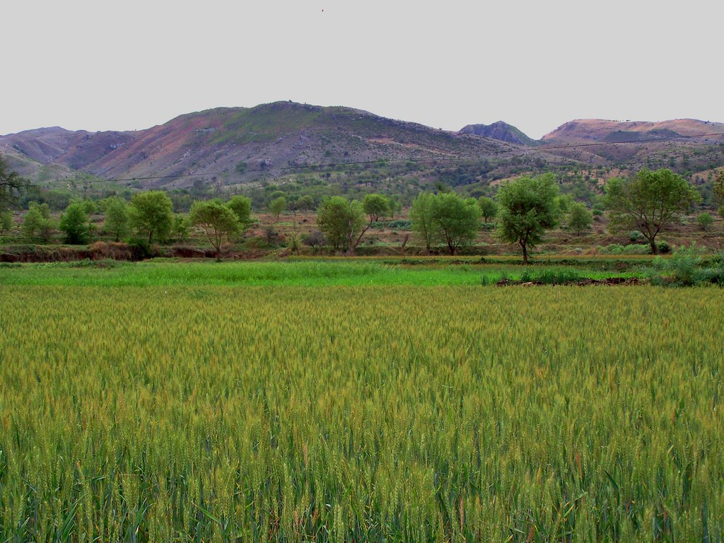
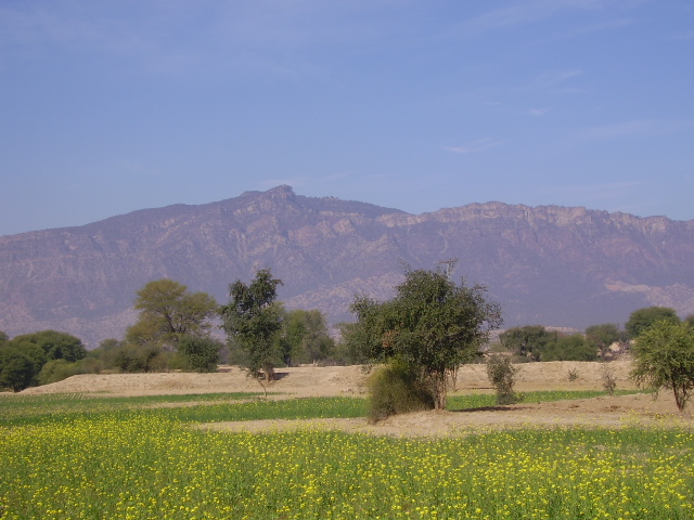
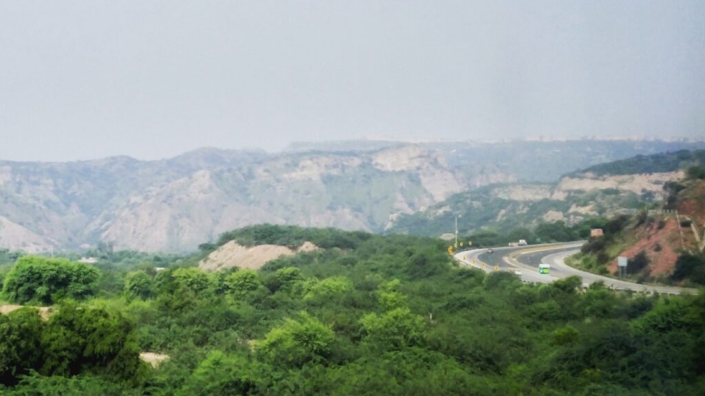
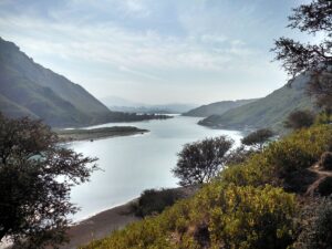
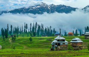
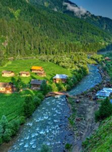
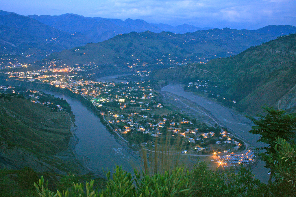
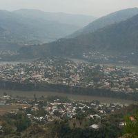
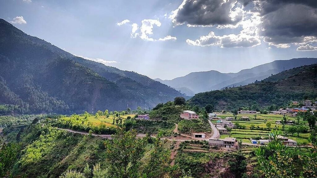
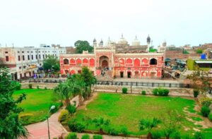
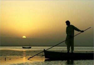
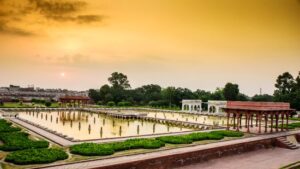
Swabi is a city in Khyber Pakhtunkhwa, situated between the rivers Indus and Kabul. It has historical as well as recreational spots.The district is known for its fertile lands, lush fields, and a network of canals that make it a vital agricultural region. Swabi’s idyllic scenery is further enhanced by the presence of the River Indus, which adds to the region’s natural charm.
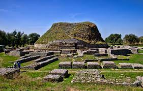
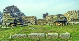
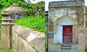
Swabi is not only about picturesque vistas; it has its own historical tales to tell. The district is home to archaeological sites like Jamal Garhi, which boasts ancient stupas and monastic cells, providing a window into the region’s Buddhist past. Moreover, Gohar Fort, a historic structure, adds to the historical allure of Swabi.
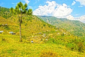
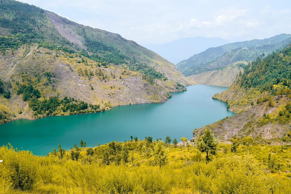
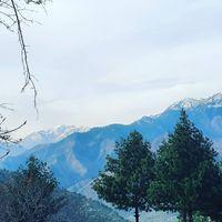
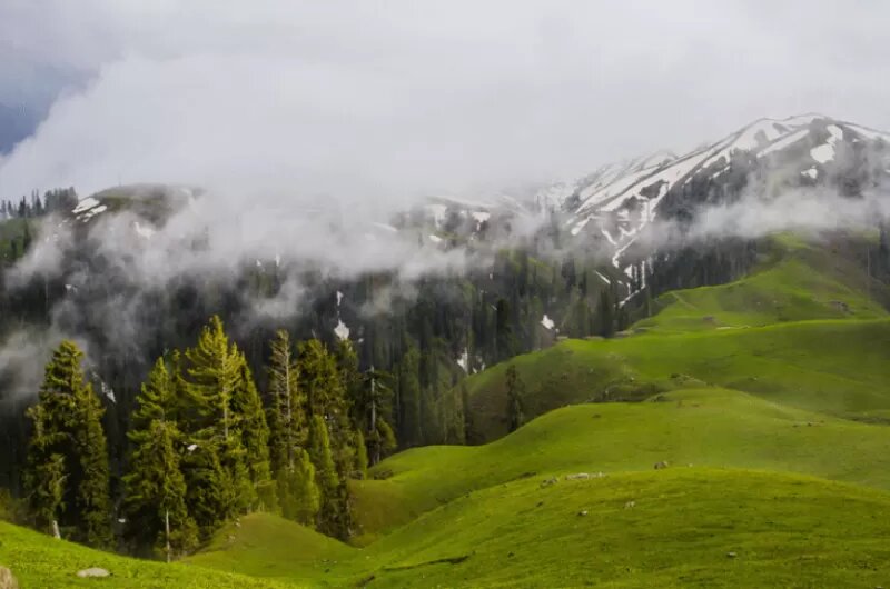
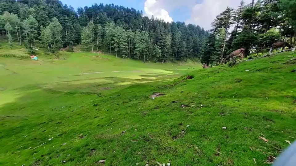
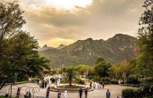
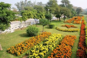
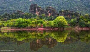
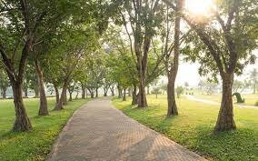
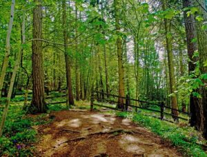
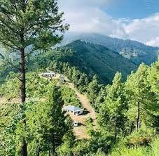
The lush green meadows of Swabi KPK
For those who appreciate a touch of adventure, Swabi is an excellent starting point for exploring the beautiful valleys of Khyber Pakhtunkhwa, including Malakand, Dir, and Buner. The district serves as a gateway to these pristine destinations, making it a convenient base for travelers.
With its natural beauty, historical sites, and proximity to other scenic areas, Swabi beckons both nature enthusiasts and history buffs. It’s a place where you can witness the harmonious coexistence of nature and heritage, offering a glimpse into the diverse tapestry of Khyber Pakhtunkhwa.
Swabi District is divided into four Tehsils named
Lahor
Razzar
Swabi
Topi
Key information about Swabi
Heading
Information
Location
Swabi is located in the Khyber Pakhtunkhwa (KP) province of Pakistan. It is situated in the heart of the province.
Geography
Swabi is characterized by lush fields, fertile lands, and a network of canals. It is also traversed by the River Indus, enhancing its natural beauty.
Historical Sites
Swabi is home to archaeological sites such as Jamal Garhi, which features ancient stupas and monastic cells, and Gohar Fort, a historic structure.
Nearby Destinations
Swabi serves as a convenient base for exploring nearby scenic areas, including Malakand, Dir, and Buner. It provides access to these pristine destinations.
Economy
The district’s economy is primarily agrarian, with agriculture playing a significant role. It is known for the cultivation of various crops and fruits.
Culture
Swabi has a rich cultural heritage, with traditions that reflect the broader Khyber Pakhtunkhwa culture. The district is known for its cultural events and festivities.
Natural Beauty
The natural beauty of Swabi is accentuated by its fertile landscapes, lush greenery, and the presence of the River Indus, making it an appealing destination for nature lovers.
History
Swabi and its surrounding areas have witnessed the footprints of various ancient civilizations, including the Gandhara civilization. This region was part of the larger Gandhara region, known for its Buddhist heritage. Archaeological sites like Jamal Garhi, with its ancient stupas and monastic cells, provide glimpses into Swabi’s ancient past.
Buddhism had a significant presence in Swabi during ancient times. The relics and ruins of Buddhist monasteries and stupas are a testament to this influence. The region played a pivotal role in the spread of Buddhism in the subcontinent.
Swabi is also home to historical structures like Gohar Fort. This fort is not only a symbol of the region’s history but also an architectural marvel. It stands as a reminder of the region’s strategic significance in various eras.
Swabi’s culture is a reflection of the broader Khyber Pakhtunkhwa culture. The district has a rich tradition of cultural events and festivities, showcasing the local customs and way of life.
Over the centuries, Swabi has witnessed changes in rulers, empires, and cultural influences. It has been part of various historical transitions, contributing to its unique historical identity.
Famous Tourist & Historical Sites
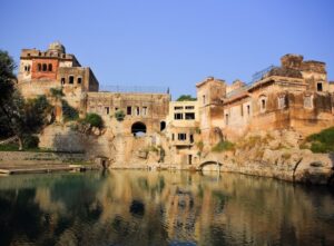
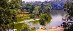
Kund Park
The borderline of Punjab ends at Khairabad and KPK starts here. It is a small village between the river Indus and the river Kabul. KPK tourism department has established a tourist park there. Vehicles can be parked at the side of the Khairabad point alongside Attock fort.
The two rivers can be seen mixing on the right side near the bridge. Kabul river has brown color while the river Indus has clear blue water. Both the brown color and blue color water flow together at a long distance. It is a fascinating and splendid sight.
Parking is there at a distance of 4km from the Attock bridge. This parking is on Pindi Road 4km from Swabi Interchange and Jahangira if you are coming Islamabad motorway. There is a ferry service, small boats, and cable cars near the edge of the river.
Kund Park where the river Kabul and the river Indus confluence
Going to the other edge of the river through any of these services is a thrilling experience. This park has rich green lawns, play areas, huts, and restaurants. There are golf cars in this 2.1 km long park. There is a facility for camel and horse riders. You can enjoy fishing too.
Hund
This ancient historical village is 6km from village Chota Lahore of district Swabi on the highway directed to Tarbela Dam which is 22km northeast of Attock. Historians used to call this village “the gate to subcontinent”.
According to Chich historians, this village was settled by Hund the grandson of Hazrat Noh (A.S). The first chapter of the Rig Veda mentions the Odabandpur (Hund) in the 41st Sukta of the 64th Bhajan. It was the capital of Hindu Shahi and an important city of Gandara civilization in 1008.
Alexander the Great crossed the Indus River here at the time of the invasion of the subcontinent. When Genghis Khan reached here like a hurricane, he saw the width of the river and went back. This was also the decisive battle between Raja Jay Pal and Mehmood Ghaznavid, the defeat of which became the fate of Raja Jayapal of Punjab.
The signs of Hund fort still exist. The valuable artifacts of the region are exhibited in Hund Museum on the bank of the river Indus. This museum can be seen from the river Indus bridge on the Islamabad Peshawar motorway.
Jeep Race in the river Indus, Hund.
Chota Lahore
The ancient area of Swabi is Chota Lahore. It was a civilized city stretching over a large area. Its oldest name was Salatur.
When the astrologers came and settled here, they were the ones who worshiped Mars. They made this place the temple of Mars and named it Lahore. Xuanzang (Hsüan-tsang) and Kangham have written it the city of “Brahmans”.
Maharaja Ashok built a memorial of Panini. Panini who was a philologist and grammarian wrote the grammar of the Sanskrit language. It was the birthplace of this great scholar. He was the first who embraced Buddhism.
Alexander the Great crossed the river Indus at this point and joined Raja Ambahi as his guest. It was the capital of the Gandara civilization and Raja Jay Pal before the Islamic regime.
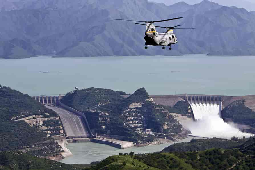
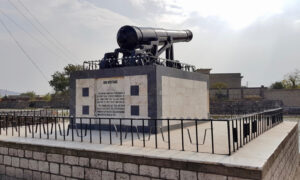
Tarbela Dam (The world’s largest earthen filling dam)
Tarbela dam project was started formally on 14th May 1968 when WAPDA and Tarbela Giant Venture signed a contract of 650 million American dollars. It was the biggest contract in the World in terms of finance.
A group of 13 Italian, French, German, and Swiss companies completed this project of the construction of the dam in three steps. The width of the river was blocked with a nine thousand feet high wall. The lower wall of the dam is 42 feet while the upper wall is only 5 feet wide.
A permission letter is required to visit the dam which can be obtained from PRO WAPDA Tarbela or WAPDA house Lahore.
A breath-taking aerial view of Tarbela Dam, Swabi
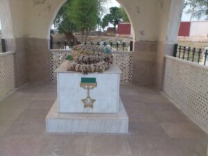
Captain Karnal Sher Khan Shaheed Nishan-e-Haider
Karnal Sher Khan was born on 1st January 1970 and got a commission in the army on 14th October 1994. Captain Karnal Sher Khan appeared as a brave soldier in the war of Kargil. He did great damage to the enemy by setting examples of bravery and courage.
At a height of 17,000 feet, he protected five defensive posts at the front of Gul Tari. On 5th July 1999, the enemy attacked the posts of Karnal Sher Khan with the assistance of two battalions and a heavy mortar. The enemy succeeded in capturing one check post.
Karnal Sher Khan regained that defensive post despite great difficulties. However, during this attack, he was martyred after getting a shot by machine gun. Later on, he was awarded the highest military award “Nishan-e-Haider”. The grave of this brave man is on the Mardan road from Swabi
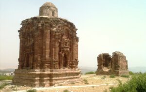
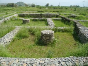
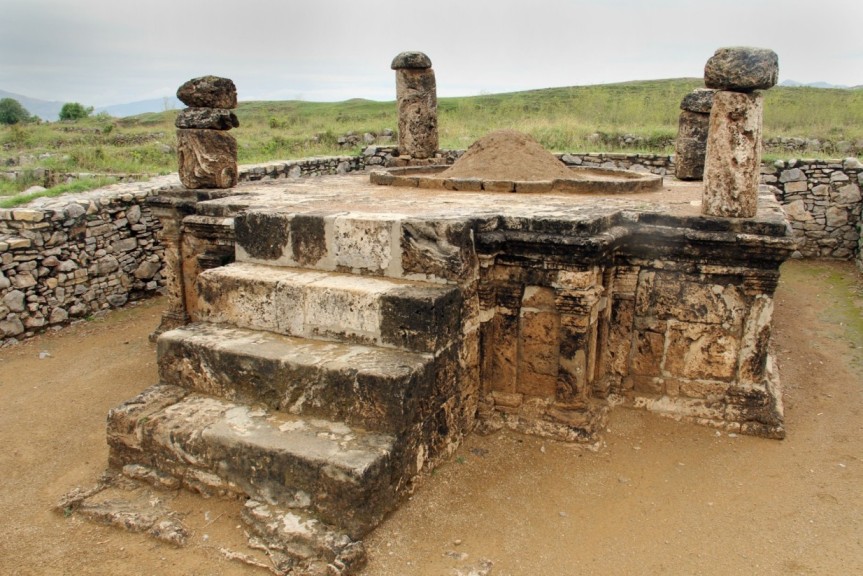
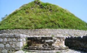
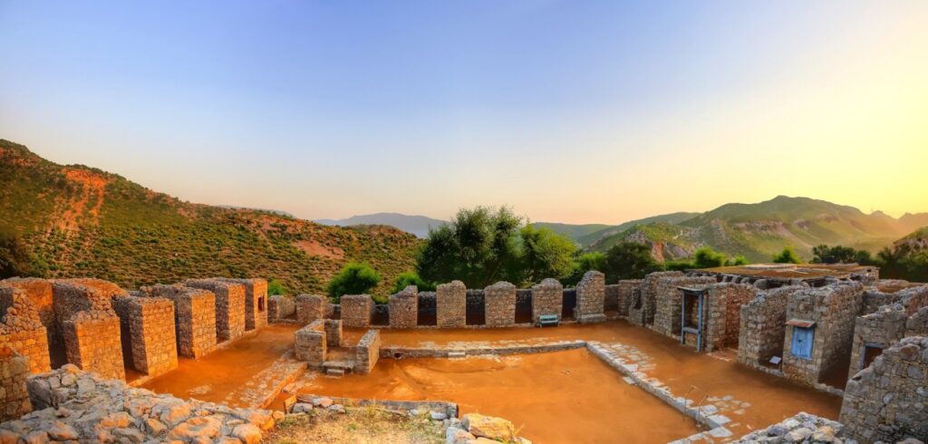
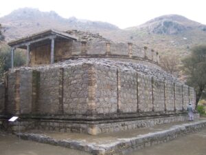
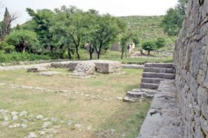
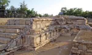
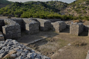
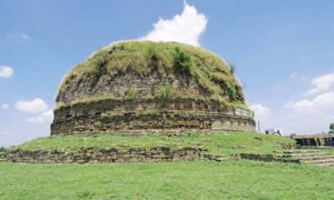
Jamal Garhi
Historical Stupas and Monastic Cells: Jamal Garhi is an archaeological site of great significance. It is known for its ancient Buddhist stupas and monastic cells, which offer a glimpse into the region’s Buddhist heritage.
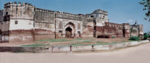
Gohar Fort
Historical Fortress: Gohar Fort, located in the district, is a historic structure with a unique blend of architectural beauty and historical importance. It serves as a reminder of the region’s rich past.
Marghuzar
Natural Beauty: Marghuzar, a picturesque town in Swabi, is known for its lush green fields, scenic beauty, and tranquil atmosphere. It’s a perfect destination for those seeking a peaceful retreat.
Yar Hussain
Agricultural Heart: Yar Hussain is a town celebrated for its agricultural significance. The region’s vast fields and fertile lands contribute to the district’s agricultural prosperity.
Shewa Adda
Commercial Hub: Shewa Adda is a bustling market in Swabi known for its economic activity. It’s a place where locals gather for shopping, dining, and socializing.
Shewa
Historical Village: Shewa is an ancient village with historical relevance. It showcases a blend of traditional architecture and a glimpse into the region’s past.
Panjpir
Spiritual Retreat: Panjpir is known for its spiritual and cultural significance. The shrine of Panjpir is a revered site for devotees and travelers.
Frequently asked questions (FAQs)
Q: What is the significance of Jamal Garhi in Swabi?
A: Jamal Garhi is an important archaeological site known for its ancient Buddhist stupas and monastic cells. It provides insights into the region’s Buddhist heritage and history.
Q: What can visitors expect to see at Gohar Fort?
A: Gohar Fort is a historic fortress in Swabi that offers a blend of historical significance and architectural beauty, making it a notable attraction for history enthusiasts.
Q: Is Marghuzar a popular tourist destination in Swabi?
A: Yes, Marghuzar is a picturesque town celebrated for its lush green fields and tranquil atmosphere, making it a favored spot for those seeking natural beauty and serenity.
Q: What is the specialty of Chota Lahor in Swabi?
A: Chota Lahor is a charming riverside location where visitors can enjoy the beauty of the river and its surroundings, making it an excellent choice for picnics and relaxation.
Q: Why is Yar Hussain known as an important town in Swabi?
A: Yar Hussain is celebrated for its agricultural significance, with vast fields and fertile lands that contribute to the district’s agricultural prosperity.
Q: What can one explore in Shewa Adda?
A: Shewa Adda is a bustling market and commercial hub in Swabi, where locals gather for shopping, dining, and social interactions, offering a taste of the local lifestyle.
Q: Is Shewa known for its historical significance?
A: Yes, Shewa is an ancient village in Swabi that provides a glimpse into the region’s history and traditional architecture, making it an interesting destination for history buffs.
Q: What is the spiritual significance of Panjpir in Swabi?
A: Panjpir is known for its spiritual and cultural importance. The shrine of Panjpir is a revered site for devotees and travelers, attracting those seeking blessings and solace.
Wind Up Lines
Swabi is a historical city of Khyber Pakhtunkhwa. It is blessed with natural beauty and splendid landmarks. Moreover, it is a town of brave people like Sher Khan.
It is surrounded by 10 to 16 thousand feet high mountains and is located 1921 meters above sea level.
It is famous as small Kashmir and it looks like heaven because of its luxuriant greenery, waterfalls, thick forests, pleasant climate, calm environment, orchards loaded with fruits, and white snow caps on the high hills.
There are two and three-floor wood houses that look similar. The environment of Leepa valley truly reflects the environment of occupied Jammu Kashmir. No other place is better than Leepa valley to enjoy the autumn season.
The area is covered with snow when red, orange, and yellow leaves stop falling. The routes to Pakistan and Azad Kashmir from Leepa valley are blocked in winter during snow falling.
A captivating sight of Leepa Valley
Walnuts, honey, cherry, apple, and apricot are abundant. A road goes to Leepa valley after crossing the river Jhelum Bridge. This bridge is 45km away from the highway directed to Srinagar from Kashmir after Hattian Bala and Neeli Village.
You will have to take a permission letter for this valley from the Hattian Bala deputy commissioner’s office. It is 60km away from Neeli Village.
Key information about Leepa Valley
Attribute
Information
Name
Leepa Valley
Location
Azad Kashmir, Pakistan
Geographical Features
Nestled in the Pir Panjal range of the Himalayas, Leepa Valley is known for its stunning natural beauty.
Area
Covers a significant area and is characterized by lush green meadows, dense forests, and flowing rivers.
Accessibility
Accessible by road, with a journey that takes you through picturesque landscapes and charming villages.
Natural Beauty
Renowned for its captivating landscapes, including terraced fields, alpine meadows, and pristine rivers.
Cultural Significance
Home to indigenous communities with a rich cultural heritage, adding to the valley’s charm.
Trekking and Hiking Trails
Offers numerous trekking and hiking opportunities that lead to panoramic viewpoints and remote villages.
Must-Visit Spots
Includes Leepa, Leepa Meadows, Leepa River, Leepa Valley Wildlife Sanctuary, and the picturesque villages.
Accommodation Options
Provides guesthouses, lodges, and camping facilities for visitors who want to immerse themselves in nature.
Local Cuisine
Offers a taste of Kashmiri and Pahari cuisine, with local specialties like Gushtaba, Dum Aloo, and more.
Weather Conditions
Features a pleasant summer season and heavy snowfall in winter, making it a year-round destination.
Famous Places in the Suburb of Leepa Valley
Eesha
22km away from Neeli Village, Eesha is a perfect place for natural beauty seekers. The road is smooth and solid till this point. For traveling beyond this place, you will have to book a jeep.
It is a better idea to book the jeep from Muzaffarabad. It is an adventurous journey on a motorbike. You can take NOC from the army check post in Eesha.
There are two ways to Leepa valley from Eesha. It will be a great idea to reach there by the Dao Khan way and return back from the other. In this way, you can visit the whole valley.
Dao Khan
It is a charming place 4km from Eesha. Its aerial views are splendid at a height of 2490 meters from sea level. There is a tourist rest house, a forest rest house, and a tent service by the tourism department.
Dao Khan Kashmir
Leepa
This central point of the valley is 38km away from Eesha and at an elevation of 1921 from ocean level. Must visit the local hydropower station on the way from Leepa to Chinian. You will be captivated by the fascinating scenery of the valley.
Leepa valley is parallel to occupied Jammu Kashmir. Pakistani and Indian forces are in front of each other. During the tension between the frontline Pakistan and India, Indian army forces attacked innocent citizens of the valley.
The Pakistan army has to be very careful because there are Muslim people on the other side of the border. It is a thrilling experience to climb the hilltop of Leepa from Eesha.
The link between Leepa to Pakistan and Azad Kashmir is jammed due to snowfall in winter. The army helicopters are the only way to reach there in the bitter cold. The Tatwal – area of occupied Jammu Kashmir is in front of Neelum valley.
Tatwal is 15km from Leepa. It was a part of Azad Kashmir before the Indian occupation.
Chinian
Chinian is at an altitude of 2226 meters from the sea level at a length of 6km from Leepa. This area is close to the line of control. There is a rest house and Chanar hotel for the public.
A Glimpse of Paradise
Geographical Wonders: Leepa Valley is a symphony of geographical elegance. As you traverse the winding roads that lead to this secluded haven, you’re greeted by lush green meadows, dense forests, and the melody of flowing rivers. The valley is cocooned by mountains, creating a cocoon of serenity.
Terraced Fields: One of the distinctive features of Leepa Valley is its terraced fields. These vibrant patches of cultivated land seem to defy gravity as they cascade down the slopes, creating a captivating visual mosaic.
Captivating River: The Leepa River meanders through the valley, its crystal-clear waters reflecting the surrounding mountains. It provides the perfect backdrop for picnics and leisurely strolls.
Alpine Meadows: Leepa Valley is renowned for its alpine meadows, where you can witness a carpet of wildflowers during the spring and summer months. These meadows are perfect for a quiet retreat or a leisurely hike.
Cultural Charms
Indigenous Communities: The valley is home to indigenous communities who have preserved their cultural heritage for generations. The warm hospitality of the locals adds to the valley’s charm, allowing you to immerse yourself in the rich traditions of the region.
Charming Villages: The valley is dotted with picturesque villages, each with its unique character. As you explore these villages, you’ll encounter quaint wooden houses, terraced fields, and a way of life that seems untouched by time.
Must-Visit Spots
Leepa Meadows: These meadows offer breathtaking views of the surrounding mountains and provide the perfect setting for a picnic or a leisurely stroll.
Leepa River: The gentle Leepa River invites you to relax by its banks, enjoy the serene atmosphere, and even try your hand at fishing.
Leepa Valley Wildlife Sanctuary: For wildlife enthusiasts, this sanctuary offers a chance to spot native species like the Himalayan brown bear, snow leopard, and the elusive Himalayan monal pheasant.
A Year-Round Destination
Leepa Valley is a destination for all seasons. In the summer, it comes alive with vibrant colors, and the meadows are adorned with wildflowers. During the winter, the valley is transformed into a winter wonderland, with heavy snowfall creating a serene, white landscape.
A Taste of Kashmiri Cuisine
No journey to Leepa Valley is complete without savoring the local cuisine. You can relish the flavors of Kashmiri and Pahari dishes, with specialties like Gushtaba and Dum Aloo tantalizing your taste buds.
Frequently asked questions (FAQs)
What is Leepa Valley known for?
Leepa Valley is renowned for its breathtaking natural beauty, including alpine meadows, terraced fields, and the serene Leepa River.
Where is Leepa Valley located?
Leepa Valley is situated in Azad Kashmir, a region in Pakistan-administered Kashmir, nestled in the Pir Panjal range of the Himalayas.
How can I reach Leepa Valley?
Access to Leepa Valley is primarily by road. The journey involves traversing picturesque landscapes and charming villages, making the trip itself a memorable experience.
What is the best time to visit Leepa Valley?
The best time to visit Leepa Valley depends on your preferences. Spring and summer offer vibrant landscapes with blooming wildflowers, while winter transforms the valley into a snowy wonderland, ideal for those seeking a winter retreat.
Are there hiking and trekking opportunities in Leepa Valley?
Yes, Leepa Valley offers various hiking and trekking trails that lead to panoramic viewpoints, alpine meadows, and remote villages, providing excellent opportunities for adventure enthusiasts.
What is the cultural significance of Leepa Valley?
Leepa Valley is home to indigenous communities that have preserved their cultural heritage for generations. Visitors can immerse themselves in the traditions and warm hospitality of the locals.
Are there accommodations in Leepa Valley?
Yes, there are guesthouses, lodges, and camping facilities available in Leepa Valley for visitors who wish to stay and experience the natural beauty and cultural richness of the region.
What is the local cuisine like in Leepa Valley?
Leepa Valley offers a taste of Kashmiri and Pahari cuisine. Local specialties include dishes like Gushtaba and Dum Aloo, providing a delightful culinary experience.
Is Leepa Valley accessible year-round?
Yes, Leepa Valley is accessible throughout the year. While the summer months offer lush greenery and wildflowers, the winter season blankets the valley in snow, making it a unique destination for winter enthusiasts.
Are there wildlife attractions in Leepa Valley?
Leepa Valley Wildlife Sanctuary is home to native wildlife species, including the Himalayan brown bear, snow leopard, and the Himalayan monal pheasant, making it an appealing destination for wildlife enthusiasts.
Wind Up Lines
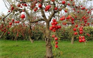
Leepa Valley is full of mesmerizing places. Sites near Leepa Valley such as Eesha, Dao Khan, and Chinian are worth watching too. It is well known for fruit orchards.
Mirpur city was settled by Meral Shah who was the son of the Ghaghra family. District Mirpur is located in the south of Azad Kashmir.
An enchanting aerial view of Mirpur Azad Kashmir
This city has plains and hilly areas with a warm climate. It is connected to Pakistan through many routes. The citizens of this town resemble the people of Jhelum and Gujrat.
Over the previous few decades, a lot of people from Mirpur have shifted to the United Kingdom for livelihood. Pakistan is getting a huge foreign exchange because of them.
The Government of Azad Kashmir has established an Industrial State for the promotion of private investment. The old Mirpur city is 459 meters high from sea level and it was a hurdle for the construction of the Mangla dam. Therefore, this new city is established with a proper plan and it has all the latest facilities.
Information about Mirpur in Azad Kashmir
Attribute
Information
Name
Mirpur
Location
Azad Kashmir, Pakistan
Geographical Features
Situated on the banks of the Mangla Dam, Mirpur boasts picturesque landscapes and a thriving, man-made lake.
Area
Covers a significant area and is one of the largest cities in Azad Kashmir.
Accessibility
Accessible by road from major cities in Pakistan, making it a popular destination for tourists.
Economic Hub
Known for its strong economy, Mirpur is a significant business and commercial center in Azad Kashmir.
Tourism
Attracts tourists with its beautiful surroundings, water sports on the Mangla Dam, and vibrant local culture.
Cultural Diversity
Mirpur is a melting pot of cultures, with influences from Kashmiri, Punjabi, and British traditions.
Industrial Development
Home to a range of industries, including manufacturing, agriculture, and trade.
Education Hub
Hosts educational institutions like Mirpur University of Science and Technology, contributing to higher education in the region.
Healthcare Facilities
Provides a range of healthcare services through hospitals and clinics, ensuring the well-being of residents and visitors.
Local Cuisine
The local cuisine reflects a blend of flavors, including traditional dishes like Kashmiri Wazwan and Punjabi cuisine.
Natural Beauty
The Mangla Dam, a key attraction, offers opportunities for boating, fishing, and enjoying the scenic beauty of the area.
Historic Significance
Holds historical importance as a region that was greatly impacted by the construction of the Mangla Dam and the resettlement of communities.
Infrastructure
Features modern infrastructure, including roads, bridges, and recreational facilities, making it an attractive city for residents and tourists.
The Historical Tapestry of Mirpur, Azad Kashmir
Nestled in the heart of Azad Kashmir, the city of Mirpur stands as a witness to a rich history that has been shaped by centuries of cultural interactions and, more recently, by the forces of modernity. Let’s unravel the historical tapestry of this captivating city.
Ancient Roots
Mirpur’s history, like the rest of Azad Kashmir, is deeply rooted in the annals of ancient civilizations. The region has been a cradle of diverse cultures and has witnessed the rise and fall of empires over the millennia. It’s believed that the area around Mirpur has been inhabited for thousands of years, with evidence of human settlements dating back to antiquity.
Influence of the British Empire
During the colonial era, the British Empire played a significant role in shaping the region. Mirpur, like many parts of South Asia, came under British colonial rule. The British presence left an indelible mark on the culture, administration, and infrastructure of the area.
The Birth of the Mangla Dam
A pivotal moment in Mirpur’s history occurred in the mid-20th century with the construction of the Mangla Dam. Completed in 1967, this colossal earth-fill dam was built to provide water storage for irrigation and generate electricity. The creation of the dam resulted in the submergence of a significant portion of the old city of Mirpur, displacing thousands of residents. The resettlement of these communities reshaped the city and its demographics.
Post-Independence Era
Following the partition of India in 1947, Azad Kashmir became part of Pakistan. As the region gained autonomy, Mirpur emerged as a major city in the newly formed Azad Jammu and Kashmir. The city’s growth was significantly influenced by the economic opportunities brought about by the Mangla Dam, making it a thriving business and commercial center.
Cultural Diversity
Mirpur’s historical narrative is not only about external influences but also about the tapestry of cultures that have blended here over time. The city’s cultural diversity is a source of pride, with residents embracing Kashmiri, Punjabi, and even British cultural elements. This diversity is reflected in the language, traditions, and way of life of the people.
Modern Mirpur
Today, Mirpur stands as a city where history and modernity coexist harmoniously. Its stunning natural landscapes and economic vitality, driven by industries such as manufacturing and agriculture, paint a vibrant picture of progress.
The city’s modern infrastructure, including roads, bridges, and educational institutions, ensures that it continues to grow and flourish. Yet, it never forgets its historical roots and the challenges it has overcome.
Mirpur, Azad Kashmir, is a city that proudly carries its historical legacy into the future. It’s a place where ancient history, colonial influences, and the ambitions of a modern, dynamic society converge to create a truly unique destination.
Historical Spots in Mirpur Azad Kashmir
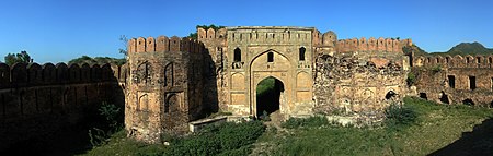
Ram Kot Fort
It is narrated that this fort was built above an ancient Shiva temple. This fort located on a mountain peak has the river Jhelum flowing on its three sides.
Muslim rulers of the sixteenth and seventeenth centuries took part in the construction of this temple. It is located in the opposite direction from Mirpur city. People can reach this temple through Mangla Lake by boat.
Army sports club is on the left side 10km away from Mirpur. From there, we can reach the temple using speed boats in 20 minutes. People reach this fort via bikes when the water level is low in Mangla Lake.
Beautiful Ram Kot is fenced by the river Jhelum
Khari Sharif
According to history, this place was ruled by Sohlan Rajput Family. It is an agricultural area of district Mirpur and is commonly called Khari.
It is located in between Mirpur City and river Jhelum hills at a distance of 8km from Mirpur. A well-known writer of romantic love stories Saif-ul-Malook, former prime minister of Azad Kashmir, and Barrister Sultan Mehmood belonged to this area of Khari Sharif.
A view of Mazar of Mian Muhammad Bakhsha, Khari Sharif Mirpur Azad Kashmir
Exploring The Mirpur
Geographical Elegance: Mirpur’s geographical beauty is its crown jewel. Situated alongside the Mangla Dam, it enjoys the embrace of rolling hills, lush greenery, and the vast waters of the dam. This picturesque setting creates an environment where nature’s artistry takes center stage.
The Mangla Dam: Mirpur’s most renowned feature, the Mangla Dam, is one of the largest earth-fill dams globally. The dam not only provides vital irrigation and power resources but also offers a scenic backdrop for various water sports and leisurely boat rides.
Cultural Diversity: Mirpur’s charm extends beyond its landscapes. The city is a cultural melting pot, influenced by Kashmiri, Punjabi, and even British traditions. This diversity is vividly reflected in the local way of life.
A Thriving Economy
Economic Hub: Beyond its natural beauty, Mirpur is a bustling economic hub in Azad Kashmir. It boasts a robust economy driven by diverse industries, including manufacturing and agriculture. The city’s markets are a testament to its trading activities, offering a wide array of products and services.
Educational Excellence: Mirpur University of Science and Technology (MUST) is a prestigious institution that provides higher education opportunities in the city, contributing significantly to the region’s academic growth.
Modern Infrastructure: The city’s infrastructure, which includes well-maintained roads, bridges, and recreational facilities, is a reflection of its modern and progressive nature.
Famous Places in Mirpur
The Mangla Dam: The star attraction of Mirpur, the Mangla Dam is not just a reservoir; it’s a serene expanse offering opportunities for boating, fishing, and capturing the scenic beauty that envelops it.
Rattan Bagh: For families and nature enthusiasts, Rattan Bagh is a tranquil park and zoo offering a relaxed atmosphere for picnics and leisurely strolls.
Kala Mata Temple: This ancient temple dedicated to the goddess Kala Mata is a place of spiritual significance and architectural beauty.
Famous Schools
Chenab Group of Colleges: Known for providing quality education and a diverse range of academic programs.
Allied School Mirpur Campus: Part of a respected educational network, Allied School offers excellent academic opportunities.
Colleges
Mirpur University of Science and Technology (MUST): A significant higher education institution in Mirpur, offering a wide range of undergraduate and postgraduate programs.
Govt. Degree College for Women: A prominent college catering to the educational needs of female students in the region.
Hospitals
City Hospital and Medical Complex: A well-equipped hospital known for its medical services and experienced healthcare professionals.
Fauji Foundation Hospital: Offers a range of healthcare services and is respected for its commitment to quality patient care.
Restaurants
Bashir Darul Mahi: Famous for its delectable seafood and local dishes, Bashir Darul Mahi is a preferred dining spot in Mirpur.
Pearl Continental Hotel – Taipan Restaurant: Located within the Pearl Continental Hotel, Taipan Restaurant offers a diverse menu with a luxurious dining experience.
Yummi Zone Restaurant: A popular choice for local and international cuisine, Yummi Zone Restaurant serves a variety of dishes in a welcoming atmosphere.
Frequently asked questions (FAQs)
What is Mirpur known for?
Mirpur is known for its stunning landscapes, including the Mangla Dam, and its role as a bustling economic hub in Azad Kashmir.
How do I reach Mirpur?
Mirpur is accessible by road from major cities in Pakistan, making it a convenient destination for tourists and travelers.
What is the Mangla Dam, and what can I do there?
The Mangla Dam is a vast reservoir known for water sports, boating, and fishing. Visitors can enjoy these activities while taking in the breathtaking views.
Is Mirpur a cultural city?
Yes, Mirpur is a diverse city influenced by various cultures, including Kashmiri, Punjabi, and British traditions. This cultural diversity is reflected in the local way of life.
What are the major industries in Mirpur?
Mirpur is home to a range of industries, including manufacturing, agriculture, and trade. It contributes significantly to the economy of Azad Kashmir.
Are there educational institutions in Mirpur?
Yes, Mirpur hosts educational institutions, including Mirpur University of Science and Technology (MUST), providing opportunities for higher education.
What are the must-try dishes in Mirpur?
Visitors can savor local delicacies like Kashmiri Wazwan and a variety of Punjabi-influenced dishes at local restaurants and food markets.
What are the famous places to visit in Mirpur?
Key attractions in Mirpur include the Mangla Dam, Ramkot Fort, Rattan Bagh, and the Kala Mata Temple. Each offers a unique experience.
Is Mirpur a safe city for tourists?
Mirpur is generally considered a safe destination for tourists. As with any travel, it’s advisable to stay updated on travel advisories and follow local guidelines.
What is the best time to visit Mirpur?
The best time to visit Mirpur depends on your preferences. Many tourists choose to explore the city during the pleasant weather of spring and autumn.
Wind Up Line
Mirpur, Azad Kashmir, is a city of contrasts where history meets modernity, and where nature and culture coexist harmoniously. The city’s scenic landscapes, economic vitality, and diverse culinary experiences make it an exciting destination for residents and tourists. Whether you’re exploring the historic Ramkot Fort, enjoying the tranquility of the Mangla Dam, or indulging in local delicacies, Mirpur offers a unique blend of tradition and progress.
Bahawalpur division has an area of 15918 square feet which is equal to the European country Denmark. It is situated 192 km fromRahim Yar Khan. It is connected to all the major cities of Pakistan via airport and road.It has splendid pieces of architecture, parks, and educational institutes. Famous for handicrafts, and pottery, there are agro-based industries too.It is the capital of the former state Bahawalpur and the headquarter of the Bahawalpur division of Pakistan to date.
Key information about Bahawalpur
Category
Details
Location
Southern Punjab, Pakistan
Area
24,830 square kilometers (9,602 sq mi)
Population
Approximately 3.7 million (as of last census)
Language
Urdu, Saraiki, Punjabi
Climate
Arid climate with hot summers and mild winters
Economy
Agriculture, trade, and small-scale industries
Major Crops
Cotton, wheat, sugarcane
Historical Significance
Former princely state, part of British India
Culture
Rich cultural heritage, traditional music and dance
Landmarks
Derawar Fort, Noor Mahal, Sadiq Garh Palace
Education
Bahauddin Zakariya University, numerous schools and colleges
Transportation
Well-connected by road, limited air connectivity
Government
Administrative divisions, part of Punjab province
Tourist Attractions
Lal Suhanra National Park, Abbasi Mosque
Industries
Textiles, agro-based industries, handicrafts
Notable Festivals
Eid, Basant, Urs celebrations at shrines
History of Bahawalpur
In the early ages, it was under the rule of a monarch. They called themselves the descendent of Hazrat Abbas (R.A). After the death of the last Abbasi caliph of Bagdad, their progeny immigrated to Iraq and then to the Sindh through Makran.
From the progenies of the caliph, Kulhora ruled over the Sindh and Dawood Potay led the foundation of the Bahawalpur state.
Later on, Nawab Sadiq Muhammad Khan’s grandson, Abbasi Awal established a united state of Bahawalpur in 1748.
In 1849, the Britishers subjugated the subcontinent and this state. Bahawalpur is the first state which unified Pakistan on 3rd October 1947. The credit goes to Ameer Bahawalpur Muhammad Khan Khamis.
In the Suburbs of Bahawalpur City
Dera Nawab Sahib
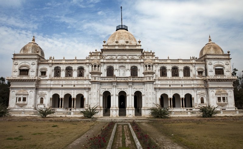
The homeland of the former minister of Bahawalpur state is Nawab Sahib. Situated 50 km from Bahawalpur, it holds significant importance because of the Gateway to the Cholistan desert.
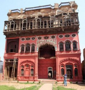
Sadiq Garh palace can be viewed from the outside.
Sadiq Garh Palace, An ancient masterpiece in Dera Nawab Sahib
Dera Nawab Sahib and Ahmad Pur Sharqiyah are twin cities.
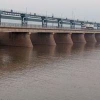
Head Punjnad
This head is 20 km from Uch Sharif.
All the five large rivers in Punjab are mixed at this point. Jhelum and Ravi mixed with Chenab. River Bayas connects with Sutlej.
Head Punjnad Indus River View
Sutlej and Chenab fall into Punjnad near Uch Sharif. This river water goes beyond 45 miles and enters into the Indus River at Mithan Kot. Finally, it falls into the Arabian sea. This head has parks and restaurants for tourists.
Sui Wahar
Gullen town is situated 28 km away on the way from Ahmad Pur to Bahawalpur. The historic monastery of Sui Wahar is 2 km on the left from Gullen.
Before the formation of Pakistan, a copper inscription was recovered from here which confirmed that Raja Kanishka had built Sui Vihar Monastery in 132 AH, eleven years after his accession to the throne.
The stone was not accessible at this place. Therefore, bricks were baked and used. They were large in size.
When the railway line was led, these bricks were used as gravel by the contractors. Mehrab Pur near Sui Wahar is the birthplace of the former Prime Minister of India Bajpai.
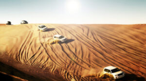
Cholistan Desert
The local name of the Cholistan Desert is Rohi. It is 30km away from Bahawalpur City and is famous for Jeep Rally held every year. Derawar fort and Jamiyah mosque are worth visiting places there.
Vehicles on the tracks of Desert Cholistan during Jeep Rally
Bahawalpur City
The old city of Bahawalpur, like Lahore and Multan, was within a circular road and wall.
Today’s Bahawalpur is recognized due to Noor Mahal, Darbar Mahal, Sadiq Mosque, Victoria Hospital, Quaid -e- Azam Medical college, Sadiq Public School, Zoological Garden, and Dring Stadium Complex.
This cultural area is located within a circular road. Kaptan Kay Pai is a famous food point. It is also famous for Khussa (a special kind of footwear).
Strong Walls was built around the city. They were destroyed with time but the name of the six doors still exists.
Famous Historical Places in Bahawalpur
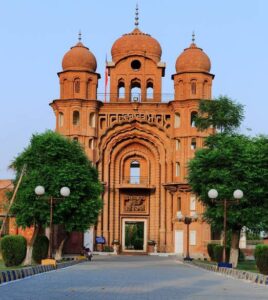
Jamiya Mosque Al-Sadiq
This mosque is situated in Chowk Bazar and it was constructed by Nawab Muhammad Bahawal Khan-II. It had only one floor.Nawab Sadiq Muhammad Khan-V gave the idea of its renovation. Under the plan, a large bazaar was built on the ground floor behind the Jama Masjid and dedicated to the mosque.
A beautiful mosque in Bahawalpur
And the courtyard of the old mosque was roofed and a new mosque building was built on the upper floor and the bazaar. Now, 20,000 people can offer prayer at one time.A clock tower was built on the upper floor. It was imported from Big Ban London. But it was against Islamic rules so the Ulema gave the order to remove it.Since it is located in the center of the city, people can enter from any gate.
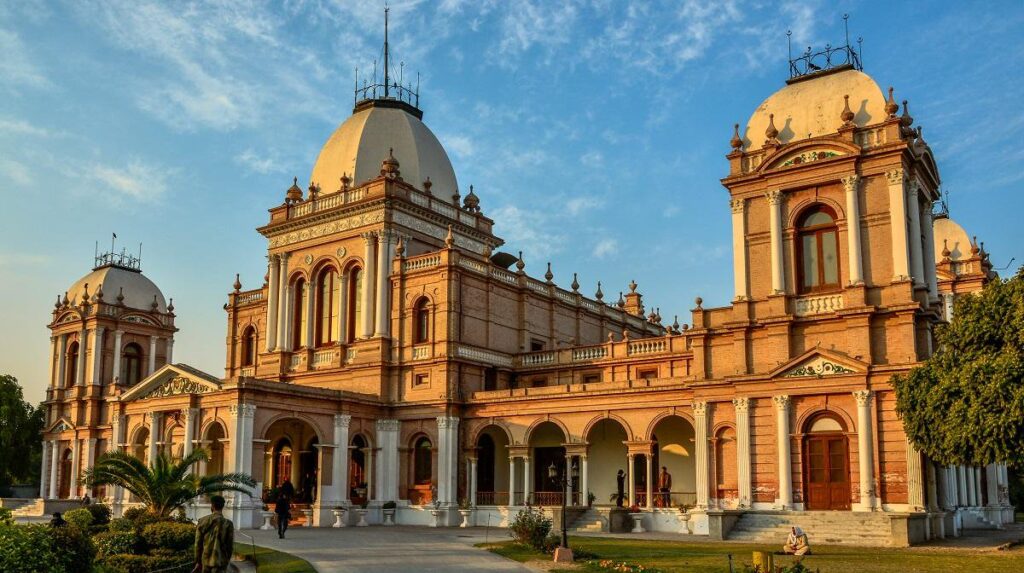
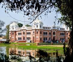
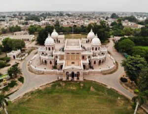
Noor Mahal
In 1872, Nawab Sadiq Muhammad Khan-IV built a palace on the northern side of Bahawalpur near Basti Malooq Shah. It was named “Noor Mahal”.This crystalline white building looks like a beacon of light from afar. Stretching over a large area, Noor Mahal’s structure is based on the Italian architectural style.
Noor Mahal Bahawalpur
Its map was designed by the engineer of the state Mr. Henein. It was completed in 1875 at a cost of 12 lacs. The furniture was imported from Italy and United Kingdom.Surrounding an area of 4140 square meters, this palace has 32 rooms, 14 basements, 6 verandas, and five dooms. In 1902, Nawab Muhmmad Bahwal Khan-V constructed a beautiful mosque on its boundary.The mosque design is replicated with the Aitchison college design. He was a student of that college. In 2001, the Government of Pakistan announced it as a monument.
Darbar Mahal
This palace was constructed by Sir Sadiq Muhammad Khan Abbasi-IV. Its construction was started in 1881 and completed in 1886. He spent 2 lacs on this fort-shaped Palace.It was a combination of many buildings. There were small palaces in it.A box was placed in front of the main door. The people used to put their applications and complaint letters there. Nawab Sahib opened the box daily. He listened to the problems and applications and gave the order to solve them.
The fascinating historical building of Darbar Mahal
Later on, the court was held there. It was famous as “Darbar Mahal”. Nowadays, Pakistan’s army offices are located there.The other palaces of Nawab Sahib are Gulzar Mahal, and Farrukh Mahal. Gulzar Mahal is also in the army’s custody.
An astonishing aerial view of Gulzar Mahal
Nishat Mahal and Farrukh Mahal are constructed in Dera Nawab Sahib and they are in the ownership of Nawab Sahib’s Family.Most of the palaces were built in the era of Nawab Muhammad Sadiq-IV. He is truly the Shah Jahan of Bahawalpur.
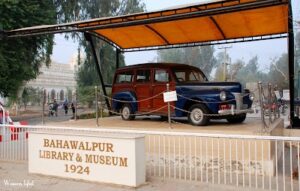
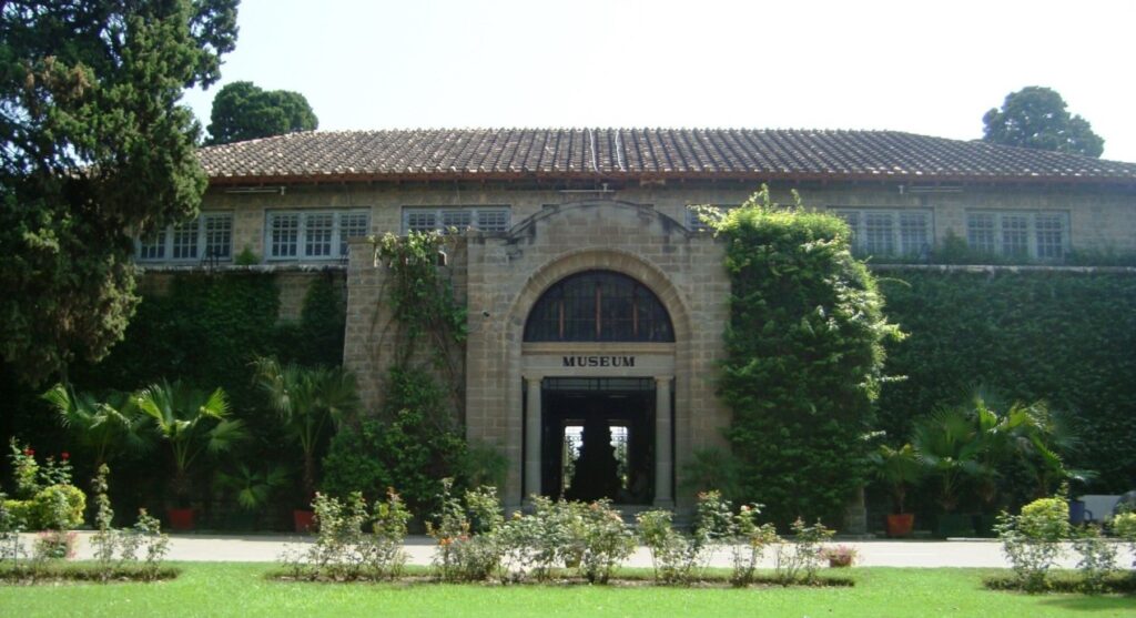
Bahawalpur Museum
This museum was established in 1976 for the protection of the culture, traditions, and history of the area. This museum is the biggest inheritor of the history of Bahawalpur state.This museum tells the history of Nawab of Bahawalpur-I to its integration with Pakistan through different items and pictures.The regional culture of Cholistan is depicted in a separate gallery. The sacred antiques of righteous caliphs of Islam and items before Christ are also exhibited.
An old vehicle in Bahawalpur Museum
Pakistan’s monument gallery, Islamic art gallery, archaeological gallery, Gandara art gallery, Hindu gallery, cultural gallery, Bahawalpur gallery, and Cholistani gallery are established there.A century-old railway steam engine from Punjnad Headworks is exhibited in the courtyard of the museum.It is located on the library road connected to Circular Road. Central Public Library and Sadiq Public School on Ahmad Pur Road are worth-watching buildings.
Craft Bazar
For the promotion of Bahawalpur’s local traditions and cultures, a craft Bazaar was established on 29th December 2011.Women’s home crafts industry is being encouraged through a display hall and a center. Moreover, TEVTA, PVTC, Punjab small industries corporation, police, private organizations, and businessmen have arranged different exhibitions for the demonstrations of local and domestic industry items.
Bahawalpur zoo and museum of Natural History.
Bahawalpur zoo was established by Nawab of Bahawalpur in 1942. In 1955, after the integration of the state of Bahawalpur with Pakistan, it was given under the control of the department of agriculture.From 1977 to 1982, this zoo was under the administration of the Punjab Livestock department. This zoo is famous for the breeding of lions and other livestock.
Peacocks dancing in the Bahawalpur zoo
The first-ever breeding of Bengal tigers, Asiatic cheetah or leopards, and black bear in Pakistan was done there. A museum named the museum of natural history was established for creating awareness about wildlife.
Lal Suhanra National Park
Lal Suhanra Park is a beautiful amalgamation of the forest, desert lake, and desert situated 36 km away on the east side of Bahawalnagar Road.
The stream in Lal Suhanra Park Bahawalpur
It was established in 1972 and extends up to an area of 162,568 acres. There is a headwork near Lal Suhanra Park. Large Canals are rising from this headwork and they irrigate the desert area.A children’s park is built on an area of 100 acres. A beautiful lake is built in an area of 7480 acres. This lake has boats and motor launches. A TDCP information center is also located here.
Different places are allocated for Rhinoceros, chinkara deer, black deer, Belgian Blue cow, and many other birds. A watchtower is fixed at a height for taking an aerial view of the natural beauty of the park.A rest house is established at a height named whispering hill. People can book this rest from the Bahawalpur office.
Famous Schools in Bahawalpur
Sadiq Public School: Renowned for its academic excellence and holistic education.
The City School: A prominent institution offering quality education.
Notable Colleges in Bahawalpur
Islamia University College: Affiliated with Islamia University Bahawalpur, known for a range of undergraduate programs.
Punjab College: A well-established college providing intermediate and bachelor’s degree programs.
Popular Restaurants in Bahawalpur
Mughal Mahal: Known for its delicious Mughlai cuisine and elegant ambiance.
Food Street Bahawalpur: A vibrant street with various local and international food options.
Prominent Hospitals in Bahawalpur
Bahawal Victoria Hospital (BVH): A major healthcare facility offering a wide range of medical services.
CMH Bahawalpur: Combined Military Hospital providing quality healthcare services to civilians and military personnel.
Frequently Asked Questions (FAQs)
What is the significance of Bahawalpur?
Bahawalpur is a city in the Punjab province of Pakistan, known for its rich history, cultural heritage, and architectural landmarks. It was once the seat of the princely state of Bahawalpur.
How do I reach Bahawalpur?
Bahawalpur is well-connected by road, rail, and air. You can reach it by taking a domestic flight, a train, or by using the extensive road network.
What are the must-visit attractions in Bahawalpur?
Some of the prominent attractions include Noor Mahal, Derawar Fort, Bahawalpur Museum, and the Abbasi Mosque. These landmarks showcase the city’s historical and architectural significance.
Tell me about the cultural events in Bahawalpur.
Bahawalpur hosts various cultural events throughout the year, including festivals, fairs, and celebrations. These events often showcase the local art, music, and traditional crafts.
Is Bahawalpur a safe destination for tourists?
Bahawalpur is generally considered safe for tourists. Like any other destination, it’s advisable to take standard precautions, such as being aware of your surroundings and following local guidelines.
What is the local cuisine like in Bahawalpur?
The local cuisine in Bahawalpur is diverse, offering a blend of traditional Pakistani dishes. You can savor local specialties like Sajji, Saag, and various types of Biryani.
Are there shopping opportunities in Bahawalpur?
Yes, Bahawalpur has bustling markets and bazaars where you can shop for traditional crafts, textiles, and souvenirs. The Shahi Bazaar is particularly known for its vibrant atmosphere.
Wind Up Lines
Bahawalpur is one of the historical cities of Pakistan. Darbar Mahal, Noor Mahal, Museum, and National Park make this a favorite tourist spot. Besides this, local industry plays a role in the economy.
The area of Cholistan is ten thousand three hundred and ninety-nine square miles (10,399 square miles). It stretches 483 km in length from northeast to southwest and 64 to 290 km in width.District Bahawalnagar, Bahawalpur, and Rahim Yar Khanare included in this area.
This desert area extends to the agricultural area of Sindh and to the areas of Bikaner and Jaisalmer towards India.This area is also called “Rohi”. The climate is too hot and sometimes the temperature goes beyond 54. Some sand dunes of Sand are higher than 500 feet. Mostly the people are nomads due to a lack of rain.Camels are used as transportation means.
About 1000 years ago, it was a green fertile land. River Hakra used to irrigate this area. It is known as Ghagra and Saraswati in India.History revealed that cities and towns were settled on the sides of the river. Settlements deserted when the river dried up and they moved to the suburbs. Cholistan has signs of 400 ancient settlements.
The locals of the Cholistan holding water pitchers
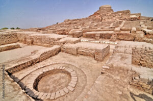
The archaeological experts match this desert area to the archeological sites of Harappa. Many forts are built there.
They include the Derawar fort (50 km from Bahawalpur), Islam Garh Fort (150 km from Derawar fort near Indian Border), Mehar Garh fort (21 km from Abbas city), Jam Garh Fort ( 9 km from Mehar Garh), Marot fort (11km from Jam Garh), Moj Garh Fort ( 32 km from Marot Fort), Khan Garh Fort (70 km from Derawar Fort), Khair Garh Fort ( 70 km from Derawar fort), Nawa Kot Fort ( 45 km from Derawar fort), Bajnot Fort ( 45 km from Nawa Kot ) and Oliyara fort.
Key info about Cholistan Desert
Attribute
Information
Location
Southern Punjab, Pakistan
Area
Approximately 16,000 square kilometers
Climate
Arid desert climate with scorching summers and cold winters
Landscape
Vast stretches of sand dunes, flat plains, and sparse vegetation
Tribes
Inhabited by the Cholistanis, mainly the Samaa, Khosa, and others
Economy
Primarily dependent on livestock farming, including camels and cattle
Tourism
Popular for its annual Cholistan Desert Rally, showcasing off-road racing and cultural festivities
Wildlife
Home to various species, including the Chinkara gazelle and desert fox
Cultural Heritage
Rich in traditional customs, arts, and crafts, particularly in camel-rearing communities
Historical Sites
Contains ancient ruins and forts, such as Derawar Fort
Challenges
Faces water scarcity and desertification issues, affecting livelihoods
Biodiversity
Despite arid conditions, the desert supports a variety of plant and animal species adapted to the harsh environment
Notable Features
The Derawar Fort, a massive and iconic desert fortress, is a prominent landmark
Accessibility
Accessible by road, and the annual rally attracts visitors from across the country
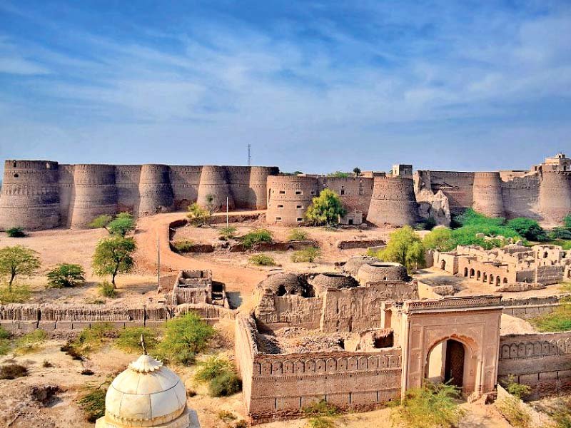
Famous Fort of Cholistan Desert
The great masterpiece of ancient civilization in the desert
It is 47 km from Ahmad Pur Sharqiyah. No one has known about its exact history. But is assumed that this fort was built in the middle of the civilization two and a half thousand years before Christ.
The walls and towers of this square-shaped fort can be seen from Cholistan which is miles away. It is said that this fort was built by Hindu Rajpoot Roy Jajja Bhatti Jaisalmer.
In 1733, Nawab Muhammad Kha Bahawal led the foundation of Bahawalpur state and declared Derawar its capital. He renovated this fort. Bricks were imported from Uch Sharif which is 60 km away.
The process of shifting these bricks was very interesting. They were transported through a man-made chain of hands from Uch to Derawar.
This grand fort has 40 towers with a strong boundary. If you enter through the only entrance on the east side, the tunnel-like path goes up.
This fort is at a height of 60 feet from ground level. Intellectuals, orators, and calligraphers lived in the first building next to the main entrance. The fort has seven floors.
Derawar Fort, A splendid masterpiece of architecture
In addition to the upper floor, the other six floors are underground, with an automated system installed to reach them. Cold Basements were specially built to withstand the heat of the scorching weather.
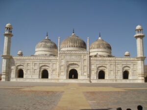
It also has magnificent tombs of the royal family, a podium for celebrations, two cannons, a special part of the Harappa era, two wells, and a grand mosque. This mosque is constructed with white marble and it was completed in 1848 within a duration of six years.
This fort is in control of the Nawab Family. A permission letter must be obtained from Dera Nawab Sahib city for visiting this fort.
Jamiya Mosque Derawar Fort
When Muslim rulers conquered the ancient forts, they built mosques there. They constructed forts and built mosques in them before the residential area.
Mosques were built near the old forts due to a lack of space inside the forts. It is assumed that there was a small mosque outside the Derawar fort in the first Hijri.
Ameer Muhammad Bahawal Khan built a spectacular mosque in 1825 during his regime. Marble stone is used in its construction. It resembles Delhi Shahi Mosque.
Abbasi Mosque in Cholistan desert
The mind is amazed that such a quantity of marble in such a desolate desert must have come from so many places. This mosque still exists today in excellent condition but unfortunately, they are not worshipers.
Cholistan Desert Safari and Jeep Rally
(Passport to Adventure)
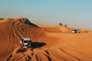
Stretching up to 25000 square kilometers, it is the largest desert in Pakistan. For the awareness of desert Cholistan culture, rituals, and traditions camel safari and jeep safari are two options.
Derawar Fort can be a great starting point for a tour of Cholistan. You can avail experienced guide there. They will arrange a camel or a jeep. The best season for the desert safari is November to march.
Arrange for the camping stuff, joggers, blankets for cold nights, jackets, sleeping bags, mineral water, and fast food. Travel to villages and towns to become familiar with the culture.
Jeep Rally
Can you imagine the wonderful sight during the camp safari – the moonlit nights with the shadows of the twinkling stars, the cool breeze in the cold weather, and you are sitting around the fire and sipping tea wrapped in a blanket, camel dancing around, and with the sounds of regional melodies in the air?
The annual jeep rally which is organized every year in the march is Pakistan’s largest motorsports festival. The tourist department of TDCP can assist with Jeep Rally, Desert Safari, and camel safari.
Exploring the Mystique of Cholistan Desert
Geography and Landscape
Cholistan Desert is part of the larger Thar Desert and extends into southeastern Pakistan, sharing borders with India. The landscape is characterized by rolling sand dunes, scattered vegetation, and occasional patches of shrubs. The Sutlej River flows along its northern boundary, providing a lifeline to the region by supporting some vegetation and sustaining the local population.
Ancient History and Archaeological Sites
Cholistan has a history dating back thousands of years, and evidence of ancient civilizations has been discovered in the region. The archaeological site of Derawar Fort stands as a testament to the rich history of Cholistan. Believed to be built in the 9th century by Rai Jajja Bhatti, the fort has served as a strategic military outpost and a symbol of power for various rulers over the centuries.
Culture and Traditions
The people of Cholistan, primarily the nomadic tribes, have a distinct and vibrant culture. The most prominent among them are the Saraiki-speaking Saraiki people and the camel-raising nomads known as the Rohi. These communities have maintained a deep connection with their traditions, visible in their colorful attire, traditional music, and folk dances.
Economy and Livelihood
Cholistan’s economy is primarily agrarian and revolves around livestock farming, especially camel breeding. The Cholistan Desert is renowned for its Marrecha breed of camels, known for their endurance and strength. The camel plays a crucial role in the lives of the locals, serving as a mode of transportation and a source of livelihood. The annual Cholistan Desert Jeep Rally, held near Derawar Fort, is a testament to the importance of these versatile animals.
Wildlife and Biodiversity
While the harsh conditions make it challenging for many forms of life to thrive, Cholistan is not devoid of biodiversity. The desert is home to various species of reptiles, small mammals, and numerous bird species. The Chinkara gazelle, desert cat, and various species of lizards are among the wildlife that has adapted to the arid environment.
Tourism Potential
In recent years, Cholistan has gained attention as a potential tourist destination. The stark beauty of the desert, coupled with its historical sites and unique culture, makes it an intriguing place for adventure seekers and history enthusiasts alike. Visitors can explore the mesmerizing landscapes, visit ancient forts, and experience the warm hospitality of the locals.
FAQs
What is Cholistan Desert known for?
Cholistan Desert is renowned for its vast expanse of arid land, ancient history, and vibrant cultural heritage. It is a part of the Thar Desert and is located in the southern region of Punjab, Pakistan.
What are the major attractions in Cholistan Desert?
Key attractions in Cholistan include Derawar Fort, an ancient fort with a rich history, and the annual Cholistan Desert Jeep Rally, a thrilling off-road race near Derawar Fort. The desert’s unique landscapes, traditional villages, and the nomadic way of life are also notable attractions.
Which tribes inhabit Cholistan Desert?
The Saraiki people, primarily speaking the Saraiki language, and the camel-raising nomads known as the Rohi are the main tribes inhabiting Cholistan. These communities contribute significantly to the cultural richness of the region.
What is the significance of Derawar Fort?
Derawar Fort, believed to be built in the 9th century, holds historical significance as a military outpost and a symbol of power for various rulers over the centuries. Its impressive architecture and panoramic views make it a major attraction in Cholistan.
How important are camels in Cholistan’s economy?
Camels play a crucial role in the economy of Cholistan. The Marrecha breed of camels, known for their endurance, is raised by the locals. Camels serve as a mode of transportation, a source of livelihood, and are celebrated in events like the Cholistan Desert Jeep Rally.
What is the Cholistan Desert Jeep Rally?
The Cholistan Desert Jeep Rally is an annual off-road motorsport event held near Derawar Fort. It attracts participants and spectators from around the world and showcases the challenging terrains of the desert, providing an adrenaline-pumping experience.
Is Cholistan open for tourism?
Yes, Cholistan is open for tourism, and its unique blend of history, culture, and landscapes is attracting an increasing number of visitors. However, sustainable tourism practices are encouraged to preserve the delicate ecosystem of the desert.
What is the wildlife in Cholistan Desert?
Despite its arid conditions, Cholistan is home to various forms of wildlife. This includes the Chinkara gazelle, desert cat, and several species of lizards. The adaptability of these species to the harsh environment is a testament to the desert’s biodiversity.
How do the people of Cholistan maintain their traditional way of life?
The people of Cholistan, particularly the nomadic tribes like the Rohi, maintain their traditional way of life through practices such as camel breeding, traditional music, and folk dances. Their colorful attire reflects the cultural richness that has been preserved for generations.
What measures are in place to preserve Cholistan’s ecosystem?
Efforts are underway to promote sustainable tourism in Cholistan to ensure the preservation of its delicate ecosystem. Balancing the influx of visitors with conservation initiatives is crucial to maintaining the environmental integrity of this unique desert region.
Wind Up Lines
The land of Province Punjab is enriched with historical landmarks, traces of ancient civilizations, and beautiful tourist spots. The Cholistan Desert, and Derawar Fort are assets of Pakistan.
Uch Sharif is a historical city at a distance of 75km from Bahawalpur.
It was situated at the junction of the river Chenab and the river Indus. Due to some reasons; this junction was shifted to 100 km away at the point of Mithan Kot.
It is assumed that the Great Alexander led its foundation in 325 B.C. In the 7th century A.D., it was under the dominion of Chach.
After a seven-day siege, Muhammad bin Qasim conquered it. Later on, in the Muslim era, it was an important center for the promotion of Islamic Teachings. Bulla Shah was also born in this two.
He Said,
اسیں اچے ساڈی ذات اچری اساں وچ وچ دے دس نے ہاں
In this city of beautiful mosques, there is a historic graveyard having the tombs of famous saints such as Bibi Jawindi, Jalal-ud-din Bukhari, and Bhao-ul Haleem. These shrines are masterpieces of Islamic art.
They are furnished with blue and white glazed tile work. No other buildings in Multan and Bahawalpur have such fine and high-quality work.
Key information about Uch Sharif
Heading
Information
Name
Uch Sharif
Location
Southern Punjab, Pakistan
Area
Approximately 25 square kilometers
District
Bahawalpur District
Historical Significance
Uch Sharif is an ancient city with a rich history, known for its cultural and architectural heritage. It was an important center for Islamic scholars and Sufis.
Landmarks
Uch Sharif Tomb Complex, including the tombs of Bibi Jawindi, Baha’al-Halim, and Jalaluddin Bukhari. ,Uch Masjid (Uch Mosque), a historic mosque. , Shrine of Sheikh Saif-ud-din Ghazrooni.
Geographical Features
Uch Sharif is situated on the banks of the Sutlej River and is surrounded by fertile agricultural land.
Cultural Significance
The city has been a center of learning, attracting scholars and students throughout history. It is recognized for its unique architectural style and as a hub of Sufi mysticism.
Accessibility
Uch Sharif is accessible by road, and the nearest major city is Bahawalpur.
Economic Activities
Primarily agrarian, with agriculture being a key economic activity due to the fertile soil in the region.
Local Population
Uch Sharif has a relatively small population, with a mix of rural and urban residents.
Tourist Attractions
The historical landmarks, including the Uch Sharif Tomb Complex and Uch Masjid, attract tourists interested in exploring the city’s rich cultural and architectural heritage.
Javindi Bibi tomb
The tombs are square-shaped or domed-shaped. Bibi Jawindi’s tomb is fully furnished with white and blue tiles. Jalal-ud-din Bhukari tomb’s roof is painted with red and blue colors.
Bha-ul-Haleem’s tomb is also decorated with white and blue tiles.
These buildings have been declared “World Heritage Site” by UNESCO.
The UNESCO World Heritage Site- Javindi Bibi tomb in Uch Sharif
People can travel to Uch Sharif through public transport which is 20km away from Ahmad Pur Sharqiyah.
Well of Baba Guru Nanak
About 100 yards from the tomb of Jalal-ud-din Surkh Posh, there is an old well (watering source). This water well has a pipal tree in it.
According to folk tales, Baba Guru Nanak used to meditate here. The administrator of this tomb Syed Zumurd Hussain Bukhari and a member of the provincial assembly Syed Iftikhar Hussian have many rarest sacred blessed things.
Head Punjnad
Punjnad Headworks is in the suburbs of Bahawalpur at a distance of 20 km from Uch Sharif. It has three canals named Punjnad canal, Abbasia Canal, and Abbasia Link Canal. These Canals are used to irrigate Bahawalpur, its neighboring areas, and Rahim Yar Khan
Head Punjnad,
All the five rivers in Punjab confluence at this point and after that this combined river meets the Indus river at Mithan Kot. It is the best Picnic Spot for families and holidaymakers. A market is also there.
Exploring The Uch Sharif
Historical Significance
Uch Sharif boasts a heritage that dates back centuries. Historically, it was a center of Islamic learning and mysticism. Scholars and Sufis were drawn to the city, contributing to its reputation as a hub of intellectual and spiritual pursuits. The city’s golden age was during the medieval period when it flourished as an important cultural and religious center.
Architectural Gems
One of the jewels of Uch Sharif is the Tomb Complex, a site that houses the tombs of notable figures such as Bibi Jawindi, Baha’al-Halim, and Jalaluddin Bukhari. These tombs are not merely structures but intricate pieces of art, adorned with exquisite tile work and geometric patterns. The craftsmanship reflects the influence of various Islamic dynasties that ruled the region over the centuries.
The Uch Masjid, or Uch Mosque, is another architectural marvel. Constructed during the reign of the Delhi Sultanate, this mosque showcases a blend of Islamic and Indo-Islamic architectural styles. Its grandeur and historical significance make it a must-visit for those interested in Pakistan’s cultural heritage.
Spiritual Haven
Uch Sharif is also renowned for its Sufi shrines. The shrine of Sheikh Saif-ud-din Ghazrooni attracts pilgrims and seekers of spiritual solace. The serene ambiance around the shrine adds to the city’s spiritual allure.
Geographical Beauty
Situated in an area blessed with fertile land, Uch Sharif is surrounded by lush green fields. The proximity to the Sutlej River not only enhances the city’s natural beauty but historically contributed to its prosperity through trade and agriculture.
Cultural Vibrancy
The cultural richness of Uch Sharif is reflected not only in its architecture but also in the traditions and practices of its inhabitants. Local festivals and celebrations bring the city to life, showcasing the enduring cultural heritage passed down through generations.
Accessibility
While Uch Sharif retains its historical charm, it is accessible to modern travelers. Roads connect the city to nearby urban centers, with Bahawalpur being the closest major city. This accessibility allows visitors to embark on a journey to explore the historical treasures that Uch Sharif holds.
Notable historical sites in Uch Sharif
Uch Masjid (Uch Mosque)
The Uch Masjid, also known as the Uch Mosque, is a masterpiece of Islamic architecture. Constructed with red bricks, the mosque exhibits a unique blend of Persian and Central Asian architectural styles. The mosque’s grandeur and historical significance make it a focal point for architectural enthusiasts and visitors interested in the cultural heritage of Uch Sharif.
Shrine of Sheikh Saif-ud-din Ghazrooni
The shrine of Sheikh Saif-ud-din Ghazrooni is a revered Sufi site in Uch Sharif. Sheikh Saif-ud-din was a prominent Sufi saint, and his shrine attracts pilgrims and devotees seeking spiritual solace. The shrine’s architecture and the surrounding atmosphere contribute to the spiritual and cultural ambiance of Uch Sharif.
Jami Mosque, Uch Sharif
The Jami Mosque, also known as the Friday Mosque, is another significant historical site in Uch Sharif. This mosque, with its distinct architectural features, adds to the religious and cultural heritage of the city. The mosque has witnessed centuries of worship and stands as a symbol of the enduring spiritual legacy of Uch Sharif.
Mai Maharban’s Tomb
Mai Maharban’s Tomb is an important historical site dedicated to a female saint. The tomb, with its architectural intricacies and historical background, adds diversity to the array of structures in Uch Sharif.
Frequently Asked Questions
What is Uch Sharif known for?
Uch Sharif is renowned for its rich historical and cultural heritage, featuring ancient tombs, mosques, and shrines that make it a significant center of Islamic civilization.
What historical sites are located in Uch Sharif?
Uch Sharif is home to historical landmarks such as the Uch Sharif Tomb Complex, Uch Masjid (Uch Mosque), the shrine of Sheikh Saif-ud-din Ghazrooni, Jami Mosque, and Mai Maharban’s Tomb.
Why is the Uch Sharif Tomb Complex famous?
The Uch Sharif Tomb Complex is famous for housing intricately designed tombs, including those of Bibi Jawindi, Baha’al-Halim, and Jalaluddin Bukhari. These structures are celebrated examples of medieval Islamic architecture.
Is Uch Sharif accessible for tourists?
Yes, Uch Sharif is accessible for tourists. Situated in the southern part of Punjab, Pakistan, visitors can explore its historical sites, including the tomb complex and mosques.
What is the significance of Uch Masjid?
Uch Masjid, also known as Uch Mosque, is significant for its unique blend of Persian and Central Asian architectural styles. Constructed with red bricks, the mosque stands as a testament to the artistic brilliance of the era.
Who was Sheikh Saif-ud-din Ghazrooni, and why is his shrine important?
Sheikh Saif-ud-din Ghazrooni was a revered Sufi saint. His shrine in Uch Sharif is considered a spiritual center, attracting pilgrims and devotees seeking blessings and spiritual solace.
Are there educational institutions in Uch Sharif?
Uch Sharif, being a historically significant town, may have modest local educational facilities. However, large and well-known schools or colleges might be located in nearby urban areas.
What is the local cuisine like in Uch Sharif?
The local cuisine in Uch Sharif may include traditional Pakistani dishes. However, as a historical town, it may not have a wide variety of restaurants, and local eateries might offer traditional meals.
Is Uch Sharif a pilgrimage site?
Yes, Uch Sharif is considered a pilgrimage site due to its association with Sufi saints and the presence of shrines. Pilgrims and devotees visit these sacred sites seeking spiritual blessings.
How can I travel to Uch Sharif?
Uch Sharif is accessible by road. The nearest major city is Bahawalpur, and visitors can travel by car or other public transportation options to reach Uch Sharif from various parts of Pakistan.
Wind Up Lines
Uch Sharif stands as a living testament to the rich tapestry of Islamic civilization and South Asian history. Its historical landmarks, vibrant culture, and spiritual significance make it a must-visit destination for those eager to delve into the roots of the region’s heritage. As visitors wander through the narrow streets and explore the intricacies of its architecture, they are transported to a bygone era, where Uch Sharif thrived as a center of knowledge, spirituality, and artistic expression.
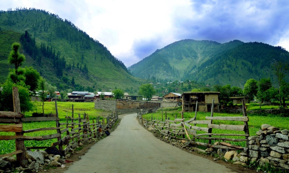
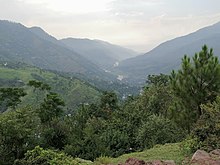
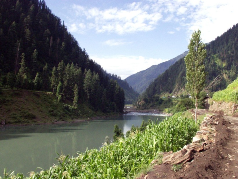
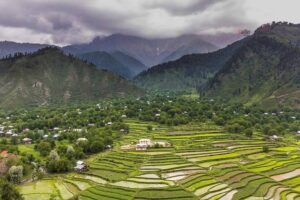
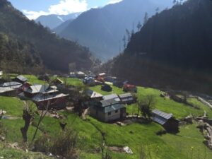
This valley is spreading from Muzaffarabad to Chakothi on the right and left side of river Jhelum till 59km. The river Jhelum flows from Srinagar to Muzaffarabad, passing from east to west through mountains meeting the river Neelum at the point of Domel.
The lush green meadows of Jhelum Valley
It enters Punjab at the point of Mangla. District Hattian of Jhelum valley is more beautiful from the tourist point of view. There is a solid road from Muzaffarabad to Chakothi. Jhelum valley road is functioning throughout the year due to moderate weather.
Key information about Jhelum Valley in Azad Kashmir
Attribute
Information
Name
Jhelum Valley
Location
Azad Kashmir, Pakistan
Geographical Features
Situated in the Himalayan and Pir Panjal ranges, characterized by lush green valleys, meandering rivers, and snow-capped peaks.
Area
Spans a significant area of Azad Kashmir, covering various towns, villages, and natural attractions.
Accessibility
Accessible by road from Muzaffarabad, the capital of Azad Kashmir, and other nearby cities.
Natural Beauty
Known for its pristine landscapes, including terraced fields, apple orchards, serene meadows, and thick forests.
Popular Tourist Sites
Leepa Valley, Toli Pir, Chikar, Leepa, Keran, Upper Neelum, Shounter Lake, Arang Kel, and more.
Outdoor Activities
Trekking, hiking, picnicking, and nature exploration. The region offers opportunities for adventure and solitude.
Cultural Heritage
Jhelum Valley exhibits a mix of Kashmiri and Pahari cultures, with traditional music, festivals, and crafts.
Seasonal Variations
The valley’s beauty changes with the seasons, with lush greenery in summer and snow-covered landscapes in winter.
Accommodation Options
Various lodges, guesthouses, and traditional wooden houses are available for tourists.
Local Cuisine
Local cuisine includes traditional dishes like kebabs, curries, and bread, often served in family-run restaurants.
Photography Opportunities
Jhelum Valley provides endless opportunities for capturing stunning landscapes, local life, and culture.
Famous Tourist Spots in Jhelum Valley
Garhi Dupatta
This town is on both sides of the river Jhelum and is located 24 km away from the highway connecting Muzaffarabad and Srinagar. It is a beautiful town surrounded by mountains.
Garhi Dupatta Jhelum Valley
This town is equipped with facilities and is a perfect place for people in search of peace.
Chakar
Beyond 7km from Garhi Dupatta, a track goes upward from Duni Baqlan. The beautiful place of Chakar (Chikkar) is 1828 meters above the sea on a mountain top in the south of Muzaffarabad. There is a PWD rest house on this peak.
The Sky-Kissing Mountains of Chikkar Valley
Non Bangla
It is at an altitude of 2011 meters from sea level and 10 km away from Chakar. This splendid hill station is surrounded by trees. There is a small market for basic needs.
Dungia
Dungia is 5 km from Lon Bangla and 2071 meter above sea level. Furnished by nature and fenced by woodlands, it is a perfect place for people in search of natural beauty and calmness. There is a laboratory station for Greek herbal medicines and shrubs examination.
Zalzal Lake
Four villages of Jhelum valley named Karli, Bhatt Sher, Lodhi Abad, and Pidar were devastated completely in the earthquake of 8th October 2005.
About 711 people were killed. The nearby mountain hills and the ruins of four villages blocked the natural flow of water.
As a result, a natural lake came into being at a distance of 3km away from this area. it was named Zalzal. On the way from Chakar to Sudhan Gali, this lake can be seen on the left side at a distance of 7km.
A beautiful sight of Zal Zal Lake in Chakar
Chanari or Chinari
Fenced by elevated mountains, this magnificent gift by nature is 51km from Muzaffarabad. A rest house of Dogara rulers is on the left side of river Jhelum near Bazar.
Well-known for the production of apples, walnuts, honey, and apricot, this site is equipped with all the facilities of life. Quid-e-Azam stayed here in a PWD rest house for a night.
A splendid sight of Chinari famous for fruits production
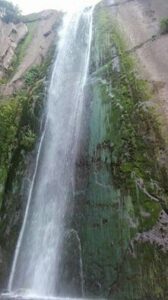
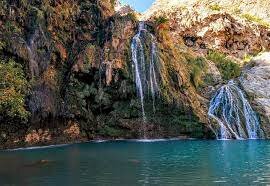
Cham Waterfall
The most beautiful waterfall in Kashmir is Cham waterfall. It enhances the beauty of Jhelum valley.
A charming view of Cham Waterfall, Jhelum Valley
Aabshar / Waterfall
This charming waterfall is on the right side of Chanari and Chakothi. It is the beauty of Jhelum valley. You will find many tourists enjoying near this waterfall. You can also enjoy swimming and showering there.
Chakothi
Chakothi is bounded by luxuriant woods with high mountains. It is located 8km away from Chanari.
Only national or local tourists can reach there since it is close to the line of control (LOC). On the other side of Azad Kashmir, the area of Aurari occupied Kashmir is located.
The LOC between India and Pakistan
There is a trade between two countries from this international border line. Due to border tensions between India and Pakistan, you will have a formal entry at the check post 3km before the borderline.
After this process, you can come here as a tourist. Pakistan military men will welcome you at the check post.
A Natural Marvel
Geographical Majesty: Jhelum Valley, framed by the mighty Himalayas and the Pir Panjal ranges, is a natural masterpiece. Its rolling hills, terraced fields, and dense forests are adorned with apple orchards and vibrant flora. The valley’s meadows are a verdant carpet under the open skies.
Seasonal Serenade: The valley undergoes a magical transformation with the changing seasons. In the summer, it’s a land of endless greenery, where vibrant wildflowers sway in the breeze. When winter arrives, Jhelum Valley becomes a snow-clad wonderland, a true winter wonder.
Captivating Rivers: The Neelum and Jhelum rivers gracefully meander through the valley, their waters glistening in the sunlight. These rivers add to the region’s beauty and provide not only aesthetic pleasure but also opportunities for various water-based activities.
The Crown Jewels of Jhelum Valley
Leepa Valley: Often referred to as “The Paradise on Earth,” Leepa Valley is renowned for its terraced fields, serene meadows, and traditional wooden houses. It’s a place where you can immerse yourself in local culture and witness the warmth of the local community.
Toli Pir: For those seeking panoramic views, Toli Pir is the place to be. A popular trekking destination, it offers stunning vistas of the valley and surrounding peaks. It’s an ideal spot for nature enthusiasts and trekkers.
Leepa: The town of Leepa is famous for its enchanting landscapes and vibrant flora. Strolling through apple orchards and embracing the natural beauty is a delightful experience.
Keran: Along the banks of the Neelum River, Keran offers mesmerizing river views and a serene environment. It’s an excellent place for relaxation, picnics, and immersing in nature’s embrace.
Upper Neelum: Upper Neelum Valley captivates visitors with its pristine beauty and scenic charm. It’s a destination for unwinding and indulging in various outdoor activities.
Shounter Lake: Hidden deep within the valley, Shounter Lake is surrounded by lush meadows and snow-capped peaks. It’s a spot for adventure and solitude, a hidden treasure waiting to be explored.
Arang Kel: Accessible by a trek, Arang Kel is a remote village offering captivating views of the valley and snow-covered peaks. It’s a destination for those seeking an off-the-beaten-path adventure.
Delightful food spots in Jhelum valley
Local Dhabas: One of the best ways to savor the local flavors is by visiting the small roadside dhabas. These humble eateries serve delicious regional dishes like kebabs, curries, and various types of bread. The simplicity and authenticity of these places make for a unique dining experience.
Guesthouse Kitchens: If you’re staying in guesthouses or lodges, don’t miss the opportunity to savor home-cooked meals. Many guesthouses offer traditional meals prepared by local cooks, providing a taste of the region’s culinary heritage.
Lalazar Restaurant: Located in Jhelum Valley, this restaurant is known for its excellent food and a fantastic view of the Neelum River. You can enjoy a variety of local and international cuisines while taking in the natural beauty that surrounds you.
Pine Park Restaurant: Situated in a beautiful setting, Pine Park Restaurant offers not only scrumptious food but also a peaceful ambiance. It’s an ideal place to relax, dine, and enjoy the serene surroundings.
Traditional Delights: Don’t forget to try traditional Kashmiri dishes like Rogan Josh (a flavorful lamb curry), Dum Aloo (spiced potatoes), and Gushtaba (minced mutton meatballs in yogurt gravy). These dishes are a culinary delight for those seeking authentic regional flavors.
Riverfront Picnics: What’s better than enjoying a picnic on the banks of the Neelum River? Many tourists and locals pack their own meals and head to the river for a delightful dining experience amidst nature.
Fruits Galore: Jhelum Valley is famous for its juicy and delicious apples. While exploring the region, you’ll come across numerous apple orchards where you can buy fresh apples and other seasonal fruits.
Frequently asked questions (FAQs)
What is Jhelum Valley known for?
Jhelum Valley is renowned for its stunning natural beauty, characterized by lush landscapes, meandering rivers, and picturesque meadows. It’s also famous for its cultural diversity and a wide range of tourist attractions.
How can I reach Jhelum Valley?
Jhelum Valley is accessible by road from Muzaffarabad, the capital of Azad Kashmir, and other nearby cities. It’s a scenic journey through the Himalayan foothills.
What are the best times to visit Jhelum Valley?
The valley is enchanting year-round. In summer, it’s lush and green, while in winter, it’s covered in a blanket of snow. The best time to visit depends on your preferences, but many tourists choose to explore the valley in the summer months.
What are the major tourist attractions in Jhelum Valley?
Some of the key attractions in Jhelum Valley include Leepa Valley, Toli Pir, Chikar, Leepa, Keran, Upper Neelum, Shounter Lake, and Arang Kel. Each offers a unique experience of the valley’s natural beauty and culture.
Are there trekking opportunities in Jhelum Valley?
Yes, Jhelum Valley offers excellent trekking and hiking opportunities, with trails that lead to panoramic viewpoints, pristine meadows, and remote villages.
What is the local cuisine like in Jhelum Valley?
Local cuisine features dishes like kebabs, curries, and various types of bread. You can also savor traditional Kashmiri specialties, such as Rogan Josh and Dum Aloo, in the local restaurants and dhabas.
Is Jhelum Valley safe for tourists?
Jhelum Valley is generally a safe destination for tourists. However, as with any travel destination, it’s advisable to stay updated on travel advisories and follow local guidelines for a safe and enjoyable trip.
Are there accommodation options in Jhelum Valley?
Yes, there are various lodging options in the valley, including guesthouses, lodges, and small hotels. Many of these accommodations offer both comfort and a local experience.
What are the must-visit spots for nature enthusiasts in Jhelum Valley?
For nature lovers, Leepa Valley, Toli Pir, and Shounter Lake are must-visit spots, offering unspoiled natural beauty and opportunities for outdoor activities.
Is there a local market in Jhelum Valley for shopping?
Yes, you can explore the local markets in towns like Leepa and Keran for unique souvenirs, local handicrafts, and fresh produce, including the famous apples of Azad Kashmir.
What is the cultural diversity like in Jhelum Valley?
Jhelum Valley is a melting pot of cultures, with influences from Kashmiri and Pahari traditions. Visitors can experience local music, colorful festivals, and the warm hospitality of the residents.
Wind Up Lines
Jhelum Valley is one of the ten districts in Azad Kashmir. Its beautiful sites and charming scenery attract vacationers.
Jhang is a historical city and the homeland of the famous noble prize winner in Physics Dr. Abdul Salam. It is the burial place of Heer Ranjha and Hazrat Sultan Bahu. It is located at a distance of 177 km from Multan.
Sultan Bahu was a Sufi poet and wrote almost 40 books on Sufism
Jhang has four Tehsils Ahmad Pur Sial, Jhang, Chiniot, and Shorkot. It is connected to Multan and some major cities of Pakistan by road and railways. It is surrounded by green fields and the climate is generally hot there.
Heer Ranjha
It is not only a romantic folk tale but also a real incident. At the end of the sixteenth century, there used to live a wealthy landlord in Hazara district Sargodha.His name was probably Muez-ud-din or Meraj Din. They were Jat by the cast and called themselves Ranjhay. His youngest son Waheed-ud-Din alias Waheed Ranjha was fond of playing flute (Bansuri) since Childhood.
He depended on his brothers since his father died in his childhood. He did farm with his brothers but he didn’t like it. When he complained to his brothers, they used to scold him. His sister-in-law also taunted him.One day a Barat (a celebratory wedding procession) came, and a barati praised Ranjha so much for the beauty and splendor of Jhang’s that Ranjha went to Jhang with him.
The people of Barat in Jhang asked him to sing a song with his flute.They started praising him. On the roof of Dewan Khana (room), a crowd of females was also listening to his voice. The daughter of Chochak was one of them. She fell in love with Ranjha.
The tomb of Heer Ranja
She requested his father to hire him. He hired him for grazing buffaloes. In this way, their love story began in fields, gardens, and in the shade of trees. And the villagers came to know about their love affair.
They started whispering about their story. Kedo, uncle of Heer complained to her father. As a result, she married to son Seedhay kheray of Chief Rang Pur district Muzaffargarh.He could not bear her separation and became a disciple of Guru ball Nath for the peace of his heart.
One day, he reached Rang Pur.Heer came to know of his arrival. She came back to her father’s home with the help of her sister-in-law. But Kedo didn’t like her.He devised a plan. He asked his brother to send the Ranjha to his town for the preparation of marriage. And he poisoned Heer.
Chochak did so. When Ranjha came there with Barat, he saw the dead body of Heer. He also died on the spot.There is a tomb of Heer on the right side at a distance of 2 miles on Faisalabad Road in Jhang Sadr, 84 miles away from Chiniot.It is famous as Mai Heer Darbar. According to locals, the place where Rajha meditated for Heer is also located in the tomb. Waris Shah wrote this love story in 1766.
Key information about Jhang
Category
Information
Location
Jhang, Punjab, Pakistan
Population
Approximately 590,000 (as of 2021)
Area
8,809 square kilometers (3,402 sq mi)
Coordinates
31.2729° N latitude, 72.3147° E longitude
District
Jhang District
Language
Punjabi, Urdu, and English
Economy
Agriculture, commerce, and trade
Major Crops
Wheat, sugarcane, cotton, and rice
Transportation
Well-connected to surrounding cities by road
Education
Numerous schools, colleges, and a campus of the University of Jhang
Healthcare
Hospitals and medical facilities
Notable Places
Tarewala Mausoleum, Shorkot Fort, and Chenab River
Culture
Rich cultural heritage with traditional music, dance, and local cuisine
Administration
Jhang is divided into several Union Councils for local governance
Climate
Hot and arid, experiencing extreme temperatures in summer
Major Highways
M-4 Motorway, Faisalabad-Jhang Road, and others
Airport
The nearest airport is Faisalabad International Airport (about 80 km away)
Famous Places in Jhang
Chenab River
The city is situated on the banks of the Chenab River, and a walk along the riverfront offers scenic views and a peaceful atmosphere.
Shrine of Heer and Ranjha
This shrine is dedicated to Heer and Ranjha, two legendary Punjabi love characters. It is a popular pilgrimage site for those seeking blessings for their love stories.
Tomb of Sultan Bahoo
This historic tomb is dedicated to the Sufi saint Sultan Bahoo. It’s an important spiritual and cultural site in Jhang.
Chenab College Jhang
An educational institution known for its academic excellence and beautiful campus.
Jhang Bazaar
A bustling marketplace where you can experience the local culture, shop for traditional crafts, and savor local cuisine.
Dinga Baba Shrine
Another important Sufi shrine in the city, visited by devotees seeking spiritual solace.
Tareen’s House
The ancestral house of the influential Tareen family, which has played a significant role in Pakistani politics.
Haveli Maan Singh
A historic haveli (mansion) that reflects the architectural heritage of the region.
Rakh Lashkar
A rural area in Jhang known for its agricultural landscapes, offering a glimpse of the agrarian life in the region.
Shrine of Shah Jewna
A revered Sufi shrine, attracting pilgrims and visitors interested in the spiritual heritage of Jhang.
Cultural and Historical Landmarks
Fawara Chowk
Fawara Chowk is a central landmark in Jhang, known for its lively atmosphere and as a meeting point for locals.
Chiniot Bazaar
The bustling Chiniot Bazaar is a cultural hub, offering a vibrant shopping experience with a variety of traditional goods and crafts.
Schools in Jhang
Jhang Public School and College
The City School Jhang Campus
Divisional Public School and College Jhang
Beaconhouse School System Jhang
The Educators School Jhang
Government Girls High School Jhang
College in Jhang
Government College University Jhang (GCU Jhang)
University in Jhang
Government College University Jhang (GCU Jhang)
GCU Jhang offers various undergraduate and postgraduate programs.
Hospitals in Jhang
DHQ Hospital Jhang
Allama Iqbal Hospital Jhang
Al Mustafa Hospital Jhang
Civil Hospital Jhang
Bilal Hospital Jhang
Shahzad General Hospital
Restaurants in Jhang
Pizza Hut Jhang
Subway Jhang
Lal Qila Restaurant
Al Rehman Restaurant
Food Master Jhang
Shaheen Shinwari Restaurant
Frequently Asked Questions (FAQs)
What is the significance of the Chenab River in Jhang?
The Chenab River holds great significance, providing a serene backdrop and a peaceful escape for both locals and visitors. Its riverbanks are often frequented for leisurely strolls.
Tell us about the historical importance of the Shahi Mosque.
The Shahi Mosque in Jhang is a historical masterpiece, reflecting intricate design and craftsmanship. It stands as a symbol of the city’s rich cultural and religious heritage.
Why is the Shrine of Sultan Bahoo renowned?
The Shrine of Sultan Bahoo is a revered spiritual sanctuary, attracting devotees seeking solace and connection. The shrine is known for its tranquil atmosphere and the legacy of the Sufi saint.
Which educational institutions are notable in Jhang?
Jhang is home to institutions like the University of Jhang and Government College Jhang, both contributing significantly to the academic landscape of the city.
What are some prominent healthcare facilities in Jhang?
DHQ Hospital Jhang and Allied Hospital are notable healthcare facilities, providing a range of medical services and treatments to the local population.
Name a few well-known restaurants in Jhang.
Jhang Sweets and Bakers, Chenab Sweets & Bakers, and Kababish Restaurant are popular eateries, each offering a unique culinary experience in the city.
Are there cultural landmarks in Jhang?
Fawara Chowk and Chiniot Bazaar are cultural landmarks in Jhang, representing lively meeting points and vibrant shopping experiences.
What is the cultural significance of Chiniot Bazaar?
Chiniot Bazaar is a bustling cultural hub known for its vibrant atmosphere and diverse array of traditional goods and crafts.
Wind Up Lines
Jhang stands as a testament to the enduring spirit of Punjab—a region where tradition meets tranquility. Whether exploring its historical landmarks, savoring local delicacies, or simply basking in the scenic beauty along the Chenab River, Jhang offers a multifaceted experience that captures the essence of this culturally rich city.
The word Khuhab is a combination of two words Khush and Aab. It has the meaning of “sweet or pleasant water”. It is enriched with green fertile lands, mountains, valleys, cascades, and lakes.
Moreover, its mountains have minerals like salt and Gypsum. The weather is very cool and calm in Summer and snowfalls at times in winter.
The heavy water and natural uranium research reactor project is there in Khushab.
The lush green fields of Khushab present a splendid view
Khushab is the homeland of the famous writers Ahmad Nadeem Qasimi and Abdul Qadir Hassan . Dhoda and Patessa (confectionery items) are the famous desserts of Khushab.
Parents of Saint Sultan Baho migrated to Shorkot from the town of Anga Soon valley.
Soon Valley, Khabeki lake, and Khadoomi waterfall in Kanhatti Garden are beautiful places to visit.
Key information about Khushab
Category
Information
Location
Khushab, Punjab, Pakistan
Population
Approximately 1,080,000
Area
6,520 square kilometers (2,517 sq mi)
Coordinates
32.2967° N latitude, 72.3375° E longitude
District
Khushab District
Language
Punjabi, Urdu, and English
Economy
Agriculture, mining, and trade
Major Crops
Wheat, sugarcane, and cotton
Minerals
Salt, coal, gypsum, and limestone
Transportation
Well-connected to surrounding cities by road
Education
Schools, colleges, and the University of Sargodha, Khushab Campus
Healthcare
Hospitals and medical facilities
Notable Places
Soon Valley, Sakesar Hill, and Noorpur Thal Lake
Culture
Rich cultural heritage with traditional music, dance, and local cuisine
Administration
Khushab is divided into several Union Councils for local governance
Climate
Hot and arid, experiencing extreme temperatures in summer
Major Highways
M-2 Motorway, Khushab-Jauharabad Road, and others
Airport
The nearest airport is Faisalabad International Airport (about 160 km away)
Famous Places in Khushab
Soon Valley – Worth A Visit
It is also called Soon Sakesar and is located in the northwest of Khushab on Bannu Road about 45 km from Sargodha.
The central point of this valley is the town of Nowshera. It starts from Pidhra village and ends at the highest peak of Salt Range Sakesar.
An enchanting aerial view of Soon Sakesar Valley
Sakesar is 5010 feet high from the sea level and it is the only place in that region where it snows occasionally in winter. This valley is about 56 km long and 14 km wide.
This beautiful valley has small and large lakes, waterfalls, natural water springs, and thick and lush green forests that attract tourists with their enchanting sights.
The waterfalls of Deep Sharif, Kafiri, and Sodi villages are spectacular. There is a rest house in Sodi Village. Some caves are discovered in this village. It is assumed that the people in the stone age lived there.
The breathtaking scenery on the way to Kanhnatti Garden can only be witnessed in Hollywood movies. In this garden, ponds, lakes, springs, and trees are loaded with hundreds of seasonal fruits awaiting you.
There is a camping site for a night’s stay. You can see Kashmir hills in the southeast on the top of Sakesar mountain when the sky is clear or after rain.
It has Jhelum in the north, Indus River and Kohat hills in the west, TakhtSuleman in the southwest, river Chenab in the far east, and Thal desert in the south.
This valley is 190 km from Islamabad and 110 km from Sargodha. Different places of Soon Valley can be visited through local buses from Khushab.
Uchali Lake, and Khabeki lake are two prominent captivating lakes.
Khabeki lake
Khabeki lake is 1 km wide and 2 km long. It is 7 km from Nowshera to Rawalpindi Road. A rest house boating and sailing facility are there is for tourists. It is said that both of these lakes are more than 400 years old.
In the winter season, thousands of Murgabi (Waterfowl birds) migrate there from far and wide. They went back in the summer season.
Khabbeki lake of Soon Valley is worth watching place for families picnic
The clothes become neat and clean without detergents by washing them in this lake water. Its water is slightly acidic.
Schools and Colleges
Government High School, Khushab
Khushab College for Women
Khushab Medical College
Hospitals
District Headquarters Hospital Khushab
Civil Hospital Khushab
Khushab Medical Complex
Restaurants
Khayyam Hotel and Restaurant
Food Street Khushab
Al-Syed Restaurant
Frequently Asked Questions (FAQs)
What is Khushab known for?
Khushab is known for its rich historical significance and natural beauty. It is famous for its salt mines, military presence, and being a hub of cultural heritage.
Where is Khushab located?
Khushab is a district located in the province of Punjab, Pakistan. It is situated in the north-western part of the province.
What are the famous spots in Khushab?
Some of the notable spots in Khushab include the Khushab Fort, Katas Raj Temples, and the Khushab Salt Mines.
What is Soon Sakesar Valley known for?
Soon Sakesar Valley is renowned for its stunning landscapes and is often referred to as a hidden gem. It offers picturesque views, lush greenery, and a serene environment.
How far is Soon Sakesar Valley from Khushab?
The distance between Khushab and Soon Sakesar Valley is approximately. The exact distance may vary depending on the route taken.
What activities can one enjoy in Soon Sakesar Valley?
Soon Sakesar Valley is an ideal destination for nature lovers and adventure enthusiasts. Visitors can enjoy hiking, trekking, and photography in the scenic surroundings.
Are there any accommodations available in Soon Sakesar Valley?
While Soon Sakesar Valley may not have an abundance of hotels, there are usually guesthouses or cottages available for accommodation. It’s advisable to plan and book in advance.
Is there an entry fee to visit Soon Sakesar Valley?
Entry fees, if applicable, may vary and are subject to change. It’s recommended to check with local authorities or information centers for the latest information on entry fees.
What is the best time to visit Soon Sakesar Valley?
The best time to visit Soon Sakesar Valley is typically during the spring and summer months when the weather is mild and the landscapes are lush and vibrant.
Are there any restrictions on photography in Soon Sakesar Valley?
Generally, photography is allowed in Soon Sakesar Valley. However, it’s advisable to respect local guidelines and regulations, especially in sensitive areas.
Can I reach Soon Sakesar Valley by public transportation?
Public transportation options may be limited, and it’s recommended to check for available transport services. Private transportation or hiring a local guide could be more convenient.
Is there mobile network coverage in Soon Sakesar Valley?
Mobile network coverage may vary, and some remote areas might have limited connectivity. It’s advisable to check with your service provider for coverage details before visiting.
Wind Up Lines
Khushab and Soon Sakesar Valley beckon with a blend of historical charm and natural splendor. From the historic Khushab Fort to the enchanting landscapes of Soon Sakesar Valley, these destinations offer a unique experience for travelers.
Whether you seek cultural exploration, outdoor adventures, or simply a tranquil retreat, the rich tapestry of Khushab and the serene allure of Soon Sakesar Valley create an unforgettable journey. Plan your visit to immerse yourself in the beauty and heritage these destinations have to offer, and let the memories linger long after you’ve bid them farewell.
It is situated on the bank of stream Palku coming from the Himalayas range in the south of river Chenab and 36 km from Gujranwala.
This city of Shaheed Amir Cheema and Molana Zafar Ali Khan was settled by Wazir Hakeem many centuries ago.
Wazirabad, a gate to the deep history
Now it is well-known around the world for the production of high-quality cutlery, lights, industrial manufacturing, knives, swords, axes, leather products, and surgical instruments.
Please visit Sher Shah Suri Dak Chowki (Mail station) and old Baoli (Stepwell). Furthermore, the Gurdwara Kotha and ancient Shamshan temple are worth watching sites.
Key info about Wazirabad PK
Category
Information
Location
Wazirabad, Punjab, Pakistan
Population
Approximately 429,000
Area
491 square kilometers (190 sq mi)
Coordinates
32.4483° N latitude, 74.1158° E longitude
District
Gujranwala District
Language
Punjabi, Urdu, and English
Economy
Known for its cutlery and metalworking industries
Major Industries
Stainless steel cutlery, surgical instruments, and hand tools
Transportation
Well-connected to surrounding cities by road and rail
Education
Several schools, colleges, and educational institutions
Healthcare
Hospitals and medical facilities
Notable Places
Allama Iqbal Park, Wazirabad Sports Complex, and Kala Shah Kaku
Culture
Rich cultural heritage with traditional music, dance, and local cuisine
Administration
Wazirabad is divided into several Union Councils for local governance
Climate
Hot and arid, experiencing extreme temperatures in summer
Major Highways
Grand Trunk Road (GT Road) and other regional roads
Airport
The nearest airport is Sialkot International Airport (about 50 km away)
Molana Zaffar Ali Khan Baba-e-Sahafat
A great journalist, writer, and poet Molana Zafar Ali Khan was born in Kot Merath Sialkot. He was appointed as a secretary of Nawab Mohsin-ul-Mulk in Mumbai (Bombay) after getting his education from Ali Garh and Wazirabad.
Then he moved to Hyderabad Dakan and was appointed as secretary home department after getting a promotion.
In 1915, the magazine “Zamindar” issued by her father was banned for the sake of opposing the British. In December 1919, the ban was lifted.
A daily newspaper was re-launched from Lahore. In 1920, he was sentenced to life in prison for mutiny. He was a member of the Indian National Congress till 1932. Then he left due to the cunning tricks of Hindu Leaders.
He joined Muslim League. He was an exceptional poet, eminent speaker, translator, and a leading journalist. The central points of his poetry were politics and religion.
Mausoleum of Baba-e-Sahafat
The collection of poetry was published with the names Baharistan, Nigaristan, and Chamnistan. Besides this, he also wrote many books and sacrificed his money and land for the war of freedom.
He died in 1952 and was buried in Karamabad (Wazirabad). The central mosque of Karam Abad has located 4 km on the right side, on the way from Wazirabad to Sialkot.
The tomb of Zafar Ali Khan is located on the lawn of this mosque.
Some famous historical sites in Wazirabad
Sohdra
This town Sohdra, a trustee of great historical heritage is located 3 km away from the road directed from the tomb of Zafar Ali Khan to Sialkot.This primeval city of high walls with hundred doors has heard the footsteps of Mehmood Ghaznavid. It has witnessed the administration of brave Afghan Generals of Ghaznavid’s reign.
The arrival of the Mughal and giving it the name Ibrahim Abad is also recorded in the pages of history. The high Peer Minaret and spacious garden are spectators of the splendor of Ali Mardan.In the time of Sikhs, the ritual of Kriya Karam has also been observed here.
Sher Punjab Raja Ranjeet Singh was crowned here at the age of 13. In the downtimes, it has witnessed the destruction of the Nowlakha garden and other buildings.Besides the holy pond of Hindus and the Setala temple, the mausoleum of Baba Mastan Shah holds significant importance. He is the one who predicted Ranjeet Singh getting a crown.Barfi and sweets are the specialties of this city.
Iqbal Manzil
Iqbal Manzil stands as an iconic historical site in Wazirabad, being the birthplace of Allama Muhammad Iqbal, one of South Asia’s most revered poets and philosophers. The ancestral home has been preserved as a museum, offering visitors a glimpse into the life and times of this intellectual giant.
Wazirabad Barrage
The Wazirabad Barrage, a significant water control structure, has historical importance due to its role in managing water resources in the region. Beyond its utilitarian purpose, the barrage also stands as an architectural landmark and a testament to the engineering prowess of its time.
Dullah Bhatti’s Fort
This historical fort is associated with the legendary Punjabi folk hero, Dullah Bhatti, who is celebrated for his acts of valor and generosity. While the fort itself has weathered the sands of time, its historical resonance adds a layer of intrigue to Wazirabad’s cultural narrative.
Mubarak Haveli
Mubarak Haveli, an old mansion in Wazirabad, is a testament to the grandeur of the Mughal era. The architecture reflects the intricate craftsmanship of the bygone years, and the haveli offers a glimpse into the lifestyle of the elite during that period.
Clock Tower
Wazirabad’s Clock Tower is not only a functional timepiece but also a historical landmark that stands as a witness to the city’s evolution. The tower’s architecture is reminiscent of colonial influences, and it serves as a central point in the city.
Masjid Nizamia
Masjid Nizamia is a historical mosque in Wazirabad known for its architectural beauty and religious significance. The mosque has a serene ambiance and stands as a place of worship that has endured through different eras.
Qazi Ka Bangla
Qazi Ka Bangla is an ancient structure that has historical and architectural significance. The building, with its distinct design, serves as a reminder of Wazirabad’s past and the cultural influences that have shaped the city.
Famous Schools and Colleges
Government High School Wazirabad: Typically, government schools are prominent in areas, and you can inquire about the reputation of the local government high school.
Private Educational Institutions: Wazirabad might have private schools and colleges. Popular chains like Beaconhouse, The City School, or Punjab Group of Colleges often have a presence in various cities.
Hospitals
Wazirabad Teaching Hospital: Check if there is a teaching hospital in Wazirabad associated with medical education.
Private Clinics and Hospitals: Local private clinics and hospitals may also provide healthcare services.
Restaurants
Local Cuisine Spots: Explore local markets and streets for eateries offering traditional Pakistani and Punjabi cuisine.
Ask Locals: Locals can provide recommendations for popular restaurants. Look for places known for their specialties.
Frequently Asked Questions (FAQs)
What is the historical significance of Wazirabad?
Wazirabad holds historical importance as the birthplace of Allama Muhammad Iqbal, a renowned poet and philosopher. It also features historical sites like the Wazirabad Barrage and Dullah Bhatti’s Fort.
Is there a notable educational infrastructure in Wazirabad?
Yes, Wazirabad has schools and colleges, including government institutions and potentially private educational establishments. The availability may vary, and locals can provide information about prominent educational institutions.
Tell me more about Wazirabad’s craftsmanship.
Wazirabad is famous for its craftsmanship, particularly in cutlery and brassware. The city’s markets showcase intricately designed knives, utensils, and decorative items, reflecting a tradition of skillful artistry.
Are there significant landmarks in Wazirabad?
Yes, apart from historical sites, Wazirabad has landmarks like the Clock Tower and Masjid Nizamia. These structures contribute to the city’s architectural and cultural heritage.
What is the primary economic activity in Wazirabad?
Wazirabad’s economy is primarily industrial, with a specialization in metalworking and manufacturing. The city is renowned for its cutlery industry, contributing significantly to the national economy.
Are there tourist attractions in Wazirabad?
Yes, Wazirabad offers tourist attractions such as Iqbal Manzil, the birthplace of Allama Iqbal, and local markets showcasing traditional craftsmanship. These sites provide insights into the city’s cultural and historical richness.
Tell me about healthcare facilities in Wazirabad.
Wazirabad likely has healthcare facilities, including government hospitals and private clinics. The Wazirabad Teaching Hospital might be a notable institution for medical services.
What are the prominent local festivals in Wazirabad?
Wazirabad celebrates various festivals, including Eid and Basant, contributing to the city’s cultural vibrancy. These events often include traditional music, dance, and communal gatherings.
How can I explore local cuisine in Wazirabad?
Exploring local markets and eateries is the best way to experience Wazirabad’s cuisine. Look for places offering traditional Pakistani and Punjabi dishes, and don’t hesitate to ask locals for recommendations.
Is there any information available about accommodations in Wazirabad?
Accommodation options in Wazirabad may include local hotels or guesthouses. Online travel platforms or local recommendations can guide you to suitable places to stay.
Wind Up Lines
Wazirabad stands as more than a city; it is a living testament to the harmonious coexistence of history, craftsmanship, and modernity. Visitors and residents alike find themselves immersed in a unique blend of tradition and progress, making Wazirabad an enchanting destination in the heart of Punjab.
Sialkot, the city settled by Raja Saal Bahan has situated 37 km from Sohdra. It is a historic city in Punjab.
Located near the river Chenab under the shadow of hills of occupied Jammu Kashmir, this thousands of years old city remained under the control of Hindus, Buddhists, Greeks, Turks, Mughals, and Siks.This homeland of the poet of East Allama Muhammad Iqbal and Faiz Ahmad Faiz is renowned internationally for sports goods and surgical instruments.This city is a recipient of “Hilal Istaqlal” in the recognition of the matchless valor of its citizens. Clock Tower in the Cantt is the center of beauty of Sialkot.
The identity of Sialkot, Clock Tower in the floods of lights
The shrine of Imam Ali Haq, traces of Sialkot fort, Jamya Mosque, Seerat Study Centre, and the local culture in the streets of Sialkot are worth watching.Gulshan Iqbal Park on Pasrur Road, Sialkot Park on Kashmir Road, and 20 away from Sialkot Head Marala works on the river Chenab are the best picnic spots.
Key Info About Sialkot
Attribute
Information
Location
Sialkot, Pakistan
Coordinates
32.4945° N, 74.5224° E
Population
Approximately 674,000
Province
Punjab
Importance
Known for its manufacturing industry, especially sports equipment and surgical instruments.
Historical Significance
Believed to be one of the oldest cities in South Asia, with a history dating back over 2,000 years.
Economy
Major hub for manufacturing and export, particularly in sports equipment, leather goods, and textiles.
Culture
Rich cultural heritage with a mix of Punjabi and Kashmiri traditions.
Landmarks
Allama Iqbal’s birthplace, Iqbal Manzil, and various historic sites.
Education
Home to several universities and educational institutions.
Transportation
Well-connected by road, rail, and air (Sialkot International Airport).
Major Industries
Sports equipment manufacturing, surgical instruments, leather products, and textiles.
Famous Sites In Sialkot
Iqbal Manzil – the birthplace of Allama Muhammad Iqbal
He was born to Sheikh Noor Muhammad on 9th November 1876. The house of Sheikh Noor Muhammad (Iqbal’s birthplace) is known as “Iqbal Manzil”.
This house was bought by his grandfather Sheikh Muhammad Rafique in February 1861. Then in December 1892 and March 1895, Iqbal’s father bought the adjacent house.
Javed Manzil, The birth place of Iqbal
The present building was reconstructed by Iqbal’s elder brother Sheikh Muhammad Atta in 1913. This renovation was done to European architecture and is still in good physical condition.
This two-floor building with ten rooms is now considered a national monument. A library has been established for the facility of Public.
His belongings like bed, study chair, inglenook fireplace, cot, box, mats, hookah, and swings are saved as a national heritage.
Here Iqbal’s personal use things such as passport, bank statements, glasses, shoes, documents, and medals are exhibited in the Iqbal Museum (Javed Manzil). Iqbal Manzil is situated on Allama Iqbal road in Sialkot.
The holy Gurdwara Sahib of Sikhs “Babay di bari” and Hindu shawala are historical places.
The Gurdwara of Sikhs named Baby di Bari
Sacred places of Hindus, Buddhism Hinduism and Sikhmat are in “Puran da kho” in the suburbs of Sialkot. The shrine of Baba Guru Nanak is in Narowal Gurdwara Kartarpur Sahib.
Chawinda
This famous historical town of district Sialkot is about 24 km from Sialkot.
In September 1965, in the Indo-Pak war, the world’s biggest horrible battle of tanks was fought after World War II.
India attacked Pakistan with 600 tanks and Pakistan defended himself with 150 tanks and Chawinda was turned into a graveyard of tanks. A memorial is built in remembrance of martyrs.
Monument in Chawinda
Sialkot Fort
An emblem of the city’s historical significance, Sialkot Fort stands as a sentinel of bygone eras. This ancient structure reflects the architectural prowess of its time and holds within its walls the echoes of centuries of history, providing a glimpse into Sialkot’s strategic importance.
Jinnah Cricket Stadium
As a city renowned for its sports manufacturing, Sialkot proudly hosts the Jinnah Cricket Stadium. This modern facility is not just a venue for cricket matches but a testament to the city’s prowess in producing world-class cricket equipment, including cricket balls that are used in international matches.
Clock Tower (Ghanta Ghar)
The Clock Tower in Sialkot, locally known as Ghanta Ghar, stands as a central landmark in the bustling city. It not only serves a functional purpose but also adds a touch of colonial-era charm to the urban landscape.
Chenab River
Flowing through the Sialkot District, the Chenab River adds a touch of natural beauty to the region. The riverbanks provide a serene escape, offering a picturesque setting for those seeking tranquility amid the historical and urban landscapes.
Sialkot Cathedral Church
A symbol of religious diversity, the Sialkot Cathedral Church stands as an architectural gem. This historic church is not only a place of worship but also a reflection of the city’s multicultural fabric.
Saddar Bazaar
For those eager to explore the vibrant local markets, Saddar Bazaar is a must-visit. Known for its hustle and bustle, it offers a kaleidoscope of goods, from traditional crafts to modern merchandise, providing a delightful shopping experience.
Iqbal Library and Museum
Dedicated to preserving the intellectual legacy of Allama Iqbal, the Iqbal Library and Museum in Sialkot is a treasure trove of literary artifacts, manuscripts, and personal belongings of the poet-philosopher.
Schools:
Sialkot has a wide range of schools offering education at various levels.
Notable schools include Sialkot Grammar School, Sialkot Public School, and Army Public School Sialkot.
Colleges:
Sialkot has several colleges providing intermediate and undergraduate education.
Some prominent colleges include Govt. Murray College, Jinnah Islamia College, and Sialkot Medical College.
University:
University of Sialkot, which offers undergraduate and postgraduate programs in various fields.
Hospital:
Sialkot has multiple hospitals and healthcare facilities to cater to the medical needs of its residents.
Notable hospitals include Allama Iqbal Memorial Teaching Hospital, Sialkot Medical Complex, and Khawaja Muhammad Safdar Medical College.
Restaurants:
Sialkot offers a variety of dining options with restaurants serving local and international cuisine.
Popular restaurants include Butt Karahi, Tandoor Restaurant, and Salt Bae Sialkot, which is part of the international Salt Bae chain.
Frequently Asked Questions (FAQs)
Q: What is the significance of Allama Iqbal in Sialkot’s history?
A: Allama Iqbal, born in Sialkot, holds immense significance as a philosopher, poet, and the intellectual force behind the idea of Pakistan. His birthplace, Iqbal Manzil, is a testament to this legacy.
Q: Can visitors explore historical sites related to Allama Iqbal in Sialkot?
A: Yes, visitors can explore Iqbal Manzil, the birthplace of Allama Iqbal, and the Iqbal Library and Museum, which preserves his literary legacy.
Q: What is the Battle of Chawinda, and why is it significant?
A: The Battle of Chawinda, fought during the 1965 war between India and Pakistan, was one of the largest tank battles since World War II. It took place near Sialkot and is a significant chapter in Pakistan’s military history.
Q: Are there educational opportunities in Sialkot?
A: Yes, Sialkot has several educational institutions, including universities and colleges, providing diverse academic programs.
Q: How is Sialkot’s healthcare infrastructure?
A: Sialkot has well-established healthcare facilities, including hospitals like Allama Iqbal Memorial Teaching Hospital and Aziz Bhatti Shaheed Teaching Hospital.
Q: What is the economic specialization of Sialkot?
A: Sialkot is renowned for its sports manufacturing industry, particularly the production of sports goods such as cricket equipment and footballs.
Q: Are there notable landmarks in Chawinda related to the 1965 war?
A: Yes, Chawinda has the Chawinda War Memorial and Chawinda Graveyard, commemorating the valor and sacrifices of the Pakistani military during the Battle of Chawinda.
Q: Where can one experience local cuisine in Sialkot?
A: Local cuisine can be enjoyed at popular restaurants like Usmania Restaurant, Food Street Sialkot, and Lahori Grill.
Wind Up Lines
Sialkot, the homeland of Allama Iqbal and the site of Chawinda’s historic battle, epitomizes the fusion of intellectual brilliance and indomitable valor. It is a city where history lives in every brick, where the echoes of philosophical musings resonate alongside tales of courage on the battlefield. Sialkot and Chawinda, each in their own way, contribute to the rich mosaic that is Pakistan, offering the world a glimpse into the soul of a nation shaped by its past and forging ahead into the future.
Situated on G.T road 15 km away from Wazir Abad, the history books give a clue about Gujarat city.
Its foundation was led by Raja Bachan Pal in 460 B.C. This land of three recipients of Nishan-e- Haider, is located between river Chenab and Jhelum.
The leading character Sohini of the romantic tale Sohni Mahiwal belonged to Gujarat.
This ancient is also renowned for craftworks and numerous departments of domestic industry.
Key Info About Gujrat PK
Attribute
Information
Location
Sialkot, Pakistan
Coordinates
32.4945° N, 74.5224° E
Population
Approximately 674,000
Province
Punjab
Importance
Known for its manufacturing industry, especially sports equipment and surgical instruments.
Historical Significance
Believed to be one of the oldest cities in South Asia, with a history dating back over 2,000 years.
Economy
Major hub for manufacturing and export, particularly in sports equipment, leather goods, and textiles.
Culture
Rich cultural heritage with a mix of Punjabi and Kashmiri traditions.
Landmarks
Allama Iqbal’s birthplace, Iqbal Manzil, and various historic sites.
Education
Home to several universities and educational institutions.
Transportation
Well-connected by road, rail, and air (Sialkot International Airport).
Major Industries
Sports equipment manufacturing, surgical instruments, leather products, and textiles.
Pottery, ceramics, furniture, electric equipment, vases, hotpot, changer (a plate for keeping tortilla) hand made woolen shawls, and Sweaters, are identities of handmade and handicrafts products.
The high-quality furniture made in Gujrat is furnished in national and provincial assemblies. You will see many furniture showrooms on the way to Lala Mousa and on Gujrat Bye Pass.
The basmati rice of Gujrat is famous not only in Pakistan but also in the European market for its best quality and pleasant odor.
More than one thousand units of domestic industry of Pakistan’s no 1 shoemaking company and fans production industry are operating in Gujrat.
Thousands of people of district Gujarat are settled in England, France, Greece, Canada, Kuwait, United Arab Emirates, Saudi Arabia, and Qatar for livelihood. You will find Gujrati people in almost every city in Europe.
The mausoleum of the wife of king Aurangzeb, ram piyari Haweli and Mughal Hamam, and the historical fort are worth watching places.
You can also visit the graveyard of British officers killed in the second Sikh Anglowaray near old CIA staff station, the tomb of Jahangir (where his bones were buried), and the Quran Mahal (established to save the old pieces or pages of Qur’an e Pak).
Some famous places and personalities of Gujrat
The oldest mosque in Gujrat- Eid Gah Gujrat
The Eid Gah Mosque in Gujrat stands as a venerable testament to the city’s historical and cultural heritage, representing one of the oldest mosques in the region. Constructed with a timeless architectural design, the mosque’s origins trace back several centuries, embodying the rich tapestry of the Islamic influence on the subcontinent.
The Eid Gah Mosque is not merely a place of worship; it is a living relic that has withstood the test of time, witnessing the ebb and flow of history in Gujrat. The mosque’s significance extends beyond its architectural charm; it serves as a spiritual hub for the local Muslim community, fostering a sense of continuity with the city’s past.
As worshippers gather within its historic walls, the mosque becomes a bridge between the contemporary and the ancient, allowing each prayer to resonate with the echoes of centuries gone by. The Eid Gah Mosque is not only a symbol of religious devotion but a living embodiment of Gujrat’s enduring connection to its Islamic roots.
The oldest mosque in Gujrat- Eid Gah Gujrat
Ram Piyari Haveli
Ram Piyari Haveli is an architectural gem nestled in the heart of Lahore, Pakistan. This historic haveli, dating back to the 19th century, stands as a testament to the grandeur and elegance of Mughal-era design.
Named after Ram Piyari, the wife of a prominent Sikh noble, the haveli reflects a blend of Hindu, Muslim, and Sikh architectural influences. The intricate detailing on its façade, with ornate jharokhas (balconies), delicately carved brackets, and frescoed walls, showcases the craftsmanship of that era. The haveli once served as a residence for the elite, and its sprawling courtyards and rooms whisper tales of opulent lifestyles.
Today, Ram Piyari Haveli is not merely a relic of the past but a cultural heritage site, drawing visitors who are captivated by its historical charm. As conservation efforts strive to preserve its fading glory, the haveli stands as a silent witness to the cultural tapestry of Lahore, inviting those who step through its aged doorways to imagine the vibrant stories that once unfolded within its walls.
Ram Piari Haveli, An ancient building by Mughals in Gujrat
Major Raja Aziz Bhatti Shaheed (Nishan-e-Haider)
Aziz Ahmad was born to master Muhammad Abdullah Bhatti of district Gujarat tehsil Kharyan Hong Kong on 6th August 1923.
He did his matriculation in Hong Kong. He learned Punjabi, Urdu, English, Chinese, German, Bangla, and Arabic language.
Then, he got a commission in Army and received the Norman Gold medal and Sword of honor from Prime minister Liaqat Ali Khan on 4th February 1950.
During the India-Pakistan war of 1965, he was commanding on Barki Sector. He destroyed the dream of the Indian General to drink wine in Lahore by defending the BRB canal.
During this, he was martyred because of a bomb blast near him on 12 September. On 23rd march 1966, he was awarded the highest military award Nishan-e-Haider.
His dead body was brought to his hometown Ladiyan Tehsil Kharyan. Ladiyan is about 25 km from Kharyan. A memorial is built on Barki Road Lahore near the western side of the BRB canal.
Major Shabbir Sharif Shaheed (Nishan-e-Haider)
When the town Kunjah of love and romance became famous as the town of Valour and bravery, the cause was major Shabbir Sharif Shaheed Nishan-e-Haider.
He was born to Major Muhammad Sharif on 28th April 1943 in Kunjah District Gujrat. He belonged to the Rajput family.
He got an education in different institutes in Lahore, Quetta, Murree, and Rawalpindi. He went to PMA Kakol academy while studying government college Lahore. He got commission in Army in 1964 and he received a sword of honor in passing out parade.
He received Sitara-e- Jurat for his mission on the Chumb joriyan front in the Indo-Pak war of 1965. He was appointed to Fazalka Sector in the battle of 1971.
He went into the battlefield of the enemy for 2 miles. A shell from the enemy pierced him and he was martyred. He was awarded Nishan-e-Haider for his excellent service and exceptional courage. He was buried in Lahore Miani Sahib Graveyard.
His memorial is present 10 km from Gujrat Sargodha Road at the beginning of Kunjah town alongside the road.
Former Chief of army staff General Raheel Sharif is the younger brother of Major Shabbir Sharif and nephew of Major Aziz Bhatti Shaheed.
Kunjah
This homeland of Major Shabbir Sharif Shaheed Nishan-e-Haider has located 8km from the Gujrat Sargodha Road.
It was settled in the regime of Ameer Taimoor by Warraich. According to some historians, it was established by Raja Kanj Pal in 810. It was a center of literature and knowledge in the reign of Chugtai.
Sher Shah Suri transformed it into a district. Ghazi Allah Ditta Shaheed of Kunjah killed the “Ghustakh Rasool” (the one who insulted Prophet).
If you come Kunjah must taste the desserts of Kaka Sweets. There is an old Bara Dari near the police station.
The village Hella name is dedicated to the beloved daughter Helen of the great Alexander, Jesic village Gurdwara Sahib is there in Kunjah.
Take a tour to 400 years old ancient mosque of the Mughal regime and temple in Qila Dar village. 700 years old Suleimani mosque is located 10 km before Kunjah on the way to Mandi Bahauddin. A sacred Gurdwara Sahib of Sikh is also there.
Major Muhammad Akram Shaheed
The town Dinda Tehsil Kharian which was once famous for its sweet Fennel Seed is now associated with Major Muhammad Akram Shaheed. He was born on 4th April 1938 in Dinga Kharian.
He passed the 9th Class exam and joined army as an Amateur. He passed the special army test and was promoted to the Lance Naik rank. In 1961, he went to PMA Kakul for a regular commission.
He was unable to pass the academic courses but was appointed as Cadet Sargent because of his skills. Later on, he made progress and reached the Major rank.
In the war of 1971, he was commending frontier force regiment company in the district Heli of East Pakistan. He lost his life in defending his beloved country on 13th December 1971 in the Denaj Sector.
The government of Pakistan bestowed him “Nishan-e-Haider” as an acknowledgment of his gallantry and courage.
He was buried in Khakiko Bogra in East Pakistan (current Bangladesh) due to some reasons. A memorial to Major Muhammad Akram is built on Ketcheri Chowk Gujrat city and on Shandar Chowk in Jhelum city.
The tale of Sohni Mahiwal
Sohni belonged to Gujrat city While Mirza Izzat Baig alias Mahiwal belonged to Balkh Bukhara. He used to come to India for trade.
According to traditional stories, he had an access to the court of Mughal emperor Shah Jahan. He stayed in Gujrat for some days during his visit to India.
The earthenware of Gujrat was famous far and wide. He sent one of his employees to bring a mud utensil. The employee went to the shop of Sohni’s brother Tulla Shop. He saw Sohni there and told his owner about the gorgeous Sohni on his return.
Mirza Izzat Baig became interested in her. He went to Sohni’s home under the pretext of buying utensils. He saw a glimpse of her and fell in deep love.
After that, he used to buy daily utensils to see her and sell them at low prices. He lost all his wealth by selling utensils at low prices and on loans.
All his friends left him after he lost his affluence. They went to his father and told him about the whole incident. During this, Izzat Baig became indebted to Sohni’s father. He started grazing buffaloes of Sohni’s father Tulla to pay off his debts.
In the Punjabi language, a person who grazes buffaloes is called “Mahiwal”. In this way, Izzat Baig became the Mahiwal. One day, he told Sohni about his feelings. She also loved him. And they started meetings in the meadows of the river Chenab.
Their love story became famous in the village and her father kicked off Mahiwal from the job. He married Sohni to another man.
In those days, the river Chenab used to flow near Gujrat. Mahiwal built a hut on the bank of the river and he used to live there. He used to catch the fish daily, roasted it, and gave it to Sohni by crossing the river.
One day, he didn’t find a fish due to the flood. He cut his meat from his leg, roasted it, and went to meet her. She tasted the roasted meat and told him that it was not fish meat. Then, Mahiwal saw his leg to her.
She felt so gloomy. She stopped him from visiting her. She decided to meet him by crossing the river in a pitcher.
One day, her sister-in-law caught him while meeting Mahiwal. She got furious. She replaced the pitcher with an underdone pitcher.
She sat in the pitcher and went into the river. The pitcher broke in the center of the river. Mahiwal jumped into the river to save Sohni. They were unable to swim and drowned.
The river embraced them forever. Today, Gujrat city is known as the city of “Sohni”. In the pottery shops, a utensil named Sohni’s pot is sold. The people purchase this pot with great desire and love.
Schools in Gujrat
City School Gujrat
Divisional Public School Gujrat
Gujrat Grammar School
The Educators School
The Educators Junior Gujrat
Beaconhouse School System
Army Public School and College
Colleges in Gujrat
Government College Gujrat
Superior College Gujrat
Punjab College Gujrat
The Superior College
Jinnah Islamia College
Gujrat Institute of Management Sciences (GIMS)
University in Gujrat
University of Gujrat (UOG)
UOG offers a wide range of undergraduate and postgraduate programs.
Hospitals in Gujrat
Aziz Bhatti Shaheed Teaching Hospital
CMH Gujrat
Aziz Bhatti Shaheed District Headquarters Hospital
Social Security Hospital
Al-Khidmat Hospital
Ahmed Medix Hospital
Restaurants in Gujrat
Salt Bae Steakhouse
Savour Foods
Pizza Hut
Subway
Lal Qila Restaurant
Sky Grill Gujrat
Al-Habib Restaurant
Frequently Asked Questions (FAQs)
What is the historical significance of Gujrat?
Gujrat boasts an ancient history, with traces dating back to ancient times. Notably, it’s associated with the great warrior Porus who confronted Alexander the Great.
What are some famous places to visit in Gujrat?
Gujrat is adorned with iconic places, including Riverside Park along the Chenab River, Gujrat Fort reflecting historical charm, Gujrat Clock Tower adding colonial-era allure, and Lala Musa Railway Station with architectural elegance.
Who are some distinguished personalities associated with Gujrat?
Gujrat has been home to notable figures like Sir Syed Ahmed Khan, the visionary behind Aligarh Muslim University; Majid Nizami, a renowned journalist; and Zaheer Abbas, the legendary cricketer and former captain of the Pakistani cricket team.
How has Gujrat evolved into an economic hub?
Gujrat has become an economic powerhouse, particularly in the manufacturing sector. It is well-known for the production of ceramics, pottery, and fans.
What contributions have personalities like Sir Syed Ahmed Khan made to Gujrat?
Sir Syed Ahmed Khan, associated with Gujrat, has made significant contributions to education and is celebrated for founding Aligarh Muslim University, a pioneering institution in the region.
What cultural vibrancy does Gujrat offer?
Gujrat is culturally vibrant, with a rich scene of traditional music, dance, and festivals. Local markets showcase the city’s artistic heritage through traditional crafts.
Tell us about the economic industries in Gujrat.
Gujrat thrives in manufacturing, particularly in ceramics, pottery, and fan production. The entrepreneurial spirit of the city has contributed to its economic dynamism.
How has Majid Nizami influenced journalism in Gujrat?
Majid Nizami, born in Gujrat, left an indelible mark on journalism. His role as the former editor of Nawa-i-Waqt and his advocacy for national causes have had a lasting impact.
Can visitors explore historical landmarks related to Gujrat’s past?
Certainly, visitors can explore Gujrat’s historical landmarks such as Riverside Park, Gujrat Fort, Gujrat Clock Tower, and the Lala Musa Railway Station, each with its unique historical significance.
What is the legacy of Zaheer Abbas in the world of cricket?
Zaheer Abbas, a cricket legend from Gujrat, is renowned for his prolific batting and leadership. His contributions to Pakistani cricket have left an enduring legacy in the sport.
Wind Up Lines
Gujrat is an industrial city in Punjab Pakistan. It is the homeland of brave and courageous people. Gujrat is connected to all the major cities of Pakistan and hence plays a major role in the economy.
Chakwal is a district located in the northern part of the Punjab province in Pakistan. It covers an area of approximately 6,600 square kilometers and is known for its rich agricultural heritage. The district’s economy is primarily based on farming, with crops like wheat, barley, and maize being the main agricultural products.
Chakwal is also famous for its natural beauty and is home to the historic Katas Raj Temples, a significant pilgrimage site for Hindus. The district has a diverse cultural heritage, with traditional Punjabi music, dance, and festivals playing a prominent role in the local culture.
Chakwal is connected to major cities like Rawalpindi and Islamabad by road, making it accessible to travelers and tourists.
A splendid sight of Chakwal
Key info about Chakwal
Attribute
Details
Location
Chakwal is a district located in the Punjab province of Pakistan. It is situated in the northeastern part of the province.
Population
The estimated population of Chakwal district is over 1.2 million people
Area
Chakwal district covers an area of approximately 6,524 square kilometers.
Geography
Chakwal is known for its hilly terrain and is part of the Pothohar Plateau. It has a mix of plains and hills.
Language
Punjabi and Urdu are the most commonly spoken languages in Chakwal.
Economy
Agriculture is a significant part of the local economy, with crops like wheat, barley, and maize being grown. Livestock farming is also prevalent. Small-scale industries are emerging.
Education
Chakwal has several educational institutions, including schools, colleges, and a campus of the University of the Punjab.
Landmarks
Notable landmarks include the Katas Raj Temples, Kalar Kahar Lake, and the Chappar Rift.
Transportation
Chakwal is connected to major cities through a network of roads and highways. The M-2 motorway also passes nearby, providing a link to Islamabad and Lahore.
Culture
The culture of Chakwal is influenced by its rural surroundings, with traditions, music, and folk festivals playing a significant role in the community.
Notable People
Chakwal has produced many notable individuals, including politicians, poets, and scholars, such as Chaudhry Pervaiz Elahi.
Famous Places in Chakwal
Kallar Kahar
It is 25 km from Chakwal (famous in Pakistan for the Rewari, a confectionery item) on the M-2 road. Kallar Kahar is a land of fruit orchards, enchanting green fields, salt, and freshwater lake, and dancing peacocks.
It is 135 km from Rawalpindi and is located at a height of 2500 feet from sea level. In 1519, the first Mughal emperor Zahir-ud-Din Babur crossed this area while going to the subcontinent.
He admired the beauty of this place. So, he ordered to build a beautiful garden there and named it “Safa”. He also built a podium there to address his military. It is still there with the name “Takht Babri”.
The peacocks come down from the hill after Assar. They dance there. This salty lake is called “Chashma Alam” in Mahabharat.
A beautiful tourist spot in Chakwal- Kallar Kahar
A TDCP hotel, a restaurant, and an information center near the lake. There are facilities for sailing and swings for people of every age. In winter, thousands of birds come here from Siberia.
Potatoes, Japanese plums apricot, and lentils are abundant.
Fossil Museum
A fossil museum was established by the department of archaeology near the rest house of the district council. Rare pieces discovered in this area are displayed there.
Katas Raj Temple
Kohistan Namak is not only famous for salt and discovered animal skeletons but also for the traces of ancient Hindu Temples. There are many temples in the valley.
Nandana, Ganya Mola, Morti, and Katas are notable archaeological sites. They are also in the form of Temples. They were built about 900 years ago Before Christ. There are seven temples.
They are built on square platforms. According to Hindu tales, they were constructed by Pando Brothers when they were living in Kohistan Namak after losing a war.
According to Indian old chronicles, Shiv Mahraj wept a lot at the death of his beloved wife Sati when two water channels came out of his eyes. One of them is in Ajmer Sharif and another is in Katas.
According to another folk tale, ponds came into being in Katas Raj and Nani Tal from the sacred springs. It is also said that the horse of Shiva cried a lot at his death time and his tears became two sacred ponds.
Many Hindus and Sikhs from India and Pakistan come every year in April to visit these sacred places. The former Deputy prime minister of India L.K Advani visited this place in 2005.
At that time, the government of Pakistan contacted the Indian, Nepali, and Sri Lankan Hinduism architects to renovate these temples. Some researchers claim that there are traces of 700 B.C.
Katas Raj Temple, A sacred place for Hindus and Sikhs
If western experts assist in these projects there are chances of signs of the Harappan era. According to general Ghangam, the sacred point of Katas is the second largest place of worship of Hindu pilgrims after Jolaya Makhi in Punjab.
Renowned Muslim Tourist Abu Rehan Al-Biruni visited Katas after learning Sanskrit from an ancient university. During his visit to Katas and Nandna fort, he wrote the book “Kitab Al-Hind”.
Katas village is 40 km from Chakwal and 24 km from Kallar Kahar interchange.
Dulmial
This village is 5 km from Katas. During World War-I, 460 young men from this area joined the army. After the victory, a cannon was given to a village in Scotland and Dulmial as an honor and reward.
Dulmial, The town of World War-II forgotten heroes
It is also famous as “Top (cannon) wala Gaon”. There is a private museum of Malik Rasheed Sahib.
A road goes from Toni Ban to Khara Sewer about 7km away from Balksar Interchange beyond Kallar Kahar. Indian Prime Minister Man Mohan Singh got his early education from Dargah village which is 9km from Toni bun.
Victoria Cross holder Subadar Khuda Dad Khan was born in Dab village which is 4km from Sohawa road.
Malot Fort
A link road from Chowk Jalebi, on the road going to Kallar Kahar and Raj Katas, goes to Malot town. An eight hundred years old temple of the Hindu community is there.
It was constructed by Raja Mil in the Kashmiri architecture style. It is built from red stones. A Shiv Ganga temple is also there.
A fort and three temples at a height of 3200 feet high from sea level are built about 1.5 kilometers from Malot village.
The ancient historical Malot fort near Chakwal
According to Ahmad Hassan Dani, this fort was constructed in 980. Beautiful pieces of paintings are hanging on the wall.
Schools and Colleges
Chakwal Public School
The Educators School Chakwal
Government College Chakwal
Punjab College Chakwal
Hospitals
District Headquarters Hospital Chakwal
Farooq Hospital Chakwal
Al-Syed Hospital Chakwal
Restaurants
Chakwal Grill House
Food Street Chakwal
Biryani House Chakwal
Kebab Corner Chakwal
FAQS
Q: What schools are prominent in Chakwal?
A: Notable schools in Chakwal include Chakwal Public School, The Educators School, Government College Chakwal, and Punjab College Chakwal.
Q: Are there reputable hospitals in Chakwal?
A: Yes, Chakwal has healthcare facilities like District Headquarters Hospital, Farooq Hospital, and Al-Syed Hospital, providing medical services to the community.
Q: Which colleges are present in Chakwal?
A: Chakwal is home to educational institutions like Government College Chakwal and Punjab College Chakwal, offering higher education opportunities.
Q: Can you recommend any restaurants in Chakwal?
A: Certainly, popular dining options in Chakwal include Chakwal Grill House, Food Street Chakwal, Biryani House Chakwal, and Kebab Corner Chakwal.
Q: What are popular schools for children in Chakwal?
A: Chakwal Public School and The Educators School are well-known institutions catering to the educational needs of children in Chakwal.
Q: What healthcare services are available in Chakwal?
A: Chakwal offers healthcare services through institutions like District Headquarters Hospital, Farooq Hospital, and Al-Syed Hospital, ensuring access to medical care.
Q: Are there higher education opportunities in Chakwal?
A: Yes, Government College Chakwal and Punjab College Chakwal provide higher education opportunities in the city.
Q: Can you suggest places to dine out in Chakwal?
A: Certainly, explore Chakwal Grill House, Food Street Chakwal, Biryani House Chakwal, and Kebab Corner Chakwal for diverse dining experiences.
Wind Up Lines
Famous as the valley of peacocks, it is a good site for holidaymakers. Confectionery item Rewry is the best dessert in Chakwal. It is a sacred place for Hindus and Sikhs.
The geographical boundary of the region Pothohar in the Indus River delta is from Jhelum to Attock. This region has an area of 12,944 square kilometers.
The seasonal streams have divided this area into small and large ups and downs. By merging these watercourses, the famous river of this area Soan came into being.
Potohar Plateau
Traces of millions of years old human civilization have been discovered on the river Soan bank.
In March 1976, the archaeological department of Pakistan in collaboration with the experts of an American university discovered a human jaw. According to the research report, this jaw is millions of years old.
The supervisor of the American Research team, Sir David Hill claimed that humans were living there about 20 million years ago.
This area is rich in minerals like natural gas, mineral oils, salt, gypsum, limestone, silica sand, and lots of others.
Key Info about Potohar Plateau
Aspect
Details
Name
Potohar Plateau
Location
Northern Pakistan, extending into parts of Punjab, Khyber Pakhtunkhwa
Geographical Area
Varies, covering parts of Punjab, Khyber Pakhtunkhwa, and Azad Kashmir
Elevation
Ranges from approximately 305 meters (1,000 feet) to 610 meters (2,000 feet) above sea level
Climate
Typically experiences a subtropical climate with hot summers and cool winters
Vegetation
Diverse, includes shrubs, grasses, and some tree species
Geological Features
Comprises sedimentary rock formations, including limestone and sandstone
Cultural Significance
Historically rich with archaeological sites, including Taxila, a UNESCO World Heritage Site
Economic Activities
Primarily agricultural, with cultivation of crops such as wheat, barley, and millet
Land Use
Utilized for agriculture, settlements, and some areas reserved for conservation
Wildlife
Supports a variety of wildlife, including birds, reptiles, and small mammals
Water Resources
Limited natural water resources, with reliance on rivers and reservoirs for irrigation
Tourist Attractions
Taxila, historical sites, and the scenic landscape attract tourists interested in archaeology and nature
Challenges
Erosion and deforestation are environmental concerns, and water scarcity poses challenges to agriculture
Cultural Heritage
Home to ancient civilizations, contributing to the region’s cultural richness
Exploring the Rich Tapestry of Potohar Plateau
Nestled in the northern regions of Pakistan, the Potohar Plateau emerges as a captivating expanse, weaving together a tapestry of cultural heritage and diverse landscapes. Stretching across parts of Punjab, Khyber Pakhtunkhwa, and Azad Kashmir, this elevated plateau not only stands as a geological marvel but also bears witness to the footsteps of ancient civilizations.
Geographical Features
The Potohar Plateau, characterized by its undulating terrain, unfolds between the majestic Margalla Hills and the mighty Jhelum River. Elevations vary, ranging from approximately 305 meters (1,000 feet) to 610 meters (2,000 feet) above sea level. The landscape, dominated by sedimentary rock formations like limestone and sandstone, offers a visual spectacle.
Climate and Vegetation
The plateau experiences a subtropical climate, marked by hot summers and cool winters. Vegetation is diverse, comprising shrubs, grasses, and select tree species adapted to the arid conditions. The landscape undergoes a transformation with the changing seasons, each bringing its own hues to the palette.
Cultural Significance
Potohar Plateau is steeped in history, and its cultural significance is exemplified by the presence of Taxila, an archaeological treasure trove. Taxila, a UNESCO World Heritage Site, bears witness to the Gandhara civilization and stands as a testament to the region’s pivotal role in ancient trade routes and cultural exchange.
Economic Activities
Primarily an agricultural region, the plateau sustains livelihoods through the cultivation of crops such as wheat, barley, and millet. Its strategic location has historically made it a crossroads for trade and commerce, contributing to its economic vibrancy.
Wildlife and Natural Resources
Despite its arid nature, the plateau supports a variety of wildlife, including birds, reptiles, and small mammals. Natural resources are a mix of limited water bodies and reservoirs, forming the lifeline for agricultural activities.
Tourist Attractions
Beyond its historical sites, Potohar Plateau attracts tourists with its scenic landscapes and natural beauty. The Margalla Hills National Park provides a sanctuary for nature lovers, and the ancient ruins of Taxila beckon archaeology enthusiasts from around the globe.
Famous Places in Potohar Plateau
Taxila – UNESCO World Heritage Site
Renowned as one of the most important archaeological sites in South Asia, Taxila takes pride of place on the Potohar Plateau. A UNESCOWorldHeritageSite, it showcases the remnants of the Gandhara civilization, including well-preserved stupas, monasteries, and statues. The Taxila Museum adds another layer to the historical narrative, housing artifacts that date back thousands of years.
Margalla Hills National Park
Nestled on the northern edge of the Potohar Plateau, the Margalla Hills National Park is a haven for nature enthusiasts. The park offers panoramic views, hiking trails, and a rich biodiversity, providing a refreshing escape from urban life. Diverse flora and fauna, coupled with well-maintained hiking paths, make it a popular destination for locals and tourists alike.
Rawat Fort
Perched on a strategic location overlooking the Potohar Plateau, Rawat Fort is a historical gem. Dating back to the 16th century, the fort stands as a testament to the military architecture of the Mughal era. Its commanding position offers breathtaking views of the surrounding landscape.
Khanpur Dam
A tranquil oasis amidst the rugged terrain, Khanpur Dam is a picturesque destination that attracts nature lovers and adventure seekers. The dam, surrounded by hills, offers opportunities for boating, fishing, and hiking. The serene waters against the backdrop of the Margalla Hills create a mesmerizing setting.
Pharwala Fort
Situated near the Jhelum River, Pharwala Fort is an ancient structure with roots dating back to the 11th century. The fort’s architecture is a blend of Hindu and Muslim influences, reflecting the diverse history of the region. The scenic beauty around the fort adds to its allure.
Rohtas Fort
Located near Jhelum, Rohtas Fort is a UNESCO World Heritage Site that commands attention with its grandeur. Built by Sher Shah Suri in the 16th century, the fort served as a defensive bastion. Its massive walls, gates, and architectural features make it a captivating destination for history enthusiasts.
Kalar Kahar
Known for its stunning saltwater lake and lush surroundings, Kalar Kahar is a popular stopover for travelers. The lake, set against a backdrop of hills, provides a serene setting for relaxation. The nearby Katas Raj Temples, a collection of ancient Hindu temples, add cultural significance to the area.
Wah Gardens
Wah Gardens, also known as Wah Cantt Gardens, offer a peaceful retreat with well-maintained lawns, fountains, and vibrant flower beds. The gardens are a favored spot for locals to unwind and enjoy nature’s beauty.
Jalalpur Sharif
A town with historical and religious significance, Jalalpur Sharif is home to the shrine of Hazrat Shah Shams Tabrez. The shrine attracts devotees and visitors seeking spiritual solace.
Frequently Asked Questions (FAQs)
What is the Potohar Plateau?
Potohar Plateau is a geographical region in northern Pakistan, extending into parts of Punjab, Khyber Pakhtunkhwa, and Azad Kashmir. It is characterized by undulating terrain, diverse landscapes, and historical significance.
What is the significance of Taxila in the Potohar Plateau?
Taxila, a UNESCO World Heritage Site in the Potohar Plateau, is an ancient archaeological site with remnants of the Gandhara civilization. It holds historical and cultural importance, showcasing Buddhist stupas, monasteries, and artifacts.
What is the climate of the Potohar Plateau like?
The Potohar Plateau experiences a subtropical climate with hot summers and cool winters. The region’s elevation and terrain contribute to variations in temperature and weather patterns.
Are there any famous landmarks in the Potohar Plateau?
Yes, notable landmarks include Taxila, Margalla Hills National Park, Rawat Fort, Khanpur Dam, Pharwala Fort, Rohtas Fort, and various historical sites reflecting the region’s rich heritage.
What economic activities are prevalent in the Potohar Plateau?
Primarily an agricultural region, the plateau supports the cultivation of crops such as wheat, barley, and millet. Additionally, it has historical significance for trade and commerce.
Is the Potohar Plateau known for its natural beauty?
Yes, the Potohar Plateau is known for its scenic landscapes, including the Margalla Hills, lakes like Khanpur Dam, and lush surroundings. These areas attract nature enthusiasts and tourists.
What challenges does the Potohar Plateau face?
Erosion, deforestation, and water scarcity are environmental challenges in the region. Balancing conservation efforts with agricultural practices is essential for sustainable development.
Are there recreational areas in the Potohar Plateau?
Yes, recreational areas like Margalla Hills National Park offer opportunities for hiking, birdwatching, and enjoying nature. The region provides a peaceful retreat for locals and tourists.
What is the cultural significance of the Potohar Plateau?
The Potohar Plateau has a rich cultural heritage, with historical sites dating back to ancient civilizations. It reflects influences from various periods, including the Gandhara civilization.
Are there any religious or spiritual sites in the Potohar Plateau?
Yes, the region is home to shrines and historical religious sites, including those associated with Sufi saints. These sites attract pilgrims and visitors seeking spiritual experiences.
How can one explore the Potohar Plateau?
Exploring the Potohar Plateau can be done by visiting historical landmarks, nature reserves, and cultural sites. Hiring local guides or joining organized tours enhances the experience.
Wind Up Lines
Potohar Plateau stands as a testament to the resilience of both nature and humanity. Its rolling landscapes, enriched by history and cultural significance, beckon explorers and scholars alike to delve into its mysteries. As conservation efforts harmonize with agricultural pursuits, the plateau continues to evolve, embodying the spirit of a region where heritage seamlessly intertwines with the timeless beauty of the land.
Lalamusa is one of the Tehsil in Gujrat. This small district provides all the basic facilities of life. ‘
It is well known for the personalities Alam Lohar (a folk singer) and journalist Javed Chaudhery. Vishno Devi temple is an ancient heritage.
Daal (beans) and Paratha (tortilla) of Mian G hotel on G.T road Lala Musa is a delicious dish.
The historical junction of Lalamusa
Key Info About Lalamusa
Attribute
Information
Location
Lalamusa, Pakistan
Coordinates
32.6282° N, 73.7603° E
Population
Approximately 120,000
Province
Punjab
Importance
Industrial and commercial center in the Gujrat District.
Economy
Known for its industrial and manufacturing sector, including steel mills and ceramics.
Education
Home to various schools and colleges.
Transportation
Well-connected by road and rail.
Notable Landmarks
Nishan-e-Manzil, a historical building, and various industrial sites.
Nearby Cities
Gujrat (about 20 kilometers to the east), Kharian, and Sarai Alamgir.
Alam Lohar (Folk Singer)
The grave of the folk local singer of Punjabi language Alam Lohar is on the left side of the road in Lalamusa City about 15 km from Gujrat. Please recite a Dua for him whenever you visit there.
Alam Lohar (1928–1979) was a highly revered Punjabi folk singer, musician, and cultural icon from Pakistan. Born in the small village of Achh in the Punjab region, Alam Lohar gained widespread recognition for his soulful renditions of traditional Punjabi folk songs.
Musical Legacy
Alam Lohar’s musical journey was deeply rooted in the rich cultural heritage of Punjab. He was known for his powerful and resonant voice, coupled with his ability to play the chimta, a traditional Punjabi musical instrument resembling tongs. Lohar’s performances were characterized by the raw and emotive quality of his vocals, captivating audiences across the subcontinent.
Popular Songs
One of Alam Lohar’s most iconic contributions to Punjabi music is his rendition of the famous folk song “Jugni.” His version of “Jugni” became immensely popular and remains a classic in Punjabi folk music. He also sang a diverse range of other folk songs, often accompanied by his chimta, creating a unique and authentic musical experience.
The grave of folk singer Alam Lohar
Historical Gems of Lalamusa
Lalamusa, a tehsil nestled within the Gujrat District of Punjab, Pakistan, is adorned with historical sites that resonate with the echoes of bygone eras. These sites stand as testaments to the rich cultural heritage and historical significance of the region.
Bibi Wala Maqbara
Bibi Wala Maqbara is a historic tomb that holds cultural and religious importance. It is known for its distinctive architecture and is believed to be the resting place of a revered figure, drawing visitors seeking spiritual solace.
Kotli Qazi
Kotli Qazi is an ancient site that carries historical significance. It is marked by remnants of structures that hint at the architectural styles prevalent in the region during different periods of history. Exploring Kotli Qazi offers a glimpse into the ancient roots of Lalamusa.
Tehsil Complex
The Tehsil Complex, while a contemporary administrative hub, houses historical records and archives that provide insights into the history of Lalamusa. It is a blend of the old and the new, serving as a repository of historical documentation.
Chak No. 21 Lalamusa
Chak No. 21 is an area that has witnessed historical events and is emblematic of the agrarian history of Lalamusa. The sprawling fields and landscape retain the essence of the region’s agricultural heritage.
Qabristan Road
Qabristan Road is home to several ancient graveyards, each gravestone telling stories of families and individuals who have been part of Lalamusa’s narrative over the years. These graveyards serve as silent witnesses to the passage of time.
Schools in Lalamusa
Government High School Lalamusa
The Educators School Lalamusa
New Punjab Public School
Tameer-e-Millat Public School
Iqra Public School
College in Lalamusa
Government Postgraduate College Lalamusa
Offers various undergraduate and postgraduate programs.
University in Lalamusa
Currently, there is no university within Lalamusa itself, but nearby cities like Gujrat may have university campuses.
Hospital in Lalamusa
DHQ Hospital Lalamusa
A district headquarters hospital providing medical services to the local population.
Restaurants in Lalamusa
Lalamusa, being a smaller city, may not have a wide variety of standalone restaurants. However, there may be local eateries and food stalls offering traditional Pakistani cuisine.
Frequently Asked Questions (FAQs)
What is the historical significance of Lalamusa?
Lalamusa holds historical importance as a tehsil in the Gujrat District of Punjab, with traces of ancient structures and sites reflecting its cultural heritage.
Are there notable educational institutions in Lalamusa?
Yes, Lalamusa is home to various schools and colleges catering to the educational needs of the local population, contributing to the intellectual growth of the tehsil.
What is the economic landscape of Lalamusa?
Primarily an agrarian region, Lalamusa has fertile land supporting the cultivation of crops. Additionally, there is a developing industrial sector contributing to the economic dynamism.
Are there healthcare facilities available in Lalamusa?
Yes, Lalamusa is equipped with healthcare facilities, including hospitals and clinics, ensuring that the community has access to essential medical services.
Tell me about the cultural events in Lalamusa.
Lalamusa hosts cultural events and festivals that celebrate the traditions and customs of the local community, providing a vibrant and festive atmosphere.
Are there historical landmarks to explore in Lalamusa?
Certainly, Lalamusa boasts historical sites such as Bibi Wala Maqbara, Kotli Qazi, and others, each offering a glimpse into the tehsil’s rich history.
What are the major industries in Lalamusa?
While agriculture is predominant, Lalamusa has seen the emergence of small and medium-sized enterprises, diversifying its economic activities.
Can you recommend popular restaurants in Lalamusa?
Local residents and directories can guide you to popular restaurants in Lalamusa, each offering a taste of the local culinary scene.
Tell me about the educational hub of Lalamusa.
Lalamusa prioritizes education with the presence of schools and colleges, contributing to the intellectual capital and development of the tehsil.
How is Lalamusa connected in terms of transportation?
Lalamusa is well-connected to major road networks, facilitating transportation within the region and connecting it to neighboring areas.
Wind Up Lines
Lalamusa, as a tehsil of Gujrat, encapsulates the essence of Punjab – a region where tradition and modernity coexist, where the land is a source of sustenance, and where the community is the heartbeat of progress. With a foundation built on history, agriculture, and evolving economic activities, Lalamusa stands as a testament to the resilience and dynamism of the Gujrat District.
Lala Musa and Kharian are rich Tehsils of district Gujrat.
Most of the people are residing in United Kingdom UK, France, and Europe for livelihood. Therefore, high-quality products outlets are in Kharian.
A TDCP restaurant, children’s playland, and information center are also there.
Kharian is called the little Norway of Pakistan because many people in Kharain are settled in Norway.
Mesmerizing sight of Kharian Cantt. Courtesy: Facebook.
This small district is a perfect fusion of city and village life. You can enjoy a family trip there.
Key info about Kharian District, Gujrat
Attribute
Information
Location
Kharian District, Gujrat, Punjab, Pakistan
Area
Approximately 1,874 square kilometers
Population
Approximately 1.2 million (as of my last update in 2021)
Tehsils
Kharian Tehsil, Lalamusa Tehsil, Sarai Alamgir Tehsil, and Dinga Tehsil
Major Towns
Kharian, Lalamusa, Sarai Alamgir, Dinga, and others
Languages Spoken
Punjabi, Urdu, and English
Economy
Agriculture, manufacturing, and trade.
Education
Several schools, colleges, and educational institutions.
Landmarks
The area is known for its natural beauty and historical sites.
Transportation
Well-connected by road and rail. The M2 motorway passes through the district.
Notable Personalities
Various individuals from Kharian have made significant contributions in various fields.
Historical Legacy
Kharian District boasts a rich historical legacy that echoes through its landscapes. Traces of ancient civilizations and structures offer glimpses into the cultural tapestry that defines this region. Historical landmarks serve as time portals, connecting the present to eras long gone, and include sites like old temples, forts, and architectural remnants that narrate the district’s story.
Historical Gems of Kharian District
Kharian District, nestled in the heart of Punjab, Pakistan, boasts a rich historical tapestry with numerous sites that echo the stories of bygone eras. From ancient structures to remnants of civilizations, these historical landmarks in Kharian District offer a glimpse into the cultural heritage of this vibrant region.
Bibi Wala Maqbara
A testament to the district’s cultural diversity, Bibi Wala Maqbara is a historic tomb that holds both religious and architectural significance. The site is adorned with intricate designs, reflecting the artistic styles prevalent in the region during different periods.
Mangla Dam
Although a modern engineering marvel, the Mangla Dam has historical importance. Its construction in the 1960s led to the creation of the Mangla Reservoir, reshaping the landscape and affecting local communities. The dam’s history intertwines with the development of the region.
Tilla Jogian
Tilla Jogian, a sacred hill, is not only a historical site but also a place of religious importance. With archaeological remnants dating back to the Buddhist era, it serves as a connection to ancient civilizations that once thrived in the area.
Ghumbat
Ghumbat, meaning “dome,” is a historical site featuring an ancient structure that resembles a dome. While its exact historical context may vary, it stands as a mysterious testament to the architectural heritage of Kharian District.
Mukeshpuri
While Mukeshpuri is primarily known for its natural beauty, it has historical significance as it served as a summer retreat during the British colonial era. The area’s serene landscapes and historical structures make it a notable destination.
Kharian Cantonment
The Kharian Cantonment, established during the British colonial period, holds historical importance as a military base. The cantonment’s architecture and layout reflect the colonial influence on the region.
Dinga
Dinga, a town in Kharian District, has historical sites that include old temples and structures reflecting the architectural styles of different eras. Exploring Dinga provides a journey into the district’s historical roots.
Schools in Kharian
Government High School Kharian
Punjab Group of Colleges Kharian
Beaconhouse School System Kharian
The Educators Kharian
Allied School Kharian
Fauji Foundation Model School Kharian
The Citizens Foundation (TCF) School Kharian
College in Kharian
Punjab College Kharian
University in Kharian
Kharian Institute of Medical Sciences (KIMS)
KIMS offers medical and healthcare education.
Hospitals in Kharian
Kharian Medical Complex
DHQ Hospital Kharian
Kharian Combined Military Hospital (CMH)
Restaurants in Kharian
Hot ‘n’ Chilli Restaurant
KFC Kharian
Pappu Samosa House
Al-Quresh Restaurant
Mirch Masala Restaurant
Skyways Fast Food & Restaurant
Frequently Asked Questions (FAQs)
What is the historical significance of Kharian District?
Kharian District holds a rich historical tapestry, with sites like Tilla Jogian and Mangla Dam reflecting its cultural heritage. These landmarks offer glimpses into ancient civilizations and historical events.
Are there notable educational institutions in Kharian District?
Yes, Kharian District is home to various schools and colleges that contribute to the educational development of the region. These institutions play a crucial role in nurturing intellectual growth.
Tell me about the healthcare facilities in Kharian District.
Kharian District is equipped with hospitals and clinics that provide healthcare services to the community. The healthcare infrastructure contributes to the overall well-being of the residents.
Are there famous landmarks in Kharian District?
Certainly, Kharian District boasts landmarks like Bibi Wala Maqbara, Ghumbat, and Mukeshpuri. Each holds historical, cultural, or religious significance, adding to the district’s charm.
What is the economic landscape of Kharian District?
The district’s economy is diverse, encompassing agriculture and emerging industries. Fertile land supports crops, while a growing industrial sector contributes to economic vibrancy.
Tell me about the cultural events in Kharian District.
Kharian District hosts cultural events and festivals that celebrate local traditions. These gatherings contribute to community bonds and showcase the district’s cultural identity.
Can you recommend popular restaurants in Kharian District?
Local residents and directories can guide you to popular restaurants in Kharian District. These establishments offer a taste of the local culinary scene.
What are the notable historical sites in Kharian District?
Historical sites in Kharian District include Tilla Jogian, Mangla Dam, and Bibi Wala Maqbara. These sites provide insights into the district’s historical roots.
Is Kharian District well-connected in terms of transportation?
Yes, Kharian District is well-connected through road networks, facilitating transportation within the district and connecting it to neighboring areas.
Tell me about the educational hub of Kharian District.
Kharian District prioritizes education, with the presence of schools and colleges contributing to the intellectual growth and development of the region.
Windup-Lines
Kharian District in Gujrat, Pakistan, is a place where history, culture, and modernity intersect. Its rich historical legacy, diverse educational institutions, healthcare facilities, and culinary offerings make it a vibrant and multifaceted region.
Visitors and residents alike can explore its historical gems, partake in educational opportunities, and savor the flavors of its local cuisine. Kharian District, with its unique international connections, stands as a testament to the historical and cultural tapestry that defines this dynamic corner of Punjab, Pakistan.
Sarai Alamgir is one of the three districts in Gujrat. Its name, Sarai, harks back to the Mughal era, signifying a resting place for travelers.
Sarai Alamgir is 15 km from Kharian Cantt near the right coastline of river Jhelum. It was settled by king Alamgir. One of its identities is Military College. It is the largest Cantonment in Pakistan
Handicrafts of Bamboo and Chick are exhibited at the corner of the road. A route goes to Mirpur Azad Kashmir which is 57 km from Sarai Alamgir Canal.
Sarai Alamgir Bridge
Key info About Sarai Alamgir
Attribute
Information
Location
Sarai Alamgir is a town located in the Gujrat District of the Punjab province in Pakistan.
Population
The population of Sarai Alamgir was estimated to be around 48,000 plus.
Geography
Sarai Alamgir is situated along the eastern bank of the Jhelum River, which flows through the region. It is known for its picturesque surroundings.
History
The town has historical significance, as it was an important center during the Mughal period and is believed to have been founded by Emperor Akbar.
Economy
The local economy is primarily agrarian, with farming and agriculture being the main sources of income for the residents.
Education
Sarai Alamgir has educational institutions ranging from primary schools to colleges, contributing to the education of its residents.
Transportation
The town is connected to major cities like Gujrat, Jhelum, and Lahore via road networks, making it accessible for transportation.
Attractions
There are a few historical sites and parks in the area, making it a potential tourist destination for those interested in history and natural beauty.
Notable Residents
Sarai Alamgir has been home to various notable individuals, including politicians, scholars, and artists.
The Mughal Connection
In the heart of Punjab, Sarai Alamgir was once a vital junction on the historic Grand Trunk Road, connecting Delhi to Kabul. The Mughals, known for their architectural prowess, left their mark here. You can still see remnants of their influence in the city’s design.
The British Influence
During the British colonial period, Sarai Alamgir was transformed into a military cantonment. The British built barracks, roads, and other infrastructure that laid the foundation for the cantonment’s modern identity.
Famous Sites
Sarai Alamgir, a town nestled in the heart of Punjab, Pakistan, is adorned with historical and cultural gems that beckon both locals and visitors. These famous sites offer a glimpse into the town’s rich heritage, showcasing architectural marvels and sacred spaces that have withstood the test of time.
Gurdwara Chakki Sahib
An epitome of religious harmony, Gurdwara Chakki Sahib is a sacred Sikh shrine with historical significance. The gurdwara stands as a testament to the town’s cultural diversity and is a place of reverence for the Sikh community.
Qila Naushera
Qila Naushera, a historical fort, is a commanding presence that dates back to ancient times. The fort’s robust architecture reflects the military history of the region and offers panoramic views of the surrounding landscapes.
Rasul Barrage
The Rasul Barrage, situated on the Jhelum River, is both an engineering marvel and a scenic spot. It serves the purpose of water regulation and provides a serene environment for visitors to enjoy the river’s beauty.
Sarai Alamgir Railway Station
A nod to the town’s connection with the railways, Sarai Alamgir Railway Station stands as an architectural landmark. Its historical charm and the bustling activity within the station offer a glimpse into the town’s transportation history.
Raja Porus’s Grave
According to local lore, the grave of Raja Porus, a historical figure associated with Alexander the Great’s invasion, is located in Sarai Alamgir. The site holds archaeological significance, connecting the town to ancient narratives.
Bhikki Shareef
Bhikki Shareef is a revered spiritual site with a historical mosque. The site attracts devotees and visitors alike, offering a tranquil space for spiritual reflection.
Baba Talib-ud-Din Shrine
A spiritual sanctuary, the Baba Talib-ud-Din Shrine is dedicated to a revered Sufi saint. The shrine is a place of pilgrimage for those seeking spiritual solace.
Jinnah Park
Jinnah Park provides a recreational space for residents and visitors. With lush greenery, play areas, and walking paths, it serves as a vibrant hub for community activities.
Sarai Alamgir Clock Tower
The Clock Tower is a prominent landmark in the town center, serving as both a functional timekeeping structure and a symbol of civic pride.
Shaheed Minar
Dedicated to the martyrs, Shaheed Minar stands as a memorial, honoring those who sacrificed their lives. The monument is a symbol of remembrance and patriotism.
Frequently Asked Questions (FAQs)
What is the significance of Sarai Alamgir as the largest cantonment in Pakistan?
Sarai Alamgir’s status as the largest cantonment in Pakistan signifies its strategic importance for the armed forces. It serves as a key military installation with various facilities and infrastructure.
Are there specific regulations for civilians living within the cantonment area of Sarai Alamgir?
Yes, living within a cantonment comes with specific regulations to ensure security and compliance. Residents are expected to adhere to certain guidelines set by the cantonment authorities.
What educational institutions are present within the cantonment of Sarai Alamgir?
Sarai Alamgir’s cantonment area likely hosts various educational institutions, including schools and colleges. Residents can access quality education within the cantonment.
How is the security maintained within the cantonment of Sarai Alamgir?
Security within the cantonment is a priority, and measures are in place to ensure the safety of military personnel and residents. Access control and surveillance systems contribute to maintaining a secure environment.
Are there recreational facilities available for civilians within the cantonment area?
Cantonment areas often include recreational facilities for both military personnel and civilians. Parks, clubs, and sports amenities may be available for the community.
Do civilians require special permissions to reside within the cantonment area of Sarai Alamgir?
Residing within the cantonment area usually requires permissions and compliance with certain criteria. The cantonment board or relevant authorities can provide information on the residency process.
What healthcare facilities are available within the cantonment of Sarai Alamgir?
Cantonments typically have well-equipped military hospitals and healthcare facilities. Residents can access quality medical services within or in proximity to the cantonment.
How does living in the cantonment of Sarai Alamgir differ from living in other parts of the town?
Living in the cantonment often comes with certain privileges and regulations not applicable in other areas. The lifestyle may differ due to security protocols and the military presence.
Is there a specific historical significance associated with the cantonment area of Sarai Alamgir?
Cantonments often have historical significance tied to military events or strategic importance. Exploring the history of Sarai Alamgir’s cantonment can provide insights into the town’s past.
How can civilians contribute to community activities within the cantonment of Sarai Alamgir?
Civilians residing in the cantonment can typically engage in various community activities, events, and social initiatives. Local community centers and organizations may facilitate such involvement.
What amenities and services are available for residents within the cantonment area of Sarai Alamgir?
Residents in the cantonment likely have access to a range of amenities, including educational institutions, healthcare facilities, recreational spaces, and other essential services.
Is there a specific process for obtaining information or addressing concerns within the cantonment area of Sarai Alamgir?
Residents can usually contact the cantonment board or relevant authorities to obtain information, address concerns, or seek clarification on matters related to living within the cantonment area.
Wind Up Lines
Sarai Alamgir is more than a geographical location; it’s a living narrative that weaves together the threads of history, culture, and progress. As the town continues to evolve, it stands as a testament to the resilience and adaptability of its people, creating a legacy that will endure through the passage of time.
Situated on the left bank of the river Jhelum about 51 km from Gujrat, it is said that Jhelum is the smallest district of Pakistan with an area of 3587 square kilometers.
This city has four districts.
The beautiful valley Jhelum of the brave soldiers
Its name is also mentioned in Mahabharat. It has always been a city of martyrs and Ghazi. The devoted inhabitants of this homeland have always laid their lives for the protection of their country. Hats off to Jhelum.
It is also known as the Land of Soldiers, martyrs, and warriors.
The river Jhelum rises from spring Veri Nag of Himalaya range, flowing through Srinagar Dal Lake it enters Pakistan.
Key Info About Jhelum PK
Property
Information
Location
Jhelum is a city in the Punjab province of Pakistan. It is located in the northeastern part of the country.
River
The city is situated on the eastern bank of the Jhelum River, from which it gets its name.
Population
As of my last knowledge update in September 2021, Jhelum had an estimated population of around 393,042 people.
History
Jhelum has a rich history and has been associated with various historical periods, including the Indus Valley Civilization, the Persian Empire, the Mauryan Empire, and more. It is known for its historical significance and ancient ruins.
Economy
The economy of Jhelum is primarily based on agriculture, trade, and small-scale industries. It has a diverse economic base, with a focus on textiles, ceramics, and agriculture.
Transportation
The city is well-connected by road and rail. The Grand Trunk Road (GT Road) runs through Jhelum, connecting it to other major cities in Pakistan. The city also has a railway station.
Education
Jhelum has several educational institutions, including schools, colleges, and a campus of the University of the Punjab.
Landmarks
Notable landmarks in Jhelum include the Rohtas Fort, the Jhelum Cantt, and the Tilla Jogian, a historical hill.
Language
The predominant language spoken in Jhelum is Punjabi, with Urdu and English also widely used.
CMH mosque, Jones Church, Major Muhammad Akram Shaheed Park, and library are worth watching places of Jhelum City.
The splendid building of Johns Church Jhelum
There is an ancient Afghani Mosque near the railway bridge of the river Jhelum, the staircase of the mosque end in the river.
Indian prime minister Indre Kamal Gujral and Man Mohan Singh belonged to Jhelum. It has significant importance in history. Signs of old history are everywhere in Jhelum.
Exploring The Jhelum
Historical Echoes
Jhelum, an ancient city nestled along the banks of the Jhelum River, boasts a history that spans millennia. Tracing its roots back to the Indus Valley Civilization, the region has witnessed the rise and fall of empires, with notable influences from the Mauryas, Kushans, Ghaznavids, and Mughals. However, one of the most enduring historical landmarks is Rohtas Fort, constructed in the 16th century by Sher Shah Suri. This UNESCO World Heritage Site stands as a formidable symbol of military architecture and strategic prowess, a silent witness to the shifting tides of power in the Indian subcontinent.
The city’s association with Alexander the Great further adds layers to its historical tapestry. Jhelum, or the Hydaspes as it was known in antiquity, was the site of the famed Battle of the Hydaspes in 326 BCE. This confrontation between Alexander and KingPorus, a regional ruler, left an indelible mark on the city’s history, forever intertwining its fate with the exploits of the ancient world’s most celebrated conqueror.
Facts and Geography
Situated on the eastern bank of the Jhelum River, the city is strategically positioned in the northern part of Pakistan. The river, after which the city is named, weaves its way through the landscape, providing sustenance to the lands it touches. With a history dating back millennia, Jhelum has evolved into a vibrant urban center while retaining its historical charm.
Cultural Mosaic
Jhelum’s cultural mosaic is a harmonious blend of diverse influences. The city has been a melting pot of Hindu, Buddhist, and Islamic traditions, each leaving an indelible mark on its customs, art, and architecture. The Raja Bahadur Kamakhya Temple and Tilla Jogian, a sacred hill associated with Guru Nanak, bear testimony to the city’s cultural diversity.
Famous Places
Rohtas Fort
A colossal fortress, Rohtas Fort, with its imposing walls and strategic design, is a testament to military architecture. It not only served as a defensive bastion but also stands as an architectural marvel.
Khewra Salt Mines
Although not within the city limits, the Khewra Salt Mines are a notable attraction nearby. These mines, the world’s second-largest, boast intricate salt carvings, underground chambers, and therapeutic environments.
Old City and Bazaar
The old city of Jhelum exudes an old-world charm with narrow streets and traditional architecture. The bustling bazaar is a vibrant hub where the past and present converge.
Peer Chattal Shah Shrine
A Sufi shrine, the Peer Chattal Shah Shrine, attracts devotees seeking spiritual solace. The shrine is not just a religious site but also a cultural beacon.
Modern Dynamism
While Jhelum cherishes its historical legacy, it is equally a dynamic modern city. Urban life thrives amidst historical remnants, and the city has embraced progress without losing touch with its roots. The convergence of tradition and modernity is evident in the bustling markets, educational institutions, and vibrant local festivals.
Jhelum has a rich historical heritage, dating back to ancient civilizations, and it was a key location during Alexander the Great’s campaign in the Indian subcontinent.
What are the major tourist attractions in Jhelum?
Notable tourist attractions include Rohtas Fort, Tilla Jogian, Khewra Salt Mines, and the old city with its bustling bazaar.
How can I get to Jhelum?
Jhelum is accessible by road, and it’s well-connected to major cities in Pakistan. The nearest airport is in Islamabad, which is approximately 100 kilometers away.
What is the local cuisine in Jhelum?
Jhelum offers a variety of local dishes, including biryani, seekh kebabs, nihari, and traditional Punjabi dishes. You can also find international fast-food chains in the city.
Are there any famous educational institutions in Jhelum?
Yes, Jhelum is home to well-known schools and colleges, including Government Murray College and various branches of the Beaconhouse and City School systems.
Is Jhelum a safe place for tourists?
Jhelum is generally considered a safe place for tourists. However, as with any travel destination, it’s advisable to exercise standard precautions and stay updated on local conditions.
What are the best times to visit Jhelum?
The best time to visit Jhelum is during the cooler months, from October to March, when the weather is pleasant for sightseeing and outdoor activities.
Are there any religious or cultural festivals celebrated in Jhelum?
Yes, Jhelum celebrates various religious and cultural festivals, including Eid, Diwali, and Muharram. These festivals are an excellent opportunity to experience the local culture and traditions.
What healthcare facilities are available in Jhelum?
Jhelum has several hospitals and healthcare facilities, including DHQ Hospital, Aziz Bhatti Shaheed Teaching Hospital, and Maryam Memorial Hospital, providing medical services to residents and visitors.
Can I explore the old city on foot?
Yes, the old city of Jhelum is best explored on foot. Its narrow streets and traditional architecture offer a glimpse into the city’s historical charm, and you can easily wander through the bustling bazaars.
Wind Up Lines
Jhelum, with its storied past and dynamic present, stands as a living testament to the passage of time and the resilience of cultural heritage. From the echoes of ancient battles to the vibrant pulse of contemporary life, Jhelum continues to narrate a tale that captivates historians, travelers, and enthusiasts alike. As it navigates the currents of the 21st century, Jhelum remains a city that treasures its history, celebrates its diversity, and beckons those eager to explore the depths of its storied past.
Completed in 1541, this fort was built by Sher Shah Suri (Farid Khan) for the suppression of Gagrahs. Actually, they used to help the Mughals against Sher Shah Suri.
At the completion of this fort, Sher Shah Suri said” I have stabbed the backbone of the enemy”. It is one of the greatest forts in South Asia. Different arguments are given about the meaning of the word Rohtas.
Rohtas Fort – UNESCO World Heritage Site
According to locals, Rohtas has the meaning of “Shining like an egg”. This fort used to shine in the night because of its construction material. That’s why it was named “Rohtas”.
There is also a Rohtas Garh Fort in India. Heavy large giant bricks are used in the construction of this fort instead of small bricks like in the other forts.
Key information about Rohtas
Name
Rohtas Fort
Location
Near Jhelum, Punjab, Pakistan
Built By
Sher Shah Suri
Construction Period
1541 – 1548
Purpose
Defensive military fortification
Architectural Style
Afghan-Persian
UNESCO World Heritage Site
Yes
Key Features
Thick defensive walls, 68 bastions, 3 main gates
Historical Significance
Built to suppress Gakhar tribes
Importance
A UNESCO World Heritage Site and a symbol of military architecture of its time
According to research, Rodomel had announced a gift of one gold coin to the mason as per day wage. This fort was completed in four years seven months and twenty-one days with the expense of 34 lacs and 25 thousand.
This fort with a perimeter of 4 km was divided into two sections. A 1750 feet high wall was constructed for dividing the residential area and military section.
The military size of the fort can be gauged from the fact that apart from artillery, 40,000 infantry and 30,000 troops were stationed here. About 86 large towers and 12 doors were built for the safety of the fort. Each door was numbered.
The most splendid, worth-watching part of this fort is its majestic boundary wall. It is still present in pretty good condition.
There is a small beautiful mosque near the Kabuli door. This mosque is one of the rare and splendid pieces of construction by Sher Shah Suri.
Raja Man Singh, a faithful general of Mughal ruler Akbar Azam built a palace. It was called Haveli Man Singh. it is located on the top of a high hill and its architectural style reflects Hindu architecture.
The palace of the widowed sister of Man Singh Srimati Roop Kumari is at a distance of 300 yards from his palace. Wells were dug called “Baoli” for fetching water. Baddi Bowli (water well) and Sat Bowli are still present there.
The inhabitants of this area used to fetch water from these wells. A pond has been built there in the southern part and Eid Gah in the center.
The gallows of the fort are on the fourth floor. Considering the charming high workmanship, great architecture, and archaeological importance of this fort, it is included in the UNESCO World Heritage Site.
A museum is established on the upper building of Sohail gate. The sculpture of Sher Shah Suri, his two swords, weapons, coins, clothes, and many other rare things are exhibited there.
A signboard “Rohtas Fort 8 km” is hanging on the left side of city Dina on the G.T Road, about 15 km away from Jhelum.
The Neighbouring Sites of Rohtas Fort
Siri Chola Sahib
This building was constructed by Raja Ranjeet Singh and is located northwest of the Rohtas fort. It is used as a worship place by Sikhs.
It is said that Baba Guru Nanak gave the good news to the king that his seven generations would rule the Subcontinent. And this prediction came true.
Tilla Jogian
One of the oldest temples of Hindus Tilla Jogian is located in the southwest of Jhelum – the land of rain gutters, springs, and minerals besides Gorakh Natas, priests, sadhus, pandits, and monks.
It is narrated that the Tilla was established by Guru Gorakh Nath in the first century B.C. It is the highest peak of the Eastern Salt Range about 3200 feet elevated from sea level.
According to the research of General Ghangam, this temple of Tilla Jogain was present at the time of the Great Alexander. There are several historical buildings on the mountain top and in the surroundings.
These buildings have large water ponds, twelve temples, a Dargah, a Buddha monastery, and a water storage pond of Mughal and Central Asian style. The aerial view from Tilla Top situated 24 km from Rohtas Fort is so enchanting.
The sunrays first fall here at this top. That’s why thousands of years ago the Hindu worshippers of the Sun used to come here to preach about the sun.
It is mentioned in the folk tale of Waris Shah. Ranjha went to Tilla Jogian to take Jog for his Heer. The founder of the Sikh religion Baba Guru Nanak meditated here for forty days.
Raja Ranjeet Singh has built a memorial there. Mughal Monarch Jahangir visited this place many times. Old buses go to Tilla Jogain directed from Dena to Rohtas fort.
The historical sacred place of Hindus and Sikhs
These buses will drop you on the way. You have to reach the Tilla top on foot. You can reach the top via jeep. It is an adventurous place for bikers. Please arrange water and food for the journey to the top.
A TDCP camping site and the kicking area are also there.
Mangla Tourist Resort and Army Water Sports Club
Mangla Dam was built in 1976 and is located a few kilometers away from Mangla Mirpur Road on Dena Bypass. A permission letter is required from PRO WAPDA Mangla or WAPDA House Lahore for visiting this dam.
Pakistan army’s resorts and private tourist resorts are established near the lake of the dam. There are facilities for sailing, rafting, water gliding, boating, and restaurants.
The enchanting site of mangla dam
You can enjoy it by motorboat, speed boat, water scooter, and launch.
Lehri’s National Park
This area is included in the National Parks of Pakistan and is located in Potohar Plateau Dina district about 10 km from G.T Road. It is near Lehri Village and is named after it. Named after the nearby Lehri town, this national park is a haven for nature enthusiasts and wildlife aficionados. Spread across lush landscapes, the park is characterized by rolling hills, dense forests, and meandering streams, offering a serene escape from the hustle and bustle of urban life.
The park is home to a diverse range of flora and fauna, with a variety of indigenous plant species adding to the scenic beauty. Visitors to Lehri’s National Park have the opportunity to witness an array of wildlife, including deer, foxes, and various species of birds. The presence of hiking trails and picnic spots provides outdoor enthusiasts with an ideal setting to explore the natural wonders of the region.
Lehri National Park
Fort Nandana
This fort is located on a large mountain near Bhaganwala in Tehsil Pind Dad Khan. It was built with stones, mud, lime, and red sand. It has significant importance in history because of three sweet water wells.
Sultan Mehmood Ghaznavid defeated the grandson of the king Nandyal in the 10th attack. In the 13th century, the fort was demolished during the attack of the Mongols.
Nanda Fort
Renowned Muslim Tourist Al-Baroni stayed here. It is narrated that he measured the circumference of the Earth. There is a temple and a mosque.
During the excavation in 1976, thirty graves of Mehmood Ghaznavid’s armed men have been discovered.
FAQs
What is the historical significance of Rohtas Fort?
Rohtas Fort holds immense historical significance as a military fortress built by Sher Shah Suri in the 16th century. It was strategically constructed to impede the return of the Mughal Emperor Humayun to India.
Why was Rohtas Fort built?
The fort was built as a defensive military structure to block the advances of Emperor Humayun. Sher Shah Suri, having seized power, aimed to establish his authority and thwart any attempts by Humayun to reclaim the throne.
What architectural features make Rohtas Fort unique?
Rohtas Fort is renowned for its massive sandstone walls, 12 grand gates, and various bastions. The architectural style reflects a blend of Afghan and Turkish influences, showcasing the military engineering brilliance of the time.
What structures can visitors explore within Rohtas Fort?
Visitors to Rohtas Fort can explore notable structures such as Haveli Maan Singh, Rani Mahal, Sohail Gate, and Talaqi Gate. These structures add depth to the historical narrative of the fort.
Why is Rohtas Fort designated as a UNESCO World Heritage Site?
In 1997, Rohtas Fort was recognized as a UNESCO World Heritage Site due to its exceptional universal value. It stands as a well-preserved example of medieval military architecture, offering insights into the historical context of the region.
How can one access Rohtas Fort?
Rohtas Fort is approximately 109 kilometers from Islamabad and is easily accessible by road. Visitors can reach the fort by private or public transportation.
What conservation efforts are in place for Rohtas Fort?
Ongoing conservation efforts aim to preserve the structural integrity and historical significance of Rohtas Fort. These efforts focus on maintaining the fort as a cultural heritage site.
Are there guided tours or information available for visitors?
Yes, there are tourist information centers and guides available at Rohtas Fort to enhance the visitor experience. These resources provide valuable insights into the history and significance of the fort.
Can visitors explore the interiors of Haveli Maan Singh and Rani Mahal?
Yes, visitors have the opportunity to explore the interiors of Haveli Maan Singh and Rani Mahal, experiencing the grandeur and historical ambiance of these structures.
What makes Rohtas Fort a unique destination for tourists?
Rohtas Fort offers a unique blend of historical significance, architectural brilliance, and natural beauty. It provides visitors with an immersive experience, allowing them to step back in time and witness the grandeur of medieval South Asian history.
Wind Up Lines
Pakistan is blessed with historical landmarks, beautiful lakes, and mesmerizing sites. Rohtas Fort is one of them. It is included in the UNESCO World Heritage Site.
The restaurants and hotels make it a good point for tourists and holidaymakers.
The Khewra Salt mines were discovered in 326 B.C during the fight between the Great Alexander and Raja Porus on the shoreline of the river Jhelum. The horses of the troopers were found licking the stones during grazing.
This gave them a clue about the presence of salt. Now, the mining of salt is continued here. Khewra Mine is the second largest salt mine in the World. About 220-million-ton minerals are located here.
The Second Largest Salt Mines in the World
The Kohistan Range starts from Bego wala near the river Jhelum and ends at Kala Bhag River Indus. Its length, width, and height are 300km, 8 to 33 km, and 2200 to 4990 feet (Koh Sakesar) respectively.
It is also considered a geological museum. It is because there are traces of the pre-Cambrian era to AH about a billion years ago. In1849, the British started mining on the basis of Scientific terms.
In 1872, a renowned British mining engineer Dr. Warth dug a large mine to gain access to the salt deposit that is still in operation. Nowadays, salt is being obtained from the seventeen levels of the salt mine.
According to scientific principles, 50% of the salt is extracted while the remaining is left there to ensure the strength of the mine.
Key info about Salt Range
Attribute
Information
Location
Khewra, Punjab, Pakistan
Discovery
Ancient times, but officially opened in 1872
Depth
Approximately 945 feet (288 meters)
Length
About 18 miles (29 kilometers) of tunnels
Salt Reserves
Estimated to have over 600 million tons of salt
Salt Composition
Primarily composed of rock salt (halite)
Salt Mining Method
Underground mining with drilling and blasting
Geological Significance
One of the world’s oldest and largest salt mines
Tourism
Major tourist attraction with salt sculptures
Health Benefits
Believed to have therapeutic properties
Industrial Use
Salt production and various industrial processes
Transportation
Salt is transported through rail and road networks
Environmental Concerns
Efforts to address salt dust and waste disposal
Khewra Salt Mine Tourist Resort
Let us travel the mine. You can contact to PMDC office for the guide. A female guide is also there. A mini-train outside the tunnel will take you to travel the 1 km long salt mine. You can travel on foot.
But a train is a better option because he will guide you about different processes and spots. The tourists are only allowed on the sixth floor and they think that is the ground floor. All recreational spots are established there.
Inside the Khewra Mines
A mosque from salt bricks, Chagii mountain, an internet café, Angoori Garden, and a Pakistan minaret are built in the Chandni Chowk located inside the mine. A post office made of salt bricks is also there.
There is a crystal valley below on the right side of the Pakistan minaret. This crystal salt is only found in Pakistan. It is also called Diamond Valley.
The 240 feet high assembly height is estimated by blowing a paper. There is a way called Pul Sirat and a beautiful Sheesh Palace is built from pink crystal salt. After crossing the Pul Sirat, there is Dewar-e-Mohabbat (wall of love) and Dewar-e-Cheen (wall of China).
A pond beyond the wall of China is named “Jheel Saif-ul-Malook”. A portrait of Allama Muhammad Iqbal and the name of Muhammad ﷺ are exhibited on the wall.
On the return from Pul Sirat, there is Anarkali and Nithya Gali. A beautiful restaurant is located near Sheesh Mahal. You can also visit hundreds of years old tracks on the western hill and enjoy an aerial view.
Hospital
A hospital model is placed on the right side of the Chandni Chowk. But the actual hospital is on the seventh floor. In this special hospital, the patients with allergies and Asthma are kept in a different environment for 110 hours.
This type of arrangement is also available in Ukraine and Poland for patients with allergies and asthma. The PMDC tourist resort is located outside the salt mine. You can stay there after your reservation.
You can buy different products made of salts from the shops outside the resort. You can get a bus for Khewra and Pind Dad Khan from Jhelum.
Khewra has located 230 km from Lahore via motorway, and 30 km away on the Pind Dad Khan Road. The distance of Mandra, Dadiyal, Chakwal and Khewra is 160 km from Islamabad.
FAQs
What is the historical significance of Khewra Salt Mine?
Khewra Salt Mine holds historical importance dating back to the time of Alexander the Great. Its discovery by his troops in 320 BC marks the beginning of its historical legacy.
What makes Khewra Salt Mine a unique geological attraction?
The mine is renowned for its extraordinary salt formations, intricate crystals, and naturally occurring sculptures, making it a visually stunning geological marvel.
How can visitors access Khewra Salt Mine?
Khewra Salt Mine is accessible by road, approximately 160 kilometers from Islamabad and 260 kilometers from Lahore, making it a feasible destination for day trips or extended visits.
What wellness opportunities does the mine offer?
The mine’s microclimate, rich in salt particles, is believed to have therapeutic benefits. Visitors can experience these wellness benefits in designated salt therapy rooms within the mine.
Is Khewra Salt Mine suitable for educational visits?
Absolutely. Guided tours offer insights into the mine’s history, geological formations, and cultural significance, making it an enriching educational experience.
How has the mine embraced sustainability in tourism?
Khewra Salt Mine places a strong emphasis on sustainable tourism practices to ensure the preservation of delicate salt formations. Conservation efforts are in place to balance tourism with environmental protection.
Are there recreational amenities available for visitors?
Yes, the mine provides well-maintained pathways, illuminated chambers, cafeterias, and souvenir shops, enhancing the overall experience for visitors of all ages.
What is the artistic significance of the mine’s underground chambers?
Beyond geological wonders, the mine features intricate salt carvings and sculptures, showcasing the artistic capabilities of the miners and adding an artistic dimension to its appeal.
Can visitors explore the mine independently or are guided tours necessary?
While some areas may be explored independently, guided tours are recommended to fully appreciate the mine’s history, geological features, and cultural significance.
Is Khewra Salt Mine suitable for all age groups?
Yes, the mine caters to visitors of all ages. Its diverse attractions, educational value, and wellness offerings make it an inclusive destination for families, students, and tourists alike.
How does Khewra Salt Mine contribute to the region’s cultural heritage?
The mine’s historical legacy, cultural importance, and unique features contribute to the preservation and celebration of the region’s rich cultural and mining heritage.
Wind Up Lines
the Khewra Salt Mine’s significance as a tourist resort lies in its ability to offer a multifaceted experience. It appeals to those seeking natural beauty, historical insights, wellness opportunities, and educational value. As a testament to the harmonious coexistence of nature, history, and tourism, Khewra Salt Mine continues to draw visitors from far and wide, contributing to its enduring significance as a unique and memorable destination.
The city of Taxila is located at the head of Doaba (a place between two rivers) in between the river Indus and the river Jhelum. It was famous as Taxshasila and Takhasila in the Sanskrit language in the past.
However, it was called Taxila in Rome and Greece. The Britishers used to call it Taxila at the time of the Invasion by Alexander the Great on the Subcontinent.
Taxila, A Historical Landmark
Today this modern city is renowned for archaeological sites, gravel stones, marble, stone utensils, decoration items, and heavy mechanical complex. There are more than 50 archaeological sites around 30km on the outskirts of Taxila.
Key information about Taxila
Name
Taxila
Location
Rawalpindi District, Punjab, Pakistan
Historical Significance
An ancient city with a history dating back to 6th century BCE, a center of Buddhism, and a hub for learning and culture
Archaeological Importance
UNESCO World Heritage Site, a significant center of ancient Buddhist civilization
Located in the picturesque Taxila Valley, surrounded by Margalla Hills
Notable Periods
Achaemenid, Mauryan, Indo-Greek, and Gandhara Buddhist periods
Educational Institutions
Ancient Taxila was a renowned center of learning and attracted students from across the world
Alexander’s Visit
A historical link to Alexander the Great’s visit and interactions with local scholars
Monasteries & Stupas
Abundance of monastic complexes, stupas, and relics showcasing Buddhist influence
Gandhara Art
Known for its distinctive Gandhara art, a fusion of Hellenistic and Indian styles
Ancient Trade Hub
Played a crucial role in trade along the Silk Road
Present-day Significance
A place of historical and cultural importance, attracting scholars, historians, and tourists
Accessibility
Easily reachable from Rawalpindi and Islamabad
Preservation Efforts
Continuous restoration and conservation work to safeguard the heritage
Languages
Urdu, Punjabi, and English widely spoken
Nearby Attractions
Islamabad, Rawalpindi, Margalla Hills National Park
Local Markets
Offer Gandhara art replicas and other handicrafts
Accommodations
A range of hotels and guesthouses for tourists
Climate
Mild, with warm summers and cool winters
Unique Features
The Taxila Museum houses an extensive collection of artifacts from the region’s history
Local Cuisine
Traditional Pakistani and Punjabi cuisine
A brief History of Taxila
When Alexander the Great reached the Indus after continuous conquests, King Taxilas came across the river to meet him.
They formally greeted each other. King Taxilas said, “if you are not here to take away water and other necessities of life then what shall we fight for?”. It is because these are the few reasons for which people fight. “Yet the items like gold and silver are concerned, if I am richer than you then I will give a part of my jewels and money.
And If I am poorer than you, I am not interested in your wealth”. Alexander replied; “What do you think that you will escape by showing this act of politeness? If you think so you are at fault. I will fight the war of givenness and benefit till my last breath.
I will never let you go beyond me”. They exchanged valuable gifts and let the Taxilas live happily with his state. King constructed a bridge of boats for Alexander at the point of Aohind hund
The Archaeological Sites and Famous Places in Taxila
The museum
Its foundation was led by general lord Chelmsford in 1918. It is located in the center of an orchard. On 15th April 1928, Habib Ullah member of the Education department inaugurated the museum.
The design for the building was devised by the principal of Meo School of Art Lahore S.M Silwan. This museum with a central hall and two galleries has more than 7000 rare artifacts discovered from Taxila.
The Taxila Museum of History
It has stone, lime, and mud sculptures, ancient coins, Sanskrit and Brahman, the Kharosthi alphabet, mud and metal utensils, and jewelry of gold and silver.
It has significant importance on the international level since it is the largest center of Gandara civilization. It is closed on the first Monday of every month.
Sir John Marshall
He was appointed the director of archaeology in 1902 in the British regime. He did the survey and excavations at Char Sadda, Raj Garh, Sir Nath, Sravasti, and Mohen Jodaro in his interest.
He excavated the ancient traces of Taxila from 1913 to 1934. He also established the Taxila museum. As we enter the museum, the personal chair, table, portrait, and belongings are arranged systematically on the right side of the museum.
In 1913, the excavations in Taxila began under the supervision of Sir John Marshall. It is one of the oldest cities, Stupa, and Temples
Bhir mound (200 to 600 B.C.)
The museum of Taxila is located adjacent to this ancient city. In the 6th century B.C. Achaemenid King Darius, I conquered Gandara. And led the foundation of the capital of the state.
Here he introduced engraved coins, Bars, stamps, Aramaic writing, and Kharosthi alphabets. In 326 B.C., King Ambahi after being defeated by Alexander invited the great Alexander to this place.
Here Alexander met kotelia and Chander Gapat Moria. Prince Ashok and Kunal also ruled there. Raja Ashok introduced Buddhism here for the very first time. After his death, Greece destroyed Taxila and Gandara.
The 2000 years old mound in Taxila
Sirkap ( 200 B.C to 200 A.D)
In the second century B.C., when Bactrian Greek King Demetrius invaded Taxila, he established a new state of Bactrian Greek. He settled in a new city Sirkap too.
A boundary wall and four doors were built to save the city. This second town of Taxila is called Diomalai folktale Raja Risalo and the Sirkap from the seven demons.
In the 40th A.D., a disciple of Jesus Scent Thomas reached Sirkap Taxila. The king welcomed him into the court. Famous tourist Apollonius visited Taxila in 44 A.D. and said that it is like Nineveh city and fenced like Greece.
The narrow streets are like Athens. There are traces of the Greek, Saka, and Pahlavi epochs.
An ancient steps temple in Sirkap Taxila
In the second century A.D., Kashan rulers destroyed Pahlavi’s reign and led the foundation of a large empire which was stretching to the river Ganga.
This ancient city is 2 km from Taxila Museum. Its reliquaries are still unique because of chess-style bazaars and straight roads.
Jandial temple (100 B.C.)
Greek-style beautiful pieces have been discovered from this temple located at a distance of 300 meters from the north door of Sirkap city. This temple is dedicated to The Zoroastrian nation.
Jandial Temple of Buddha Civilization
Sir Sikh (200 B.C. to 500 B.C.)
Kashan rulers settled the third city of Taxila in 80 A.D. at a distance of 2km from Taxila’s second city Sirkap.
It is narrated that the name of sir Sikh’s brother was Sirkap. He was the person who ruled this area. The 18 feet wide wall of this city reflects its brilliant past.
Dharmarajika Stupa (200 B.C. to 500 B.C)
It is the oldest and largest monastery of Buddhism in Dharmarajika Taxila. It is located at the edge of the Dharam stream.
This monastery was built by monarch Ashok of the Maurya family on the sacred ashes of Mahatma Buddha.
Maharaja Ashok was called Dharmarajika because he served Buddhism. That’s why this monastery was given the name “Dharmarajika”. Its central stupa has a diameter of 131 feet. And the dome has a height of 45 feet.
The stupa was damaged in the earthquake of 40 A.D. during the Kashan regime, it was reconstructed and renovated two times. And different sights of his life were shaped on the stones.
These stones were fixed near Stupa. At the end of the fifth century, Kashan lost his state to Safeed Hun. This place is 3km from Taxila’s museum in the North near Shah Pur village.
The Oldest Monastery of Buddha in Taxila
Kunal’s Stupa
This stupa is located in the southwest of Sirkap city on a hilltop. It is dedicated to the son of King Ashok. It is said that his stepmother had destroyed his eyes while taking revenge.
Jaulian Monastery
Jaulian Buddhist Monastery in Taxila
From Taxila Museum, on Haripur Road, a small road to the northeast from Nakra Bangla stop leads to Jaulian Stupa.
The archaeological remains of Jaulian belonged to the Kashan era. It consists of a Buddhism stupa constructed at a height of 300 feet and a Monastery.
Large stones are shaped and transformed into different sculptures. They depict the life events of Mahatma Buddha.
Such a huge amount of sculpture is rarely seen anywhere. Therefore, national and international researchers consider it mandatory to visit this place.
Mohra Muradu (200 B.C. to 500 B.C.)
This monastery of Buddhism belonged to the second century and is built away from the city. It is built on hatiyal hill for meditation. In the fourth and fifth centuries, it was furnished and renovated on a large scale.
Its stupa is fixed at 14 feet high podium. However, a Gandara-style style monastery consists of 27 rooms. The novel discovery of this place is 20 feet high around Manti Stupa.
The Mohra Muradu Temple
It was established as a memorial to a respectable and honorable teacher. The stupa in the central hall of Taxila Museum is a replica of the stupa in the Room of Mohra Murad temple.
This Buddhism worship place is in the west of Monastery Jaulian and on the east side of Taxila Museum About 6km away.
Piplan
It is called piplan due to the thick shady trees of peepal. They used to provide shade during sunlight and rain to everyone before excavations.
Different archaeological remains have been discovered during excavations and they are placed one over the other.
This monastery of ancient times was built at the beginning of the Kashan regime. But it was ruined in the fourth and fifth centuries.
The archaeological remains in Piplan Image Courtesy Dawn.
These traces were leveled and a new monastery was built. Its architectural style reflects Mohra Murado and Jaulian. This monastery is 6km away from Taxila Museum.
Jinnan wali Dheri (400 A.D. to 500 A.D.)
This monastery of Buddhism and Stupa traces are located about 10km to the northeast of the museum and 3km to the west of Jaulian village in Bhera village. It is a fine piece of architecture.
Jinnan Wali Dheri
Khola Inn
The stone discovered from Khola Inn gives a clue that Taxila was settled in 3000 B.C. These traces are assumed to be the first building of Taxila. The remains of Khola Inn have located 3km the southwest from bharr mound.
Hatiyal
These traces were discovered in 1980 and proved that this is the place where Mahabharat -the sacred book of Hindus, was first recited in a court.
Giri Fort
This fort is located beneath the margala hills about 8km away from Taxila on the northeast side. There are signs of two monasteries and Stupa.
One of them is below the hill and the other one is at the hilltop. Giri fort is at the hilltop and was built by Buddhist worshippers in the fifth century.
The Ruins of Giri Fort Taxila
After that, Sultan Masood, the son of Sultan Mehmood Ghaznavid stayed here too. Khurram Gujjar and Khurram Paracha villages are the ways to this fort.
Bhalmala
It holds a significant status because of its Christianity cross sign architecture style. A plate was discovered there to depict the death scene of Mahatma Buddha.
A monastery like other monasteries is located on the East side of Stupa. The first stop for every trade flock traveling from Taxila to Resham highway in the northeast is Bhalmala Which is 22km away from Taxila Museum.
The beautiful scenery of Bhamala Pakistan
The role of King Ashok and Chandragupta Maurya is very important therefore it is important to write about their life history.
King Ashoka
He is called the greatest king in the history of the subcontinent. He is also called Ashoka the Great. A sculpture of three lions on the pillar top of Sang Khara is the national sign of modern India.
Raja Ashoka ordered to build this and it was discovered by Sarnath. Ashoka was born in Bundu SAR. He was fond of luxury at a young age. He eradicated the rebellious activities in Taxila in his father’s government.
In 272 B.C., after the death of his father, he became the king. His rule was all over Pakistan, in the southwest area of Balochistan and the Northern areas of the province KPK. At that time, Pakistan had two names, Ithrapath and Adichie.
While the Taxila was the capital. Patali Puttar was also its capital. In the war of 261 B.C., he was conquered but about one lac people were killed. 1.5 lac were arrested and millions of people were sick and starved.
After seeing the terrifying results of the war, he stopped his war policy and adopted the peaceful religion of Buddhism. He sent the Buddha scholars not only to Subcontinent, Sri Lanka, and Burma but also to Tibet, China, Japan, Egypt, Sham, and Maqdunia.
He declared Buddhism the royal religion. He engraved the orders, announcements, and instructions of the government near the public speaking places on a hill or a stone. 36 orders of such kind have been discovered to date.
These all orders are written by the engravers of Taxila. He was the first ruler of the Subcontinent who built Stone buildings. Kashmir valley’s city, Srinagar was settled by Ashoka.
Pakistan was very prosperous during his tenure. A luxury lifestyle was common. Most of the people were well-literate.
He died in 232 B.C. and ruled this area for 40 years. Nobody knows how he died. But according to a Tibet narrative, he died in Taxila.
King Ashoka
Chandragupta Maurya
He was the son of a Gypsy Tribal chief. While his mother belonged to a low caste. He gained military pieces training.
He had a conflict with Magda’s king Nand Raja due to some reason and the king ordered him to leave the country.
When he came to Punjab, he met Alexander the Great. He urged him to attack Magda. But his wish never came true because Alexander left this place.
After the death of Alexander The Great, there arose a rebellion against the Greeks in Punjab. Chandragupta Maurya gathered the army and defeated the Greeks with his assistant Chankia.
He captivated most of the area in Punjab. Later on, he invaded Magda and killed Raja Maha Padm Dhan Nand. He became the king and led the foundation of the Maurya family after his mother’s name.
Slowly and gradually, he conquered a different state and set a vast state. He made patli Puttar his reign’s capital. His state prevailed from Bengal to Koh Hindukush. And from Himalayan to Narbada.
His army had 6 lac people, 30 thousand armed men, 9 thousand warrior’s elephants, and 8 Ruth’s. In 297 B.C., he gave his government to his son Bundu SAR and went to the forest with Mahatma Badar Baho. He died of starvation.
Khan Pur Lake and Dam
This dam is built on the river Haro. Its purpose is the supply of water to Hazara, Rawalpindi, and Islamabad for drinking, irrigation, and industrial needs.
It is 167 feet high and stretches at a length of 1550 feet. It has a capacity of storing 2.5 lac acres of water.
This lake is 48 km away from Islamabad and located near Khanpur town of province KPK. That’s why it is called Khanpur lake.
The mesmerizing lake of Khanpur Lake Dam
Every year, the KPK tourism development corporation held sailing and other sports competitions. Moreover, fishing and sailing facilities are there for tourists and the students who came with informative tours.
Families of Rawalpindi, Islamabad, Abbottabad, Haripur, and Taxila come here for a picnic on weekends. You can reach there from Taxila via an Auto and a Suzuki van.
Schools in Taxila:
City Public School Taxila: A reputable school offering primary and secondary education with a focus on academic excellence.
Fauji Foundation Model School: A school run by the Fauji Foundation, providing quality education to students in the region.
Colleges in Taxila:
Government Degree College for Women: This college offers undergraduate programs for female students in various disciplines.
Government Degree College for Men: Provides undergraduate education for male students in a range of fields.
Universities in Taxila:
University of Engineering and Technology (UET) Taxila: Known for its engineering and technology programs, this university is a prominent institution in the region.
Hospitals in Taxila:
THQ Hospital Taxila: A government-run hospital that provides medical services to the local community, including emergency care and outpatient services.
Taxila Institute of Medical Sciences (TIMS): A private hospital and medical institute offering a wide range of healthcare services.
Restaurants in Taxila:
Food Street Taxila: A popular spot for local and traditional Pakistani cuisine. It offers a variety of dishes and is a favorite dining destination.
New Savour Foods: A restaurant known for its delicious fast food and traditional Pakistani dishes.
Zaika Restaurant: Offers a diverse menu with a mix of Pakistani, Chinese, and fast-food options.
Fast Food Junction: A small eatery serving quick and tasty fast-food items like burgers, sandwiches, and fried chicken.
FAQs
1. What is the historical significance of Taxila?
Taxila is an ancient city with a history dating back to the 6th century BCE. It was a center of Buddhism and a hub for learning and culture. It played a crucial role in ancient Buddhist civilization and was a significant trade hub along the Silk Road.
2. Where is Taxila located?
Taxila is located in the Rawalpindi District of Punjab, Pakistan. It is situated in the picturesque Taxila Valley, surrounded by the Margalla Hills.
3. What are some famous sites and landmarks in Taxila?
Taxila boasts numerous archaeological sites, including the Taxila Museum, Sirkap, Julian Monastery, Jaulian, and Mohra Muradu. Each of these sites holds historical and cultural significance.
4. How can I reach Taxila, and what are the nearby attractions?
Taxila is easily accessible from Rawalpindi and Islamabad. Nearby attractions include Islamabad, Rawalpindi, and Margalla Hills National Park.
5. Can you tell me about the historical significance of Taxila during Alexander the Great’s visit?
Taxila has a historical link to Alexander the Great’s visit, where he met local scholars and exchanged valuable gifts with King Taxilas. Taxila’s significance during this time is reflected in its archaeological remains.
6. What is the architectural significance of the Taxila Museum?
The Taxila Museum, founded in 1918, houses more than 7,000 rare artifacts discovered from Taxila. It contains stone, lime, and mud sculptures, ancient coins, scripts in Sanskrit and Brahman, and various utensils and jewelry made of gold and silver. The museum is a central repository of the Gandhara civilization’s art and history.
7. Can you provide information on some of the important archaeological sites in Taxila?
Taxila features several significant archaeological sites, including:
Bhir mound (200 to 600 B.C.)
Sirkap (200 B.C. to 200 A.D.)
Jandial temple (100 B.C.)
Sir Sikh (200 B.C. to 500 B.C.)
Dharmarajika Stupa (200 B.C. to 500 B.C)
Kunal’s Stupa
Jaulian Monastery
Mohra Muradu (200 B.C. to 500 B.C.)
8. Who were King Ashoka and Chandragupta Maurya, and what were their roles in Taxila’s history?
King Ashoka, also known as Ashoka the Great, was a renowned ruler who embraced Buddhism and promoted it throughout the region. He played a significant role in the history of Taxila and established many stone buildings and engravings.
Chandragupta Maurya was a leader who rose to power by defeating various rulers in the region. He founded the Maurya dynasty and extended his rule over a vast area, including Taxila. He made Patali Puttar (modern-day Srinagar) the capital.
9. What is Khanpur Lake and Dam, and where is it located?
Khanpur Lake and Dam are situated on the Haro River and serve the purpose of supplying water to Hazara, Rawalpindi, and Islamabad for various needs, including drinking, irrigation, and industry. The lake is located near Khanpur town in the Khyber Pakhtunkhwa province, approximately 48 kilometers from Islamabad.
10. What recreational activities are available at Khanpur Lake and Dam?
Khanpur Lake and Dam offer recreational activities such as sailing and other water sports competitions. Tourists can also enjoy fishing and sailing. It’s a popular destination for picnics among families from Rawalpindi, Islamabad, Abbottabad, Haripur, and Taxila.
11. How can I reach Khanpur Lake and Dam from Taxila?
You can reach Khanpur Lake and Dam from Taxila by taking an auto or a Suzuki van. The journey is approximately 48 kilometers and provides a beautiful scenic route.
12. Are there any nearby sites that are worth visiting around Taxila?
Nearby sites that are worth visiting around Taxila include the Khola Inn, Hatiyal, Giri Fort, and Bhalmala, each with its unique historical and architectural significance.
13. What languages are commonly spoken in Taxila?
In Taxila, you will commonly hear Urdu, Punjabi, and English spoken by the local population.
14. What types of accommodations are available for tourists in Taxila?
Taxila offers a range of hotels and guesthouses to accommodate tourists. You can find various options to suit your preferences and budget.
15. What is the climate like in Taxila?
Taxila experiences a mild climate with warm summers and cool winters, making it a suitable destination for year-round visits.
Wind Up Lines
Taxila has a deep history. Its ancient and archaeological sites are famous among history writers. Dharmarajika Stupa, Bhamala, and Buddha monasteries are worth watching spots.
It is the largest district of Kashmirby area and the smallest district in terms of population. Athmuqam is the central headquarter which is 84km from Muzaffarabad.
A breathtaking sight of Neelum Valley
Neelum valley is spreading over an area of 240km from Domel to Tao Butt on both sides of the river Neelum in the northeast of Muzaffarabad. The total area of neelum valley is 3621 square kilometers.
Its population is about 3 Lacs. There are deodar cedar, pine, and walnut evergreen forests on one side while sky-high and snow-capped mountains are positioned on the other side.
Cold and clear water springs, waterfalls, and streams with thrilling waves are there for refreshing your mood. Occupied Jammu Kashmir is at some locations of the river Neelum.
It is parallel to Kaghan valley. Elevated mountains covered with snow act as a boundary between these valleys. It is ideal for trekking.
Key information about Neelum Valley
Attribute
Information
Name
Neelum Valley
Location
Azad Kashmir, Pakistan
Geographical Features
Nestled in the Himalayan range, Neelum Valley is characterized by lush green valleys, pristine rivers, and majestic mountains.
Climate
Neelum Valley enjoys a temperate climate, with warm summers and snowy winters, making it a year-round destination.
Natural Beauty
Known for its breathtaking landscapes, Neelum Valley offers diverse natural attractions, including meadows, forests, and rivers.
Historical Significance
The valley has historical and cultural significance, with traces of ancient civilizations and historical sites.
Adventure Activities
Neelum Valley is a haven for adventure enthusiasts, offering trekking, camping, and opportunities for outdoor sports.
Local Culture
Indigenous communities in the valley celebrate their traditions and festivals, giving visitors a glimpse of the local way of life.
Accessibility
Neelum Valley is accessible by road, and visitors can reach it from Muzaffarabad, the capital of Azad Kashmir.
History
Neelum Valley, nestled in the heart of Azad Kashmir, Pakistan, boasts a captivating history that spans ancient civilizations, dynasties, and cultural influences. While specific historical records may be limited, the valley’s story begins in antiquity, with traces of the Indus Valley Civilization testifying to its ancient roots. Over the centuries, it has been shaped by the rise and fall of empires, from the Mauryan and Gupta dynasties to the Mughal Empire, leaving behind architectural remnants that echo the past.
The Mughals, in particular, made their mark on Neelum Valley, introducing the region to their distinctive culture and architectural grandeur. The valley’s cultural heritage reflects its place within the larger Kashmiri context, with shared traditions and a rich history.
With the partition of India in 1947, Neelum Valley became part of Pakistan, marking a significant chapter in its history. This transition brought changes in administration, and the valley continued to evolve.
Today, Neelum Valley stands as a testament to its historical legacy, with its lush landscapes, pristine rivers, and majestic mountains serving as a canvas for the stories of the past. The indigenous communities in the valley celebrate their traditions and cultural heritage, offering visitors a chance to immerse themselves in the local way of life. In Neelum Valley, the echoes of history resonate in every corner, making it a destination that seamlessly weaves the past into its breathtaking natural beauty.
Famous Tourist Spots in Neelum
Petka
Petka is the first tourist spot at a distance of 19km from Muzaffarabad. There are a few hotels and restaurants in a large market.
Mobile networks of all companies are available there. Beyond this point, only zong and local network scom facilities are available. There is an official guest house too.
Noseri
Neelum Jhelum hydro project, a splendid masterpiece of Pakistan-China friendship is under construction at the point of Noseri. It is 38 km from Muzaffarabad.
This project is capable of producing 968 megawatts of electricity by connecting the river Neelum to the River Jhelum through an underground tunnel.
Dhani Waterfall in Noseri
Challiana
Human’s emotions are so deep here at this unique site situated on the shore of the river Neelum at a distance of 46 km from Muzaffarabad.
The line of control (LOC) between India and Pakistan has divided this small town into two parts. There is a crossing bridge for meetings of Kashmiri residents on both sides of the border.
Indian army, national flag, and cannons can be seen across the borderline. The relatives of the two towns cannot sit together. River Neelam is the hurdle between them. People of the two towns shout to talk to each other at the riverbank throughout the year.
Their voices are clearer during winter when the water flow is slow and less noisy. On the other side of the river, Tetawal village of occupied Jammu Kashmir is located.
It remained the Tehsil headquarters of Neelum valley at the time of United India. But now it is in the Indian Territory.
The Lush Green Mountains and meadows of Leepa Valley near Challiana
Ashkot
67km away from Muzaffarabad, this town is famous for rainforests on the left edge of river Neelum.
Kundul Shahi
Kundal Shahi town is 74km from Muzaffarabad where Jagran pond merges with the river Neelum. The hotel, bazaar, restaurant, and all the basic facilities are there.
Jagran valley is on the left side of Kundal Shahi. You can catch trout fish in the Jagran stream. But you have to take a license from Mahi Parwari Muzaffarabad.
An aerial view of Kundal Shahi Village in Neelum Valley
Forward Jagran stream, there is a beautiful hilltop named Babwan top. Thaniyan peak is located nearby. You can reach Rani Lake from Thaniyan. It is a one-day long-distance walk. You can reach it earlier by riding on animals.
Kutton Waterfall
Azad Kashmir is full of waterfalls. But Neelum valley is well-known for them. And Kutton fall is the most famous one. It is above the Jagran stream.
It reminds me of Niagara Falls Canada. Beyond this, there are worth watching sites of Jagran valley. Kutton Waterfall and Jagran valley are 6km from kundal Shahi via road.
An underground stone-made hydro project of 324 megawatts is a unique piece of architecture by France and Swedish companies.
Mountain top “Raja Pogi” in front of Jagran is telling the interesting and beautiful folk take of Deomalai.
The Kutton Waterfall in Neelum Valley reminds you of Niagra Falls
Salkhala
Salkhala is 5km forward from Kindle Shahi. There is an arrangement for fish growth by the fishery’s department in this village.
Ath point or Athmuqam
The district headquarters of Neelum valley Ath is 5km from Salkhala. It is called Athmuqam by combining Atai and Muqam. 4500 feet high from sea level, it is famous for the fruit orchards.
It is the first staying point for hikers. There is a rest house and different facilities. Roads there are in good physical condition. It has the best jeep track. Hotel, markets and basic facilities are available there.
Athmuqam, an adventurous spot for hikers and holidaymakers
Karen – Neelum
Karen town is on the bank of river Neelum at a distance of 12km from Athh point. It is at an altitude of 1524 meters from sea level. However, there is the Karen town of occupied Jammu Kashmir after crossing the river.
The people who resided on both sides of the river are in a blood relationship but they cannot meet each other. Here the Koshinage River is linked with the river Neelum.
You can enjoy the sweet sounds of river Neelum water and charming scenery of Karen-occupied Jammu Kashmir in the rest house located here. All the basic needs of life are accessible at this point.
A beautiful landscape of Karen Neelum Valley
Upper Neelum
Upper Neelum is a beautiful point for lovers of hiking and tracking at a height of 2.5 km from Karen Neelum. The snow-capped mountains and forests of Kaling Malang, Dhodi, Shangar Laryan, and Ganja can be seen from the upper Neelum.
The Thick Green mountains and plains of Upper Neelum refresh the tourists
Below this point towards Karen, the twisting stream of Neelum valley will attract you. It is famous for apples and walnuts. All kinds of residential facilities are available there.
Lawat
Lawat pine stop is 100km from Muzaffarabad and 7km from Karen. You can reach Lawat in a 4×4 vehicle from Dawarian bypass which is at a distance of 1.5 hours by walk.
Dowarian- Ratti Gali Lake
13 km beyond Neelum at a height of 5300 feet from sea level, Ratti Gali brook confluences with the river Neelum at the center of Dowarian. The rest house of the forestry department is on the peak of the mountain.
18 km from Dowarian towards Kaghan valley, the Ratti Gali Lake is located at 12,000 feet above ocean level. You can reach there only via 4×4 vehicle. However, a new road is under construction.
It is the most beautiful and largest lake in Azad Kashmir. It is also called the lake of fairies stretching at a length of 1.5km.
The men praise the art of nature by sighting the blue calm water, and lovely flowers. From this point, Ratti Gali’s top is at a height of 14000 feet. You can reach Kaghan valley by walking a few hours from the other side of this top.
The heavenly beautiful sight of Ratti Gali Lake in Dowarain
Sharda
The noisy waves of river Neelum pass in a calm and quiet manner due to the wide area in Sharda which is at an elevation of 6500 feet from sea level and 30km beyond Dowarian.
Archaeological signs of the Buddhism era can be seen by crossing the river’s bridge. According to some historians, there were great worship places and seminaries for Buddhist monks in Raja Ashok’s regime.
Heavy stones weighing about 40 to 50 maunds are used for the construction of these worship places. Besides Buddhist religion, geography, logic, and philosophy were taught too. An old fort is located nearby.
There are facilities for sailing. Rest houses, Bazaar, hotels, and restaurants are there for holidaymakers. Sargan watercourse and the river Neelum confluence at Sharda. A track goes to Kaghan valley via Nori Nar Pas.
A wood bridge in Sharda, a site full of archaeological traces
Kel
Kel is 19km from Sharda at an altitude of 6873 feet above sea level at the point where the river like a water channel Shunter convergences with the river Neelum. You can reach Chitta Katha lake through Shunter valley from this point.
Kel is an important trade center in northern Neelum valley. All basic services like hotels, bazaars, and restaurants are available.
Muzda Bus service is there from Muzaffarabad to Kel. It is better to reach Gurez valley beyond Kel by 4×4 jeep because of the rough road.
A beautiful lake has been formed in the northwest of Kel due to the flood of Shunter valley in the river Neelum. This lake is given the name “Gangaa Kashan”.
The sky-scrapers mountains of Kel
Arang Kel
Arang Kel is across the river on the right hand where one has to climb continuously for one hour. A chairlift can also take you to Arang Kel from Kel. It is easier to reach there via chairlift.
Thousands of flowers spread far and wide in the lush region, a masterpiece of nature’s craftsmanship, make one think of divinity. For moving forward, horses and mules are there for travelers.
There is a rest house and private hotel too with all kinds of facilities.
A morning sight of Arang Kel , Neelum Valley
Noori Top
Two ways from the thick green forests around Sargan brook in Kel are directed to Noori top and Ratti Gali. At the Noori Top, cold wind blow in the noon in the months of June and July.
After reaching the top, the height from the sea level becomes more than 14,000 feet. You will be astonished by the beauty of this top.
At a long distance below, the lush forests of Kashmir are shaded. In the twinkling of an eye, a flock of black clouds will suddenly appear and the Kel forests below will disappear in the fog. And light clouds will float around you.
It will be a nice idea to stay a night in a rest house on the top to enjoy this foggy charming sight.
Noori Top, A valley that connects Neelum to Naran and Kaghan
Chitta Katha Lake
It is a mesmerizing lake of Neelum. It is at 2 hours jeep drive from Kel. The Jeep will drop you at Chitta Katha village. A walkway goes to Upper Domel. You can enjoy tea if you feel tired. A restaurant is there for quality food and a hotel for a stay.
The Snow-Capped Mountains of Chitta Katha Lake
Food points in Neelum valley
Local Dhabas: Along the roads in Neelum Valley, you’ll find small local dhabas (roadside eateries) serving traditional Kashmiri and Pahari dishes. These are great places to try local delicacies like Dum Aloo (spicy potatoes) and Rogan Josh (a flavorful meat dish).
Restaurants in Keran: Keran, a picturesque village in Neelum Valley, hosts several restaurants offering a variety of dishes. You can enjoy local and Pakistani cuisine with a stunning view of the Neelum River.
Sharda Market: The market in Sharda, another beautiful village in the valley, features stalls and shops selling local snacks and refreshments. Don’t miss the opportunity to try out some regional specialties.
Guesthouses and Lodges: Many guesthouses and lodges in the valley offer homemade and traditional meals as part of their hospitality. This is a great way to enjoy authentic local food while experiencing the warm hospitality of the region.
Tea Stalls: You’ll come across tea stalls throughout Neelum Valley. The local pink tea, known as Kashmiri Chai, is a must-try. It’s a creamy, aromatic tea infused with spices.
Local Bakeries: Some local bakeries offer fresh, traditional bread and bakery items. These are perfect for a quick snack or to accompany your tea.
Fresh Fruits: Neelum Valley is known for its fresh and juicy fruits, especially apricots and apples. You can buy them from local vendors or markets to enjoy as a healthy and refreshing snack.
Frequently asked questions (FAQs)
What is the geographical location of Neelum Valley?
Neelum Valley is located in Azad Kashmir, Pakistan, nestled in the Himalayan range.
What is the climate like in Neelum Valley?
Neelum Valley enjoys a temperate climate, with warm summers and snowy winters, making it a year-round destination.
What are the major attractions in Neelum Valley?
Prominent attractions in Neelum Valley include pristine rivers, lush green meadows, historic Mughal gardens, and the architectural remnants of the past.
Are there adventure activities in Neelum Valley?
Yes, Neelum Valley offers various adventure activities, including trekking, camping, and opportunities for outdoor sports in its picturesque landscapes.
What is the significance of Mughal influence in the valley?
The Mughals left their architectural imprint on the valley, with the remnants of Mughal gardens and structures offering insights into the historical and cultural heritage of the region.
How can I access Neelum Valley?
Neelum Valley is accessible by road, with Muzaffarabad, the capital of Azad Kashmir, serving as a gateway to the valley.
What local traditions and festivals are celebrated in Neelum Valley?
Indigenous communities in the valley celebrate their traditions and festivals, providing visitors with a chance to experience the local culture and way of life.
Is Neelum Valley suitable for year-round visits?
Yes, Neelum Valley’s moderate climate makes it a versatile destination, offering experiences for all seasons, from summer hiking to winter snowfall.
Wind Up Lines
Neelum Valley has numerous worth-watching sites. The charming valleys, lush green pastures, sky-high mountains, singing brooks, and waterfalls will mesmerize you. It is the perfect place for holidaymakers and adventurous people.
The historical city Attock is 48km from Rawalpindiand 17km from Taxila. Attock is the district headquarter.
It has six districts
Attock
Hassan Abdal
Fateh Jang
Hazro
Pindi Gheb
Jand
From the tourist point of view, there is a Gurdwara Panja Sahib, the tomb of Lala Rukh in a square garden, and a dedicated place to Sufi Saint Baba Hassan Abdal on a nearby hill.
The beautiful scenery of Attock Train Bridge
Key information about Attock
Name
Attock
Location
Punjab, Pakistan
Historical Significance
A region with a rich history and strategic importance
Geography
Situated at the confluence of the Indus and Kabul rivers
Population
Approximately 1.88 million (as of 2021)
Area
Approximately 6,858 square kilometers
Administrative Division
Attock District
Nearby Cities
Rawalpindi, Islamabad, Peshawar, and Nowshera
History
Ancient crossroads of Central and South Asia, Strategic military importance during colonial and modern eras
Cultural Diversity
Home to various ethnic groups and languages, including Punjabi, Pashto, and Urdu
Economy
Agriculture, industry, trade, and proximity to the Indus Highway and the Grand Trunk Road contribute to its economic significance
Forts and Landmarks
Attock Fort, Sheikh Badin National Park, Kala Chitta Range, Indus River banks
Education
Home to several schools, colleges, and a campus of Allama Iqbal Open University
Healthcare Facilities
Hospitals and medical services available for residents and visitors
Accessibility
Connected by the Grand Trunk Road and railway to major cities in Pakistan
Language
Predominantly Punjabi, Pashto, and Urdu spoken
Local Markets
Offer traditional goods, handicrafts, and agricultural produce
Religious Sites
Places of worship for various religions, including mosques, gurdwaras, and temples
Climate
Experiences a subtropical climate with hot summers and mild winters
Nearby Attractions
Hasan Abdal, Wah Cantt, and the scenic Kala Chitta Range
Historical Legacy
A region with ties to the Indus Valley Civilization and Alexander the Great’s campaigns
Cultural Festivals
Celebrates various cultural and religious festivals throughout the year
Famous Tourist Spots and Historical Sites
Hassan Abdal
(City of The Guru)
Saint Baba Hassan of the 15th century is also called Baba Kandhari. He lived there from 1404 to 1416. This city was settled by his efforts and named Hassan Abdal after him.
He died in a village Baba wali in Qandahar Afghanistan and was buried there. You can enjoy the sight of Hassan Abdal city and suburbs through a staircase on the hilltop.
The world wonder highway Resham starts from the right side of Hassan Abdal. This highway leads to China through Abbottabad, Mansehra, Basham, Dasu, Chillas, Gilgit, Hunza, Sosat, and Khunjrab Pass.
This highway has strengthened the Pak-China relationship.
An Aerial view of Hassan Abdal
Gurdwara Panja Sahib
It is one of the sacred places of Sikhs. Pilgrims across the world visit this Gurdwara two times a year. Specifically, it is crowded in April at the fair of Baisakhi.
Its interior is very beautiful. One part has a handprint of Baba Guru Nanak. Sikhs consider it sacred. Baba Guru Nanak reached Hasan Abdal in 1521 with his brother Mardana.
This Gurdwara is located at the same place where they stayed in Hassan Abdal. Different tales have been dedicated to his hand reflection.
According to Sikhs’ religious beliefs, Baba Wali Qandahari moved the stone from the hill and Baba Guru Nanak stopped with his hand. And as a result, his hand was printed. It was built by Hari Singh Nalwa in 1823. It was under the Hindu administration till 1920.
It was given under the supervision of Sikhs after their protest. On 25th November 1920, the Gurdwara Panja Sahib committee was established. People can reach in five minutes from Hassan Abdal general bus stand.
The sacred place of Gurdwara Panja Sahib
Tomb of Hakeema
Khawaja Shams-ud-din Khawafi, King Akbar’s engineer built this tomb for himself. During its construction, he stayed in the Attock fort for five years. But he died somewhere else and he was not buried in this tomb.
The companion of Akbar Hakeem Abul Fateh Gillani and his brother Hakeem died and he ordered to bury them in this tomb.
Lala Rukh Mausoleum
This tomb is named after the daughter of Mughal king Aurangzeb Lala Rukh based on a story by Irish poet Tamus Mor. However, there is no proof in history about the daughter Lala Rukh. It is adjacent to the tomb of Hakeema.
The remains of the tomb of princess Lala Rukh
Mughal Garden
Mughal emperor Akbar established this garden. It is between Hassan Abdal and Wah Cantt near Wah Town.
He stayed here for three days. He caught the fish, put a pearl in their nose, and left them in the water again. There is a Mughal well in the park of Wah Cantt.
The rich green trees of Wah Garden Attock
Laurence Pur
The city of Laurance Henry, Laurance Pur is located beyond the Hassan Abdal and Mughal Garden.
Sir Laurance Henry was a British citizen and he was settled in Lahore. Nowadays it is famous for its textile industry. You can buy high-quality clothes from factory outlet shops.
Attock fort
Attock is a word from the Turkish language which has the meaning of Daman Koh or foothills. The foundation of this fort near the Indus River was led by Akbar Azam.
Its construction was completed in 14 months under the supervision of Khawaja Shams-ud-din Khawafi. According to defense experts, its construction style is different from Delhi, Lahore, and Fateh Pur forts.
According to Ali Raza Abidi, the Kabul people took this fort from the Mughals. British took it from Sikhs. After that, Sikhs captured it from Britishers. Besides this, it is still in good condition.
This fort has Turkish architecture-style bathrooms, a tunnel for escaping during the war, communication trench signs, a dead cell like a well, and a chair of the British Monarch.
Attock Fort, A grandeur of architecture by Mughals
It is under the control of the Pakistan army since the creation of Pakistan. An Inn and Kanjri’s fort near the Attock fort is also worth watching.
The doors of the fort have engraved a line: “May Allah blesses King Akbar”. A stone near the bank of River Indus has signs of a British regiment. They were busy in the war for years.
Schools:
Govt. High School for Boys: A well-established public school in Attock offering quality education to male students at the secondary level.
Govt. High School for Girls: A public school catering to the educational needs of female students in Attock at the secondary level.
Beaconhouse School System: A private school providing a comprehensive education from preschool to secondary levels.
Colleges:
Government Postgraduate College: A leading college in Attock that offers a wide range of intermediate and undergraduate programs.
Punjab College Attock: A well-known private college providing intermediate and undergraduate education with a focus on science and commerce streams.
Universities:
University of Education, Attock Campus: A branch of the University of Education offering various undergraduate and graduate programs in education and other disciplines.
University of Engineering and Technology (UET), Taxila Sub-Campus Attock: A sub-campus of UET Taxila that provides engineering and technical education to students in the region.
Hospitals:
District Headquarters Hospital: The main government hospital in Attock, providing medical services and healthcare facilities to the local community.
Shifa International Hospital Attock: A private hospital offering a range of medical services, including specialized healthcare and diagnostics.
Restaurants:
Al-Miraj Hotel and Restaurant: A local favorite, serving Pakistani cuisine and a variety of dishes in a casual dining setting.
Biryani Express: Known for its delicious biryani, this restaurant offers a menu of Pakistani and Indian dishes.
Pizza Hut Attock: Part of the popular international chain, offering a variety of pizza and fast-food options.
Frequently asked questions (FAQs)
What is the historical significance of Attock?
Attock is historically significant as a vital crossroads for trade and military movements between Central and South Asia. It also played a role in Alexander the Great’s campaigns.
How diverse is the culture in Attock?
Attock is a melting pot of cultures, with Punjabi, Pashto, and Urdu-speaking communities coexisting harmoniously.
What famous landmarks can I visit in Attock?
Some of the famous landmarks in Attock include Attock Fort, Sheikh Badin National Park, Kala Chitta Range, and the scenic Indus River banks.
Are there any educational institutions in Attock?
Yes, Attock is home to several educational institutions, including schools, colleges, and universities.
What is the local cuisine like in Attock?
Attock offers a diverse culinary experience, with a blend of Punjabi and Pashto flavors. You can enjoy kebabs, curries, biryanis, and more.
How is the healthcare infrastructure in Attock?
Attock provides access to healthcare facilities, including hospitals and medical services for residents and visitors.
What are some of the cultural festivals celebrated in Attock?
Attock celebrates various cultural and religious festivals throughout the year, marked by colorful processions and traditional music.
Is there religious diversity in Attock?
Yes, Attock is home to places of worship for various faiths, including mosques, gurdwaras, and temples, promoting religious harmony.
What is the significance of the name “Attock”?
The name “Attock” means “gateway” in Persian, reflecting its historical role as a gateway for trade and military movements.
How can I get to Attock?
Attock is easily accessible by road and railway from major cities in Pakistan, making it a convenient destination for travelers.
Wind Up Lines
Attock Fort is the identity of Attcok’s historical city. It is also famous for Gurdwara Panja Sahib, Mughals Gardens, and Lala Rukh tomb.
In the summer, when the sun shines to its fullest and is affecting every living soul through its scorching heat, then human beings and even animals sometimes bubble up with the intensity of heat.
Then around the Margalla Hills, the streets of Queen of the hills Murree, Hazara, Kagan, Naran, Gilgit, Skardu, Hunza, Chitral, Swat, the forests that surround them, and beyond these forests are the lakes of nature’s masterpieces, the white snow-capped mountains, the rivers, the springs and waterfalls that come from the tops of these hills whisper something.
They are all calling you with their arms outstretched.
They are saying that if you are tired of running away from the hustle of life, then spend some precious moments of your life with us, we will immortalize these moments of yours forever.
Please try to visit these places so that you feel refreshing
A captivating aerial view of Murree- The Queen of mountains
It is the closest place to residents of plain areas and is located 64 km away from Rawalpindi.
It is at a height of 7,000 to 8,000 feet from seal level. You can travel there throughout the year. However, it is overcrowded from May to September.
Besides this, tourists flock here in winter due to snowfall. The central city close to Murree is Rawalpindi.
It is connected to the country through railways, airways, G.T road, and Motorway. You can avail wagon for Murree from Rawalpindi Faizabad and Peero High Stand.
An A.C coach goes to Murree direct from Lahore and Faisalabad. This place is 50 minutes away from the Expressway from Islamabad.
Famous Tourist Spots in Murree
1- Chattar
This charming valley is stretching over a long area at the bank of a stream and 20 km away on the Kashmir highway on the other side of Islamabad.
It was famous for evergreen thick trees and loquat and Japanese plum in the past but now it is converted into a picnic spot.
This site has an 80 feet high waterfall, a modern park with an area of 12.5 acres, a playland, a zoo, a restaurant, a tourist cottage, a swimming pool, sailing, and much more.
The bendy highway will take you to Murree. Some truck hotels provide quality food at a distance of 2 km from Chattar Park at the Baroha point.
Chattar Park Murree
2- Salgirah
It is 6km from Chattar and 38 km from Rawalpindi. It is the best picnic spot covered in Deodar cedar trees. There is a restaurant by TDCP.
The swings in Salgirah park Murree
Tareet and Nand Kot beyond Salgirah are worth watching towns. There are many other restaurants at Takiya Muharram Shah and Charra Pani.
You will find a lot of tourists enjoying fritters, chips, fries, boiled eggs, Shami Kebabs, fish, and cold drinks.
3- Valley Amusement Park
This beautiful park is at the back of TDCP restaurant. There is a playland in this park between the lush green trees and streams.
4- Khajot/ Khajut
There is a TDCP hilltop resort at a height of 1947 km from sea level near Samli Bewa Mall. It is located 17 miles away on Islamabad Murree Expressway and 27 km from RMK toll plaza.
The beautiful TDCP resort Khajot Murree is a perfect place for holidaymakers
5- Charra Pani
This place is at a height of 4,200 feet from sea level and 40 km from Rawalpindi. The water from the mountains passes through this park in the form of a stream.
The people of the twin cities often visit this place since it is close to Islamabad and Rawalpindi. The TDCP has established a point for staying there.
The captivating waterfalls in Charrra Pani Murree
It holds a historic significance too. In the war of 1857, Sardar Sher Baz Khan and his son were killed here. The British army was appointed here during the British regime.
6- Nand Kot
A road on the right side from Chara Pani goes to Nand Kot at a distance of 3 km. This pathway is covered with woods of pine trees.
The fog, clouds and drizzling rain make the environment more enchanting. You will be astonished to see the beauty of meadows above the Bohar Chowk beyond Nand Kot.
Nand Kot near Taret is surrounded by luxuriant forest and mountains
People are captivated by the scenery of this place and prefer to stay here. It was the best picnic spot in the British era. The graves of British army officers are proof.
7- Ghora Gali
It is located 5000 feet in height from sea level. It was of great importance for the tourists coming from distant areas of Kashmir in the past.
Before the motor vehicles, horses were used for traveling. The passengers used to take a rest there with their horses. Moreover, the traders also used to stay there and exchanged their horses.
A beautiful building of army college – Laurence college in Ghora Gali
There is a TDCP resort on the left side. There are scouts’ campuses for girls and boys.
8- Sunni Bank
The entrance door of Murree is Sunni Bank at a distance of 59 km from Rawalpindi. Two ways go to Murree. There is a way on the left side from cart road to mall road at a distance of 4km. And on the main road from Kaldana to GPO at a distance of 6km
9- Jhika Gali
Jhika Gali is located 5.2 km away from Kaldana. New Murree, Patriata, and Bhorpan way go from here. Usually, this road is used as a return path.
10- Mall Road
It is the most famous highway in Murree. It is always crowded since it is the central point and highway of Murree. Tourists seem everywhere.
In 1869, two furlongs long Mall Road was built. This 2 km road has hotels, restaurants, coffee & ice shops, precious artifacts, and many other shops on both sides.
GPO Mall Road Murree
It will be a better idea to travel to the suburbs during the day and return to the mall road at night. The sweet pleasant smell of ice cream spreads everywhere in the night with the floods of light.
The smell of barbecue from the restaurants along the road makes you feel hungry. Then you can sit in the hotel and watch the people coming and going through the glass During the snowfall, beautiful faces glow in the glare of the snow.
Throwing snow at each other and making bears are forever memorable.
Tourists staying in any part of Murree but they must visit Mall Road once. Young people will be seen laughing and riant. Enjoy being a part of them too.
11- Pindi Point
Murree is spreading in 7km from Pindi point to Kashmir point. Pindi point is a prime point for tourism in Murree. You can take an aerial view of the twin cities Islamabad and Rawalpindi settled at the foothills of Margala.
The scenery looks more beautiful at night. The chair lift at Pindi point will take you 1.5 km below. The sights during traveling through the chairlift are awesome.
The snow-capped mountains of Pindi point
The pine trees will be your companions all the way long. You can relish refreshments and let the children play in the playland.
You can also enjoy horse riding. The ways to Laurence College, Ghora Gali, Lower Topa, and Upper Topa go from here.
You can also see the Patriata hills from Pindi Point. There is a thick forest and different tracking points.
12- Kashmir Point
This site is at a distance of 1km from GPO situated on Mall Road Murree.
The surrounding area is so calm and captivating since it is located at the top. This area is fenced in Pine trees, a government house, Bhag-e-Shaheeda, and a picnic spot of the forestry department.
You can see Kashmir’s Mountain ranges and hilltops. That’s why it is called Kashmir Point. Bhag-e-Shaheeda in the memory of martyrs.
A beautiful evening in Kashmir Point
There are two ways to reach the Kashmir point from GPO. Both the ways have different sights. You can also visit President’s house near the Cadet college.
13- Bhurban
It is named after the Bhurban forest in its surroundings. It is located 13 km away from Murree.
It is at a height of 6,500 feet on Bhurban Murree Kashmir Road. It is one of the favorite spots of holidaymakers in winter. It is called the heaven of tourists.
Some plants in this area are not found anywhere in Pakistan. There is a Pedestrian track from Bhurban to Ayubia National Park.
The five-star pearl continental hotel there is the preferred place for vacationers because of its facilities and geography. There is a golf course with nine holes. A youth hostel is also there.
The PC hotel in Bhurban between elevated mountains
14- Patriata
It is located in the southeast,26 km away from Murree towards Lower Topa. It is located at a height of 6,790 feet from sea level.
it is the highest point of Murree and Galiyat. In winter, the temperature here first drops to minus before anywhere else.
There are monkeys and tigers in the nearby forests. Never try to go at a far distance.
It is also famous for its beauty, chairlift, and international standard cable car lift. The chairlift goes from Gulehra Gali to Patriata Bazaar covering a distance of 1300 m.
It will take you to the middle hill. There is a cafeteria for refreshments. A cable car will take you 1800 meters away to Patriata
Patriata Chairlift, a thrilling adventure for tourists
This trip will be unforgettable for new sightseers and children. The scene becomes more captivating if it starts snow falling during the chair lift and cable car ride.
From the endpoint of the chairlift, you can view char ban and Maskari mountain at its back. On the left side, you can enjoy the scenery of PC Bhurban, Lower Topa, and a glimpse of Azad Kashmir and Ganga Choti.
In Summer, the hilltops are covered with greenery and they shine with snow in winter. A TDCP information center is also at the top. You can also take a horse ride. Local wagons go to Patriata from the Murree Bus stand.
15- Bandar Point
There is a place named Bandar point on Nathia Gali Road Murree. There are lots of monkeys due to the thick forests.
Monkeys playing on the roads of Bandar point
The monkeys come to the side of the road and take things from the tourists and eat and quarrel with each other. Their behavior is friendly and they don’t harm anyone.
16- Changla Gali
It is a beautiful spot surrounded by deodar cedar trees at a height of 8,400 feet.
It is situated 14 km away from Murree on the Nahtia Gali road. This place is always foggy and it portrays a splendid sight.
The sky kissing mountains of Changla Gali, Murree
During the night, the lights of the federal capital look very beautiful from this point. The path to Ayubia is blocked during the snowfall.
17- Ayubia
This place is located 26 km away from Murree and was famous as Kala Dhaka in the past. Ayubia is at a height of 7700 to 8500 feet from sea level.
In 1964, former Prime Minister Ayub Khan ordered the installation of a chairlift. And it was named Ayubia after his name.
It is one of the oldest chairlifts in Asia. Going uphill through the chairlift is an unforgettable event. There is a PTDC hotel.
Ayubia Chairlift in the pine trees
There is an adjacent area named Khanaspur. A campus of Punjab University is there too. Moreover, one of the best tracks in the world is there in between Donga Gali and Ayubia.
Ayubia National Park’s lush green forests are around the track. The Muksh Pori track also starts from here.
There is a wildlife museum and Ayubia National Park information center too. The area between Khaira Gali and Bara Gali is declared Ayubia National Park. And hunting is prohibited here.
You can see a lot of birds and animals during your visit to this area.
18- Mukesh Puri pack (Mis Puri)
It is located above Donga Gali in the area of Ayubia National Park at a height of 9200 feet from sea level.
Mukesh Puri’s snow-capped mountains
After crossing the 4km path in the west of Nathia Gali you can enjoy the enchanting sight of the eastern part of KPK, river Jhelum, Bhag district, Murree city, and district Murree.
19- Nicolson Memorial
This memorial is of Brigadier General John Nicolson and is located 26 km away from Islamabad on Peshawar Road near Margala Pass hilltop.
This is the place mentioned by Al-Biruni, Farista, and Jahangir in their writings. It is a boundary between the old capital Gandara and the new capital Islamabad.
A memorial and a minaret were built in acknowledgment of the success of military expeditions by General Nicolson. After some time, this road was expanded and the memorial was shifted near the old G.T Road. However, the minaret can be seen at a long distance from the Islamabad side.
20- Old Generali Road
A little part of old Shahi Road can be seen near Margala Pass. It is on the Nicolson Minaret way. In 516 B.C., Persians built this road.
In 1540, Afghan king Sher Shah Suri a road from Peshawar to Kolkata, and it was called the grand trunk road (G.T Road) or Generali Road. A stone fixed on the western side gives evidence that it was reconstructed in 1672.
Trekking Trails
Every man has tried to look active, fit, and smart since the beginning of this universe. Trekking will keep you fit and you will feel energetic. Galiyat has the best tracking routes.
Nathia Gali Trekking Routes list
S.no
Nathia Gali Trekking Routes
Rout length (kilometers, km)
1
Nathia Gali to meer Najani
5, 3
2
Mir Najani to Degree trek
10
3
Degree to Baran Gali trek
13
4
Thandiani to Baran Gali Trek
10
5
Nathia gali to Mushk pori Hilltop trek
3km (9,200 feet)
6
Donga Gali to Ayubia Trek
4
7
Ayubia to Changla gali trek
4
Murree Trekking Routes
8
Railway rest house Kashmir points to a Military dairy farm
2.5 km
9
Railway rest house Kashmir Point to Kaldana main bazaar
2
10
Naval headquarters rest house to Jesus and Marry School
1km
11
Gharial camp Kashmir Road to Kashmir Bazaar
2.5
12
Kashmiri Bazaar to governor annex
2
13
Mohra mor to governor annex
2
Distances to different sites from Murree
Name of the point
Distance, kilometers km
Name of the point
Distance, kilometers km
Abbottabad
64
Sawar Gali
49
Bara Gali
49
Nathia Gali
32
Donga Gali
30km
Patriata
26
Ayubia
26
Koza Gali
19
Changal Gali
16
Khaira Gali
12
Ghora Gali
10
Bhurban
13
Bansra Gali
8km
Jhika Gali
2
Schools:
Lawrence College, Murree: Established in 1860, Lawrence College is one of the oldest and most prestigious boarding schools in Pakistan, providing quality education to students.
Colleges:
Government Post Graduate College Murree: This college offers a variety of intermediate and bachelor’s degree programs, serving the educational needs of the region.
Universities:
Murree is primarily a tourist destination and does not host universities. However, nearby cities like Rawalpindi and Islamabad offer a wide range of universities and higher education institutions.
Hospitals:
Combined Military Hospital (CMH) Murree: CMH Murree provides medical services to military personnel and their families. It may also provide medical assistance to civilians in case of emergencies.
Restaurants:
Pearl Continental Hotel, Marco Polo Restaurant: This upscale hotel in Murree offers various dining options, with Marco Polo Restaurant serving a variety of cuisines and scenic views.
Lockwood Hotel, The Restaurant: The Lockwood Hotel is known for its cozy ambiance and offers a restaurant serving Pakistani and continental dishes.
Alpine Restaurant: Located on The Mall Road, Alpine Restaurant is a popular choice for traditional Pakistani dishes, especially barbecue and local cuisine.
Cafe de Brando: This charming café on The Mall Road is known for its coffee, snacks, and delightful desserts.
Gloria Jeans Coffees: If you’re looking for a familiar coffee shop experience, Gloria Jeans on The Mall Road offers a variety of coffee and snacks.
FAQs
1. What is Murree, and where is it located?
Answer: Murree is a picturesque hill station in Pakistan known for its natural beauty. It’s located approximately 64 kilometers away from Rawalpindi and sits at an altitude of 7,000 to 8,000 feet above sea level.
2. When is the best time to visit Murree?
Answer: Murree is a year-round destination, but it’s most crowded from May to September due to pleasant summer weather. Winter is also popular for snowfall and winter sports.
3. What are the famous tourist spots in Murree?
Answer: Some popular tourist spots in Murree include Chattar, Salgirah, Valley Amusement Park, Khajot, Charra Pani, Nand Kot, Ghora Gali, Sunni Bank, Mall Road, Pindi Point, Kashmir Point, Bhurban, Patriata, Bandar Point, Changla Gali, and more.
4. Are there trekking opportunities in Murree?
Answer: Yes, there are trekking routes in and around Murree. Nathia Gali and Murree offer various trekking paths that allow you to explore the scenic beauty of the region.
5. Are there educational institutions in Murree?
Answer: Yes, Murree has schools like Lawrence College, Murree, and Government Post Graduate College. However, for higher education, students may need to commute to nearby cities like Rawalpindi and Islamabad, which have universities.
6. What healthcare facilities are available in Murree?
Answer: Combined Military Hospital (CMH) Murree provides medical services in the area. It primarily serves military personnel but may also assist civilians in case of emergencies.
7. What dining options are available in Murree?
Answer: Murree offers a variety of dining options. Some popular restaurants include Marco Polo at Pearl Continental Hotel, The Restaurant at Lockwood Hotel, Alpine Restaurant, Cafe de Brando, and Gloria Jeans Coffees for coffee and snacks.
8. What are some must-visit points in Murree?
Answer: Must-visit points include Pindi Point for a view of Islamabad and Rawalpindi, Kashmir Point for its serene surroundings, Mall Road for shopping and dining, and Patriata for its chairlift and cable car adventures.
9. Is there accommodation available in Murree?
Answer: Yes, Murree offers a range of accommodations, including hotels, guesthouses, and resorts, catering to various budgets and preferences.
10. What is the significance of Murree in history?
Answer: Murree has historical importance as it was a popular rest stop for travelers during the British colonial era. It served as a hill station for the British, and remnants of that colonial past can still be seen in the architecture and infrastructure.
Wind Up Lines
Pakistan is blessed with numerous beautiful places. Murree is one of the most astonishing areas of Pakistan and is famous as the Queen of Mountains.
Ghora Gali, Changla Gali, Kashmir Point, Ayubia, Nathia Gali, and Patriata are famous tourist spots. Trekking routes of Nathia Gali and Murree are popular among sportsmen and let you keep healthy and strong.
Azad and Jammu Kashmir state comprise an area of 13,297 square kilometers spreading over 73-35 longitude and 33-36 latitudes.
A major area of the state consists of diverse small and large mountain ranges. There are valleys and beautiful lush green plains at the foothills of mountains.
Its average height is 360 meters from sea level in the south and 6,325 meters in the North.
Thick green forests enriched with beauty, orchards loaded with fruits, flowing rivers, noisy streams, and valleys at the foothills of mountains make it the most enchanting place in the Subcontinent.
About 100% population is Muslim there.
A Heavenly beautiful sight of Azad Kashmir
Key information about Kashmir
Name
Kashmir
Location
Northern region of the Indian subcontinent
Administrative Division
Divided between three countries: India, Pakistan, and China
Geography
Nestled in the Himalayan mountain range
Area
Approximately 85,806 square miles (222,236 square kilometers)
Population
Varied population across the Indian-administered and Pakistani-administered regions
Languages
Multiple languages, including Kashmiri, Urdu, Dogri, and Ladakhi
Religion
Predominantly Islam, with Hinduism and Buddhism in the region
History
A region with a long and complex history, characterized by conflicts and cultural diversity
Conflicts
Historical and ongoing territorial disputes, including the India-Pakistan and India-China conflicts
Natural Beauty
Renowned for its stunning landscapes, including the picturesque Dal Lake and lush valleys
Agriculture
Known for its agriculture, producing saffron, apples, and other crops
Tourism
A popular tourist destination for its natural beauty, trekking, and cultural richness
Educational Institutions
Houses a number of universities, schools, and colleges
Healthcare Facilities
Offers medical services to residents and visitors
Economy
A mix of agriculture, handicrafts, and tourism contributes to the economy
Climate
Varies from temperate in the valleys to cold in the mountains
History of Kashmir
In 1947, at the time of the Indo-Pak separation, the states were given the right to be affiliated with any of the countries. The ruler of Kashmir Hari Singh distanced himself from both countries.
He ruthlessly slaughtered the Muslim majority population with the assistance of Dogra armed men and professional killers. As a result, a war began against him and for freedom.
Thousands of armed tribesmen entered Muzaffarabad. On 22nd October 1947, they announced an independent state after two days as they reached Srinagar.
Sardar Muhammad Ibrahim Khan was appointed as the first President of the independent state. Raja signed an accession treaty with India on 27th October. Lord Mount Beaten had announced to include Gurdaspur in Pakistan.
Sir Radcliffe favored India and handed over the Muslim majority areas of Gurdaspur. In this way, India found a way to reach Kashmir via Pathankot. Indian military forces entered Kashmir and captured the Muslim majority areas illegally.
Frightened by the outbreak of the war of independence, India took this dispute to the UN. India requested the UN for a free and fair UN-sponsored referendum. But, India always refuses to fulfill its promise.
Today’s Azad Kashmir
After independence, Triarkhal was declared the first capital. Later on, it was shifted to Muzaffarabad. Now, Muzaffarabad is the Capital of Azad Kashmir.
Azad Kashmir has a parliamentarian government. The state has its president, prime minister, and legislative assembly.
Administratively, Azad Kashmir state consists of ten districts.
The people of the countryside are linked with the occupations of forestry, livestock, and agriculture.
The enchanting lakes of Kashmir
Famous Crops and Fruits
Maize, wheat, and rice are major crops. While, apple, plums, peach, walnuts, apricot, and pear are famous fruits.
Apple Orchards in Kashmir Pakistan
Languages
English and Urdu are official languages.
Whereas, Kashmiri, Pahari, Gojri, Punjabi, and Pashto are regional languages.
Handicrafts
Mats, rugs, Numda cloth, Guba, Patto, silk cotton, woolen shawls, and wood carvings handicrafts are prepared there.
Delicious Dishes of Kashmir
Math, maaz, harissa, Gushtaba, ristay, Tabak, and Aab gosht, are delicious traditional dishes.
Famous Tourist Spots in Kashmir
This place has a lot of opportunities for traveling since it is surrounded by charming valleys and charismatic meadows. Due to its beauty, it is called “Kashmir like heaven” in Chahar Dang Aalam.
Kohala Burj and Picnic Point
This historical area is called the gateway of Kashmir. It is located at the junction of district Bhag and district Muzaffarabad 30km away from Muzaffarabad and 90 km away from Islamabad.
Kohla Bridge Kashmir – A gateway to Kashmir Valley
The river Jhelum flowing in this area is wide near the new bridge. The passengers stay here for a while and enjoy the fresh cold water of the river.
Quid-e-Azam tourist Lodge and Barsala
his tourist lodge is located 40km from Murree and 3km from Kohala. It was built by Dogra rulers and they used to stay here during their travel between Rawalpindi and Srinagar.
In 1944, when Quid-e-Azam visited here when he was returning back to Srinagar. There is also a chair used by him.
Quid-e-Azam Tourist Lodge Barsala Kashmir
The tourism department of Azad Kashmir has opened this lodge for people and holidaymakers. There are rooms for a night’s stay and residence. In the summer season, the cool breeze of river Jhelum gives a pleasant feel to the tourists.
Iconic places in Kashmir
Dal Lake
The Jewel of Srinagar: Dal Lake is the poster child of Kashmir’s beauty. It’s an extensive, serene lake surrounded by lush gardens and overlooked by the majestic Zabarwan Range. Visitors can enjoy a shikara (traditional wooden boat) ride on its tranquil waters or stay on one of the many houseboats that adorn the lake.
Gulmarg
Meadows of Gold: Gulmarg is a picturesque hill station that offers breathtaking landscapes. In summer, it’s a haven for trekkers and nature enthusiasts. In winter, it transforms into a winter wonderland, attracting skiers and snow lovers. The Gulmarg Gondola is one of the highest cable cars in the world and provides sweeping views of the surrounding mountains.
Pahalgam
The Valley of Shepherds: Pahalgam is a scenic valley known for its lush green meadows and the Lidder River. It’s an excellent destination for trekking and outdoor activities. The Aru and Betaab Valleys are nearby and offer captivating natural beauty.
Srinagar
The Summer Capital: Srinagar, the largest city in Kashmir, is famous for its Mughal gardens, including Shalimar Bagh and Nishat Bagh. The city’s bustling markets, such as Lal Chowk, offer a glimpse into local life and are perfect for shopping for handicrafts, saffron, and local specialties.
Sonmarg
Meadow of Gold: The name “Sonmarg” translates to “meadow of gold,” and it’s not hard to see why. This place is a paradise for nature lovers, offering stunning vistas of the Himalayas. It’s also a base for the annual Amarnath Yatra pilgrimage.
Shankaracharya Temple
Spiritual Solace: Perched atop a hill, the Shankaracharya Temple offers panoramic views of Srinagar and Dal Lake. It’s not only a place of worship but also an architectural marvel, dating back to the 9th century.
Amarnath Cave Temple
A Sacred Journey: The Amarnath Cave Temple is a significant pilgrimage site for Hindus. The ice lingam (a natural ice formation) is believed to represent Lord Shiva. Pilgrims undertake a challenging trek to reach the cave during the annual Amarnath Yatra.
Mughal Road
Historical Trail: The Mughal Road is an ancient route that once connected Srinagar with Poonch and Rajouri. It’s a journey through history, with remnants of the Mughal era and captivating natural beauty.
Betaab Valley
A Bollywood Connection: Named after the Bollywood movie “Betaab,” this valley is a verdant paradise surrounded by hills. It’s an excellent spot for picnics and leisurely walks.
Leh-Ladakh
The High Desert: While technically part of the larger Ladakh region, Leh is a gateway to a world of high-altitude desert landscapes, serene monasteries, and challenging treks.
Famous Schools
Abbas Institute of Medical Sciences, Muzaffarabad: This prestigious institution provides quality education and training in various medical fields, making it a hub for aspiring healthcare professionals.
Beaconhouse School System, Muzaffarabad: Part of a renowned educational network, Beaconhouse School System offers a well-rounded curriculum and has gained recognition for academic excellence.
Army Public School and College, Muzaffarabad: This institution provides a quality education and is known for its disciplined and structured learning environment.
Colleges
University of Azad Jammu and Kashmir, Muzaffarabad: The university offers a wide range of undergraduate and postgraduate programs, contributing significantly to higher education in the region.
Azad Jammu and Kashmir Medical College, Muzaffarabad: This medical college is an important educational institution for medical students, offering programs in various medical disciplines.
Government Postgraduate College, Rawalakot: Known for its academic rigor, this college plays a pivotal role in the education sector of Azad Kashmir.
Restaurants
Red Onion Restaurant, Muzaffarabad: A popular eatery serving a variety of local and international cuisines, known for its delightful ambiance and tasty dishes.
Kutton Jagran Resort Restaurant, Rawalakot: Located amidst scenic beauty, this restaurant offers delicious meals in a tranquil setting.
Sarhad Restaurant, Muzaffarabad: Renowned for its regional dishes and a splendid view of the Neelum River.
Hospitals
Combined Military Hospital (CMH), Muzaffarabad: CMH is a well-equipped healthcare facility providing a wide range of medical services, including specialized care for military personnel and civilians.
District Headquarters (DHQ) Hospital, Rawalakot: A major healthcare institution offering comprehensive medical services to the local population.
Shaikh Khalifa Bin Zayed Al Nahyan Hospital, Rawalakot: Named after the former President of the UAE, this hospital is known for its healthcare services and modern facilities.
Frequently asked questions (FAQs)
What is Azad Kashmir?
Azad Kashmir, often referred to as Pakistan-administered Kashmir, is a self-governing administrative region in Pakistan. It shares borders with India-administered Jammu and Kashmir to the east, the Pakistani provinces of Punjab and Khyber Pakhtunkhwa to the south, and Pakistan-administered Gilgit-Baltistan to the north.
What is the status of Azad Kashmir?
Azad Kashmir has a special autonomous status within Pakistan. It has its own constitution and president, while Pakistan oversees its defense and foreign affairs.
What is the geography of Azad Kashmir?
Azad Kashmir is characterized by its mountainous terrain, with the Himalayas and the Karakoram Range running through the region. It is known for its scenic beauty, including lush valleys and rivers.
What is the capital of Azad Kashmir?
The capital of Azad Kashmir is Muzaffarabad, a picturesque city located along the confluence of the Neelum and Jhelum rivers.
What languages are spoken in Azad Kashmir?
The primary languages spoken in Azad Kashmir are Urdu and Pahari. Additionally, English is often used for official and educational purposes.
Are there famous educational institutions in Azad Kashmir?
Yes, Azad Kashmir is home to several reputable educational institutions, including the University of Azad Jammu and Kashmir in Muzaffarabad and Azad Jammu and Kashmir Medical College.
What are the tourist attractions in Azad Kashmir?
Azad Kashmir is famous for its natural beauty, with attractions like the Neelum Valley, Rawalakot, and Toli Pir offering stunning landscapes. Additionally, the region is known for adventure sports, hiking, and treks.
Is Azad Kashmir safe for tourists?
Azad Kashmir is generally safe for tourists, but it’s advisable to stay updated on travel advisories and local guidelines. Like any tourist destination, it’s essential to take necessary precautions.
What is the healthcare infrastructure like in Azad Kashmir?
Azad Kashmir has several healthcare facilities, including public and private hospitals, to provide medical services to residents and visitors.
What is the cuisine of Azad Kashmir like?
The cuisine of Azad Kashmir is influenced by the region’s culture. Traditional dishes often include kebabs, curries, and bread, with a touch of regional flavors.
Are there restrictions on visiting Azad Kashmir?
Travel to Azad Kashmir may have some restrictions, especially for international tourists. It’s advisable to check with relevant authorities and embassies for the latest travel regulations.
What are the main economic activities in Azad Kashmir?
Economic activities in Azad Kashmir include agriculture, particularly the cultivation of crops like rice and wheat, as well as tourism, handicrafts, and small-scale industries.
What is the best time to visit Azad Kashmir?
The best time to visit Azad Kashmir is during the spring and summer months when the weather is pleasant and the natural beauty is in full bloom.
Is there a significant cultural presence in Azad Kashmir?
Azad Kashmir has a rich cultural heritage, with a mix of Kashmiri, Pahari, and other regional influences. Local festivals, music, and dance are integral parts of the culture.
What is the political status of Azad Kashmir?
Azad Kashmir operates under a special autonomous status within Pakistan, with its own legislative assembly and president. The region is self-governing in many aspects but is constitutionally a part of Pakistan.
Wind Up Lines
Kashmir is considered a “Paradise on Earth” because of its high snow-capped mountains, lush green meadows, pastures, thick forests, culture, traditions, food, and norms. There are many tourist spots. It has the honor of hosting many famous personalities.
This place has been sacrificed a lot because of the conflicts between the two states of India and Pakistan. But, no one could harm its beauty and charm.
Muzaffarabad is the capital of Azad Kashmir. It is located at the confluence of river Jhelum and River Neelum and at the foothills of Peer Chanasi.
It was settled by the chief of the Rajput tribe Sultan Muhammad Muzaffar Khan in 1652. This city is 138 km away from Rawalpindi, 70km from Abbottabad, and 182 km from Srinagar.
It is at a height of 2470 feet from sea level.
A breathtaking aerial view of Muzaffarabad Azad Kashmir
In 1921, Allama Iqbal used this path to reach Kashmir. In 1948, Quid-e-Azam used the Srinagar Muzaffarabad route while he was returning from Kashmir.
This district is surrounded by mountain ranges. And the weather is too hot in the summer season and cold in the winter season. However, many areas of this district are above sea level and the weather is dry and pleasant there in summer.
Key information about Muzaffarabad
Attribute
Information
Name
Muzaffarabad
Location
Azad Kashmir, Pakistan
Geographical Features
Situated along the confluence of the Neelum and Jhelum rivers
Area
Approximately 1,642 square kilometers
Population
Varied population reflecting the region’s diversity
Languages Spoken
Urdu, Pahari, and English (for official purposes)
Historical Significance
Muzaffarabad has a rich history, with cultural and historical landmarks. It was the site of the 2005 earthquake’s epicenter.
Administrative Importance
It serves as the capital and administrative center of Azad Kashmir.
Economy
The city’s economy is driven by trade, agriculture, and government services.
Cultural Heritage
Muzaffarabad features a mix of Kashmiri and Pahari cultural influences, with traditional music, festivals, and crafts.
Tourist Attractions
The city offers attractions such as the Red Fort (Chak Fort), the confluence of the Neelum and Jhelum rivers, and nearby natural beauty spots like Leepa Valley and Toli Pir.
Education and Healthcare
Muzaffarabad hosts educational institutions, including the University of Azad Jammu and Kashmir, and provides healthcare services through hospitals and clinics.
Accessibility
The city is accessible by road and serves as a gateway to the scenic regions of Azad Kashmir.
Historical Significance
The city has a rich history, dating back centuries. It has been influenced by various cultures and civilizations, including the Mughals and the British. Muzaffarabad also holds a unique place in modern history as it was the epicenter of the devastating earthquake that struck the region in 2005.
Shopping and Handicrafts
The crowded bazaars of Muzaffarabad city are awaiting tourists. You can find everything of daily need.
You will find pieces of fine arts. They include engravings on walnut wood, woodworking, Guba embroidery, Numda embroidery, and Shawls.
Special shawls of Kashmiri embroidery can be purchased from the Bazaars of Muzaffarabad. Kashmir Shawl house is an important center in Madinah Market.
Travel Guide
Transport is available from the General Bus Stand of Lahore and different areas of Rawalpindi for Muzaffarabad. It is connected to the whole of Pakistan by road since it is the capital of Azad Kashmir.
Karen route goes to occupied Jammu Kashmir above Chakhoti. Mughals emperors and tourists used to adopt this way to reach Kashmir.
Famous Tourist Spots in Muzaffarabad
The worth watching sites of this city are the Sultani Mosque built by Sultan Muzaffar Khan on Ketcheri road, Lal fort on the bank of river Jhelum, a monument to Jalal-ud-din Akbar, a garden, and Peer Chanasi.
Muzaffarabad Fort
This fort is also called Lal fort and it was built by Chak rulers. It is a splendid and rare piece of architecture.
There were clashes between King Akbar Azam and Chak chiefs. Therefore, they started the constriction to this fort in 1529 for defense purposes.
Red fort Muzaffarabad, a masterpiece of fine architecture
It was completed in the regime of Sultan Muzaffar in 1665. The nearby flowing river enhances its beauty.
Food Street
A beautiful confluence of river Jhelum and river Neelum takes place at the point of Domel in Muzaffarabad. A food street is established on the right side of the river Jhelum. Traditional Kashmiri foods are served with regional culture.
Syed Sain Sakhi Saheli Sarkar
This tomb has the same importance in Muzaffarabad as the shrine of Hazrat Ali Hijvari in Lahore and Bari Shah Latif in Islamabad. It is crowded all day long.
The Tomb of Hazrat Saheli Sarkar
The devotees come to visit his shrine in bitter cold during Urs Shareef held from 13th January to 20th January.
Surbhi
This lake is 8km away from Muzaffarabad and came into being due to heavy rainfall in 1975. Fishermen are awaiting tourists with their Shikaray (special boats of Kashmir).
Lohar Gali
This place is 9km away from Muzaffarabad on Abbottabad Road. It is located at a height. You can enjoy an aerial view of Muzaffarabad and the suburbs at this point.
The rich green mountains of Lohar Gali Muzaffarabad
The whole scenery looks stunning at night in the floods of light.
Shaheed Gali
It is located at a height of 4500 feet from sea level on the northwest side about 16km away from Muzaffarabad. People can take a birds-eye of Muzaffarabad valley from this site.
There is a rest house of the tourism department.
Luxuriant pastures of Shaheed Gali
Patikka
This place attracts tourists for its beautiful geography and is located 17 km away from Muzaffarabad on the North side. This area is full of pine cheer tree forests.
Trout fish farms and Wildlife parks are also sources for vacationers. A rest house is there in the clumps of trees.
Patikka village of Muzaffarabad Kashmir
Peer Chanasi
This tourist destination Peer Chanasi is 34 km away from Muzaffarabad on the northeast side. It is located at a height of 2429 meters on a mountain. The weather is quite pleasant even in summer since it is located at a peak point.
There are numerous opportunities for hiking, trekking, and paragliding due to the high mountains and lush green slopes. The route from Peer Chanasi to Muzaffarabad is very attractive.
The sky-kissing mountains of Peer Chanasi, Muzaffarabad Kashmir
Never forget to take a jacket and sweater to this site. You can enjoy Kashmiri tea on your way to this site. You can also stay at night to fully enjoy Peer Chanasi. The sun rising sight in the morning is mesmerizing.
Famous Schools
Al-Noor Public School and College: This institution is known for its commitment to quality education and holistic development of students.
City School Muzaffarabad: Part of a respected educational network, City School provides a well-rounded academic experience.
Beaconhouse School System Muzaffarabad: Beaconhouse offers a quality education and is recognized for its academic excellence.
Colleges
Azad Jammu and Kashmir University: This esteemed university in Muzaffarabad provides a wide range of undergraduate and postgraduate programs, contributing significantly to higher education in the region.
Azad Jammu and Kashmir Medical College: Offering programs in various medical disciplines, this medical college plays a crucial role in healthcare education.
Hospitals
Abbas Institute of Medical Sciences (AIMS): AIMS is a renowned healthcare facility, providing a wide range of medical services and specialized care.
Shaikh Khalifa Bin Zayed Al Nahyan Hospital: Named after the former President of the UAE, this hospital is known for its modern facilities and quality healthcare services.
Restaurants
Mir Continental Hotel and Restaurant: This restaurant within the Mir Continental Hotel offers a diverse menu and a pleasant dining atmosphere.
Pine Park Restaurant: Located in a beautiful setting, Pine Park Restaurant serves a variety of local and international cuisines.
Lalazar Restaurant: Known for its regional dishes and picturesque view of the Neelum River, Lalazar Restaurant is a favorite among locals and visitors alike.
Frequently asked questions (FAQs)
What is the significance of Muzaffarabad in Azad Kashmir?
Muzaffarabad is the administrative and cultural heart of Azad Kashmir, serving as the capital city and housing the autonomous government’s key institutions.
What are the major attractions in Muzaffarabad?
The city offers attractions such as the Red Fort (Chak Fort), the confluence of the Neelum and Jhelum rivers, and nearby natural beauty spots like Leepa Valley and Toli Pir.
Is Muzaffarabad easily accessible for travelers?
Yes, the city is well-connected by road, making it a convenient starting point for exploring Azad Kashmir’s breathtaking landscapes.
What is the cultural heritage of Muzaffarabad like?
Muzaffarabad is a melting pot of Kashmiri and Pahari cultures, with traditional music, festivals, and crafts playing a significant role in the city’s cultural life.
Are there educational and healthcare facilities in Muzaffarabad?
Yes, the city hosts educational institutions, including the University of Azad Jammu and Kashmir, and provides healthcare services through hospitals and clinics, ensuring the well-being of residents.
What is the historical significance of Muzaffarabad?
Muzaffarabad has a rich historical background, with influences from various civilizations, including the Mughals and the British. It was also the epicenter of the 2005 earthquake.
What are the economic activities in Muzaffarabad?
The city’s economy is diverse, with trade, agriculture, and government services contributing significantly to its economic growth.
What are the natural wonders near Muzaffarabad?
Muzaffarabad serves as a gateway to breathtaking natural destinations, including Leepa Valley and Toli Pir, offering panoramic views of the surrounding hills.
Is Muzaffarabad a cultural hub in Azad Kashmir?
Yes, the city is known for its cultural vibrancy, with traditional music, festivals, and crafts reflecting the region’s cultural identity.
What is the current status of Muzaffarabad within Azad Kashmir?
Muzaffarabad continues to serve as the capital and the administrative center of Azad Kashmir, maintaining its role as a hub for governance and culture.
Is Muzaffarabad a safe destination for travelers?
Muzaffarabad is generally a safe city for tourists. However, like any travel destination, it’s advisable to stay updated on travel advisories and follow local guidelines.
Wind Up Lines
Kashmir is bestowed with divine beauty. Its capital Muzaffarabad is a beautiful city with many tourist and historical sites. Lal fort, the tomb of the Sain saint, Shaheed Gali, and Peer Chanasi are the source of attraction for holidaymakers.
The city is equipped with all kinds of facilities of life. A visit to this city will refresh your physique and soul.
It is one of the oldest cities in Pakistan. Situated 53 km away in the south of Lahore, it is famous worldwide for its daily flag-raising ceremonies on the border with India.
It is well-known for the variety of food. Fried fish, Falooda (a dessert), Andrassy, and Kasuri Fenugreek are famous items. It is a city of renowned personalities. Baba Bulleh Shah and the queen of melody Noor Jahan belonged to this city. She sang national songs during the Indo-Pak war of 1965 and represented the people of Kasur and Pakistan
Key information about Kasur
Heading
Information
Location
Punjab, Pakistan
Coordinates
31.1151° N latitude, 74.4462° E longitude
Establishment
Ancient city with a history dating back to the Mughal era
Area
Approximately 3,995 square kilometers
Population
Over 3 million
District Capital
Kasur City
Languages
Punjabi, Urdu, English
Geography
Situated on the border with India, fertile agricultural land
Agriculture
Known for the cultivation of crops like rice and citrus fruits
Industries
Agriculture-based, with emerging sectors in textiles and manufacturing
Education
Numerous schools, colleges, and a university campus
Transportation
Well-connected by road, with Kasur Railway Station
Historical Sites
Kasur Fort, Tomb of Bulleh Shah, and various Mughal-era structures
Tourist Attractions
Shalimar Gardens, Shrines, and Kasur’s vibrant bazaars
Economy
Agriculture remains a primary economic driver, with emerging industrial sectors
A brief History of Kasur
Before the creation of Pakistan, Sikhs were living in the suburbs villages of Kasur while there was the majority of Muslims in the Kasur city. The Sikhs migrated to India after the separation. Different stories are famous about the name “Kasur”.
It is said that the son of King Ram led the foundation of this city and gave it the name Kasur after his name. His brother settled the city of Lahore after his name. According to another folk tale, the Afghan city was established in the Mughal king Akbar’s regime. The immigrants from Kabul built 12 forts there. The word fort has the meaning of “Qasr” in the Persian language. Therefore, it was named “Kasur” meaning the city of many forts.
Famous Places of Kasur
Kasur Museum
This museum is situated 2 km away from Kasur city on the highway going from Lahore to Kasur. Five galleries have been established there.
Kasur Museum, Punjab-Pakistan
Greek coins, models of Gandara civilizations, fossils of Chakwal, different items related to the Sikh era, handwritten Quran-e-Pak, Holy Quran written in Nastalik by Hafiz Murtaza Afghan Kasuri, weapons of Muslim regime, jewelry, and other valuable items are exhibited there.
Noor Jahan gallery is under construction here.
Baba Bulleh Shah
His real name was Abdullah Shah. He was a great Sufi poet and a philosopher who love humanity. He was born in 1680 in Uch Sharif near Bahawalpur. According to history, his forefathers immigrated from Uzbekistan.
Tomb of Baba Bulleh Shah
His spiritual teacher was Sufi Inayat Shah Qadri. He did spiritual poetry by following Punjabi poets like Shah Hussain (1538-1599), Sultan Baho (1629-1691), and Shah Sharaf (1640- 1724). Baba Bulleh Shah and Shah Abdul Latif Bhatti are contemporaries.
He died in 1757 and was buried in Kasur city.
Ganda Singh Border
Ganda Singh is the last village in Pakistan on the Indian Border. It is in front of village Hussaini wala district Feroz Pur of Eastern Punjab. It is named after army officer Ganda Singh (1830-1903).
It was opened for transportation in the decades of 1960 and 1970. However, it was closed and opened at the Wahga frontier near Lahore. The flag-raising ceremony is organized daily in the afternoon.
It is alike the ceremony held at the Lahore Wahga border. The river Sutlej flows near Ganda Singh.
Kasur Fort
Also known as Raja Jagat Singh Fort, this historical fort dates back to the 17th century and serves as a reminder of the city’s past.
Changa Manga Forest
A vast man-made forest, Changa Manga offers a natural escape with picnic spots, walking trails, and a lake for boating.
Nishat Cinema
An iconic cinema in Kasur, known for its architectural design and role in local entertainment.
Sheikhupura Fort
Although located in nearby Sheikhupura, this historic fort is often included in visits from Kasur. It showcases impressive Mughal architecture.
Gurdwara Sachcha Sauda
A significant religious site for Sikhs, commemorating Guru Nanak’s visit to Kasur.
Shrine of Sultan Bahu
This Sufi shrine is dedicated to the renowned Punjabi Sufi saint Sultan Bahu, attracting pilgrims and devotees.
Kasur Railway Station
A historic railway station showcasing colonial-era architecture and serving as a transportation hub for the region.
Schools in Kasur
Beaconhouse School System, Kasur Campus
The Educators, Kasur Campus
Government Comprehensive High School, Kasur
Notable Colleges in Kasur
Government Postgraduate College Kasur
Punjab College Kasur
Superior College Kasur
Prominent Hospitals in Kasur
District Headquarters Hospital Kasur
Shifa Medical Center Kasur
Chaudhry Hospital Kasur
Popular Restaurants in Kasur
Lahori Chatkhara Restaurant
Haveli Restaurant Kasur
City Grill and Barbecue Kasur
Food Street Kasur
Frequently Asked Questions (FAQs)
What is the historical significance of Kasur?
Kasur boasts a rich history dating back to the Mughal era, evident in structures like Kasur Fort and the Tomb of Bulleh Shah. These historical landmarks contribute to the city’s cultural identity.
How important is agriculture in Kasur’s economy?
Agriculture plays a pivotal role in Kasur’s economy, with the cultivation of crops like rice and citrus fruits. The city’s fertile lands contribute significantly to Punjab’s agrarian prosperity.
What are the notable educational institutions in Kasur?
Kasur hosts a range of educational institutions, including schools like Beaconhouse and colleges like Government Postgraduate College. The University of Kasur is a notable higher education landmark.
Are there healthcare facilities in Kasur?
Yes, Kasur provides healthcare services through hospitals like District Headquarters Hospital and Shifa Medical Center, ensuring access to medical facilities for residents.
What are the popular tourist attractions in Kasur?
Tourists can explore historical sites like Kasur Fort and the Tomb of Bulleh Shah. Shalimar Gardens and vibrant bazaars add to the city’s appeal.
Is there a railway station in Kasur?
Yes, Kasur has a railway station, contributing to the city’s transportation connectivity.
What are some famous restaurants in Kasur?
Lahori Chatkhara, Haveli Restaurant, and City Grill and Barbecue are popular dining spots, offering a variety of local and traditional cuisines.
Tell me about Kasur’s cultural landmarks.
Kasur has cultural landmarks like Arts Council Kasur and community centers that promote cultural activities and events.
How has Kasur evolved economically in recent years?
While agriculture remains a significant economic driver, Kasur has seen the emergence of industrial sectors, particularly in textiles and manufacturing, contributing to economic diversification.
What role does education play in Kasur’s identity?
Education is integral to Kasur’s identity, with numerous schools, colleges, and a university campus fostering intellectual growth and contributing to the city’s educational landscape.
Famous for the production of rice, it is the sixteenth largest city in Pakistan. It is one of the oldest cities settled in the Mughal regime. Sheikhupura Fort and Hiran Minar are some famous historical places. It is famous for the production of rice.
Key information about Sheikhupura
Name
Information
Location
Punjab, Pakistan
Coordinates
31.7131° N latitude, 73.9783° E longitude
Establishment
Historical city with roots dating back to the Mughal era
Area
Approximately 5,960 square kilometers
Population
Over 3 million
District Capital
Sheikhupura City
Languages
Punjabi, Urdu, English
Geography
Situated on the fertile plains of Punjab, rich agricultural land
Agriculture
Known for the cultivation of crops like wheat, sugarcane, and citrus fruits
Industries
Agriculture-based, with emerging sectors in manufacturing and textiles
Education
Hosts numerous schools, colleges, and a university campus
Transportation
Well-connected by road and rail networks
Historical Sites
Hiran Minar, Sheikhupura Fort, and various Mughal-era structures
Tourist Attractions
Qilla Sheikhupura, Sheikhupura Stadium, and local markets
Economy
Agriculture remains a key economic driver, with growing industrial sectors
Famous Historical Places of Sheikupura
Sheikhupura Fort
In 1620, king Jahangir hunted in the royal hunting ground of Jahangir Abad (Hiran Menaar) on his return from Kashmir. He settled a village there after his name and built a building. He gave this building under the supervision of Sikander Sabin.
After the enthronement of Jahangir, this village was gifted to Sikander Sabin as Jagir (A jagir was a type of feudal land grant in South Asia bestowed by a monarch to a feudal superior in recognition of his administrative services).
Sheikupura fort – an eye witness of history
The king ordered to build a pond, Minaret, and a fort. After the death of Sikander, this Jagir was awarded to Iradat Khan and he completed the project. It was completed at a cost of 1.5 lacs. The building is dilapidated due to a lack of maintenance.
It surrounds an area of 65 Canals and has five floors. Small bricks are used in the construction of high walls. Beautiful paintings on its walls enhance its beauty.
You have to go to Sheikhupura, 37 km away from Lahoreto visit this fort. From where the road leads to the fort on Shah Jamal Road on the left side from Saddar Chowk on Sargodha Road.
A memorial to animal’s love / Hiran Menaar
Noor-Ud-Din Salim Jahangir, the son of Mughal monarch Jalal-ud-din Akbar was born on 20th September 1569. In 1605, he became King. He was fond of hunting. A special hunting ground was established in Sheikhupura for him. He used to come there for hunting very often.
One day, he saw a deer in the thick forest. He fell in love with the deer. He ordered his servants to catch the deer. They did so and took it to the king. He loved this deer so much that he gave it the title of “Royal Deer” and named it Hassan Siraj.
Whenever he came here, this deer would be the center of his special attention. In this way, the love between a man and this animal continued to grow.
One day he went out hunting. He took Siraj Hassan with him. During the hunt, the deer came at his target and died in agony before his eyes. He felt gloomy for the deer. To compensate for this loss, he ordered to build a beautiful minaret there and banned hunting.
This project was initiated under the supervision of Sikander Mueen. After that in 1620, Iradat Khan worked near this minaret. After the death of Jahangir, Shah Jahan built a pond near the minaret to make this place more beautiful.
A two-story building is built in the center and a special path ends at Bara Dari which is built in the center of the pond. This building is a model of classical Mughal Art.
A captivating site of Hiran Minar – a memorial to Emperor Jahangir’s beloved deer
This Hiran Minaret complex with a pond and a Bara Dari stretches at an area of 16 acres. This minaret has a height of 110 feet with 108 stairs. This minaret is in a round shape. Its diameter is 33 feet at the base and decreases gradually towards the top. Its diameter is reduced to 23 feet at the top.
Enjoy the swings in the park and sailing in the center of the lake. It is included in the UNESCO World Heritage Site. You have to go to Hafiz Abad Road which is 8 km away from Sheikhupura.
Waris Shah, The great Sufi Poet of Punjabi
The great Sufi poet of Punjabi language and writer of Heer’s poem, Waris Shah was born in 1150 AH in Jandiala Sher Khan (a suburb of Sheikhupura). He got his early education from his father and went to Kasur and Pakpattan.
He came to Thatta after gaining inner grace and spirituality. He fell in love with Bhag Bhari and when the story of love spread around, he went to Malka Hanis. He wrote the story of Heer and Ranjha there.
In his poetry, he has summarized the love story of Heer Ranja along with injustice, cruelty, the political conditions culture and tradition of Punjab, lifestyle, industry, and agriculture.
Syed Waris Shah’s tomb – a true depictor of Punjabi Culture
According to folk tales, Waris Shah and Bulla Shah were class fellows and colleagues.
His tomb is located in a spacious garden that is 10 km away from Hiran Minaret and in Jandiala Sher Khan.
There is a library and a complex adjacent to the shrine. This tomb is the only one that is under the supervision of the Arts Council. Every year on the 15th of Sawan (5th month in the Hindu Calendar), the Jashen Heer Khawni competition is held.
Khushboo-e-Madinah Museum Farooq Abad
Haji Riaz Shahid (late) belonging to Farooq Abad, established a personal museum with a collection of Islamic blessed items. It is located on Sargodha Road 15 km away from Sheikhupura.
Khushbu-e-Madina Museum, a place of sacred and holy gifts
The holy hair of Hazrat Muhammad ﷺ, Hazrat Usman R.A, and Hazrat Bilal R.A., letters of Hazrat Muhammad ﷺ, the calligraphy of Sahaba (companions of Hazrat Muhammad ﷺ), valuable and holy items from Makkah and Madinah, models of Islamic sites, and many other things are exhibited in showcases in air-conditioned halls.
Islamic history is revealed with the help of pictures, charts, and maps. Photography, audiographer, and videography galleries are also established.
It is open in the evening for two hours. You can find out the timetable by contacting on 0300-4476786
Sacha Suda
The beautiful building of Sacha Sauda
The old name of Farooq Abad was Chohar Khana. You can also visit Sacha Suda Gurdwara of Baba Guru Nanak which is 3 km from Khushboo-e-Madinah Museum.
Famous Schools
Beaconhouse School System, Sheikhupura Campus
The Educators, Sheikhupura Campus
Government Comprehensive High School, Sheikhupura
Notable Colleges
Government Postgraduate College Sheikhupura
Punjab College Sheikhupura
Superior College Sheikhupura
Prominent Hospitals
Sheikhupura District Headquarters Hospital
Hameed Latif Hospital Sheikhupura
Social Security Hospital Sheikhupura
Popular Restaurants
Al-Nakhal Restaurant
Butt Karahi House
Food Street Sheikhupura
Frequently Asked Questions (FAQs)
What is the historical significance of Sheikhupura?
Sheikhupura has a rich historical heritage, with landmarks like Hiran Minar and Sheikhupura Fort reflecting its Mughal-era roots.
What role does agriculture play in Sheikhupura’s economy?
Agriculture is a key economic driver in Sheikhupura, with the cultivation of crops like wheat, sugarcane, and citrus fruits contributing significantly.
Are there notable educational institutions in Sheikhupura?
Yes, Sheikhupura hosts various schools, colleges, and a university campus, fostering educational growth and development.
What are some famous visiting places in Sheikhupura?
Famous places include Hiran Minar, Sheikhupura Fort, local markets, and Sheikhupura Wildlife Park.
Tell me about healthcare facilities in Sheikhupura.
Sheikhupura provides healthcare services through hospitals like District Headquarters Hospital and Hameed Latif Hospital.
Are there transportation facilities in Sheikhupura?
Yes, Sheikhupura is well-connected by road and rail networks, facilitating easy transportation within the city and to neighboring regions.
What are the popular restaurants in Sheikhupura?
Al-Nakhal, Butt Karahi House, and Food Street Sheikhupura are popular dining spots offering a variety of local cuisines.
Is there a university in Sheikhupura?
Yes, Sheikhupura is home to the University of Sheikhupura and Sheikhupura Institute of Technology.
Tell me about Sheikhupura’s cultural landmarks.
Cultural landmarks include Arts Council Sheikhupura and community centers that promote cultural activities and events.
How has Sheikhupura evolved economically in recent years?
While agriculture remains prominent, Sheikhupura has seen the emergence of industrial sectors, contributing to economic diversification.
Wind Up Lines
The city is enriched with historical landmarks. In addition to this, it is linked to urban cities through railways which means there are more chances of development in both agriculture and industrial sectors.
Nankana Sahib, located in the Punjab province of Pakistan, holds profound spiritual significance as the birthplace of Guru Nanak, the founder of Sikhism and the first of the Sikh Gurus.
Revered by millions worldwide, Nankana Sahib is a sacred pilgrimage site for Sikhs, attracting devotees and visitors who come to pay homage to the revered Guru and immerse themselves in the spiritual aura of this historical city.
Beyond its religious importance, Nankana Sahib boasts architectural gems such as Gurdwara Janam Asthan, the birthplace of Guru Nanak, making it a site of cultural and historical significance.
Key Info About Nankana Sahib
Category
Information
Location
Nankana Sahib, Punjab, Pakistan
Population
Approximately 80,000
Area
1,376 square kilometers (531 sq mi)
Coordinates
31.4475° N latitude, 73.6978° E longitude
District
Nankana Sahib District
Language
Punjabi, Urdu, and English
Religious Significance
Birthplace of Guru Nanak Dev Ji, the founder of Sikhism
Economy
Agriculture, small-scale trade, and commerce
Major Crops
Wheat, sugarcane, cotton, and rice
Transportation
Road connectivity, with the N-35 highway passing through
Education
Educational institutions, including schools and colleges
Healthcare
Hospitals and medical facilities
Notable Places
Gurdwara Janam Asthan, a prominent Sikh shrine; other gurdwaras and historical sites
Local Festivals
Guru Nanak Gurpurab, Baisakhi, and other Sikh religious festivals
Culture
A rich Sikh cultural heritage with traditional music, religious processions, and festivals
Administration
Nankana Sahib is divided into several Union Councils for local governance
Industries
Agriculture, retail, and small-scale businesses
Tourism
Significant religious tourism due to the birthplace of Guru Nanak Dev Ji
Climate
Hot and arid, with extreme temperatures in summer
Major Highways
N-35 (also known as the Grand Trunk Road) is a prominent highway
Nearest Airport
Allama Iqbal International Airport in Lahore (around 85 km away)
Guru Nanak (Founder of Sikh Religion)
Baba ji Guru Nanak was born on 21st November 1469 in Rai-Bhoi-Di-Talwandi Nankana Sahib. He was born to a mathematician family.
His father’s name was Kalyan Das Ji and the alias was Kalu Ji. His cast was Khatri, tribe Badi, and his family profession was farming. He was not interested in Business. He learned Hindi, Sanskrit, and Persian.
On 12th September 1487, he married Mulchand’s daughter Mata Salakhni of Gurdaspur. She gave birth to two sons. In 1497, he detached from the Worldliness and started tourism with three of his friends. He was a saint who was engaged in meditation.
He was a true believer in one God. He hated idolatry. He was against Racism. Baba Guru Nanak led the foundation of the Sikh religion and most of his teachings were in accordance with Islam.
According to his teachings, Allah is one. He is the Sole Creator of everything, Al-Mighty, and All-Knowing. We should worship only one Allah. The persons who find Allah are blessed with eternal life.
It is said that he went for Hajj two times. He was a great poet. He combined and collected the poetry of Baba Fareed Ganj Shahkar and Bhagat Kabeer.
His poetry and sayings are included in the religious book of Sikhs “Granth Sahib”. in 1504, he settled a town near the river Ravi named it “Kartarpur”. In his old age, he used to live in Kartarpur and died there.
An aerial view of the historical landmark, Nankana Sahib
The Gurdwara
Baba Guru Nanak, the founder of the Sikh religion was born to mathematician Kalu Khatri in 1469 in the Talundi district of Punjab which is 16 km away from FaisalabadRoad, 32 km from Sheikhupura.
He was against idolatry and discrimination. He believed in monotheism and believed in the oneness of one God. He had deep love and devotion toward Islam and Prophet Muhammad ﷺ. He had admired him (ﷺ, Peace be upon him) in many Janam Sakhis.
A beautiful building is constructed at his birthplace and the religious book of Sikh (Granth Sahib) is placed there. This place is called “Harmandir Sahib”.
Muslims use the word “Sharif” with their sacred books and places, Hindus use “Shiri” with holy places, and Sikhs use the word “Sahib” with their religious books and sites.
The Gurdwara built at the birthplace of Baba Guru Nanak is “Gurdwara Janam Asthan”. This area is transformed into a spacious building. There are seven Gurdwaras related to the early life and miracles of Baba Guru Nanak.
Their names are Hall ji, Sacha Suda, Tanbu Sahib, Panchiwi Badshahi, Nihanga, Bal Lela, and Janam Asthan. That’s why Nankana Sahib is called the “City of Gurdwaras”.
There is a big festival organized on the fourteenth day of the rising moon in the month of Baba’s birthday in Nankana Sahib.
Sikhs walk around the city in procession, barefoot, with drummers, singing religious hymns with tongs. Fireworks are displayed at the end of the festival.
Famous Places in Nankana Sahib
Gurdwara Janam Asthan
The heart of Nankana Sahib, Gurdwara Janam Asthan is the birthplace of Guru Nanak. Pilgrims and devotees gather here to pay homage to the revered Guru and absorb the spiritual energy that permeates the surroundings.
Gurdwara Bal Leela
Situated in close proximity to Gurdwara Janam Asthan, Gurdwara Bal Leela is where Guru Nanak spent his childhood. The gurdwara encapsulates the divine innocence of Guru Nanak’s early years, making it a cherished site for visitors.
Nankana Sahib Railway Station
Beyond its spiritual sites, Nankana Sahib boasts the historical Nankana Sahib Railway Station. This station played a role in the life of Guru Nanak and serves as a testament to the historical development of the region.
Gurdwara Malji Sahib
Another significant gurdwara in Nankana Sahib, Gurdwara Malji Sahib is associated with Guru Nanak’s early education. Pilgrims visit this place to connect with the educational journey of Guru Nanak.
Gurdwara Tambu Sahib
Gurdwara Tambu Sahib is dedicated to Guru Nanak’s marriage. The site holds historical and cultural importance, and visitors can explore the surroundings to learn more about this aspect of Guru Nanak’s life.
Panj Tirath
Panj Tirath is a historical site in Nankana Sahib associated with the five Pirs (Muslim saints) who were impressed by the divine aura of Guru Nanak. The site symbolizes the harmonious coexistence of different faiths.
Bhai Lalo’s Shrine
Bhai Lalo was a close companion of Guru Nanak, and his shrine is a place of reverence. Pilgrims visit to pay their respects to Bhai Lalo, who exemplified Guru Nanak’s teachings through his way of life.
Shrine of Pir Buddhu Shah
Pir Buddhu Shah was a Muslim saint who supported Guru Gobind Singh during the Battle of Chamkaur. His shrine in Nankana Sahib is a symbol of the unity that transcends religious boundaries.
Educational Institutions
Guru Nanak College of Education
Nankana Sahib Public School
Guru Nanak Dev Engineering College
Khalsa College, Nankana Sahib
Government High School, Nankana Sahib
Healthcare Facilities
Guru Nanak Dev Hospital
Civil Hospital Nankana Sahib
Fateh Memorial Hospital
Nankana Sahib Dental Clinic
Guru Nanak Charitable Hospital
Restaurants and Eateries
Langar Hall (At Gurdwara Janam Asthan)
Desi Zaika Restaurant
Nankana Zaika
Guru Nanak Restaurant
Friends Food Point
Frequently Asked Questions (FAQs)
What is the significance of Nankana Sahib in Sikhism?
Nankana Sahib is the birthplace of Guru Nanak, the founder of Sikhism. It holds immense religious importance and is a major pilgrimage site for Sikhs worldwide.
How many gurdwaras are there in Nankana Sahib?
Nankana Sahib is home to several gurdwaras, with Gurdwara Janam Asthan and Gurdwara Bal Leela being the most prominent ones associated with Guru Nanak’s life.
Are there educational institutions in Nankana Sahib?
Yes, Nankana Sahib has several educational institutions, including colleges and schools, fostering both modern and traditional education.
What are some popular restaurants in Nankana Sahib?
Visitors can enjoy local and traditional cuisine at places like Langar Hall (at Gurdwara Janam Asthan), Desi Zaika Restaurant, and Nankana Zaika.
Are there healthcare facilities in Nankana Sahib?
Nankana Sahib is equipped with healthcare facilities such as Guru Nanak Dev Hospital, Civil Hospital, and other medical centers to cater to the health needs of the community.
How can I reach Nankana Sahib?
Nankana Sahib is well-connected by road and rail. The nearest major city is Lahore, and from there, one can travel by road or train to reach Nankana Sahib.
Are there historical sites to explore in addition to gurdwaras?
Yes, besides gurdwaras, Nankana Sahib has historical sites like the Nankana Sahib Railway Station, adding to the city’s cultural and historical charm.
What festivals are celebrated in Nankana Sahib?
Nankana Sahib celebrates various religious festivals with great enthusiasm, including those associated with Sikhism. The city comes alive with vibrant festivities during these occasions.
Wind Up Lines
Nankana Sahib is not just a city; it’s a spiritual haven, a repository of history, and a cultural gem. It welcomes visitors with open arms, offering an immersive experience that goes beyond the physical and enters the realm of the spiritual. As pilgrims and tourists traverse the streets of Nankana Sahib, they are not just traversing physical landscapes; they are embarking on a journey of the soul.
Formerly known as Sandal, and Layellpur, Faisalabad is the third-largest city in Pakistan. It is situated 137 km from Lahoreand it is connected to the country through a motorway, railways, and an airport.
Key information about Faisalabad PK
Category
Information
Location
Faisalabad, Punjab, Pakistan
Population
Approximately 3.2 million
Area
1,230 square kilometers (473 sq mi)
Coordinates
31.4182° N latitude, 73.0772° E longitude
District
Faisalabad District
Language
Punjabi, Urdu, and English
Nicknames
“The Manchester of Pakistan” due to its textile industry
Economy
Industrial and commercial hub, known for its textile and manufacturing industries
Major Industries
Textiles, manufacturing, agriculture, and trade
Transportation
Well-connected with a network of roads and railway lines
Education
Home to numerous schools, colleges, and universities
Healthcare
Several hospitals and medical facilities
Notable Places
Clock Tower, Jinnah Garden, and Lyallpur Museum
Local Festivals
Eid, Basant (spring festival), and various cultural celebrations
Culture
Rich cultural heritage with traditional music, dance, and local cuisine
Administration
Faisalabad is divided into several Union Councils for local governance
Climate
Hot and dry, experiencing extreme temperatures in summer
Major Highways
M-3 Motorway and Faisalabad-Pindi Bhattian Road
Airport
Faisalabad International Airport (Lyallpur Airport)
Industries
Textiles, manufacturing, agriculture, and commerce
Commerce
Wholesale markets, industrial zones, and commercial centers
Sports
Cricket and field hockey are popular sports in the city
A Brief History of Faisalabad
It was a deserted area. Its settlement plan was drawn up in the last quarter of the nineteenth century. Its urbanization was initiated in 1890. And in 1906, the settlement plan of the city was completed.
This uncultivated area was an open pasture. In 1982, this area came under cultivation due to the construction of the various canal. In 1985, the foundation of the city was laid.
It was named “Lyallpur Pur” after the name of the Governor of Punjab Sir James B Layal. Its design was made by Desmond but the final design was put into practice by the famous town planner Sir Ganga Ram. He was given a plot of 5 acres as a gift.
The map of Faisalabad is a duplication of the British Flag Union Jack. There is a clock tower in the center and 8 Bazaars or markets are established around the circle. They are linked to each other through a round Bazaar.
A beautiful aerial sight of Clock Tower Faisalabad
Earlier, there was a well at the place of Clock Tower. Its construction was done under the supervision of Gulab Khan, who belonged to the family of architects who built the Taj Mahal Agra.
The clock was given by a watchmaker in Bombay. In 1910, a railway line was established. And in 1920, the first colony named Daglas Pura was established. The industry was revolutionized after 1930. The Lyall Pur Cotton mill was completed in 1934. This city progressed by leaps and bounds as time passed.
Today’s Faisalabad
At the time of the creation of Pakistan, its area was 3 square miles and now it is the third-largest city in Pakistan. In 1997, it was named after King Faisal of Saudi Arabia.
On 1st July 1982, it become the capital of the Division. It is also the third-largest hub of trade and industry in Pakistan. At the time of the creation of Pakistan, there were about two dozen small and big factories. At this time, they have reached thousands of industrial units.
Faisalabad has the largest textile industry in Pakistan. That’s why it is called the Manchester of Pakistan. Besides textile, there are other factories of the different industrial departments. They are playing a major role in the economy of Pakistan.
Some Famous Places to visit in Faisalabad
Faisalabad Agricultural University
Faisalabad Agricultural University, often referred to as the University of Agriculture Faisalabad (UAF), stands as a cornerstone of agricultural education and research in Pakistan. Situated in the bustling city of Faisalabad, Punjab, it has earned a distinguished reputation for its pivotal role in advancing agricultural sciences and contributing significantly to the country’s agricultural sector.
UAF is a prominent academic institution known for its academic excellence in agriculture and related fields. Established in 1906 as the Punjab Agricultural College and Research Institute, it has evolved into a comprehensive university with an array of academic programs encompassing agriculture, animal sciences, food sciences, and environmental management.
The university’s research endeavors have a profound impact on agricultural practices and policies in Pakistan. Its researchers are at the forefront of addressing the challenges faced by the agricultural sector, such as increasing crop productivity, improving livestock management, and enhancing food security. UAF’s innovative research contributes not only to the local agricultural landscape but also on an international scale.
UAF boasts state-of-the-art laboratories, research centers, and experimental farms that provide students and faculty with a conducive environment for hands-on learning and groundbreaking research. These facilities play a crucial role in fostering innovation and technological advancements in agriculture.
Recognizing the importance of knowledge dissemination, Faisalabad Agricultural University actively engages in extension activities. It collaborates with farmers, government agencies, and the private sector to share research findings, provide training, and transfer modern agricultural techniques to local communities.
UAF’s role in shaping the agricultural landscape of Pakistan cannot be overstated. It has contributed to the development of high-yield crop varieties, improved livestock breeds, and sustainable farming practices, all of which have been instrumental in increasing agricultural productivity and livelihoods in the region.
The university has forged collaborations with renowned international institutions and universities, fostering exchange programs, joint research initiatives, and a broader global perspective for its students and faculty.
UAF celebrates its deep-rooted connection to agriculture and rural culture with events like the Faisalabad Agri Expo and the Barani (Rainfed) Agricultural Show. These events showcase innovations and best practices in agriculture and provide a platform for knowledge sharing.
Agriculture University Faisalabad, a masterpiece of grandeur
Jinnah Garden
Jinnah Garden, located in the heart of Faisalabad, is a well-maintained urban park named after Pakistan’s founding father, Quaid-e-Azam Muhammad Ali Jinnah. It provides a serene escape from the bustling city life, featuring lush greenery, walking paths, fountains, and a beautiful floral clock.
A charming scenery in Jinnah Gardens, Faisalabad
Clock Tower Faisalabad
The Clock Tower, also known as Ghanta Ghar, is an iconic landmark in Faisalabad. It stands tall at the city’s center, dating back to the British colonial era. This majestic structure serves as a symbol of the city’s rich heritage and history.
A closer look at the clock tower of Lyallpur, Faisalabad
Gat wala or Gutwala Park
Gatwala Park is a sprawling recreational area on the outskirts of Faisalabad. It offers a peaceful environment for picnics, family outings, and outdoor activities. The park is known for its green expanses, a lake with boating facilities, and an amusement park for children.
Gatwala Park
Lyallpur Museum Faisalabad
The Lyallpur Museum, named after the city’s former name, showcases a diverse collection of artifacts, cultural exhibits, and historical items. It offers visitors insights into the heritage and history of Faisalabad, making it an enriching cultural experience.
Faisalabad Lyallpur Museum, a place of archaeological remains
Faisalabad Arts Council
The Faisalabad Arts Council is a cultural hub where various forms of art, including visual arts, performing arts, and literary activities, are celebrated and promoted. The council hosts art exhibitions, music performances, and literary events, fostering creativity in the city.
Faisalabad Arts Council named after the late singer Nusrat Fateh Ali Khan
Hockey Stadium
Faisalabad’s Hockey Stadium is a sporting venue where field hockey enthusiasts gather to watch and participate in this beloved sport. It has witnessed numerous local and national hockey matches, showcasing the city’s passion for the game.
Hockey Stadium. Hockey, the national game of Pakistan
D- ground
D-Ground is a bustling commercial area in Faisalabad, famous for its vibrant markets and shopping streets. It’s a prime destination for shopping, dining, and experiencing the lively atmosphere of the city.
Darul Ehsan of Sufi Barkat
It is located on the left side of Sahiyanwala Interchange on Faisalabad Pindi Bhattian Motorway.Darul Ehsan is a revered Sufi shrine dedicated to Sufi Barkat Ali, a spiritual figure of significance. Devotees visit the shrine to seek blessings, offer prayers, and partake in the spiritual ambiance.
The Holy Place of the Quran Mahal
The Quran Mahal is a religious and cultural center where people come to recite the Quran, seek religious guidance, and participate in various Islamic activities. It is a significant religious space in Faisalabad.
Sindbad
Sindbad is a popular amusement and entertainment center in Faisalabad. It offers a wide range of indoor and outdoor activities for people of all ages, including arcade games, rides, and a food court, making it a favorite spot for family outings and recreation.
Sindbad Wonderland, is an amusement place for families
Ganga Ram
The village Chak# GB-591 of Tehsil Jaranwala of district Faisalabad is famous as the “Ganga Ram”. Renowned architect and civil engineer Sir Ganga Ram belonged to this village.
It is said that he was the landlord and owner of the village. He made this village a model village.
At the end of the nineteenth century, the latest machinery was introduced for the development of the agriculture sector. A heavy-duty motor was imported from Lahore through rail for Gogera Branch Canal. This canal water was used for irrigation.
There was a facility of railway line till Bachiyana. But there was no proper track from which the motor can be taken between Bachiyana to Gangapur. At that time, Sir Ganga Ram ordered the building of a narrow railway track between Bachiyana and Gangapur.
And the motor was brought to Gangapur through a horse trolley. After the installation of the motor, this trolley was used by people as local transport.
About after 100 years, this horse trolley track was closed due to its poor physical condition and economic issues.
At last, on 9th March 2010, this rare horse trolley was again started, and nowadays it is known as Ganga Ram.
A real horse train, a gift by Sir Ganga Ram to his village
To enjoy this unique ride, you have to go to Bachiyana from Jaranwala.
Ganga Ram built the Lahore Museum, National College of Arts, General Post office, Mayo Hospital Lahore, Aitchison College, Ganga Ram Hospital, Hailey College of Commerce, and many other buildings and welfare agencies.
He started a campaign for the marriage of widow Hindus. He established an association for this purpose. This association has arranged the marriage of 39,500 widows in 18 years.
Mirza Sahiba
Mirza Khan was a handsome young man of the Kharal tribe situated near the river Ravi. He was the son of the chief of village Dana Abad, Tehsil Jaranwala district Faisalabad.
The maternal uncle of Mirza had two sons (Ameer and Sher) and a daughter named Sahiba. Sahiban was a sculpture of beauty. At a young age, Mirza and Sahiban used to study in the same institution. They fell in love with each other.
Their love story became popular among the villagers. When Khewa Khan came to know about it, he called the elders of the tribe. They decided to marry Sahiba to another man according to society’s norms.
They engaged Sahiban to a prosperous young man Tahir Khan. According to some folk tales, it was that Chanda tribe that turned into Chiniot City.
The day of marriage arrived. Everyone in the family was happy. But the Sahiban was gloomy. She sent a message to Mirza through his servant Kamoo.
When Mirza came to know about Sahiba’s marriage, he got miserable. He rode on his faithful mare Bukki and reached Sahiba’s village.
He stayed at her aunt’s home. He changed his appearance and flee away with Sahiba. On their way, he felt exhausted and slept on the knees of Sahiban.
Sahiba thought that if his brothers there chasing them, Mirza will kill them with his excellent skill in archery. She hung his arrow and bow on the tree. Their uncle first came to know about their escape.
He took Sahiban’s brothers with him and chased them in the Jungle. She heard the voice of horses around her. She awakened Mirza. He got up and searched for his arrow and bow. Suddenly, an arrow stuck in his chest and he died. She was shedding tears wrapped around him when an arrow pierced her too.
In this way, both of them left this world. Renowned Historian Asif Khan has set the era between 1625 to 1676 as Mirza Sahiba Era.
Educational Institutions
University of Agriculture Faisalabad (UAF): A renowned agricultural university.
GC University Faisalabad: A prestigious public research university.
Chenab College Faisalabad: A prominent college known for academic excellence.
The Educators School: A chain of quality educational institutions.
Allied School: A well-recognized school offering quality education.
Restaurants
Faisalabad Serena Hotel: Offers a variety of dining options.
Nando’s: Known for its peri-peri chicken and international cuisine.
Pizza Hut: A popular pizza chain.
Bundu Khan: Famous for its barbecue and traditional Pakistani dishes.
Ginsoy: Offers Chinese and Thai cuisine in an elegant setting.
Hospitals
Allied Hospital Faisalabad: A well-equipped medical facility.
Faisalabad Institute of Cardiology (FIC): Specialized in heart care.
National Hospital Faisalabad: Known for its medical services.
Aziz Fatimah Hospital: Offers a range of healthcare services.
Faisalabad International Hospital: Provides comprehensive medical care.
Frequently asked questions (FAQs)
What is the history behind the name “Faisalabad”?
Faisalabad was originally named Lyallpur, but it was renamed in 1977 in honor of King Faisal of Saudi Arabia.
What is Faisalabad known for?
Faisalabad is famous for its textile industry and is often referred to as “The Manchester of Pakistan.”
What are the popular tourist attractions in Faisalabad?
Tourists can explore places like Jinnah Garden, Clock Tower, and Lyallpur Museum, among others.
How do I get to Faisalabad?
Faisalabad is accessible by road and has an international airport, Faisalabad International Airport, connecting it to major cities in Pakistan.
Is Faisalabad a good place for shopping?
Yes, Faisalabad is a great place for shopping, especially for textiles and garments. D-Ground is a popular shopping area.
What are the major industries in Faisalabad?
The city is primarily known for its textile industry, but it also has a significant presence in manufacturing, agriculture, and trade.
Are there renowned educational institutions in Faisalabad?
Yes, Faisalabad is home to esteemed institutions like the University of Agriculture Faisalabad and GC University.
What is the climate like in Faisalabad?
Faisalabad experiences a hot and arid climate, with extreme temperatures during the summer months.
What cultural events are celebrated in Faisalabad?
Festivals like Eid and Basant, a spring festival with kite-flying, are celebrated in the city.
Is Faisalabad known for its food and restaurants?
Yes, the city has a variety of restaurants offering both local and international cuisine.
What is the significance of Clock Tower in Faisalabad?
The Clock Tower is an iconic historical landmark and symbol of the city’s heritage.
Can tourists visit historical and cultural sites in Faisalabad?
Yes, tourists can explore cultural sites like the Lyallpur Museum and the Darul Ehsan of Sufi Barkat.
Wind Up Lines
Faisalabad is a masterpiece of rich history, culture, and traditions. Clock Tower, the village of Mirza Sahiban, and Lyell Pur Museum are witnesses to its glorious past. In addition to this, it is a center of Pakistan’s textile industry thus playing a key role in the economy. It has many shopping sites, recreational places, and food courts making it a good spot for tourists.
This city is located 10 km from Eimanabad and 65 km from Lahore in the North on the G.T Road. It is one of the historical and major cities of the Punjab Province.It is not an old city. This city is not even quoted in the books of the Mughal Era.
Key Info About Gujranwala PK
Category
Information
Location
Gujranwala, Punjab, Pakistan
Population
Approximately 2,200,000
Area
3,198 square kilometers (1,234 sq mi)
Coordinates
32.1612° N latitude, 74.1883° E longitude
District
Gujranwala District
Language
Punjabi, Urdu, and English
Economy
Industrial and commercial hub, known for its manufacturing and trade
Major Industries
Metalworking, textiles, rice milling, and ceramics
Transportation
Well-connected by road and rail to surrounding cities
Education
Several schools, colleges, and the University of the Punjab, Gujranwala Campus
Healthcare
Hospitals and medical facilities
Notable Places
Gulshan Park, Gujranwala Cricket Stadium, and Gondal House
Culture
Rich cultural heritage with traditional music, dance, and local cuisine
Administration
Gujranwala is divided into several Union Councils for local governance
Climate
Hot and arid, experiencing extreme temperatures in summer
Major Highways
M-2 Motorway, Grand Trunk Road (GT Road), and others
Airport
Sialkot International Airport (about 40 km away) serves the region
A Brief History of Gujranwala
Sheranwala Bagh Gujranwala, A place where the leaders of the subcontinent delivered their speeches
Eimanabad and Hafizabad were settled in Akbar’s regime. This area was deserted in the eighteenth century. Then, the Gojar people were expelled by Jat from Amritsar and they got settled here.
This Dera (place) of Gojar’s is called Gujranwala. At last, the grandfather of Ranjeet Singh, Charat Singh Jat occupied this area and declared Gujaranwala the capital of the state.
This place was also the residence of the son and grandson of Charat Singh. The graves of Charat Singh and his son of Mahan Singh and the birthplace of Ranjeet Singh still exist.
Wrestlers of Gujranwala
Gujranwala is not only known for the export-driven industrial units but also for the internationally recognized wrestlers. This city is honored to raise wonderful wrestlers that prove themselves around the globe. The wrestlers of Gujranwala won many grand titles ever won by any city in the world. There are about 25 bouts for wrestling in Gujranwala. Therefore, it is called the “Land of Wrestlers” and “Pahalwana da Shehar”.
Different terms are used in Gujranwala for wrestling. The style of wrestling is “Pahalwani”, the bouts are called “Dangal” and the sport is called “Kushti”. The wrestlers are named “Pahalwans”.
Rahim Baksh Sultani Wala, Muhammad Afzal (Goga Pahalwan), Yonous Pahalwan (Sitara-e-Pakistan), Meraj Pahalwan, Acha Pahalwan, Shahid Pehlwan Atty Wala, and Babar Sher-e-Punjab are some worth mentioning wrestlers in the history of Gujranwala.
Rahim Baksh Sultani wala was a great wrestler in Gujranwala with a tall height of 7 feet. He defeated the wrestlers of Lahore and Amritsar.
Yonous Pahalwan was a student of Rahim Baksh. Sitara-e-Pakistan Yonous was born on 30th December 1925 in Gujranwala. He fought at the age of 16 for the first time. He won the title of “Rustum-e-Punjab” at a very young age.
Shahid Pervaiz Butt – the pride of Punjab was born in 1964 in Gujranwala. His father and many famous wrestlers trained him. He was entitled to “Rustum-e-Gujranwala” in 1984 after defeating Aslam Pehlwan in Lahore.
Pakistan has won the most medals in wrestling since 1952. And many of the wrestlers belong to Gujranwala.
Inam Butt is one of the wrestlers of Gujranwala who is undefeated for the past many years. Despite the difficulties and inadequate facilities, he won medals for his land and nation. He won the first gold medal against India in Commonwealth Games. Pakistan won this title after 40 years.
He defeated Kenya and South Africa too. He also won the title of “Rustom-e-Pakistan”. He gained popularity as an international player in 2019 when he won a medal in World Beach Wrestling Championship. He received “Pride of Performance” by the Government of Punjab.
Haider Ali, Talha Talib, and Nida Dar are among the heroes of Gujranwala.
Haider Ali has the honor of achieving Pakistan’s first gold medal in the history of the Paralympics.
Nida Dar is the first Pakistani cricketer to complete a century of wickets in T20 matches.
Talha Talib is a young weight lifter from Gujranwala Pakistan. He made the nation proud with his excellent performance in Olympics. Coached by his father, this young wight lifter represented Pakistan in the Olympics after 45 years. He stood 5th in the 67kg category.
You can also enjoy wrestling in the local training centers. They are open in the evening. Pakistani youth have great talent. If proper training centers, gyms, grounds, and sponsorship are provided for these sports, Pakistan can win many titles in near future.
Today’s Gujranwala
Gujranwala City
This city is the seventh-largest city in Pakistan and is located at a height of 744 feet. The old city is located on a circular road. It had doors all around this city. Traces of some doors are still present.
The historical Sheranwala garden is in the center of the city. This garden plays the same role in Pakistan’s movement as the Lahore Manto Park did.
Quid-e-Azam, Liaqat Ali Khan, Mohtarma Fatima Jinnah, Sardar Abdul Rab Nishter, Allama Mashriqi, Atta Ullah Shah Bukhari, Pandit Nehru, and other leaders delivered their enthusiastic speeches in front of a huge crowd there.
There is a beautiful Baradari in the garden built by Raja Ranjeet Singh.
It is also a city of Body Builders and wrestlers who gave birth to Rustom Hind wrestler. The old Bazaars of Gujranwala are considered among the best Bazaar in Pakistan.
Today, this city is known for iron cupboards, closets, electric fans, electronics, furniture, utensils of copper and aluminum, ceramics, stainless steel, sports, leather, and textile industries.
Bestowed with fertile land, the soil of Nandi Pur Gujranwala barrage has been laid in cricket stadiums around the world.
Famous Places of Gujranwala
Eimanabad/Aimanabad Gurdwara Rori Sahib
This Gurdwara is located in Eimanabad city, four miles to the right side on G.T Road, ten miles before Gujranwala on the way from Lahore to Gujranwala.
It is said that the cornerstone of this historical city Aimanabad was led by the king of Sialkot Salbahun in the first century B.C. This city was settled and ruined too many times. General of Humayun Aiman Baig burnt this city and settled it again as Eimanabad.
Gurdwara Eimanabad Gujranwala, A magnificent piece of architecture
This ancient city has many historical sites in which Gurdwara Rori Sahib is one of the most sacred places for Sikhs.
It is stated that Baba Guru Nanak stayed here for some days. He didn’t find a proper place for taking a rest. He leveled the ground with small stones and slept there.
After that, Sikhs considered this place a holy place. A Gurdwara was constructed at this place and the largest Beshaki fair in United Hindustan was held there. Its redecoration continued after the creation of Pakistan. The present building is a splendid piece of architecture.
Parks
Model town park, Liaqat Park, Jinnah Park, and Iqbal Park on G.T Road have enhanced the beauty of Gujranwala. It has playgrounds, picnic spots, sailing, and playland recreational areas.
A memorial to the martyrs of Pakistan’s army is built in the Nishan Manzil Park.
Nishan-e-manzil park, Gujranwala
The food of Wrestlers and food streets
This world-famous city of wrestlers is also renowned for its delicious food variety. Kebab, Chicken Tikka, and Chops are famous dishes. Traditional breakfasts are a specialty of this city.
In addition to Shahbaz Tikka, Allah Rakha Chicken Karhai, there are lots of restaurants and food courts at Sialkot Darwaza, androon city, and Chan da Qila Lahore Road.
Gakhar Mandi
It is a few kilometers away from Gujranwala and famous for the manufacturing of mats. There is an ancient temple of Hindus near Gakhar Mandi built on the architecture of Hiran Menaar. This locality contributes to the economic vitality of Gujranwala through diverse commercial and possibly industrial activities. Embedded in the rich cultural fabric of the region, Gakhar Mandi likely features local markets, fostering community life and offering residents access to educational and civic facilities. As an integral part of Gujranwala, Gakhar Mandi reflects the broader urban dynamics and historical narratives of this thriving city.
Toomri Temple, Gujranwala, an eyewitness of history
Famous Schools
Beaconhouse School System: A well-known chain of private schools with a branch in Gujranwala, offering quality education.
City School Gujranwala Campus: Another prominent private school contributing to the educational landscape of the city.
Govt. Comprehensive High School: A notable government school with a long-standing history in Gujranwala.
Famous Colleges
Government College University (GCU) Gujranwala: An esteemed institution offering a range of undergraduate and postgraduate programs.
Punjab College Gujranwala: A widely recognized private college providing intermediate and bachelor’s degree programs.
Famous Hospitals
CMH (Combined Military Hospital) Gujranwala: A reputable military hospital known for providing healthcare services to civilians as well.
Civil Hospital Gujranwala: A major public hospital offering a range of medical services to the local population.
Famous Restaurants
Salt Bae Grill: A popular restaurant known for its grilled dishes and a variety of cuisines.
Bundu Khan Restaurant: Renowned for its Pakistani and barbecue specialties, offering a vibrant dining experience.
Food Street Gujranwala: A lively area with numerous local eateries, providing a diverse range of Pakistani and international cuisines.
Frequently Asked Questions (FAQs)
Q: Why is Gujranwala known as “The City of Wrestlers”?
A: Gujranwala earned this title due to its deep-rooted wrestling culture, historical significance in producing skilled wrestlers, and a strong tradition of wrestling training centers.
Q: Are there specific training centers for wrestlers in Gujranwala?
A: Yes, Gujranwala is home to numerous Akharas, traditional training centers where aspiring wrestlers undergo rigorous training regimens to hone their skills.
Q: What role do Pehlwans (wrestlers) play in the community?
A: Pehlwans in Gujranwala hold a special place in the community, serving as sources of pride and inspiration. They often become local icons, and their achievements are celebrated with enthusiasm.
Q: Has Gujranwala produced wrestlers of national and international acclaim?
A: Absolutely. Gujranwala has produced legendary wrestlers who have not only excelled nationally but have also represented Pakistan on the international stage, gaining recognition globally.
Q: How is wrestling integrated into the culture of Gujranwala?
A: Wrestling is not just a sport; it’s a cultural phenomenon in Gujranwala. The city’s festivals and celebrations often feature wrestling competitions, intertwining the sport with local cultural events.
Q: What challenges does Gujranwala’s wrestling culture face in the modern era?
A: While the wrestling culture in Gujranwala has thrived, it faces challenges from modernization and the rise of other sports. However, the community has shown resilience in adapting while preserving the essence of the tradition.
Q: Are there any famous annual wrestling events in Gujranwala?
A: Yes, Gujranwala hosts various wrestling events throughout the year, drawing large crowds. These events are not only sporting competitions but also cultural celebrations.
Q: How does the wrestling legacy contribute to Gujranwala’s identity?
A: The wrestling legacy is an integral part of Gujranwala’s identity, shaping the city’s history and reflecting the resilience, strength, and determination of its people.
Q: Can visitors experience wrestling culture in Gujranwala?
A: Absolutely. Visitors can witness wrestling events, visit Akharas, and explore the cultural fusion of wrestling with local festivities, providing an immersive experience into Gujranwala’s unique identity.
Wind Up Lines
Gujranwala is an industrial city that is flourishing by leaps and bounds. Furthermore, it has a lot of historical places, shopping centers, food streets, and tourist spots which make it a favorite place to travel.
Gujranwala’s designation as “The City of Wrestlers” is not just a label; it is a living, breathing testament to the enduring spirit of its people and their commitment to a tradition that transcends generations. As the city evolves, its wrestling legacy remains etched in the collective memory, a source of pride and inspiration for all who call Gujranwala home.
Chiniot is a historical city in Punjab Pakistan. This city is the homeland of many famous personalities. It is located on the bank of river Chenab.
This city is 58 km from Lahoreand is famous for its high-quality wood furniture. The skill of workers is depicted in doors, windows, balconies, and stone windows (Jharoka). There are some worth watching places for tourists.
It is said that the word Chiniot is derived from two words “Chin” and “Ot”. It has the meaning of “dark before the moon”.
Key information about Chiniot
Category
Information
Location
Chiniot, Punjab, Pakistan
Population
Approximately 240,000
Area
160 square kilometers (62 sq mi)
Coordinates
31.7196° N latitude, 72.9787° E longitude
District
Chiniot District
Language
Punjabi, Urdu, and English
Economy
Known for its skilled craftsmanship and woodworking
Major Industries
Woodworking, furniture, and cottage industries
Transportation
Well-connected to surrounding cities by road
Education
Several schools and colleges
Healthcare
Hospitals and medical facilities
Notable Places
Shah Burhan Tomb, Ramban Park, and various mosques
Culture
Renowned for intricate woodwork and craftmanship
Climate
Hot and arid, experiencing extreme temperatures in summer
Major Highways
Faisalabad-Chiniot Road (N-70) and others
Airport
Nearest airport is Faisalabad International Airport (about 75 km away)
Prehistoric Chiniot
According to Doctor Amjad Saqib’s research, Chiniot is mentioned in Maha Bharat. According to another study, this area was named Chandan Wat after the name of Rani Chandan before Christ.
It changed to Chiniot as the time passed. These facts were verified when archeologists found traces of B.C. construction in the Punj Peer area on the bank of river Chenab.
It is also assumed that there was a university of Buddhism. The department of archaeology is still researching it.
It is situated adjacent to small hills mountain range near Chenab’s seashore and 38 km away from the highway directed from Faisalabad to Sargodha.
Chinioti
Some traditions and personalities become the special identity of their area. The richest man in Pakistan Mian Muhammad Mnsha (Nishat Group) belonged to Chiniot. Famous comedian Nasir Chinioti is a brave son of this city. A craftsman of Chiniot Haji Atta Muhammad has received Pride of Performance for his art.
The local food of Chiniot is so delicious. The Chinioti Kunna (mutton cooked in mud utensil) is a special dish here. There is a wide range of handicrafts in this city. Please don’t forget to enjoy the aerial view of this city from a cliff in the northwest of the city.
Some Famous Places to Visit
Umar Hayat Palace
This wonderful palace is a masterpiece of the finest woodwork of the nineteenth century and is called the Taj Mahal of Chiniot. Now, this Mahal is called Gulzar Mahal.
Umar Hayat Palace , Chiniot Pakistan
Sheik Umar Hayat (his forefathers shifted to Chiniot from Kolkata) decided to build a palace in the happiness of the birth of a son. Syed Hassan Shah was appointed as a supervisor for this purpose.
He gathered different skilled craftsmen from different areas. They import wood from Rangoon and Burma, tiles, glass, and colors from Europe.
The artisans of Chiniot amalgamated Muslim, European, and local architecture. The stone windows depict the Hindu style. The designs are so beautiful that one forgets to blink his eyes while visiting this palace.
The art of well-known carpenter Elahi Bakhsh and architect Jan Muhammad truly came to the fore. A bathroom has been built based on the Royal Bathrooms in Lahore. A specialty of this palace is that the design of every room is different.
In 1935, Sheikh Umar Hayat died. His widow Fatima Bibi married his son Gulzar with such pomp and splendor that there is no precedent in the history of Chiniot. But destiny had decided something else.
The very next morning, when Gulzar entered the bathroom, he died of suffocation due to the poisonous gas of the coal-fired for hot water. He was buried in the courtyard of the Palace. After some time, Fatima Bibi died and was buried alongside his son. Their graves are present in the lower courtyard.
The ground floor is utilized as a Library. It is open to tourists.
Shahi Mosque
This mosque is situated in the center of Chiniot and it was constructed by the prime minister Nawab Saad Ullah Khan Thaheem in the era of Shah Jahan.
In 1645, when Nawab Saad was appointed as Prime Minister, he was awarded 3 million and lots of other presents. He led the foundation of this beautiful mosque in 1646 in his hometown with that money.
For the construction of this mosque, stones from the nearby mountains were used. The construction was completed under the supervision of Nazar Hussain, Muhammad Yaqoob, and Ustaz Khair Muhammad.
Shahi Mosque in Chiniot
They were the craftsmen who built the Taj Mahal Agra, the Kashi Ram temple of Banaras, and the Wazir Khan Mosque.
The beautiful intricating designs on the walls have elevated its decoration. This mosque standing on 21 pillars was completed in 9 years. It is also called Masjid-e-Larza (a trembling mosque). The pillars are replicated from the Khirka mosque in Delhi.
Rekhti Fort
This fort was built in 1326 by Gias-Ud-Din Tughluq son of Sultan Muhammad Tughluq. It is said that it was situated on the right bank of river Chenab. However, the historical city Chiniot was settled on the left seashore. The traces of this fort can be found in front of Umar Hayat Mahal.
Chilla Gah and Mosque Bu Ali Qalandar
Shah Sharaf bu Ali qalandar Chiniot Pakistan
The saint Sharf-ud-Din Bu Ali Qalandar used to meditate on the seashore of river Chenab for 12 years. He belonged to Pani Pat India.
A few years ago, a beautiful mosque is constructed there that attracts tourists because of its unique architecture. It is built like the Badshahi Mosque in Lahore.
The shrine of Sai Sikh
These shrines are of Ahmad Mahi alias Sai Sikh and his wife Ayesha Bibi. They immigrated from Madh Ranjha to Chiniot.
They initiated the construction of the shrine in his life. From 1950, the third generation of artisans is busy in the construction of it. The architecture and the decoration in the shrine and adjacent area are worth watching.
There are two verandas outside the two tombs. Moreover, there are two splendid domes inside and outside the mausoleum.
The memorial
In the Indo-Pak war of 1971, the Indian army attacked to demolish the bridge on the river Chenab to stop the supply line of the Sargodha airbase of the Pakistan Airforce.
The army troop crashed the plane with a tiny anti-aircraft gun. A part of this plane is fixed on the left side of the old bridge as a memorial. On the riverbank, a TDCP resort, and an information center are located as picnic spots.
From Chiniot to Pindi Bhattian is a village called Daleki, 6km away on Lahore Road, which is the hometown of the famous freedom fighter Abdullah alias Dilla Bhatti. And an ancient mosque of the Khaleji era is located 21 km from Pindi Bhattiyan Interchange on Hafiz Abad Road.
Educational Institutions
Chiniot Islamia School and College
Government Degree College Chiniot
City Grammar School Chiniot
The Educators – Chiniot Campus
The Superior College Chiniot Campus
Healthcare Facilities
Chiniot General Hospital
DHQ Hospital Chiniot
Aziz Medical Complex
Ali Hospital Chiniot
Zainab Memorial Hospital
Restaurants and Eateries
Chinioti Dera Restaurant
Al-Kareem Bakers & Restaurant
Karachi Haleem & Fast Food
Food Street Chiniot
Pizza Hut Chiniot
Frequently Asked Questions (FAQs)
What makes Chiniot renowned for its craftsmanship?
Chiniot is celebrated for its exceptional woodwork and furniture craftsmanship, passed down through generations. The city’s artisans are known for intricate designs and meticulous attention to detail.
Are there notable historical landmarks in Chiniot?
Yes, Chiniot boasts historical landmarks such as Chiniot Fort, Shahi Masjid, and Qila Takh-i-Bahi, each narrating tales of the city’s rich past and cultural evolution.
How diverse is the economic landscape of Chiniot?
Chiniot’s economy is multifaceted, with agriculture, industry, and crafts playing pivotal roles. The city’s skilled craftsmen significantly contribute to the local and global furniture markets.
What educational institutions are present in Chiniot?
Chiniot hosts educational institutions like Chiniot Islamia School and College, Government Degree College Chiniot, and others, fostering intellectual development within the community.
Tell us about the healthcare facilities in Chiniot.
Chiniot is equipped with healthcare facilities such as Chiniot General Hospital, DHQ Hospital Chiniot, and Aziz Medical Complex, ensuring the health and well-being of the local residents.
Is Chiniot easily accessible?
Yes, Chiniot is well-connected by road, with convenient accessibility from the nearby city of Faisalabad. This facilitates both local residents and visitors in exploring the city’s cultural and historical offerings.
What is the significance of local cuisine in Chiniot?
Chiniot’s culinary scene is enriched with traditional Punjabi dishes, offering a delightful blend of flavors that reflect the city’s cultural vibrancy.
Apart from historical sites, what else does Chiniot offer to tourists?
In addition to historical sites, Chiniot’s craft markets and museums provide an immersive experience, allowing tourists to witness artisans at work and explore the city’s cultural evolution.
Wind Up Lines
Chiniot is relatively a small city in Punjab Pakistan with many honors and rich history. It is one of the best tourist spots for history lovers and explorers.
Sargodha city is one of the three cities of Pakistan that were settled by a plan. It used to be a small town in the British era, and an army airport was established there because of its geographical importance.
After the creation of Pakistan, it was given under the control of the Pakistan Airforce (PAF). It is a remount depot and the eighth-largest city in Pakistan.
Furthermore, it is known as the California of Pakistan because of the production of Kinno Citrus.
It is 121 km from Jhang, 55 km from Lahore, and 185 km from Islamabad. It is equipped with the latest facilities and is one of the best Business Hubs.
Key information about Sargodha
Category
Information
Location
Sargodha, Punjab, Pakistan
Population
Approximately 660,000
Area
5,854 square kilometers (2,259 sq mi)
Coordinates
32.0836° N latitude, 72.6711° E longitude
District
Sargodha District
Language
Punjabi, Urdu, and English
Economy
Agriculture, trade, and commerce
Major Crops
Citrus fruits, wheat, sugarcane, and cotton
Transportation
Well-connected by road and rail to surrounding cities
Education
Home to several schools, colleges, and the University of Sargodha
Healthcare
Hospitals and medical facilities
Notable Places
Sargodha Fort, Jinnah Hall, and Kirana Hills
Culture
Rich cultural heritage with traditional music, dance, and local cuisine
Administration
Sargodha is divided into several Union Councils for local governance
Climate
Hot and arid, experiencing extreme temperatures in summer
Major Highways
M-2 Motorway, Lahore-Sargodha Road, and others
Airport
Sargodha has a domestic airport for regional flights
Honors of Sargodha
In the war of 1965, the fighter jet of the Pakistan Airforce took off from Sargodha to destroy the airbase of the enemy. Our brave soldiers fought against the enemy with great courage and defeated them. Iqbal wrote for them
پلٹنا جھپٹنا، جھپٹ کر پھر پلٹنا
لہو گرم رکھنے کا ہے اک بہانہ
The hawks (armed forces) of this city aimed at the enemy’s military bases and this city become a strong wall against the enemy. Due to this bravery, this city is also called “a city of Eagles”. In addition to this, it is also awarded “Hilal-e-Istaqlal”.
If you fix the Sargodha city as a center and move the compass at a distance of about 35 km to 40 km in the circle, this whole area produces the world’s best quality Kinnow or Kinno and orange.
The first-ever asexual reproduction of orange by grafting method was done in Tehsil Bhalwal of Sargodha. Fish of Alam Deen and beans of Jhal Chakiyan are famous dishes.
The largest tree in Pakistan
The largest tree in Pakistan is 40 km away from Sargodha city on Madh Ranjha road. Its branches are spreading over 3 acres. According to locals, this city is 400 years old.
Famous Places of Sargodha
Bhera
In ancient times, it was famous as Jobnath at the name of Raja Jobnath. It settled and deserted many times in history. Alexander also this area when he came to Punjab.
Ameer Taimoor became its chief. Sher Shah Suri looted this city. His looted Bhera is still existing on the other bank of river Jhelum. The present city is located at the boundary of Punjab.
The Kohistan Namak range starts from its ends. The old Bhera city is built inside the walls of eight doors just like Lahore and Peshawar.
The three-dome mosque in this city is built on the Delhi Mosque, Agra, and Shahi Mosque Lahore architecture style. A 200 years old library is located adjacent to the mosque.
Sher Shah Suri Mosque, Bhera
Pheniyan
(layered vermicelli), Pateesa (a confectionary item), Mehandi / Henna, and Vadiyan (made of green mong beans) are delicious dishes of Bhera.
There is a signboard for a mosque on the Bhera motorway interchange. Also, visit this place if you have spare time.
Sillanwali
This Tehsil of Sargodha is well-known for its fine-quality woodwork. It is a center of a wide variety of wood engraving, mosaic, doors, windows, furniture, wall-clock, and handicrafts.
A wooden Handicraft by the artisans of Sillanwali
About 10,000 to 11,000 thousand people’s employment is related to this 150-year-old industry. Sheesham (Indian Rosewood) wood is used in most cases.
About 70% of demand for it is fulfilled from Sillanwali. Mostly, handicrafts are exported. They include a Table lamp, Jewelry box, trolley, table set, and models of animals and famous buildings.
Mona Depot
This depot was established in 1903. It is located 50 km away from Sargodha and near Kot Momin Interchange. It is famous for the best breeding of horses.
Mona depot, a place for the world’s best horses
Stretching an area of more than 11000 acres, this farm produces and prepared world-class horses. There is a Bird watching site and a riding training school for the Pak army training.
Historical Places in Sargodha
Jinnah Hall
Jinnah Hall, named after the founder of Pakistan, Muhammad Ali Jinnah, is a historical landmark in Sargodha. It stands as a testament to the city’s cultural and architectural heritage and is often used for public events and gatherings.
Sargodha Fort (Shergarh Fort)
Shergarh Fort, also known as Sargodha Fort, is a historical fort that dates back to the 19th century. Its strategic location and imposing structure make it a key historical site in the region.
Company Bagh (Company Gardens)
The Company Bagh is a well-maintained garden with historical significance. It was established during the British colonial period and has been a recreational and cultural space for the residents of Sargodha.
The Clock Tower
The Clock Tower is a prominent structure in the heart of Sargodha, symbolizing the city’s historical and architectural character. It has been a central point for locals and visitors alike.
Rabwah Monument
Although technically located in Chiniot, not far from Sargodha, the Rabwah Monument is an important historical site. It commemorates the establishment of Rabwah, which was once the headquarters of the Ahmadiyya Muslim community.
Shahpur Dam
While more known for its scenic beauty, Shahpur Dam also holds historical importance as it was constructed during the British era to provide water for irrigation in the region.
Famous Schools
Sargodha Grammar School
Beaconhouse School System, Sargodha Campus
Divisional Public School, Sargodha
Prominent Colleges
Sargodha Medical College
University College of Agriculture, Sargodha
Government College Sargodha
Notable Hospitals
DHQ Teaching Hospital Sargodha
Combined Military Hospital (CMH) Sargodha
Fatima Jinnah Women University Hospital
Well-Known Restaurants
Salt Bae Grill
Zaytoon Grill
Saima Food Point
Frequently Asked Questions (FAQs)
What is the historical significance of Jinnah Hall in Sargodha?
Jinnah Hall is a historical landmark named after Muhammad Ali Jinnah, the founder of Pakistan. It holds cultural and architectural importance and is often used for public events.
Tell me about the historical background of Sargodha Fort (Shergarh Fort).
Sargodha Fort, also known as Shergarh Fort, dates back to the 19th century. Its strategic location and imposing structure make it a key historical site in the region, reflecting the city’s historical roots.
What is the Company Bagh, and why is it historically significant?
The Company Bagh is a well-maintained garden established during the British colonial period. It has historical significance as a recreational and cultural space that has been enjoyed by the residents of Sargodha for many years.
Why is the Clock Tower in Sargodha considered a notable structure?
The Clock Tower is a prominent structure in Sargodha, symbolizing the city’s historical and architectural character. It has served as a central point for both locals and visitors.
What is the significance of the Rabwah Monument near Sargodha?
Although technically located in Chiniot, the Rabwah Monument is relevant to Sargodha’s history. It commemorates the establishment of Rabwah, which was once the headquarters of the Ahmadiyya Muslim community.
Why is Shahpur Dam considered historically important?
Shahpur Dam, known for its scenic beauty, was constructed during the British era to provide water for irrigation in the region. Its historical importance lies in its role in supporting agricultural activities.
Wind Up Lines
This city is a place of honors. It is famous for the production of wheat, rice, and sugarcane. Thus playing a major role in the economy of Pakistan. It is the district headquarter of Sargodha and one of the fastest-growing cities in Pakistan.
Islamabad is a beautiful modern city of Pakistan and a masterpiece of architecture. It is divided into different zones and areas. It is one of the modern capitals in the world.
It attained the rank of Gamma world city. According to an international survey report, it is included in the five world’s most beautiful capitals.
A large number of beautiful green belts, fountains, gardens, parks, avenues, and shopping centers on its road’s edges have made this unique from the others.
An alluring sight of Islamabad
Islamabad which is 1663 feet high from sea level and the ancient city of Ghagras are located side by side. Therefore, they are called twin cities. Situated at the foot of river Kurang, Rawal dam, Margalah hills, and Rawalpindi, this city stretches about 906 square kilometers.
Queen of mountains and famous picnic point Muree is settled on one side and Taxila – the city that witnessed thousands of years old history is located on the other side.
Being the capital of Pakistan, it is the head office of all the government agencies and departments. The embassy of many countries in the world is established in Islamabad to represent their country.
Islamabad is the center of all government activities while Rawalpindi is the pivot point of industrial, trade, and military activities. Its weather is quite pleasant because of the three artificial dams named Rawal, samli, and Khanpur.
The internationally recognized institutes such as Allama Iqbal open university, Quid-e-Azam University, International Islamic University, and national university of science and technology (NUST) have increased their dignity.
Establishment of Islamabad
Former President of Pakistan Field Marshal Muhammad Ayub Ahmad Khan devised a plan to settle a new city Islamabad (this name was suggested by Qazi Abdul Rehman of Sahiwal) in the north of Rawalpindi on the bank of Potohar Plateau, in between the Margala hills and in the plains of Syed Pur and Noor Pur.
It is now the Capital of Pakistan. Maulana Ismail Zabih has written in his book that Quid-e-Azam selected Pind Malkan village in the suburbs of Islamabad to establish the Capital.
It is also the homeland of Lance Naik Muhammad Mehfooz Nishan-e-Haider.
In 1947, Karachi was selected as the Capital of Pakistan. But there was a chance of attack since it is on the edge of the Arabian sea. So, a site was designated that is accessible to all Pakistani and has a strong defense.
The Federal Capital Commission took a geological survey of different areas’ locations, weather, weather changing patterns, logistics, and geological structure. They choose this place and gave a master plan near zero point in Shakarparain hills.
A detail is written on a podium in Shakarparian as a memorial that is still present there.
The memorial of Islamabad Master Plan in Shakarparain
In October 1961, all the stages from the beginning to the end of the project are present in the form of pictures in the temple hall of Syedpur village.
The capital was not shifted from Karachi to Islamabad directly. Rather, it was shifted to Rawalpindi temporarily. After the completion of Islamabad, the capital was formally transferred to Islamabad.
Famous Places of Islamabad
1- Faisal Mosque
Faisal Mosque, is the identity of Islamabad, the largest mosque in Pakistan and in South Asia, and the sixth-largest mosque in the World.
From 1986 to 1993, it was the largest mosque in the world. But, the Hassan-II in Casablanca took the honor of the world’s largest mosque after its completion.
The construction of this mosque is a gift from late Saudi monarch Prince Shah Faisal for Pakistanis. This mosque is named after him. (The Lyallpur is also named Faisalabad after his name). Completed with a huge cost of 50 million American dollars, it is declared the national mosque of Pakistan.
Pleasant View of Shah Faisal Mosque, Islamabad.
17 expert architects of the world gave 43 maps and designs for this mosque. After the observation and conversations for 4 days, the design from Turk Architect Vedat Dalokay was selected.
Its construction was started in 1975 and completed in 1986. There is a space for more than 3 lac worshippers. It is the third mosque after Masjid Haram and Masjid Nabi that has the largest capacity for worshippers.
This mosque has four minarets each with a height of 260 feet. And these minarets have the record of highest minarets in South Asia. The Chandelier of the central hall weighs 6.5 tons. This chandelier has 1000 bulbs.
An Islamic research center, a library, press center, lecture hall, museum, cafeteria, and the Sharia law department are located below the courtyard of the mosque on two floors.
2- Saidpur Village
This village is 400 to 500 years old. It is at foot of the lush green Margala hills range and enrich with many historical tales and traditions.
Hindus narrated that Ram Chand jee stayed in Syedpur. It is named after the name of Ghaghar chief Syed Khan who was the son of Sultan Sarang Khan. Mughal commander Raja Man Singh transformed it into a Hindu worship place.
CDA started a project with an initial investment of 400 million rupees and changed all the mosques, temples, and Gurdwaras into the old state. The streets, houses, and environment depict the lifestyle of the rural area.
Saidpur Village: A Visit to the History
Modern restaurants have been set up in old-style houses. They are the source of attraction for visitors.
The incidents during the construction and renovation of Islamabad and Saidpur are exhibited in a hall to enhance the information of tourists.
Please visit the skilled pottery makers Rahim Dad Khan and Niaz Muhammad whenever you go to Saidpur. You will be surprised to see the train made of mud and other stuff.
On the zoo road, you will see the Saidpur village from a distance where a gate made of mud bricks will welcome you.
3- Daman-e-Koh
It is an enthralling place located in the north Margala mountain range. A spacious road will take you to the height of 7th Avenue.
You will reach Daman-e-Koh at a distance of 3 km from the zigzag road between the thick green trees. You will see monkeys dancing on your way to this place. Don’t try to disturb them. You can reach the lobby via a small golf course car from the parking.
Daman-e-Koh; A worth watching place in Islamabad
There are corridors in between the green lawns where you will see peacocks and other animals.
You can enjoy an aerial view of Islamabad from the terrace of the lobby and gallery.
British princess Lady Diana said on her visit to this place that it is one of the most fascinating sceneries she had ever seen in her life. There is a map of Islamabad on the other side of the terrace.
People can see the Rawal lake and Islamic university on the left side of the terrace. The scenery becomes more beautiful in the floods of lights at night.
There is a track for the adventurers. A pathway goes from the zoo to Daman-e-Koh at a height. Different shops and restaurants are there for refreshment. A PTDC restaurant staff is there for welcoming tourists.
4- Peer Sohawa
At a height of 5500 feet, it is the highest point in Islamabad. It is a part of district Haripur. But it looks like a part of Islamabad since it is close to Islamabad.
Before the establishment of the city, Peer Sohwa was the way to reach Haripur. The temperature here is even less than in Islamabad. Therefore, the holidaymakers come here for a picnic.
The splendid sight of the highest point in Islamabad , Pir Sohawa
Since it is located at a height, it is sometimes surrounded by clouds. There is a restaurant named Monall completed in 2006. It compelled both national and international tourists for its charming views.
Peer Sohawa gives a clearer scenery of Islamabad than Shakar Parian and Daman Koh.
It will be a nice idea to stay here from evening till night.
5- Marghzar zoo
It is located at the foothills of Margala. Cheetah, deer, bear, peacocks, and many others are kept there. It is not too big but best for animal care and the environment.
Daman Koh and Peer Sohwa’s ways start here. There is a Japanese-style park and playland adjacent to it. It is a gift from Japanese children to Pakistani children.
A display center of the Pakistan national museum of natural history is also there.
6- Blue Area
It is the center of trade, and shopping in Islamabad and is linked to the road going to important government departments.
A glimpse of the Skyscrapers of the modern city, Blue Area Islamabad
This area is represented with blue color on the map of Islamabad. That’s why it is called Blue Area.
A complex is under construction named The Centaurus with international investment. It is a hub of trade and will boost the economy.
7- Constitution Avenue
You can watch the beautiful buildings of Parliament house, president house, Supreme court of Pakistan, Pakistan broadcasting House, National Library of Pakistan, Foreign office, Auditor General of Pakistan, and Grand Hayat Islamabad via traveling this avenue.
The glorious building of the Supreme Court of Pakistan, Constitution Avenue Islamabad
8- Super Market and Jinnah Super Market
It is an expensive city as compared to the other cities in Pakistan. These two markets have branded shops where you can buy high-quality products, garments, jewelry, handicrafts, and rugs.
Besides, there are restaurants and food streets for refreshment.
9- Fatima Jinnah Park
It is also called F-9 park. It is named after the sister of Quid-e-Azam Mohtarma Fatima Jinnah in the acknowledgment of his services.
A memorial to Mohtarma Fatima Jinnah
It is one of the largest parks in South Asia. Lakes, rock gardens, monuments, fountains, and aquariums are the source of its charms.
It was designed by Michael Jasper.
10- Sports complex and Aabpara Market
It is one of the oldest markets in Islamabad located near the Lal Mosque on Khayaban Soharwardi. It is dedicated to “Aab Para” who has the honor of being the firstborn in Islamabad.
The prices are a little bit low here. You will find everything for daily use there. The splendid building of Islamabad Sports Complex is on the other side of the Kashmir Highway. There is a Liaqat Gymnasium for indoors and a Jinnah Stadium for outdoor games.
11- Shakar Parian
It is located between Faizabad and zero point at a height of 1998 feet. The scenery of Islamabad and Rawalpindi is clear from this small hill.
The fountains terrace and park situated in the East and North part of Shakar Parian enhance the beauty of this place. People can easily watch and enjoy the Jinnah sports complex, Rawal lake, Margala, and Muree hills.
An aerial view of Shakar Parain Islamabad
According to the tradition, the international ministers plant a sapling there that grows into a tree as a symbol of friendship. On 24th May, General Ayub Khan formally approved the master plan of Islamabad. A monument is also built there.
12- Lok Virsa /Folk heritage
It is one of the best cultural museums in Pakistan. It is also known as folk heritage. It is under the administration of the National Institute of Folk and Traditional Heritage.
Lok Virsa is the best source for becoming familiar with Pakistani foods, clothes, and lifestyles. The Lok Virsa fair is the largest cultural activity in Pakistan for the last 22 years.
Different actors, singers, and skilled craftsmen come here every year to show their talent. Furthermore, the different international delegation also participates in this fair. At this fair, the artists welcome guests by wearing their cultural dresses and signing their local music.
This fair portrays the lifestyle of all the provinces of Pakistan along with different zones. The celebrations continued for 10 days.
Lok Virsa Museum, A gate to Pakistani culture, traditions, norms, and lifestyle
However, the museum remained open the whole year.
Its building has a display center related to embroidery, clothes, dresses, shawls, jewelry, wood, metalwork, block-printing, and ivory. Traditional architecture, marble, fresco, glasswork, and other models are displayed.
There is a library adjacent to Lok Virsa Museum. Different kinds of things are sold in souvenir shops. Moreover, these products are available in the Lok Virsa shop in Super Market.
13- Nargis Jheel (Lotus Lake)
A road on the right side near Lok Virsa goes to Lotus Lake. This small lake is crowded with flowers.
There are balconies for walking. You can enjoy the charming flowers with pleasant by walking in these galleries.
A charming view of flowers in the lotus lake, Islamabad
14- Rose and Jasmine Garden
Situated on Shakar Parain hills, it surrounds an area of 150 acres. About 250 kinds of roses and dozens of jasmine flowers are enhancing the beauty of this garden.
Many Flower Exhibitions are held by Government. You can enjoy a picnic at a nearby camping site. The weather is quite pleasant at the start of the summer and winter seasons. It is an adventure to travel to this garden in these times.
15- Pakistan’s Monument
This project costs more than 850 million and started on 25th May 2004. It was opened to the Public after its completion on 23rd March 2007.
Pakistani Culture has been portrayed in this monument. Situated in the west of Shakar Parain, the design by Arif Masood was approved for this monument. Its map is like a blooming flower.
The large four petals represent four provinces and three small petals Fata, Gilgit Baltistan, and Azad Kashmir. The artists have worked 111,900 hours on these petals.
A captivating sight of the Pakistan Monument
These petals have pictures of Badshahi mosque Lahore, Rohtas fort, Gwadar, Faisal Mosque, Quid-e-Azam, Fatima Jinnah, Minar-e-Pakistan, Shah Jahan Mosque, Karakorum highway, the shrine of Shah Rukh-ne-Alam, Shahi fort Lahore, Delta River Indus, Shalamar Gardens, the tomb of Uch Sharif, Islamia College Peshawar, Ziarat residency, Khyber Pass, and Polo match pictures.
It looks like the moon and star of the Pakistani flag from the top. The scenery of Rawalpindi and Islamabad looks beautiful since it is located at a height. The beauty of these twin cities is intensified by the floods of light at night.
16- Monument Museum
It is located inside the Pakistan Monument. It was inaugurated in September 2010. This museum contains deep information about Islamic History and the struggle of Muslims of the Subcontinent for a separate state.
17- Museum of Natural History
It is located on Garden Avenue. Different things related to human history, geology, and Pakistan’s wildlife are places there. They are a source of attraction for children.
18- National Art Gallery
It is located on a small hill in front of the president’s house and Parliament. It was opened to the public on 26th August 2007. A contest was organized in the country for the selection of its design.
The designs by Naeem Pasha and Sohail Abbasi got selected. Surrounded by an area of 1800 square feet, this gallery has four floors. These four floors have 14 galleries, a lecture hall, a theatre, and an auditorium with a capacity of 400 people.
19- Shrine of Imam Bari
The real name of the famous pious Sufi saint Hazrat Imam Bari was Shah Abdul Latif Kazmi. He is also called Imam-ul-Faqr. He was born to Syed Mehmood Shah in 1617 in Chakwal. His father shifted to Bagan (Aab para, Islamabad).
Hazrat Imam Bari traveled to Gor Ghasti (Attock) for gaining knowledge. He learned about Hadith, mathematics, medicine, and other subjects.
The tomb of Hazrat Imam Bari
When he returned to Aab Para, this area was under the dacoits. This area was called Chor Pur. Those dacoits were impressed by his teaching and left robbery. The name of this area was changed to Noor Pur.
Mughal monarch Aurangzeb renovated his tomb. A wagon goes to his shrine from Aab Para.
20- Karwan Park
This small park is a short distance from Shakar Parian. It is for foreigners only. Its purpose is to protect them and give them special care. This park provides foreigners with great facilities so they do not feel homesick.
21- Rawal Lake
This lake is the aged fellow of Islamabad. It is built on a large barrage for providing water facilities to the twin cities. The water from the river Korang and small streams of Margala hills mix into this lake.
It stretches at an area of 8.8 square kilometers and is located within the boundary of Margala Hills National Park. The surrounding of this lake is beautified with fruit trees and orchards.
Rawal Dam and Rawal lake view
It is transformed into the best picnic spot through the facilities of fishery and sailing. There is an Islamabad club on the west of this lake. They provide services for different sports.
A PTDC Jaltrang restaurant is there for tourists. Rawal Dam is located on the right side of Rawal chowk.
22- Lake View Park
This worth watching park of splendid landscapes, gardens, picnic spots, and galleries is constructed by CDA. This amusement park has a motorbike safari, roller coaster, and many other thrilling games for people of every age.
Staircase garden, sailing, and fishery facilities have made this park a crowded park. Different water sports contests are organized in the lake of the park.
Lake view Park Islamabad
Islamabad Sports club also provides opportunities for different sports. The motion ride set up in this park is the largest motion ride in Pakistan.
This park is on Murree Road about three kilometers away from the Convention center.
23- Shahdara
This splendid and captivating spot is a favorite place for locals and foreigners. It has not been given special attention at the government level but it is the best picnic site for tourists.
Very few locals know about this place. It is located 8km away from Quid-e-Azam University. A way goes to Shahdara on the road directed to Muree near Bhara Kau.
24- Simly Dam
This lake and dam are located 30 km away from Islamabad. The water comes from the springs in the mountains of Murree. This water is used by the citizens of Islamabad.
There is a facility for sailing and fishery in the lake. There is a rest house of CDA. There are two ways to reach this Dam. One from the Lehtrar road and the other from Bhara Kau.
25- Railway Museum
This unique museum is in the southeast of Margala Hills in the E-11 sector of Islamabad and in the east of Taxila. It is 1994 feet high from sea level and located on the platform of Golra Sharif Railway station near the railway line going from Rawalpindi to Peshawar.
Constructed with small stones, it is built in Victorian architecture style. It is useful as a junction. The train going to Karachi, Peshawar, Rawalpindi to Multan through bisal, Jhung, Mianwali, Kundiya, and Layyah turn from this railway station.
This railway station was established in 1862, it is the only museum in the world that is located on the platform of a railway station.
Surrounded by thick green 130 years old banyan trees it is built to create awareness among the youth about the history and culture of railways.
The museum was established in 2001 by converting an inn into a museum. This railway station was built for the pilgrims who used to come to the shrine of Pir Mehar Ali Shah Golarvi.
There is a 115-year-old steam engine on the Nero gauge railway line. An old handling crane is also there. this 115-years-old engine was operational till 1990. It is still functional. A hand pump of 1901 is positioned here.
Golra Sharif Railway Museum
A 7MM gun used by a safety guard, kerosene oil lamps of different sizes, Ampere meters, pendulums, watches, gate signals, navigation stuff, crockery of railways offices, fans, weapons, railway emergency bogies, surgical instruments, historical pictures, piano and a time table of 1943 are exhibited in the museum.
At the time of separation, a train came from India with 500 passengers. The bogies of the train were locked from inside to keep the passengers safe within the boundary of India. Those historical keys of bogies are displayed in the museum.
An interesting fact is that there is a signboard of tea in five different languages. These languages are Urdu, English, Bengali, Devanagari, and Gurmukhi languages.
A local Suzuki van from Raja Bazaar Chowk Fowara to Goltra Sharif.
Schools:
Beaconhouse School System: A well-known private school with several branches in Islamabad, offering quality education from pre-school to higher grades.
Roots Millennium School: An international school with a strong academic curriculum and a focus on extracurricular activities.
Islamabad Model College for Boys/Girls: A government institution providing education from the intermediate level to higher education.
Westminster School and College: A prestigious institution offering both Cambridge and local educational systems.
Froebel’s International School: A respected school following a progressive educational approach.
Colleges:
Quaid-e-Azam Postgraduate College: Offers a wide range of undergraduate and postgraduate programs in various disciplines.
Federal Government College: A government college with a strong academic reputation.
Preston University Islamabad: A well-established private university offering undergraduate and graduate programs.
Universities:
Quaid-i-Azam University: One of the top universities in Pakistan, known for its strong academic programs.
National University of Sciences and Technology (NUST): A leading technical university offering a wide range of undergraduate and postgraduate degrees.
International Islamic University Islamabad (IIUI): Focused on Islamic studies and offering a diverse range of programs.
COMSATS Institute of Information Technology: Known for its IT and engineering programs.
Hospitals:
Pakistan Institute of Medical Sciences (PIMS): A major public-sector hospital providing a wide range of medical services.
Shifa International Hospital: A private hospital known for its high-quality healthcare services.
Aga Khan University Hospital: Part of a prestigious medical institution, offering world-class healthcare in Islamabad.
Restaurants:
Monal Restaurant: Located at Daman-e-Koh, it offers spectacular views of Islamabad along with a variety of Pakistani and international cuisines.
Savour Foods: A popular spot for traditional Pakistani dishes, especially their delicious biryani.
Street 1 Café: A trendy café in F-6 sector known for its great coffee and continental menu.
Tuscany Courtyard: A fine-dining Italian restaurant serving authentic Italian dishes.
Khyber Dodai: A restaurant offering traditional Pakistani and Afghan cuisine in a cultural setting.
FAQs
What is Islamabad known for?
Islamabad is known for its modernity, beautiful architecture, and being the capital city of Pakistan. It is often praised for its lush greenery, parks, and pleasant weather.
Why was Islamabad chosen as the capital of Pakistan?
Islamabad was chosen as the capital due to its central location, accessibility, and strategic defense advantages compared to the initial capital, Karachi. It was carefully selected by the Federal Capital Commission.
Tell me about the Faisal Mosque in Islamabad.
The Faisal Mosque is the largest mosque in Pakistan and one of the world’s largest. It was a gift from Saudi Arabia, named after King Faisal. The mosque’s construction was a collaborative effort of international architects and took place from 1975 to 1986.
What are the top tourist attractions in Islamabad?
Some popular attractions include Faisal Mosque, Saidpur Village, Daman-e-Koh, Peer Sohawa, Rawal Lake, Pakistan Monument, and Lok Virsa Museum, to name a few.
What is unique about Saidpur Village in Islamabad?
Saidpur Village, located at the foot of Margala Hills, boasts a rich history and features old-style houses turned into modern restaurants. It offers a glimpse into the traditional rural lifestyle.
What can visitors expect at Daman-e-Koh in Islamabad?
Daman-e-Koh offers a breathtaking view of Islamabad, with peacocks and green lawns. British Princess Lady Diana once described it as one of the most fascinating sceneries she had ever seen.
What is the significance of Peer Sohawa in Islamabad?
Peer Sohawa is the highest point in Islamabad, known for its cool climate and picnic spots. The area is often surrounded by clouds and offers stunning panoramic views of the city.
What is unique about the Golra Sharif Railway Museum?
The Golra Sharif Railway Museum is the only museum in the world located on a railway station platform. It showcases historical artifacts, railway memorabilia, and the history of Pakistan’s railway system.
Are there any shopping areas in Islamabad?
Yes, Islamabad has shopping areas like Blue Area and Super Market, known for branded shops and high-quality products. Visitors can find garments, jewelry, handicrafts, and more.
What natural attractions can be found in Islamabad?
Islamabad offers natural attractions like Rawal Lake, Lake View Park, Rose and Jasmine Garden, and Simly Dam, which are perfect for picnics and outdoor activities.
Wind Up Lines
Islamabad is one of the most beautiful cities in the South Asia region and the second most beautiful capital in the World. It is progressing city in terms of economy, tourism, technology, population, and urban development.
It is under the administration of the Pakistan Federal Government. Besides this, its rich green areas and historical places make it a favorite place for holidaymakers.
It is commonly known as Pindi and is the fourth largest city in Pakistan.
It is the most important City on the Pothohar plateau and the twin city of the Federal Capital Islamabad. The Pakistan Army Headquater is also located here.
The original city of Rawalpindi is the old fort in the middle of the contemporary city. This fort is a splendid masterpiece of ancient architecture style.
It is of great importance as it is the central connecting location of Azad Kashmir, Khyber K.P.K, and Gilgit Baltistan.
Almost all the areas of Azad Kashmir, Murree, Galiyat, and Gilgit Baltistan are connected to Rawalpindi for trade.
It is the first station for tourists coming from all across Pakistan. It is connected to all areas of Pakistan through highways, railways, and airports. Therefore, there are transport and hotels for almost every class.
Foreign tourists on their arrival in Pakistan booked transport from Rawalpindi for the trip to northern areas according to their tour plan. The weather is pleasant here as it is close to Murree.
Key information about Rawalpindi PK
Attribute
Rawalpindi
Location
Punjab Province, Pakistan
Population
Approximately 2.1 million (as of 2021)
Coordinates
33.6007° N latitude, 73.0679° E longitude
Founded
1493 (historical origin)
Climate
Hot and dry in summers, cold in winters
Major Language
Punjabi and Urdu
Economy
Commercial and industrial hub, with a focus on trade, manufacturing, and services
Landmarks
Rawalpindi Cricket Stadium, Jinnah Park, Raja Bazaar, and Pakistan Army Museum
Transportation
Well-connected by road and rail, Benazir Bhutto International Airport
Educational Institutions
Home to several universities and colleges
Military Presence
Headquarters of the Pakistan Army
Tourism
Proximity to Islamabad, the capital of Pakistan, and various historic sites
Notable Fact
Known for its vibrant bazaars and the Pindi Food Street offering diverse cuisine
A brief history of Rawalpindi
A beautiful aerial view of Rawalpindi Metro Station
River soan is the oldest river there. Its caves have the signs of the age of stones. These millions of years old archaeological signs have proved Punjab to be the first birthplace of humans in the world.
At the time of the attack of Alexander the Great, it was called Amanda. According to the Guinness Book of World Records, Rawalpindi, located near one of the oldest universities in the World Takshashila was settled in 1000 B.C. The Mughal regime called it “Sindh Sagar”.
During the invasion of the Mughals, it was destroyed completely and deserted for a long time. At last, a chief Jhunday Khan Rawal of the Ghakhar tribe settled this city and named it “Rawalpindi”.
In 1765, Sikhs seized this city. in 1849, the Britishers defeated them and included them in their government. In 1851, it was transformed into army Head Quarters.
In 1960, it become a temporary capital of Pakistan when Islamabad was under construction.
In the Suburbs of Rawalpindi
Stupa
Stupas are those tombs in which the remains of the follower of the Mahatma Buddha were buried. After the death of Mahatma Buddha, his remains were divided into 8 parts and buried in different places.
Maharaja Ashok dismantled all the burials and took off all the remains. He spread these remains in every corner of his empire and built a stupa at every remain.
Mankiala Stupa
It is narrated that this stupa belonged to 128-151 B.C. this stupa was established in the Kanishka era. It is said that the Mahatma Buddha sacrificed his body parts to fulfill the hunger of seven cubs.
Mankiala Stupa, A place of Buddhas
In 1930 excavations, gold, copper, silver coins, and bronze boxes have been discovered. They are engraved in the Kharosthi language.
The largest stupa in this area is 32 km before Rawalpindi on the right side of Makayla village. Makayla village is 2km from G.T road. Stupa can be seen from G.T Road.
Rawat Fort
Rawat has a meaning of Inn. It was built by the brave Ghaghar chiefs of the Potohar plateau at the beginning of the 16th century.
It is located 8km away from Makayla on the G.T road. It was an Inn, built at the beginning of the 15th century for tourists, and government officials.
Rawat Fort Rawalpindi, is a majestic fort with a deep history
It is also dedicated to Masood the son of Mehmood Ghaznavid. The rebellious soldiers of his Army arrested him in this fort. And they killed him in the Giri fort near Taxila.
There are rooms and large doors in the east and north around the wall. There is a tomb, a mosque, and some graves surrounding the fort. This fort is located alongside the street of Rawat Bazaar.
Sawar Muhammad Hussain Shaheed (Nishan-e-Haider)
Muhammad Hussain Dhodak Peer Baksh (Gojar Khan) was born on 18th June 1948. Before his matriculation, he joined the army as a driver in an Armored core.
During the Indo-Pak war of 1971, his regiment was posted in Shaker Garh. He went into the enemy’s battlefield with only one stun gun. He analyzed the enemy’s checkpoint and told his colleagues.
Sawar Hussain destroyed 16 tanks alone. He created a disturbance on the frontline of the foe. He ran and pointed his comrades at the enemy’s tanks and troops.
The grave of Sawar Muhammad Hussain Shaheed, the recipient of Nishan-e-Haider
He was assisting one of his comrades when a bullet pierced his chest. In this way, he martyred while supporting his companions and safeguarding his country.
He was bestowed “Nishan-e-Haider”, the highest military award. He was the first soldier recipient of this honorable reward.
Before this, it was given to officers only. His tomb is located in Dhodak Muhammad Hussain Janjoa which is 6km on the right side from Jatli and 23 km away from Chakwal Road.
Captain Muhammad Sarwar Shaheed (Nishan-e-Haider)
A memorial to the brave captain of Pakistan Muhammad Sarwar Shaheed
He was born to constable Raja Muhammad Hayat on 10th November 1910. He did his matriculation from Layal Pur Faisalabad. In 1929, he joined the army as a soldier and got a commission in 1942.
He was promoted to captain rank at the time of the creation of Pakistan. In 1948, the foe captured a sensitive area of Kashmir and established a frontline there. The enemy wanted to move forward.
Captain Muhammad Sarwar’s regiment was ordered to stop the enemy. When he reached the mountain top with his battalion, the enemy’s troops bombarded his battalion with cannons and machine guns.
Muhammad Sarwar strongly defended his country and moved forward. He faced hurdles due to iron wires around the enemy’s frontline.
During this, a bullet hit him and he couldn’t survive. His comrades attacked the enemy and took revenge for their caption.
He was awarded Nishan-e-Haider in acknowledgment of his unparalleled services. He is the first caption to receive this honor.
He was buried inTilpatra. In 1971, the Tilpatra was in Pakistan’s land. In the Indo-Pak war, India captured this area. Singhroi Sarwar Shaheed village is beyond mandra and Gojar Khan.
The memorial to this Shaheed is 2km from this village.
Famous Places in Rawalpindi City
Ayub National Park
Stretching an area of 2,300 acres it is one of the unique parks of its kind. As you enter the park, you will find carts, camels, and horse riders looking for you. They will travel you to the whole park.
There is a Jungle World amidst swathes of thick green meadows. It has a zoo, playland, snake house, and a reptile world.
A heritage house is established there focusing on the Muslim and Pakistani military history. Different sculptures, maps, pictures, and models in the museum reflect the golden and brilliant history of military achievements.
An eye-catching pleasant sight of Ayub National Park
A Garden café, an open-air theatre, an aquarium, and a Japanese Garden hold glory. There is a lake with sailing facilities.
The pictures of the recipients of the Nishan-e-Haider are engraved on the rocks in front of the lake which is called ideal rock.
A jogging track and a Bara Darri are there for the people fond of walking.
A food street with a variety of continental foods, Jungle Barracks rest house, and Topirakh auditorium make it a worth-watching site.
Army Museum
It was established on 24th April 1962 and shifted to the present building in 1993. There is a sculpture of constable Khuda Dad Khan in uniform (the person who received the first-ever Victoria Cross in World War-I).
Tanks, cannons, helicopters, and cars used in different wars are exhibited in the courtyard of the museum. A centurion and Sherman tank of the enemies is also displayed.
There are two Cadillac cars, weapons, pictures, uniforms, and other rare pieces placed near the reception camp.
The artifacts are beautifully decorated in the Infantry Gallery, Nishan-e-Haider gallery, uniform gallery, general gallery, and armed and services gallery.
Army Museum, an airplane in the courtyard
The sword of king Jahangir, a battle-ax of Ameer Khan, and the arrow and bow of Sultan Tipu Shaheed are worth notable artifacts.
You can also see the pictures of martyrs, uniforms, personal use things, letters, clothes, tributes, and rewards. There are also embossed pigeons and red flags presented by China on the inauguration of Resham Highway.
It is located on the highway going to Rawalpindi GHQ adjacent to the army central library.
Jinnah Park
Fascinating fountains in Jinnah Park
It is a well-known park in Rawalpindi. It is close to jail road and MacDonalds and has a playground, fountains, green lawns, playlands, and a jogging track.
Besides this, DHA jungle park, Rumi Park, Shah Baloot Park, Racecourse, Nawaz sharif Park, Children Park, and Liaqat National Bhag are the beauty of Rawalpindi.
Pharwala Fort
Gate of Pharwala fort Rawalpindi
It is located on Kahuta road, 40 km from Pindi in a semi-mountain range. It is surrounded by a small Himalaya range on one side and river Soan on the other side. So, it is naturally defended.
In 1002 A.D, its construction was started by Chief Ghaghar Shah and it was the first Islamic fort.
In 1012, Data Ali Hijvari R.A stayed here. In 1519, Mughal king Babur conquered this fort. After some time, he gave it back to Ghaghar. After that, Sikhs defeated them and captured the fort.
Tanaza Dam
It is located on Diamial road about 35km away in the southwest of Rawalpindi. It is a good place for a family trip.
The fact that Tanaza Dam is nestled in the southwest of Rawalpindi suggests that it offers a picturesque and natural setting. The surrounding landscapes likely include hills, greenery, and potentially a water reservoir, making it an attractive spot for nature enthusiasts and families seeking a peaceful escape from urban life.
Dams often provide opportunities for recreational activities such as picnicking, hiking, and boating. Visitors can enjoy quality time with their families, indulge in outdoor activities, and appreciate the beauty of the surroundings.
Your mention of Tanaza Dam as a good place for a family trip implies that it’s a suitable destination for people of all ages. Family-friendly locations often have amenities like picnic areas, play areas for children, and facilities for making the visit enjoyable for everyone.
Being just 35 kilometers from Rawalpindi makes it a convenient destination for a day trip. Visitors can plan a visit without the need for an extended journey, making it accessible for families with young children or those looking for a quick getaway.
The captivating view of Tanaza dam Rawalpindi make it a perfect place for holidaymakers
Misriot Dam
It is also located in the southwest of Rawalpindi at a distance of 12 km. There is a facility for sailing and fishery in the lake. A permission letter is required from the guard. The charming view of the lake will capture your heart.
One of the notable attractions of Tanaza Dam is the provision for sailing and fishery in the lake. This means that visitors can not only enjoy the serene beauty of the lake but also actively engage in activities like sailing and fishing. These activities can add an element of adventure and recreation to your visit.
It’s important to note that, according to the information provided, visitors may require a permission letter from the guard to participate in activities at Tanaza Dam. This requirement is typical for many recreational areas to ensure the safety and management of the site. Be sure to inquire about the specific process and requirements for obtaining the permission letter.
The charming view of the lake, as you’ve described, captures the heart of visitors. The scenic beauty of the lake, combined with the surrounding landscapes, makes Tanaza Dam an attractive destination for those who appreciate the tranquility and natural beauty of such locations. It’s an ideal place for individuals and families seeking a break from the hustle and bustle of city life.
Tanaza Dam’s proximity to Rawalpindi, just 12 kilometers away, makes it a convenient and accessible local attraction. It’s an excellent option for a day trip, weekend excursion, or a brief escape to enjoy the natural surroundings, recreational activities, and the charm of the lake.
Shopping and Food Points
Raja Bazaar, Bara market, Sarafa Bazaar, Saddar Bazar, Mall Road Saddar, Muree Road, and Commercial market are big shopping sites.
You can buy the best hair oil from the shop of Hafiz Yaseen named Jamil perfume which was established in 1947 in Raja Bazaar.
Lasania Restaurant, Usmania Restaurant, Lavish restaurant, and Savor food are famous for their quality foods. Former Prime Minister of Pakistan Mian Muhammad Nawaz Sharif often visits Raja Bazar Dilbar Hotel.
You can also enjoy the taste of Haleem Ghar of Kohauti Bazar, Aziz Tikka from babu Bazar, and Bhabra’s Nihari.
A food street is also established near the cricket stadium and Nawaz Sharif Park on Muree Road.
The branches of all good restaurants are there. It is the best place to enjoy food of different kinds.
Schools
Army Public School and College
Beaconhouse School System
Sadeeqa’s Learning System (SLS)
Roots Millennium Schools
Froebel’s International School
Colleges
Gordon College Rawalpindi
Punjab College Rawalpindi
FG Postgraduate College
Fazaia Inter College Rawalpindi
Rawalpindi Medical University
Restaurants
Monal Restaurant Rawalpindi
Savour Foods
Virsa BBQ and Restaurant
Usmania Restaurant
Pappasallis
Hospitals
Rawalpindi Medical University Teaching Hospital
Benazir Bhutto Hospital
Holy Family Hospital
Military Hospital (MH) Rawalpindi
Rawalpindi Institute of Cardiology (RIC)
FAQs
Q: What is Rawalpindi’s significance in Pakistan?
A: Rawalpindi is one of Pakistan’s major cities, known for its historical, cultural, and economic importance, often referred to as the “twin city” of Islamabad.
Q: What is the population of Rawalpindi?
A: The population of Rawalpindi was approximately 2.2 million as of my last knowledge update in September 2021. Population figures may change over time.
Q: How far is Rawalpindi from Islamabad?
A: Rawalpindi and Islamabad are neighboring cities and part of the same metropolitan area, with a distance of approximately 10-15 kilometers (6-9 miles) between them.
Q: What is the history of Rawalpindi?
A: Rawalpindi has a rich history dating back to ancient times, with influences from various empires, including the Mughal and British periods. It played a significant role during the partition of India in 1947.
Q: What are the main economic activities in Rawalpindi?
A: Rawalpindi’s economy is diverse, with trade, manufacturing, and services sectors. It’s home to major markets and commercial areas.
Q: Are there educational institutions in Rawalpindi?
A: Yes, Rawalpindi has numerous schools, colleges, and universities, making it an educational hub in the region.
Q: What are some famous landmarks in Rawalpindi?
A: Notable landmarks include Rawalpindi Cricket Stadium, Raja Bazaar, Liaquat Bagh, Rawalpindi Arts Council, and many more.
Q: How is the healthcare system in Rawalpindi?
A: Rawalpindi has several hospitals and healthcare facilities, including government and private institutions, to cater to the medical needs of the local population.
Q: What is the cultural scene in Rawalpindi like?
A: Rawalpindi’s culture is diverse and influenced by various ethnic groups. It hosts festivals, art exhibitions, and musical performances.
Q: How can I explore Rawalpindi’s suburbs and nearby attractions?
A: Rawalpindi’s suburbs offer a mix of scenic beauty, quiet neighborhoods, and outdoor activities. Nearby attractions like Murree are ideal for a day trip from Rawalpindi.
Wind Up Lines
Maize, Barley, millet, and wheat are the main crops that are grown in the neighboring rural areas. It is also known for its oil refineries, brewery, cotton, and textile industries. It has gained popularity due to tourism, administrative, commercial, industrial, cultural, and educational activities.
Dadu is an old and historic city of Sindh. The area of the district is 19,070 square kilometers. Wheat, rice and gram are famous crops. Most of the population lives in rural areas. The Prodigious sites of Dadu are Manchar lake, Rani Kot fort, Kirthar National Park and Khuda Abad mosque.
Dadu
Key Info About Dadu PK
Attribute
Information
Location
Dadu, Sindh, Pakistan
Area
Approximately 19,073 square kilometers
District
Dadu is the headquarters of the Dadu District
Population
Approximately 406,335
Geography
Situated in the arid plains of Sindh, with the Indus River flowing nearby
Climate
Arid climate with scorching summers and mild winters
Economy
Predominantly agrarian, with agriculture, livestock, and fishing as the primary economic activities
Culture
A rich blend of Sindhi traditions and customs, with a diverse population
Education
Home to various schools, colleges, and the Shaheed Benazir Bhutto University of Veterinary and Animal Sciences
Landmarks
Mohenjo-Daro, an ancient archaeological site, is located nearby
Transportation
Connected to other cities by road, with the Indus Highway passing through Dadu
Languages Spoken
Sindhi, Urdu, and English are commonly spoken
Notable Features
Known for its cultural festivals and traditional music, including folk songs and dances
Local Cuisine
Offers a variety of Sindhi dishes, with Sindhi biryani and sajji being popular
Biodiversity
The region features diverse flora and fauna adapted to the arid conditions
Challenges
Faces water scarcity and irrigation issues, which impact agriculture and livelihoods
Tourist Attractions
Mohenjo-Daro, Shrine of Lal Shahbaz Qalandar, and various Sufi shrines
Prodigious sites of Dadu
Khuda Abad Masjid
This beautiful mosque is situated on the highway, 136 km from Larkanaand 10 km south of Dadu, in Khuda Abad town. This mosque was built by Mian Muhammad Yar Kulhora of the Kulhora family from 1700 to 1718. They nominated Khuda Abad as capital but after some time the capital was shifted to Hyderabad.
Khuda-Abad Mosque
This exquisite mosque holds a unique status because of Kashi Kari, beautiful domes, and alluring tile work. The Shrine of Mian Muhammad Kulhora and some others mosques are noteworthy places.
Shahbaz Qalandar
Shrine of Lal Shahbaz Qalander
His real name was Usman and he was a resident of Maiwand (marond) town situated near Tabrez (the current capital of Azerbaijan). That’s why he was famous as Maiwandi (marondi). His year of birth is 573 Hijri.
He chose Sewan Sharif Sindh and started guiding and preaching Islam. He was a high-ranking Sufi saint and a very eloquent Persian poet. He was also proficient in the Arabic Language and Grammar. He died in 673 Hijri and was buried in his chamber (room).
Manchar lake
Machar lake is the largest lake of sweet water in Pakistan and one of the largest lakes in the world. In the district Dadu, in the south of the river Indus and Sewan Sharif, this lake has a perimeter of 350 square kilometers and goes up to 520 km depending upon the quantity of water.
The water is collected in the lake from the Kirthar mountains and other water channels. This lake came into being in 1930 when Sukkar Barrage was constructed on the river Indus.
Manchar lake
Two canals Aral and Danister are the sources of connection between the lake and the river Indus. Some time ago, due to the sweetness of the water, a lot of fish were caught. But nowadays it is reduced because of the mixing of salt in the lake water.
The result is that the Siberian birds don’t stay here for food in the winters. The Winter season is best for visiting this lake. In this season, thousands of birds can be seen around this lake. This lake is located 25 km from Sewan Sharif.
Amri
Amri Harappa’s archeological sites belonged from 3300 B.C to 3600 B.C. 88 km from Dadu, these archeological sites are located near the Kirthar mountain range. Amri is located near Baluchistan’s area that was thickly populated with skilled farming men (4000 B.C. to 6000 B.C.).
On the western bank of the river Indus, an eight-hectare ancient mound has been extensively excavated. During the excavation, signs of a massive fire have been found. In addition to this, the utensils found there are of exceptional designs. They are given the name of “Amri Ware”.
Rani Kot Fort
Despite being the largest fort in the world, this fort, despite its individuality, is of interest to the people because it is not mentioned anywhere in history. This fort is known as “Super Natural Wonder of Sindh”. It is a memorial to ancient times in the gigantic desert.
The Great Alexander Chander Gapat Moria took part in its construction. At the entrance of the fort, two castles are seen constructed on each other. The underneath fort is called “mary” and the higher castle is known as “Sher Gash”.
These are built at the height of 1480 feet. It is assumed that this fort is established in the era of Arias. They brought the architectural style of the “China Wall” with them to the Sub-continent along the way of Gilgit and Taxila. Too many similarities are found in the height of the China Wall and the wall of this citadel.
The height of the China wall is about 26 to 30 feet while that of Rani Kot’s fort is 30 feet. The length of the Rani Kot wall is 32 km. Stupa, At the entrance of the fort, reminds visitors of the Hindu period. Phrases are written in ancient language on the fine quality yellow stone.
The walls are made of gypsum, lime, and rocky stones. Travel Sun from Dadu. The 20 km beyond Sun is a sandy path. The ride through Jeep is better.
Gorakh Hill Station
The Kirthar mountain range is situated on the boundary of Sindh and Balochistan. This mountain range is spreading like a wall from Jacob Abad to Karachi. Gorakh hill station is an under-developed hill station of Sindh. It is situated in the Kirthar mountain range about 93 km in the northwest of Dadu city.
At the height of 5688 feet from sea level, covering up to 32 to 40 square km of the area it is the highest plateau of Sindh. Surrounded by the hot plain areas, it is the only hill station of Sindh, where it snows in winter.
The temperature goes beyond in winter, and in summer it is less than 20. It is the reason; Gorakh hill station is known as the “Murre of Sindh”. It is the best place for people in search of natural beauty.
Gorakh Hill station Dadu
In 1935, the British government decided to build a Sanatorium but this project was not initiated. Former Governor Sindh, Sir Ghulam Hussain Hidayat Ullah gave the idea of making it the winter capital. Now, the project of turning this natural rocky garden into the first Hill Station of Sindh is in progress.
From Dadu to Johi, come to Wahi Pandi, which is the base camp of Gorakh Hill Station. Here at this point, one can find the 4×4 vehicle and a guide easily. On the way to the top of the hill, almonds, pistachio, and olive trees in a massive volume make your path memorable. The cold breeze keeps blowing there.
Take your warm clothes when you travel to this station. It is 421 km from Karachi at a height of 5688 from sea level (close to the height of Murree). The distance remains 260 km if one travels along the way of Krachi to Baluchistan.
Butta Quba
It means a tomb without a dome. This graveyard is situated in the historic area of Johi near district Dado. This momentous place is related to the Talpurs family. They ruled over Sindh in the past.
Kirthar National Park
This park was established in 1974 by the Department of Wild Life. This park is the second-largest park after Hungol National Park. And it is one of the four parks included in the UNO list of National Parks. Cheetah, Hyenan with strips, ships, Chinkara dear, Sindhi goats, Ratels, flying animals, nightingales, Ghazal, and lots of other animals are kept here.
Kirthar National Park
This place is specially made as to the habitat of rare animals. The black tigers of Texas America gifted to the state of Bahawalpur, are also kept here. A hub lake is present in the park. The park becomes rich green during the Monsoon rainy season. However, October to February is the best season for a picnic.
A rest house of Sindh Wildlife management is present. Two tourists spot named Kharadar and Karchat is located inside the park. Rest houses and guides facilities are available for vacationers. One must see the designs on the rocks discovered from the Kirthar Mountain Ranges.
Schools
Dadu Public School
Government Boys High School Dadu
Happy Home School Dadu
Colleges
Government Degree College Dadu
Sindh Law College Dadu
Dadu Institute of Science and Technology
Hospitals
Civil Hospital Dadu
Liaquat Medical Center Dadu
Fatima Medical Center
Restaurants
Al-Habib Restaurant
Foodie’s Haven
Oasis Restaurant and Grill
Frequently Asked Questions (FAQs)
Q: What is the population of Dadu?
A: As of the 2017 census, the population of Dadu is approximately 408,733.
Q: What is the primary language spoken in Dadu?
A: The primary languages spoken in Dadu are Sindhi and Urdu.
Q: Which are the major crops cultivated in Dadu?
A: Dadu is known for the cultivation of major crops such as cotton, rice, and wheat.
Q: What is the climate like in Dadu?
A: Dadu experiences a hot desert climate with high temperatures, typical of the Sindh region.
Q: Are there any famous landmarks in Dadu?
A: Yes, Dadu boasts notable landmarks such as Gorakh Hill Station and Dadu Fort.
Q: What is the economic focus of Dadu?
A: The economy of Dadu is primarily agrarian, with a focus on agriculture. Trade and services also contribute to the economic landscape.
Q: Which festivals are celebrated in Dadu?
A: Residents of Dadu celebrate festivals such as the Urs of Lal Shahbaz Qalandar and Sindhi Topi Day with enthusiasm.
Q: Are there educational institutions in Dadu?
A: Yes, Dadu is home to various educational institutions, including schools, colleges, and universities.
Q: What is the administrative setup of Dadu?
A: Dadu is subdivided into talukas and union councils for administrative purposes.
Q: Are there tourist attractions in Dadu?
A: Yes, besides historical landmarks, tourist attractions in Dadu include Gorakh Hill Station and the shrine of Lal Shahbaz Qalandar.
Q: Can you recommend some hospitals in Dadu?
A: Some hospitals in Dadu include Civil Hospital Dadu, Liaquat Medical Center, and Fatima Medical Center.
Q: Which are some famous restaurants in Dadu?
A: Popular restaurants in Dadu include Al-Habib Restaurant, Foodie’s Haven, and Oasis Restaurant and Grill.
Wind Up Lines
The historical places of Dadu Sindh such as Shahbaz Qalander, Manchar lake, Gorakh Hill Station, Rani Kot Fort not only enhanced the importance of Pakistan on a geographic level but also promoted tourism. The government must take the steps to renovate and promote these places.
Mohan Jodaro is a word of the Sindhi language that means men’s Mound. Mohen Jo Daro was the center of the old civilization of Mehran Sindh. According to archaeological experts, this city was present in 2600 B.C and demolished in 1700 B.C due to some unknown reasons.
However, floods, the changed path of the river Indus, and earthquakes may be the reasons for its destruction. According to experts, this city was settled and destroyed seven times. Its reference is also given in the old Hindu Book “Rag o vaid”.
Moen Jo Daro’s archeological site was discovered by sir Jon Marshal in 1922. According to researchers, Moen Jo Daro was first discovered by the Indian historian R.K Bhandar in 1911. He took the overview of the things and declared this place as a sacred place for Buddhists. After one decade, Sir John Marshal started regular excavations. The car of Sir John Marshal is placed in the boundary of Moen Jo Daro.
Marshalls Mohen Jodaro
According to the archaeological discoveries that have been made, the city has been settled on a large scale with a high degree of planning. The roads were vast and straight. Drainage was well managed while in some places drainage was underground.
About 35,000 people were living there. While constructing houses in the city, special care was taken to ensure that the structure of the building collapsed in the event of an earthquake. Near these archeological remains, a museum is located. Different things obtained in the discovery, are exhibited there. These include jewelry, weapons, sculptures, everyday things, pictures engraved on stones, and transcripts are exhibited here.
According to archeological experts, the transcripts proved that there is a link between Moen Jo Daro’s old language and the present Sindhi language. This city is included in the “World Heritage” by UNESCO (United Nations Educational, Scientific and Cultural Organization). About six years ago, an exhibition was held in Paris (capital of France) to demonstrate the remains of Moen Jo Daro.
For the promotion of tourism in Pakistan, an airport is already located in Moen Jo Daro. Now, the national airline is planning to establish a planetarium and aviation gallery. This will help in understanding the history of Moen Jo Daro and promote tourism in Pakistan.
If the tourists and researchers want to stay here, a rest house of the archeology department, PTDC hotel, Cafeteria, Handy craft shop, and other facilities are available. Pictures are also existing on ten- and twenty-rupee notes
Mohenjo Daro Sculptures
To sum up the discussion, the Indus Valley Civilization named Mohen Jodaro is a miraculous place for researchers, philosophers, and tourists. That is the reason, it is included in the World’s Heritage. People can visit this place to see the magnificent glory of the site.
Overview Of Mohen Jodaro
Attribute
Information
Location
Sindh Province, Pakistan
Designation
UNESCO World Heritage Site
Age
Approximately 4,500 years old
Civilization
Indus Valley Civilization
Discovery Year
1922
Excavation Status
Ongoing
Importance
Major urban center of ancient civilization
Architectural Features
Advanced city planning, intricate drainage systems
Notable Finds
Great Bath, Granary, Seal Impressions
Current Condition
Some structures preserved; ongoing preservation efforts
Architectural Marvels
Mohenjo-daro boasts advanced architectural features that reflect a sophisticated understanding of city planning. The city’s streets were laid out in a grid pattern, and it possessed an intricate drainage system, showcasing a level of urban planning that was unparalleled in its time.
Notable Structures
Among the notable structures discovered at Mohenjo-daro, the Great Bath stands out. This large, well-designed public bath is believed to have had ritualistic and symbolic significance. The Granary, a massive structure, points to the advanced storage systems employed by the ancient residents.
Cultural Artifacts
The site has yielded a trove of cultural artifacts, including seal impressions featuring a script that is yet to be fully deciphered. These seals, often depicting animals and human-like figures, provide valuable insights into the symbolic language and trade practices of the civilization.
Challenges and Preservation
While Mohenjo-daro offers an unparalleled window into the past, it faces challenges of preservation. Environmental factors, including flooding from the nearby Indus River, and human activities threaten the structural integrity of the site. Ongoing preservation efforts aim to protect and conserve this invaluable heritage for future generations.
Famous Places in and Around Mohenjo-daro
Great Bath: A remarkable structure believed to have had ritualistic and symbolic significance, showcasing the advanced engineering skills of the ancient inhabitants.
Granary: A massive structure indicating the sophisticated storage systems employed by the ancient residents, shedding light on their agricultural practices.
Mohenjo-daro Museum: Located near the archaeological site, the museum houses a collection of artifacts unearthed during excavations, providing deeper insights into the daily life and culture of the Indus Valley Civilization.
Stupa at Mohenjo-daro: An archaeological discovery representing the Buddhist influence on the region during a later period, adding layers to the city’s historical narrative.
Culinary Delights of the Region
Sindhi Biryani
A fragrant and flavorful rice dish, often prepared with aromatic spices, tender meat, and sometimes potatoes, reflecting the local culinary richness.
Sai Bhaji
A nutritious and savory dish made with spinach, lentils, and various local vegetables, showcasing the traditional flavors of Sindhi cuisine.
Sindhi Karhi
A tangy and spicy yogurt-based curry, typically served with rice, providing a delicious taste of the region’s culinary heritage.
Kheer
A popular dessert made with rice, milk, and sugar, garnished with nuts and flavored with cardamom, offering a sweet conclusion to Sindhi meals.
Healthcare Facilities
Mohenjo-daro Hospital: Serving the local community, this hospital provides essential healthcare services, contributing to the well-being of residents in the region.
Larkana Medical Complex: While not directly in Mohenjo-daro, the Larkana Medical Complex, located in the nearby city, is a significant healthcare facility offering a range of medical services.
Educational Institutions
Mohenjo-daro Model School: Catering to the educational needs of the local community, this school contributes to the intellectual development of students in the region.
Schools in Larkana: While Mohenjo-daro itself may not host extensive educational institutions, the nearby city of Larkana is home to several notable schools, fostering a culture of learning and knowledge.
Frequently Asked Questions (FAQs)
Q: What is Mohenjo-daro, and why is it significant?
A: Mohenjo-daro is an ancient archaeological site in the Sindh Province of Pakistan, representing one of the major cities of the Indus Valley Civilization. Its significance lies in its well-preserved urban planning and artifacts, providing insights into an advanced ancient civilization.
Q: What are the famous places to visit in Mohenjo-daro?
A: Key attractions include the Great Bath, Granary, Mohenjo-daro Museum, and the Stupa. These sites offer a glimpse into the advanced architecture, daily life, and cultural practices of the ancient inhabitants.
Q: What is Sindhi Biryani, and why is it famous in the region?
A: Sindhi Biryani is a flavorful rice dish prepared with aromatic spices, meat, and sometimes potatoes. It’s famous for its unique taste and is a staple in Sindhi cuisine, reflecting the rich culinary heritage of the region.
Q: Are there healthcare facilities in and around Mohenjo-daro?
A: Yes, there are healthcare facilities, including the Mohenjo-daro Hospital and the Larkana Medical Complex in the nearby city. These facilities cater to the healthcare needs of the local population.
Q: Tell us about the educational institutions in Mohenjo-daro and Larkana.
A: Mohenjo-daro has the Mohenjo-daro Model School, contributing to local education. Larkana, in proximity, hosts various schools fostering a culture of learning and knowledge.
Q: What is the significance of the Granary in Mohenjo-daro?
A: The Granary is a massive structure in Mohenjo-daro believed to be a storage facility. Its significance lies in revealing insights into the advanced storage systems and agricultural practices of the ancient inhabitants.
Q: Can visitors explore Mohenjo-daro Museum?
A: Yes, the Mohenjo-daro Museum, located near the archaeological site, houses a collection of artifacts unearthed during excavations. It offers a deeper understanding of the daily life and culture of the Indus Valley Civilization.
Q: What is the age of Mohenjo-daro, and when was it discovered?
A: Mohenjo-daro is approximately 4,500 years old, dating back to around 2600 BCE. It was discovered in 1922 by R.D. Banerji, and excavations have been ongoing since then.
Q: What challenges does Mohenjo-daro face in terms of preservation?
A: Mohenjo-daro faces preservation challenges due to environmental factors such as flooding from the Indus River and human activities. Ongoing preservation efforts aim to protect and conserve this invaluable heritage.
Q: Is there a Buddhist influence in Mohenjo-daro?
A: Yes, the presence of a Stupa at Mohenjo-daro indicates a later Buddhist influence in the region, adding layers to the city’s historical narrative.
Wind Up Lines
In the shadow of the present-day city of Larkana, Mohenjo-daro stands as a testament to the ingenuity of ancient civilizations. It invites historians, archaeologists, and curious minds alike to unravel the mysteries of a bygone era. As we explore its streets and dwellings, we bridge the gap between the past and the present, appreciating the enduring legacy of Mohenjo-daro, a cornerstone in the mosaic of human history.
Situated 163 km from Quetta, this city has significant importance in history.
This city is an eyewitness of the Great Alexander, MehmoodGhaznavi, Naseer ud Din qabacha, and other triumphers and emperors.
Sibi Balochistan
Britishers built residency and a memorial hall which is known as “Jirga Hall”. This hall has been changed into a museum. The museum has archaeological samples discovered from the Mehar Garh.
Sibi is famous for its summer season and Sibi fair.
Key Info Of Sibi District – Balochistan
Aspect
Details
Location
Sibi is located in the Sibi District of Balochistan, Pakistan. It is situated on the eastern bank of the River Bolan.
Geography
The city is surrounded by hills and is part of the arid and semi-arid landscapes of Balochistan. The terrain is characterized by rugged mountains and vast plains.
Climate
Sibi experiences a hot desert climate. Summers are extremely hot with temperatures soaring, while winters are mild.
History
Sibi has a rich historical background, with evidence of ancient settlements. It was an important junction for trade and travel in the region, serving as a transit point on the historic Bolan Pass.
Culture and Demographics
The population of Sibi is diverse, with a mix of various ethnicities, including Baloch, Pashtuns, and others. The city reflects the cultural richness of Balochistan.
Economy
The economy of Sibi is primarily based on agriculture and trade. The fertile plains along the Bolan River support cultivation, and the city serves as a commercial center for the surrounding areas.
Transportation
Sibi is well-connected by road and rail. The Bolan Pass Road and the Sibi-Khost Highway are crucial transportation routes. The Sibi Railway Station is an important railway junction.
Notable Events
Sibi hosts the annual Sibi Mela, a famous traditional festival that attracts people from across Balochistan. The festival showcases local culture, handicrafts, and agricultural products.
Landmarks
Sibi Fort: A historic fort that stands as a testament to the city’s strategic importance. Bolan Pass: An iconic mountain pass that has played a significant role in the region’s history.
Education
Sibi has educational institutions that cater to the local population, providing schooling and higher education opportunities.
Healthcare
The city has healthcare facilities to address the medical needs of its residents, including hospitals and clinics.
Tourist Attractions
Apart from its historical landmarks, Sibi offers natural beauty, especially along the Bolan River, making it an attraction for nature lovers.
Challenges and Opportunities
Like many cities in Balochistan, Sibi faces challenges such as water scarcity and infrastructural development. However, there are opportunities for economic growth, particularly in agriculture and trade.
Exploring The Sibi District – Balochistan
Geography and Landscape
Sibi District is situated in the eastern part of Balochistan, bordered by the Bolan Pass to the west and the Suleiman Range to the east. The district’s topography is diverse, featuring arid plains, mountainous terrain, and the meandering Bolan River. The landscape, though challenging, is endowed with a rugged beauty that captivates both residents and visitors.
Historical Significance
The history of Sibi can be traced back to ancient times when it served as a crucial junction on the historic Bolan Pass, connecting South Asia with Central Asia. The city’s strategic location made it a hub for trade and commerce, with merchants, travelers, and conquerors passing through its gates. The remnants of the Sibi Fort, a historic structure, stand as a silent witness to the city’s storied past.
Cultural Diversity
Sibi District is home to a diverse population, reflecting the broader cultural mosaic of Balochistan. Baloch, Pashtuns, and other ethnic groups coexist harmoniously, contributing to the vibrant tapestry of local culture. Traditional events like the Sibi Mela bring people together, showcasing the region’s traditional music, dance, crafts, and agricultural practices.
Economic Pillars
The economy of Sibi revolves around agriculture and trade. The fertile plains along the Bolan River support the cultivation of various crops, while the city itself serves as a commercial center for the surrounding areas. Traditional markets, or ‘souks,’ bustle with activity, offering a colorful array of goods reflective of the district’s cultural diversity.
Transportation Hub
Sibi’s strategic location is not only historical but also critical in modern times. The city serves as a transportation hub with the Bolan Pass Road and the Sibi-Khost Highway facilitating the movement of goods and people. The Sibi Railway Station, a vital railway junction, further connects the district to the national rail network.
Natural Beauty
Beyond its historical and cultural significance, Sibi District boasts natural beauty that enchants nature enthusiasts. The Bolan River, winding its way through the plains, provides a serene backdrop for those seeking respite from the arid surroundings. The district becomes a palette of colors during spring when wildflowers carpet the landscape.
Challenges and Opportunities
While Sibi District has a rich tapestry, it faces challenges such as water scarcity, inadequate infrastructure, and socio-economic disparities. However, the region is not without opportunities. There is immense potential for agricultural development, tourism, and sustainable practices that can uplift the living standards of the local population.
Educational Institutions
Government Boys High School Sibi: A notable educational institution providing quality education to young boys in Sibi. The school plays a vital role in shaping the academic landscape of the district.
Government Girls High School Sibi: Committed to empowering young girls through education, this school is a cornerstone of female education in Sibi, contributing to the educational upliftment of the community.
Sibi Law College: Catering to those pursuing legal education, Sibi Law College is a significant institution providing a platform for students to study law and contribute to the legal profession.
Hospitals and Healthcare Centers
Civil Hospital Sibi: Civil Hospital Sibi is a key healthcare facility, offering a range of medical services to the residents of Sibi and the surrounding areas. It plays a crucial role in addressing the healthcare needs of the community.
Rural Health Center (RHC) Sibi: Focused on providing healthcare services to rural areas, RHC Sibi is instrumental in ensuring that medical assistance is accessible to those in remote parts of the district.
Restaurants
Sarhad Hotel and Restaurant: A popular eatery in Sibi, Sarhad Hotel and Restaurant is known for serving local and traditional Balochi cuisine. It provides a taste of authentic flavors to both residents and visitors.
Javed Sajji House: Renowned for its Sajji, a traditional Balochi dish, Javed Sajji House is a go-to place for those looking to savor local culinary delights. The slow-cooked meat dish is a specialty of the region.
Khyber Hotel and Restaurant: Khyber Hotel and Restaurant offers a diverse menu, blending local and international flavors. It is a popular spot for those seeking a variety of dishes in a comfortable setting.
Frequently Asked Questions
Q: What are some prominent educational institutions in Sibi?
A: Sibi hosts notable educational institutions such as Government Boys High School, Government Girls High School, and Sibi Law College, contributing to the academic development of the district.
Q: Which hospitals are significant in Sibi for healthcare services?
A: Civil Hospital Sibi is a key healthcare facility providing a range of medical services, along with the Rural Health Center (RHC) Sibi, which focuses on catering to healthcare needs in rural areas.
Q: Are there any renowned restaurants in Sibi?
A: Yes, Sibi boasts several popular restaurants, including Sarhad Hotel and Restaurant, known for local Balochi cuisine, Javed Sajji House, specializing in traditional Sajji, and Khyber Hotel and Restaurant, offering a diverse menu of local and international dishes.
Q: What is the specialty of Javed Sajji House?
A: Javed Sajji House is renowned for its Sajji, a traditional Balochi dish. Sajji involves slow-cooking marinated meat, usually lamb or chicken, resulting in a flavorful and tender delicacy.
Q: Which hospital addresses the healthcare needs in rural areas of Sibi?
A: The Rural Health Center (RHC) Sibi is focused on providing healthcare services to rural areas, ensuring that medical assistance is accessible to those in remote parts of the district.
Q: How does Civil Hospital Sibi contribute to the community’s health?
A: Civil Hospital Sibi is a significant healthcare facility that plays a crucial role in addressing the healthcare needs of the community by providing a range of medical services to residents in and around Sibi.
Q: Which schools are noteworthy for education in Sibi?
A: Government Boys High School and Government Girls High School in Sibi are notable educational institutions contributing to the academic development of young boys and girls in the district.
Q: What type of cuisine does Sarhad Hotel and Restaurant offer?
A: Sarhad Hotel and Restaurant is known for serving local and traditional Balochi cuisine, providing residents and visitors with an opportunity to savor authentic flavors.
Q: Are there any institutions providing legal education in Sibi?
A: Yes, Sibi Law College is an institution in Sibi that caters to students pursuing legal education, offering a platform for the study of law and contributing to the legal profession.
Wind Up Lines
Sibi, a captivating force of nature, is like the wind that gracefully sweeps through the tapestry of life, leaving behind an indelible mark of charm and charisma. With an aura that whirls with both mystery and warmth, Sibi is the gentle breeze that whispers tales of resilience and strength. Like the wind-up of a cherished melody, Sibi’s presence is the final note that lingers in the hearts of those fortunate enough to have crossed paths, a symphony of grace and enduring spirit.
The most famous recreational spot of Balochistan Province, Ziarat, is 2449 meters from sea level.
The weather is cold in Ziarat even in the summer season. It is snow falling in winter and the temperature drops down to -19.
Ziarat, Balochistan Pakistan
Red and Black apples are produced in winters, while black cherry, apricot, and peach fruits are cultivated in the summer season in plenty.
Ziarat is well known for the Juniper Forests. Juniper forests of Ziarat spread over an area of 247000 acres and they had 5000 to 7000 years old trees. They are second after the oldest trees in California. UNESCO has declared them the “World Net of Biosphere Reserves”. Pakistan’s first Bio travel area is in Lal Sohanra is in Bahawalpur.
A PTDC guesthouse and other hotels are there with all the facilities.
15km from the Ziarat, a water dam is a good picnic spot. On the way from Ziarat to Kharwari Baba, stand on the top of the mountain and see the shrine of Kharwari Baba in the lowlands and Allah written naturally on the hill in front. To see this clearly, use a telescope. Means of Transportation can be availed from Quetta Bus Stand.
Key information about Ziarat
Attribute
Information
Location
Ziarat, Balochistan, Pakistan
Altitude
Approximately 2,543 meters (8,343 feet) above sea level
Climate
Cool temperate climate with cold winters and mild summers
Landscape
Surrounded by rugged hills, juniper forests, and scenic valleys
Tourist Attractions
Ziarat Residency (Quaid-e-Azam’s Residency), Juniper Forest, Prospect Point, Ziarat Valley, Sandeman Tangi Dam, Shrine of Baba Kharwari
Historical Significance
Ziarat Residency, the summer residence of Quaid-e-Azam Muhammad Ali Jinnah, Pakistan’s founder
Economy
Primarily agriculture, with apples and cherries being significant crops
Biodiversity
Home to a variety of wildlife, including Markhor, leopards, and various bird species
Cultural Heritage
Enriched with local traditions and cultural festivals, such as the Marri Festival
Accessibility
Connected by road, accessible from Quetta, the provincial capital
Notable Features
Ziarat is known for its stunning natural beauty, juniper forests, and being a serene retreat for tourists
Accommodation
Offers various hotels, rest houses, and cottages for tourists
Outdoor Activities
Hiking, trekking, and nature walks in the beautiful surrounding landscapes
Local Cuisine
Traditional Balochi cuisine, with kebabs, sajji, and bread being local specialties
Famous Places of Ziarat
Quid-e-Azam Residency
This building was established in 1882 by the British Government. Chief commissioner Balochistan, used this place as a summer headquarter. This building was also used as an army hospital.
Quaid -e- Azam came here when his illness got worse. He used to work there day and night. At last, the doctor suggested shifting Ziarat. He spent the last days of his illness here. On 7th January 1977, the Senate of Pakistan named this residency “Quaid -e Azam” house.
Quaid_e_Azam_Residency, Ziarat,Pakistan
His belongings are also exhibited there. Residency is constructed from fine-quality wood and it is a great construction masterpiece. Surrounded by lush green lawns, poplar trees, and plants with loaded flowers, this building has been given the status of National Heritage.
Ziarat residency’s picture is available on a 100 rupee note.
Chashma Walk
A spring is located 2km away from PTDC Hotel. The spring’s water is used for irrigation. This 2km long way surrounded by mountains and valleys makes you feel fresh and glad.
Sandeman Tangi
At this place, 4 miles from, clear water flows from the top of a small cave inside the sky-high craggy cliff. The water freezes in winter and it becomes an avalanche. It breaks as the winter season ends. It sounds so loud that Ziarat residents recognize that it’s time to say goodbye to the cold. In summer, travelers flock here.
Fern Tangi
A road direct to Fern Tangi 8 km from the highway leads to Quetta from Ziarat. 2km from this point, a cascade falls from the mountain. It has become the best recreational spot because of the scenery and the surrounding area.
fern tangi
Kohen Tangi and Quas Tangi are also beautiful picnic points.
Zindara
This splendid place “Zinadara” is 14 km from Ziarat. Besides this, zarri (16km from Ziarat) and Mana Dam (20 km from Ziarat) are also worth-watching places.
Choteer Valley
This beautiful valley is located on Loralai Road,14 km from Ziarat. The local people of this area live in wood houses. These wood houses are unique as compared to other wood houses in Balochistan. This distinctiveness attracts vacationers to this place. There are a lot of picnic spots in the valley. Rest houses are also existing.
Tangi Chotiyari
Tangi is a local word that means “pass”. This place is at a drive of half an hour on the highway directing Ziarat to Loralai. Stay in the resthouse for some days and enjoy your vacation.
Prospect Point
The steep path from residency goes to prospect. At this point, the most appealing and beautiful scenes of the valley can be viewed. 89000 feet high from sea level, prospect point has Balochistan’s highest mountain peak (3485 meters) in its south.
Prospect point, Ziarat
From this place, the word “Allah” can be seen naturally written on a mountain. Mian Abdul Hakeem Khurwari’s tomb is located 3km from this place. 35 km from Ziarat Minhar(Munna) lake is a worth-viewing place.
Ziarat is renowned for its vast juniper forests, some of which surround Quaid-e-Azam Residency. The juniper trees, some believed to be thousands of years old, contribute to the unique and refreshing atmosphere of the region.
Prospect Point: For panoramic views of the valley and surrounding hills, visitors can head to Prospect Point, offering a breathtaking vantage point. The scenery from this location captures the essence of Ziarat’s natural beauty.
Sandeman Memorial Hall: Named after Sir Robert Sandeman, a prominent British colonial administrator, the Sandeman Memorial Hall is another historical site in Ziarat. The hall serves as a museum, displaying artifacts and documents related to the region’s history.
Hiking and Sightseeing:
Ziarat beckons to nature enthusiasts and hikers, offering scenic trails and opportunities for exploration. The combination of natural beauty and historical sites makes it a haven for those seeking both adventure and tranquility.
Local Cuisine and Crafts:
Visitors can immerse themselves in the local Balochi culture by savoring traditional Balochi dishes and exploring the vibrant local markets. Ziarat is known for its handwoven carpets and Balochi embroidery, providing unique souvenirs for travelers.
Famous Schools
Quaid-e-Azam Public School, Ziarat:
A prominent educational institution that reflects the historical significance of the region.
Famous Colleges
Government Degree College, Ziarat:
A well-known college offering higher education in various disciplines.
Prominent Hospitals
District Headquarters Hospital, Ziarat:
The main healthcare facility catering to the medical needs of the residents and visitors.
Popular Restaurants
Juniper Restaurant:
Known for offering local Balochi cuisine and a cozy ambiance.
Ziarat Valley Restaurant:
A restaurant that provides a scenic view of the valley along with a diverse menu.
Pine Park Restaurant:
Located amidst the natural beauty of Ziarat, offering a relaxing dining experience.
Frequently Asked Questions
Q: What is Quaid-e-Azam Residency?
A: Quaid-e-Azam Residency is a historical building located in Ziarat, Balochistan, Pakistan. It served as the residency of Muhammad Ali Jinnah, the founder of Pakistan, during the last days of his life.
Q: Why is Quaid-e-Azam Residency significant?
A: Quaid-e-Azam Residency holds historical importance as it was the residence of Muhammad Ali Jinnah during the last days of his life in 1948. It is a symbol of the struggle for independence and the birth of Pakistan.
Q: What is the architectural style of Quaid-e-Azam Residency?
A: The architecture of Quaid-e-Azam Residency reflects a colonial style, characterized by its wooden structure and pitched roofs. It is surrounded by a beautiful garden and is situated amidst the scenic beauty of Ziarat.
Q: Can visitors enter Quaid-e-Azam Residency?
A: Yes, Quaid-e-Azam Residency is open to the public. Visitors can explore the rooms and artifacts inside the residency, gaining insights into the life of Muhammad Ali Jinnah.
Q: Are there any museums or exhibits within Quaid-e-Azam Residency?
A: Yes, there is a museum inside Quaid-e-Azam Residency that showcases personal belongings, photographs, and historical documents related to Muhammad Ali Jinnah. It provides a comprehensive view of the leader’s life.
Q: What is the best time to visit Quaid-e-Azam Residency?
A: The best time to visit Quaid-e-Azam Residency is during the spring and summer months (March to June) when the weather is pleasant, and the surrounding landscapes are lush and vibrant.
Q: Are there other attractions in Ziarat besides Quaid-e-Azam Residency?
A: Yes, Ziarat is known for its scenic beauty and has other attractions, including the Juniper Forest, Prospect Point, and the Shrine of Baba Kharwari.
Q: How can one reach Ziarat and Quaid-e-Azam Residency?
A: Ziarat is accessible by road, and the nearest airport is in Quetta. Visitors can hire local transport or use their private vehicles to reach Ziarat and explore Quaid-e-Azam Residency.
Q: Is there an entry fee for Quaid-e-Azam Residency?
A: Yes, there is a nominal entry fee for visitors to Quaid-e-Azam Residency. The funds generated are often used for the maintenance and preservation of this historical site.
Q: Can visitors take photographs inside Quaid-e-Azam Residency?
A: Photography is generally allowed inside Quaid-e-Azam Residency, but it is advisable to check with the authorities for any specific guidelines or restrictions.
Wind up Lines
This city holds significant importance in the History of Pakistan. Furthermore, it is famous for the production of fruits. UNESCO has declared this place on the list of World Heritage sites. A tour to Balochistan Province without Ziarat is incomplete.
It is situated on the GT road about 37 km from Sahiwal. It was settled in the 19th century and it has Punjab’s most fertile land.
Its villages and towns are part of history. Haveli Lakha, Baseer Pur, and Deepal Pur’s history in this area is about 3000 B.C. Roy Ahmad Khan Kharal and Mehar Murad are proud freedom fighters of this land.
Gol Masjid, Okara.
In 1982, it was transformed into a district. There are army dairy farms that are famous for delicious Cheese. This district is also famous for Neeli Ravi and Sahiwal buffaloes. It is situated on Faisalabad Road and about 14 km from Okara.
Bahadur Nagar Livestock farm holds significant importance due to a large number of buffaloes, bulls, sheep, and goats. Okara is Asia’s largest district of cold storage capacity. It is a modern city with the latest facilities of every kind.
Okara’s Jamiyah Mosque is a unique mosque of its own kind. Sit Garha fort and Mir Chakar’s tomb is located in Sit Garha town.
Key info about Okara
Heading
Information
Location
Punjab, Pakistan
Establishment
Formed as a district in 1982
Area
Approximately 4,377 square kilometers
Population
Over 3 million
District Capital
Okara City
Languages
Punjabi, Urdu, English
Geography
Fertile agricultural land, part of the Bari Doab region
Agriculture
Mainly known for the cultivation of crops such as wheat, rice, and sugarcane
Industries
Agricultural processing, textiles, and small-scale industries
Education
Several schools, colleges, and a university campus
Transportation
Well-connected by road and rail networks
Historical Sites
Limited historical sites, but notable for its cultural heritage
Tourist Attractions
Local markets, parks, and recreational areas
Economy
Agriculture is the primary economic driver, with emerging industrial sectors
Historical Significance
While Okara may not be renowned for ancient historical landmarks, its history is deeply rooted in the broader narrative of the Indian subcontinent. The region has witnessed the ebb and flow of various civilizations and empires. Over time, Okara has evolved from a part of the larger Montgomery District to a distinct administrative entity, reflecting the dynamic history of the region.
Famous Historical Places of Okara
Thatta Ghulam’s Dhero (Thatta Kidona)
Thatta Kedona, a village development project.
This village is situated in Okara on Faisalabad Road and holds an exclusive international status. In 1993, Doctor Centa Sills trained the girls in the village that how to make dolls.
This process continued until these dolls and toys are exhibited in the museum and theme parks of the World. Many countries in the world prefer to use Pakistani dolls in the Puppet Show.
Deepal Pur’s Fort
The Deepal Pur fort is situated 17 miles away from Okara. Its foundation was led by Kind Deepal. It is narrated that Muhammad Bin Qasim also visited this place.
Famous for the army’s history, it was the capital of Punjab in the past. This fort is many centuries older than Shahi fort Lahore. It is present with its historical splendor. The historical temple, Hindu inn, and the Nankana Sahib’s Inn are historical buildings. People can also visit Bhamman Shah Gurdwara in suburbs.
Deepal Pur’s old Shahi Mosque
Feroz Shah Tughluq built a splendid mosque. The mixture for its building was made from the mixture of beans and jaggery. Its strong walls hold history in them. It remains cold in summer.
Depalpur Sharif
A Sufi shrine dedicated to Hazrat Baba Kamal Chishti, visited by pilgrims and devotees seeking blessings and spiritual solace.
Okara Military Dairy Farm
Known as the largest military dairy farm in Asia, it’s a significant center for dairy production and research.
Ghulam Mohammadabad
A town within Okara known for its vibrant bazaars and cultural significance.
Okara Baradari
A historic site with 12 gates, known as “Baradari,” that once served as a gathering place and a symbol of the city’s heritage.
R.C. Church Okara
A beautiful Roman Catholic church known for its architectural beauty and significance in the local Christian community.
Okara Cantt
The cantonment area of Okara, known for its well-planned layout and military presence.
Okara Railway Station
A historic railway station showcasing colonial-era architecture and serving as a transportation hub for the region.
Okara Fort
Also known as Raja Jajja Singh Fort, this historical fort stands as a testament to the region’s historical legacy.
Jamia Masjid Siddique-e-Akbar
A significant mosque in Okara known for its grandeur and cultural importance.
Bharoosa Sharif
A Sufi shrine dedicated to Hazrat Baba Ji Mouj Darya, attracting devotees and visitors.
Famous Schools
Divisional Public School and College Okara
The Educators Okara Campus
Government High School Okara
Notable Colleges
Government Postgraduate College Okara
Superior College Okara
Punjab Group of Colleges Okara
Prominent Hospitals
District Headquarters Hospital Okara
CMH Okara (Combined Military Hospital)
Ali Hospital Okara
Popular Restaurants
Hot ‘n’ Spicy Restaurant
Food Street Okara
Chatkharay Dar Pakwan
Frequently Asked Questions (FAQs)
What is the history of Okara District?
Okara District, established in 1982, has a history deeply rooted in the broader narrative of the Indian subcontinent. While not known for ancient landmarks, its evolution from part of Montgomery District reflects the dynamic history of the region.
What is Okara District known for agriculturally?
Okara is renowned for its significant contributions to agriculture, cultivating crops such as wheat, rice, and sugarcane. The district’s fertile lands make it a vital player in Punjab’s agrarian landscape.
Are there educational institutions in Okara?
Yes, Okara hosts a range of educational institutions, including schools, colleges, and the University of Okara. These institutions contribute to the intellectual growth of the community.
What are some notable landmarks in Okara?
Okara boasts historical sites like Depalpur Fort and the Haveli of Mian Khan. Additionally, landmarks celebrating agriculture include Okara Agriculture University and the Cotton Research Institute.
Are there healthcare facilities in Okara?
Yes, Okara provides healthcare services through hospitals such as District Headquarters Hospital and CMH Okara, ensuring access to medical facilities for residents.
What are the popular festivals in Okara?
Cultural festivals like Basant, the Urs of Shah Shams Tabrez, and the Okara Mango Festival are celebrated with enthusiasm, reflecting the district’s rich cultural tapestry.
Are there transportation hubs in Okara?
Okara is well-connected by road and rail, with hubs like Okara Railway Station and the Okara Bus Terminal facilitating transportation within the district and beyond.
What are some famous markets and bazaars in Okara?
Okara hosts local markets like the Grain Market and Model Bazaar, providing a glimpse into the daily life and commerce of the district.
Tell me about some educational landmarks in Okara.
Educational landmarks include the University of Okara and Okara Institute of Technology, contributing to the educational landscape of the district.
Wind Up Lines
Okara is a historical city with three Tehsils. It has the honor of Punjab’s most fertile land. It is famous for the production of potatoes, sugarcane, maize, and rice crops and livestock farming. The University of Okara is an educational hub for knowledge seekers.
Welcome to Lahore, the cultural and historical heart of Pakistan!
Nestled in the province of Punjab, Lahore is a vibrant metropolis that seamlessly blends the old with the new.
With a rich history dating back over a millennium, this captivating city is a treasure trove of architectural wonders, enchanting bazaars, and a bustling street life that never fails to mesmerize its visitors.
From its iconic Mughal-era landmarks to its delectable cuisine and warm hospitality, Lahore offers an immersive experience that will leave you enthralled and yearning for more.
So, join us as we embark on a journey to explore the diverse tapestry of Lahore, where the past converges with the present, creating a unique and unforgettable destination.
Lahore city is also famous as the “City of Gardens”. Lahore is the second-largest city in Pakistan after Karachi and 26th largest city in the World. It is the capital of the province Punjab.
It presents a beautiful contrast between ancient historical culture and rich modern civilization. It is renowned internationally for its culture, traditions, cheerfulness, civilization, and hospitality.
Its historical places are included in the UNESCO World Heritage Sites.
Lahore has a rich history and served as the capital of the Mughal Empire from 1585 to 1598. It has witnessed numerous invasions and has been a center of art, culture, and commerce for centuries.
Cultural Heritage
Known as the cultural heart of Pakistan, Lahore is renowned for its traditional music, dance, literature, and cuisine. It is home to various festivals, including the renowned Basant (Kite) Festival.
Educational Institutions
Lahore is a major educational hub with prestigious universities and colleges, including the University of the Punjab, Lahore University of Management Sciences (LUMS), and Government College University.
Transportation
Lahore is well-connected through an extensive road network, railways, and the Allama Iqbal International Airport, which serves domestic and international flights. The city also has a rapid transit system called the Lahore Metro.
Major Industries
Textiles, pharmaceuticals, information technology, automotive, food processing, and handicrafts are among the prominent industries in Lahore.
Cuisine
Lahore is famous for its diverse and mouthwatering cuisine, offering a variety of street food, including Lahori chargha (roasted chicken), nihari (slow-cooked meat stew), and falooda (a sweet dessert).
Festivals
Eid-ul-Fitr, Eid-ul-Adha, Basant (Kite) Festival, and the Urs festival at Data Darbar are some of the major festivals celebrated in Lahore.
Sports
Cricket is the most popular sport in Lahore, and the city has hosted several international cricket matches. It is also home to the Gaddafi Stadium, a renowned cricket venue.
Sister Cities
Lahore has sister city relationships with several cities around the world, including Chicago (United States), Xi’an (China), Istanbul (Turkey), and Kuala Lumpur (Malaysia).
Historical Sites
In addition to famous landmarks, Lahore is home to numerous historical sites such as the Wazir Khan Hammam, Lahore Museum, Jahangir’s Tomb, and the Hiran Minar.
Parks and Gardens
Lahore boasts several beautiful parks and gardens, including the Jilani Park, Model Town Park, Race Course Park, and Bagh-e-Jinnah (Lawrence Gardens).
Art and Literature
Lahore has a thriving art and literary scene, with numerous art galleries, theaters, and cultural festivals. The city is also known for its vibrant publishing industry and hosts the Lahore Literary Festival annually.
Shopping
Lahore is a shopaholic’s paradise, offering a range of shopping options from traditional bazaars like Anarkali and Liberty Market to modern shopping malls such as Emporium Mall and Packages Mall.
Religious Sites
Lahore is home to various religious sites, including the Data Darbar (shrine of Sufi saint Hazrat Data Ganj Bakhsh), Minar-e-Pakistan, and numerous mosques, temples, and gurdwaras.
Museums
Apart from the Lahore Museum, the city has several other museums, such as the Fakir Khana Museum, National History Museum, and Chughtai Museum, showcasing a diverse range of artifacts and art collections.
Performing Arts
Lahore has a vibrant performing arts scene with theaters and cultural centers that host musical concerts, dance performances, and theater plays. The Alhamra Arts Council is a prominent venue for cultural events.
Educational Legacy
Lahore has a rich educational legacy, with historical institutions like Government College University and Aitchison College that have produced notable scholars, leaders, and intellectuals over the years.
Tourism
Lahore attracts a significant number of tourists due to its cultural heritage, festivals, and historical landmarks. The city has a range of hotels, guesthouses, and accommodations to cater to visitors’ needs.
Lahore, Punjab Pakistan
A Brief History of Lahore
Raja Loh, the son of Raja Ram led the foundation of Lahore at a height of 968 from sea level. It is called the contemporary city of Mohen Jodaro and Harappa.
There were other places named Lahore. Hindu Shahi’s capital Lahore was situated on the river Indus. There was a Lahore in Kashmir and Mewar. A Lahore was located near Gawalyar. A seaport of Sindh was named Lahore. It had different names. Loh Pur, Loh Kot, Loharan, Loh Garha, Lohar Kot, Lahnor, Loharo, and Loha Nagar. etc.
It is proved historically that Lahore city was razed several times and then settled before the Muslim era.
Lahore is the capital of Punjab for more than one thousand years. Mahmood Ghaznavid conquered Punjab in 1022 and the Muslim reign started here. He settled in Lahore under a new name “Mehmood Pur”. Ayaz was appointed as the governor of Mehmood Pur.
ancient Lahore
Many rulers ruled here. People’s blood flowed for power. Blood relations came in front of each other for the greed of power.
In 1584, the Great Mughal Emperor Jala -ud – din Muhammad Akbar held his court in Lahore (1584-1598). He declared Lahore the capital of the Mughal Régime. Monarch Akbar renovated the tomb and city. His son Jehangir continued the tradition of his ancestors. Shahdra Garden and Anarkali’s tomb are built by him. His son Shah Jahan built Jahangir’s tomb, Asif Khan’s grave, Noor Jahan’s tomb, Mian Mir’s catacomb, Shalamar Garden, and Wazir Khan Mosque.
One of his prominent works includes the construction of the Taj Mahal Agra. His daughter Jahan Ara established Chobar Ji Garden. His son made the largest mosque in the world of that time in Lahore. He renovated and enlarged the Shahi fort and built the Alamgiri door in front of the Shahi Mosque.
Today’s Lahore
لہور لہور اے ۔۔۔۔ جنیں لہور نئیں ویکھیا ۔۔۔۔۔ او جمیاای نئیں
“دیھاڑے ست تے اٹھ میلے ۔۔۔۔۔ میں گھر جاواں کیہڑے ویلے”
These are the sentences, and titles that are famous for Lahore and the people of Lahore. The reason for this is the lively and jovial hearts of Lahoris.
.Krishan Chand once said, “my eyes get wet when I think about Lahore and its citizens”. Lahore has countless tourists spots and historical places.
History students can visit thousands of years old buildings. If you are fond of greenery, then its numerous parks are waiting for you. It is also called the “City of Gardens”. If you are a true foodie, then you can enjoy the whole of Pakistan’s cuisine in Lahore.
October to March is the best time period for travel. The “Garden” declared Lahore the second-best tourist spot in 2008.
Andron Lahore
Lahore city was situated on a 9-
Androon Lahore, Punjab Pakistan
meter-high wall during the Mughal regime. It had 13 doors. A circular road was used to connect these doors.
There were beautiful gardens neat the wall. Some doors are still existing in Lahore. For the renovation of old historical places in Lahore, different projects like “Dilkash Lahore” and “Walled city of Lahore” have been initiated.
We are hopeful that these societies will regain the old status and beauty of Lahore city. People can visit Andron Lahore to become familiar with the history, culture, and traditions of Lahore.
Walled City of Lahore Authority
Walled City Lahore
A contract was signed in 2012 between the World Bank and the Government of Punjab for the restoration of thousands of years old historical monuments and culture.
According to this agreement, the royal pathways of Andron Lahore, Doors, Walls, and old historic buildings will be renovated. The tourism industry will flourish due to this project. The administration of the walled city Lahore has arranged a guided tour for tourists.
No other guide is better than the walled city authority for Andron City tour. You can contact 042-99204196042. For the awareness of the history and historical places of Lahore, please contact the discoverer of Lahore researcher Faizan Abbas. His contact detail is 0345-4176691
Lahore’s Food
Lahoris are fond of delicious and tasty food. They can travel far places in search of good food. That’s why the good quality restaurants are always overcrowded in different areas of Lahore. I
n the morning, people love to eat Hareesa, Nihari, Bong, Siri Payee, Haleem, Halwa Pori, and Murgh Chaney. Lassi and curd are preferred over tea. In the evening, people not only relish traditional food but also Chinese, continental, Italian, Mexican, and fast food.
There are different places for food restaurants. Lakshmi Chowk is the oldest place and center of traditional food. Daal Chawal, Chicken Karhai, Mutton Karhai, and Tuka tuk are mouth-watering dishes. Now people can enjoy all the food in one place because of Wall city.
Before that, there were food streets in Gawal mandi and old Anarkali. There are many shops for Nihari but Muzang Chungi, scheme mor Mohammadi Nihari, Anarkali Paisa Akhbar Bazaar Nihari are more famous.
Harissa is a Kashmiri dish but it is also a favorite food of Lahoris. Harissa’s best restaurant is near Gawalmandi. Best-quality fresh fish can be enjoyed from Qazaffi stadium Basheer dar Almahi, Gawalmandi Sardar fish, Dubai Chowk, Iqbal Town Haji Sardar fish, Scheme Mor, and Garhi Shaho Haji Saddique. Must enjoy the Kebab of Bhayya in model town.
Gawalmandi food street, Lahore
People can order food like Harissa, Nihari, fish, Haleem, Chicken Karhai, Mutton Karhai, Tikka Kebab, Tukka tuk, Chapli Kebab, Balochi Sijji, Chinioti Kunna, Handi Meat, Siri Payee, Pathoray, Kashmiri Daal Chawal, corn’s tortilla, and mustard green with butter, and Kabuli Pulao in latest Fort Road food street, and Gawal Mandi food street.
People can also enjoy a cold drink, green tea, Peshawari Qehwa, and Lassi. Paray Wali Lassi and Meeta Pan will refresh you. Traditional foods of Hunza can be enjoyed in food street old Anarkali. Now, restaurants are established on Mall Road in front of the High Court.
Moreover, the best and most high-quality restaurants are present in Qazzafi Stadium. Here you can find Pakistani, Indian, Afghani, and Bengali cuisines. Food courts are available near Fortress stadium.
A lot of cafes are present on different roads near M.M Alam in the Liberty area. Local and international foods are provided there at cheap rates. The buffet system is available in Village, Ziafat, Salt n Pepper, WINDMILL, and other restaurants. P.C hotel’s Dum Pakhat will urge you to come here again and again.
Falooda and Raberi milk are old traditional food items. There are many falooda Shops near old Anarkali that are consulted from generation to generation because of their taste.
Besides this, Qasoori Falooda can be enjoyed near the Ichhra graveyard on Feroz Pur Road. Watching the people enjoying ice cream at 2 covered in the woolen cap, two sweaters, with one jacket in bitter cold or drizzling on Baden Road in front of Mall Road Shuhda mosque is a wonderful sight.
You will experience the same view in Chaman ice cream, Punjab ice cream, and Fiesta ice creams parlors. It seems that they are giving free ice cream but that is not true. These shops are famous for their good quality and taste. Fresh fruit juices are also served there.
Roll Patesa (a sweet) of Bismillah Sweets at Chowk Yateem Khana is famous all across Pakistan. Khaleefa’s Khatai, Lal Koh, and Rafique sweets confectionery items are gifts from Lahore.
Playlands in Lahore
Lahore is home to several exciting playlands where individuals of all ages can indulge in thrilling amusement and recreational activities.
These playlands offer a wide range of entertainment options, from exhilarating rides to engaging games and much more.
Here are some popular playlands in Lahore:
Joyland:
Located in Fortress Stadium, Joyland is one of the oldest and most renowned amusement parks in Lahore. It boasts a variety of rides, including roller coasters, ferris wheels, bumper cars, and water slides.
Joyland also features a dedicated area for children with age-appropriate rides and attractions.
Sozo Water Park:
If you’re looking to beat the summer heat and enjoy water-based fun, Sozo Water Park is the perfect destination.
Situated near Fortress Stadium, this sprawling water park offers a range of slides, pools, and water attractions for visitors of all ages.
Sindbad’s Wonderland:
Situated in the Gulberg area, Sindbad’s Wonderland is a popular indoor amusement park. It offers an array of rides, arcade games, go-karting, and a 7D cinema experience.
The park also includes an indoor ice rink and a food court, providing a complete entertainment package.
Wonder World Lahore:
Located in Johar Town, Wonder World Lahore is a family-friendly entertainment center. It features a variety of indoor and outdoor rides, go-karting tracks, bumper boats, a 5D cinema, and an indoor play area.
The park also offers a selection of food stalls and a dedicated party area.
Aladin Amusement Park:
Situated in the heart of Gulberg, Aladin Amusement Park is known for its fun-filled rides and recreational activities.
The park includes attractions such as a roller coaster, a giant wheel, bumper cars, a haunted house, and a video game arcade.
These playlands in Lahore provide an escape from the daily routine, offering an enjoyable and adventurous experience for individuals and families alike. Whether you seek adrenaline-pumping rides, water-based fun, or a mix of indoor and outdoor activities, Lahore’s playlands have something to cater to every taste and preference.
Famous Places of Lahore
1- Minar -e-Pakistan
Minar-e- Pakistan is built-in Iqbal Park Lahore as a memorial to Pakistan Resolution. This minaret’s design reflects the modern and old Mughal architectural style. On 23rd March 1940, the Muslims of the Sub-continent passed a formal resolution.
The minaret was designed and built under the supervision of Dagestan’s architect-engineer Nasar ud din Murat Khan. He did this job without any cost. Mian Abdul Khaliq and Co. constructed it. Its foundation was led on 23rd March 1960 and this project was completed on 31st October 1968. It was opened to the Public in 1969. It is an interesting fact that no one inaugurated this place. Its construction expenses worth 500,000 were collected from the taxes of cinema halls and horse race tickets.
Tourists can enjoy the aerial view of the city from the top of the minaret by using a staircase and lift.
A splendid sight of Minar-e-Pakistan.
The total height of the minaret is 276 feet. The open petals around the minaret are at a height of 27 feet. The outer diameter is about 30 feet. The minaret stands on four base platforms. These four base platforms depict the struggle for freedom in a systematic manner.
On the base of the minaret, the context of resolution is written in Urdu, Bengali, and English language on white marble. Calligraphy of different Quran e Pak verses along with references, 99 names of Allah, Quid-e-Azam portraits, Allam Iqbal poetry in Urdu, English, and Bengali, and the national anthem of Pakistan are engraved there.
There are dancing fountains, different monuments, food courts, and a playland.
2- Badshahi Mosque (A magnificent paradigm of Islamic architecture)
The foundation of this majestic and spacious was led in 1673 under the regime of Mughal emperor Aurangzeb Alamgir. It was completed in 2.5 years. White marble and red stones were used in their construction.
In the era of Shah Jahan, Dara Shikwa was appointed as the governor of Punjab. He established the shrine of Mian Mir, Bala Pir, and Mulla Shah Qadir. Red stones were used in the construction of these tombs. A large number of stones were left. These extra stones become the reason for the construction of this splendid mosque.
He had a plan to reach the Mian Mir’s tomb through a clean red stoned road barefooted. And nobody was allowed on this road. Before the completion of this project, Aurangzeb Alamgir captured the area and killed his brother Dara Shikwa. He ordered to build a mosque with these red stones.
Badshahi Mosque, Lahore
Fidai Khan was appointed as a supervisor of this mosque. In turkey language, Koka is the son of a nursing mother and is called the son of a midwife, who had breastfed the king in infancy. Fidai Khan performed his duty with utmost diligence. Badshahi mosque is the second largest mosque in Pakistan and the fifth largest mosque in Asia. It has had the honor of being the world’s largest for 313 years.
Its architectural style is similar to the Jama Mosque Delhi. It was constructed in 1648 by Aurangzeb and his father Shah Jahan. There is a mosque in the west of Shahi fort. About one lac worshippers can offer prayer.
There are four minarets on the four corners of the mosque. Each minaret has a height of 176 feet. An amazing fact is that one can view only three minarets of Jehangir’s tomb from these four minarets. 500 rupees note has the picture of this mosque.
The holy presents of Badshahi Mosque
These holy gifts are placed in the rooms above the porch at the entrance door of the Badshahi mosque. It has a green turban with a cap, a green coat, white trousers, and signs of footsteps, all these belong to the Holy Prophet Muhammad (ﷺ), and a white piece that has verses engraved on it.
It also has holy gifts like Hazrat Ali R. A’s first Para of the Quran-e-Pak, turban, amulet, and the handkerchief of Syeda Fatima R.A., Jay-e- Namaz (a piece of cloth for offering prayer), Imam e Hussain’s turban, Bloody handkerchief, Sheikh Abdul Qadir Jilani’s turban, blanket, Jai-e-Namaz, red soil of Karbala, the broken tooth of Hazrat Awais Qarni and much more.
3- Shahi Qila, Lahore Fort, Royal Fort
Nobody is sure about who laid the foundation of this fort and when? However, the excavations done by the department of archology revealed that this fort was built before 1025. It is because a gold coin (of the Mehmood Ghaznavid era in 1025) was found at a depth of 62.7 meters from the garden during the excavations in Dewan-e- Aam in 1959.
In 1566, emperor Akbar built a grand fort in Lahore on the foundation of an old mud fort.
This magnificent fort is built in a rectangular shape. It is clearly divided into two parts. The first part consists of admin, entrance pathways, orchards, and Dewan -e- Aam (courtyard).
Shahi Qila, Lahore
The second part has secret and private residents, an elephant’s door, Sheesh Mahal, a private room, Bathrooms, and bedrooms. Its actual main door is in front of Maryam Zamani Mosque, and the outer main door opens at Hazoori Garden. The Grand Badshahi mosque is also located there.
It is included in the UNESCO World Heritage Sites too.
4- Loh’s Samadi
At the entrance to the fort from the Alamgiri Gate, located in front of the Badshahi Mosque and Hazoori garden, on the right is the tomb of Raja Loh under an arch in the southwest corner. It is said that he settled the Lahore city. The constructors of the fort left it as it is. The Alamgiri door is closed due to security reasons.
5- Dolat -e- Khana Khas o Aam (دولت خانہ خاص و عام)
It was established in 1556 in the era of king Akbar. It was the residence of the king. This building consisted of 114 rooms. On 27th 1857, a great court of nine days was held.
6- Dewan-e-Aam
It was constructed by king Shah Jahan. Its construction was started in 1628 and completed in 1631. It is connected to Dolat Khana Khas-o- Aam. The building is standing on 40 red stones pillars. It was damaged in the Sikh era. The British ruler ordered to rebuild its roof. But the red stone fringe around the podium was built in Akbar’s era. A window of marble stills exists in front of this building.
7- Jahangir’s Bedroom
Its construction was completed in 1617. It was specially built for the king. A pond is built in front of the courtyard with an area of 100×100 square feet. It also has fountains. There is a platform for sitting there. In 1928, this building was transformed into a museum. Nowadays, it is named the Mughal gallery. The Taj Mahal Agra’s model made from ivory is worth watching.
8- Dewan -e- Khas
This three-story building was built in 1645 in the era of Shah Jahan. This building is based on 26 stone marble pillars. Its corner has a red Burj where a staircase went into the river.
9- Shah Burj (Sheesh Mahal)
It is the most beautiful building of Mughal’s regime. It was built by King Shah Jahan in 1631-32. It consists of small and large rooms and they are decorated with glass and paint with great ability. On the Northside, there are fine marble windows.
Sheesh Mahal
The sight of Minar -e- Pakistan is worth watching from there. A pool is made from the sky and yellow-colored tiles. There is a fountain in it. This place was used as the king’s harem.
10- Naulakah Bangalow
This bungalow is built in a corner of Sheesh Mahal. It is said that 9 lacs were spent on its construction that’s why it is named “Nauakkah”.
Naulakha Lahore
The white marble pillars are decorated with precious stones such as antiques, lapis lazuli, sapphire, and gold. They lost their shine as time passed. And the valuable stones are extracted from there. One rupee note has its picture.
11- Pai Bhag
It was built by Shah Jahan and only females were allowed there.
12- Hamam Shahi
They were constructed in 1633. They were hot water bathrooms near the Shahi bedrooms. The building is now dilapidated.
13- Shah Burj Gate
It was constructed in 1631 by king Shah Jahan. There is a 58 steps staircase along with the gate. People used to reach Sheesh Mahal by elephants from this place. It was also known as the elephant door. It was a royal pathway. The grave of king Ranjeet Singh is in front of Shah Burj’s gate. Today this gate is used to enter Shahi fort.
14- The Basement (تہہ خانہ )
There are basements below the buildings of Sheesh Mahal, Shah Jahan, and Jahangir rooms on the northwest side of the fort. These basements are cold spaces in the summer season and warm in the winter season. These rooms are designed in such a way that they are naturally well- ventilated and well-lit.
An amazing feature is that there are two tunnels in these basements. This tunnel goes to Jahangir’s tomb, Noor Jahan’s tomb and another tunnel go to Shalamar Garden. These tunnels are so spacious that a carriage and a horse rider can run through these tunnels. Nowadays these tunnels are closed to tourists.
15- Moti Mosque
It was built by Shah Jahan in 1645. Mughal emperors built three Moti mosques. The first Moti Mosque is in Lahore fort. The second mosque was built in Akbar Abad by Shah Jahan in 1654. The third mosque was built in Delhi fort by Alamgir.
Moti-Mosque-Lahore.
16- Taswiri Dewar
There are 350 years old pictures on the outer wall of Shah Burj gate. These are beautiful masterpieces of Mughal art. These pictures reflect the unique era of the Mughal regime. This art is rare in the World. 50 rupees note has the picture of Shahi fort. In 1981, UNESCO has included this fort in the World Heritage sites.
17- Iqbal’s Tomb
Allam Muhammad Iqbal was a great poet, philosopher, and thinker. He was born on 9th November 1877 and his funeral prayer was offered in the courtyard of Shahi mosque on 21st April 1938.
The design of the tomb of Iqbal is quite simple but a splendid masterpiece of unique architectural style. It is present in between the two historical buildings of Badshahi Mosque and Shai fort and on the side steps of Badshahi mosque.
Chief of Architect Nawab Zain Yar Jung Bahadur of Hyderabad Dakan completed the design of the tomb. The craftsmen of Delhi, Agra, and Makrana gave it a shape.
Tomb of Allama Muhammad Iqbal
The red stone for the building was imported from Jay Pur India, while the white marble was available in Pakistan. The building reflects the culture of Afghanistan and Moorish. Renowned calligrapher Hafiz Muhammad Yousaf Sadidi convert the property of Iqbal into inscriptions.
The construction of the shrine was completed from 1946 to 1951. In 1976, the tomb of the Iqbal was handover to the endowment department. Now the rangers of Pakistan are offering the duty of its safety with extreme carefulness.
18- Hazori Garden (Bhag)
This garden was built by king Ranjeet Singh when he celebrated after snatching the world’s most important diamond from the unlucky king Shah Shuja. This valuable diamond was 1.5 inches long and 1 inch wide. It had been the ornament of the peacock throne. At that time, the king ordered to build a garden on the podium between Shahi fort and Badshahi mosque. After the garden, he ordered to build Bara Darri. He ordered to remove marble from different tombs and use them in the construction of Bara Darri.
19- Samadhi Ranjeet Singh
Go to Menaar-e-Pakistan towards Shahi fort, Gurdwara Dera, and Ranjeet Singh Samadhi is located on the right side of Shahi Qila. Gurdwara Dera Sahib was used as a house of worship. The three-stories Samadhi (shrine) of King Ranjeet Singh is on the western side of Gurdwara.
He died on 24th June 1839 and his son Kharak Singh initiated the building of Samadhi. It was completed by the Grandson of Ranjeet Singh in 1848.
samadhi of Ranjit singh Lahore Pakistan
A samadhi is built on an umbrella-shaped platform in the large room on the second floor. The pictures of Ranjeet Singh and Baba Guru Nanak are hung on the wall.
It is narrated that when When his coffin was set on fire, 4 queens and seven concubines also died. A pigeon flying above the bonfire was also burnt in the fire. The ash of all these is present in the Samadhi. Sikh devotees must visit their holy place when they travel to Pakistan.
King Ranjeet Singh
He was born on 13th November 1780 in Gujranwala. His one eye was lost due to smallpox in childhood. He used to take part in wars with his father Mahan Singh at a very young age. He became the chief of the tribe at the age of 12 after the death of his father. He got married at the age of 15.
There were local small tribes. Ranjeet Singh extracted the cannons from the river Jhelum and gave them to the king of Kabul Shah Zaman. Shah Zaman gave him the governance of Punjab. At that time, Lahore was under the control of three cruel Sikh rulers.
The Muslim elites conspired with Raja Ranjeet Singh and on 7th July 1799 they handover the capital Lahore to him. From there, his reign started. In no time, he occupied Punjab and in 1801 led the foundation of the first Sikh government.
In 1806, he signed his first contract with the British. Slowly and gradually, he captured Punjab, Kashmir, and most of the areas of KPK. His administration was better than other rulers.
He was fond of horses and jewels. His success was due to the Luxury, moral decay, and hypocrisy of Muslim leaders and the bravery of European Generals.
He died on 27th June 1839. Kharak Singh and Sher Singh built their Samadhi. Sikhs visit this place every year and consider this place a sacred place. They feel proud to stay here.
20- Maryam Zamani Mosque
Maryam Zamani was a queen of King Akbar. They built this mosque in 1614 along Shahi Qila near Masti gate. It is also known as Begum Shahi Mosque. This mosque is a masterpiece of Mughal art and unique in its kind. There is a pond in the center of the mosque for the purpose of ablution. The artwork and paintings on its wall remind us of the magnificence of the Mughal regime.
21- Iqbal Park
It is a historical park with thick green lands and loaded with flowers. Minar-e-Pakistan is located in its center. It was built as a memorial to the resolution of Pakistan that was passed on 23rd March 1940.
Dancing colorful fountains at Iqbal Park, Lahore
People enjoy a lot in this spacious garden. It’s a recreational place for both elders and children. Elders come there for a walk while children usually enjoy swings. This park is located in front of Badshahi mosque, Shahi Qila, and the General Bus stand.
22- Hafeez Jalandhari
Great poet, writer, and above all the author of the Pakistan National Anthem Hafeez Jalandhari was born on 14th January 1900 in the city of east Punjab named Jalandhar. He took part in the Pakistani movement and urged the Muslims for freedom.
In 1948, he joined the army for the freedom of Kashmir and got injured. The anthem of Kashmir “Watan Hamara Azad Kashmir” was written by him. He wrote poetry full of patriotism for the nation during the war of 1965.
He worked as an advisor with Field Marshal President Muhammad Ayub Khan and as an assistant to Director General Morals. He was a director of Writer Gild. His Kalam “Shah Nama Islam” gave him fame. He wrote the National Anthem of Pakistan. Its music was set by Ghulam Ali.
He was bestowed with “Hilal Imtiaz” and “Pride of Performance” because of his services. He was died on 2nd December 1982 and buried in the graveyard of Model Town Lahore. Later on, his dead body was shifted to the tomb in the boundary of Minar-e-Pakistan.
23- Shahi Hamam
Situated on the left side of the Delhi gate, this building is still in good physical condition. It was used by the King and royal family in the regime of Mughal king Shah Jahan.
It was constructed by Sheikh Ilm-ud-din Ansari. Its bathrooms are made in Turkish architectural style. This building has dressing rooms and steam bathrooms for a hot and cold showers. In 2014 excavations were done for renovations and some basement-shaped buildings were revealed there. The research work is still continued.
24- Masjid Wazir Khan
It is located some distance from Shahi Hammam in the Bazaar of Delhi gate. It was established in 1634 by the governor of king Shah Jahan named Hakeem Ilm-ud-din Ansari. He was awarded the title of Nawab Wazir Khan.
It was completed in seven years. Each and every bit of the construction of this mosque was done with great care. The walls are painted with beautiful designs.
Wazir Khan Mosque, Lahore Pakistan
Renowned designers and painters used to come there to learn calligraphy and painting there. And the elites replicated its designs in their palaces. Well, known writer, Kanya Lal wrote in his book that such a magnificent bronze work in this building is rarely seen anywhere else. It is a proud moment for Lahoris.
25- Sunehri Masjid
This mosque was built in 1753 by Nawab Bhikari Khan Naib Hakim Lahore and it is famous for its golden dome and minarets. The structure of the building is so strong and it is present on the first floor. It is still shiny. This mosque is located in the crowded area of Dabbi Bazaar and in the center of Kashmiri Bazar.
26- Tomb of Ayaz Malik
Beyond the Kashmiri Bazaar, the tomb of the favorite and intelligent General of Mehmood Ghaznavid is located. In 1042, after defeating Raja Jay Pal, Mehmood Ghaznavid appointed Ayaz Malik as the governor of Lahore and he was ordered to renovate Lahore. Therefore, he is known as the founder of today’s Lahore.
27- Masjid Shab Bar
It is a small mosque outside the biggest trade center of Lahore Shah Alam Market. It is a two-story building with two shops on the first floor and a mosque on the second floor. Before this, there was a mud platform. People used to offer prayer there. A Hindu temple was built near and the Muslims had the idea to construct a mosque there. The government banned this project because of Hindu-Muslim conflicts.
In May 1922, a group of young people consulted with each other and built a mosque in one night. They started after Esha Prayer and completed the mosque in Fajar. Allama Iqbal wrote a poem about this whole incident.
مسجد تو بنا دی شب بھر میں ایمان کی حرارت والوں نے
من اپنا پرانا پاپی ہے، برسوں میں نمازی نہ بن سکا
28- Newi Masjid / Newi mosque
This strange mosque is located in Kocha Dogra between Lohari Mosque and Shah Alami gate. It was constructed by Zulfiqar Ali Lodhi in the 16th century in Lodhi Era.
There used to be mosques on the platforms. He dug into one story and built the mosque in the basement. The water of the mosque does not go anywhere. Rather, it is drowned down in the ground. The people go down through stairs. This mosque is still in good condition with three domes.
29- Faqeer Khana Museum
This museum is located at Bhati Gate Bazar Hakeema in an old historical house. The ancestors of the Faqeer Family immigrated from Bukhara to Uche Shareef. Faqeer Aziz-ud-din was the Prime Minister and personal physician of King Ranjeet Singh.
Faqeer Khana Museum, Lahore Pakistan
The museum has ancient Islamic antiques, Quran-e-Pak drafts, valuable jewels, and stones, Chinese and Japanese paintings, Miniature cups, engraved stones of Buddhism, rare pottery, carpets, and gifts from the international delegations, Raja Ranjeet Singh and Queen Victoria.
It has 60 rare drats of Quran-e-Pak. It has Quran-e-Pak written by Hazrat Ali R.A, Hazrat Imam Hussain R.A, and Hazrat Imam Hassan R.A.
30- Hazrat Ali Hijwairi
His real name is Abul Hassan Ali bin Usman. He was born in Ghazni Afghanistan. He was a great Persian Scholar and a saint. He was called Hijwairi because he belonged to Hijvair Ghazni. He came to Lahore on the call of his Murshid Sheikh Abul Fazal.
Shrine-of-Data-Ali-Hijvari-Lahore
Thousands of people embraced Islam by following his teachings. There are many books on his saying and teachings. Kashaf-a-fil-Majoob is one of them. A book named Kashaf-ul-Asrar is a famous book on Sufism. He died in 1072.
31- Mall Road
British rulers promoted the art of Mughal, Gothic, and Victorian architectural styles. Punjab High court, Government college, National College of Arts, Montgomery Hall, Railway Station, Punjab University’s old campus, and Punjab Assembly buildings reflect this style of Architecture.
Mall Road is a famous highway in Lahore also called Quaid-e-Azam Highway. There are many buildings on Mall Road that hold historical and cultural importance. There are buildings of British, Mughal, and modern styles of architecture.
No doubt, this road has witnessed many periods of history. Some famous tourists spots are Nasir Garden, Town Hall, Zamzama Top, Lahore museum, Punjab university old campus, National College of Arts, Punjab Public Library, Lahore heritage museum, New Anarkali, Old Anarkali, Bank square, Blue dome, GPO, Punjab High court, State Bank, Suhahda mosque, Panorama, Punjab Assembly, Simet Minaret, Wapda House, Zoo, Avari hotel, Alhamra Hall, Stock Exchange, Dewan-e-Iqbal, Jinnah Garden, Jinnah Library, Governor House, Children Complex, Aitchison college, PC Hotel, Lahore Canal and fortress Stadium.
32- Nasir Garden
It is also called hyde park in Lahore. Its old name was Gol Bhag. The religious and political rallies were initiated from here. This garden is at the start of Mall Road and in the center of the Post Master general office, Government college university, Punjab university old campus, and Jinnah Hall.
33- Zamzama Top (Cannon)
This historic cannon was built in 1757 by Ahmad Shah Abdali. Its length is 14 feet and 4.5 inches with a diameter of 9.5 inches. Irons shells were used in it. In 1761, Ahamad Shah Abdali used this cannon in the Pani Pat war against Marhatta and he gave it to the Governor of Lahore.
In 1762, this cannon was captured by Sikh general Hari Singh Bhangi and it became famous as the cannon of Bhangi. In 1818, this cannon was used against Multan by Raja Ranjeet Singh. When the British occupied Lahore they exhibited this cannon between Punjab University and the museum.
34- Lahore Museum
Lahore museum is the oldest museum in Pakistan. This museum was constructed in 1864 and named “Industrial Arts Museum of the Punjab”. It was constructed in a beautiful building of Tolton Market. Now it has been transformed into the Lahore Heritage Museum.
On 3rd February 1890, the grandson of Queen Victoria Prince Albert led the foundation of the modern building. And in 1984 this museum was shifted to the building. Sardar Bhai Ram Singh gave the design of this building. Sir Ganga Ram worked as an engineer there.
The expense of this building was managed by donations. Five halls of the building were constructed in the first section.
Lahore Museum
At the time of the creation of Pakistan, one-fourth of the antiques were given to Eastern Punjab according to the principles and rules of division. This is the largest museum in Pakistan because of the collection of archaeological items, arts, coins, sculptures, Shahi dresses, and rare stuff of Indo-Pak history.
Due to its expansion from time to time, nowadays, this museum has a picture gallery, Manuscripts and speeches, Fabrics, BA Qureshi, Jain temple, weapons, Regional Culture, Pakistan’s movement, Post tickets, Crafts, Coins & Medals, Gandara, Hindu, Brahman, Buddhism, Indus Valley civilization, Islamic galleries, Sadiqin Galleries, laboratory, modeling section, Research and reference library.
35- Wazir Khan Bara Darri
This Bara Darri was a central point of Wazir Khan Garden and Wazir Khan was the founder of Shahi Hamam and other famous Mughal buildings. The garden is destroyed but the Bara Darri still exists. It is one of the splendid historical buildings that are still in good physical condition. In 1860, it was used as a reading room for Punjab Public Library. It was used as a museum and Telegraph office in the nineteenth and 20th centuries. It is located at the back of the museum.
36- Lahore Heritage Museum (Tollinton Market)
This beautiful building was built adjacent to the museum to hold a grand exhibition from January to April 1864. In this exhibition, the wonders of ancient Hindu and Muslim times were brought to light. These Historical Antiquities were shifted to the present museum. Later on, the Al-Hamra store, Punjab store, and mutton and fish markets were established there. Nowadays, exhibitions are organized for the promotion of art and culture.
37- Tomb of Anarkali
According to the tourist Finch who came to Lahore in 1611, Akbar’s wife Nadira Begum’s nickname was Anarkali. Akbar had sealed Anarkali alive in a wall after seeing him smiling with Prince Saleem. According to English tourist Finch, Anarkali was the mother of Danyal. He was born in 1572. At the time of death, Anarkali was 50 years old while Saleem was 30 years old.
It was incomprehensible to marry a thirty years old man to a fifty years old woman. According to another research, in this shrine, a queen Sahib Jamal is buried who was a cousin of Zareen Khan Koka. Jahangir married her in 1586 in Lahore.
Prince Pervaiz was born to them. The garden of Sahib Jamal was here and he was called Anarkali. She died in 1599 and was buried in this garden. When Jahangir became king, he built a tomb there.
Anarkali’s tomb.
This tomb of Anarkali is situated in the boundary of Secretariat Lahore. Now, offices record is kept in this building. Kharak Singh occupied this building in the Sikh era. Army parade was held in the garden. It was transformed into a church in the British regime.
This building is one of the only historic buildings that still exist. In the British era, a cross was hung on the dome of Anarkali. After that, that cross was fixed in the Cathedral church as a memorial. The beautiful marble amulet of Anar Kali’s tomb was uprooted from the middle and placed along a wall. There is a verse engraved on it.
تا قیامت شکر گویم، کرد گار خویش را
آہ اگر من باز بینم روئے یار خویش را
38- Anarkali Bazar
It is said that Anarkali was a maid of King Akbar. Her real name was Nadra Begum. The king called her Anarkali because of her beauty. When the king was busy on Dakan Mission, Anarkali died. According to some folk tales, the king sealed him in a wall as a punishment for his love affair with Saleem.
The Bazar named after Anarkali is more famous among people than other markets in Lahore.
Anarkali Bazaar
Its streets and roads are full of grocery things. Silk products, leather products, embroidered garments, bangles, embellished shoes, jewelry, ready-made national and international garments, traditional handicrafts, and different metalware. In Short, you can buy anything you want. If you visit Anarkali, must enjoy Jalandhar’s samosas, Waris Nihari and Qasar-e- Shirin’s Pathoray.
39- Tomb of Qutub-ud-Din Aibak
A trader bought Qutub-ud-Din Aibak at a very young age. Qazi Fakhar-ud-Din of Nishapur bought him. He was educated and trained with his sons. He became a Memorizer of the Qur’an Pak. He reached Shahabuddin while selling. Qutub-ud-Din showed the essence of manliness and bravery in different wars with the king.
The king was impressed by his bravery and married his only daughter to him. He was given the title of Lakh Data and Lakh Baksh because of his generosity. He built Qutub Minaret (Qutub’s Lath). He also constructed a mosque. He is also known as the founder of the “slave family”.
He was also fond of Polo. He reserved a ground for Polo. In 1210, he fell down from a horse while playing Polo and died.
His tomb was renovated in the regime of Ex-Prime Minister Zulfiqar Ali Bhutto. The walls are designed with the design of the Qutub Minaret Delhi. This tomb is situated on Qutub-ud-Din Aibak Road between Anarkali road and Hospital Road.
40- Punjab Assembly
The construction of the present building of the Punjab Assembly was started in 1935. Its design was prepared by Basil M Selion.
It is a two-story building and one of the most historic and splendid buildings in the country. This building reflects Roman Architectural style.
Beautiful view of Punjab Assembly, Lahore
In February 1974, this building has the honor of hosting the second Conference of the “Organization of the Islamic Cooperation” (OIC). Usually, the strikes in Lahore end at Punjab Assembly Chowk.
41- Summit Minaret/ Simit Minaret
This minaret was built in 1974 in front of the Punjab Assembly as a memorial to the second OIC conference. Its architecture reflects Turkey, Arabic, Africa, Europe, and Mughal styles. Its design was made by Turk Architect Dedat.
This project started in 1975 and tiles were imported from Turkey. Red stone was imported from Soon Valley. It costs about 1.5 crores and has a height of 155 feet and 5 square meters in width. Its structure is designed in such a way that it can withstand a storm and earthquake with a speed of 200 miles per hour.
Tent-shaped inscriptions are made on its four sides with red stones. The Quran-E-Pak on the lawn on the cord platform was gifted by Mrs. Ayesha Khalid Mirza on 27th Ramazan. Gold was used in the writing of the verses. Before that, there was a sculpture of Queen Victoria. This sculpture is now exhibited in Lahore Museum.
Islamic Summit_Minar_Charing_Cross
This minaret was inaugurated by General Zia-ul-Haq. The gallery on the ground floor has dresses from Islamic countries, jewelry, different gifts, models of Quran-E-Pak calligraphy, models of Aqsa Mosque, Bab-e-Khyber, Faisal Mosque, and a framed piece of Cloth of Ka’ba cover (Kiswa).
42- WAPDA House
This building is owned by the WAPDA department and situated on Charing cross Mall Road. It has different relevant departments of WAPDA. It is an exceptional masterpiece of modern architecture.
43- The Zoo
It is the largest zoo in Pakistan and was established in 1872. It is the fourth oldest zoo in the World. It has more than 1300 animals, 300 mammals, 900 kinds of birds, 40 reptiles, and different aquariums.
There is a playland for children and a cafeteria for refreshments.
Lahore Zoo
Now, it is under the authority of the Wild Life and Parks Department. A lot of advancements are made by this department. It is located on Mall Road near Assembly Hall in front of five Star hotel Avari.
44- Al-Hamra Hall
Al-Hamra is the heart of Lahore culture just as Lahore is the cultural capital of Pakistan. Al-Hamra is an Arabic word that means a woman covered in red cloth. All the buildings are built with red stones.
This exclusive design for Arts Council was given by Expert Architecture Nayyar Ali Dada. These buildings are awarded the Sir Agha Khan International prize. Pakistan Arts Council, established on 10th December 1949 takes care of all these buildings.
Al-Hamra, Arts Council
Different events are held in different halls that are a source of promoting culture on a national and regional level. Night stage drama shows are organized. This grand building is located on Mall Road near the Avari hotel.
45- Bhag Jinnah / Jinnah Garden
Basically, it was a botanical garden and it was named after John Laurence (Subcontinent viceroy 1864-69). John Laurence called the expert team of royal garden Kew in Lahore and started the construction of this garden. Its construction was started in 1862 and completed in 1868.
It was called Laurence Garden or Laurence Bhag in the past. Nowadays, Jinnah gardens occupy an area of 141 acres. The zoo was linked to this garden but some departments were separated after some time. Now, only the botanical resources are present there.
It holds significant importance among the botanical gardens in the world. There are 282 different kinds of trees, 140 kinds of Shrubs, 50 kinds of vines, 30 kinds of one-sided trees, and 100 kinds of lush green plants. Some trees are more than 500 years old.
Bhag Jinnah
This garden is so beautiful that T.V dramas and film shootings are done here. Hearing the scream of the eagle reminds me of Banu Qudsia’s novel “Raja Gidh”. There is Cricket Stadium that is established in 1885. The international cricket team begins its tour by playing a three-day practice match with the local first-class team.
The Quaid-e-Azam Library in Jinnah Garden is one of the best libraries in the country. Dar-ul-Salam Library, Lahore Gym Khana Club, Ladies club, and Cosmopolitan club are its special identities. Besides this, the open-air theatre hall on the hill is grooming artists for years. Gol Gappa (a spicy food) is delicious food there.
46- Pakistan’s Ideology Trust
The foundation of this trust was led by Chief Minister Ghulam Hyder Wai (late) on 14th July 1992. He was a selfless and active worker of the Pakistan movement in Punjab. In 1997, Punjab Assembly at that time transformed Pakistan’s Ideology trust into Pakistan Foundation through an act.
Punjab Assembly verified this decision on 17th August 2008. Renowned journalist and active worker of Pakistan’s movement Majeed Nizami was appointed as the Chairman of the trust.
Its main objectives are the promotion of Pakistan’s Ideology, research the documents of Pakistan’s ideology, keeping their record, and establishing research departments on the Muslim Leaders of Pakistan’s movement.
As you enter the building of the worker’s house (Aiwan-e-Karkunan) in the Madar-e-Millat Park on the Quid-e-Azam highway, you will see pictures of Pakistan’s movement everywhere.
People must visit this two-story building situated on Mall Road in front of Governor House with their children so that they become familiar with the struggles for the creation of Pakistan. Schools and Colleges in different cities visit this place for creating awareness in children.
47- Fortress Stadium
Fortress Stadium is situated at Mall Road Lahore Cantt. It has shopping centers, restaurants, Cafeterias, Playland, Cinema Hall, and Sports Stadium.
It is one of the busiest trading areas of the city. It has shops with a wide variety of fine quality products. Pakistan’s famous Horse and Cattle show was organized there. Also, industrial exhibitions were also held there.
Fortress Stadium
Nowadays, fortress mall, hyper star mall, and the mall of Lahore are also established near Fortress Stadium.
48- Joy Land
This ISO 9001-certified Park was established in 1997 in the area of Fortress Stadium. By this time, changes have been made in accordance with the requirements of the new innovations. It is one of the well-known playlands of the city. It is famous for its unique swings. It is a favorite place among all classes of people for its best security system and clean environment. The swings are positioned keeping in mind the tastes and moods of people of all ages.
49- Yadgar- e- Shuhada
A memorial to the army is built near Garrison Golf Club on the way from Fortress Stadium to Airport. Three pillars and war tools are placed between the fountains of a large park. While the museum has information related to three military forces of the Pakistan army.
50- Memorial of Major Aziz Bhatti Shaheed (Nishan-e-Haider)
The place of martyrdom of Major Aziz Bhatti Shaheed is on the western side of BRB canal Barki Road. During the Indo-Pak war on 10th September 1965, he destroyed the plan of the Indian Army of capturing Lahore and celebrating the victory. A grave of an unknown martyred is also there.
51- Lahore Railway Station
The railway station of Lahore was built during the British era. Its style reflects British architectural elegance.
Lahore railway station
The contract for the construction was given to Mian Muhammad Sultan Chugtai who was the prince of the Shahi Mughal regime. This railway station has 11 platforms. Platform 1 is fixed for Samjhoota Express which connects Pakistan with India.
52- Dai Anga Masjid
Dai Anga’s real name was Zaib-un-Nisa and he was the maid of Shah Jahan and the wife of Murad Khan. This beautiful building was built in 1635 and is situated near the Lahore railway station. In 1850, this building was used as a residence by the first historian of Lahore “Mr. Henry Cop”. In 1903, it was given back to Muslims.
53- Allama Iqbal Museum
This building was known as Javed Manzil. It is situated on Allam Iqbal Road (on a highway from Lahore railway station to Garhi Shaho) in front of Railway Hospital. Allama Iqbal spent rupees 42,025 on the construction of this building. Based on European architecture, it was completed in 1935. He lived there for three years.
In 1961, this building was transformed into a museum. Chief Justice of Pakistan Sheikh Anwar-ul-Haq inaugurated the museum on 1st December 1977. The main purpose of the museum was to highlight the services and life of Allama Iqbal.
Iqbal-Museum-Lahore
It has 10 galleries and related stuff from 1877 to 1938 is exhibited there. These 10 galleries have Iqbal’s drafts, poetry, letters, thanking notes, publications, documentation, educational certificates, medals, clothes, shoes, coat (wasket)of Cheeta’s skin, wristwatch, glasses, models of residence and educational institutes, and pictures. Guides are there to help tourists.
54- Kos Minaret
These minarets were built by great general Sher Shah Suri. They were built after every 3km on the General Road which stretched 3000 km from Peshawar to Bengal. They did not have any specific design rather they were like the brick kiln. All of them were demolished except the one in Karachi Phattak Laurence colony Garhi Shaho.
55- Hazrat Mian Mir
He was a great saint of Qadri Silsila. He was born in 1550 in Sewan Sharif. He came to Lahore at the age of 25 and settled here. He had a simple life and personality. King Jahangir and Shah Jahan were among their devotees.
According to Shah Jahan, Hazrat Mian Mir is one of them who gave him knowledge about God and religion. He was so popular that Sikhs asked him to lead the foundation of their golden temple. He died in 1635.
A part of his tomb was built by Dara Shikwa and another part was built by Aurangzeb. This shrine is built in a spacious area on a platform in Dharampura.
56- Tomb of Nadra Begum
Nadra Begum was the wife of the eldest son Dara Shikwa of king Shah Jahan. She was buried near the tomb of Hazrat Mian Mir according to her last will. She had great respect for him. This two-story square-shaped building is built on a platform. She was buried between Bara Dari and a large pond as in Hiran Minaret.
57- Khusboo Harmain Shahrefan Museum
This museum was established by Al-Haj Muhammad Hussain Gohar a few years ago. He collected holy items from Hijaz (sacred lands of Islam). These sacred pieces are exhibited in showcases, and closets along with their history.
The hair of Holy Prophet Muhammad ﷺ, coat, stick, shoe, a cover of Ka’ba, and objects related to the glorious Islamic historical past associated with holy mountains, plains, Khana Ka’ba, Masjid Nabi ﷺ, and Aab Zamzam well are exhibited there.
You have to go to bungalow number 235 triple road near Gol Bhag Shahad Bhag to feel the blessed atmosphere and enlighten your hearts. The museum is open on Sundays only. You can contact 0333- 4875522 before visiting.
58- Tomb of Ali Mardan Khan
Ali Murad Khan held great positions in the Era of Mughal Emperor Shah Jahan such as an expert Engineer, a High-ranking commander, the most trusted envoy, Governor of Kashmir, Governor Qandahar, and Chief of Kabul.
His services to the Mughal family are very commendable. The construction of Shalamar Bhag and bringing water from India by constructing a special canal to irrigate the garden are his marvelous jobs. He is buried in front of Singh Pura Sabzi Mandi.
59- Sharf-un-Nisa
The chief of Punjab Nawab Zakaria Khan’s daughter Sharf-un-Nisa never married. She used to say that she was married to Quran-e-Pak and sword. She owned a garden in Lahore and there was a minaret in the center of the garden.
She used to recite Qur’an at the top minaret and leave her sword and Qur’an Pak there. She was buried in the minaret according to her will. The Qur’an Pak and sword were also placed there and the doors of the minaret were sealed with bricks.
In the Sikh era, they demolished the minaret in search of treasure. They didn’t find anything except the Qur’an Pak and sword. They took it with them. Allama Iqbal appreciated Sharf-un-Nisa in Javed Nama and said that the glory of Muslims is with the Qur’an Pak and the sword.
Sharf-un-Nisa said that even if my tomb is without a dome and paint, it must have a Qur’an Pak and sword. This strange tower-shaped tomb in Begum Pura Lahore is at a height of 16 feet from the ground.
60- National Museum of Science of Technology
The construction of this museum started in 1965 and it was opened to the Public in 1976. Its purpose was to adopt traditional and unconventional methods to create interest in students and people towards the latest scientific inventions and knowledge.
National Museum of Science and Technology
This spacious building has two floors and four galleries. These four galleries have countless models to explain the basic principles of Science and Technology.
It has information related to Biology, Physics, Mathematics, Mechanical, Electronics, Meteorology, Satellites, Astrology, Computers, Minerals, Natural History, Mass Communications, Light, Trade, Zoology, Environment, and Earth Science. It is linked to the University of Engineering (UET).
61- Shalamar Bhag
According to the narrators, Shah Jahan had a dream about this garden. He selected a place for the construction of the Garden. The owner of that place Lehnga Khan refused to sell it and gave it to Shah Jahan as a gift.
Mughal king Shah Jahan constructed this garden for the recreation of the royal people and he led the foundation on 12th June 1641. The duty of its design was given to renowned designer Ali Mardan. He designed this garden in the Iranian architectural style.
A huge amount of Rs. 600,000 was spent on its construction. A canal was dug from Madhapur India which is 161 away from the garden.
This garden has three sections. Their names are Farrukh Baksh, Faiz Baksh, and Hayat Baksh. The canal water was used to irrigate the garden, the middle part, and then the lower area of the garden. The upper ground has a lake and 105 fountains. The middle section has one lake and 152 fountains and the lower ground has a lake and 153 fountains. All these fountains are internally linked.
A beautiful sunset at Shalamar Garden, Lahore
The building consists of the following parts; Sawan Bhadon Pavilion, Naqarkhana, Dormitory, Bath, Aiwan, Resting Room, Queen’s Resting Room, Baradari, Diwan Khas & Aam, Two Large Domes, and Minaret in the Corners of the Garden.
In 1981, Shalamar Bhag is declared a UNESCO World Heritage Site. On the arrival of international delegations in Lahore, the lively people of Lahore arrange a grand dinner at Shala Mar Garden in their honor. Shala Mar Garden is situated 2km away from the engineering university on the left side of Wagah Road.
62- Yad-e- Gar Shuhda / The martyrs memorial
A beautiful martyrs memorial is built in front of Manawa police station on the road going from Shala Mar Bhag to Wagah. Three memorials are built in the park. The names of brave martyrs are engraved on these memorials who sacrificed their lives on different fronts.
63- Bata Pur Memorial
At the midnight between 5th and 6th September 1965, the Indian Armed Forces crossed Pakistan’s Borders without announcing war.
The Baloch 3 group was given the responsibility of defending the Wagah sector and the BRB canal bridge on GT Road from the enemy. The soldiers of this group fulfill their responsibilities with utmost bravery and great valor and stopped the enemy from crossing the BRB canal. This memorial is built in remembrance of this fight.
64- Bhaini Memorial
At the midnight between 5th and 6th September 1965, a fierce battle took place at Pando village’s Bhaini bridge due to the attack of the cunning enemy without any war announcement. The Baloch regiment blew up this bridge from Dynamite explosives as a defensive act. A memorial is built at this place to present an honor to this Gallantry awarded Baloch Battalion. It is located at Siphon Road 4 km away from Bata Pur.
65- Ravi Siphon
The river Ravi and the BRB canal cross at this point. The canal has been brought back to its former height by crossing the river. You have to go 3 km from the Bhaini memorial to view this splendid sight.
66- Wagah Border
Wagah Border is situated on the old GT Road (built by Sher Shah Suri) going from Lahore to the Indian city Amar Taser near Wagah Village. This border is the central path for people traveling from Pakistan to India and for the transportation of goods.
A flag-raising ceremony is held daily in the evening at this border. Thousands of people from both countries gathered at their borders to enjoy this ceremony. Stairs are built there as in Stadium for watching the ceremony.
Wahga Border Lahore
During this ritual, national songs, and War Hymns are played to enhance patriotism. People raise slogans to support the defense force men. Their passion is matchless. They promote patriotism in people through their courage, bravery, and passion. Every Pakistani at Wagah Border shows his love for the country with every breath.
This border is 30 km away from Lahore. A bus from the Railway station goes straight to Wagah Border through Shala Mar Garden. The ceremony continued for 2 hours. To enjoy this ceremony to the fullest, reach there half an hour before Assar Prayer.
67- Sozo Water Park
This is the best water park in Lahore stretching up to an area of 25 acres. It is situated on the edge of a canal passing through the city near Jallo Park.
Sozo Water Park.
It is unique because of the latest water slides, swimming pools, and rides. There are separate portions for females and children. You can reach this park very easily. You can reach this park by any bus going towards Jallo Park. This park is at a distance of a 10-minute drive from Mall Road.
68- Jallo Park
It is also known as the Forest Research Center and is situated on the bank of the central canal of Lahore at a distance of 20 km from Jallo Village. It is a research center for various kinds of plants and trees.
This park has a small zoo for children, parks, playgrounds, water-theme parks, a playland, a swimming pool, a museum, and a souvenir shop.
Botanical garden at Jallo Park
There is a lake spreading over an area of 450 acres with a facility for sailing. It is the largest park in Lahore in terms of area. There are lush green trees and fresh grass everywhere.
You can enjoy a night’s stay in the huts of a tourist village. A camping site is also there. The TDCP information center is present. You can reach this park via Bus going to Jallo.
69- Tomb of Khan Jahan Bahadur
Khan Jahan Bahadur Jang Kokaltash is counted among the emperors of Aurangzeb Alamgir. He died in 1697. This building is in octagon shape and situated on an octagon platform. The prominent feature of this mosque is that trimmed bricks are used instead of Red Stones. This feature makes it unique in the buildings of that time. This tomb is located near Chowbacha Phatak.
70- Lahore Metro Bus Service
It is the second-largest city in Pakistan after Karachi with a population of more than 1.25 crores. The Punjab government established Metro Bus Authority to provide safe, better, and international-level means of transport to the citizens.
A 27 km long road is built from Gajomata to Shahdara with a huge amount of 30 billion. This project is initiated by this authority with the contribution of Turkey.
A special bridge is built from ground level to height every 8 km. There are 29 bus stops with shades, platforms, washrooms escalators, lifts, parks, ride stands, and mini-parks. Metro Bus Service has been started in Multan, Rawalpindi, and Islamabad. While a report is being prepared for Faisalabad.
71- Gaddafi Stadium Complex
It is located on Feroz Pur Road and is the largest playground in Pakistan. It was established in 1959. The first-ever cricket test match on this ground was played between Pakistan and Australia. It was named “Lahore Stadium”.
It was designed by architect Murat Khan. Its name was changed when Libyan president Muammar Qazzafi gave a speech in favor of Pakistan’s nuclear weapons during the second OIC Conference.
Gaddafi stadium
In 1995, it was redesigned by Nayyar Ali Dada. Qazzafi Stadium, Punjab Stadium, Hockey Stadium, Mini-Hockey Stadium, LCCA ground, Cycle drome, Punjabi Complex, Al-Hamra open-air theatre, and Pakistan’s Cricket Academy all are situated in a large area. Moreover, there are the best food courts. Horse Riding grounds are also there.
72- Chughtai Museum
Well-known painter Abdul Rehman was born on 21st September 1897. He introduced a unique art of its own kind named “Chughtai Art”.
No other artist can beat his level. He preferred to play with watercolors instead of Oil colors paintings. His topics of special interest were Islamic celebrities, Hindi, Dev Mala, Buddhism, Punjabi Farmers, Kashmiri agriculturalists, Bengali Sadhu, and Madrasai young girls. His paintings were exhibited in all countries of Europe.
The first-ever art exhibition in Pakistan’s history was held on 11th December 1949 and his pictures were exhibited there. He had a deep interest in literature and published two collections of fiction named “Lagan” and “Kajal”. The British Government gave him the title of “Khan Bahadur” for his services.
Chugtai Museum
Later on, the Government of Pakistan awarded him the honor of “Hilal-e-Istaqlal” and “Pride of Performance”. Chughtai was considered the greatest artist of modern Islamic art of the century.
His paintings are hung in UNO Headquarters, British Museum London, different Art centers and museums around the World, Pakistani government offices, and in the Presidency.
On 17th January 1975, after his death, his son Rehman Chughtai established Chughtai Art Home near the Chughtai Museum. This art home has valuable and rare pieces of art, many documents, and drafts related to art and research, and thousands of books and pictures.
To visit the Chughtai art home and museum, you have to go to Mian Saleh Lane 4 Garden Block, Garden Town near Kalma Chowk. You can contact 042- 35850733 for further queries and information.
73- Shakir Ali Museum
This museum was established on 27th January 1975 after the death of the famous painter Shakir Ali by the Pakistan National Council of Arts. The students of NCA (National College of Arts) transformed the home of Shakir Ali into a museum under the supervision of Nayyar Ali Dada.
The Government of Pakistan awarded him the honor of “Sitara-e-Imtiaz” and “Pride of Performance” for his services in the field of arts.
Shakir Ali Museum
Shakir Ali’s wristwatch, clothes, utensils, furniture, educational certificates, ID card, pictures of international personalities, glasses, and a Quran-e-Pak is exhibited there. Workshops for music, Art, Dance, Acting, and Painting are organized there. It is situated at 93 Tipu Block Garden Town.
74- The Lahore Heritage Club
Many people are busy restoring the historic and cultural status of Lahore. One of them is Tahir yazidani Malik. He has gathered a huge collection of historic, valuable, and rare Antiquities and organized them into a private museum. To become familiar with the culture of Punjab and Lahore you can contact the admin office at 0321-4372082.
75- Gulshan Iqbal Park
This park is situated in Allama Iqbal Town within 13 doors like Lahore city. Lush green lawns spread far and wide on irregular grounds and colorful flowers blooming everywhere are its identity.
Gulshan Iqbal Park Lahoe
There are playlands, jogging tracks, walking tracks, a cafeteria, a beautiful lake on an island, sailing and boating, a waterfall, canals, and beautiful birds in cages to satisfy your enjoyment.
76- Model Town Park
This famous park of Lahore is situated in the center of the elite area of Model Town. A fountain rising to the top from a pond in the center of the park presents an appealing view. People enjoy this view by sitting on the nearby benches.
This park with slides, swings, small bridges, and corridors is crowded with people every evening. Its jogging track is one of the famous tracks in Lahore.
77- Nawaz Sharif Park
This park is situated on Feroz Pur Road and stretches from the model town corner to the front of Children’s Hospital. It was a wide enough green belt in the era of Chief Minister Mian Muhammad Nawaz Sharif.
He paid special attention to the beauty and expansion of this park. The highest fountain in Lahore has been installed there. It stretches an area of 3 km and has jogging tracks, lakes, fountains, swings, and a mini zoo.
78- Race Course Park
It is a favorite place of people for a family picnic. The people in the family enjoy different games there. A high waterfall enhances the beauty of this park.
The spacious lush green lawns loaded with flowers attract tourists. Different programs are organized there at different festivals. The cart (baggie) and horse ride on solid track is an interesting hobby of people there. This park is situated on Jail Road in front of Services Hospital.
79- Chauburji
It is said that no place in the World is better than Lahore to observe and analyze closely the architectural style of the Mughals. The garden established by Mughal princess Zaib-un-Nisa was located at Chaubarji.
Chauburji, Lahore
The garden is deserted but the central door and the four Burj remain there. This small memorial is present there named “Chauberji”.
80- PIA Planetarium
The museum PIA Planetarium of the national airline of Pakistan named Pakistan International Airlines (PIA) is located near Chauberji.
It was established in 1987 with the objective to provide scientific information to citizens and especially students.
This museum has a Bowing airplane and a Sky-Dom Hall. You can acquire information related to the Solar System’s ancient and latest trends through a slideshow in the large Sky-dome Hall.
People sitting on the airplane seats are informed about the space through the sound effects created by an artificial spaceplane.
PIA Planetarium
You can get information about the internal operations of the airplane from the bowing plane on the green lawn. You have to buy a separate ticket for Airplane and Planetarium.
81- Major Shabbir Sharif Shaheed (Nishan-e-Haider)
Major Shabbir Sharif was born to Major Muhammad Sharif (a Rajput Family) on 28th April 1943 in the district Gujrat. He got his education in different schools in Lahore, Quetta, Murree, and Rawalpindi. While he was studying at Government College Lahore, he joined PMA Kakol.
In 1964, he got a commission in the army. He was awarded the “Sword of Honor” in the passing out parade. In September 1965, he was awarded “Sitara-e-Jurat” on the front of Chumb Joriyan (Iftekhar Abad).
In December 1971 war, he was appointed to the Sulemanki sector. He reached a distance of 2km while attacking the enemy. On 6th December, a bullet from the enemy side hit him. He was martyred. He was awarded “Nishan-e-Haider” for his matchless bravery and courageousness.
He is buried in the graveyard of Miani Sahib near Chauberji. There is a grave of Ghazi Ilm-ud-din on the other side of the road.
82- Zaib-un-Nisa’s Tomb
Princess Zaib-un-Nisa was the daughter of Aurangzeb and Persian lady Dil Ras Bano. She was a pious lady, Hafiz-e- Quran, a scholar, and a poetess of the Persian language.
She worked for the development of Lahore and built the Chauberji Garden. Its boundary was stretched till Nawan Kot at that time. This tomb was a part of this garden. The English translation of his poems is included in the “Wisdom of the East”.
The tomb of this Mughal Princess is located beyond Chauberji’s neat Zaib-un-Nisa stop at Multan Road.
83- The Museum of Puppetry
Rafi Pir theater workshop is the largest and oldest puppet company in Pakistan.
In 1992, the first international festival of the puppet was organized, and Rafi Pir Theater took part in it. This exhibition got a tremendous response and the administration department contacted the puppet companies around the world.
Sculptures in Puppetry Museum Lahore
At last, on 14th January 2004, they inaugurated the first Puppet Museum of Pakistan. Surrounding an area of one acre, this beautiful building has three floors and halls. The puppets of more than fifty countries are placed there. These puppets depict the local culture of the countries.
The students of different schools visit there, and they are shown the puppet show full of fun and amusement.
Besides this, people are trained related to a training program, dance, and music. In the international festivals that are organized from time to time, the local artists of Pakistan and different countries perform in different departments of arts.
A special department named “Art and craft village” is established to promote the regional culture of Pakistan. The skilled workers of Art, embroidery, handicrafts, woodcarving and many other art fields are gathered there.
There are 11 studio shops and two art galleries for this purpose. In Peeru’s café, in addition to the food variety, Sufi Music night, Ghazal night, Qwali night, and Sunday Family Man are organized there. To enjoy this, you have to go to 7km on Raiwind road 1- green acre farm housing society.
84- Safari Park
Safari Park is a worth-watching place other than the central zoo in Lahore. A lot of animals are placed in a large spacious thick green ground. The most prominent feature of this park is Line Safari and Tiger Safari.
You enter through a gate by sitting in a closed vehicle. By traveling on the paved roads, you can see lions and tigers roaming in the open environment. Passing through these paths is an adventure.
You can’t forget the thrill of these moments. Furthermore, a large Aviary is built for birds. There is also a playland for children. This park is 10 km away from the puppet museum. You can reach this park through the bus and wagon going to Raiwind.
85- Rana Resort
This resort is furnished with the best facilities for family events and is situated on the road from Lahore to Multan, 15 km from Bhai Phero near the Balloki head.
You can enjoy Jungle Safari Day and night there. It has a facility of luxury rooms and a tent village. This resort is safe and secure and the boundaries have electric current.
This resort surrounds an area of 250 acres and 2.5 lac trees are planted there. There are 6 miles long canals and an 8-mile-long jogging track.
A charming view of Rana Resort
Ladies beach volleyball, dancing floors, Japanese restaurant, sculptures of different animals, meeting hall, swimming pools, luxury bedrooms, safari train, horse riding, Pink Flamingoes, rare Dalmatian dogs, more than 500 deer of different kinds, more than 200 peacocks, and a water Avery enhance the beauty of this place.
Surrounded by thick green trees, a bone fire party on a starry night is an unforgettable experience. You can do fishing there. you can contact these numbers for the reservation of huts. 042-35713880/ 0300-4828630.
86- Changa Manga Forest (Park)
It is said that in the eighteenth century, there used to live two robbers’ brothers named Changa and Manga. They used to hide in the naturally grown trees of berries after the robbery.
This jungle was named after them because of their fear. When steam engines were introduced to the subcontinent’s railways, there was a need for coal for engines’ fuel. To meet the need for fuel, Shisham, mulberry, hyacinth, and lilac trees were planted. The trees were watered through wells especially dug for this purpose.
After the initiation of the canal system, these canals were used for irrigation purposes. This jungle was built in 1865, and it is the largest man-made artificial jungle in the world.
It surrounds an area of 12,000 acres. In 1960, the government of Pakistan transformed this jungle into a recreational park. A national park, zoo, swimming pools, a children’s park, children’s playland, rich green lawns, and many other recreational spots are built there.
Lush Green trees, Changa Manga Lahore
A prominent feature of this park is the facility of both automatic boats and row-boat is available there in the Mehtabi lake. Moreover, the oldest steam railway engine in the world is there. The forest express(train) operated on steam is there for traveling across the jungle.
A TDCP’s tourist resort equipped with all facilities and an information center is located in the jungle for a stay. This park is located 80 km away from Lahore on Multan Road near Bhai Phero. You can reach there through wagons in the different bus stands of Lahore.
Across the River Ravi
87- Kamran Bara Dari
Kamran baradari and Lahore Bagh are among the oldest Mughal buildings. It was built by the son of King Babar’s son Mirza Kamran in 1520 when he ruled Lahore.
At that time, the Ravi used to flow about 2km away from Bara Dari and Bhag. There were gardens of many chiefs between Kamran Garden and the river Ravi. This garden and Bara Dari were built by Kamran as a summer season residence.
Kamran Bara Dari
During king Muhammad Shah’s regime, the Ravi changed its path. All the gardens including a part of this garden were destroyed. This building is located in between Ravi as a heightened island. This garden is the best tourist spot.
88- The tomb of Noor Jahan
Queen Noor Jahan is the only queen in the Mughal regime whose name was engraved on the coins. She had control over Jahangir’s heart and mind. The king would do whatever he said. From the womb of this woman, the king had no children. They had a daughter only named Shera Fagan.
She used to live alone after the death of Jahangir. Shah Jahan fixed 2 lacs as an annual grant for her. She had distributed all the money among the poor, needy, destitute, and orphans. A huge amount of money was spent on the marriage of poor young girls.
She died on 18th December 1645. She was buried in the mausoleum built by her in her own garden. Her daughter is also buried there. There are two graves in the hall but they are buried in the basements.
The magnificent building of Noor Jahan’s tomb
Noor Jahan used to say that she is afraid of the dark. She willed that instead of burying me in the grave, I should be put in a coffin and the coffin should be hung from the ceiling of the basement. Around the basement, she made a tunnel-like path for the distant light and placed the skylights so that the first and last rays of the sun must fall on the grave.
A tunnel went to Jahangir’s tomb and another went to Shahi Fort. They are closed now. During the Sikh’s invasion, they took off the coffin and jewelry and buried the coffin in the ground. You’ll reach the shrine in 3 minutes from Shahdara.
89- Jahangir’s tomb
The place where Jahangir’s mausoleum is located was actually a garden owned by Jahangir’s wife, Queen Noor Jahan, whose name was Dilaksha Bagh.
The emperor Jahangir died in 1627 at the place of Rajouri on his way from Kashmir to Lahore. The son and successor of Jahangir, King Shah Jahan built this tomb at a huge cost of 10 lacs in ten years.
This mausoleum is a beautiful historical building. And it is proof of the rich history of Lahore. After Taj Mahal Agra, the Mughal architecture seems to be at its peak here. This building has only one floor with a square-shaped architecture.
Emperor Jahangir’s tomb, a fine piece of Mughal’s architecture
This building is constructed at a height of 4 feet. Red stone has been used on the front and on the lower side of minarets. And this stone is also used to decorate marble.
At the four corners are octagonal five-story towers about 100 feet high. The amulet of the tomb is engraved with stones and the ninety-nine attributes of Allah are inscribed.
Lehnga Khan severely damaged the tomb. Ranjeet Singh uprooted the valuable stones and used them in the Sikh Gurdwara in Amritsar.
French General Amice used this building as his residence during the Sikh reign. The British Government renovated this tomb in 1889-90.
After the creation of Pakistan, its reformation continued from time to time. Akbari Inn, the tomb of Asif Jah, and Jahangir’s tomb are linked to each other and situated on the other side of the Railway line. Its picture is printed on one thousand rupees note.
90- Akbari Inn
A row of rooms spread around the four sides between the Jahangir’s tomb and Asif’s mausoleum is called Akbari Sarai. A historian of king Shah Jahan’s court Mulla Abdul Hameed called this place “Jalwa Roza Khana” in his book “Badshah Nama”. It means an attached enclosure of a mausoleum.
Akbari Inn
The inn is surrounded by a high platform with 180 small rooms. There is a veranda in front of every room. Two big doors based on Mughal architecture style are built on the North and Southside of the Inn.
The arts and the architecture on the doors revealed that there were two purposes behind the construction of this inn. The first reason was to provide a stay to the tourists. The second reason was to provide convenience for the staff assigned to maintain the mausoleum.
There is a splendid mosque with three domes between the rooms on the western side of the inn. On the outer side of the mosque, red stone is placed and it is decorated with marble. The interior of the mosque is decorated with carvings.
Ranjeet Singh transformed this inn into an army cantonment. A foreign General Mousa Frangi lived in this inn with his Platoon.
91- Tomb of Asif Jah
His real name was Mirza Abul Hassan. He was the brother of Queen Noor Jahan and the father of Queen Mumtaz Mahal. Jahangir appointed him as the Governor of Lahore in 1625 and gave him the title of Asif Jah.
He was given this title because of his courage and wisdom. He enabled the king Jahangir to conquer India. Shah Jahan also admired him.
In 1641, he was buried in front of Jahangir’s tomb. Built at a cost of Rs 2 million, the mausoleum was octagonal. It used to be counted among the beautiful and majestic tombs of Lahore. It was famous all over the world for its art. It is located at the back of Akbari Inn.
Shopping
Anarkali Bazaar, Gulberg, Liberty market, Main Boulevard Gulberg, Allama Iqbal Town, Ichra Bazar, Rang Mahal, Shah Alam Market, Mall Road, Panorama, and Fortress are the best shopping sites.
92- Small Industries Pakistan and Handicrafts Shop
Small and local industry is considered the backbone of the economic progress of any country. The cottage industry, a department of small industries, plays an important role in the progress of the country.
The domestic industry is the source of income for the major population of the country and department of the handicrafts is one of the important sections. The government of Pakistan has established small industries department for the promotion of this sector.
High-quality home crafts are sold in these departments and shops. These stores are present all across the country. These are, in fact, government-run departmental custody shops.
Pakistani handicrafts exhibition at the Chinese Embassy
The people living in different areas of Pakistan have different lifestyles and they use different handicrafts according to their geographical location.
One of the reasons for different kinds of crafts in Pakistan is the availability of raw materials in that region. A variety of domestic and industrial stuff is exhibited in these shops. You will find it hard to choose between a wide variety of items.
Domestic furniture, bedsheets, beds, cutlery, handmade clothes, and a lot of other stuff is exhibited there.
Given below is a list of different centers in different cities in Pakistan
23 Davis Road Lahore Ph: 042-36364109
Departure lounge Allama Iqbal International airport Lahore Ph: 042-99240463
Pindi club building the mall Rawalpindi Cantt Ph: 051- 9270084-5
Rizwan Plaza Blue area Islamabad Ph: 051- 9217288
Mall of Muree near Marhaba Restaurant Ph: 051- 3410049
Patriata New Murree
P.C Bhurban Muree Ph: 051- 3355700-ext-2552
Quid-e-Azam Shopping center no 4 Multan Cantt Ph: 061-9200709
Lahore is a center of political, educational, tourism, food, and trade. It is considered the backbone of the economy of Pakistan. The UNESCO World Heritage Sites, Parks, Museums, and many other tourist spots make it a favorite place for the explorers. In short, it is the “Cultural Heart of Pakistan”.
During the laying of the railway line from Multan to Lahore, the excavations at 148 km from Multan and 20km before Sahiwal gave the signs of archaeological sites.
The city Harappa was discovered there. However, research was done after 70 years on a Scientific basis.
These signs revealed that the Harappa civilization was a developed community. The map of the city was designed with a proper strategy.
Harappa, near Sahiwal Pakistan
There were solid bricks houses, washrooms, spacious streets, houses in a row, sewerage systems in accordance with the principles of health. Covered pipes, grain storage places, farmers’ residents, wells, metal smelters, bricks and pots kilns, metal seals, colorful embroidered pots, and women’s jewelry of Gold and silver revealed their way of living. All these items and signs give a clue that the people were well settled, skilled, and experts.
Hari Yopia city in Rigveda is actually Harappa city. It has the meaning of a city with the pillars of sacrifice in Sanskrit.
The civilization was divided into many parts. There were defensive walls surrounding the city. There are signs of their foundations. There were big doors for the entrance. The population was dispersed over a large area. The trees discovered during ages have lives of thousands of years.
The river Ravi is flowing 10 km away from the Harappa site.
Key info about the Archaeological Site of Harappa
Heading
Information
Name
Archaeological Site of Harappa
Location
Punjab, Pakistan
Coordinates
30.6228° N latitude, 72.6795° E longitude
Period
Mature Harappan Civilization (3300–1300 BCE)
Excavation Year
Discovered in the 1920s; Excavations ongoing
Significance
One of the major urban centers of the ancient Indus Valley Civilization
Layout and Ruins
Grid-patterned city with well-planned streets and advanced drainage system
Artifacts
Numerous artifacts, including seals, pottery, tools, and figurines
Great Bath
Notable structure with evidence of a sophisticated water management system
Trade and Culture
Indications of trade with other civilizations, suggesting a rich cultural exchange
Historical Context
Flourished alongside Mohenjo-daro and other Harappan cities during the Bronze Age
Current Status
UNESCO World Heritage Site; Protected archaeological site
Museum
Harappa Museum nearby showcasing artifacts and providing historical context
Challenges
Preservation efforts due to weathering and urbanization; Conservation projects ongoing
Research Opportunities
Ongoing archaeological research to uncover more about Harappan civilization
Accessibility
Open to tourists and researchers; guided tours available
Historical Significance
Harappa was a thriving urban center of the ancient Indus Valley Civilization, known for its advanced city planning, intricate architecture, and a complex social structure. The civilization, contemporaneous with ancient Mesopotamia and Egypt, flourished in the Bronze Age.
Harappa Museum
The department of archaeology has built a museum there.
Harappa museum.
This museum has items discovered from Harappa such as sports items, mud sculptures, oysters, snails, pearls, agricultural stuff, Ivory, and deer horns, different kinds of utensils, bone seals, wine stuff, children’s toys, arts on the pots, human skeleton, pearl’s necklace, valuable stones, and jewelry. A brief history is also described there.
A rest house is there for tourists.
Unveiling the Mysteries of Harappa
The Archaeological Site of Harappa, nestled in the fertile plains of Punjab, Pakistan, stands as a silent testimony to the grandeur of one of the world’s oldest civilizations—the Indus Valley Civilization. Discovered in the early 20th century, Harappa, along with Mohenjo-daro, offers a captivating glimpse into a sophisticated urban culture that flourished around 3300–1300 BCE.
Name and Location
The Archaeological Site of Harappa is named after the modern-day village of Harappa, located in Punjab. Situated along the banks of the Ravi River, Harappa is one of the most significant archaeological sites in South Asia.
Excavation and Discoveries
The site gained global attention in the 1920s when British archaeologist Sir John Marshall initiated excavations. The meticulous excavation revealed a meticulously planned city with a grid layout, well-laid streets, and advanced drainage systems. Notable discoveries included seals, pottery, tools, figurines, and the iconic “Dancing Girl” statuette.
City Layout and Architecture
Harappa’s city layout was remarkably advanced for its time. The grid-patterned streets were indicative of a sophisticated urban planning system. The city featured multi-roomed houses made of kiln-baked bricks, a testament to the architectural prowess of its inhabitants. The Great Bath, a large public structure with evidence of an intricate water management system, stands as an engineering marvel.
Artifacts and Cultural Significance
Artifacts found at Harappa provide insight into the daily life, culture, and trade of the Indus Valley people. The discovery of seals with a yet-to-be-deciphered script, pottery with intricate designs, and various tools suggests a highly developed and organized society. The Great Bath, believed to have had ritualistic and cleansing purposes, showcases the cultural and religious practices of the civilization.
Trade and Connections
Harappa’s artifacts reveal a civilization engaged in extensive trade with Mesopotamia and other contemporary cultures. The seals, for instance, have been found in locations far from the Indus Valley, suggesting a vast trade network and cultural exchange.
Challenges and Preservation Efforts
Harappa faces challenges due to weathering, urbanization, and the passage of time. Preservation efforts are ongoing to protect the archaeological remains. Conservation projects aim to strike a balance between public access and safeguarding this invaluable site for future generations.
Museum and Research Opportunities
Adjacent to the archaeological site is the Harappa Museum, a repository of artifacts and a hub for research. Ongoing archaeological excavations and studies provide continuous opportunities for scholars to unravel more about the Indus Valley Civilization.
UNESCO World Heritage Site
In acknowledgment of its immense historical significance, Harappa was designated a UNESCO World Heritage Site in 1980, recognizing its contribution to human history and understanding of ancient civilizations.
Visiting the Archaeological Site of Harappa is like stepping back in time, where the remnants of an advanced civilization whisper stories of innovation, cultural richness, and the human spirit’s eternal quest for knowledge. Harappa remains a mesmerizing testament to the achievements of our ancient ancestors and an enduring source of fascination for archaeologists, historians, and curious travelers alike.
Notable historical sites of Harappa
Great Bath
The Great Bath is an iconic structure, central to Harappa’s historical significance. This large, rectangular tank, with steps leading down to the water, is believed to have had ritualistic and cleansing purposes. The engineering marvel of the Great Bath reflects the advanced water management systems of the Indus Valley Civilization.
Residential Quarters
The excavated residential areas of Harappa reveal the city’s urban planning and architectural prowess. Multi-roomed houses made of kiln-baked bricks demonstrate a level of sophistication in construction, offering insights into the daily lives of the ancient inhabitants.
Assembly Hall
An Assembly Hall, or a large public building, was discovered during excavations. While the exact purpose of this structure is not definitively known, its size and design suggest a place for communal gatherings, possibly for administrative or ceremonial functions.
Marketplace
Evidence of a marketplace with well-defined stalls and storage areas indicates a thriving economic system. The presence of weights and measures suggests a regulated and organized trade environment, emphasizing Harappa’s role as a significant trade center.
Granaries
Harappa features granaries, indicative of the civilization’s agricultural practices and food storage methods. The design of these granaries suggests an understanding of efficient storage and distribution of surplus grains, critical for sustaining a large urban population.
Citadel
The citadel area, elevated above the lower town, housed some of the major structures, including the Great Bath and the Assembly Hall. The citadel’s strategic placement reflects a hierarchical organization of space within the city.
City Walls and Gates
The presence of well-defined city walls and gates showcases a level of urban planning aimed at securing the city. These defensive structures are evidence of the organized layout and concern for the safety of the inhabitants.
Cemetery
Harappa’s cemetery, located outside the city walls, provides insights into burial practices and possibly the religious beliefs of the people. Discoveries of burial sites with various funerary practices contribute to the understanding of the civilization’s cultural and spiritual aspects.
Frequently Asked Questions (FAQs)
Q: What is the Archaeological Site of Harappa?
A: The Archaeological Site of Harappa is an ancient city, part of the Indus Valley Civilization, dating back to around 3300–1300 BCE. It is a UNESCO World Heritage Site located in Punjab, Pakistan.
Q: How was Harappa discovered?
A: Harappa was discovered in the 1920s during excavations led by British archaeologist Sir John Marshall. The site’s significance became evident as artifacts and structures were unearthed.
Q: What makes Harappa historically significant?
A: Harappa is historically significant as one of the major urban centers of the ancient Indus Valley Civilization. Its well-planned city layout, advanced architecture, and artifacts provide insights into early urban life.
Q: What are the key structures at Harappa?
A: The Great Bath, residential quarters, assembly hall, marketplace, granaries, city walls, gates, and a cemetery are among the key structures and areas excavated at Harappa.
Q: What is the significance of the Great Bath?
A: The Great Bath is a large rectangular tank believed to have had ritualistic and cleansing purposes. It is an engineering marvel showcasing the advanced water management skills of the civilization.
Q: Were there cultural exchanges with other civilizations?
A: Yes, artifacts found at Harappa, including seals, suggest trade and cultural exchanges with Mesopotamia and other contemporary civilizations.
Q: What is the significance of the seals found at Harappa?
A: The seals found at Harappa bear yet-to-be-deciphered scripts and are indicative of administrative functions. They are also evidence of long-distance trade.
Q: Are there challenges in preserving Harappa?
A: Yes, Harappa faces challenges such as weathering, urbanization, and the need for conservation. Ongoing efforts aim to balance public access with the preservation of this archaeological site.
Q: Is there a museum at Harappa?
A: Yes, there is the Harappa Museum adjacent to the archaeological site. The museum houses artifacts and provides historical context to enhance visitors’ understanding.
Q: Can tourists visit Harappa?
A: Yes, Harappa is open to tourists, and guided tours are available. Visitors can explore the historical structures and artifacts that offer insights into the Indus Valley Civilization.
Wind Up Lines
In the windswept plains of Punjab, the Archaeological Site of Harappa stands as a silent storyteller of a civilization lost to time. Its well-planned streets, intricate structures, and enigmatic artifacts provide a window into the ingenuity and cultural richness of the ancient Indus Valley people.
Preserved amidst the challenges of modernity, Harappa invites visitors to embark on a journey through history, where each brick and artifact whispers tales of a bygone era, leaving an indelible mark on the canvas of human heritage.
Sahiwal city is situated on the GT road 169 km from Multan city.
It is counted among the ancient areas. The river Ravi flows in the northwest of Sahiwal and the river Sutlej flows in the southeast. Before, the Mughal regime, Depal Pur was the capital of this area.
When the Britishers occupied Punjab, they declared Pakpattan as district headquarter. After some time, the offices were again shifted to Sahiwal. At that time, Montgomery was the governor of Punjab. This city was named Montgomery. On 16th November 1966, its old name was reinstated.
Sahiwal
It is considered one of the best districts for agriculture. About 80 % of the skilled persons in the confectionery and biscuit industry belonged to this area.
It is the twin city of Manchester’s town named Rochdale. A milestone of Sahiwal is installed in the central area of Rochdale.
A stadium, auditorium, Majeed Amjad Park, Chaman Zar Park are famous places.
Key Info about Sahiwal PK
Heading
Information
Name
Sahiwal
Location
Punjab, Pakistan
Coordinates
30.6727° N latitude, 73.1067° E longitude
Population
Approximately 1.6 million
District
Sahiwal District
Province
Punjab
Official Language
Urdu, Punjabi
Major Industries
Agriculture, Livestock, Textiles, Power Generation
Climate
Hot summers, mild winters
Education
Sahiwal hosts several schools, colleges, and a university
Economy
Agriculture-based, with emerging industrial sectors
Transportation
Well-connected by road and rail networks
Cultural Sites
Historical mosques, shrines, and local festivals
Tourist Attractions
Parks, gardens, and local markets
Notable Feature
Known for Sahiwal breed of cattle
Local Cuisine
Traditional Punjabi cuisine with local flavors
Healthcare
Hospitals and healthcare facilities available
Festivals
Celebrates major Islamic and local festivals
Exploring The Sahiwal
Cultural Heritage
Sahiwal, with its historical mosques and shrines, echoes the cultural tapestry of Punjab. The city comes alive during local festivals, where the spirit of celebration reverberates through its markets and streets. Residents proudly uphold the traditions of Bhangra and other folk dances, adding a colorful dimension to Sahiwal’s cultural identity.
Economic Landscape
Agriculture is the lifeblood of Sahiwal’s economy. The fertile lands surrounding the city support a thriving agricultural sector, with a focus on crops, livestock, and the renowned Sahiwal breed of cattle. In recent years, Sahiwal has also seen emerging sectors such as textiles and power generation, contributing to economic diversification.
Tourist Attractions
Sahiwal offers a blend of natural and cultural attractions. Parks and gardens provide serene spaces for relaxation, while local markets showcase the vibrancy of daily life. The city’s architectural heritage, with historical mosques and shrines, invites exploration by those interested in the history and culture of the region.
Sahiwal Breed of Cattle
A distinctive feature of Sahiwal is the renowned Sahiwal breed of cattle. Known for its high milk-producing capability and adaptability to local conditions, this breed plays a significant role in the city’s agricultural landscape. The Sahiwal cattle breed has garnered recognition not only locally but also internationally.
Tourist attractions in Sahiwal
Qadir Stadium
Qadir Stadium is a prominent sports venue in Sahiwal, hosting various local and regional sports events. It is a hub of activity and a great place for sports enthusiasts.
Sahiwal Zoo
Sahiwal Zoo is a popular spot for families and animal lovers. It houses a variety of species, providing an educational and recreational experience for visitors.
Jinnah Park
Jinnah Park is a serene green space in the heart of Sahiwal, offering a relaxing environment for picnics, walks, and recreational activities.
Local Markets
Sahiwal’s local markets, such as the main bazaar and others, offer a lively and vibrant atmosphere. Visitors can explore these markets to experience the local culture, buy traditional crafts, and savor local flavors.
Famous Schools in Sahiwal
Bloomfield Hall School
The Educators Sahiwal Campus
Government Comprehensive High School
Notable Colleges in Sahiwal
Government College Sahiwal
Sahiwal Medical College
Punjab College Sahiwal
Prominent Hospitals in Sahiwal
Sahiwal Medical Complex
Farooq Hospital Sahiwal
DHQ Teaching Hospital Sahiwal
Popular Restaurants in Sahiwal
Salt Bae Sahiwal
Zaiqa Restaurant
Bundoo Khan Sahiwal
Food Street Sahiwal
Frequently Asked Questions
Q: What is the significance of the Sahiwal breed of cattle?
A: The Sahiwal breed is known for its high milk yield and adaptability to local conditions, making it a vital part of Sahiwal’s agricultural landscape.
Q: How is Sahiwal contributing to economic diversification?
A: While agriculture remains central, Sahiwal has seen the emergence of sectors such as textiles and power generation, contributing to economic diversification.
Q: What are the cultural highlights of Sahiwal?
A: Sahiwal celebrates local festivals with enthusiasm, showcasing traditional dances like Bhangra. The city’s historical mosques and shrines add to its cultural richness.
Q: What educational opportunities are available in Sahiwal?
A: Sahiwal offers a robust education system, with schools, colleges, and the University of Sahiwal providing a diverse range of educational opportunities.
Q: How is Sahiwal addressing healthcare needs?
A: Sahiwal has established hospitals and healthcare facilities to ensure access to quality medical services for its residents.
Q: Are there tourist attractions in Sahiwal?
A: Yes, Sahiwal offers parks, gardens, and historical sites for visitors. Local markets also provide a glimpse into the city’s daily life and culture.
Wind Up Lines
Sahiwal emerges not only as an agricultural hub but as a city that treasures its cultural heritage, invests in education, and embraces economic diversification. Its unique blend of tradition and progress positions Sahiwal as a city of dynamic growth and rich possibilities.
The recreational place of “Gokurt” is 90km from Quetta and 30 km from Sibi.
Surrounded by lush green trees, Gokurt canal has water coming from Kerna, Pir Gaib, and Bibi Nani areas. It is the best picnic spot for people fond of recreation.Nestled in the southwestern region of Pakistan, Balochistan unveils a cultural tapestry rich in history and tradition, with one of its distinctive threads being the enchanting town of Gokurt. This hidden gem, set against the rugged backdrop of the Balochistan landscape, beckons with a unique blend of ancient charm and contemporary allure.
Gokurt, like a well-kept secret, boasts a character shaped by its people, history, and the breathtaking vistas that surround it. As the gateway to a realm of untold stories and unparalleled beauty, Gokurt stands as a testament to the captivating diversity that defines the heart of Balochistan.
A Natural Paradise
Gokurt finds itself ensconced by majestic mountain ranges, fertile valleys, and meandering rivers. The Bolan River gracefully courses through the heart of the town, bestowing upon it a lush oasis amid the otherwise arid surroundings. Gokurt’s ecosystem is further enriched by an assortment of wildlife, featuring diverse avian species, mammals, and reptiles.
Tracing Historical Footsteps
The Bolan Pass, an age-old trade route, has etched a profound historical narrative, and Gokurt plays a pivotal role in this epic. The town hosts a plethora of historical sites, including the Bibi Nani Pass dating back to the Mughal era and the steadfast Mach Fort, an enduring relic from the British colonial period.
A Cultural Kaleidoscope
Gokurt is a melting pot of Baloch, Pashtuns, and various other ethnic communities, each contributing a unique strand to the town’s cultural fabric. These distinct traditions are vividly mirrored in the local cuisine, music, and art, offering a vibrant and diverse cultural experience.
Current Travel Information
Gokurt is a safe and inviting destination for both domestic and international travelers. The ideal time to explore this hidden gem is during the temperate seasons of spring and fall when the weather is most agreeable. The town is readily accessible via road and rail from Quetta and other major cities in Pakistan.
Attractions in Gokurt
Embark on a journey through the captivating Bolan Pass and soak in the breathtaking vistas.
Glide along the Bolan River with a memorable boat trip.
Immerse yourself in history by visiting the time-honored sites of Bibi Nani Pass and Mach Fort.
Delve into the vibrant cultures and traditions of the Baloch, Pashtuns, and other communities that call Gokurt home.
Savor the local cuisine, which tantalizes taste buds with fresh meats, seasonal vegetables, and an array of aromatic spices.
Frequently Asked Questions
Is Gokurt a safe destination for travelers?
Yes, Gokurt is a secure place to visit, welcoming both local and international tourists.
When is the best time to explore Gokurt?
The optimal seasons for a Gokurt adventure are spring and fall, offering mild and pleasant weather conditions.
How can I reach Gokurt?
Gokurt is conveniently accessible by road and rail from Quetta and other major urban centers in Pakistan.
Windup-lines
Gokurt, a well-kept secret of Pakistan, beckons travelers to experience its unrivaled natural beauty, delve into its rich historical tapestry, and immerse themselves in its diverse cultural heritage. This town is a sanctuary of safety and warmth, extending its arms to visitors from all corners of the globe. For a travel experience that is genuinely unique and unforgettable, Gokurt is a must-visit destination.
Vehari is about 100km from the city of saints Multan. It is a historical city and the hometown of a famous personality, Major Muhammad Tufail. It is the district headquarters of three districts Burewala, Mailsi, and Vehari. Vehari is famous for the production of cotton.
Key Info About Vehari
Category
Information
Location
Vehari, Punjab, Pakistan
Population
Approximately 275,000
Area
1,367 square kilometers (528 sq mi)
Coordinates
30.0333° N latitude, 72.3333° E longitude
District
Vehari District
Language
Punjabi, Urdu, and English
Economy
Agriculture, commerce, and trade
Major Crops
Cotton, wheat, sugarcane, and rice
Transportation
Road and rail networks
Education
Several schools and colleges
Healthcare
Hospitals and medical facilities
Notable Places
Jinnah Stadium, Jamia Masjid, and Vehari Fort
Local Festivals
Eid, Basant, and local fairs
Culture
Rich cultural heritage with traditional music and dance
Administration
Vehari is divided into several Union Councils for local governance
Industries
Agriculture, textiles, and small-scale manufacturing
Tourism
Historical sites and parks
Transportation
Road network well-connected to other cities in Punjab
Climate
Hot and arid, experiencing extreme temperatures in summer
Major Highways
Multan Road (N5) and Vehari-Multan Road
Airport
The nearest airport is Multan International Airport (around 100 km away)
Historical Significance of Vehari
Vehari, with its roots extending deep into history, has witnessed various epochs and played a role in shaping the cultural and socio-economic landscape of the region.
The city stands as a testament to the historical richness of Punjab. Over the years, Vehari has been a crossroads for trade and commerce, connecting different regions and cultures. Its historical significance is often reflected in the architecture of mosques, shrines, and other structures that bear witness to the city’s evolution.
The city’s past is intricately linked to the broader history of the Indian subcontinent, particularly during periods of Mughal and British rule. The remnants of historical sites not only serve as architectural wonders but also as windows into the cultural amalgamation that defines Vehari.
Some Famous Personalities
Minhaj-ul-Quran Vehari
Major Muhammad Tufail Shaheed (Nishan -e- Haider)
He was born on 22nd July 1914 in Hoshiarpur eastern Punjab. He did his F.A. from the Government College Jalander and joined the army. In 1947, he got promoted to a Major. After the creation of Pakistan, his father molvi Meraj-ud-din shifted to Sahiwal Chak # 253-EB with his family.
In June 1958, he was transferred to East Pakistan rifles. On 2nd August 1958, the Indian Army occupied a frontier village named “Lakshmi Pur” in Brahman Barya in Eastern Pakistan. Major Tufail was given the task of liberating this area.
Major Muhammad Tufail Shaheed’s Tomb
On 6th August, he attacked this area with proper planning. The enemy was alert. During the advancement, machine gun bullets hit him at a distance of 10 yards in exchange for firing. He continued to fight despite being injured. He stopped the enemy by firing a bomb at the enemy’s machine gun.
During the fight, the Indian army corps fled away. Major Muhammad Tufail was admitted to CMH Kumala and he was martyred during the surgery. On 8th August 1958, he was buried in his village Chak # 253 EB Tehsil Burewala district Vehari.
He was awarded “Nishan -e- Haider”. The chak name was changed to Tufail Abad.
It is located 147 km from Multan.
Masood Jhandir Library
The largest private library in Pakistan is probably the one that is 12 km from Mailsi District Vehari and situated in a small town named Sardar Pur Jhandir.
A landlord of this area named Malik Ghulam Muhammad Chogta had a deep love and passion for books. He was a scholar and poet. In 1890, he led the foundation of a library.
After the death of Malik Ghulam Muhammad, his son-in-law Mian Sardar Muhammad Jhundair took the charge of the library.
Later on, his three sons made this library the biggest private library in Pakistan.
It has more than two lac books, including English and Eastern languages books, novels, and magazines. These books cover almost every topic.
Masood Jhandir Library
Quran -e- Pak in more than 30 languages are kept there.
In addition to this, numerous valuable archives are there. It is a references library and books are not issued. Proper arrangements are done for the accommodation of research scholars.
Culture and Traditions
Cultural Mosaic
Vehari boasts a diverse cultural mosaic, shaped by the traditions of Punjab. The people of Vehari are known for their warmth and hospitality, welcoming visitors with open arms. Traditional music and dance, such as Bhangra and Giddha, echo through the air during festive occasions, creating an atmosphere of joy and celebration.
Festivals and Celebrations
Vehari comes alive during various festivals, with Eid, Basant, and other local celebrations marking the cultural calendar. The colorful bazaars are adorned with vibrant fabrics, intricate bangles, and traditional crafts during these festivities.
Cuisine: The culinary scene in Vehari reflects the flavors of Punjab. Traditional dishes like Biryani, Saag, and Lassi are cherished, offering a gastronomic journey through the region’s culinary heritage. The local street markets present an array of snacks, inviting both locals and tourists to savor the delectable tastes.
Famous Places
Tomb of Sufi Sultan Bahoo
The Tomb of Sufi Sultan Bahoo is a revered Sufi shrine in Vehari. It is dedicated to the renowned Sufi poet and saint, Sultan Bahoo. The shrine is a place of spiritual significance and is often visited by devotees seeking blessings and spiritual solace.
Mausoleum of Qazi Isa
The Mausoleum of Qazi Isa is another important Sufi shrine in Vehari. It commemorates the local Sufi saint Qazi Isa and serves as a site for spiritual pilgrims and those interested in the Sufi tradition.
Vehari Fort (Qila Derawar)
The historic Vehari Fort, also known as Qila Derawar, is a striking architectural structure. It reflects the historical heritage of the region and is known for its grandeur and imposing presence.
Sadiq Public School
Sadiq Public School is a renowned educational institution in Vehari. It is celebrated for its academic excellence and picturesque campus, making it an educational landmark in the city.
Vehari Clock Tower
The Vehari Clock Tower stands as an iconic landmark in the city center. It not only serves as a timekeeping device but also symbolizes the heart of Vehari.
Jinnah Hall
Jinnah Hall is a cultural and community center in Vehari that hosts a variety of events, including cultural gatherings, exhibitions, and social functions. It plays a vital role in the city’s cultural activities.
Iqbal Stadium
Iqbal Stadium is a local cricket venue in Vehari where cricket enthusiasts can enjoy matches and sporting events. It is a hub for sports and recreation in the city.
Vehari Museum
The Vehari Museum is a repository of historical artifacts and items that provide insights into the history, culture, and heritage of the region. It is a place where visitors can explore the city’s past.
Chenab River
Vehari is located along the banks of the Chenab River. The river offers picturesque views and a tranquil environment, making it a pleasant place for leisurely walks and relaxation.
Educational Institutions
Vehari is home to various educational institutions, including colleges and schools. These institutions play a crucial role in the city’s educational development, providing quality education to its residents.
Famous Schools
Beaconhouse School System
The City School
Allied School Vehari Campus
Bloomfield Hall School
Notable Colleges
Government Postgraduate College Vehari
Punjab College Vehari
Government Degree College for Women
Islamia College Vehari
Prominent Hospitals
District Headquarters Hospital Vehari
Akram Shaheed Memorial Hospital
Fatima Jinnah Hospital
Vehari Institute of Medical Sciences (VIMS)
Popular Restaurants
Al-Nakhal Restaurant
Zaiqa Restaurant
Desi Spice Restaurant
City Food Point
Vehari Food Street (local vendors and eateries)
Frequently Asked Questions (FAQs)
Q: What is the historical significance of Vehari?
A: Vehari has a rich historical background, reflecting its role in various epochs, including Mughal and British rule. The city’s architecture and historical sites bear witness to its cultural heritage.
Q: What are the notable educational institutions in Vehari?
A: Vehari is home to several reputable schools and colleges, including Beaconhouse School System, Government Postgraduate College, and Punjab College.
Q: Are there prominent healthcare facilities in Vehari?
A: Yes, Vehari hosts notable healthcare institutions such as District Headquarters Hospital and Akram Shaheed Memorial Hospital, catering to the medical needs of the residents.
Q: What are the economic challenges faced by Vehari?
A: Vehari, like many regions, faces economic challenges such as the need for diversification beyond agriculture, infrastructural development, and efforts to address unemployment.
Q: How is the cultural scene in Vehari?
A: Vehari boasts a vibrant cultural scene, with festivals, traditional music, and dance being integral parts of its identity. Local markets and restaurants also contribute to the cultural experience.
Q: What are the primary industries in Vehari?
A: Agriculture is a significant industry in Vehari, complemented by emerging sectors such as textiles and small-scale industries.
Q: Are there environmental challenges in Vehari?
A: Yes, Vehari faces environmental challenges, including water scarcity and the impact of climate change on agriculture. Sustainable practices are being explored to address these issues.
Q: How is the city addressing infrastructural development?
A: Efforts are underway to enhance infrastructural development in Vehari, focusing on improving roads, transportation, and utilities to support the growing needs of the city.
Q: What are the popular dining options in Vehari?
A: Vehari offers a range of dining options, including local restaurants like Al-Nakhal and Zaiqa Restaurant, providing a taste of traditional Punjabi cuisine.
Q: What initiatives are in place for community empowerment in Vehari?
A: Community empowerment initiatives include skill development programs and projects aimed at addressing poverty and unemployment, fostering a self-sufficient society.
Wind Up Lines
Vehari is an agricultural city. Furthermore, its importance has increased in the Educational sector because of Jhandir Libray, the University of Education (UE) campus, and the COMSATS Vehari campus.
Balochistan is blessed with natural beauty, historical places, mountain ranges, fruits, and minerals. Bolan Pass is a gateway to South Asia, connecting Jacobabad, Sibi, and Quetta. It is also famous for its tunnels.
Bolan Pass, Balochistan
This pass connects Balochistan to upper Sindh and Punjab. Both the Road and train tracks can be used for this. The interesting fact about Bolan is that the train passes through 21 tunnels and gives a thrilling feel.
Key info about Bolan Mach
Attribute
Information
Location
Balochistan Province, Pakistan
Bolan Pass Length
Approximately 120 kilometers (75 miles)
Mach
A town in the Bolan Pass region
Geography
Mountainous terrain with rugged landscapes
Historical Significance
Part of the ancient trade route known as the “Bolan Pass,” used for centuries
Climate
Arid and dry with hot summers and mild winters
Vegetation
Sparse desert vegetation and rocky terrain
Tribes
Inhabited by various Baloch tribes
Economy
Livestock farming, agriculture, and trade
Transportation
Served as a key transportation route connecting Balochistan to other regions
Notable Features
Natural beauty, the “Bolan Train Safari,” and the picturesque Mach Valley
Wildlife
Home to various species, including leopards, wolves, and various bird species
Challenges
Water scarcity, limited infrastructure, and difficult living conditions
Accessibility
Accessible via road and rail, with the Bolan Pass route being a historical trade and travel corridor
Local Culture
Rich Baloch cultural heritage and traditions are an integral part of life in the region
Tourism
Attracts tourists and adventure seekers interested in the scenic beauty and local culture
Khojak Tunnel
From 1857 to 1858, Quetta, Sibbi, and Chaman railway tracks were constructed because of Russian attack threats in the subcontinent. There was a threat of a Russian attack on India from Bolan Pass. In 1850, some graves of Russians were found in the Sibi, which gives a clue of their presence.
In 1876, The Britishers conquered Quetta and its nearby areas. They devised a railway track plan from Qandahar to Sukkar. This project was initiated in 1879 but it was postponed. The railway line ended at Chaman. In this way, Chaman was the last station toward the Afghan border.
kojak tunnel
Kojak pass was a hurdle for reaching Chaman so it was changed into the tunnel. Regular work started on 14th April 1886. There was a shortage of water because of a dry mountain range in the area. 80 tons of water were brought there by train.
Many people died of Pneumonia due to cold winds during the winter season. 800 masons died because of typhoid in just four months (1890-1891). For lightening the tunnel, a large mirror is placed on the trolly and the reflection of the sun is sent to the tunnel. The tunnel gets illuminated through this process. This process is still in practice.
This tunnel has a height of 5394 feet above sea level at the Shela Bhag station which is 113 km from Quetta. Constructed in 1891, it was the largest tunnel in Asia with a length of 3.91 km. Now, the Lowari tunnel has broken this record with a length of 8.6 km.
In 1976, Khojak tunnel picture was printed on the five-rupee currency note. These currency notes remained in circulation till 2005.
Pir Gaib
About 70 km away From Quetta to Sibi, and in the middle of Bolan Pass, Mach city is famous for its dangerous jail. There is a signboard of “Pir Gaib” on the national highway about 16 km from Mach City.
Pir gaib waterfall, Balochistan
It is better to have a four-wheeled vehicle to travel beyond this area. A route directs to mountains from the center of Bolan Pass. Balochistan’s famous recreational spot “Pir Gaib” is 2 km from the Khajoori village.
Here the water of spring with constant speed, flowing from the naturally made rocky ponds, making its way through mountains, falls in the form of an enchanting waterfall among the lush green palm trees. Sitting in the shade of a nearby palm grove has its own fun.
Exploring Bolan Mach
Historical Significance
Trade and Connectivity
At the heart of Bolan’s history lies the Bolan Pass, a historically significant trade route. This ancient passage has connected civilizations, serving as a lifeline for traders, explorers, and conquerors for centuries.
Sibi Fort
As a testament to the region’s historical importance, Sibi Fort stands proudly, overlooking the landscape. It narrates stories of bygone eras when empires vied for control over these strategic routes.
Bolan
Geography and Climate
Bolan’s geography is a masterpiece of rugged terrain and imposing mountains, with the iconic Bolan Pass carving through the landscape. The district experiences a hot desert climate, where scorching summers yield to mild winters, creating a dynamic and challenging environment.
Wildlife
Bolan is not just about arid landscapes; it’s a haven for diverse wildlife. Various species of birds and mammals find refuge in this region, adding to its ecological significance.
Cultural Richness
Language and Traditions
Balochi and Brahui echo through the air, reflecting the linguistic diversity of Bolan. The district boasts a vibrant tapestry of traditions, from the poetry of the nomadic tribes to the lively dances that celebrate their heritage.
Festivals and Celebrations
Bolan comes alive with vibrant festivals. The Bolan Pass witnesses a unique blend of cultural celebrations during events like Sibi Mela, where music, dance, and local crafts take center stage.
Challenges and Triumphs
Economic Pillars
Agriculture and livestock form the backbone of Bolan’s economy. Wheat, barley, fruits, and dates are cultivated, sustaining the local communities.
Challenges
While Bolan thrives with natural beauty and cultural richness, it faces contemporary challenges. Infrastructure development and resource accessibility are key concerns that the district continues to address.
Schools and Colleges
Government High School, Bolan Mach
Bolan Mach Model College
Al-Falah School and College, Bolan Mach
Bolan Mach Public School
Hospitals and Healthcare Facilities
Civil Hospital Bolan Mach
Bolan Mach Medical Center
Al-Noor Hospital, Bolan Mach
Restaurants and Eateries
Bolan Grill and Restaurant
Spice Delight Fast Food, Bolan Mach
Khan’s Biryani Corner, Bolan Mach
Desert Flavors Café
Frequently Asked Questions (FAQ)
What is Bolan Mach known for?
Bolan Mach is known for its unique combination of rugged landscapes, historical significance, and cultural richness. The region is often appreciated for its scenic beauty and the Bolan Pass.
Are there educational institutions in Bolan Mach?
Yes, Bolan Mach is home to various educational institutions, including schools and colleges such as Government High School, Bolan Mach Model College, Al-Falah School and College, and Bolan Mach Public School.
What healthcare facilities are available in Bolan Mach?
Bolan Mach has healthcare facilities, with notable options including Civil Hospital Bolan Mach, Bolan Mach Medical Center, and Al-Noor Hospital.
Tell me about the dining scene in Bolan Mach. Any recommended restaurants?
There are several restaurants and eateries in Bolan Mach, offering a variety of cuisines. Some popular options include Bolan Grill and Restaurant, Spice Delight Fast Food, Khan’s Biryani Corner, and Desert Flavors Café.
What landmarks or attractions can be found in Bolan Mach?
Bolan Mach is known for the Bolan Pass, a historical trade route that has played a crucial role in connecting civilizations. Additionally, the region boasts scenic spots and natural beauty.
What festivals or events are celebrated in Bolan Mach?
Local festivals and events in Bolan Mach often reflect the cultural vibrancy of the region. The Bolan Pass and surrounding areas may witness celebrations during significant occasions.
How is the climate in Bolan Mach?
Bolan Mach experiences a climate typical of arid regions, with hot summers and mild winters. The terrain and climate contribute to the unique ecosystem of the area.
Are there any ongoing development projects in Bolan Mach?
Information on ongoing development projects may vary, but efforts are often made to address infrastructure needs and enhance the overall quality of life in Bolan Mach.
What challenges does Bolan Mach face?
Like many regions, Bolan Mach may face challenges related to infrastructure development, resource accessibility, and other community-specific concerns.
Tell me about wildlife in the Bolan Mach region.
The Bolan Mach region may host diverse wildlife, including various bird species and mammals. Preserving this biodiversity is often a consideration in local conservation efforts.
How accessible is Bolan Mach?
Bolan Mach is accessible by road, and its strategic location makes it a point of interest for those traveling through the Bolan Pass.
Wind Up Lines
Bolan Pass is a pathway for traders and a tourist spot for travelers. It is a historic place of province Balochistan. In Bolan, the whispers of history blend seamlessly with the winds that sweep through the Bolan Pass. It is a district where the echoes of ancient trade routes harmonize with the vibrant beats of cultural celebrations.
French historians are credited for discovering this historic archeological site having signs of 2500 B.C to 7000 B.C. They did excavation at Mehar Garh district Kachhi in 1974.
Situated in the west of river Indus near Bolan Pass, these archeological sites revealed that the people of this area were used to living in houses. Barely and wheat crops were cultivated. Furthermore, there were proper arrangements for the breeding of sheep, goats, and other cattle.
Key information about Kachhi District – Balochistan
Name
Kachhi District
Location
Balochistan province, Pakistan
Capital
Dera Bugti
Geography
Diverse landscapes including plains, mountains, and rivers
Population
Approximately [population data needed]
Languages
Primary language is Balochi; Urdu is widely understood
Climate
Arid climate with hot summers and mild winters
Economy
Agriculture and livestock farming, rich in natural resources
Agricultural Products
Wheat, barley, dates, fruits, livestock
Culture
Rich cultural heritage with traditional music, dance, festivals
Transportation
Connected by road networks; Dera Bugti serves as a central hub
Tourist Attractions
Scenic beauty, traditional architecture, cultural events
Education
Presence of educational institutions including schools and colleges
Healthcare
Healthcare facilities including hospitals and clinics
Notable Features
Natural beauty, historical sites, cultural significance
Diverse wildlife contributing to ecological diversity
Exploring Kachhi District, Balochistan
Geographical Splendor of Kachhi District
Kachhi District is situated in the northeastern part of Balochistan and is known for its diverse topography, ranging from fertile plains to arid landscapes. The district is flanked by the Suleiman Range to the west and the Kirthar Range to the east, creating a picturesque setting that has witnessed the ebb and flow of human civilization for millennia.
Mehargarh Civilization
At the heart of Kachhi District lies Mehargarh, an archaeological site that has rewritten the history books. Mehargarh, meaning “Mound of the Dead” in the local language, is considered one of the earliest cradles of civilization. The site spans several periods, with its roots dating back to around 7000 BCE, making it one of the oldest known settlements in South Asia.
Key Features of Mehargarh Civilization
Neolithic Beginnings
Mehargarh provides evidence of the transition from a nomadic, hunter-gatherer lifestyle to settled agriculture. The inhabitants of Mehargarh were among the first to cultivate plants and domesticate animals, marking a pivotal moment in human history.
Urban Planning
The site reveals an organized urban layout, featuring residential structures, granaries, and even an elaborate drainage system. This showcases a level of sophistication in city planning that was unprecedented for its time.
Artistic Expression
Excavations at Mehargarh have unearthed a trove of artifacts, including pottery, figurines, and ornaments. The intricate designs and craftsmanship on these artifacts offer insights into the artistic sensibilities of the Mehargarh people.
Modern-day Kachhi District
Beyond its archaeological significance, Kachhi District is a vibrant region with a unique blend of tradition and modernity. The district is home to diverse communities, each contributing to the cultural mosaic of Balochistan. Agriculture, livestock farming, and handicrafts are integral to the local economy, providing a glimpse into the resilience of the people who have called Kachhi home for centuries.
Tourist Attractions in Kachhi
Bolan Pass
This historic pass, connecting Kachhi to the rest of Balochistan, offers breathtaking views of the rugged landscapes.
Bibi Nani Tomb
A revered shrine dedicated to a local saint, the Bibi Nani Tomb is a spiritual and architectural landmark.
Sibi Mela
The famous Sibi Mela, held annually in Kachhi District, attracts people from across the region with its colorful festivities, traditional music, and cultural displays.
Schools
Government Boys High School Kachhi
Girls High School Kachhi
Al-Noor Public School Kachhi
Colleges
Government Degree College Kachhi
Balochistan College of Business and Commerce, Kachhi
Kachhi Law College
Hospitals
District Headquarters Hospital Kachhi
Al-Biruni Hospital, Kachhi
Rural Health Center Kachhi
Restaurants
Mehran Restaurant
Balochistan Diners
Saba Fast Food
Frequently Asked Questions (FAQs)
Q: What is the historical significance of Kachhi District?
A: Kachhi District is historically significant due to its association with the ancient Mehargarh Civilization, one of the earliest settled civilizations dating back to the Neolithic period.
Q: What is Mehargarh, and why is it important?
A: Mehargarh is an archaeological site in Kachhi District, renowned for being one of the earliest known settlements, offering insights into early human agricultural practices, urban planning, and artistic expression.
Q: What healthcare facilities are available in Kachhi District?
A: Kachhi District has healthcare facilities like District Headquarters Hospital, Al-Biruni Hospital, and Rural Health Center, ensuring medical services for the local population.
Q: Can visitors explore historical sites in Kachhi?
A: Yes, visitors can explore the ancient site of Mehargarh, which holds archaeological treasures from the Neolithic era, showcasing the development of early human civilization.
Q: What are some popular tourist attractions in Kachhi District?
A: Popular attractions include the scenic Bolan Pass, the revered Bibi Nani Tomb, and the annual Sibi Mela, known for its cultural festivities.
Q: How is Mehargarh being preserved for future generations?
A: Preservation efforts for Mehargarh include environmental monitoring, controlled excavation, and public awareness campaigns to protect and promote the historical site.
Q: Are there local culinary delights to explore in Kachhi?
A: Yes, Kachhi offers a variety of local cuisines. Notable restaurants include Mehran Restaurant, Balochistan Diners, and Saba Fast Food, offering a taste of the region’s flavors.
Q: What are the geographical features of Kachhi District?
A: Kachhi District features diverse topography, with fertile plains and arid landscapes, bordered by the Suleiman Range to the west and the Kirthar Range to the east.
Q: How can one reach Kachhi District?
A: Kachhi District is accessible by road, with the Bolan Pass being a historic route connecting it to other parts of Balochistan. The nearest airports and railway stations can also facilitate travel to the region.
Wind Up Lines
Kachhi District, with its roots embedded in the Mehargarh Civilization, stands as a living testament to the journey of human civilization. From the ancient echoes of Mehargarh to the vibrant present, Kachhi invites explorers to unravel its historical mysteries and experience the warmth of its contemporary culture.
Chaman is situated about 120 km away from Quetta in the north, in the northern lowlands of craggy mountains. The water level is low in this small city. That’s why it is not so green.
Pak-Afghan Border near Chaman, Afghanistan
It is close to Afghanistan, and a famous market for international stuff (things) is 2km from this area. Famous for the name of “Chaman Lal”, this city has a beautiful “Satan Dharam” of Arya Socialist.
Its entrance door has beautiful mosaic work. In the subcontinent, Chaman was famous for its grapes. These grapes were stored in ice and transported to Mumbai (Bombay), Madras, and Kolkata. They were called the “Pearls of Chaman”.
Key information about Chaman
Attribute
Details
Name
Chaman
Location
Balochistan Province, Pakistan
Coordinates
30.9222° N latitude, 66.4461° E longitude
Population
Approximately 150,000 (as of last update)
Language
Predominantly Pashto
Climate
Arid climate with hot summers and mild winters
Economy
Primarily agriculture and trade
Major Industries
Agriculture, livestock, trade
Transportation
Road connectivity, Chaman Railway Station
Border Crossing
Important border crossing with Afghanistan
Cultural Significance
Rich Pashtun cultural heritage
Landmarks
Spin Boldak Fort, Bab-e-Dosti (Friendship Gate)
Religion
Predominantly Islam (mainly Sunni Muslims)
Education
Presence of schools and educational institutions
Healthcare
Hospitals and medical facilities available
Notable Events
Various cultural and religious festivals
Challenges
Security concerns due to border proximity
All About Chaman – Balochistan
A Glimpse into History
Ancient Roots
Chaman’s history is deeply rooted in the ancient civilizations that traversed the region. Its strategic location at the crossroads of South Asia, Central Asia, and the Middle East has made it witness to a myriad of cultures and historical events.
Pashtun Heritage
The predominant Pashtun population in Chaman contributes to its rich cultural tapestry. The Pashtuns, with their distinct language (Pashto) and traditions, have shaped the identity of the city over centuries. Chaman resonates with the echoes of Pashtun poetry, music, and traditional rituals.
Chaman Border
Strategic Significance
Chaman shares a border with Afghanistan, making it a strategically significant location. The Bab-e-Dosti (Friendship Gate) is a testament to the historical ties between Pakistan and Afghanistan. It symbolizes not just a border but the interconnectedness of cultures and shared histories.
Trade and Commerce
The Chaman border is a bustling hub of trade and commerce. The border crossing facilitates the movement of goods and people between the two nations, fostering economic ties and cultural exchange. Spin Boldak, on the Afghan side, is a crucial counterpart, making this border crossing a lifeline for the region.
Culture and Daily Life
Festivals and Celebrations
Chaman comes alive with various cultural and religious festivals. These celebrations offer a glimpse into the traditions and customs cherished by the people, showcasing the diversity within unity.
Daily Life
The daily life in Chaman revolves around agriculture, livestock, and trade. The bazaars bustle with activity, reflecting the economic vibrancy of the region. Traditional markets showcase handmade crafts, textiles, and the warmth of Pashtun hospitality.
Famous places of Chaman – Balochistan
Chaman Border
Chaman is known for its border crossing with Afghanistan. The border is a hub for trade and travel between the two countries, and it’s a bustling place with customs offices and a constant flow of people and goods.
Khojak Pass
The Khojak Pass, located near Chaman, has historical significance as it was part of the Bolan Pass, a crucial trade route in the region. The pass is surrounded by rugged mountains and provides breathtaking views.
Chaman Railway Station
The city’s railway station serves as a key transportation hub, connecting Chaman to other parts of Pakistan. The railway journey offers a scenic route through the beautiful landscapes of Balochistan.
Chaman Bazaar
Chaman’s marketplace is a vibrant and bustling center where visitors can explore the local culture. It’s a great place to shop for traditional crafts, local products, and savor the flavors of Balochi cuisine.
Shela Bagh Park
Shela Bagh Park is a tranquil oasis in Chaman, offering a respite from the city’s hustle and bustle. It’s a popular spot for picnics and relaxation, surrounded by lush greenery and scenic views.
Haji Khel Fort
This historic fort is situated near Chaman and is a testament to the colonial-era architecture. It provides a glimpse into the region’s history and the influence of British rule.
Chaman Museum
The Chaman Museum houses a collection of historical artifacts and items that shed light on the history and culture of the region. Visitors can explore exhibits that showcase the local heritage.
A diverse range of Bronze Age pottery: This ancient pottery, dating back over 3,000 years, is crafted from materials like clay, stoneware, and terracotta, featuring intricate decorations such as geometric patterns and depictions of animals.
A remarkable collection of Gandhara sculptures: These sculptures, originating from the period when the Buddhist kingdom of Gandhara thrived between the 2nd and 6th centuries AD, portray Buddhist deities and scenes from Buddhist mythology.
An impressive exhibit of Mughal weaponry: Dating from the Mughal Empire’s rule over the region in the 16th to 18th centuries, this collection includes a variety of weapons like swords, daggers, and shields.
A stunning array of Balochi jewelry: Balochi jewelry is celebrated for its intricate designs, incorporation of precious metals, and gemstones. The jewelry on display in the museum dates from the 19th and 20th centuries.
An extensive display of Balochi textiles: Known for their vibrant patterns and use of traditional motifs, the textiles in the museum date back to the 18th and 19th centuries.
The Chaman Museum: A valuable resource for exploring the rich history and culture of Balochistan, making it an essential visit for anyone interested in the region’s heritage.
Shah Ismail Shaheed Library
This library is an intellectual hub in Chaman, providing access to a wide range of literature and educational resources. It’s a place for learning and research for the local community.
Jogi Chowk
Jogi Chowk is a central meeting point in the city, where various roads converge. It’s a lively hub of activity, and visitors can immerse themselves in the local atmosphere, interact with residents, and observe the city’s daily life.
Schools and Colleges
Government High School, Chaman
Chaman Model College
Al-Badar School and College
Crescent Public School, Chaman
Hospitals and Healthcare Facilities
Civil Hospital Chaman
Chaman Medical Complex
Al-Saif Hospital
Government Rural Health Center
Restaurants and Eateries
Chaman Grill and Restaurant
Spicy Bites Fast Food
Kabul Inn Restaurant
Taste of Chaman Cafe
Frequently Asked Questions (FAQ)
Where is Chaman located?
Chaman is situated in the Balochistan Province of Pakistan, near the border with Afghanistan.
What is the significance of Chaman’s border with Afghanistan?
Chaman’s border is strategically important for trade and cultural exchange between Pakistan and Afghanistan. The Bab-e-Dosti (Friendship Gate) symbolizes the historical ties between the two nations.
What is the population of Chaman?
As of the last available information, Chaman has an approximate population of 150,000.
What is the primary language spoken in Chaman?
Pashto is the predominant language spoken in Chaman.
Are there educational institutions in Chaman?
Yes, Chaman is home to various schools and colleges, including Government High School, Chaman Model College, and others.
What are the major industries in Chaman?
The economy of Chaman is primarily based on agriculture, livestock, and trade.
Are there healthcare facilities in Chaman?
Yes, Chaman has hospitals and medical complexes such as Civil Hospital Chaman and Chaman Medical Complex.
What are some popular landmarks in Chaman?
Spin Boldak Fort and Bab-e-Dosti (Friendship Gate) are notable landmarks in Chaman.
Are there security concerns in Chaman due to its proximity to the Afghan border?
Chaman has faced security challenges due to its border location, reflecting the broader geopolitical context. However, efforts are made to address these concerns.
What cultural events and festivals take place in Chaman?
Chaman hosts various cultural and religious festivals, providing insights into the traditions and customs of the Pashtun community.
Are there restaurants and eateries in Chaman?
Yes, Chaman has several restaurants and eateries, including Chaman Grill and Restaurant, Spicy Bites Fast Food, and others.
What is the climate like in Chaman?
Chaman experiences an arid climate with hot summers and mild winters.
Wind Up Lines
Chaman, with its historical roots, cultural richness, and strategic importance, serves as a mosaic reflecting the diversity and resilience of its people. As it continues to navigate the challenges of the modern era, the city remains a bridge between nations, embodying the enduring spirit of connection and friendship at its border.
Zhob has the meaning of “flowing water”. Zhob is a name of a city, a district, a river, and a division.
Zhob River, Balochistan-Pakistan
Zhob’s old name was Sandeman. It was changed into Zhob in 1972. Zhob is the second-largest city in Balochistan in terms of area and population after Quetta.
Key information about Zhob city
Attribute
Details
Name
Zhob
Location
Balochistan, Pakistan
Coordinates
31.3417° N, 69.4482° E
Population
Approximately 160,000 (estimate)
Climate
Arid climate with hot summers and cold winters
Elevation
Around 1,524 meters (5,000 feet) above sea level
Language
Predominantly Pashto, with some Balochi and Urdu
Major Industries
Agriculture, Livestock, Trade
Historical Significance
Zhob has a rich history, with evidence of ancient civilizations in the region. It has been a crossroads for various cultures over the centuries.
Transportation
Connected by road; Zhob Airport for air travel
Landmarks
– Fort Sandeman: Historical fort in the city
– Zhob Valley: Scenic natural landscapes
Education
Several schools and colleges, with limited higher education facilities
Local Cuisine
Traditional Pashtun and Balochi dishes, including chapli kebabs and sajji
Notable Events
Zhob Festival, celebrating local culture and traditions
Challenges
Limited access to education and healthcare facilities, water scarcity
Zhob city is surrounded by Stony Mountains and Two high mountains divide this city in the center. Southside has a bazaar and residential area while the north has a cantonment. That’s why it is prominent among the other cities of Balochistan.
Furnished from the furniture of the Victorian era, Zhob Jirga Hall is a center of political, literary, and social activities. The length of river Zhob is 410 km and it flows towards the north.
Zhob Airport, Balochistan
The seashores of river Zhob are always crowded with tourists throughout the year.
Airport, Company Garden, and Shahna Garden enhances the beauty of this city. Silyaza canal flows a few kilometers away from Zhob. A dam is constructed there.
The orchards of grapes, apples, apricot, and peach around the dam intensify the beauty of this place. The archeological remains and old caves are also there which were discovered by Seroral Sign.
Sheen Gar
Sheen-Gar.
Transport is available for Sheen Gar from the Zhob Bus stand. About 2.5 hours of drive, the coldest area of Sheen Gar starts. This area has woods of Chilgoza pine tree.
A small rest house is located on the top of Sheen gar. This beautiful area is full of wild animals and plants. Former president Ayub Khan used to come there for hunting. The moments spend here are unforgettable.
Exploring Zhob, Balochistan
Location and Landscape
Situated at coordinates 31.3417° N latitude and 69.4482° E longitude, Zhob enjoys an elevated position of around 1,524 meters (5,000 feet) above sea level. The city is enveloped by a rugged terrain, contributing to its distinct character. The Zhob Valley, with its picturesque vistas, adds a touch of natural beauty to the region.
Zhob Culture
Zhob is a cultural mosaic, where traditions are woven into the fabric of everyday life. Influenced predominantly by Pashto and Balochi cultures, the city exudes warmth and hospitality. Visitors are often captivated by the vibrant bazaars where the rhythm of daily life beats to the tune of local craftsmanship, delicious street food, and the distinctive blend of languages spoken by the diverse community.
The annual Zhob Festival stands out as a celebration of cultural heritage. Music, dance, and traditional rituals come to life during this event, attracting locals and tourists alike. It’s a unique opportunity to witness the lively spirit that defines Zhob’s cultural identity.
Zhob River
The Zhob River gracefully meanders through the city, bestowing its surroundings with natural beauty and tranquility. Residents and visitors often find solace along the riverbanks, where they can revel in the peaceful ambiance or take a leisurely stroll amidst the lush greenery.
The Zhob River not only adds scenic charm to the city but also plays a vital role in sustaining the local agriculture. Its waters are harnessed for irrigation, supporting the cultivation of crops and the livelihoods of many in this arid region.
Zhob Airport
Zhob Airport serves as a pivotal hub for air travel in the region, connecting this remote city with the broader national and international network. Despite its relatively modest size, the airport plays a crucial role in facilitating travel for the residents of Zhob and nearby areas.
The airport’s significance extends beyond its physical infrastructure. It symbolizes the city’s openness to the world, fostering economic opportunities, tourism, and cultural exchange. For Zhob, the airport is not just a transport hub but a gateway that links the city to the global tapestry.
Economic Pillars
The economy of Zhob revolves around agriculture and livestock, with trade playing a significant role. The city’s arid climate poses challenges, but the resilient community has adapted, engaging in activities like farming and herding. Traditional markets bustle with activity, offering a glimpse into the vibrant local trade.
Challenges and Growth
While Zhob boasts cultural richness, a serene river, and an essential air travel link, it also faces challenges typical of many regions. Access to quality education and healthcare remains a concern, and sustainable development initiatives are essential for the city’s future prosperity.
As Zhob navigates the delicate balance between preserving its cultural heritage and embracing modernization, the city represents a microcosm of the challenges and opportunities facing many regions in Pakistan and around the world.
Schools
Government Boys High School Zhob
Government Girls High School Zhob
The Educators Zhob Campus
Quaid-e-Azam Public School Zhob
Colleges
Government Degree College Zhob
Balochistan Residential College Zhob
Government Girls Degree College Zhob
Hospitals
District Headquarters Hospital Zhob
Civil Hospital Zhob
Al-Syed Hospital Zhob
Restaurants
Kabul Restaurant
Al-Habib Restaurant
City Restaurant Zhob
Quetta Restaurant Zhob
Frequently Asked Questions (FAQ)
Where is Zhob located?
Zhob is situated in the Balochistan province of Pakistan. Its geographical coordinates are approximately 31.3417° N latitude and 69.4482° E longitude.
What is the population of Zhob?
As of the last available estimate, Zhob has a population of approximately 160,000 people. Population figures may vary over time.
What is the climate like in Zhob?
Zhob experiences an arid climate with hot summers and cold winters. The temperature can vary significantly between seasons.
Which languages are spoken in Zhob?
The primary languages spoken in Zhob are Pashto, Balochi, and Urdu.
Are there any notable landmarks in Zhob?
Yes, Zhob is home to Fort Sandeman, a historical fort that holds significance in the city’s history. The Zhob Valley, known for its scenic beauty, is also a notable landmark.
What are the major industries in Zhob?
Agriculture and livestock are significant contributors to Zhob’s economy. Trade also plays a crucial role in the city’s economic activities.
Are there educational institutions in Zhob?
Yes, Zhob has various schools and colleges. Notable ones include Government Degree College Zhob, Balochistan Residential College Zhob, and several others.
Tell me about healthcare facilities in Zhob.
Zhob has hospitals such as District Headquarters Hospital and Civil Hospital, providing healthcare services to the local population.
Is there an airport in Zhob?
Yes, Zhob has an airport, known as Zhob Airport. It serves as a vital air travel hub, connecting the city with other regions.
What is the Zhob Festival?
The Zhob Festival is an annual celebration that showcases the cultural heritage of the city. It typically includes music, dance, and traditional rituals.
What is the significance of Zhob River?
Zhob River flows through the city, providing a scenic backdrop and playing a crucial role in supporting local agriculture through irrigation.
What are the culinary specialties in Zhob?
Traditional Pashtun and Balochi dishes, including chapli kebabs and sajji, are popular in Zhob. Various local restaurants offer these delicacies.
What challenges does Zhob face?
Like many regions, Zhob faces challenges such as limited access to education and healthcare facilities. Sustainable development is a key focus for addressing these issues.
Can tourists visit Zhob?
Yes, tourists can visit Zhob to explore its historical landmarks, natural beauty, and experience the local culture during events like the Zhob Festival.
Wind Up Lines
In conclusion, Zhob, Balochistan, encapsulates the spirit of a city where tradition meets modernity, where the Zhob River weaves a tale of natural beauty, and where the airport serves as a bridge to the wider world. Exploring Zhob is an invitation to discover a unique blend of cultural vibrancy, riverside serenity, and the aspirations of a community striving for a brighter future.
(Panjgur) It is narrated that when Muslims first captured this area, their five officers were martyred.
They were buried here. It was named “Panjgur” after the five martyrs. This old, popular, and traditional area of Balochistan comprises lush green fields, charming woods, dry mountain ranges, and lowland canals.
Panjgor Airport
This place is known as the “ Shimla of Makran Valley” because of the refreshing atmosphere. Best quality dates like mozowati, languor, Jan zard, zardan and dandari are produced in this area.
Panjgur airport has the shortest runway in Pakistan which is 1524 km long.
Key information about Panjgur
Attribute
Details
Name
Panjgur
Location
Balochistan, Pakistan
Coordinates
26.9569° N, 64.0913° E
Population
Approximately 250,000 (estimate)
Climate
Arid climate with hot summers and mild winters
Elevation
Around 935 meters (3,068 feet) above sea level
Language
Balochi, Urdu
Major Industries
Agriculture, Livestock, Date Farming
Historical Sites
Qasim Bagh, Shahi Tump
Education
Several schools and colleges
Healthcare
District Headquarters Hospital Panjgur
Transportation
Road network, limited air connectivity
Local Cuisine
Traditional Balochi dishes, dates, and seafood
Cultural Events
Balochi cultural festivals and events
Challenges
Limited access to modern amenities, water scarcity
All About Panjgur District – Balochistan
Geographical Location and Climate
Panjgur is strategically located in Balochistan, with coordinates approximately 26.9569° N latitude and 64.0913° E longitude. The district experiences an arid climate characterized by hot summers and mild winters. Its elevation of around 935 meters (3,068 feet) above sea level adds to the rugged charm of the region.
Population and Languages
With an estimated population of around 250,000, Panjgur is a community of diverse backgrounds. Balochi is the primary language spoken, reflecting the rich cultural tapestry of the region. Urdu is also commonly used for communication.
Agriculture and Date Farming
Panjgur’s moniker, “The City of Dates,” is well-earned. The district is renowned for its date palms that stretch across the horizon, contributing significantly to Pakistan’s date production. Date farming is not merely an economic activity; it is a way of life, deeply ingrained in the cultural and agricultural practices of the local residents.
Transportation
The district is connected by a network of roads, facilitating travel within the region. While road transportation is common, air connectivity is more limited, emphasizing the district’s rural and remote character.
Historical Places in Panjgur
Qasim Bagh
Qasim Bagh is a historical site in Panjgur that holds cultural significance. It is known for its historical relevance and architectural elements that tell stories of the past. Visitors can explore the area to gain insights into the historical and cultural heritage of Panjgur.
Shahi Tump
Shahi Tump is another notable historical site in Panjgur. This ancient mound is believed to have archaeological importance, potentially containing remnants from ancient civilizations. Archaeologists and history enthusiasts find Shahi Tump intriguing for its historical mysteries.
Schools in Panjgur
Government Boys High School Panjgur
Government Girls High School Panjgur
Al-Huda Public School Panjgur
Faridia Public School Panjgur
Colleges in Panjgur
Government Degree College Panjgur
Balochistan Residential College Panjgur
Government Girls Degree College Panjgur
Hospitals in Panjgur
District Headquarters Hospital Panjgur
Civil Hospital Panjgur
Al-Habib Hospital Panjgur
FAQs
What is the geographical location of Panjgur?
Panjgur is situated in Balochistan, Pakistan, with coordinates approximately 26.9569° N latitude and 64.0913° E longitude.
How would you describe Panjgur’s climate?
Panjgur experiences an arid climate characterized by hot summers and mild winters, typical of the Balochistan region.
What is the approximate population of Panjgur?
Panjgur is home to an estimated population of around 250,000 people.
What languages are spoken in Panjgur?
The primary language spoken in Panjgur is Balochi, reflecting the rich cultural diversity of the region. Urdu is also commonly used.
Why is Panjgur known as “The City of Dates”?
Panjgur is renowned for its extensive date palm groves, making date farming a significant economic and cultural activity in the district.
Are there any historical landmarks in Panjgur?
Yes, Panjgur boasts historical sites such as Qasim Bagh and Shahi Tump, offering insights into the district’s rich history.
How is education and healthcare in Panjgur?
Panjgur has several schools and colleges, and healthcare needs are addressed by facilities like the District Headquarters Hospital, though challenges in access to modern amenities persist.
What modes of transportation are available in Panjgur?
Panjgur is connected by a network of roads, and while road transportation is common, air connectivity is more limited.
Can you tell us about the local cuisine in Panjgur?
Balochi cuisine in Panjgur is influenced by local traditions and features flavors such as dates, seafood, and aromatic spices.
What challenges does Panjgur face?
Panjgur faces challenges typical of rural areas, including limited access to modern amenities and water scarcity. However, the community’s resilience is evident in their commitment to preserving cultural heritage.
How would you describe the cultural events in Panjgur?
Panjgur hosts cultural events, including Balochi festivals, that add vibrancy to the community, celebrating traditions passed down through generations.
Is Panjgur a tourist destination?
While Panjgur may not be a mainstream tourist destination, it offers a unique experience for those seeking to explore the heart and soul of a community thriving amidst the challenges of its landscape.
Wind Up Lines
Panjgur is more than just a district in Balochistan; it’s a living testament to the harmonious coexistence of tradition and progress. From the sweeping date palm groves to the echoes of cultural festivals, Panjgur invites visitors to experience the heart and soul of a community that thrives amidst the challenges of its unique landscape